
- Home
-
Browse All
-
Alameda County
>
- Albany Bulb
- Alameda Creek Regional Trail
- Brickyard Cove
- Brushy Peak Regional Preserve
- Anthony Chabot Regional Park (Lake Chabot)
- Aquatic Park
- Barlago Italian Kitchen
- Buchanan Dog Beach
- California Canoe & Kayak (Oakland)
- Cali Kid Burgers ‘N Shakes
- César Chávez Park
- Chabot Park
- Claremont Canyon
- Coyote Hills Regional Park
- Crab Cove
- Cull Canyon Regional Recreation Area
- Dimond Canyon Park
- Don Castro Regional Recreation Area
- Don Edwards Wildlife Refuge
- Dublin Hills Regional Park
- Emeryville Marina
- Fairmont Ridge
- Five Canyons Open Space Preserve
- Fremont Central Park
- Garin/Dry Creek Pioneer Regional Park
- Gilman Brewing Company
- Greenbelt Trails
- Hayward Regional Shoreline
- Heron Bay Trail
- Ikaros Greek Restaurant
- Jerusalem Organic Kitchen
- Joaquin Miller Park
- Lake Anza
- Lake Chabot
- Lake Merritt
- Leona Canyon Regional Open Space Preserve
- Leona Heights Park
- Marina Park
- Martin Canyon Creek Trail
- Martin Luther King Jr. Regional Shoreline
- Mission Peak
- Montclair Railroad Trail/ Torii Gate
- Morgan Territory Regional Preserve
- Oyster Bay Regional Shoreline
- Park Street Classic Car Show (Annual)
- Pleasanton Ridge Regional Preserve
- Point Emery
- Reinhardt Redwood Regional Park
- Robert's Park
- Room 389
- Shoreline Park
- Sibley Volcanic Regional Preserve
- Skyline Gate Staging Area
- Strawberry Canyon Fire Trail
- Sunol Regional Wilderness
- Temescal Regional Recreation Area
- Tilden Regional Park
- Upper Anthony Chabot Regional Park (Oakland Entrance)
- Upper Knowland Park
- Vargas Plateau Regional Park
- Butte County >
-
Contra Costa County
>
- Acalanes Ridge Open Space
- Briones Regional Park
- Carquinez Strait Regional Shoreline
- Crockett Hills Regional Park
- Diablo Foothills Regional Park
- EBMUD Trails
- Fernandez Ranch
- Frowning Ridge
- Geppetto's Caffe
- Hacienda de las Flores Park
- Hillside Nature Area
- Howe Homestead Park
- Indian Rock
- Kennedy Grove Regional Recreation Area
- Lafayette Community Park
- Lafayette Reservoir
- Las Trampas Regional Wilderness
- Lime Ridge Open Space
- Miller/Knox Regional Shoreline
- Moraga Commons Park
- Mulholland Ridge Open Space Preserve
- Point Isabel
- Point Molate Beach Park
- Point Pinole Regional Shoreline
- Point San Pablo Harbor
- Rubio's
- San Quentin Beach
- Shell Ridge Open Space
- Sobrante Ridge Regional Preserve
- Sugarloaf Open Space
- Sycamore Valley Open Space Preserve
- Tender Greens
- Tilden Regional Park
- Wildcat Canyon Regional Park
- El Dorado County >
-
Marin County
>
- 101 Surf Sports
- Baltimore Canyon Open Space Preserve
- Blackie's Pasture
- Camino Alto Preserve
- Carson Falls
- Cascade Falls
- Cataract Falls
- Dawn Falls
- Hippie Tree
- Ignacio Valley Preserve (Fairway Falls)
- Indian Valley Open Space Preserve
- King Mountain Open Space Preserve
- Marin Headlands (Coastal Trail)
- Old Saint Hilary's Open Space Preserve
- Phoenix Lake
- Red Hill Dog Park
- Red Hill Trail
- Ring Mountain Open Space Preserve
- Roy's Redwoods
- Sam's Anchor Cafe
- Sorich Ranch Park
- Tiburon Peninsula Historical Trail
- Tiburon Uplands
- Tucker Trail Falls
- Mariposa County >
- Mendocino County >
- Mono County >
- Monterey County >
- Nevada County >
- Placer County >
-
San Francisco County
>
- 2.2 Mile Urban Hike
- Bernal Heights Park
- The Brixton
- Billy Goat Hill Park
- Blackwood
- Clipper Cove Beach
- Crissy Field
- Dynamo Donut + Coffee
- Fort Funston
- Fort Mason
- Glen Canyon Park
- Golden Gate Park
- Grand View Park
- The Great Lawn/ Avenue of the Palms
- Java Beach Cafe
- John McLaren Park
- Interior Greenbelt
- Lake Merced
- Lands End
- Letterman Digital Arts Center
- Marina Green
- Mount Davidson
- Mount Sutro Open Space Reserve
- Ocean Beach
- Palace of Fine Arts
- Philz Coffee Truck
- Stern Grove
- Sutro Baths
- Sutro Heights Park
- TreasureFest
-
San Mateo County
>
- 7 Mile House Sports Bar & Grill
- Barbara's Fishtrap
- Bedwell Bayfront Park
- Bob's Vegetable Stand and Pumpkin Farm
- Cafe Pacifica
- Devil's Slide Coastal Trail
- Esplanade Beach
- Flying Fish Grill
- Half Moon Bay Kayak Co.
- McNee Ranch State Park (Montara Mountain)
- Montara State Beach
- Mori Point
- Mussel Rock Park
- Nick's Seafood Restaurant
- Panera Bread
- Pedro Point Headlands
- Poplar Beach
- Pulgas Ridge Open Space Preserve
- Rancho Corral de Tierra
- Seal Point
- Taqueria La Mexicana
- Wavecrest Open Space
- Santa Clara County >
- Santa Cruz County >
- Solano County >
- Sonoma County >
- Tuolumne County >
- Yuba County >
-
Alameda County
>
- Map View
-
More
Address: 37°26'47.8"N 122°26'15.9"W
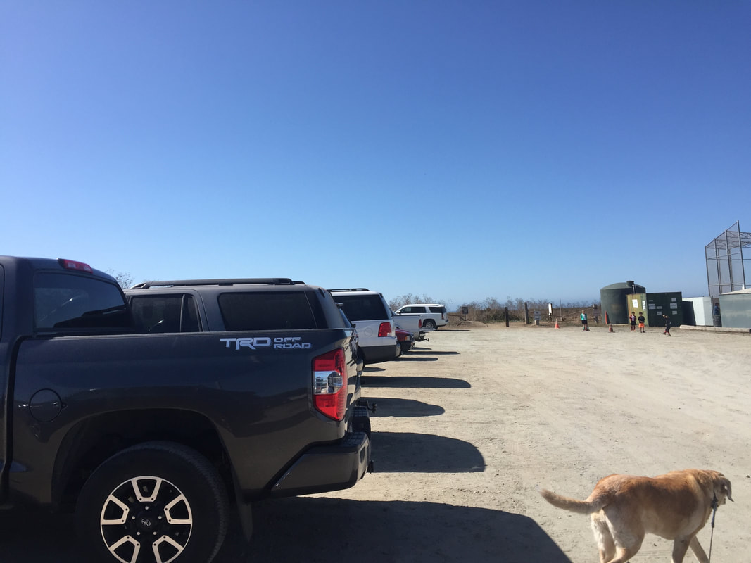
Parking: Free parking lot at the address above. Trailhead is at the end of the parking lot.
Hours: Sunrise to Sunset
Type: Walk (on-leash)
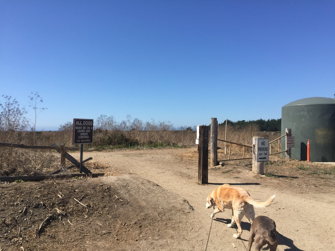
Regulations: Dogs allowed on-leash
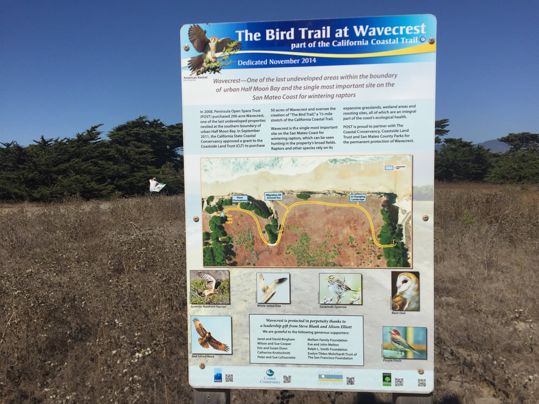
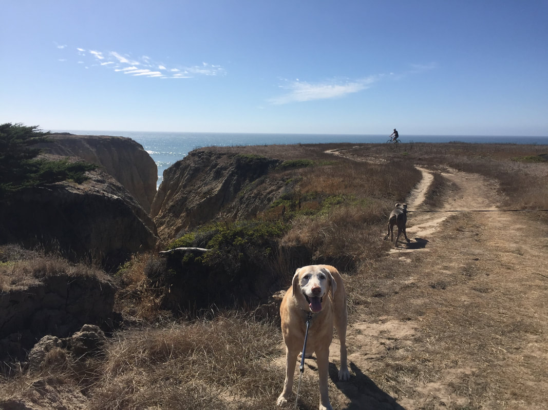
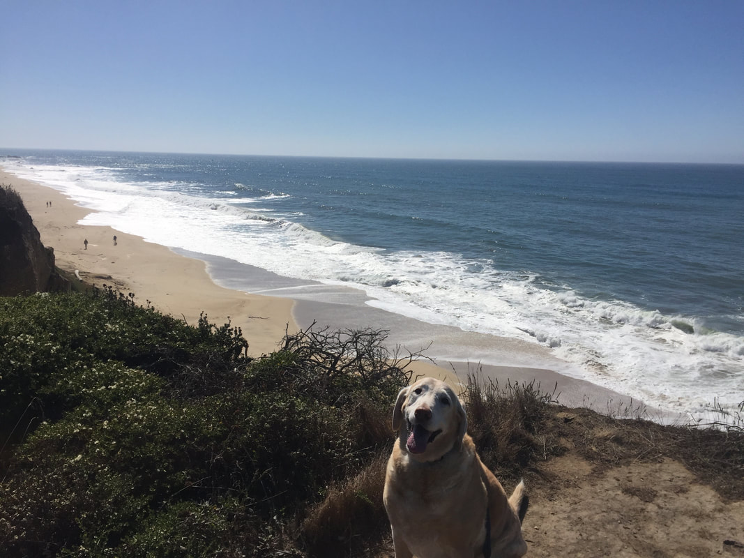
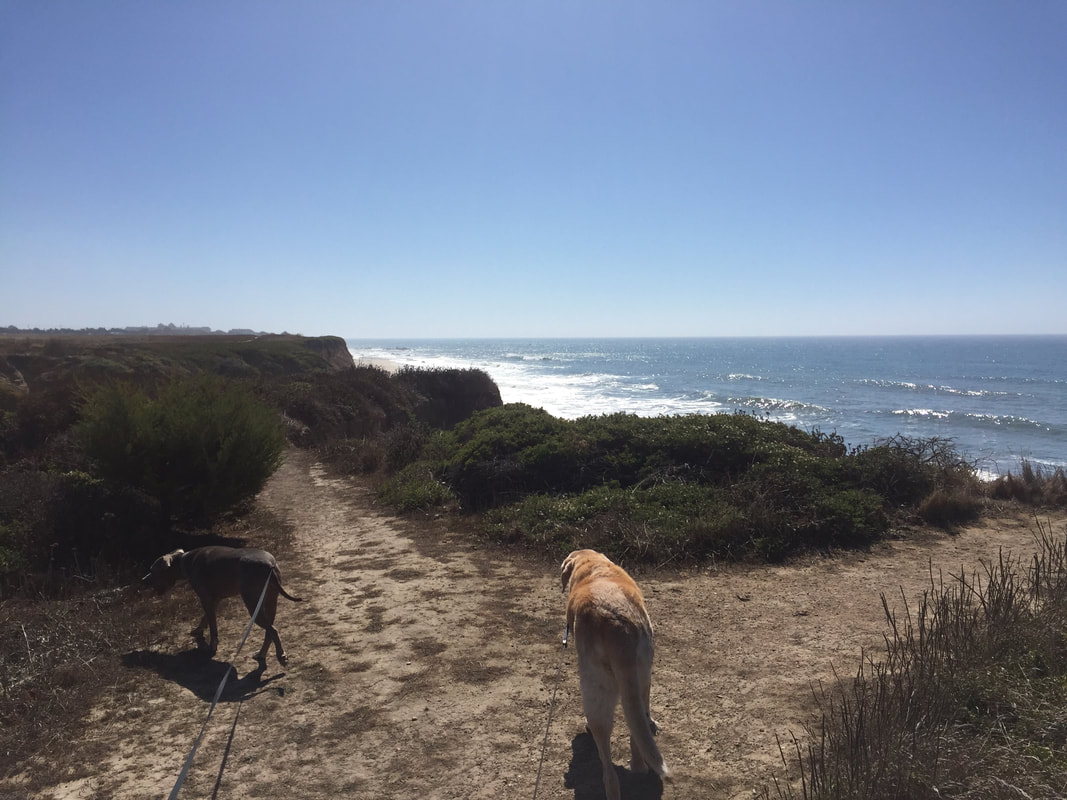
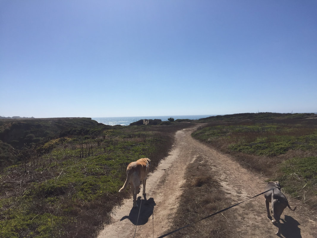
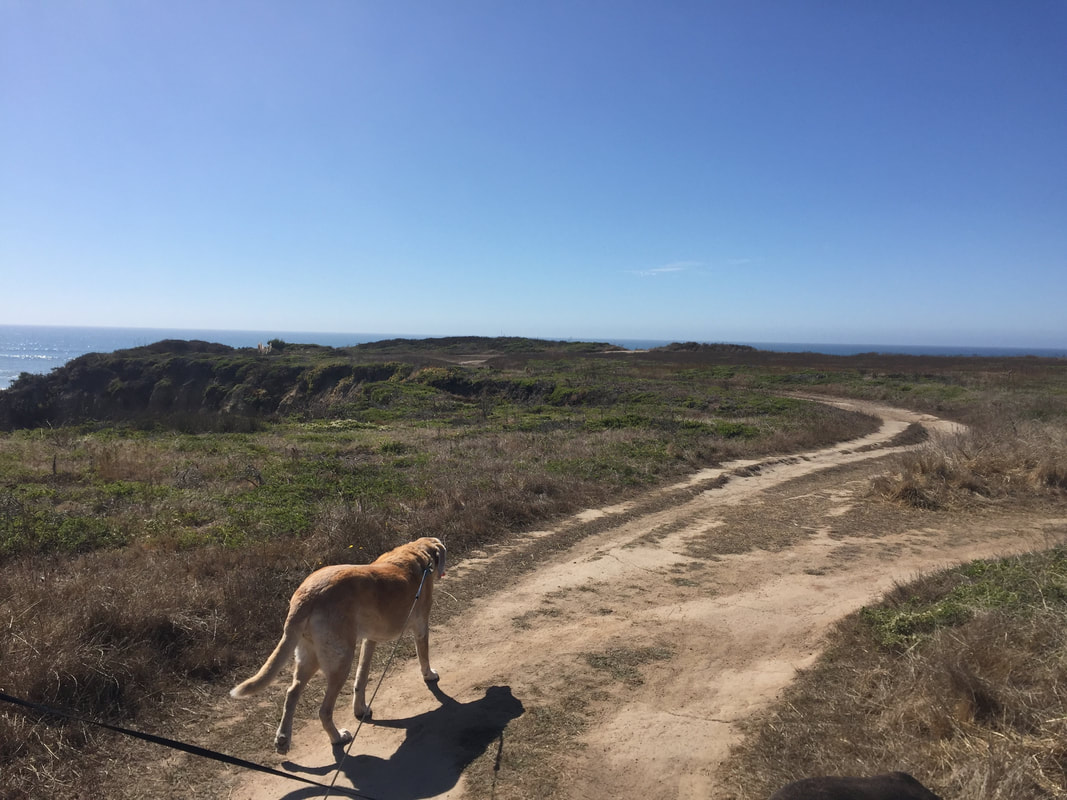
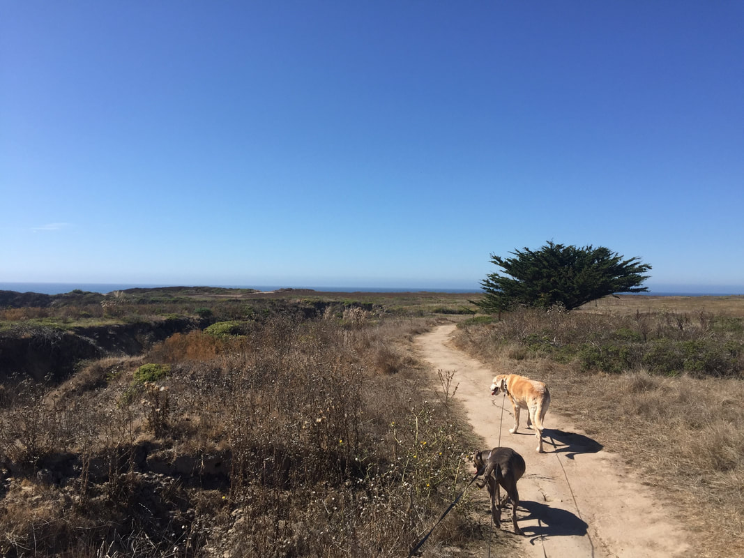
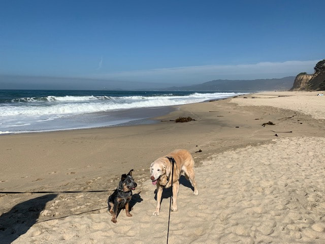
Description: This 206-acre hidden gem is a beautiful walk along the coast through this preserve. A 1.5-mile section of the California Coastal Trail runs through this preserve, but there are quite a few other unmarked trails traversing it. Finding this open space is a bit tricky, as there isn’t much signage. To know where to turn off the highway, look for a red double-decker bus and a giant pumpkin.
The trail begins at the very end of this road at the end of the parking lot for the baseball field. There’s a faded sign near the trail entrance (about 50 feet in), but you won’t see another one for a couple miles.
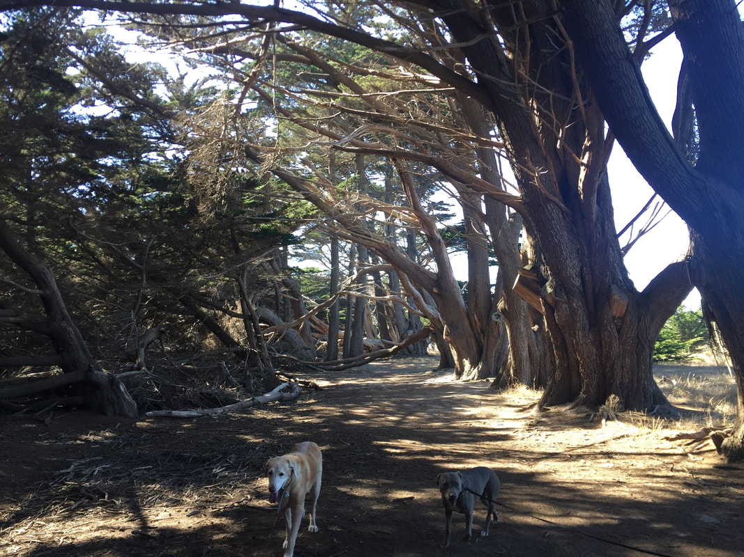
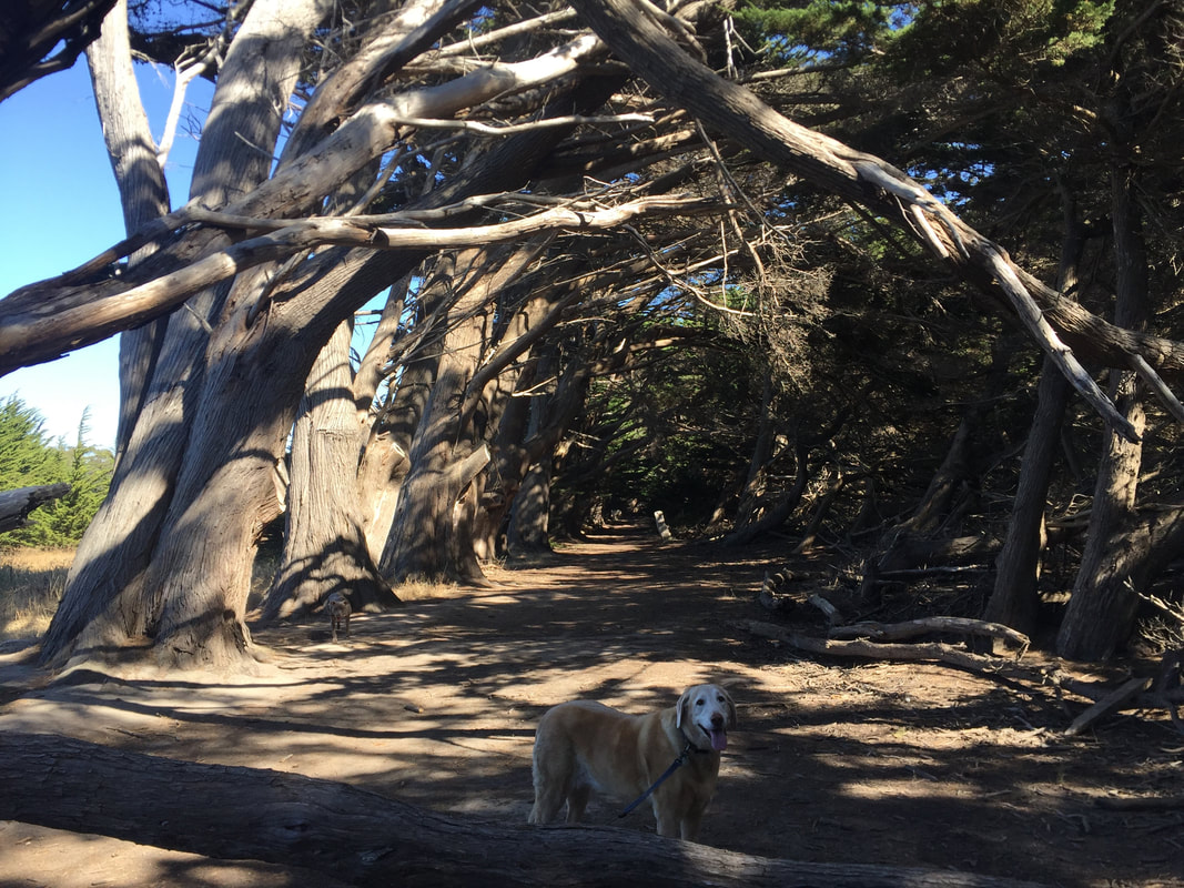
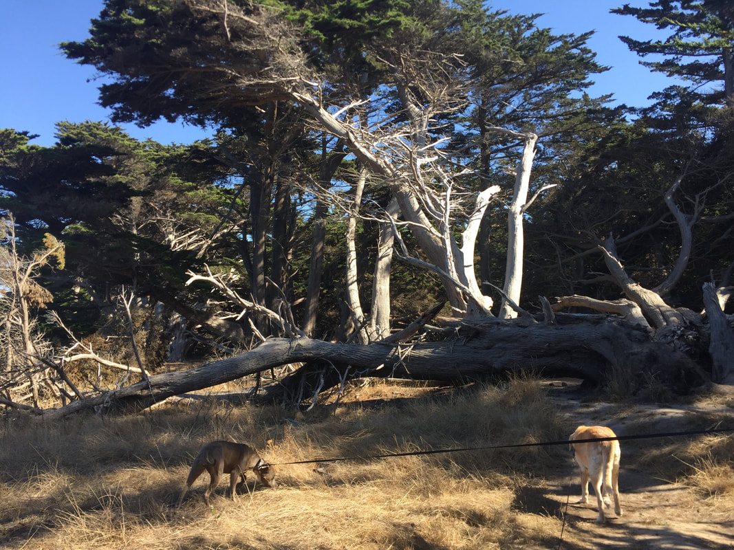
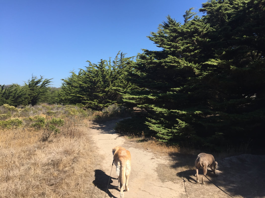
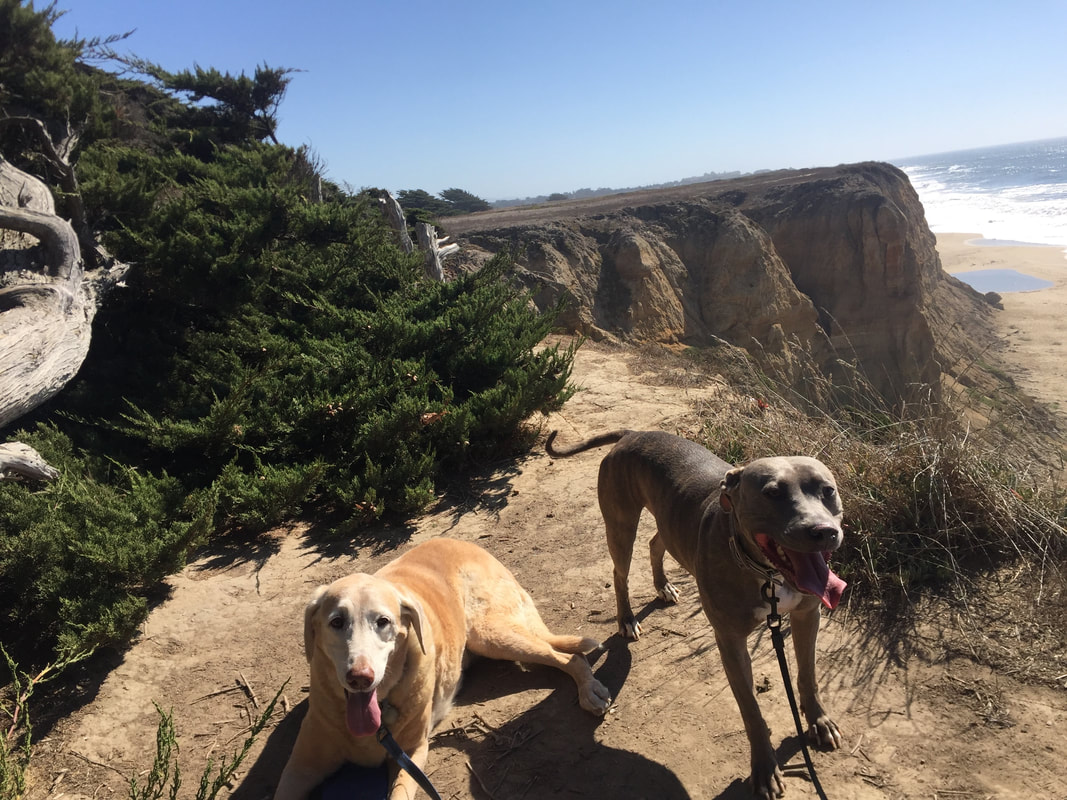
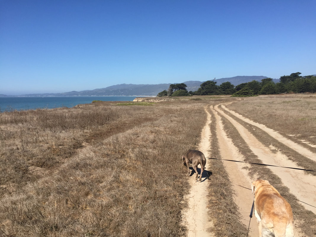
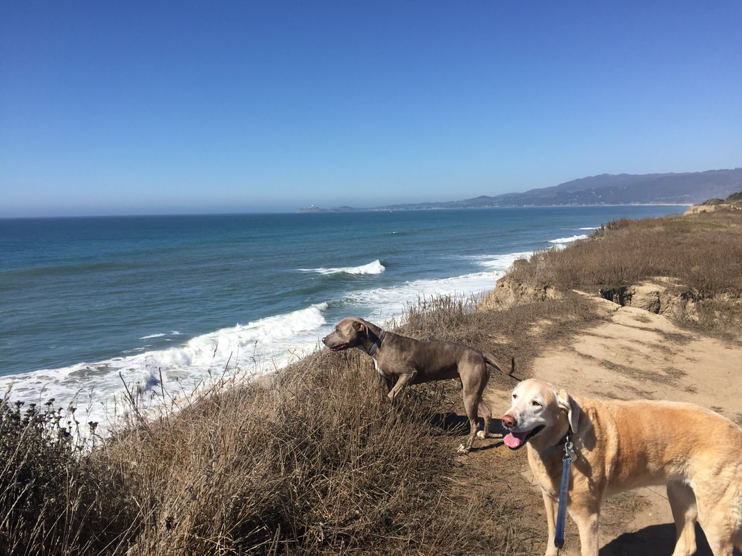
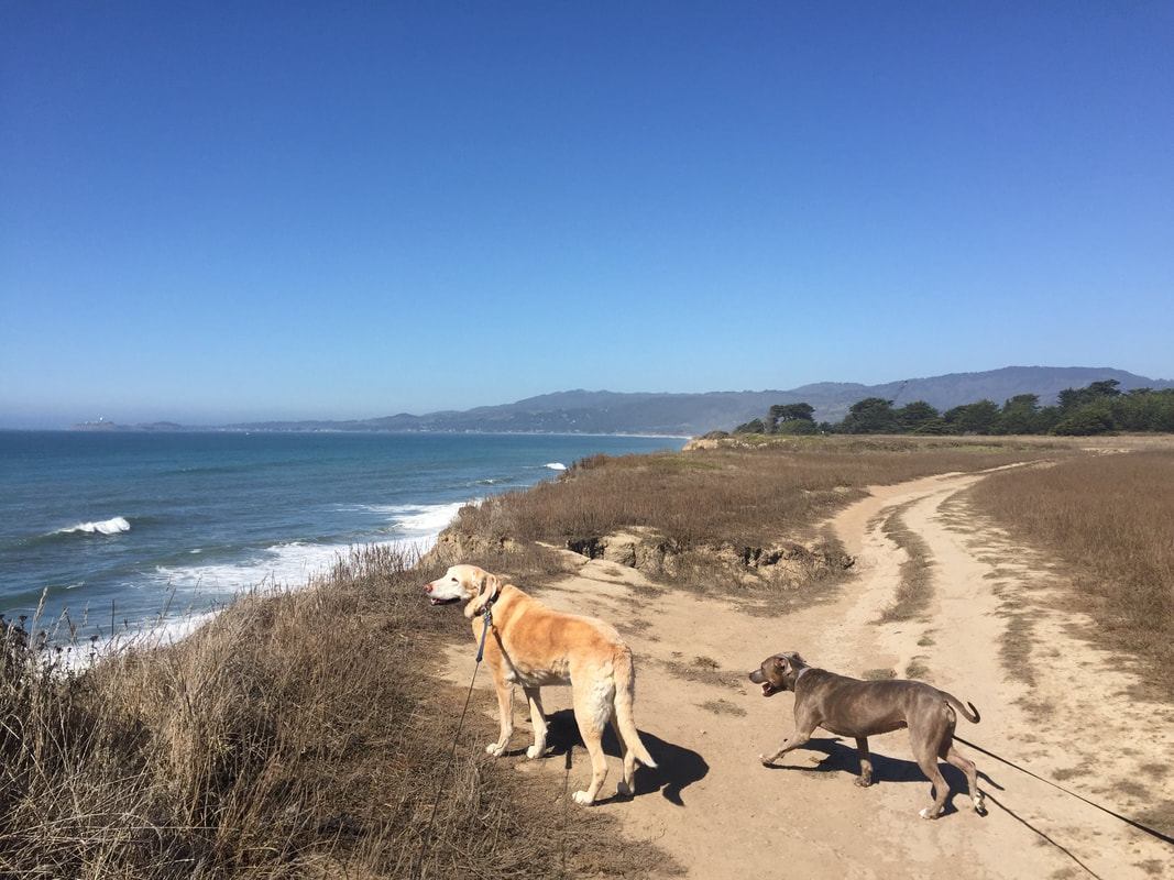
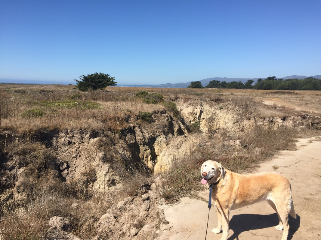
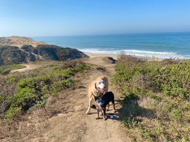
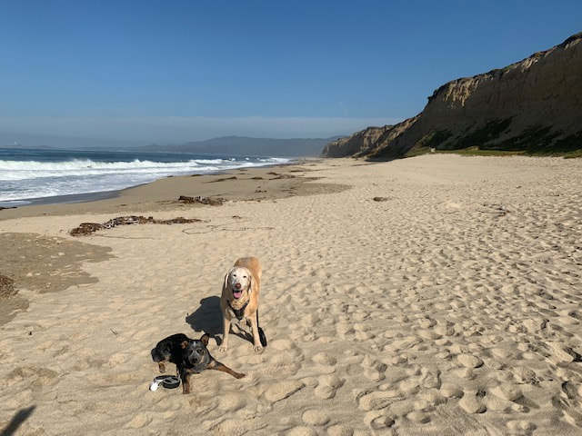
You’ll have to use your sense of direction to explore this park since it lacks signage, but it’s worth it because you’ll feel like you have the place to yourself. We come here every time we visit Half Moon Bay and run into few people during hours of hiking. The trail along the bluffs yields sweeping ocean views as far up the coast as you can see. There is also an interesting grove of trees in the middle of the park, with an unmarked trail running through the center. This grove reminded me of a smaller version of the Cypress Tree Tunnel in Point Reyes. I do recommend keeping your dog on-leash, as the coastal trail runs right along the bluffs, and it’s a steep drop down to the beach below. There are also large cracks in the ground near the bluffs, as if the earth just opened up, and your dog could hurt a leg if it falls through. Our usual route takes us from the baseball field entrance to the left and then straight down to the beach. We walk along the beach a couple miles until there's a trail back up to the bluffs. Each time we go to the beach we see horseback riders. The waves can be strong here, so be careful with your dog, but there's plenty of places to dip your paws in. There's another large parking lot at the trail that leads up from the beach (but you have to pay for it, and it's very crowded). The main trail leads back to where we parked and you can see the crowd dissipate as you get further from the beach.
There is a garbage can and doggy clean-up bags at the baseball field entrance. At the beach entrance, if you make it that far, there are porta potties. Bring plenty of water, as there is no running water.
Parking: Free parking lot at the address above. Trailhead is at the end of the parking lot.
Hours: Sunrise to Sunset
Type: Walk (on-leash)
Regulations: Dogs allowed on-leash
Description: This 206-acre hidden gem is a beautiful walk along the coast through this preserve. A 1.5-mile section of the California Coastal Trail runs through this preserve, but there are quite a few other unmarked trails traversing it. Finding this open space is a bit tricky, as there isn’t much signage. To know where to turn off the highway, look for a red double-decker bus and a giant pumpkin.
The trail begins at the very end of this road at the end of the parking lot for the baseball field. There’s a faded sign near the trail entrance (about 50 feet in), but you won’t see another one for a couple miles.
You’ll have to use your sense of direction to explore this park since it lacks signage, but it’s worth it because you’ll feel like you have the place to yourself. We come here every time we visit Half Moon Bay and run into few people during hours of hiking. The trail along the bluffs yields sweeping ocean views as far up the coast as you can see. There is also an interesting grove of trees in the middle of the park, with an unmarked trail running through the center. This grove reminded me of a smaller version of the Cypress Tree Tunnel in Point Reyes. I do recommend keeping your dog on-leash, as the coastal trail runs right along the bluffs, and it’s a steep drop down to the beach below. There are also large cracks in the ground near the bluffs, as if the earth just opened up, and your dog could hurt a leg if it falls through. Our usual route takes us from the baseball field entrance to the left and then straight down to the beach. We walk along the beach a couple miles until there's a trail back up to the bluffs. Each time we go to the beach we see horseback riders. The waves can be strong here, so be careful with your dog, but there's plenty of places to dip your paws in. There's another large parking lot at the trail that leads up from the beach (but you have to pay for it, and it's very crowded). The main trail leads back to where we parked and you can see the crowd dissipate as you get further from the beach.
There is a garbage can and doggy clean-up bags at the baseball field entrance. At the beach entrance, if you make it that far, there are porta potties. Bring plenty of water, as there is no running water.


All content within this site Copyright © 2023 Hikes Dogs Love. All rights reserved. No part of this website may be reproduced without permission.

- Home
-
Browse All
-
Alameda County
>
- Albany Bulb
- Alameda Creek Regional Trail
- Brickyard Cove
- Brushy Peak Regional Preserve
- Anthony Chabot Regional Park (Lake Chabot)
- Aquatic Park
- Barlago Italian Kitchen
- Buchanan Dog Beach
- California Canoe & Kayak (Oakland)
- Cali Kid Burgers ‘N Shakes
- César Chávez Park
- Chabot Park
- Claremont Canyon
- Coyote Hills Regional Park
- Crab Cove
- Cull Canyon Regional Recreation Area
- Dimond Canyon Park
- Don Castro Regional Recreation Area
- Don Edwards Wildlife Refuge
- Dublin Hills Regional Park
- Emeryville Marina
- Fairmont Ridge
- Five Canyons Open Space Preserve
- Fremont Central Park
- Garin/Dry Creek Pioneer Regional Park
- Gilman Brewing Company
- Greenbelt Trails
- Hayward Regional Shoreline
- Heron Bay Trail
- Ikaros Greek Restaurant
- Jerusalem Organic Kitchen
- Joaquin Miller Park
- Lake Anza
- Lake Chabot
- Lake Merritt
- Leona Canyon Regional Open Space Preserve
- Leona Heights Park
- Marina Park
- Martin Canyon Creek Trail
- Martin Luther King Jr. Regional Shoreline
- Mission Peak
- Montclair Railroad Trail/ Torii Gate
- Morgan Territory Regional Preserve
- Oyster Bay Regional Shoreline
- Park Street Classic Car Show (Annual)
- Pleasanton Ridge Regional Preserve
- Point Emery
- Reinhardt Redwood Regional Park
- Robert's Park
- Room 389
- Shoreline Park
- Sibley Volcanic Regional Preserve
- Skyline Gate Staging Area
- Strawberry Canyon Fire Trail
- Sunol Regional Wilderness
- Temescal Regional Recreation Area
- Tilden Regional Park
- Upper Anthony Chabot Regional Park (Oakland Entrance)
- Upper Knowland Park
- Vargas Plateau Regional Park
- Butte County >
-
Contra Costa County
>
- Acalanes Ridge Open Space
- Briones Regional Park
- Carquinez Strait Regional Shoreline
- Crockett Hills Regional Park
- Diablo Foothills Regional Park
- EBMUD Trails
- Fernandez Ranch
- Frowning Ridge
- Geppetto's Caffe
- Hacienda de las Flores Park
- Hillside Nature Area
- Howe Homestead Park
- Indian Rock
- Kennedy Grove Regional Recreation Area
- Lafayette Community Park
- Lafayette Reservoir
- Las Trampas Regional Wilderness
- Lime Ridge Open Space
- Miller/Knox Regional Shoreline
- Moraga Commons Park
- Mulholland Ridge Open Space Preserve
- Point Isabel
- Point Molate Beach Park
- Point Pinole Regional Shoreline
- Point San Pablo Harbor
- Rubio's
- San Quentin Beach
- Shell Ridge Open Space
- Sobrante Ridge Regional Preserve
- Sugarloaf Open Space
- Sycamore Valley Open Space Preserve
- Tender Greens
- Tilden Regional Park
- Wildcat Canyon Regional Park
- El Dorado County >
-
Marin County
>
- 101 Surf Sports
- Baltimore Canyon Open Space Preserve
- Blackie's Pasture
- Camino Alto Preserve
- Carson Falls
- Cascade Falls
- Cataract Falls
- Dawn Falls
- Hippie Tree
- Ignacio Valley Preserve (Fairway Falls)
- Indian Valley Open Space Preserve
- King Mountain Open Space Preserve
- Marin Headlands (Coastal Trail)
- Old Saint Hilary's Open Space Preserve
- Phoenix Lake
- Red Hill Dog Park
- Red Hill Trail
- Ring Mountain Open Space Preserve
- Roy's Redwoods
- Sam's Anchor Cafe
- Sorich Ranch Park
- Tiburon Peninsula Historical Trail
- Tiburon Uplands
- Tucker Trail Falls
- Mariposa County >
- Mendocino County >
- Mono County >
- Monterey County >
- Nevada County >
- Placer County >
-
San Francisco County
>
- 2.2 Mile Urban Hike
- Bernal Heights Park
- The Brixton
- Billy Goat Hill Park
- Blackwood
- Clipper Cove Beach
- Crissy Field
- Dynamo Donut + Coffee
- Fort Funston
- Fort Mason
- Glen Canyon Park
- Golden Gate Park
- Grand View Park
- The Great Lawn/ Avenue of the Palms
- Java Beach Cafe
- John McLaren Park
- Interior Greenbelt
- Lake Merced
- Lands End
- Letterman Digital Arts Center
- Marina Green
- Mount Davidson
- Mount Sutro Open Space Reserve
- Ocean Beach
- Palace of Fine Arts
- Philz Coffee Truck
- Stern Grove
- Sutro Baths
- Sutro Heights Park
- TreasureFest
-
San Mateo County
>
- 7 Mile House Sports Bar & Grill
- Barbara's Fishtrap
- Bedwell Bayfront Park
- Bob's Vegetable Stand and Pumpkin Farm
- Cafe Pacifica
- Devil's Slide Coastal Trail
- Esplanade Beach
- Flying Fish Grill
- Half Moon Bay Kayak Co.
- McNee Ranch State Park (Montara Mountain)
- Montara State Beach
- Mori Point
- Mussel Rock Park
- Nick's Seafood Restaurant
- Panera Bread
- Pedro Point Headlands
- Poplar Beach
- Pulgas Ridge Open Space Preserve
- Rancho Corral de Tierra
- Seal Point
- Taqueria La Mexicana
- Wavecrest Open Space
- Santa Clara County >
- Santa Cruz County >
- Solano County >
- Sonoma County >
- Tuolumne County >
- Yuba County >
-
Alameda County
>
- Map View
-
More