
- Home
-
Browse All
-
Alameda County
>
- Albany Bulb
- Alameda Creek Regional Trail
- Brickyard Cove
- Brushy Peak Regional Preserve
- Anthony Chabot Regional Park (Lake Chabot)
- Aquatic Park
- Barlago Italian Kitchen
- Buchanan Dog Beach
- California Canoe & Kayak (Oakland)
- Cali Kid Burgers ‘N Shakes
- César Chávez Park
- Chabot Park
- Claremont Canyon
- Coyote Hills Regional Park
- Crab Cove
- Cull Canyon Regional Recreation Area
- Dimond Canyon Park
- Don Castro Regional Recreation Area
- Don Edwards Wildlife Refuge
- Dublin Hills Regional Park
- Emeryville Marina
- Fairmont Ridge
- Five Canyons Open Space Preserve
- Fremont Central Park
- Garin/Dry Creek Pioneer Regional Park
- Gilman Brewing Company
- Greenbelt Trails
- Hayward Regional Shoreline
- Heron Bay Trail
- Ikaros Greek Restaurant
- Jerusalem Organic Kitchen
- Joaquin Miller Park
- Lake Anza
- Lake Chabot
- Lake Merritt
- Leona Canyon Regional Open Space Preserve
- Leona Heights Park
- Marina Park
- Martin Canyon Creek Trail
- Martin Luther King Jr. Regional Shoreline
- Mission Peak
- Montclair Railroad Trail/ Torii Gate
- Morgan Territory Regional Preserve
- Oyster Bay Regional Shoreline
- Park Street Classic Car Show (Annual)
- Pleasanton Ridge Regional Preserve
- Point Emery
- Reinhardt Redwood Regional Park
- Robert's Park
- Room 389
- Shoreline Park
- Sibley Volcanic Regional Preserve
- Skyline Gate Staging Area
- Strawberry Canyon Fire Trail
- Sunol Regional Wilderness
- Temescal Regional Recreation Area
- Tilden Regional Park
- Upper Anthony Chabot Regional Park (Oakland Entrance)
- Upper Knowland Park
- Vargas Plateau Regional Park
- Butte County >
-
Contra Costa County
>
- Acalanes Ridge Open Space
- Briones Regional Park
- Carquinez Strait Regional Shoreline
- Crockett Hills Regional Park
- Diablo Foothills Regional Park
- EBMUD Trails
- Fernandez Ranch
- Frowning Ridge
- Geppetto's Caffe
- Hacienda de las Flores Park
- Hillside Nature Area
- Howe Homestead Park
- Indian Rock
- Kennedy Grove Regional Recreation Area
- Lafayette Community Park
- Lafayette Reservoir
- Las Trampas Regional Wilderness
- Lime Ridge Open Space
- Miller/Knox Regional Shoreline
- Moraga Commons Park
- Mulholland Ridge Open Space Preserve
- Point Isabel
- Point Molate Beach Park
- Point Pinole Regional Shoreline
- Point San Pablo Harbor
- Rubio's
- San Quentin Beach
- Shell Ridge Open Space
- Sobrante Ridge Regional Preserve
- Sugarloaf Open Space
- Sycamore Valley Open Space Preserve
- Tender Greens
- Tilden Regional Park
- Wildcat Canyon Regional Park
- El Dorado County >
-
Marin County
>
- 101 Surf Sports
- Baltimore Canyon Open Space Preserve
- Blackie's Pasture
- Camino Alto Preserve
- Carson Falls
- Cascade Falls
- Cataract Falls
- Dawn Falls
- Hippie Tree
- Ignacio Valley Preserve (Fairway Falls)
- Indian Valley Open Space Preserve
- King Mountain Open Space Preserve
- Marin Headlands (Coastal Trail)
- Old Saint Hilary's Open Space Preserve
- Phoenix Lake
- Red Hill Dog Park
- Red Hill Trail
- Ring Mountain Open Space Preserve
- Roy's Redwoods
- Sam's Anchor Cafe
- Sorich Ranch Park
- Tiburon Peninsula Historical Trail
- Tiburon Uplands
- Tucker Trail Falls
- Mariposa County >
- Mendocino County >
- Mono County >
- Monterey County >
- Nevada County >
- Placer County >
-
San Francisco County
>
- 2.2 Mile Urban Hike
- Bernal Heights Park
- The Brixton
- Billy Goat Hill Park
- Blackwood
- Clipper Cove Beach
- Crissy Field
- Dynamo Donut + Coffee
- Fort Funston
- Fort Mason
- Glen Canyon Park
- Golden Gate Park
- Grand View Park
- The Great Lawn/ Avenue of the Palms
- Java Beach Cafe
- John McLaren Park
- Interior Greenbelt
- Lake Merced
- Lands End
- Letterman Digital Arts Center
- Marina Green
- Mount Davidson
- Mount Sutro Open Space Reserve
- Ocean Beach
- Palace of Fine Arts
- Philz Coffee Truck
- Stern Grove
- Sutro Baths
- Sutro Heights Park
- TreasureFest
-
San Mateo County
>
- 7 Mile House Sports Bar & Grill
- Barbara's Fishtrap
- Bedwell Bayfront Park
- Bob's Vegetable Stand and Pumpkin Farm
- Cafe Pacifica
- Devil's Slide Coastal Trail
- Esplanade Beach
- Flying Fish Grill
- Half Moon Bay Kayak Co.
- McNee Ranch State Park (Montara Mountain)
- Montara State Beach
- Mori Point
- Mussel Rock Park
- Nick's Seafood Restaurant
- Panera Bread
- Pedro Point Headlands
- Poplar Beach
- Pulgas Ridge Open Space Preserve
- Rancho Corral de Tierra
- Seal Point
- Taqueria La Mexicana
- Wavecrest Open Space
- Santa Clara County >
- Santa Cruz County >
- Solano County >
- Sonoma County >
- Tuolumne County >
- Yuba County >
-
Alameda County
>
- Map View
-
More
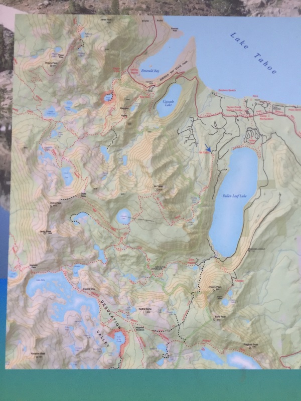
Address: 38.926986, -120.069494 (trailhead sign is across from Baldwin Beach)
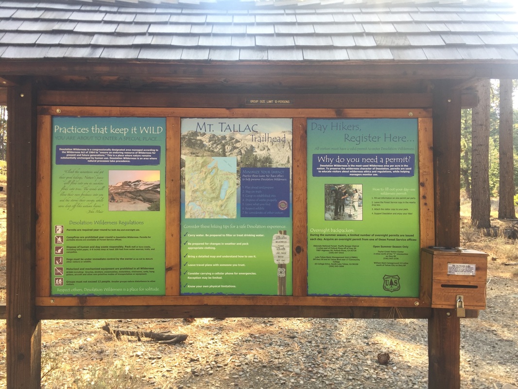
Parking: Free parking lot near the address above. Register for a self-serve wilderness permit at the trailhead.
Hours: Not Posted
Type: Hike (Difficult, 10 miles)
Regulations: Dogs allowed on-leash
Best time to visit: June to October when snow is not present on a cool day
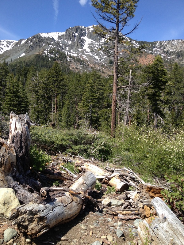
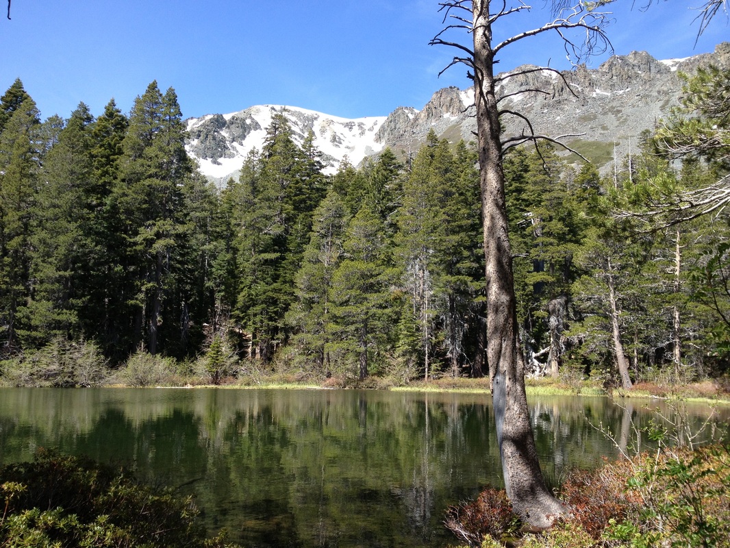
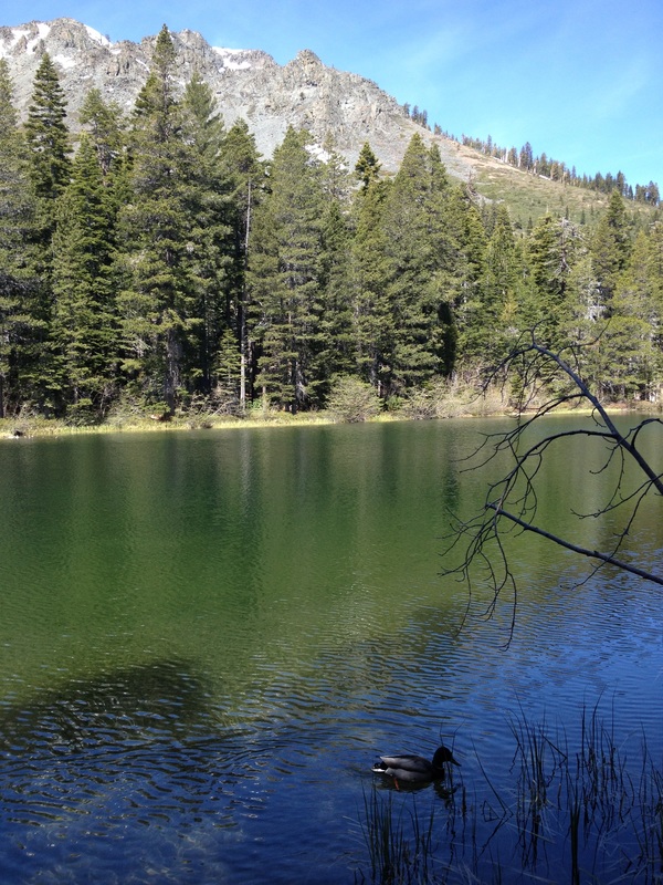
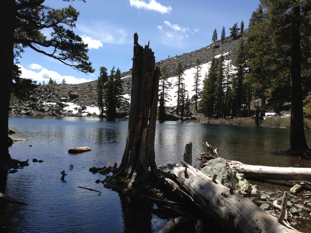
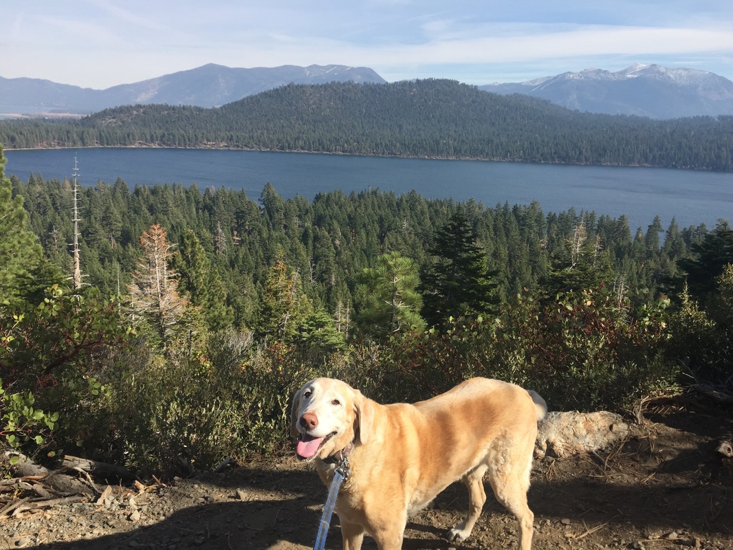
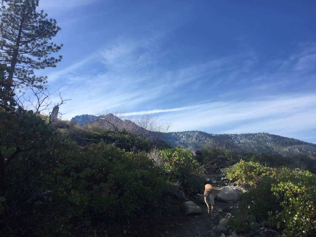
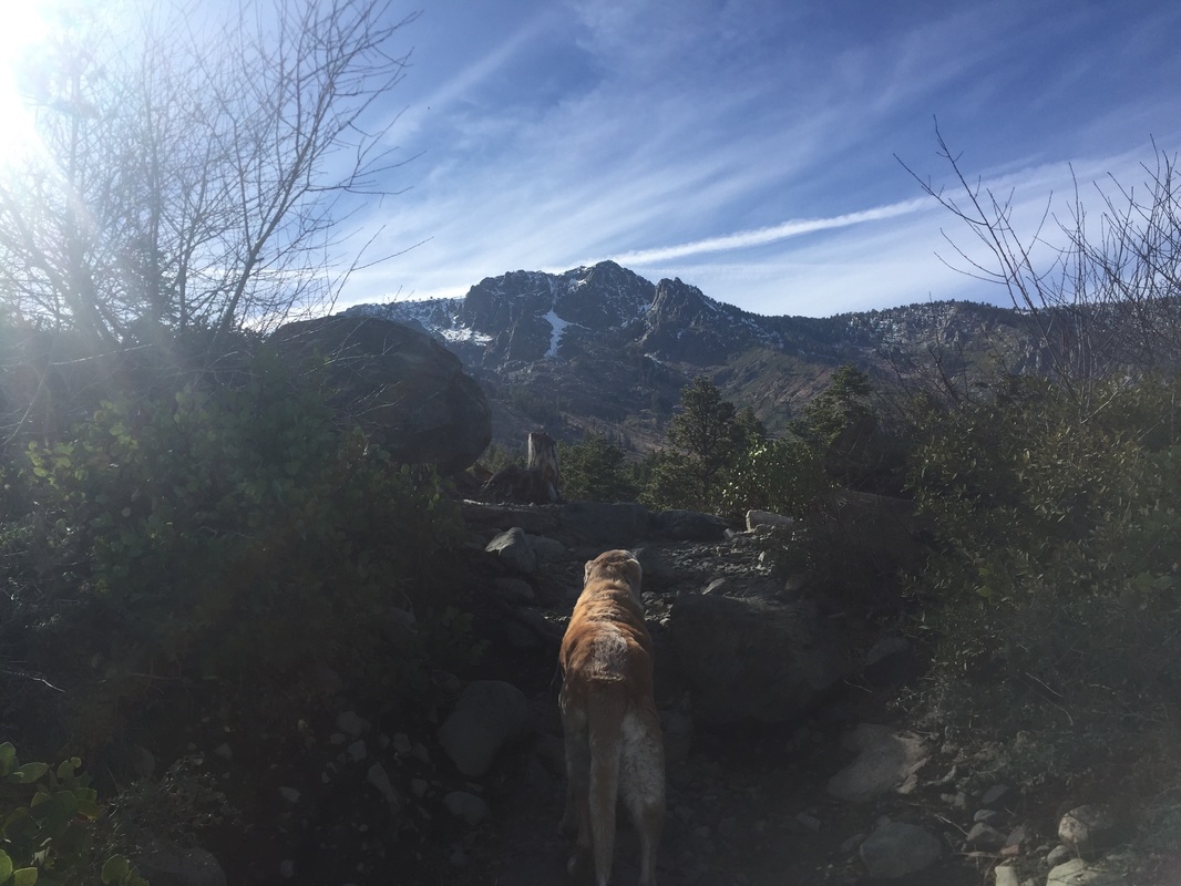
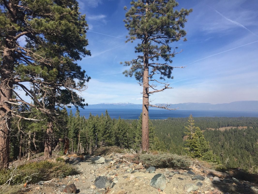
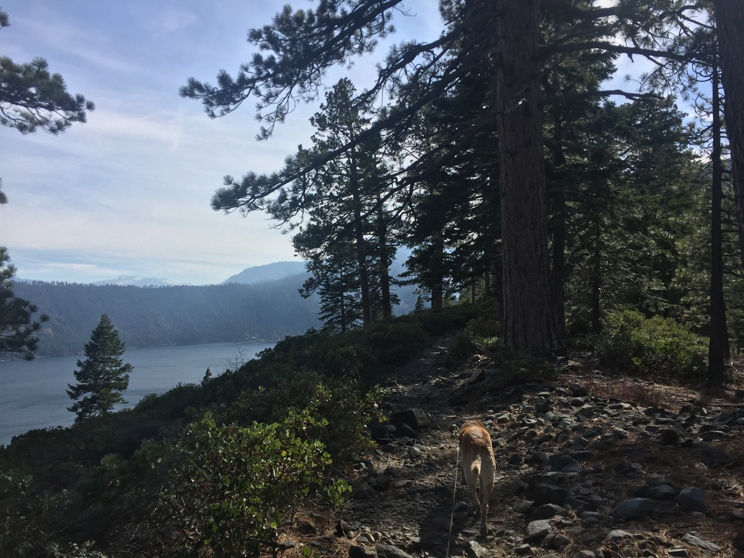
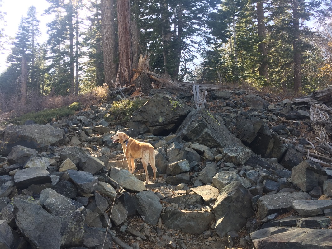
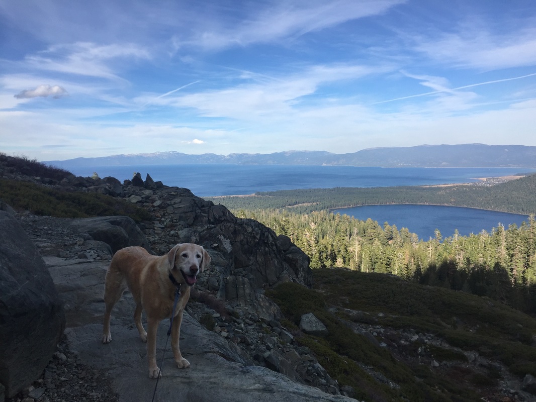
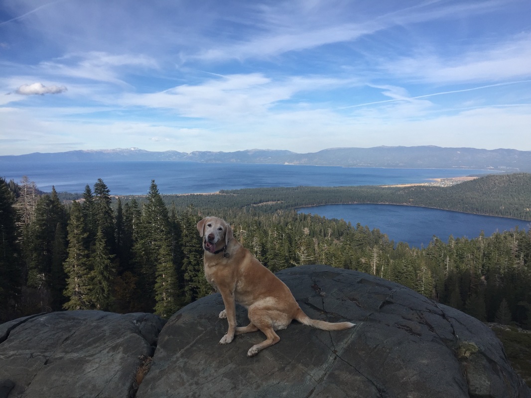
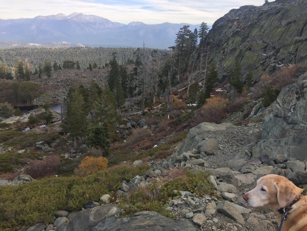
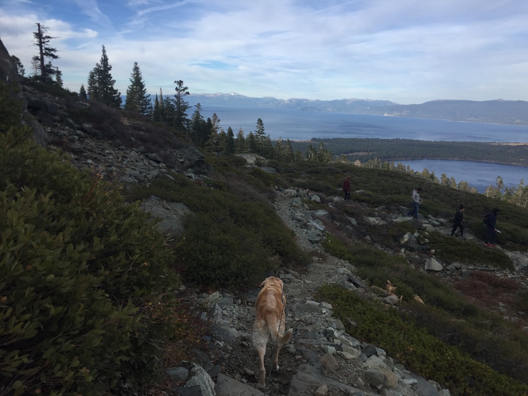
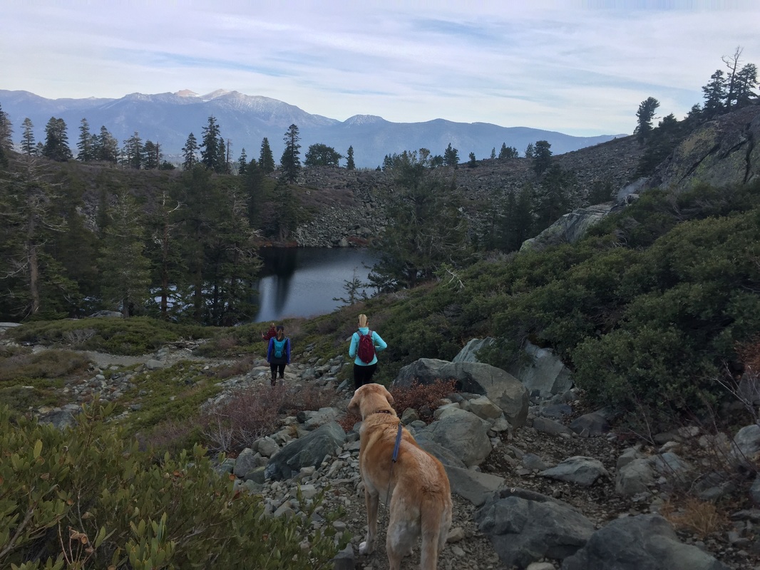
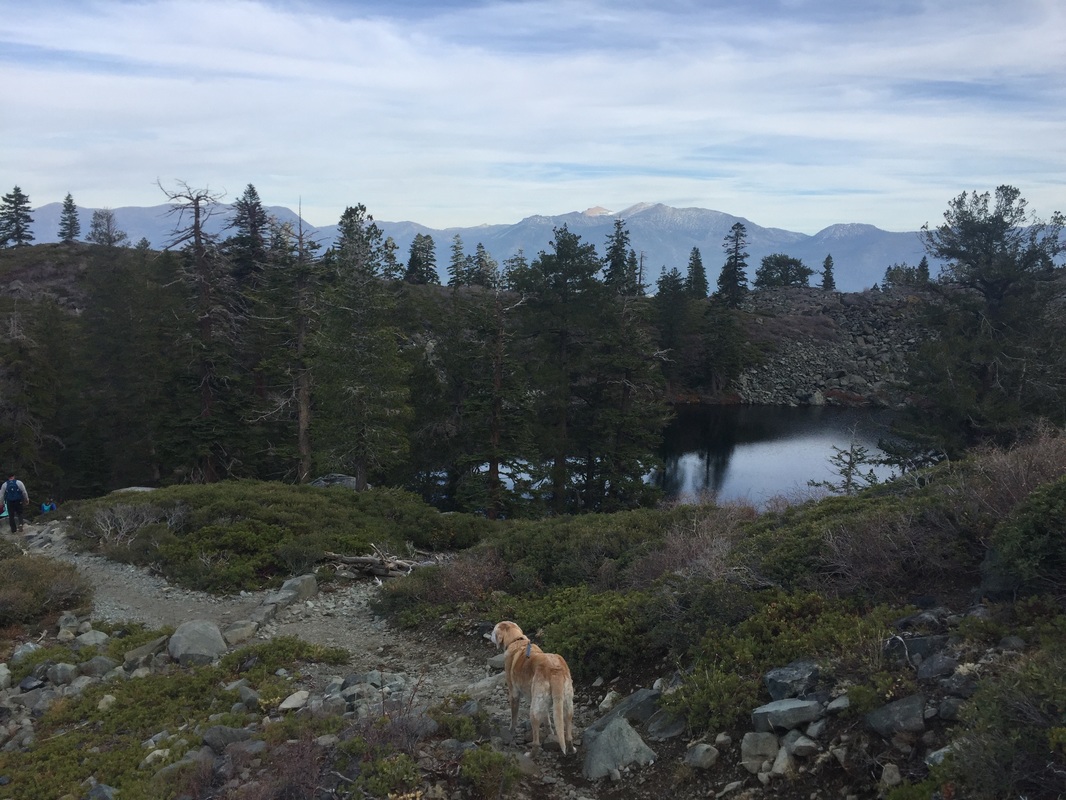
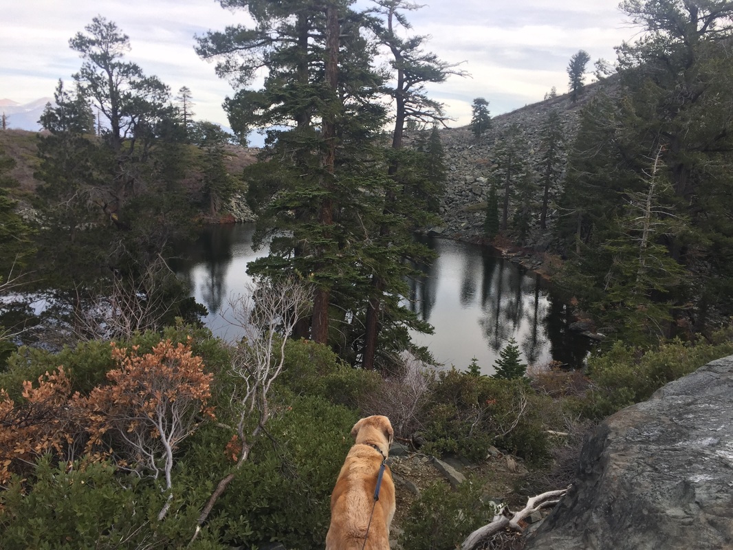
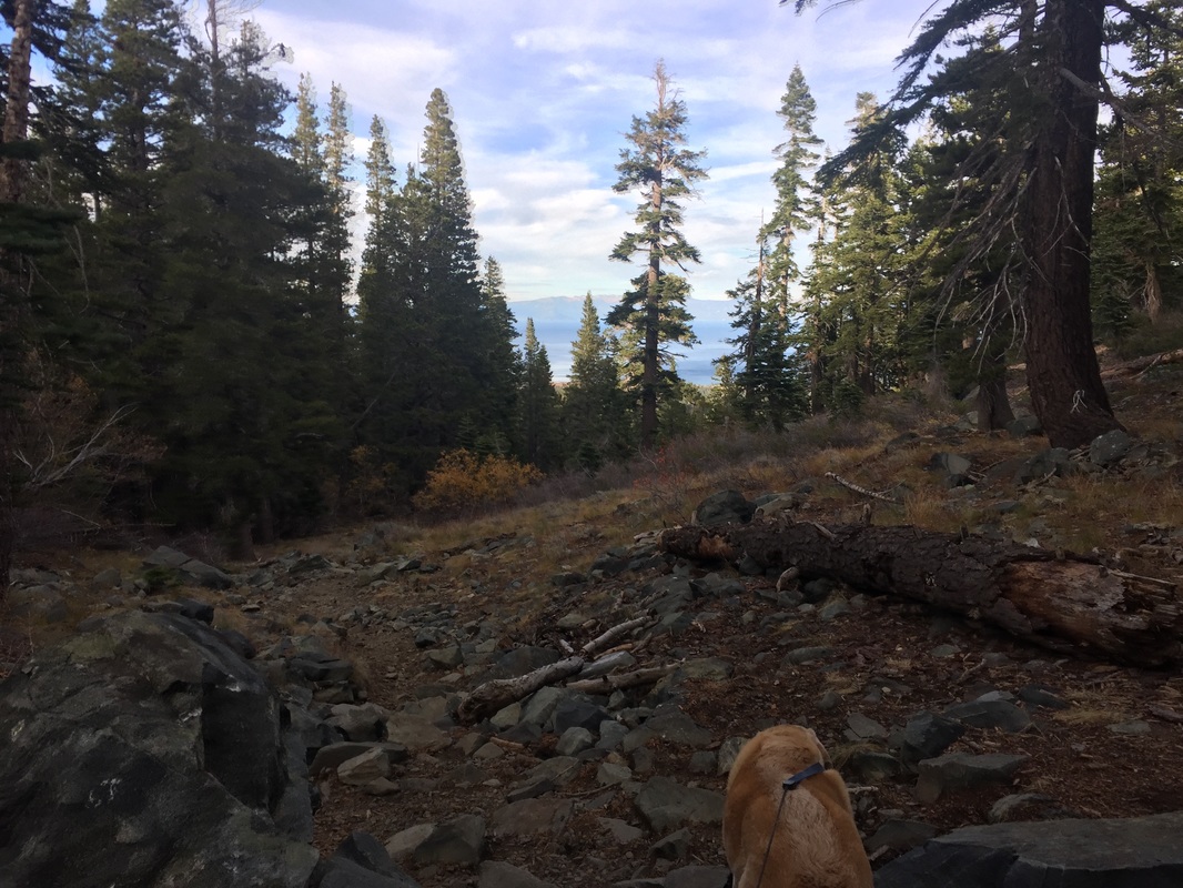
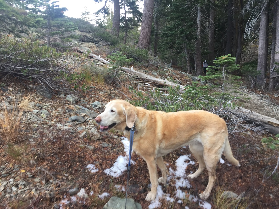
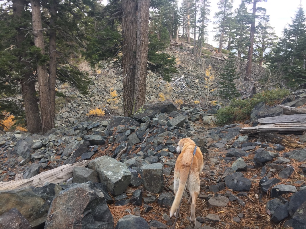
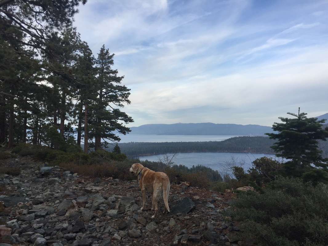
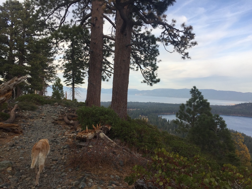
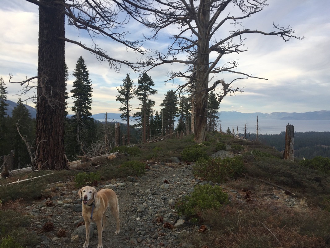
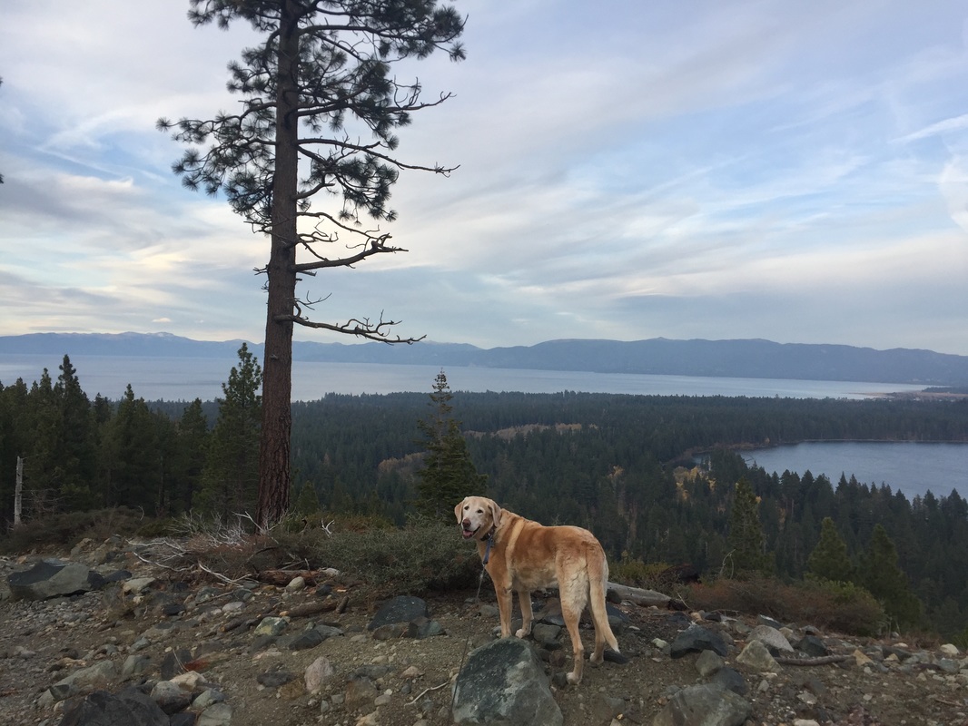
Description: This is one of the most stunning hikes you will probably ever encounter. Although it's long, it winds through ever-changing scenery, from wooded areas, to hidden lakes. It ends at the incredible 9,735 ft summit with 360 degree views of the mountains and Lake Tahoe. Although the trail was strenuous, I did not find it too difficult until the last scramble up to the peak. This trail is rocky and very steep, and often covered in snow even when the trail below is not. I would not recommend the hike to the summit unless you and your dog are in excellent shape. However, even if you do not make it to the summit, the trails below are well worth the hike. You can turn back at Floating Island Lake (1.7 miles one way), or Cathedral Lake (2.5 miles one way), and still have an incredible hike. Bring lots of water, and watch your dog for signs of overheating. Take it easy as you'll be able to feel the 3,500ft elevation gain. I would recommend a very early start, as it's a long hike, and the parking lot fills early.
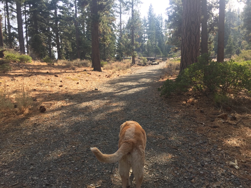
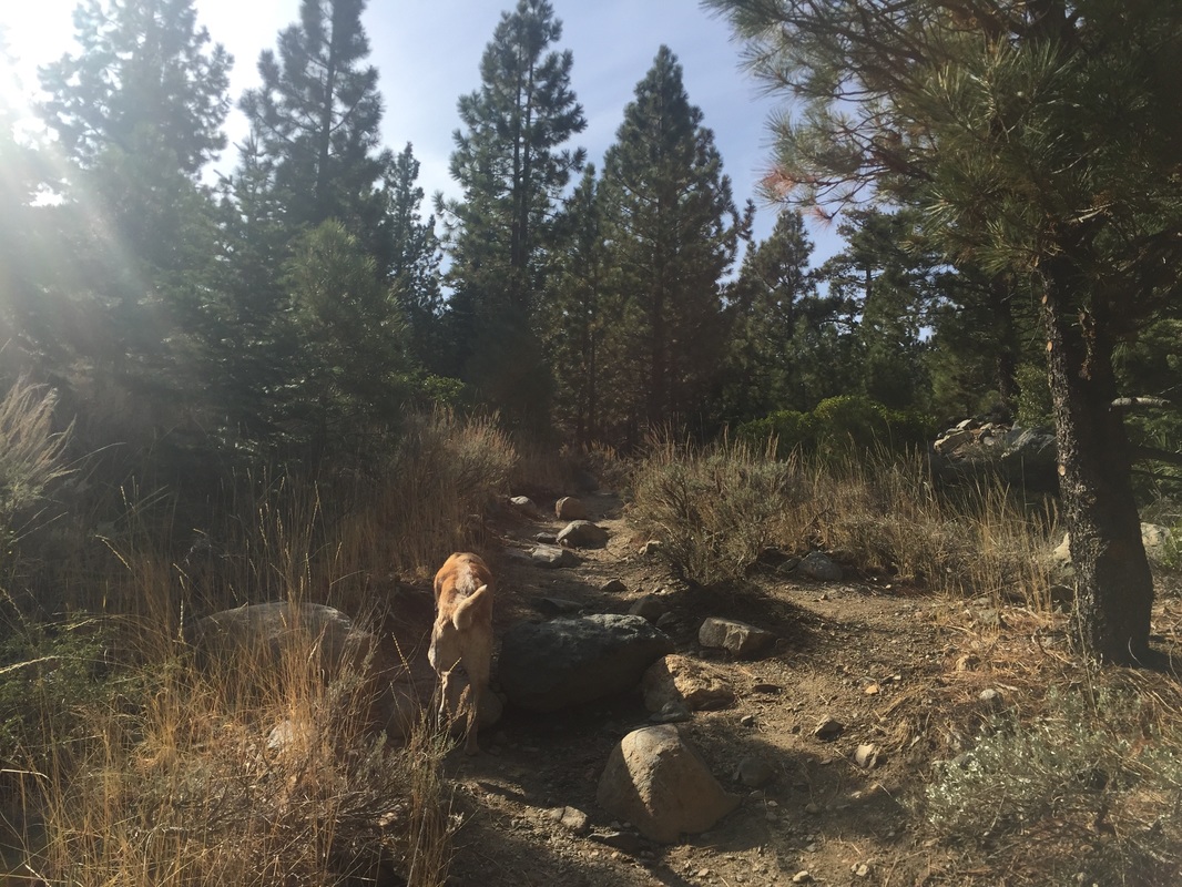
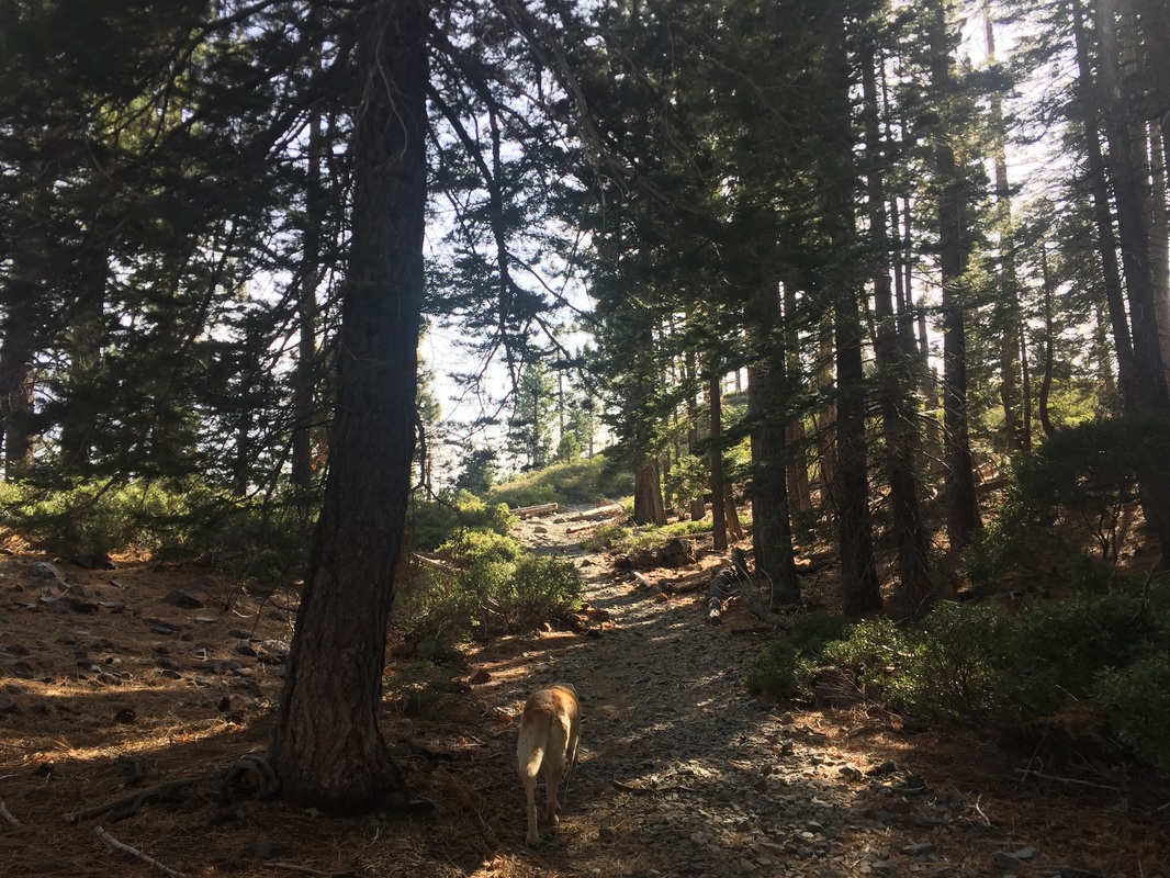
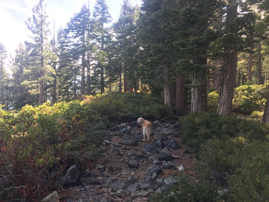
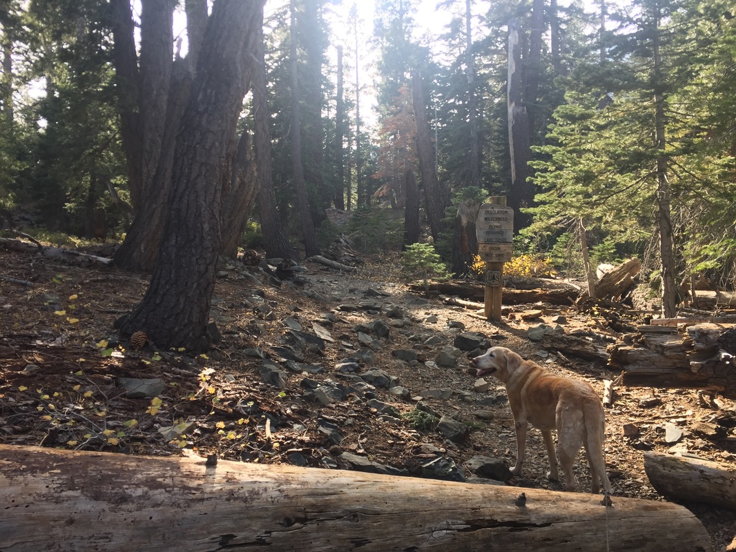
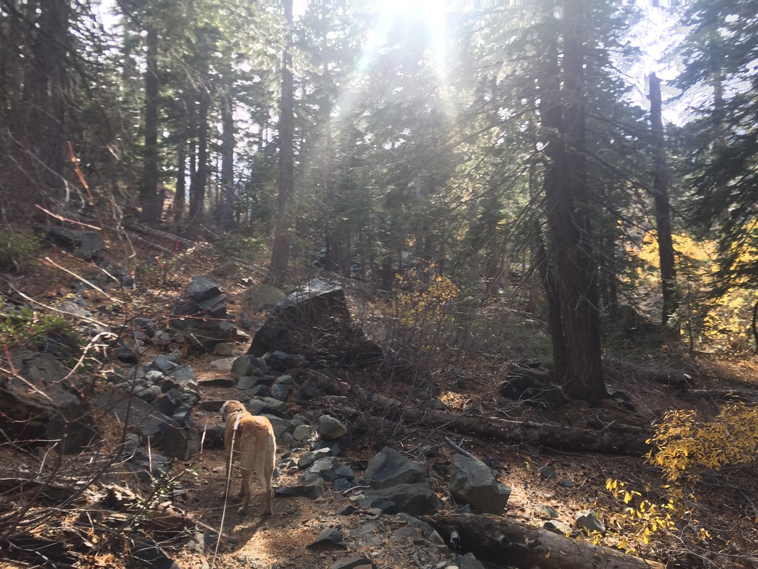
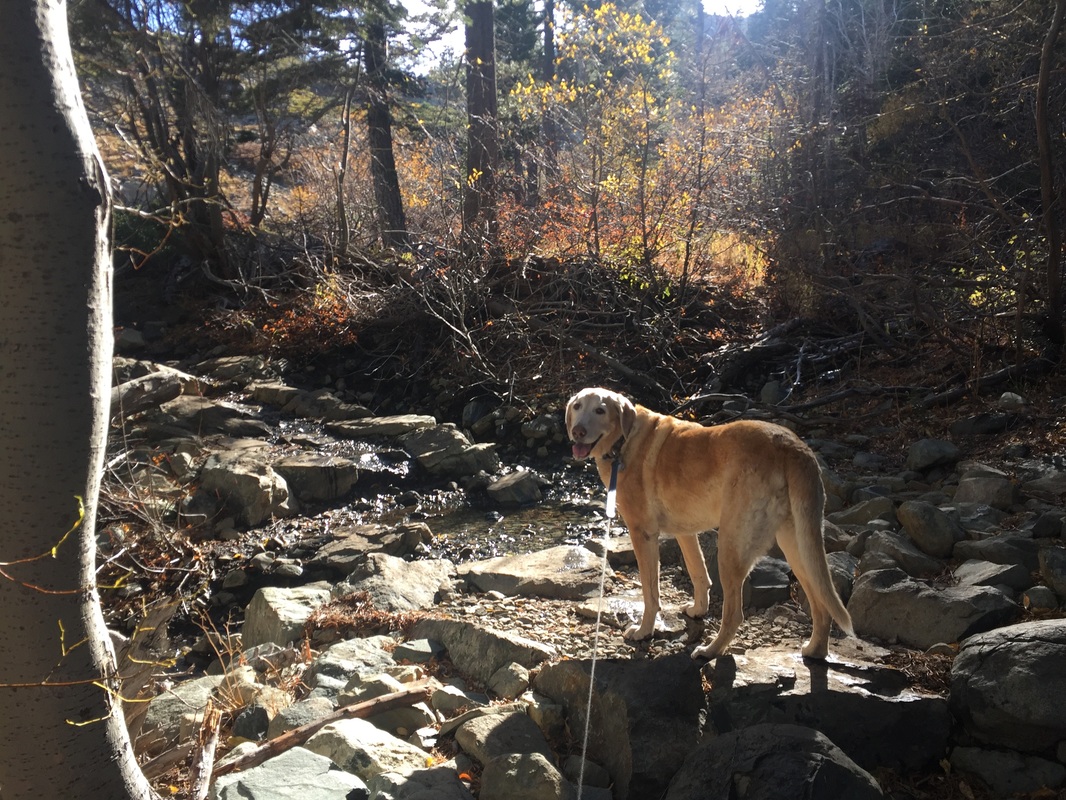
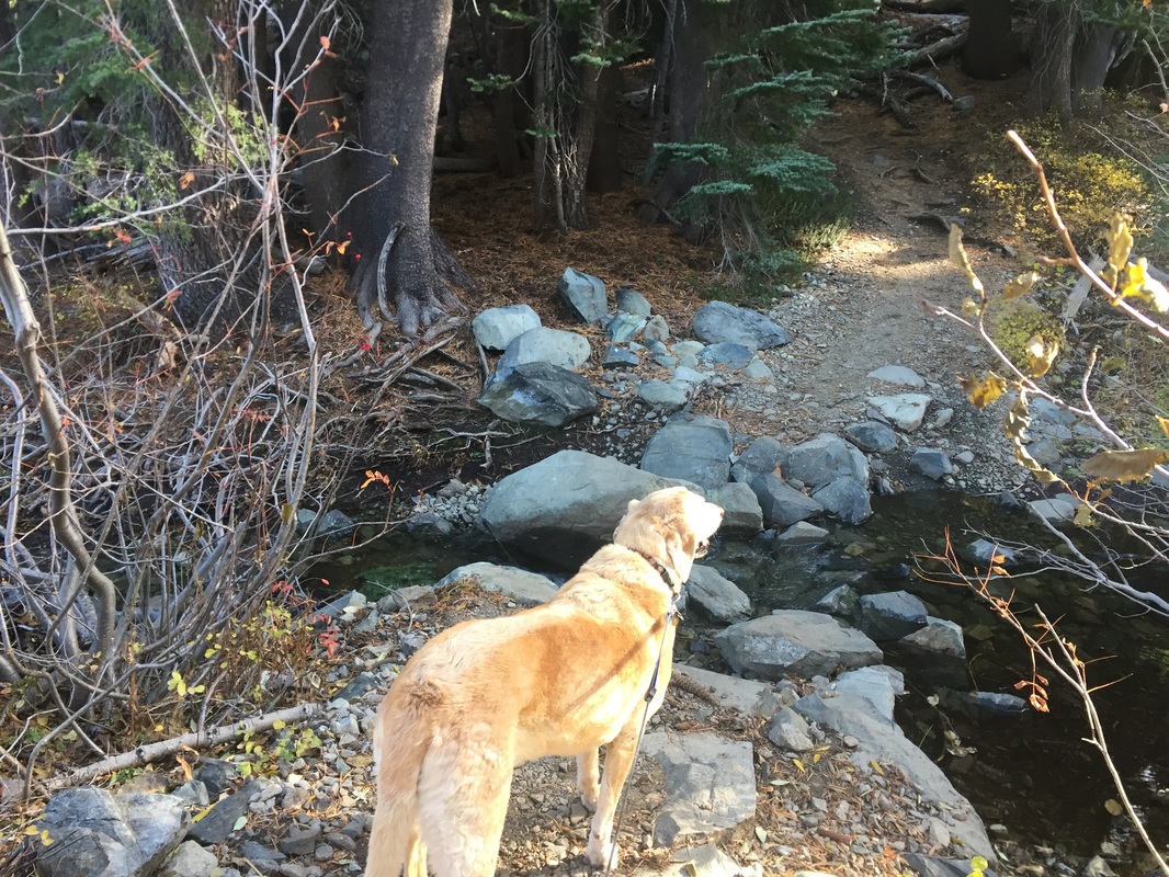
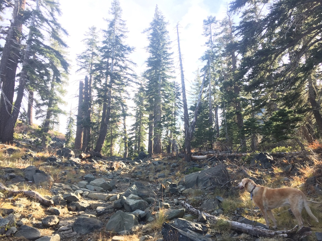
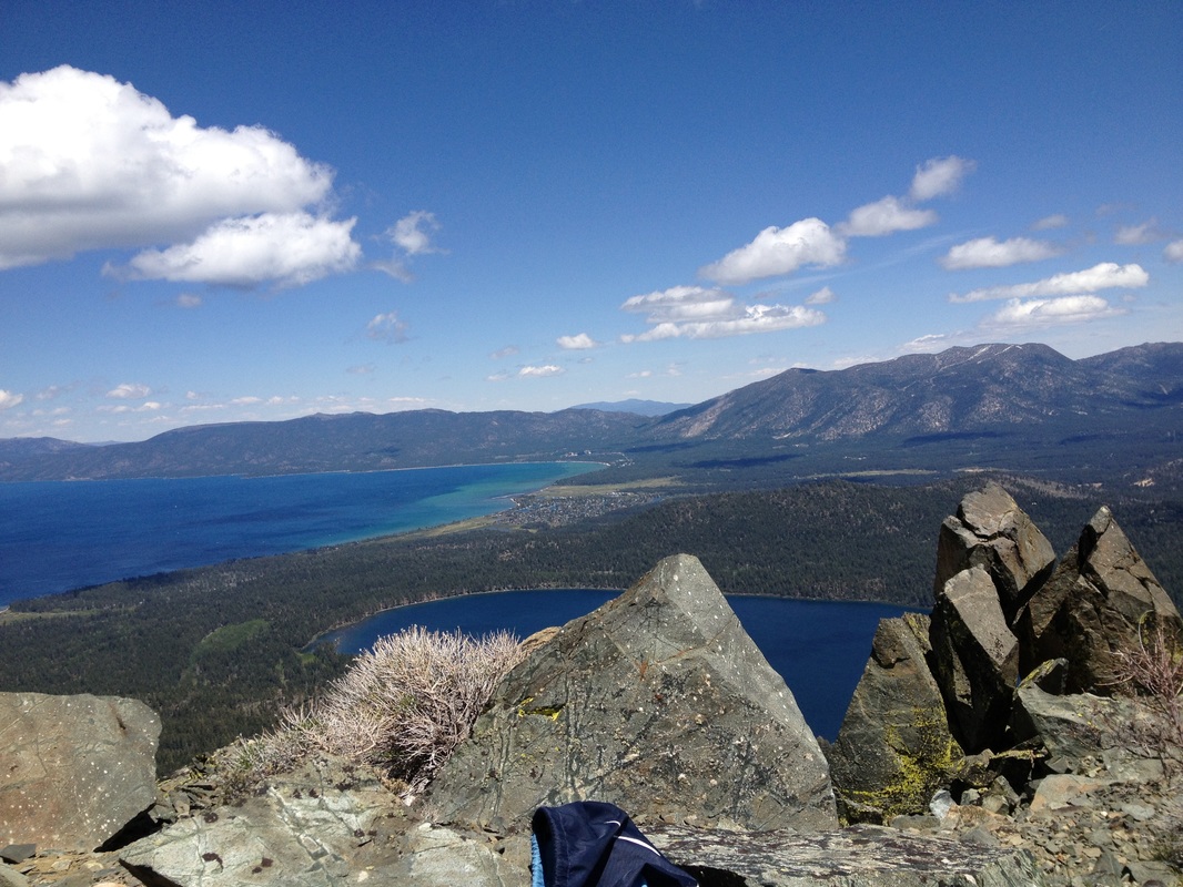
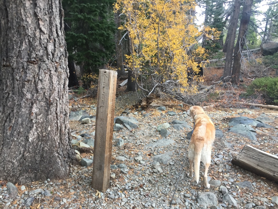
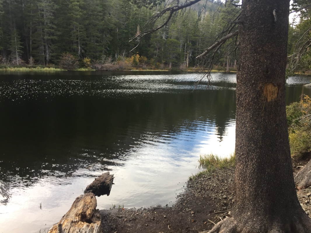
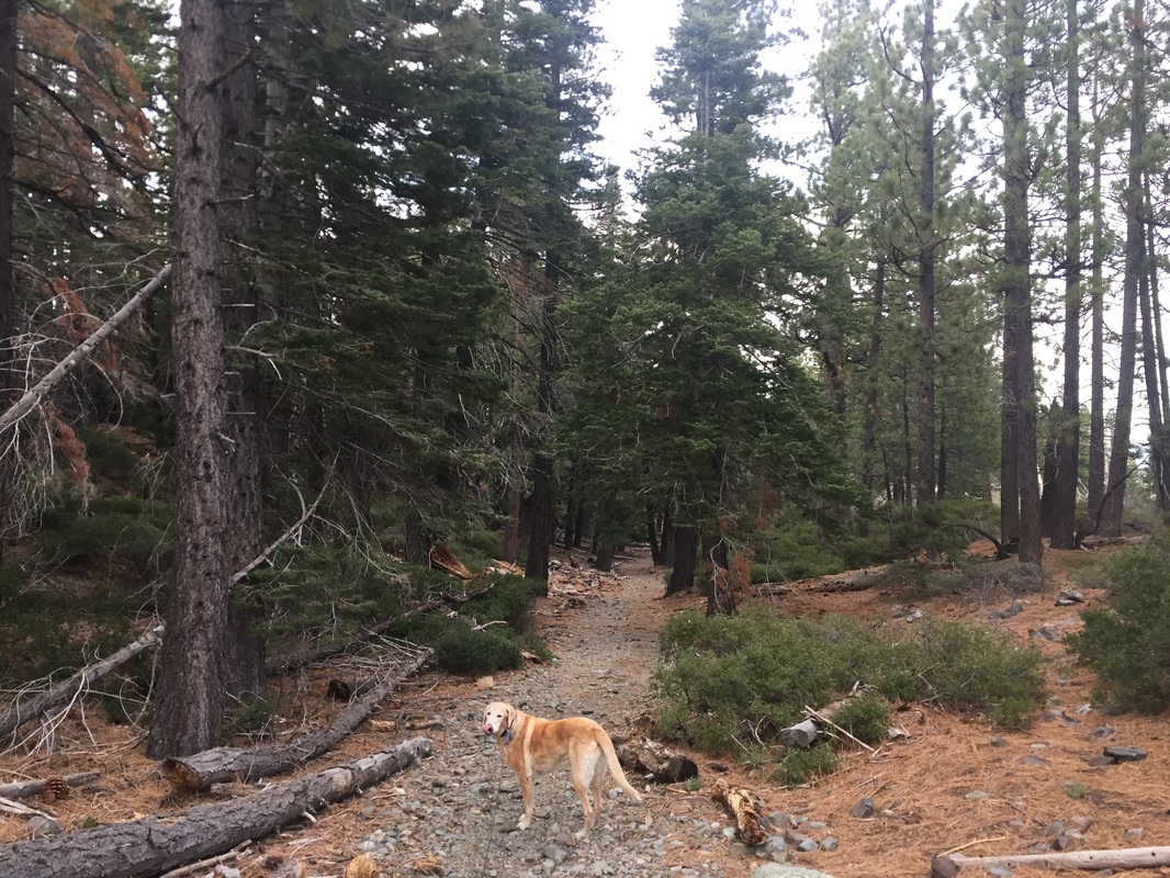
The beginning of the hike has a few switchbacks but slopes gently up the hillside through the trees. After a little less than a mile you'll finally reach a clearing in the trees and have great views of Fallen Leaf Lake and Lake Tahoe. The trail then becomes rocky and is mostly flat but completely covered in small rocks. There are a few boulder "stairs" you'll have to climb in several sections and at 1.7 miles you'll reach Floating Island Lake, which will be on your right. As you continue to hike you'll hear the creek and have to cross shallow sections of it a couple times. We even saw some snow at this elevation. You'll continue to climb, eventually reaching a trailhead post (stay to your right, going uphill). At 2.5 miles you will reach Cathedral Lake. After this you'll have to climb a lot of steep rock stairs, with several switchbacks cut into the rockside climbing uphill. There are amazing views of the lakes below at this point, which is only about 3.5 miles into the hike. The last stretch of the hike is a steep rock scramble leading you to the peak of Mt. Tallac at 9,735 feet.
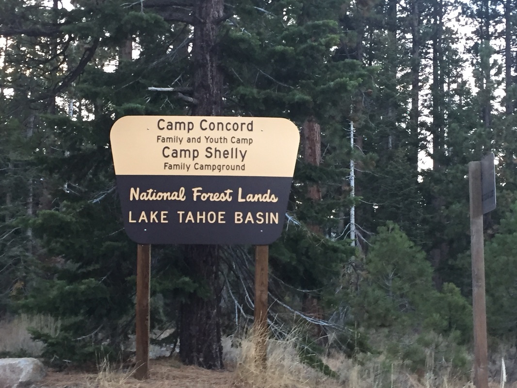
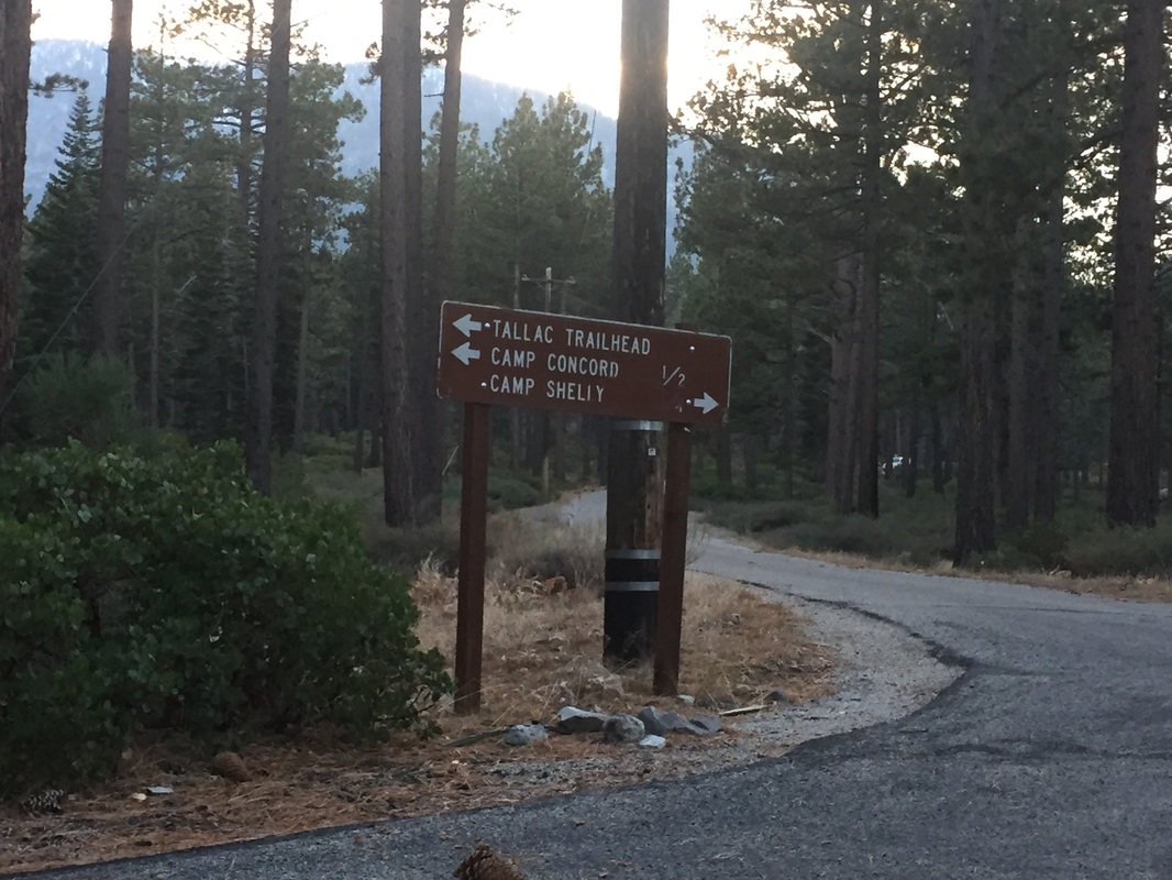
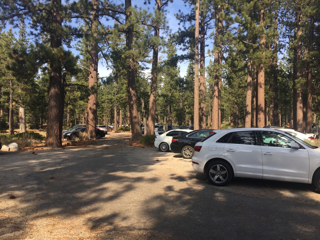
The parking lot is across from Baldwin Beach, and you'll see a sign for the "Mt. Tallac Trailhead" on your left as your pass Baldwin Beach on your right. You will drive down a road for about a quarter mile and see another sign telling you to turn left for Mt. Tallac. Keep driving and eventually you will reach the parking lot and trailhead. The actual parking lot at the trailhead is very small, but there's plenty of room to park alongside the road for quite a ways down. If you arrive late you will see lots of cars parked on the side of the road as you drive in.
There are no trash cans, restrooms or running water at the trailhead, so pack out your trash and bring plenty of water.
Parking: Free parking lot near the address above. Register for a self-serve wilderness permit at the trailhead.
Hours: Not Posted
Type: Hike (Difficult, 10 miles)
Regulations: Dogs allowed on-leash
Best time to visit: June to October when snow is not present on a cool day
Description: This is one of the most stunning hikes you will probably ever encounter. Although it's long, it winds through ever-changing scenery, from wooded areas, to hidden lakes. It ends at the incredible 9,735 ft summit with 360 degree views of the mountains and Lake Tahoe. Although the trail was strenuous, I did not find it too difficult until the last scramble up to the peak. This trail is rocky and very steep, and often covered in snow even when the trail below is not. I would not recommend the hike to the summit unless you and your dog are in excellent shape. However, even if you do not make it to the summit, the trails below are well worth the hike. You can turn back at Floating Island Lake (1.7 miles one way), or Cathedral Lake (2.5 miles one way), and still have an incredible hike. Bring lots of water, and watch your dog for signs of overheating. Take it easy as you'll be able to feel the 3,500ft elevation gain. I would recommend a very early start, as it's a long hike, and the parking lot fills early.
The beginning of the hike has a few switchbacks but slopes gently up the hillside through the trees. After a little less than a mile you'll finally reach a clearing in the trees and have great views of Fallen Leaf Lake and Lake Tahoe. The trail then becomes rocky and is mostly flat but completely covered in small rocks. There are a few boulder "stairs" you'll have to climb in several sections and at 1.7 miles you'll reach Floating Island Lake, which will be on your right. As you continue to hike you'll hear the creek and have to cross shallow sections of it a couple times. We even saw some snow at this elevation. You'll continue to climb, eventually reaching a trailhead post (stay to your right, going uphill). At 2.5 miles you will reach Cathedral Lake. After this you'll have to climb a lot of steep rock stairs, with several switchbacks cut into the rockside climbing uphill. There are amazing views of the lakes below at this point, which is only about 3.5 miles into the hike. The last stretch of the hike is a steep rock scramble leading you to the peak of Mt. Tallac at 9,735 feet.
The parking lot is across from Baldwin Beach, and you'll see a sign for the "Mt. Tallac Trailhead" on your left as your pass Baldwin Beach on your right. You will drive down a road for about a quarter mile and see another sign telling you to turn left for Mt. Tallac. Keep driving and eventually you will reach the parking lot and trailhead. The actual parking lot at the trailhead is very small, but there's plenty of room to park alongside the road for quite a ways down. If you arrive late you will see lots of cars parked on the side of the road as you drive in.
There are no trash cans, restrooms or running water at the trailhead, so pack out your trash and bring plenty of water.


All content within this site Copyright © 2023 Hikes Dogs Love. All rights reserved. No part of this website may be reproduced without permission.

- Home
-
Browse All
-
Alameda County
>
- Albany Bulb
- Alameda Creek Regional Trail
- Brickyard Cove
- Brushy Peak Regional Preserve
- Anthony Chabot Regional Park (Lake Chabot)
- Aquatic Park
- Barlago Italian Kitchen
- Buchanan Dog Beach
- California Canoe & Kayak (Oakland)
- Cali Kid Burgers ‘N Shakes
- César Chávez Park
- Chabot Park
- Claremont Canyon
- Coyote Hills Regional Park
- Crab Cove
- Cull Canyon Regional Recreation Area
- Dimond Canyon Park
- Don Castro Regional Recreation Area
- Don Edwards Wildlife Refuge
- Dublin Hills Regional Park
- Emeryville Marina
- Fairmont Ridge
- Five Canyons Open Space Preserve
- Fremont Central Park
- Garin/Dry Creek Pioneer Regional Park
- Gilman Brewing Company
- Greenbelt Trails
- Hayward Regional Shoreline
- Heron Bay Trail
- Ikaros Greek Restaurant
- Jerusalem Organic Kitchen
- Joaquin Miller Park
- Lake Anza
- Lake Chabot
- Lake Merritt
- Leona Canyon Regional Open Space Preserve
- Leona Heights Park
- Marina Park
- Martin Canyon Creek Trail
- Martin Luther King Jr. Regional Shoreline
- Mission Peak
- Montclair Railroad Trail/ Torii Gate
- Morgan Territory Regional Preserve
- Oyster Bay Regional Shoreline
- Park Street Classic Car Show (Annual)
- Pleasanton Ridge Regional Preserve
- Point Emery
- Reinhardt Redwood Regional Park
- Robert's Park
- Room 389
- Shoreline Park
- Sibley Volcanic Regional Preserve
- Skyline Gate Staging Area
- Strawberry Canyon Fire Trail
- Sunol Regional Wilderness
- Temescal Regional Recreation Area
- Tilden Regional Park
- Upper Anthony Chabot Regional Park (Oakland Entrance)
- Upper Knowland Park
- Vargas Plateau Regional Park
- Butte County >
-
Contra Costa County
>
- Acalanes Ridge Open Space
- Briones Regional Park
- Carquinez Strait Regional Shoreline
- Crockett Hills Regional Park
- Diablo Foothills Regional Park
- EBMUD Trails
- Fernandez Ranch
- Frowning Ridge
- Geppetto's Caffe
- Hacienda de las Flores Park
- Hillside Nature Area
- Howe Homestead Park
- Indian Rock
- Kennedy Grove Regional Recreation Area
- Lafayette Community Park
- Lafayette Reservoir
- Las Trampas Regional Wilderness
- Lime Ridge Open Space
- Miller/Knox Regional Shoreline
- Moraga Commons Park
- Mulholland Ridge Open Space Preserve
- Point Isabel
- Point Molate Beach Park
- Point Pinole Regional Shoreline
- Point San Pablo Harbor
- Rubio's
- San Quentin Beach
- Shell Ridge Open Space
- Sobrante Ridge Regional Preserve
- Sugarloaf Open Space
- Sycamore Valley Open Space Preserve
- Tender Greens
- Tilden Regional Park
- Wildcat Canyon Regional Park
- El Dorado County >
-
Marin County
>
- 101 Surf Sports
- Baltimore Canyon Open Space Preserve
- Blackie's Pasture
- Camino Alto Preserve
- Carson Falls
- Cascade Falls
- Cataract Falls
- Dawn Falls
- Hippie Tree
- Ignacio Valley Preserve (Fairway Falls)
- Indian Valley Open Space Preserve
- King Mountain Open Space Preserve
- Marin Headlands (Coastal Trail)
- Old Saint Hilary's Open Space Preserve
- Phoenix Lake
- Red Hill Dog Park
- Red Hill Trail
- Ring Mountain Open Space Preserve
- Roy's Redwoods
- Sam's Anchor Cafe
- Sorich Ranch Park
- Tiburon Peninsula Historical Trail
- Tiburon Uplands
- Tucker Trail Falls
- Mariposa County >
- Mendocino County >
- Mono County >
- Monterey County >
- Nevada County >
- Placer County >
-
San Francisco County
>
- 2.2 Mile Urban Hike
- Bernal Heights Park
- The Brixton
- Billy Goat Hill Park
- Blackwood
- Clipper Cove Beach
- Crissy Field
- Dynamo Donut + Coffee
- Fort Funston
- Fort Mason
- Glen Canyon Park
- Golden Gate Park
- Grand View Park
- The Great Lawn/ Avenue of the Palms
- Java Beach Cafe
- John McLaren Park
- Interior Greenbelt
- Lake Merced
- Lands End
- Letterman Digital Arts Center
- Marina Green
- Mount Davidson
- Mount Sutro Open Space Reserve
- Ocean Beach
- Palace of Fine Arts
- Philz Coffee Truck
- Stern Grove
- Sutro Baths
- Sutro Heights Park
- TreasureFest
-
San Mateo County
>
- 7 Mile House Sports Bar & Grill
- Barbara's Fishtrap
- Bedwell Bayfront Park
- Bob's Vegetable Stand and Pumpkin Farm
- Cafe Pacifica
- Devil's Slide Coastal Trail
- Esplanade Beach
- Flying Fish Grill
- Half Moon Bay Kayak Co.
- McNee Ranch State Park (Montara Mountain)
- Montara State Beach
- Mori Point
- Mussel Rock Park
- Nick's Seafood Restaurant
- Panera Bread
- Pedro Point Headlands
- Poplar Beach
- Pulgas Ridge Open Space Preserve
- Rancho Corral de Tierra
- Seal Point
- Taqueria La Mexicana
- Wavecrest Open Space
- Santa Clara County >
- Santa Cruz County >
- Solano County >
- Sonoma County >
- Tuolumne County >
- Yuba County >
-
Alameda County
>
- Map View
-
More