
- Home
-
Browse All
-
Alameda County
>
- Albany Bulb
- Alameda Creek Regional Trail
- Brickyard Cove
- Brushy Peak Regional Preserve
- Anthony Chabot Regional Park (Lake Chabot)
- Aquatic Park
- Barlago Italian Kitchen
- Buchanan Dog Beach
- California Canoe & Kayak (Oakland)
- Cali Kid Burgers ‘N Shakes
- César Chávez Park
- Chabot Park
- Claremont Canyon
- Coyote Hills Regional Park
- Crab Cove
- Cull Canyon Regional Recreation Area
- Dimond Canyon Park
- Don Castro Regional Recreation Area
- Don Edwards Wildlife Refuge
- Dublin Hills Regional Park
- Emeryville Marina
- Fairmont Ridge
- Five Canyons Open Space Preserve
- Fremont Central Park
- Garin/Dry Creek Pioneer Regional Park
- Gilman Brewing Company
- Greenbelt Trails
- Hayward Regional Shoreline
- Heron Bay Trail
- Ikaros Greek Restaurant
- Jerusalem Organic Kitchen
- Joaquin Miller Park
- Lake Anza
- Lake Chabot
- Lake Merritt
- Leona Canyon Regional Open Space Preserve
- Leona Heights Park
- Marina Park
- Martin Canyon Creek Trail
- Martin Luther King Jr. Regional Shoreline
- Mission Peak
- Montclair Railroad Trail/ Torii Gate
- Morgan Territory Regional Preserve
- Oyster Bay Regional Shoreline
- Park Street Classic Car Show (Annual)
- Pleasanton Ridge Regional Preserve
- Point Emery
- Reinhardt Redwood Regional Park
- Robert's Park
- Room 389
- Shoreline Park
- Sibley Volcanic Regional Preserve
- Skyline Gate Staging Area
- Strawberry Canyon Fire Trail
- Sunol Regional Wilderness
- Temescal Regional Recreation Area
- Tilden Regional Park
- Upper Anthony Chabot Regional Park (Oakland Entrance)
- Upper Knowland Park
- Vargas Plateau Regional Park
- Butte County >
-
Contra Costa County
>
- Acalanes Ridge Open Space
- Briones Regional Park
- Carquinez Strait Regional Shoreline
- Crockett Hills Regional Park
- Diablo Foothills Regional Park
- EBMUD Trails
- Fernandez Ranch
- Frowning Ridge
- Geppetto's Caffe
- Hacienda de las Flores Park
- Hillside Nature Area
- Howe Homestead Park
- Indian Rock
- Kennedy Grove Regional Recreation Area
- Lafayette Community Park
- Lafayette Reservoir
- Las Trampas Regional Wilderness
- Lime Ridge Open Space
- Miller/Knox Regional Shoreline
- Moraga Commons Park
- Mulholland Ridge Open Space Preserve
- Point Isabel
- Point Molate Beach Park
- Point Pinole Regional Shoreline
- Point San Pablo Harbor
- Rubio's
- San Quentin Beach
- Shell Ridge Open Space
- Sobrante Ridge Regional Preserve
- Sugarloaf Open Space
- Sycamore Valley Open Space Preserve
- Tender Greens
- Tilden Regional Park
- Wildcat Canyon Regional Park
- El Dorado County >
-
Marin County
>
- 101 Surf Sports
- Baltimore Canyon Open Space Preserve
- Blackie's Pasture
- Camino Alto Preserve
- Carson Falls
- Cascade Falls
- Cataract Falls
- Dawn Falls
- Hippie Tree
- Ignacio Valley Preserve (Fairway Falls)
- Indian Valley Open Space Preserve
- King Mountain Open Space Preserve
- Marin Headlands (Coastal Trail)
- Old Saint Hilary's Open Space Preserve
- Phoenix Lake
- Red Hill Dog Park
- Red Hill Trail
- Ring Mountain Open Space Preserve
- Roy's Redwoods
- Sam's Anchor Cafe
- Sorich Ranch Park
- Tiburon Peninsula Historical Trail
- Tiburon Uplands
- Tucker Trail Falls
- Mariposa County >
- Mendocino County >
- Mono County >
- Monterey County >
- Nevada County >
- Placer County >
-
San Francisco County
>
- 2.2 Mile Urban Hike
- Bernal Heights Park
- The Brixton
- Billy Goat Hill Park
- Blackwood
- Clipper Cove Beach
- Crissy Field
- Dynamo Donut + Coffee
- Fort Funston
- Fort Mason
- Glen Canyon Park
- Golden Gate Park
- Grand View Park
- The Great Lawn/ Avenue of the Palms
- Java Beach Cafe
- John McLaren Park
- Interior Greenbelt
- Lake Merced
- Lands End
- Letterman Digital Arts Center
- Marina Green
- Mount Davidson
- Mount Sutro Open Space Reserve
- Ocean Beach
- Palace of Fine Arts
- Philz Coffee Truck
- Stern Grove
- Sutro Baths
- Sutro Heights Park
- TreasureFest
-
San Mateo County
>
- 7 Mile House Sports Bar & Grill
- Barbara's Fishtrap
- Bedwell Bayfront Park
- Bob's Vegetable Stand and Pumpkin Farm
- Cafe Pacifica
- Devil's Slide Coastal Trail
- Esplanade Beach
- Flying Fish Grill
- Half Moon Bay Kayak Co.
- McNee Ranch State Park (Montara Mountain)
- Montara State Beach
- Mori Point
- Mussel Rock Park
- Nick's Seafood Restaurant
- Panera Bread
- Pedro Point Headlands
- Poplar Beach
- Pulgas Ridge Open Space Preserve
- Rancho Corral de Tierra
- Seal Point
- Taqueria La Mexicana
- Wavecrest Open Space
- Santa Clara County >
- Santa Cruz County >
- Solano County >
- Sonoma County >
- Tuolumne County >
- Yuba County >
-
Alameda County
>
- Map View
-
More
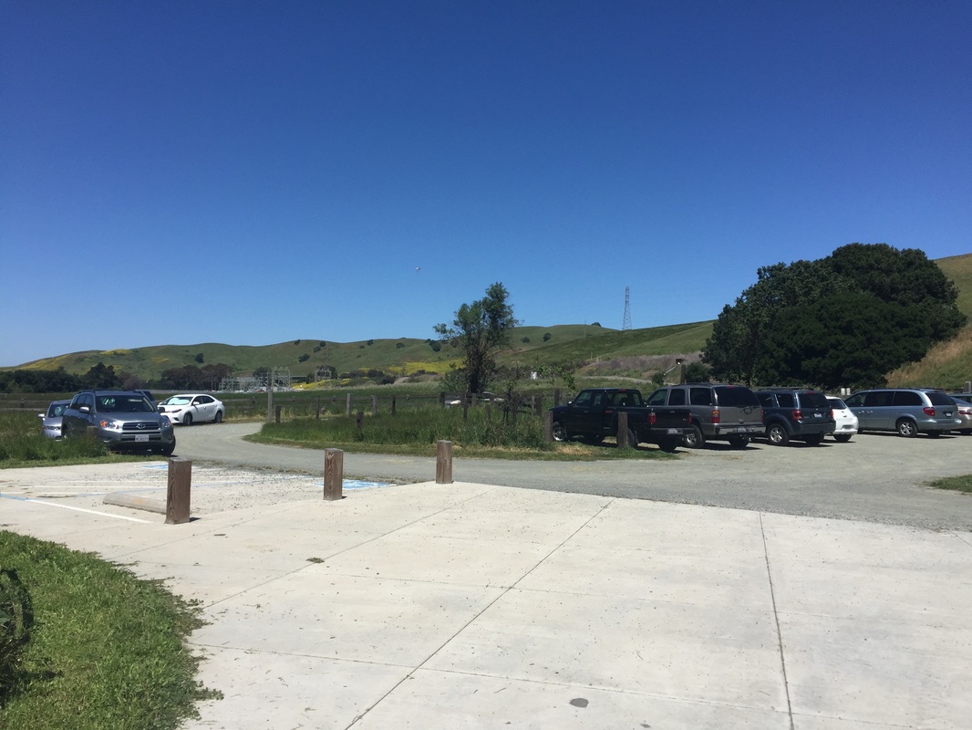
Address: 37.999497, -122.204702 (~0.6 miles down Christie Rd from CA-4 E)
Parking: Free parking lot at the address above
Hours: Dawn to Dusk
Type: Hike (moderate)
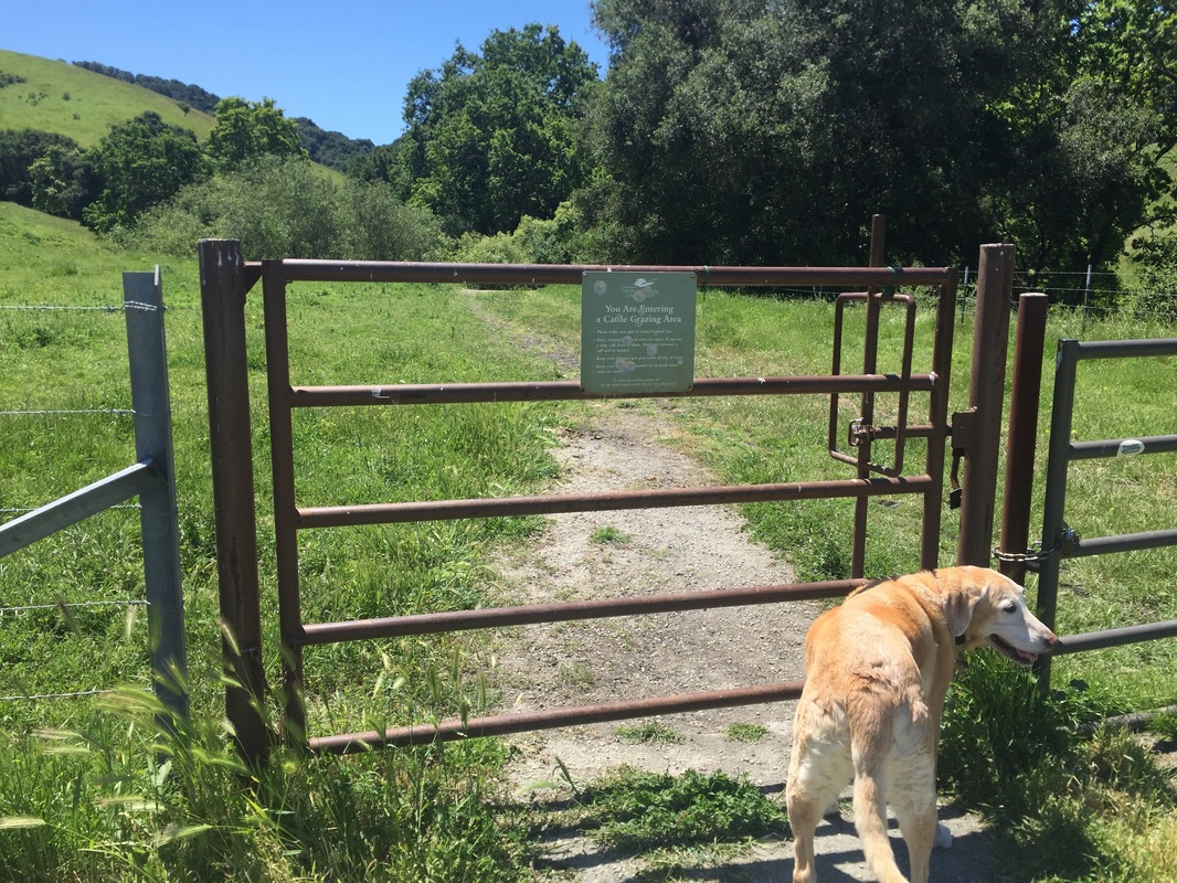
Dog Rules: Dogs must be on-leash near picnic tables but are allowed off-leash in the rest of the park, if under voice control. Bring a leash in case you encounter grazing cattle.
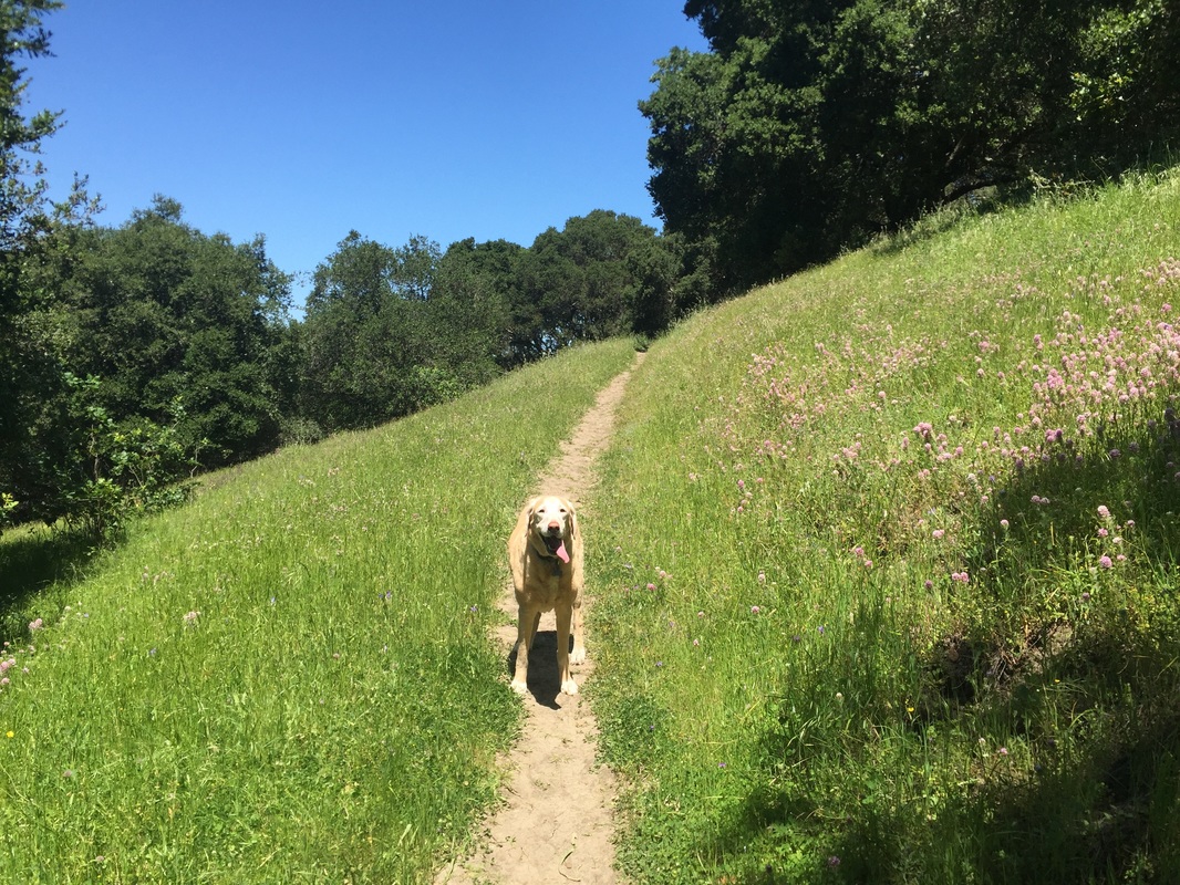
Best time to visit: Morning or on a cloudy day. The initial trails are fully exposed to sunlight, and many of the trails have sunny stretches, fully exposed to sunlight. The dirt gets hot under your dog’s paws.
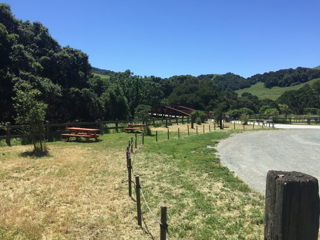
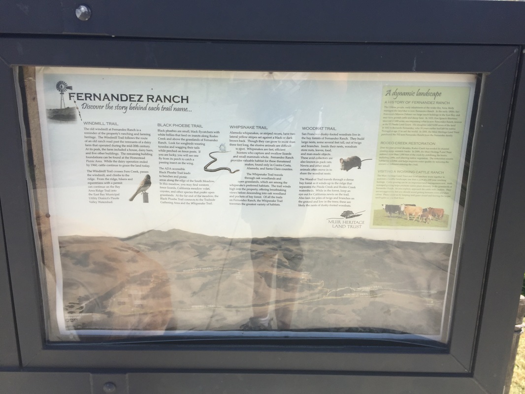
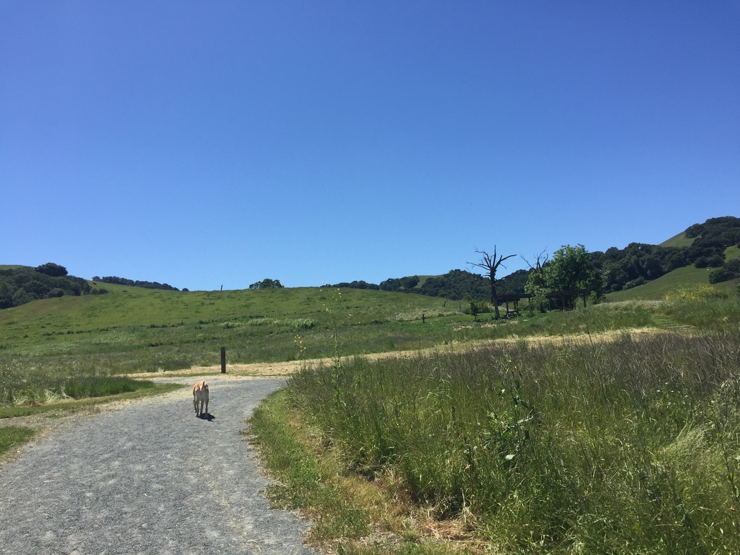
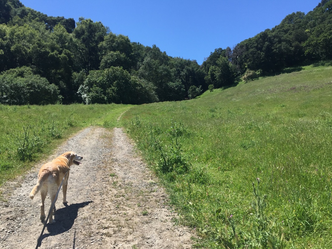
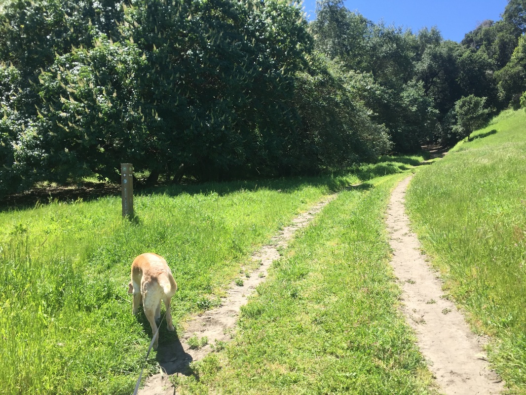
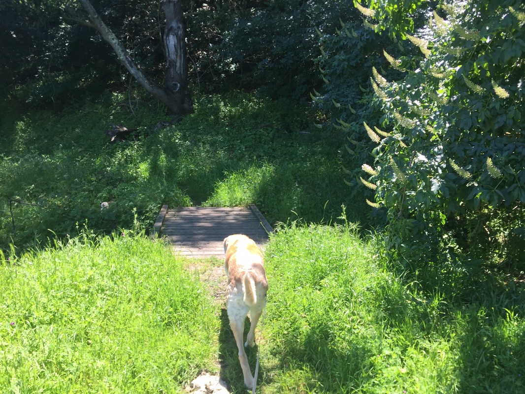
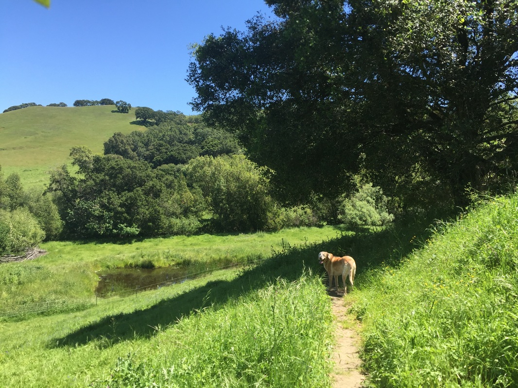
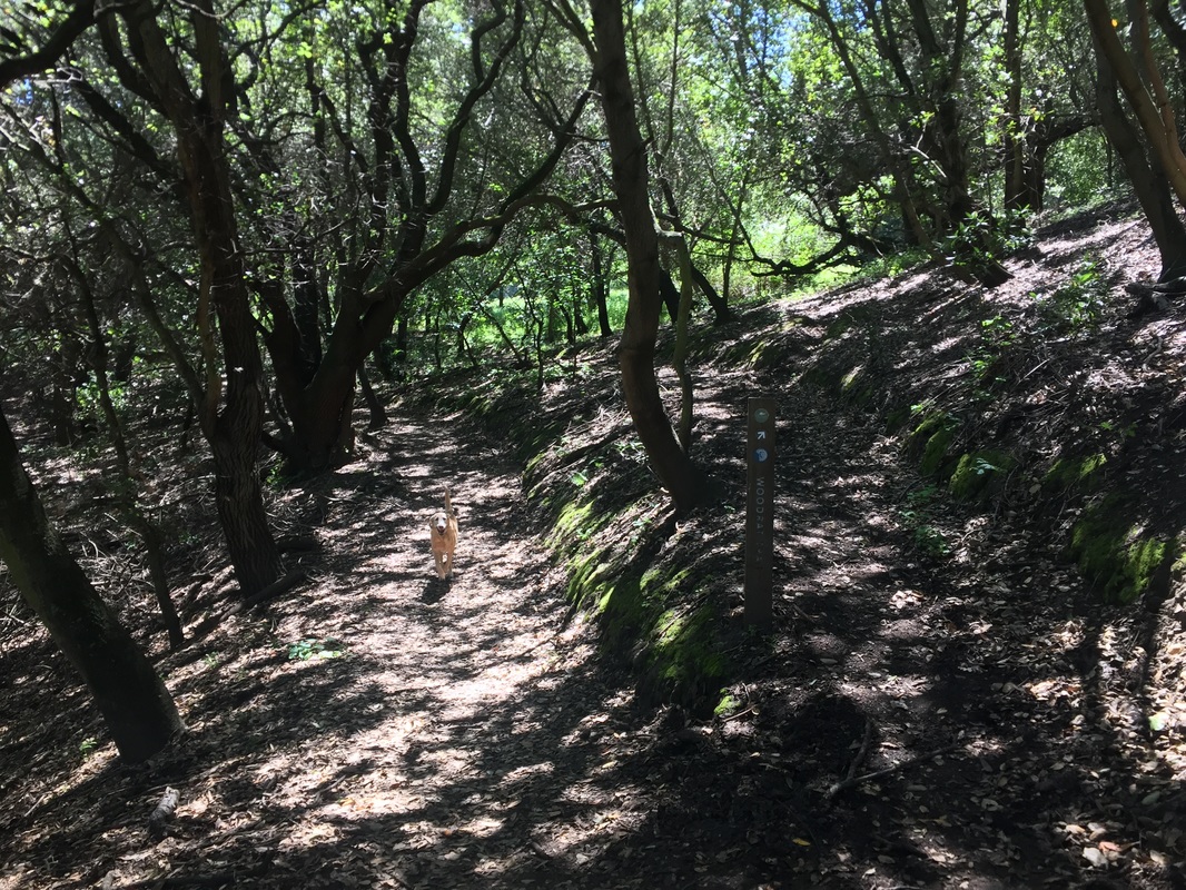
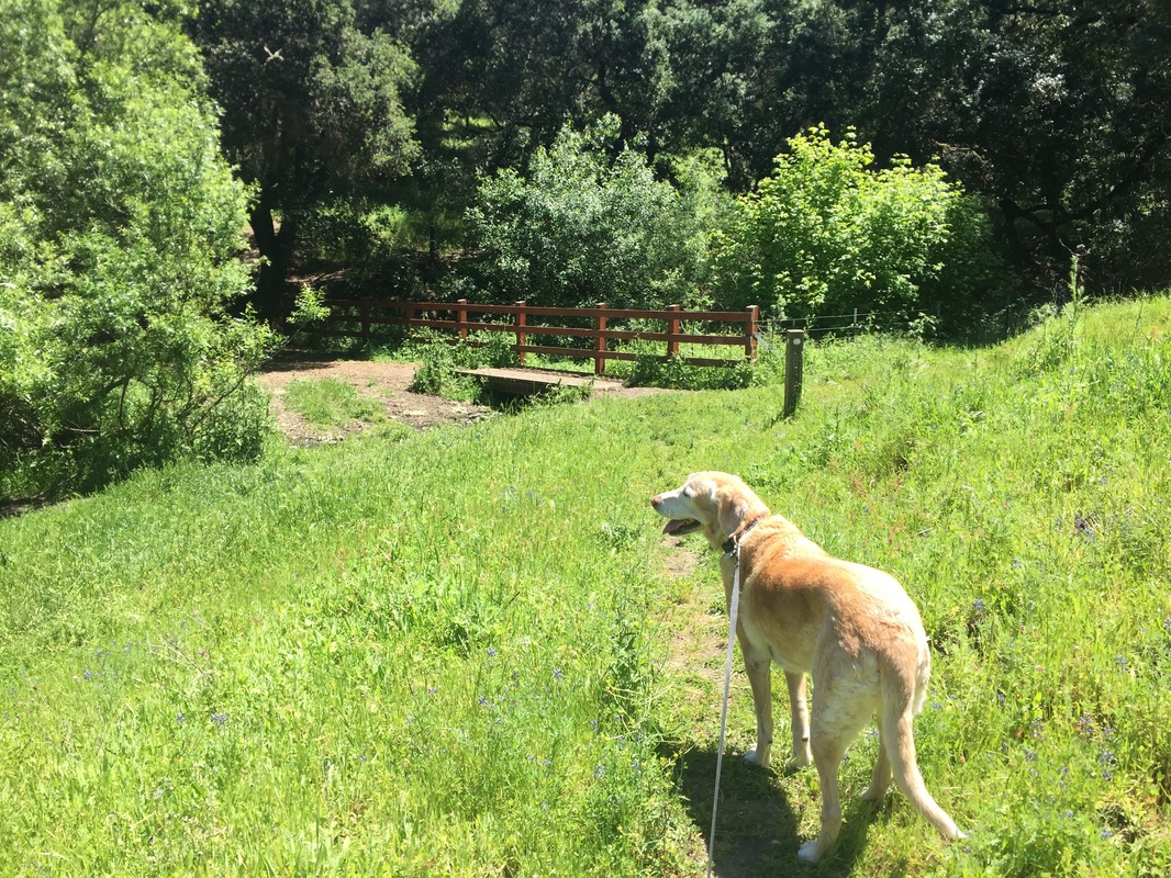
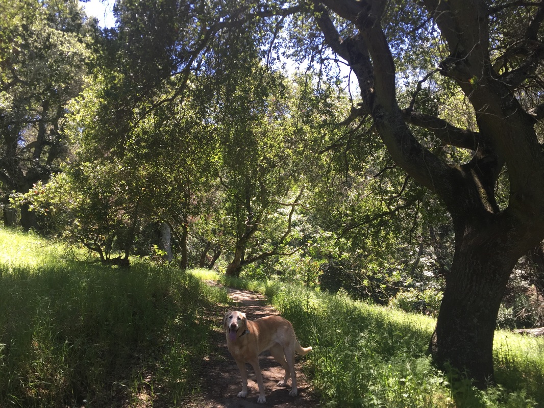
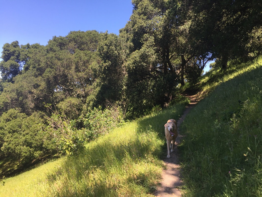
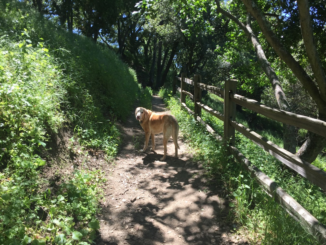
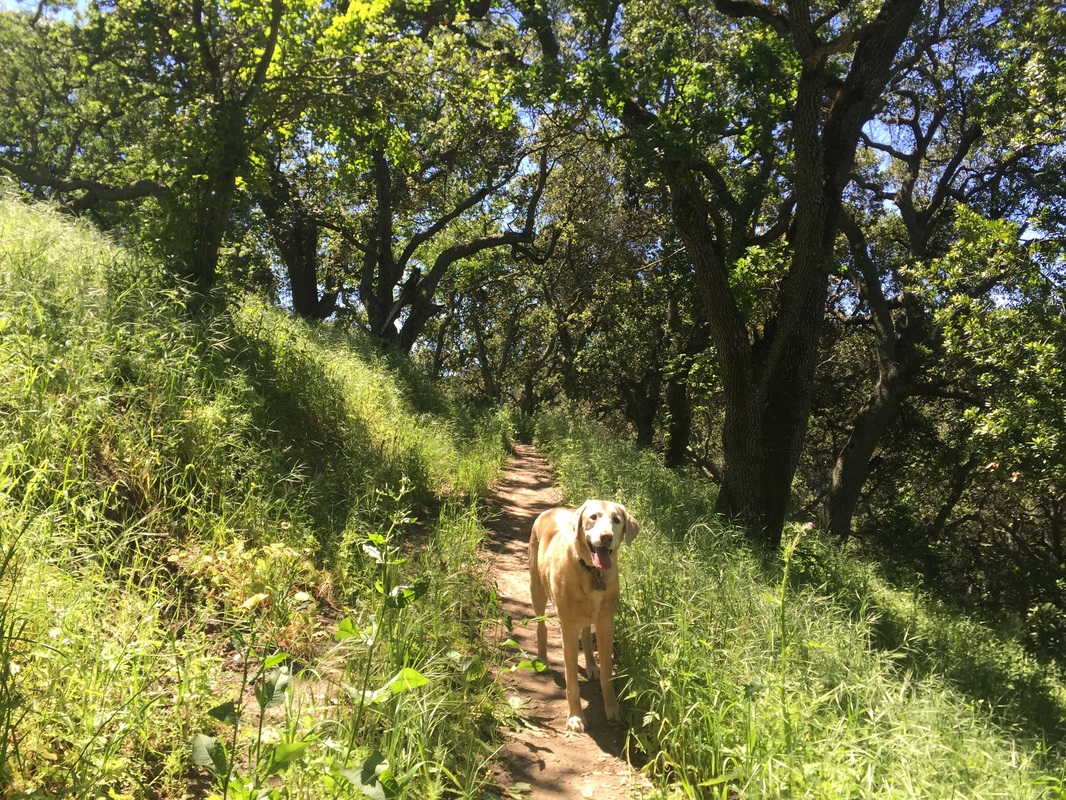
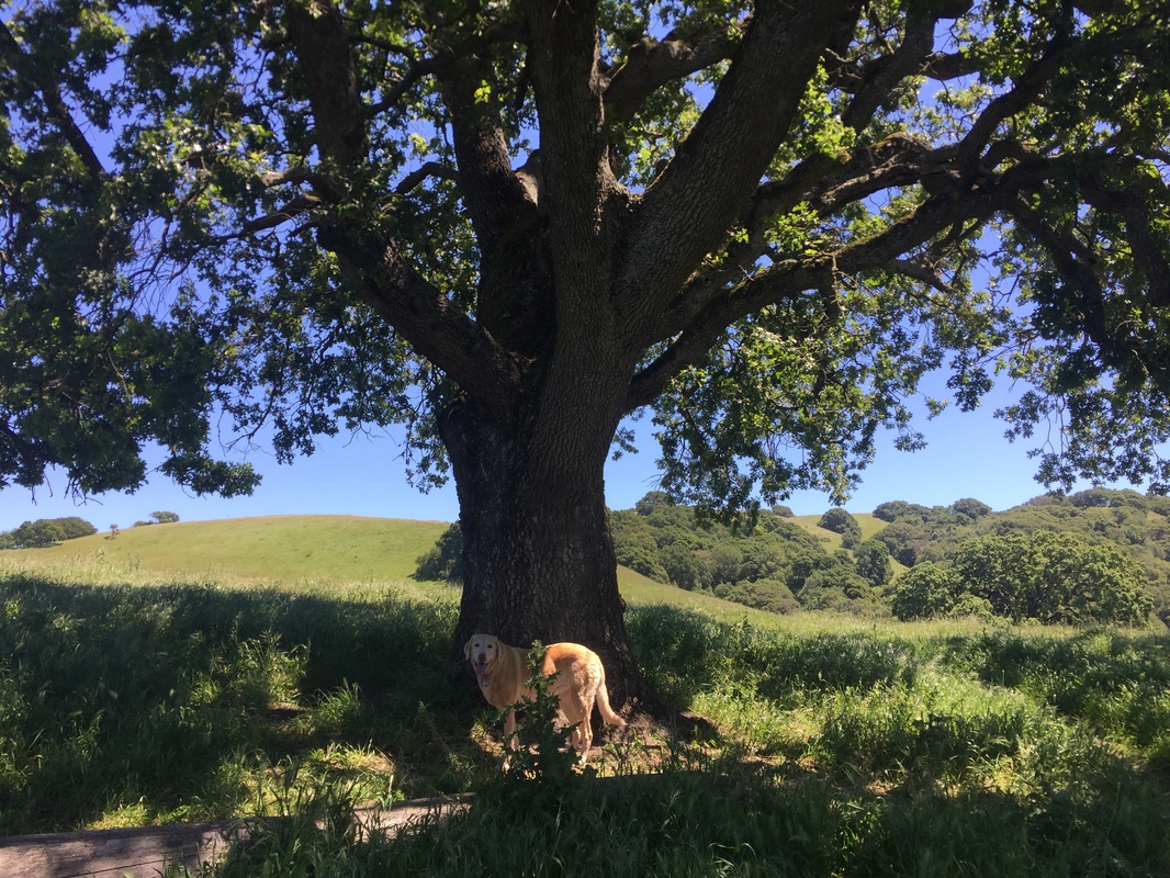
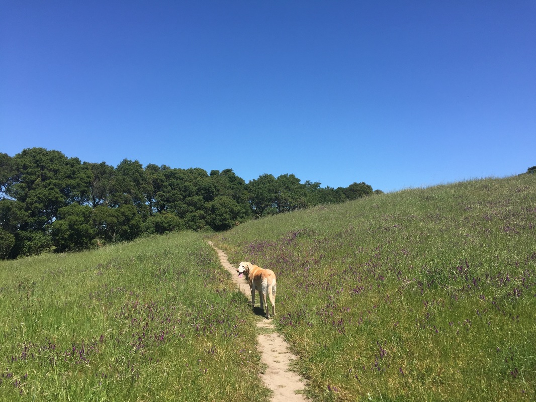
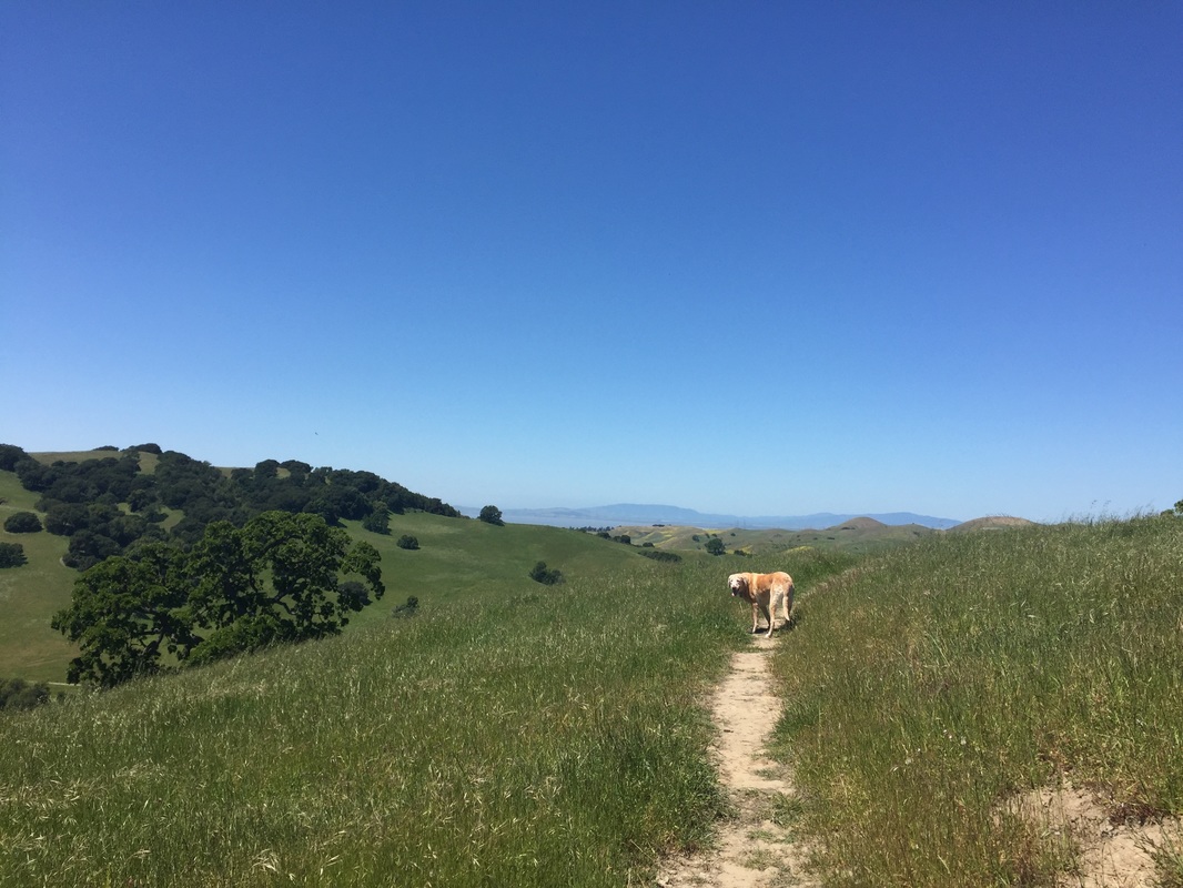
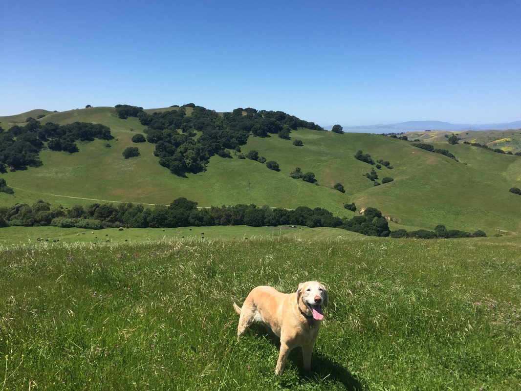
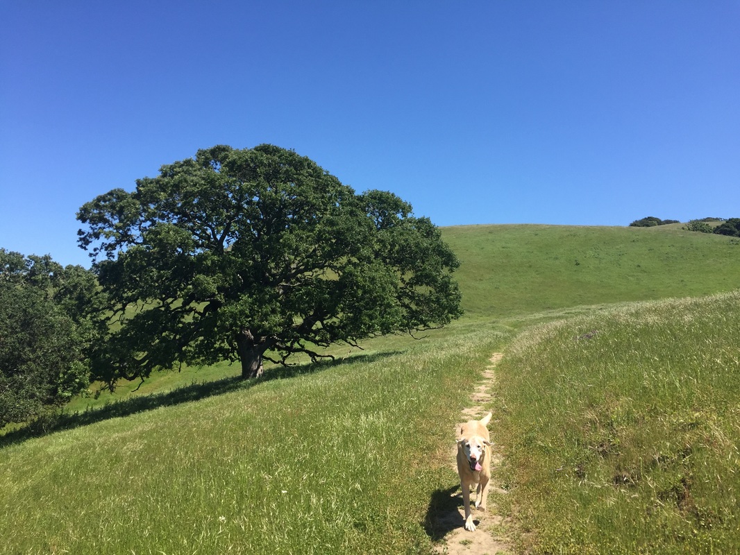
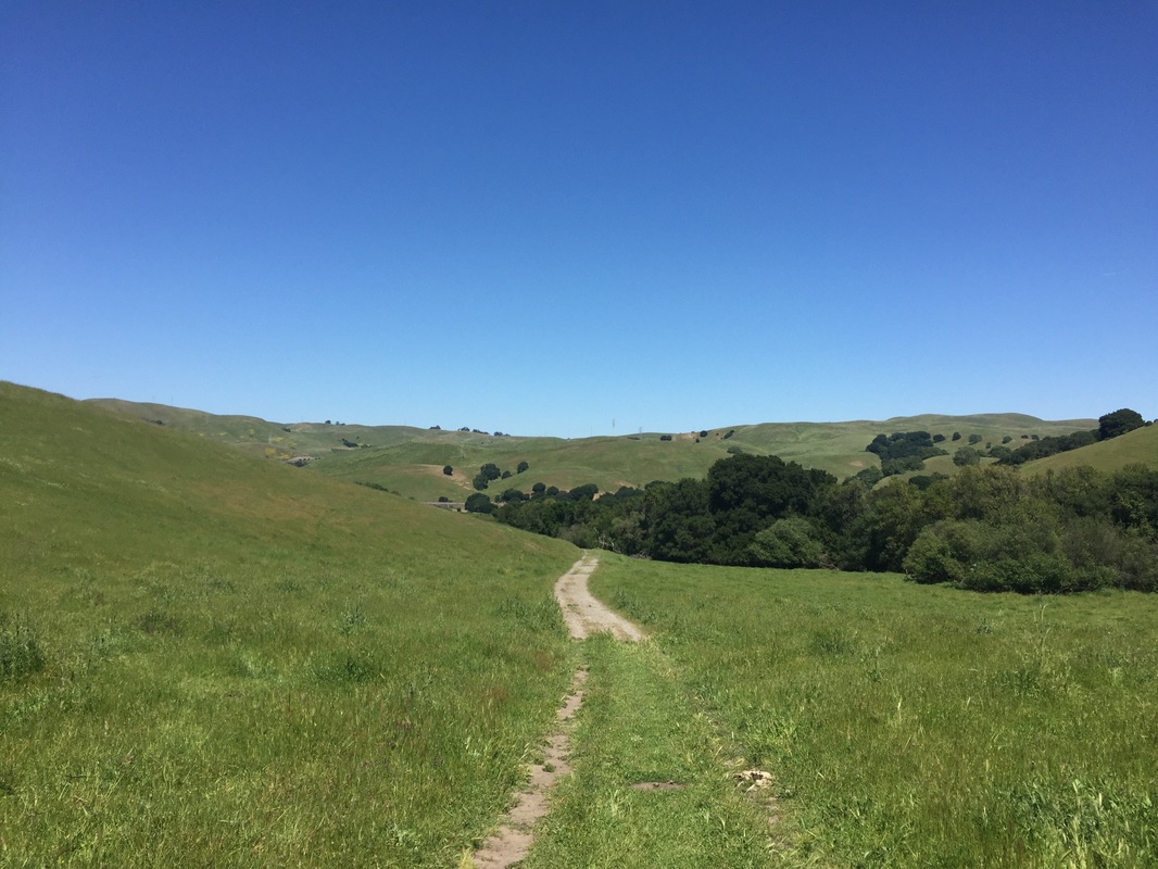
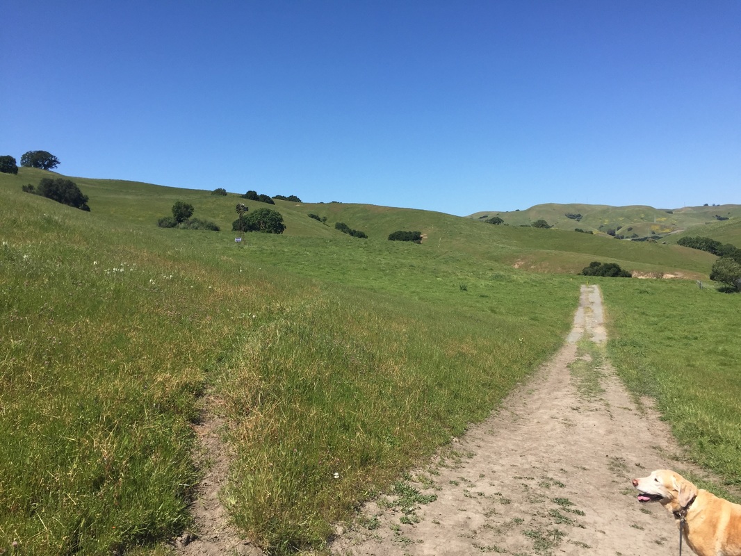
Description: This is a beautiful dog-friendly 700-acre park with ridge top views. The initial trail is hot and dry, fully exposed to sunlight. Once you reach the Whipsnake Trail, many of the trails have intermittent shade under forests of oak trees. You can hike up along the hillside, dotted with purple and yellow wildflowers, until you reach a lookout point with views of the bay. We noticed that the trails closest to the parking lot are undergoing maintenance, and weeds and high grass are being cut down. A few stretches of trails on the hillside are overgrown with tall grass, so be careful and wear long pants during your hike. Although we saw grazing cattle in the distance, we did not run into any during our hike. They stayed near the creek away from the trails.
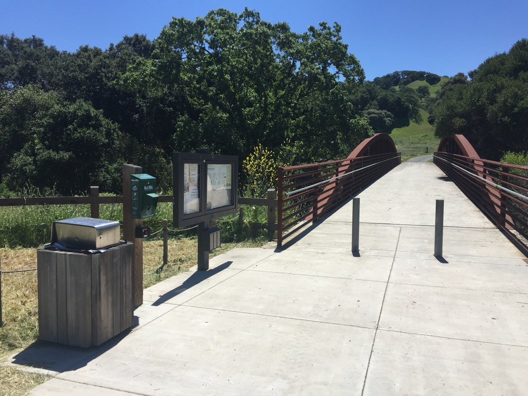
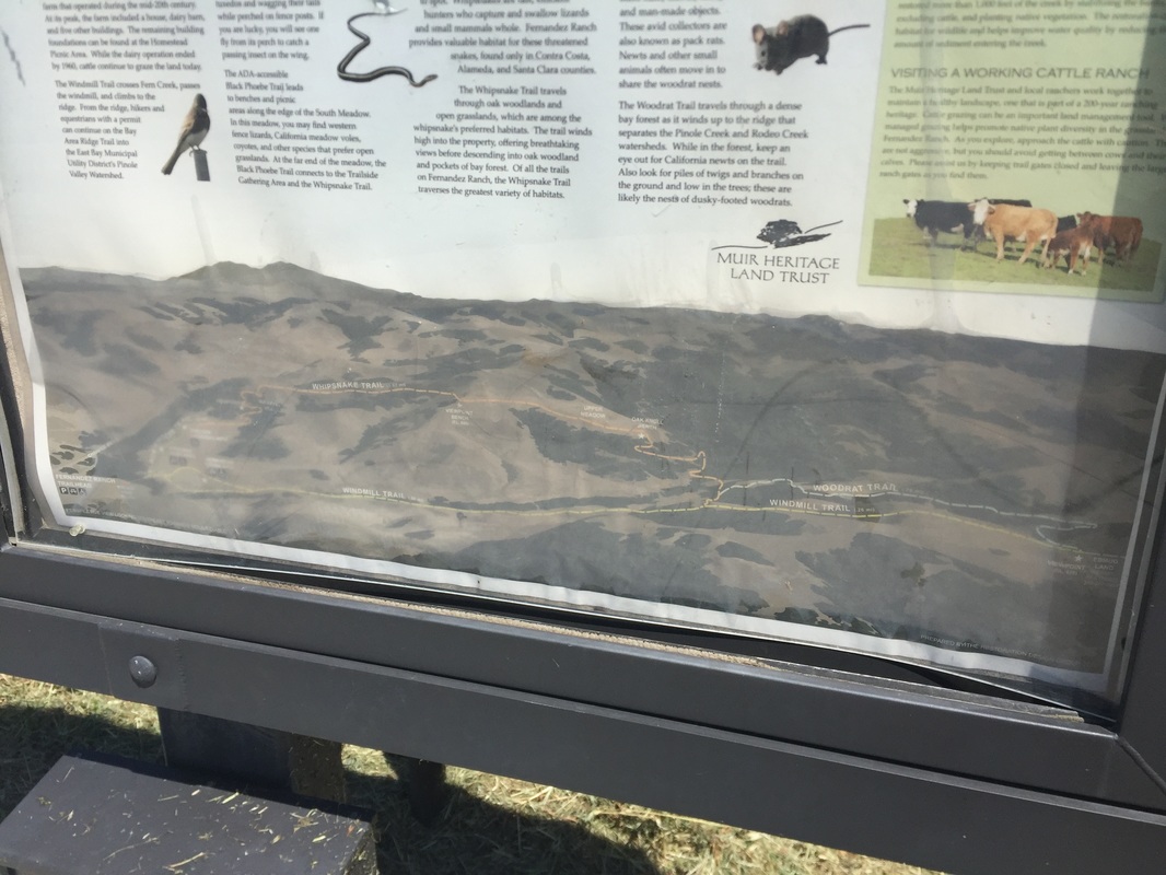
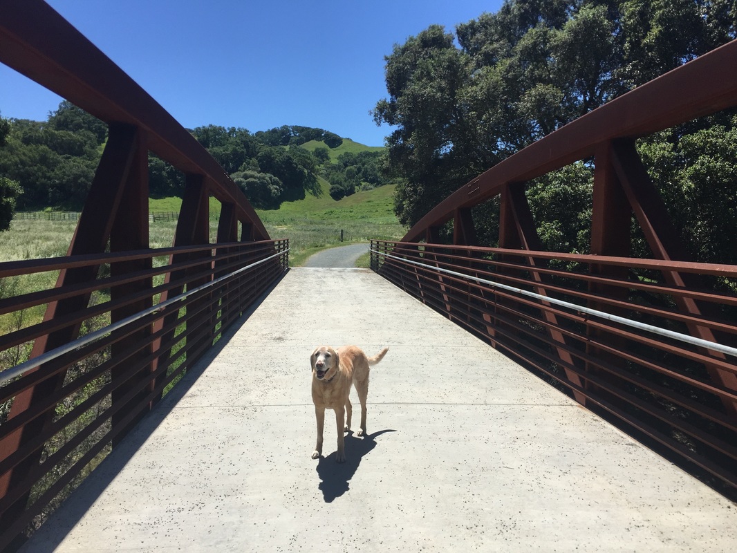
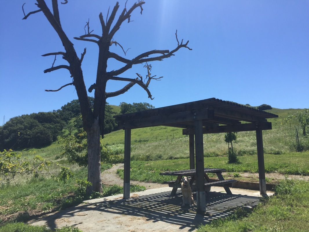
During our hike, we hiked to the viewpoint overlooking the bay, which was approximately a 3.5 mile round trip hike with 300ft of elevation gain. From the parking lot, proceed over the bridge and up between the two shaded picnic tables. Continue on the Windmill trail to your right, through the cattle gate. After a couple short hills you will see a windmill on your right. Hike over another small hill and you will see a sign for the Windmill Trail on your left. Cross a small bridge, hike through the shaded forest, cross another bridge, and you will pass through another open cattle gate. Stay to your right and head up hill. After several switchbacks through shaded trails, you will emerge on the hillside. Pass a large tree and continue on a trail, which will eventually lead you to the left. You will soon see a wooden bench and you will have a view of the bay. Head back for a 3.5 mile round trip hike. Or you can continue on the trail and back where you started from the Black Phoebe Trail. You can also loop the Woodrat trail on your way back.
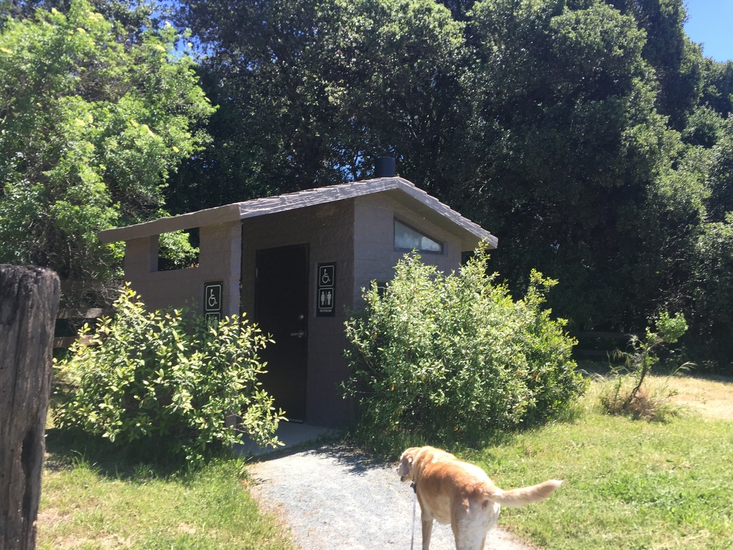
This park has multiple picnic tables, a pit toilet in the parking lot and doggy clean-up bags at the trailhead. No running water is available so pack in plenty of water.
A note on reaching the park: The park is secluded, and you will probably lose cell phone reception reaching it. You will need to exit CA-4 E on Christie Road, which is an abrupt exit down a dirt road that says it’s a dead-end. Proceed about 0.6 miles down the road, passing a house and train tracks, and you will see a dirt parking lot with a “Fernandez Ranch” sign. When exiting the park, you will need to enter the freeway at the same place you exited. It’s a little tricky because you’re entering after a stop sign on a freeway with cars going 55 MPH. Take your time and be cautious.
Parking: Free parking lot at the address above
Hours: Dawn to Dusk
Type: Hike (moderate)
Dog Rules: Dogs must be on-leash near picnic tables but are allowed off-leash in the rest of the park, if under voice control. Bring a leash in case you encounter grazing cattle.
Best time to visit: Morning or on a cloudy day. The initial trails are fully exposed to sunlight, and many of the trails have sunny stretches, fully exposed to sunlight. The dirt gets hot under your dog’s paws.
Description: This is a beautiful dog-friendly 700-acre park with ridge top views. The initial trail is hot and dry, fully exposed to sunlight. Once you reach the Whipsnake Trail, many of the trails have intermittent shade under forests of oak trees. You can hike up along the hillside, dotted with purple and yellow wildflowers, until you reach a lookout point with views of the bay. We noticed that the trails closest to the parking lot are undergoing maintenance, and weeds and high grass are being cut down. A few stretches of trails on the hillside are overgrown with tall grass, so be careful and wear long pants during your hike. Although we saw grazing cattle in the distance, we did not run into any during our hike. They stayed near the creek away from the trails.
During our hike, we hiked to the viewpoint overlooking the bay, which was approximately a 3.5 mile round trip hike with 300ft of elevation gain. From the parking lot, proceed over the bridge and up between the two shaded picnic tables. Continue on the Windmill trail to your right, through the cattle gate. After a couple short hills you will see a windmill on your right. Hike over another small hill and you will see a sign for the Windmill Trail on your left. Cross a small bridge, hike through the shaded forest, cross another bridge, and you will pass through another open cattle gate. Stay to your right and head up hill. After several switchbacks through shaded trails, you will emerge on the hillside. Pass a large tree and continue on a trail, which will eventually lead you to the left. You will soon see a wooden bench and you will have a view of the bay. Head back for a 3.5 mile round trip hike. Or you can continue on the trail and back where you started from the Black Phoebe Trail. You can also loop the Woodrat trail on your way back.
This park has multiple picnic tables, a pit toilet in the parking lot and doggy clean-up bags at the trailhead. No running water is available so pack in plenty of water.
A note on reaching the park: The park is secluded, and you will probably lose cell phone reception reaching it. You will need to exit CA-4 E on Christie Road, which is an abrupt exit down a dirt road that says it’s a dead-end. Proceed about 0.6 miles down the road, passing a house and train tracks, and you will see a dirt parking lot with a “Fernandez Ranch” sign. When exiting the park, you will need to enter the freeway at the same place you exited. It’s a little tricky because you’re entering after a stop sign on a freeway with cars going 55 MPH. Take your time and be cautious.


All content within this site Copyright © 2023 Hikes Dogs Love. All rights reserved. No part of this website may be reproduced without permission.

- Home
-
Browse All
-
Alameda County
>
- Albany Bulb
- Alameda Creek Regional Trail
- Brickyard Cove
- Brushy Peak Regional Preserve
- Anthony Chabot Regional Park (Lake Chabot)
- Aquatic Park
- Barlago Italian Kitchen
- Buchanan Dog Beach
- California Canoe & Kayak (Oakland)
- Cali Kid Burgers ‘N Shakes
- César Chávez Park
- Chabot Park
- Claremont Canyon
- Coyote Hills Regional Park
- Crab Cove
- Cull Canyon Regional Recreation Area
- Dimond Canyon Park
- Don Castro Regional Recreation Area
- Don Edwards Wildlife Refuge
- Dublin Hills Regional Park
- Emeryville Marina
- Fairmont Ridge
- Five Canyons Open Space Preserve
- Fremont Central Park
- Garin/Dry Creek Pioneer Regional Park
- Gilman Brewing Company
- Greenbelt Trails
- Hayward Regional Shoreline
- Heron Bay Trail
- Ikaros Greek Restaurant
- Jerusalem Organic Kitchen
- Joaquin Miller Park
- Lake Anza
- Lake Chabot
- Lake Merritt
- Leona Canyon Regional Open Space Preserve
- Leona Heights Park
- Marina Park
- Martin Canyon Creek Trail
- Martin Luther King Jr. Regional Shoreline
- Mission Peak
- Montclair Railroad Trail/ Torii Gate
- Morgan Territory Regional Preserve
- Oyster Bay Regional Shoreline
- Park Street Classic Car Show (Annual)
- Pleasanton Ridge Regional Preserve
- Point Emery
- Reinhardt Redwood Regional Park
- Robert's Park
- Room 389
- Shoreline Park
- Sibley Volcanic Regional Preserve
- Skyline Gate Staging Area
- Strawberry Canyon Fire Trail
- Sunol Regional Wilderness
- Temescal Regional Recreation Area
- Tilden Regional Park
- Upper Anthony Chabot Regional Park (Oakland Entrance)
- Upper Knowland Park
- Vargas Plateau Regional Park
- Butte County >
-
Contra Costa County
>
- Acalanes Ridge Open Space
- Briones Regional Park
- Carquinez Strait Regional Shoreline
- Crockett Hills Regional Park
- Diablo Foothills Regional Park
- EBMUD Trails
- Fernandez Ranch
- Frowning Ridge
- Geppetto's Caffe
- Hacienda de las Flores Park
- Hillside Nature Area
- Howe Homestead Park
- Indian Rock
- Kennedy Grove Regional Recreation Area
- Lafayette Community Park
- Lafayette Reservoir
- Las Trampas Regional Wilderness
- Lime Ridge Open Space
- Miller/Knox Regional Shoreline
- Moraga Commons Park
- Mulholland Ridge Open Space Preserve
- Point Isabel
- Point Molate Beach Park
- Point Pinole Regional Shoreline
- Point San Pablo Harbor
- Rubio's
- San Quentin Beach
- Shell Ridge Open Space
- Sobrante Ridge Regional Preserve
- Sugarloaf Open Space
- Sycamore Valley Open Space Preserve
- Tender Greens
- Tilden Regional Park
- Wildcat Canyon Regional Park
- El Dorado County >
-
Marin County
>
- 101 Surf Sports
- Baltimore Canyon Open Space Preserve
- Blackie's Pasture
- Camino Alto Preserve
- Carson Falls
- Cascade Falls
- Cataract Falls
- Dawn Falls
- Hippie Tree
- Ignacio Valley Preserve (Fairway Falls)
- Indian Valley Open Space Preserve
- King Mountain Open Space Preserve
- Marin Headlands (Coastal Trail)
- Old Saint Hilary's Open Space Preserve
- Phoenix Lake
- Red Hill Dog Park
- Red Hill Trail
- Ring Mountain Open Space Preserve
- Roy's Redwoods
- Sam's Anchor Cafe
- Sorich Ranch Park
- Tiburon Peninsula Historical Trail
- Tiburon Uplands
- Tucker Trail Falls
- Mariposa County >
- Mendocino County >
- Mono County >
- Monterey County >
- Nevada County >
- Placer County >
-
San Francisco County
>
- 2.2 Mile Urban Hike
- Bernal Heights Park
- The Brixton
- Billy Goat Hill Park
- Blackwood
- Clipper Cove Beach
- Crissy Field
- Dynamo Donut + Coffee
- Fort Funston
- Fort Mason
- Glen Canyon Park
- Golden Gate Park
- Grand View Park
- The Great Lawn/ Avenue of the Palms
- Java Beach Cafe
- John McLaren Park
- Interior Greenbelt
- Lake Merced
- Lands End
- Letterman Digital Arts Center
- Marina Green
- Mount Davidson
- Mount Sutro Open Space Reserve
- Ocean Beach
- Palace of Fine Arts
- Philz Coffee Truck
- Stern Grove
- Sutro Baths
- Sutro Heights Park
- TreasureFest
-
San Mateo County
>
- 7 Mile House Sports Bar & Grill
- Barbara's Fishtrap
- Bedwell Bayfront Park
- Bob's Vegetable Stand and Pumpkin Farm
- Cafe Pacifica
- Devil's Slide Coastal Trail
- Esplanade Beach
- Flying Fish Grill
- Half Moon Bay Kayak Co.
- McNee Ranch State Park (Montara Mountain)
- Montara State Beach
- Mori Point
- Mussel Rock Park
- Nick's Seafood Restaurant
- Panera Bread
- Pedro Point Headlands
- Poplar Beach
- Pulgas Ridge Open Space Preserve
- Rancho Corral de Tierra
- Seal Point
- Taqueria La Mexicana
- Wavecrest Open Space
- Santa Clara County >
- Santa Cruz County >
- Solano County >
- Sonoma County >
- Tuolumne County >
- Yuba County >
-
Alameda County
>
- Map View
-
More