Hikes Dogs Love
  • Home
  • Map View
    • Vacation Hikes >
      • Arizona >
        • Papago Park
      • New Mexico >
        • Oliver Lee Memorial State Park >
          • Browse All >
            • Alameda County >
              • Albany Bulb
              • Alameda Creek Regional Trail
              • Barlago Italian Kitchen
              • Brickyard Cove
              • Brushy Peak Regional Preserve
              • Anthony Chabot Regional Park (Lake Chabot)
              • Aquatic Park
              • Buchanan Dog Beach
              • California Canoe & Kayak (Oakland)
              • Cali Kid Burgers ‘N Shakes
              • César Chávez Park
              • Chabot Park
              • Claremont Canyon
              • Coyote Hills Regional Park
              • Crab Cove
              • Cull Canyon Regional Recreation Area
              • Dimond Canyon Park
              • Don Castro Regional Recreation Area
              • Don Edwards Wildlife Refuge
              • Dublin Hills Regional Park
              • Emeryville Marina
              • Fairmont Ridge
              • Five Canyons Open Space Preserve
              • Fremont Central Park
              • Garin/Dry Creek Pioneer Regional Park
              • Gilman Brewing Company
              • Greenbelt Trails
              • Hayward Regional Shoreline
              • Heron Bay Trail
              • Ikaros Greek Restaurant
              • Jerusalem Organic Kitchen
              • Joaquin Miller Park
              • Lake Anza
              • Lake Chabot
              • Lake Merritt
              • Leona Canyon Regional Open Space Preserve
              • Leona Heights Park
              • Marina Park
              • Martin Canyon Creek Trail
              • Martin Luther King Jr. Regional Shoreline
              • Mission Peak
              • Montclair Railroad Trail/ Torii Gate
              • Morgan Territory Regional Preserve
              • Oyster Bay Regional Shoreline
              • Park Street Classic Car Show (Annual)
              • Pleasanton Ridge Regional Preserve
              • Point Emery
              • Reinhardt Redwood Regional Park
              • Robert's Park
              • Room 389
              • Shoreline Park
              • Sibley Volcanic Regional Preserve
              • Skyline Gate Staging Area
              • Strawberry Canyon Fire Trail
              • Sunol Regional Wilderness
              • Temescal Regional Recreation Area
              • Tilden Regional Park
              • Upper Anthony Chabot Regional Park (Oakland Entrance)
              • Upper Knowland Park
              • Vargas Plateau Regional Park
            • Butte County >
              • Feather Falls
              • Motel 6 - Oroville
              • Riverbend Park
            • Contra Costa County >
              • Acalanes Ridge Open Space
              • Briones Regional Park
              • Carquinez Strait Regional Shoreline
              • Crockett Hills Regional Park
              • Diablo Foothills Regional Park
              • EBMUD Trails
              • Fernandez Ranch
              • Frowning Ridge
              • Geppetto's Caffe
              • Hacienda de las Flores Park
              • Hillside Nature Area
              • Howe Homestead Park
              • Indian Rock
              • Kennedy Grove Regional Recreation Area
              • Lafayette Community Park
              • Lafayette Reservoir
              • Las Trampas Regional Wilderness
              • Lime Ridge Open Space
              • Miller/Knox Regional Shoreline
              • Moraga Commons Park
              • Mulholland Ridge Open Space Preserve
              • Point Isabel
              • Point Molate Beach Park
              • Point Pinole Regional Shoreline
              • Point San Pablo Harbor
              • Rubio's
              • San Quentin Beach
              • Shell Ridge Open Space
              • Sobrante Ridge Regional Preserve
              • Sugarloaf Open Space
              • Sycamore Valley Open Space Preserve
              • Tender Greens
              • Tilden Regional Park
              • Wildcat Canyon Regional Park
            • El Dorado County >
              • Angora Lakes Trail
              • Bijou Community Park
              • Cascade Falls
              • Horsetail Falls
              • Inspriation Point
              • Motel 6 - South Lake Tahoe
              • Mt. Tallac
            • Marin County >
              • 101 Surf Sports
              • Baltimore Canyon Open Space Preserve
              • Blackie's Pasture
              • Camino Alto Preserve
              • Carson Falls
              • Cascade Falls
              • Cataract Falls
              • Dawn Falls
              • Hippie Tree
              • Ignacio Valley Preserve (Fairway Falls)
              • Indian Valley Open Space Preserve
              • King Mountain Open Space Preserve
              • Marin Headlands (Coastal Trail)
              • Old Saint Hilary's Open Space Preserve
              • Phoenix Lake
              • Red Hill Dog Park
              • Red Hill Trail
              • Ring Mountain Open Space Preserve
              • Roy's Redwoods
              • Sam's Anchor Cafe
              • Sorich Ranch Park
              • Tiburon Peninsula Historical Trail
              • Tiburon Uplands
              • Tucker Trail Falls
            • Mariposa County >
              • Happy Burger Diner
              • Yosemite National Park
            • Mendocino County >
              • Catch-a-Canoe
              • Gowan's Heirloom Ciders
              • MacKerricher State Park
              • Mendocino Headlands State Park
              • Navarro River Redwoods State Park
              • Princess Seafood
              • Skunk Train
              • The Stanford Inn By The Sea
              • Van Damme State Beach
            • Mono County >
              • Bodie State Historic Park
              • Jolly Kone
              • Lundy Canyon
              • Mono Lake (Tufa State National Reserve)
              • Virginia Creek Settlement
            • Monterey County >
              • 17-Mile Drive
              • Asilomar State Beach
              • Bistro Beaujolais
              • Carmel Beach
              • Fishwife
              • Fort Ord Dunes State Park
              • Garland Ranch Regional Park
              • Jack's Peak
              • Monterey Bay Coastal Trail
              • Monterey Bay Kayaks
              • Monterey Municipal Beach
              • Motel 6 - Downtown Monterey
              • Ryan Ranch Disc Golf Course
              • Ventana Wilderness
            • Nevada County >
              • Fairy Falls
            • Placer County >
              • Hidden Falls
              • Regional Park Auburn Disc Golf Course
              • Thirsty Barrel Taphouse & Grille
              • Wolf Creek Trail
              • The Yeti Tavern
            • San Francisco County >
              • 2.2 Mile Urban Hike
              • Bernal Heights Park
              • The Brixton
              • Billy Goat Hill Park
              • Blackwood
              • Clipper Cove Beach
              • Crissy Field
              • Dynamo Donut + Coffee
              • Fort Funston
              • Fort Mason
              • Glen Canyon Park
              • Golden Gate Park
              • Grand View Park
              • The Great Lawn/ Avenue of the Palms
              • Java Beach Cafe
              • John McLaren Park
              • Interior Greenbelt
              • Lake Merced
              • Lands End
              • Letterman Digital Arts Center
              • Marina Green
              • Mount Davidson
              • Mount Sutro Open Space Reserve
              • Ocean Beach
              • Palace of Fine Arts
              • Philz Coffee Truck
              • Stern Grove
              • Sutro Baths
              • Sutro Heights Park
              • TreasureFest
            • San Mateo County >
              • 7 Mile House Sports Bar & Grill
              • Barbara's Fishtrap
              • Bedwell Bayfront Park
              • Bob's Vegetable Stand and Pumpkin Farm
              • Cafe Pacifica
              • Devil's Slide Coastal Trail
              • Esplanade Beach
              • Flying Fish Grill
              • Half Moon Bay Kayak Co.
              • McNee Ranch State Park (Montara Mountain)
              • Montara State Beach
              • Mori Point
              • Mussel Rock Park
              • Nick's Seafood Restaurant
              • Panera Bread
              • Pedro Point Headlands
              • Poplar Beach
              • Pulgas Ridge Open Space Preserve
              • Rancho Corral de Tierra
              • Seal Point
              • Taqueria La Mexicana
              • Wavecrest Open Space
            • Santa Clara County >
              • Byxbee Park
              • Calero County Park
              • Uvas Canyon County Park
            • Santa Cruz County >
              • Byrne-Milliron Forest
              • Greyhound Rock County Park
              • Henry Cowell Redwoods State Park
              • Jaliscos Restaurant
              • Mount Madonna County Park
              • Roaring Camp Railroads
            • Solano County >
              • Alvarez 9th Street Park
              • Benicia Classic Car Show
              • Benicia Waterfront
              • Lagoon Valley Park
              • Peña Adobe Regional Park
            • Sonoma County >
              • Doran Regional Park
              • Fishetarian
              • Helen Putnam Regional Park
            • Tuolumne County >
              • Donnell Vista
              • Tuttletown Recreation Area
            • Yuba County >
              • Ellis Lake
        • White Sands National Monument
      • Oregon >
        • Multnomah Falls
      • Washington >
        • Olympic National Park >
          • Kalaloch Beach
          • Madison Falls
          • Quinault Rainforest
        • Rattlesnake Ridge
  • More
    • Vacation Spots >
      • Restaurants >
        • Southern California >
          • Fire Island Grill
          • Lazy Dog Restaurant & Bar
          • Perkies Coffee Haus
        • Washington >
          • Rose Pho
    • Archived Hikes >
      • Archived Hikes 2
      • Archives 2016-2018
    • Planning Your Trip
    • Dog Gear
    • About >
      • Contact Us
      • Privacy Policy
      • Terms and Conditions

Joaquin Miller Park

Address: 37.810791, -122.184785 (Parking lot on Sanborn Drive off of Joaquin Miller Rd)
OR
98 Joaquin Miller Ct, Oakland, CA (Approx. to less crowded starting point for Palos Colorados Trail)
​ OR
10199 Skyline Blvd, Oakland (Approx. to Redwood Bowl)
OR
37.816630, -122.197175 (Castle Drive, Oakland) to Sunset Trailhead
IMPORTANT: I highly recommend parking in an actual lot, not on the side of the Joaquin Miller Rd or Skyline. Do not park on Joaquin Miller Rd above Mountain Blvd, as cars are constantly being broken into (seemingly for fun-despite having any valuables, and my window was smashed the first time I parked there many years ago.)
Parking: Free parking at two lots near the dog park off of Sanborn Drive. Several free parking spaces are available at the trailhead on Joaquin Miller Ct (please be respectful of residents); Large, free parking lot at Redwood Bowl (just cross the street to the trailhead). Free (limited) street parking on Castle Drive (please be respectful of residents)
Hours: Not posted
Type: Hike (moderate)
Regulations: Dogs allowed on-leash
Best time to visit: Anytime, as many of the trails are shaded, so it's a great place to come to escape the heat
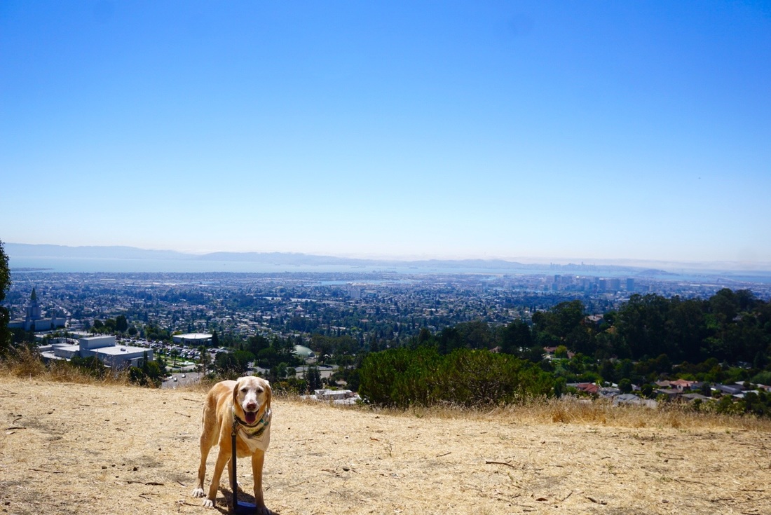
Don't miss: The Sunset Trail

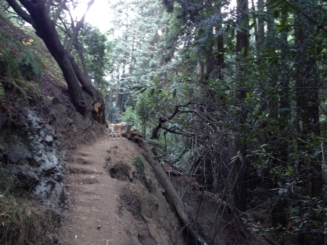
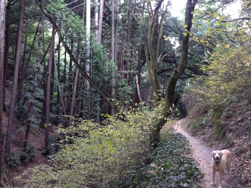
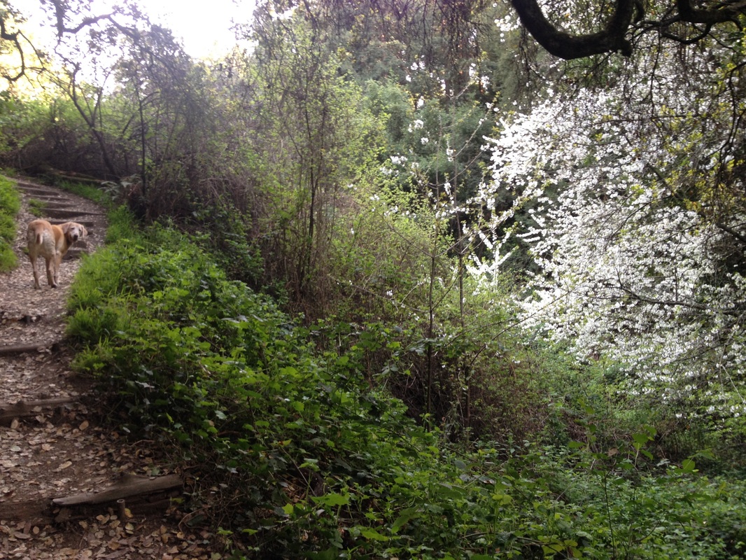
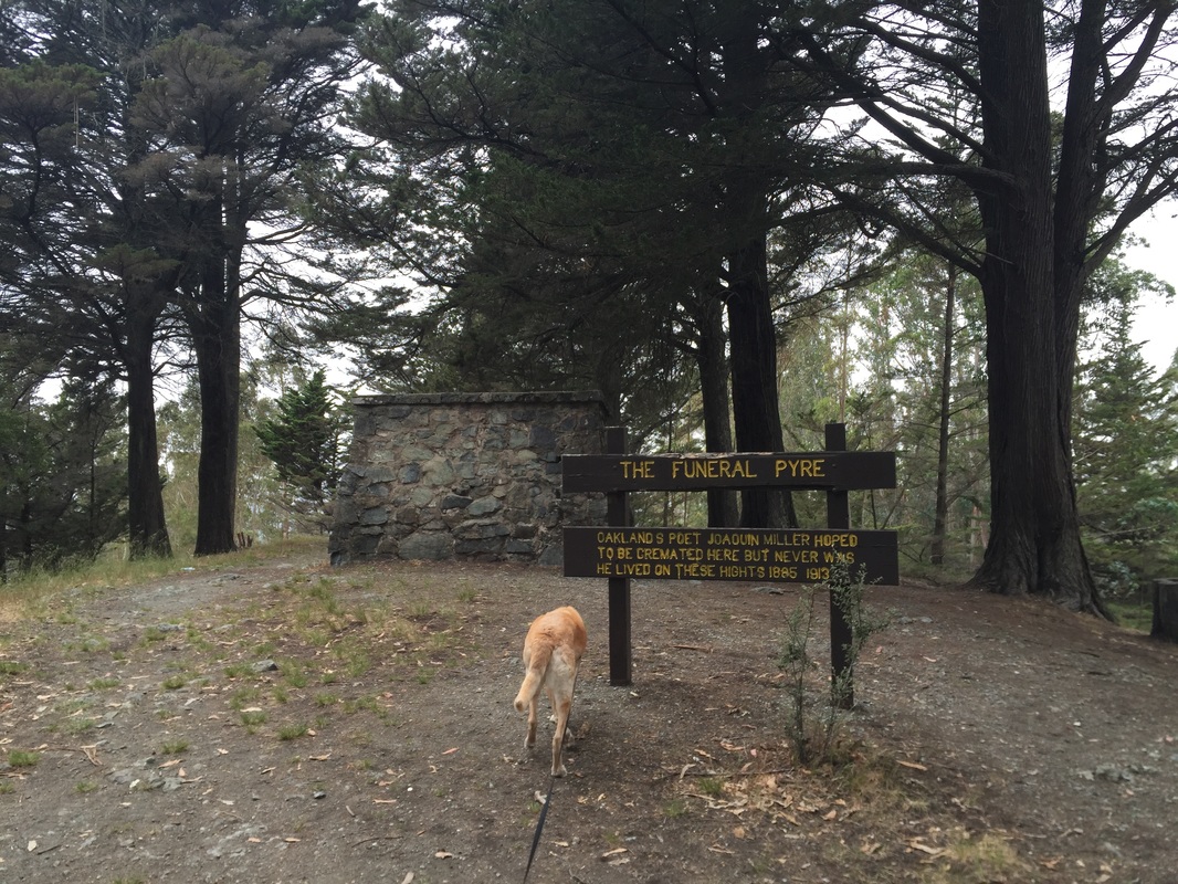
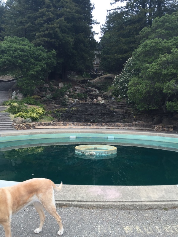
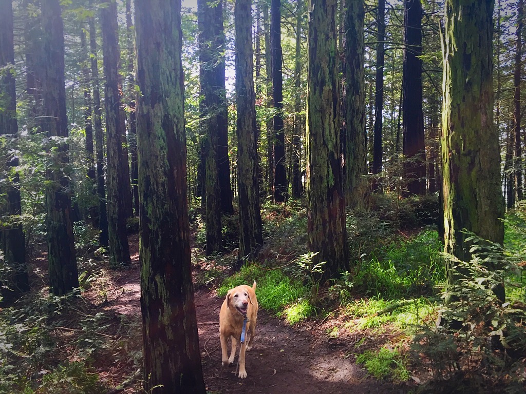
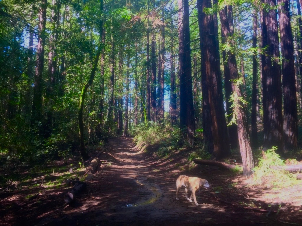
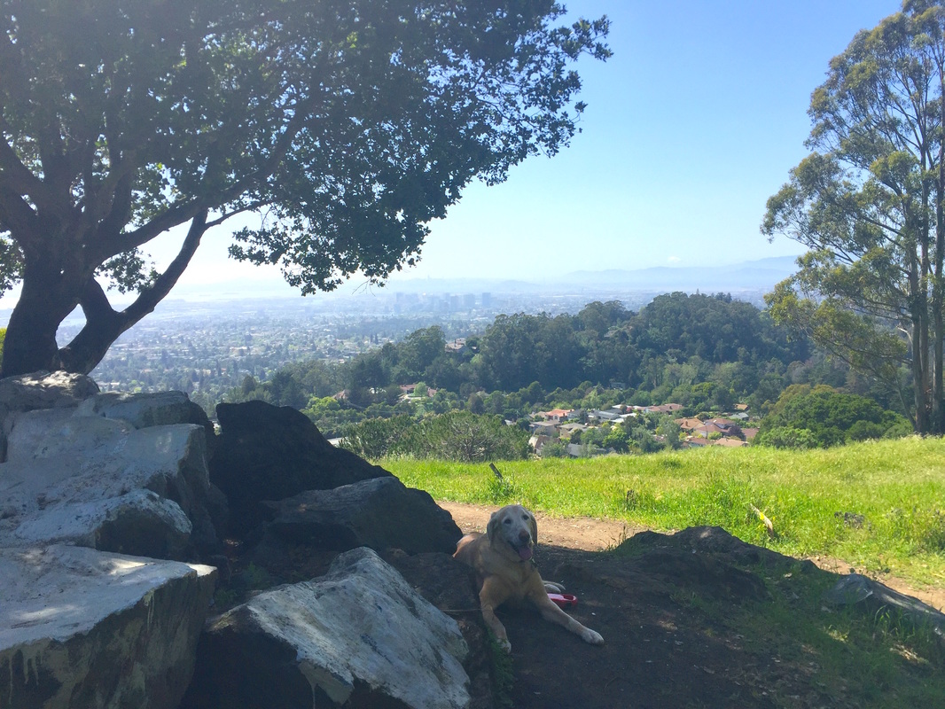
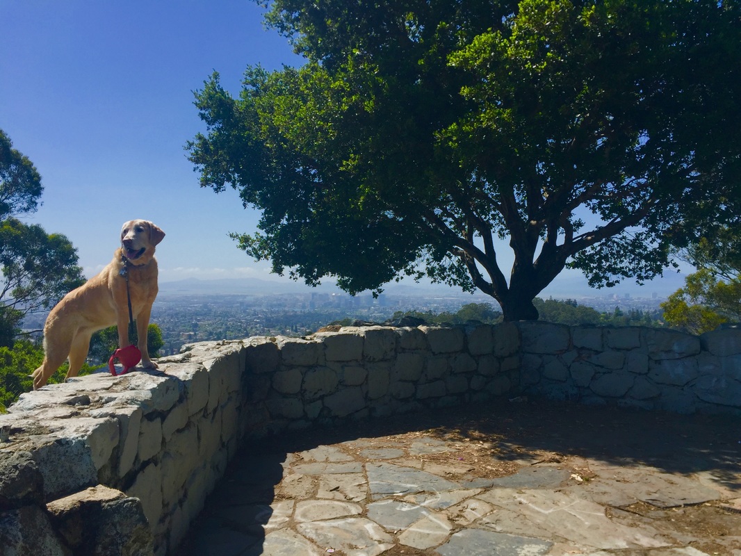
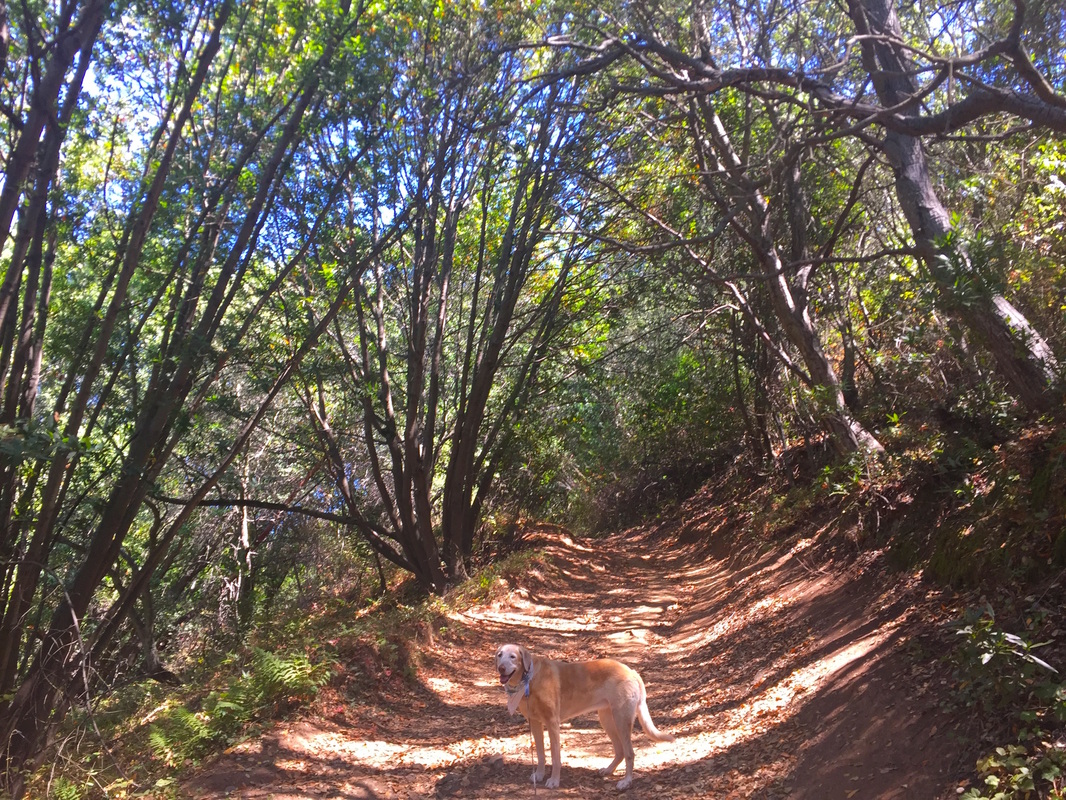
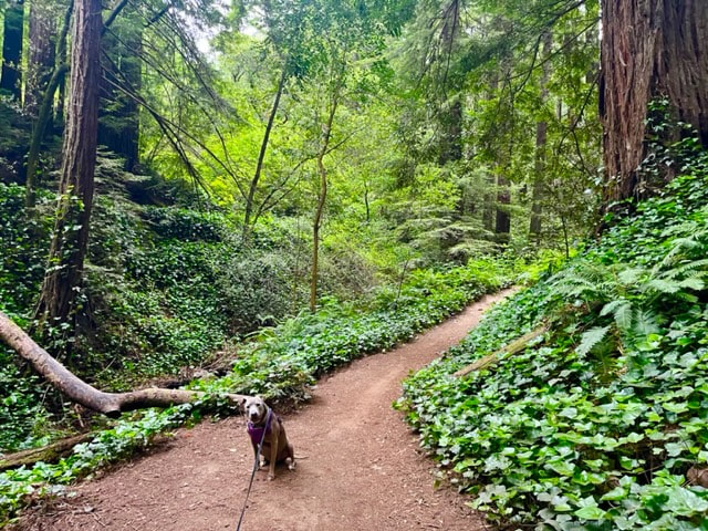
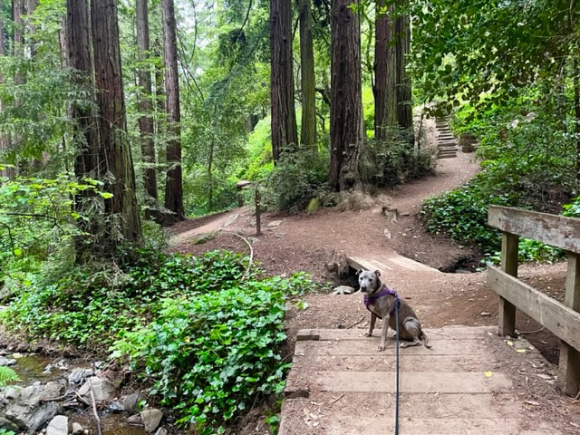
Description: This is a beautiful park located just below Redwood Park, so many of the trails are in the heart of the valley floor. The trails have ample shade, huge redwoods and you will be surrounded by vibrant greenery. Once you get off the valley floor, you can hike up to the sets of stairs winding up to the amphitheater, where there was once a beautiful waterfall-like fountain, before the drought. Above this, there is a lookout point with views of the bay, and even the funeral pyre where Joaquin Miller hoped to be cremated. I also enjoy the trails above, some of which are the Sunset, Chaparral and Sequoia-Bayview loop trails. Although there is ample free street parking available higher up on Skyline and Joaquin Miller Road, the last time I parked on Joaquin Miller I returned from a hike to find my car window smashed in during broad daylight, so I would not recommend parking on one of those streets. I've heard many stories about it happening to others, in daylight, with plenty of other cars parked around. I always see glass in the street, so I would not recommend taking that chance. There are also some paid parking lots, which you can see on the map link below.

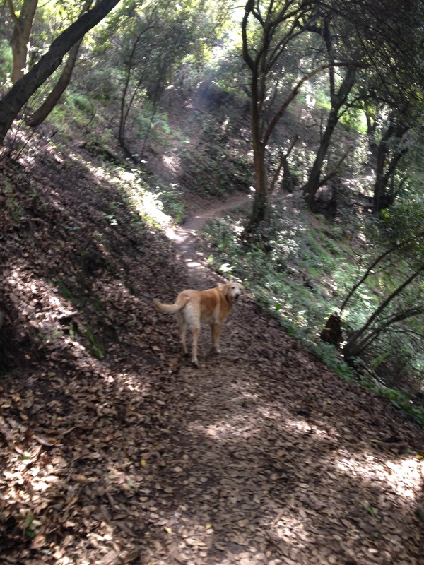
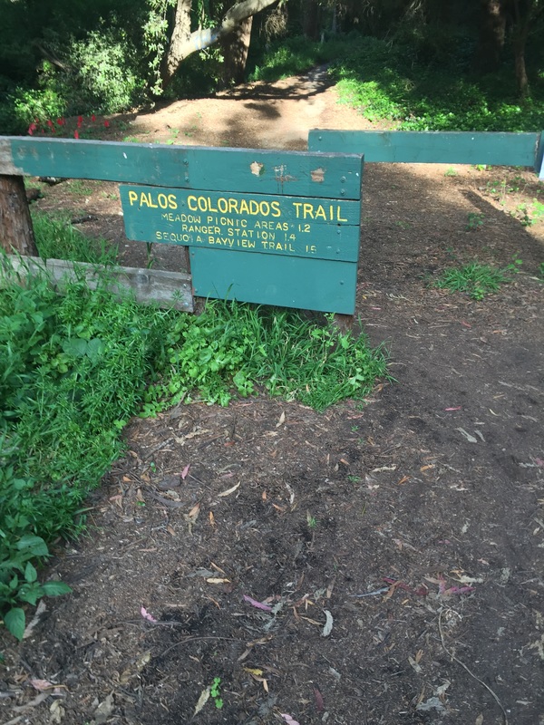
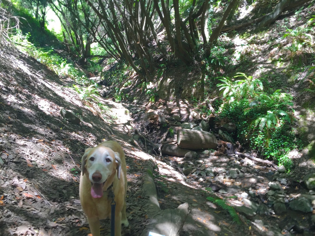
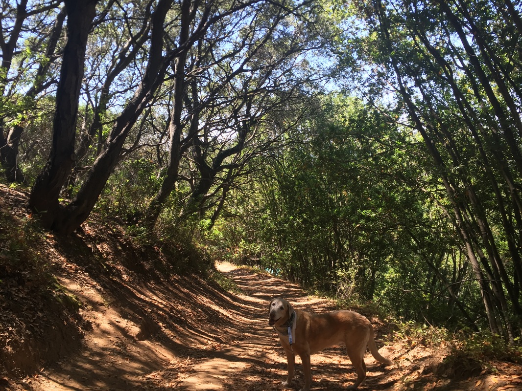
I enjoy starting at the bottom of Joaquin Miller Park and hiking up via the Palos Colorados Trail. I often park at the neighborhood trailhead of Joaquin Miller Ct (not to be confused with Joaquin Miller Rd), and sometimes I start from Dimond Park. The Palos Colorados Trail is usually quiet with little foot traffic and no bicycles are allowed, so it's a peaceful hike compared to some of the more crowded trails in the center of Joaquin Miller Park.

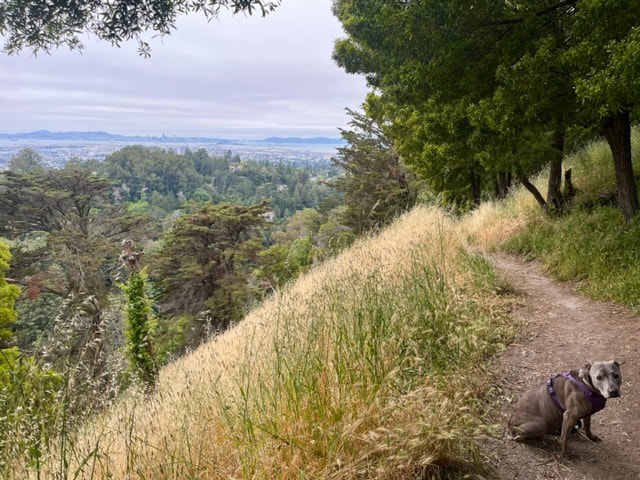
The Sunset Trail is a must-see with sweeping views of the Bay Area. You can begin this hike by parking at Redwood Bowl and crossing the street to the Castle Park Trail. Hike down it, continue after it reaches the street, and you will pass over a bridge and soon connect to the Sunset Trail to the right of the bridge. It's a short walk from here for sweeping views of the bay. You can retrace your steps or take the Cinderella Trail back to the Castle Park Trail for a roughly 3 mile hike.

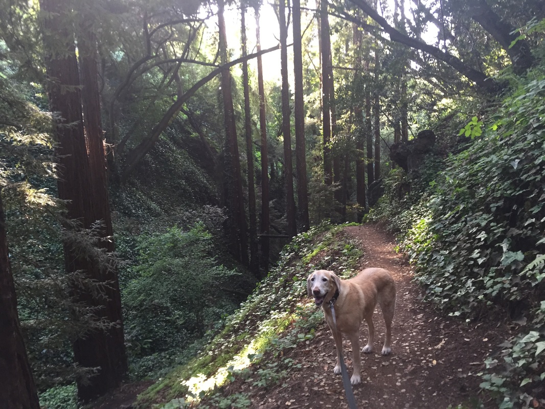
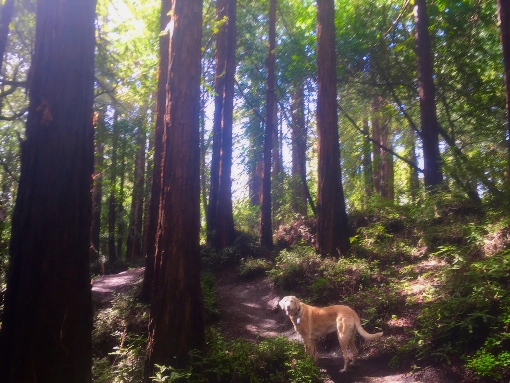
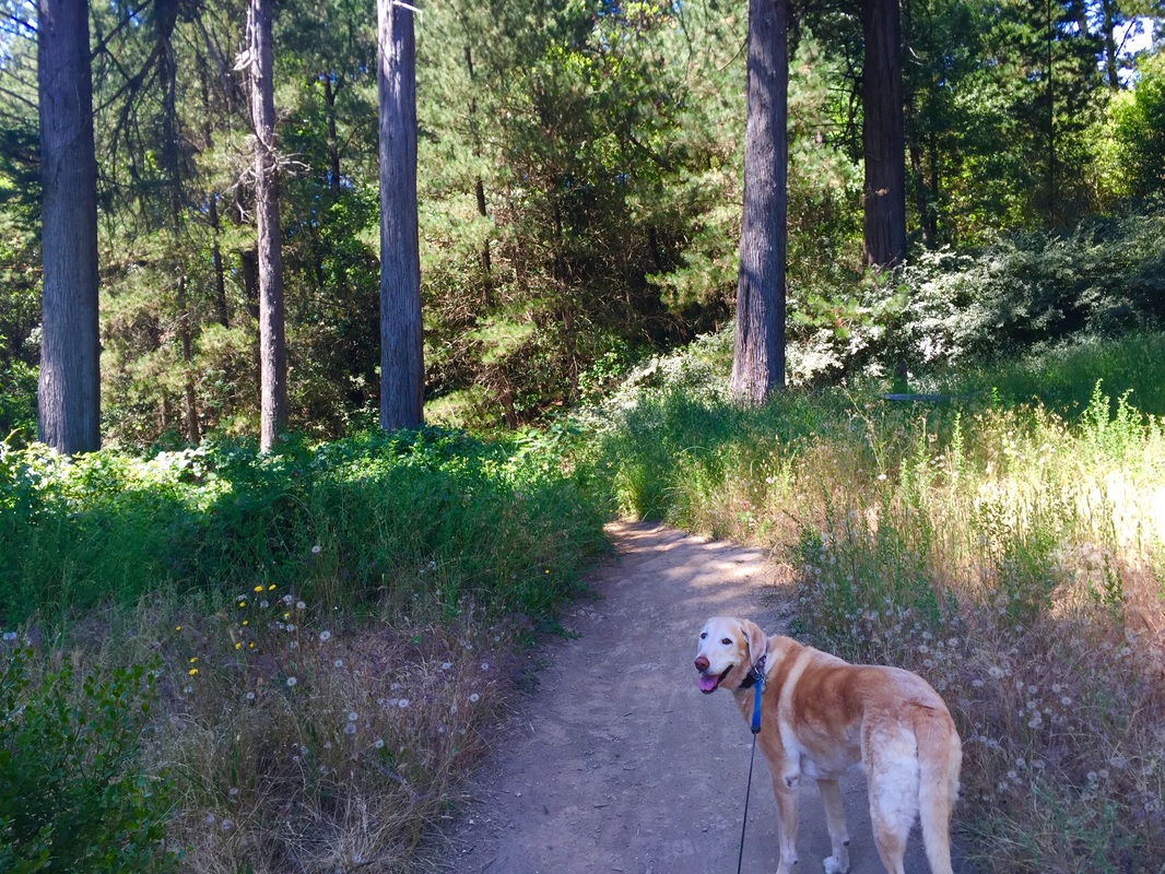
We also enjoy hiking the 2 mile loop combining the Big Trees Trail and the Sequoia Bayview Trail. This hike is mostly shady, it has a couple hills but is not challenging. You will hike through towering redwoods and you can hear the stream below the trail. This is a great loop for trail running, and you can easily connect to many of the nearby trails for a longer hike. No matter what your fitness level, I'm sure you'll find some trails you'll enjoy in this park.

Throughout the park you can find 3 structures still standing built by the poet Joaquin Miller. One is the Pyramid to Moses, built in 1892, which symbolizes his belief in the 10 commandments. Another is the Funeral Pyre, where he hoped to be cremated. You can also find the Browning Monument, built in 1904 to honor his fellow poet friends.

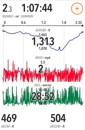
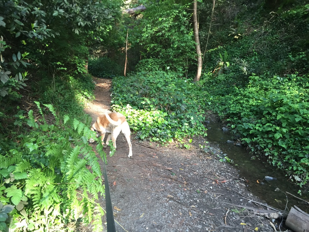
One of our favorite quick hikes is beginning on Sunset Trail (off of Castle Dr.) and hiking down to the Palos Colorados Trail. You'll enjoy views of the bay and then a shady hike along the stream down in the canyon for a quick 1.5 mile hike with 350ft of elevation gain. There's plenty of connecting trails you can take should you wish to extend your hike. 

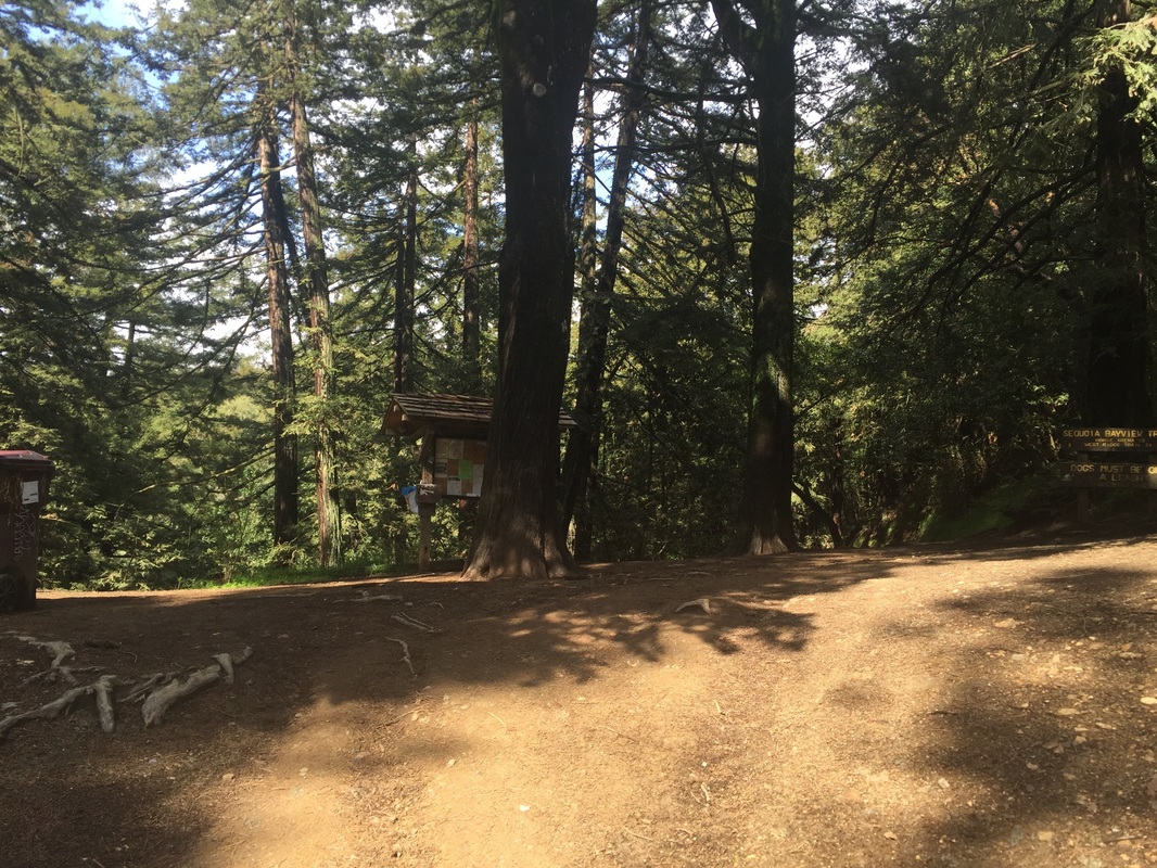
There are garbage cans but no restrooms at the Palos Colorados Trailhead, and at the Big Trees/ Sequoia Bayview trailheads. There are restrooms spread throughout the park.
Click here for a trail map courtesy of Friends of Sausal Creek


Recommended Loops (with trail stats):

​
Big Trees>Sequoia-Bayview>Big Trees Trail
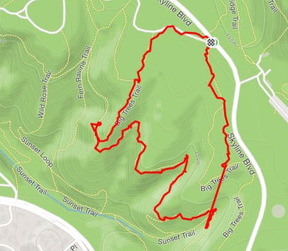
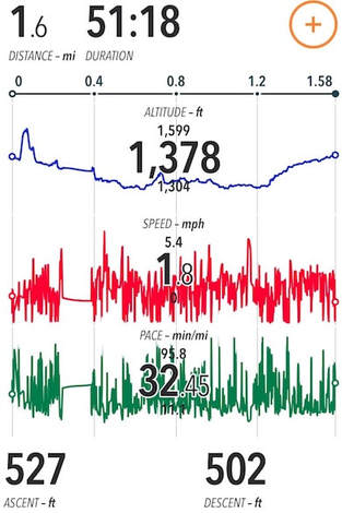
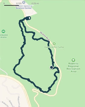
Length: Approx. 1.6 miles
Elevation Gain: Approx. 230 ft
This loop is almost entirely shaded, and relatively short and easy. This is a perfect hike for a hot summer day. You can park at Redwood Bowl or at the pullout across from it (off of Skyline Blvd). The entire hike is about 1.6 miles with 230 feet of elevation gain. The hike starts off descending gently through the Redwoods, and several switchbacks through fern-lined trails. You'll head downhill and hug the road near another entrance. From here, you'll walk on the relatively flat Sequoia-Bayview Trail, which is surrounded by redwoods. You'll pass a couple seasonal waterfalls (in winter), and snake around the hillside. At one point you'll even have a glimpse of SF and the Bay Bridge. The trail continues around the hillside, and then abruptly takes off up the hill via the Big Trees Trail. From here, you'll climb a short but steep rocky section, and emerge once again on a relatively flat trail lined with Redwoods. It's a short walk from here back to where you parked. You can easily extend this loop and make a more strenuous hike by adding Palos Colorados Trail or Sunset Trail. 
Picture
Picture
Picture


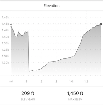
​Castle Park Trail>Big Trees>Palos Colorados>Sunset>Fern Ravine>Sequoia Bayview>Castle Park Trail. 
​​
Picture
Length: Approx. 2.5 miles
Elevation Gain: Approx. 500 ft
This loop is longer and more challenging than the first, but you'll only notice it in a few short, steep stretches. This hike is almost entirely shaded and will take you along fern-lined trails with towering redwoods. During certain times of the year you will even pass a seasonal waterfall on the Fern Ravine Trail. For this hike, park in the Redwood Bowl parking lot, cross the street, and you'll find the trailhead for Castle Park Trail near the trash can. 

Picture
Contact Us
Privacy Policy
Terms and Conditions
All content within this site Copyright © 2023 Hikes Dogs Love. All rights reserved. No part of this website may be reproduced without permission.
DMCA.com Protection Status
  • Home
  • Map View
    • Vacation Hikes >
      • Arizona >
        • Papago Park
      • New Mexico >
        • Oliver Lee Memorial State Park >
          • Browse All >
            • Alameda County >
              • Albany Bulb
              • Alameda Creek Regional Trail
              • Barlago Italian Kitchen
              • Brickyard Cove
              • Brushy Peak Regional Preserve
              • Anthony Chabot Regional Park (Lake Chabot)
              • Aquatic Park
              • Buchanan Dog Beach
              • California Canoe & Kayak (Oakland)
              • Cali Kid Burgers ‘N Shakes
              • César Chávez Park
              • Chabot Park
              • Claremont Canyon
              • Coyote Hills Regional Park
              • Crab Cove
              • Cull Canyon Regional Recreation Area
              • Dimond Canyon Park
              • Don Castro Regional Recreation Area
              • Don Edwards Wildlife Refuge
              • Dublin Hills Regional Park
              • Emeryville Marina
              • Fairmont Ridge
              • Five Canyons Open Space Preserve
              • Fremont Central Park
              • Garin/Dry Creek Pioneer Regional Park
              • Gilman Brewing Company
              • Greenbelt Trails
              • Hayward Regional Shoreline
              • Heron Bay Trail
              • Ikaros Greek Restaurant
              • Jerusalem Organic Kitchen
              • Joaquin Miller Park
              • Lake Anza
              • Lake Chabot
              • Lake Merritt
              • Leona Canyon Regional Open Space Preserve
              • Leona Heights Park
              • Marina Park
              • Martin Canyon Creek Trail
              • Martin Luther King Jr. Regional Shoreline
              • Mission Peak
              • Montclair Railroad Trail/ Torii Gate
              • Morgan Territory Regional Preserve
              • Oyster Bay Regional Shoreline
              • Park Street Classic Car Show (Annual)
              • Pleasanton Ridge Regional Preserve
              • Point Emery
              • Reinhardt Redwood Regional Park
              • Robert's Park
              • Room 389
              • Shoreline Park
              • Sibley Volcanic Regional Preserve
              • Skyline Gate Staging Area
              • Strawberry Canyon Fire Trail
              • Sunol Regional Wilderness
              • Temescal Regional Recreation Area
              • Tilden Regional Park
              • Upper Anthony Chabot Regional Park (Oakland Entrance)
              • Upper Knowland Park
              • Vargas Plateau Regional Park
            • Butte County >
              • Feather Falls
              • Motel 6 - Oroville
              • Riverbend Park
            • Contra Costa County >
              • Acalanes Ridge Open Space
              • Briones Regional Park
              • Carquinez Strait Regional Shoreline
              • Crockett Hills Regional Park
              • Diablo Foothills Regional Park
              • EBMUD Trails
              • Fernandez Ranch
              • Frowning Ridge
              • Geppetto's Caffe
              • Hacienda de las Flores Park
              • Hillside Nature Area
              • Howe Homestead Park
              • Indian Rock
              • Kennedy Grove Regional Recreation Area
              • Lafayette Community Park
              • Lafayette Reservoir
              • Las Trampas Regional Wilderness
              • Lime Ridge Open Space
              • Miller/Knox Regional Shoreline
              • Moraga Commons Park
              • Mulholland Ridge Open Space Preserve
              • Point Isabel
              • Point Molate Beach Park
              • Point Pinole Regional Shoreline
              • Point San Pablo Harbor
              • Rubio's
              • San Quentin Beach
              • Shell Ridge Open Space
              • Sobrante Ridge Regional Preserve
              • Sugarloaf Open Space
              • Sycamore Valley Open Space Preserve
              • Tender Greens
              • Tilden Regional Park
              • Wildcat Canyon Regional Park
            • El Dorado County >
              • Angora Lakes Trail
              • Bijou Community Park
              • Cascade Falls
              • Horsetail Falls
              • Inspriation Point
              • Motel 6 - South Lake Tahoe
              • Mt. Tallac
            • Marin County >
              • 101 Surf Sports
              • Baltimore Canyon Open Space Preserve
              • Blackie's Pasture
              • Camino Alto Preserve
              • Carson Falls
              • Cascade Falls
              • Cataract Falls
              • Dawn Falls
              • Hippie Tree
              • Ignacio Valley Preserve (Fairway Falls)
              • Indian Valley Open Space Preserve
              • King Mountain Open Space Preserve
              • Marin Headlands (Coastal Trail)
              • Old Saint Hilary's Open Space Preserve
              • Phoenix Lake
              • Red Hill Dog Park
              • Red Hill Trail
              • Ring Mountain Open Space Preserve
              • Roy's Redwoods
              • Sam's Anchor Cafe
              • Sorich Ranch Park
              • Tiburon Peninsula Historical Trail
              • Tiburon Uplands
              • Tucker Trail Falls
            • Mariposa County >
              • Happy Burger Diner
              • Yosemite National Park
            • Mendocino County >
              • Catch-a-Canoe
              • Gowan's Heirloom Ciders
              • MacKerricher State Park
              • Mendocino Headlands State Park
              • Navarro River Redwoods State Park
              • Princess Seafood
              • Skunk Train
              • The Stanford Inn By The Sea
              • Van Damme State Beach
            • Mono County >
              • Bodie State Historic Park
              • Jolly Kone
              • Lundy Canyon
              • Mono Lake (Tufa State National Reserve)
              • Virginia Creek Settlement
            • Monterey County >
              • 17-Mile Drive
              • Asilomar State Beach
              • Bistro Beaujolais
              • Carmel Beach
              • Fishwife
              • Fort Ord Dunes State Park
              • Garland Ranch Regional Park
              • Jack's Peak
              • Monterey Bay Coastal Trail
              • Monterey Bay Kayaks
              • Monterey Municipal Beach
              • Motel 6 - Downtown Monterey
              • Ryan Ranch Disc Golf Course
              • Ventana Wilderness
            • Nevada County >
              • Fairy Falls
            • Placer County >
              • Hidden Falls
              • Regional Park Auburn Disc Golf Course
              • Thirsty Barrel Taphouse & Grille
              • Wolf Creek Trail
              • The Yeti Tavern
            • San Francisco County >
              • 2.2 Mile Urban Hike
              • Bernal Heights Park
              • The Brixton
              • Billy Goat Hill Park
              • Blackwood
              • Clipper Cove Beach
              • Crissy Field
              • Dynamo Donut + Coffee
              • Fort Funston
              • Fort Mason
              • Glen Canyon Park
              • Golden Gate Park
              • Grand View Park
              • The Great Lawn/ Avenue of the Palms
              • Java Beach Cafe
              • John McLaren Park
              • Interior Greenbelt
              • Lake Merced
              • Lands End
              • Letterman Digital Arts Center
              • Marina Green
              • Mount Davidson
              • Mount Sutro Open Space Reserve
              • Ocean Beach
              • Palace of Fine Arts
              • Philz Coffee Truck
              • Stern Grove
              • Sutro Baths
              • Sutro Heights Park
              • TreasureFest
            • San Mateo County >
              • 7 Mile House Sports Bar & Grill
              • Barbara's Fishtrap
              • Bedwell Bayfront Park
              • Bob's Vegetable Stand and Pumpkin Farm
              • Cafe Pacifica
              • Devil's Slide Coastal Trail
              • Esplanade Beach
              • Flying Fish Grill
              • Half Moon Bay Kayak Co.
              • McNee Ranch State Park (Montara Mountain)
              • Montara State Beach
              • Mori Point
              • Mussel Rock Park
              • Nick's Seafood Restaurant
              • Panera Bread
              • Pedro Point Headlands
              • Poplar Beach
              • Pulgas Ridge Open Space Preserve
              • Rancho Corral de Tierra
              • Seal Point
              • Taqueria La Mexicana
              • Wavecrest Open Space
            • Santa Clara County >
              • Byxbee Park
              • Calero County Park
              • Uvas Canyon County Park
            • Santa Cruz County >
              • Byrne-Milliron Forest
              • Greyhound Rock County Park
              • Henry Cowell Redwoods State Park
              • Jaliscos Restaurant
              • Mount Madonna County Park
              • Roaring Camp Railroads
            • Solano County >
              • Alvarez 9th Street Park
              • Benicia Classic Car Show
              • Benicia Waterfront
              • Lagoon Valley Park
              • Peña Adobe Regional Park
            • Sonoma County >
              • Doran Regional Park
              • Fishetarian
              • Helen Putnam Regional Park
            • Tuolumne County >
              • Donnell Vista
              • Tuttletown Recreation Area
            • Yuba County >
              • Ellis Lake
        • White Sands National Monument
      • Oregon >
        • Multnomah Falls
      • Washington >
        • Olympic National Park >
          • Kalaloch Beach
          • Madison Falls
          • Quinault Rainforest
        • Rattlesnake Ridge
  • More
    • Vacation Spots >
      • Restaurants >
        • Southern California >
          • Fire Island Grill
          • Lazy Dog Restaurant & Bar
          • Perkies Coffee Haus
        • Washington >
          • Rose Pho
    • Archived Hikes >
      • Archived Hikes 2
      • Archives 2016-2018
    • Planning Your Trip
    • Dog Gear
    • About >
      • Contact Us
      • Privacy Policy
      • Terms and Conditions