Hikes Dogs Love
  • Home
  • Browse All
    • Alameda County >
      • Albany Bulb
      • Alameda Creek Regional Trail
      • Anthony Chabot Regional Park (Lake Chabot)
      • Aquatic Park
      • Chabot Park
      • Barlago Italian Kitchen
      • Buchanan Dog Beach
      • California Canoe & Kayak (Oakland)
      • César Chávez Park
      • Claremont Canyon
      • Coyote Hills Regional Park
      • Crab Cove
      • Cull Canyon Regional Recreation Area
      • Dimond Canyon Park
      • Don Castro Regional Recreation Area
      • Don Edwards Wildlife Refuge
      • Dublin Hills Regional Park
      • Fairmont Ridge
      • Five Canyons Open Space Preserve
      • Fremont Central Park
      • Garin/Dry Creek Pioneer Regional Park
      • Greenbelt Trails
      • Hayward Regional Shoreline
      • Heron Bay Trail
      • Holy Land Restaurant
      • Ikaros Greek Restaurant
      • Jerusalem Organic Kitchen
      • Joaquin Miller Park
      • Lake Anza
      • Lake Chabot
      • Lake Merritt
      • Leona Canyon Regional Open Space Preserve
      • Leona Heights Park
      • Marina Park
      • Martin Canyon Creek Trail
      • Martin Luther King Jr. Regional Shoreline
      • Mission Peak
      • Montclair Railroad Trail/ Torii Gate
      • Morgan Territory Regional Preserve
      • Oyster Bay Regional Shoreline
      • Park Street Classic Car Show (Annual)
      • Pleasanton Ridge Regional Preserve
      • Reinhardt Redwood Regional Park
      • Robert's Park
      • Room 389
      • Shoreline Park
      • Sibley Volcanic Regional Preserve
      • Skyline Gate Staging Area
      • Strawberry Canyon Fire Trail
      • Sunol Regional Wilderness
      • Temescal Regional Recreation Area
      • Tilden Regional Park
      • Upper Anthony Chabot Regional Park (Oakland Entrance)
      • Upper Knowland Park
      • Vargas Plateau Regional Park
    • Butte County >
      • Feather Falls
      • Motel 6 - Oroville
      • Riverbend Park
    • Contra Costa County >
      • Acalanes Ridge Open Space
      • Briones Regional Park
      • Carquinez Strait Regional Shoreline
      • Crockett Hills Regional Park
      • Diablo Foothills Regional Park
      • EBMUD Trails
      • Fernandez Ranch
      • Frowning Ridge
      • Geppetto's Caffe
      • Hacienda de las Flores Park
      • Hillside Nature Area
      • Howe Homestead Park
      • Indian Rock
      • Kennedy Grove Regional Recreation Area
      • Lafayette Community Park
      • Lafayette Reservoir
      • Las Trampas Regional Wilderness
      • Lime Ridge Open Space
      • Miller/Knox Regional Shoreline
      • Moraga Commons Park
      • Mulholland Ridge Open Space Preserve
      • Point Isabel
      • Point Molate Beach Park
      • Point Pinole Regional Shoreline
      • Point San Pablo Harbor
      • Rubio's
      • San Quentin Beach
      • Shell Ridge Open Space
      • Sobrante Ridge Regional Preserve
      • Sugarloaf Open Space
      • Sycamore Valley Open Space Preserve
      • Tender Greens
      • Tilden Regional Park
      • Wildcat Canyon Regional Park
    • El Dorado County >
      • Angora Lakes Trail
      • Bijou Community Park
      • Cascade Falls
      • Horsetail Falls
      • Inspriation Point
      • Motel 6 - South Lake Tahoe
      • Mt. Tallac
    • Marin County >
      • 101 Surf Sports
      • Baltimore Canyon Open Space Preserve
      • Blackie's Pasture
      • Camino Alto Preserve
      • Carson Falls
      • Cascade Falls
      • Cataract Falls
      • Dawn Falls
      • Ignacio Valley Preserve (Fairway Falls)
      • Indian Valley Open Space Preserve
      • King Mountain Open Space Preserve
      • Marin Headlands (Coastal Trail)
      • Old Saint Hilary's Open Space Preserve
      • Phoenix Lake
      • Ring Mountain Open Space Preserve
      • Roy's Redwoods
      • Sam's Anchor Cafe
      • Tiburon Peninsula Historical Trail
      • Tucker Trail Falls
    • Mariposa County >
      • Happy Burger Diner
      • Yosemite National Park
    • Mendocino County >
      • Catch-a-Canoe
      • MacKerricher State Park
      • Mendocino Headlands State Park
      • Navarro River Redwoods State Park
      • Princess Seafood
      • Skunk Train
      • The Stanford Inn By The Sea
      • Van Damme State Beach
    • Mono County >
      • Bodie State Historic Park
      • Jolly Kone
      • Lundy Canyon
      • Mono Lake (Tufa State National Reserve)
      • Virginia Creek Settlement
    • Monterey County >
      • 17-Mile Drive
      • Asilomar State Beach
      • Bistro Beaujolais
      • Carmel Beach
      • Fishwife
      • Fort Ord Dunes State Park
      • Garland Ranch Regional Park
      • Jack's Peak
      • Monterey Bay Coastal Trail
      • Monterey Bay Kayaks
      • Monterey Municipal Beach
      • Motel 6 - Downtown Monterey
      • Ryan Ranch Disc Golf Course
      • Ventana Wilderness
    • Nevada County >
      • Fairy Falls
    • Placer County >
      • Hidden Falls
    • San Francisco County >
      • 2.2 Mile Urban Hike
      • Bernal Heights Park
      • The Brixton
      • Billy Goat Hill Park
      • Blackwood
      • Clipper Cove Beach
      • Crissy Field
      • Dynamo Donut + Coffee
      • Fort Funston
      • Fort Mason
      • Glen Canyon Park
      • Golden Gate Park
      • Grand View Park
      • The Great Lawn/ Avenue of the Palms
      • Java Beach Cafe
      • John McLaren Park
      • Interior Greenbelt
      • Lake Merced
      • Lands End
      • Letterman Digital Arts Center
      • Marina Green
      • Mount Davidson
      • Mount Sutro Open Space Reserve
      • Ocean Beach
      • Palace of Fine Arts
      • Philz Coffee Truck
      • Stern Grove
      • Sutro Baths
      • Sutro Heights Park
      • TreasureFest
    • San Mateo County >
      • 7 Mile House Sports Bar & Grill
      • Barbara's Fishtrap
      • Bedwell Bayfront Park
      • Bob's Vegetable Stand and Pumpkin Farm
      • Cafe Pacifica
      • Devil's Slide Coastal Trail
      • Esplanade Beach
      • Flying Fish Grill
      • Half Moon Bay Kayak Co.
      • McNee Ranch State Park (Montara Mountain)
      • Montara State Beach
      • Mori Point
      • Mussel Rock Park
      • Panera Bread
      • Pedro Point Headlands
      • Poplar Beach
      • Pulgas Ridge Open Space Preserve
      • Rancho Corral de Tierra
      • Seal Point
      • Taqueria La Mexicana
      • Wavecrest Open Space
    • Santa Clara County >
      • Byxbee Park
      • Calero County Park
      • Uvas Canyon County Park
    • Santa Cruz County >
      • Byrne-Milliron Forest
      • Greyhound Rock County Park
      • Henry Cowell Redwoods State Park
      • Jaliscos Restaurant
      • Mount Madonna County Park
      • Roaring Camp Railroads
    • Solano County >
      • Lagoon Valley Park
      • Peña Adobe Regional Park
    • Sonoma County >
      • Doran Regional Park
      • Fishetarian
      • Helen Putnam Regional Park
    • Tuolumne County >
      • Donnell Vista
      • Tuttletown Recreation Area
    • Yuba County >
      • Ellis Lake
  • Map View
  • Vacation Spots
    • Vacation Hikes >
      • Arizona >
        • Papago Park
      • New Mexico >
        • Oliver Lee Memorial State Park
        • White Sands National Monument
      • Oregon >
        • Multnomah Falls
      • Washington >
        • Olympic National Park >
          • Kalaloch Beach
          • Madison Falls
          • Quinault Rainforest
        • Rattlesnake Ridge
    • Restaurants >
      • Southern California >
        • Fire Island Grill
        • Lazy Dog Restaurant & Bar
        • Perkies Coffee Haus
      • Washington >
        • Rose Pho
  • Planning Your Trip
  • About
    • Contact Us
    • Privacy Policy
    • Terms and Conditions
  • Dog Gear
  • Archived Hikes 1
    • Archived Hikes 2 >
      • Archives 2016-2018

Diablo Foothills Regional Park​

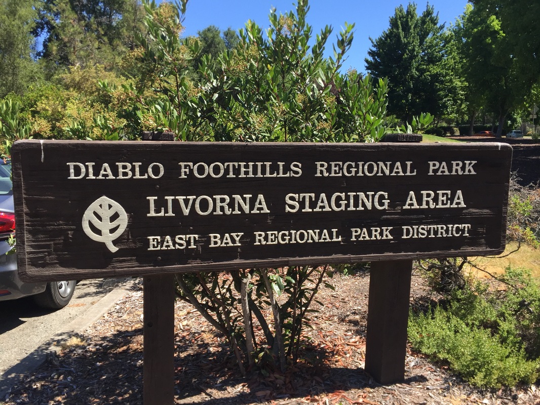
Approximate Address: 37.870475, -122.009998 (Livorna Staging Area off of Stonegate Drive in Alamo, CA)
                                                                                             OR
​                                        37.896970, -121.998180 (Orchard Staging area off of Castle Rock Rd, Walnut Creek)
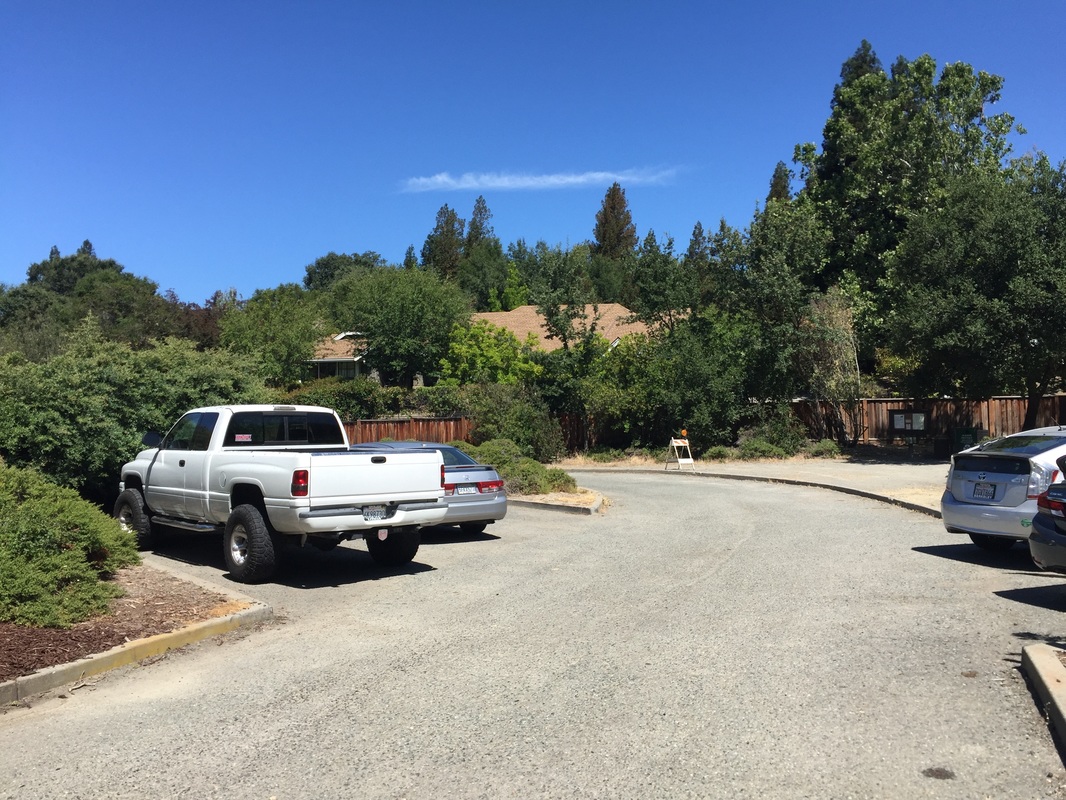
Parking: Free parking lots at the addresses above. 
Hours: Nov 1-Feb 28: 7:30AM-7PM, Mar 1-May 31: 7:30AM-8PM, Jun 1-Oct 31: 7:30AM-9PM 
Type: Hike (moderate)
Regulations: Dogs allowed off-leash if under voice control in undeveloped areas
Best time to visit: Spring, winter, or early mornings on a hot day, as there is little shade on the trails. 
Click here for a trail map courtesy of EBRPD
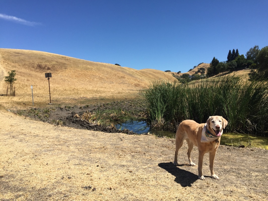
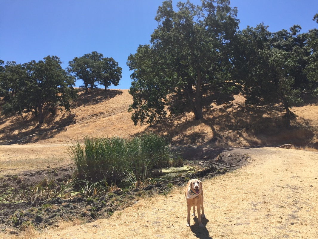
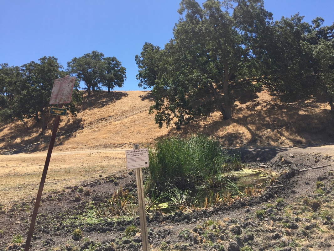
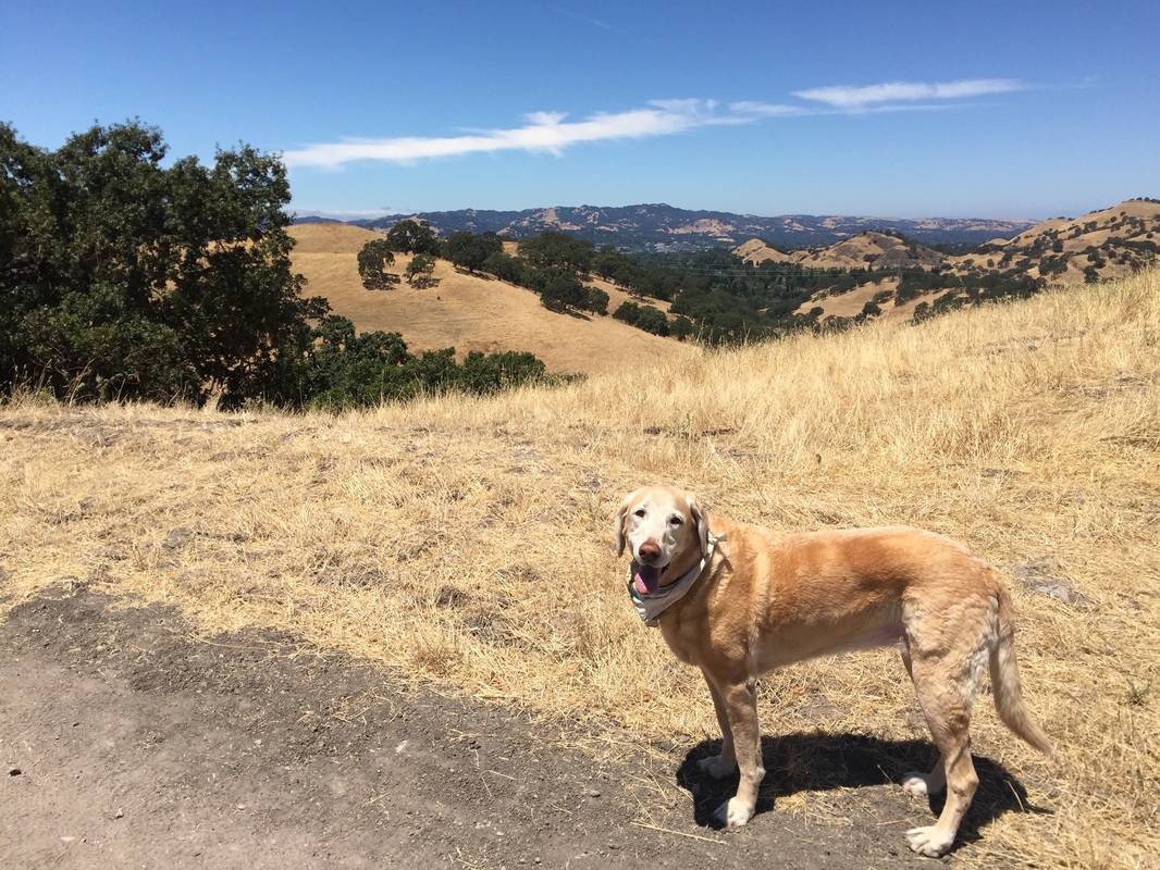
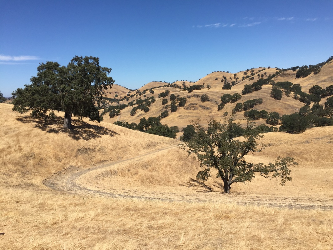
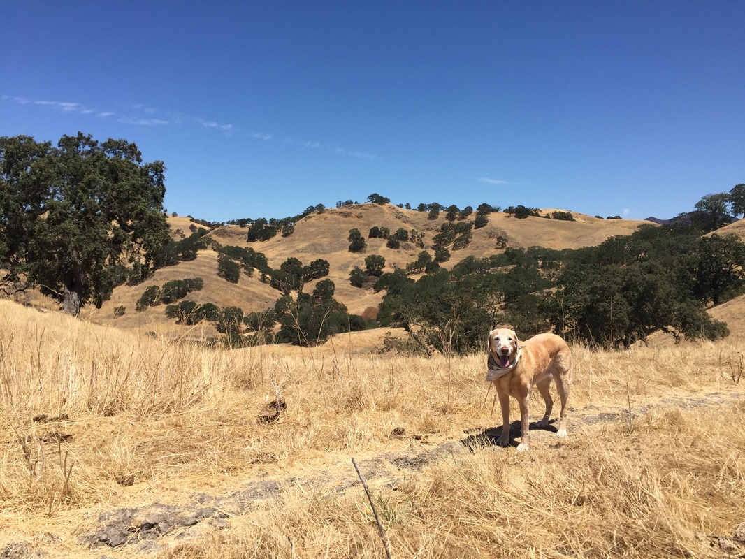
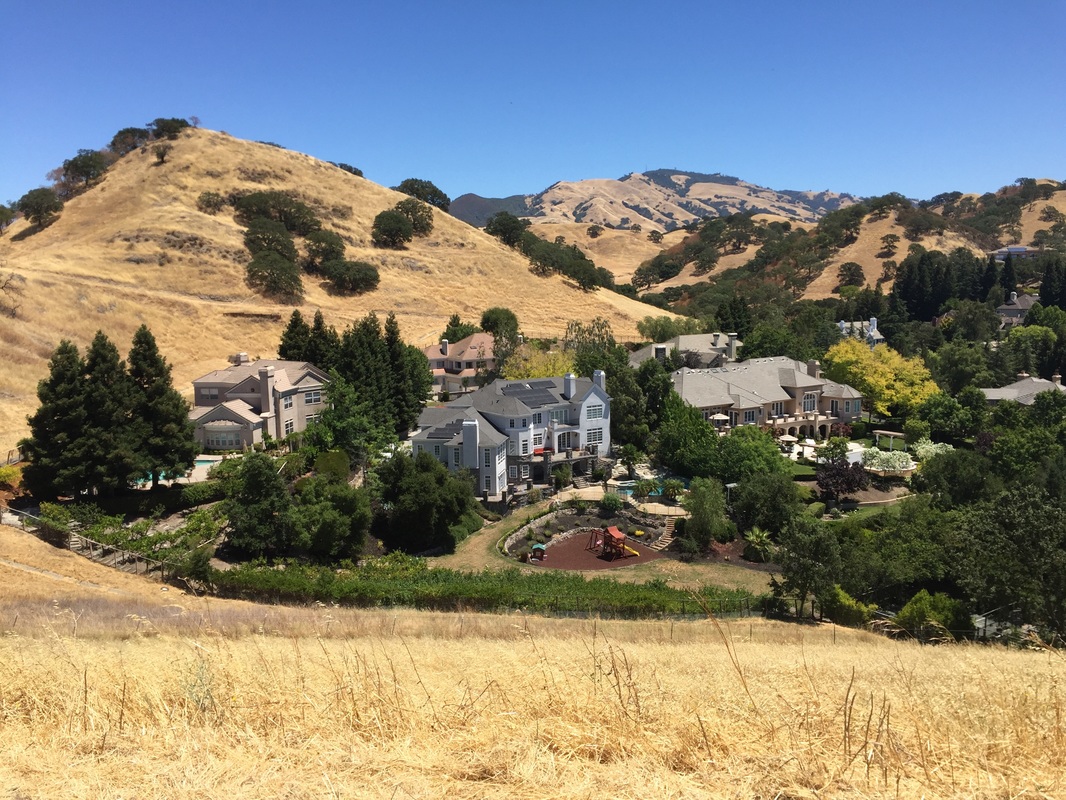
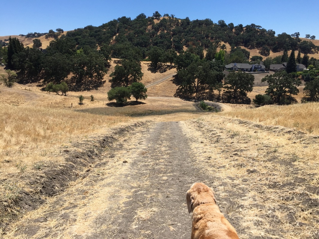
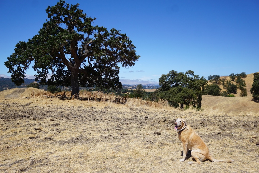
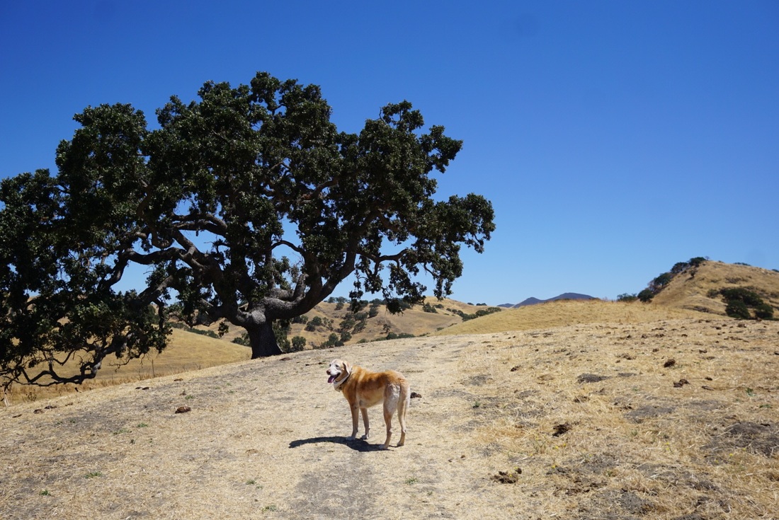
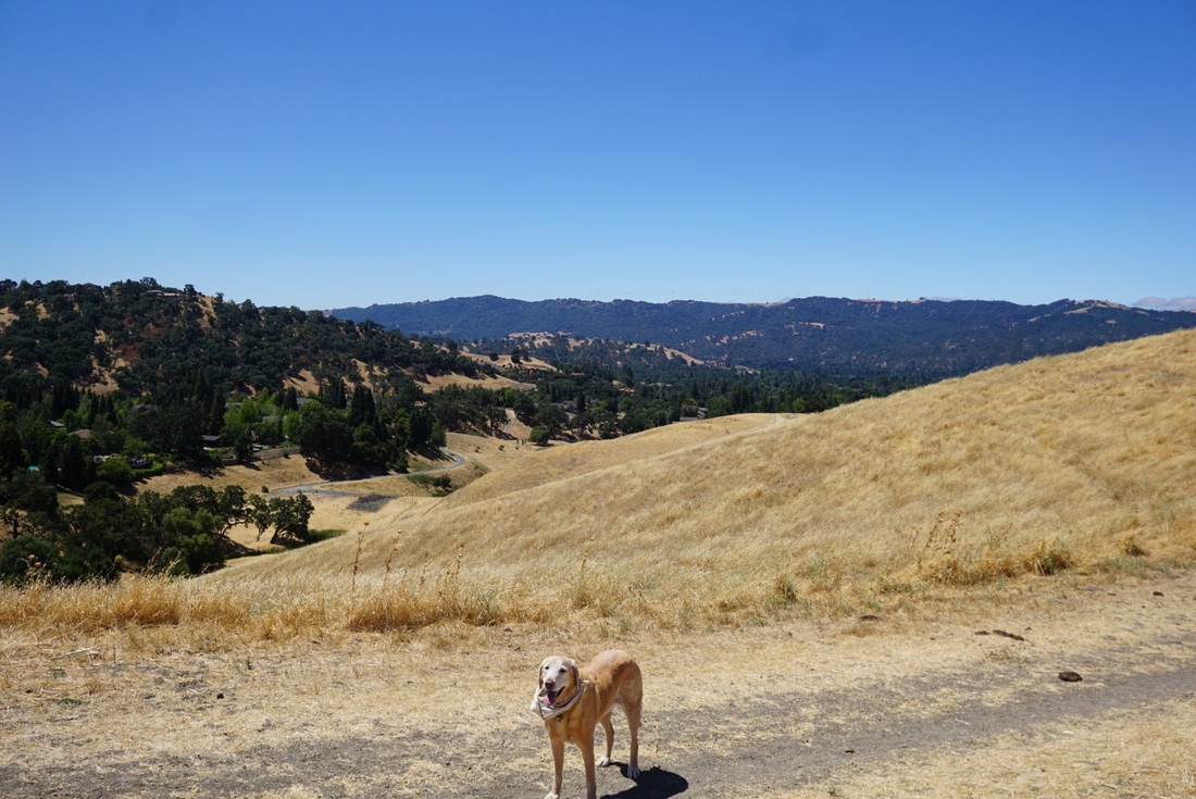
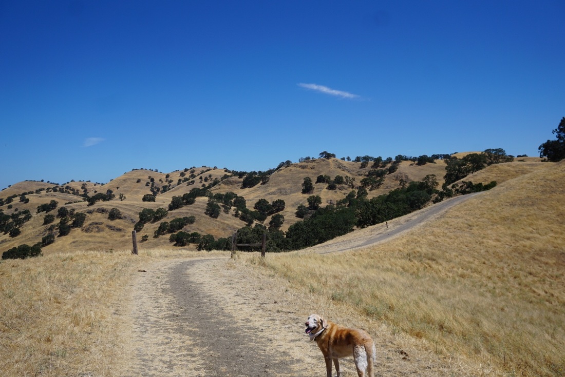
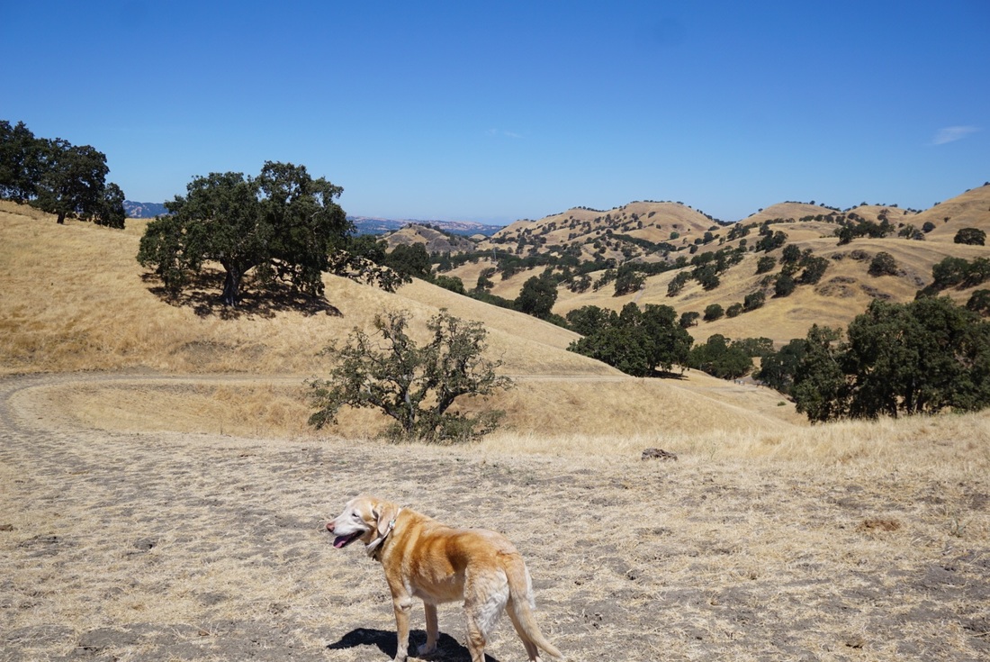
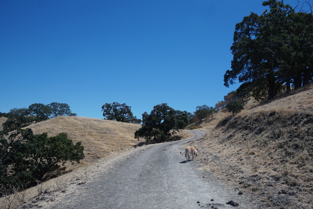
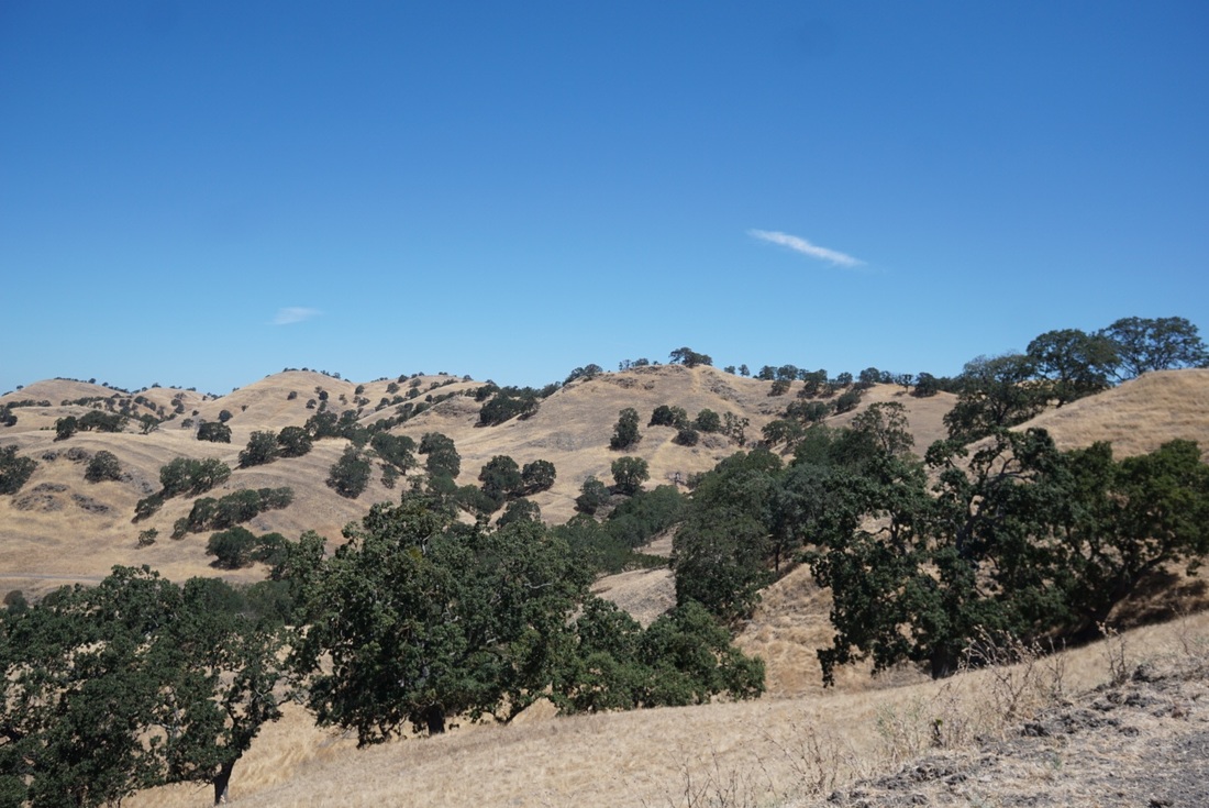
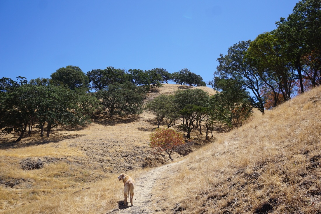
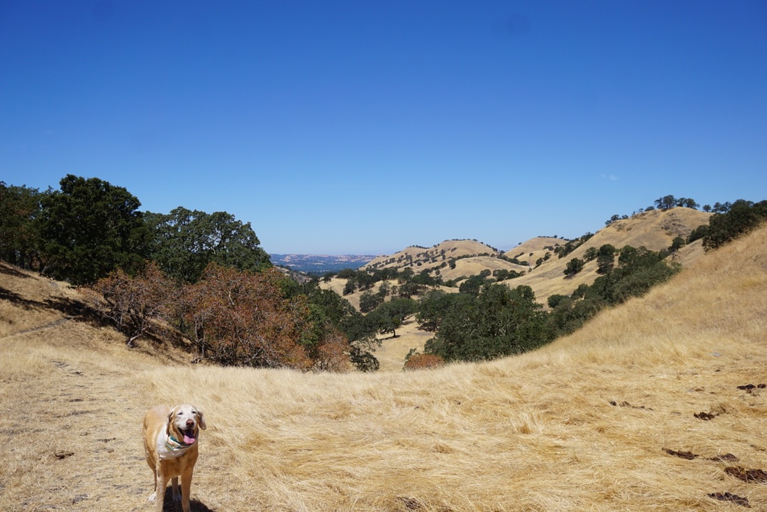
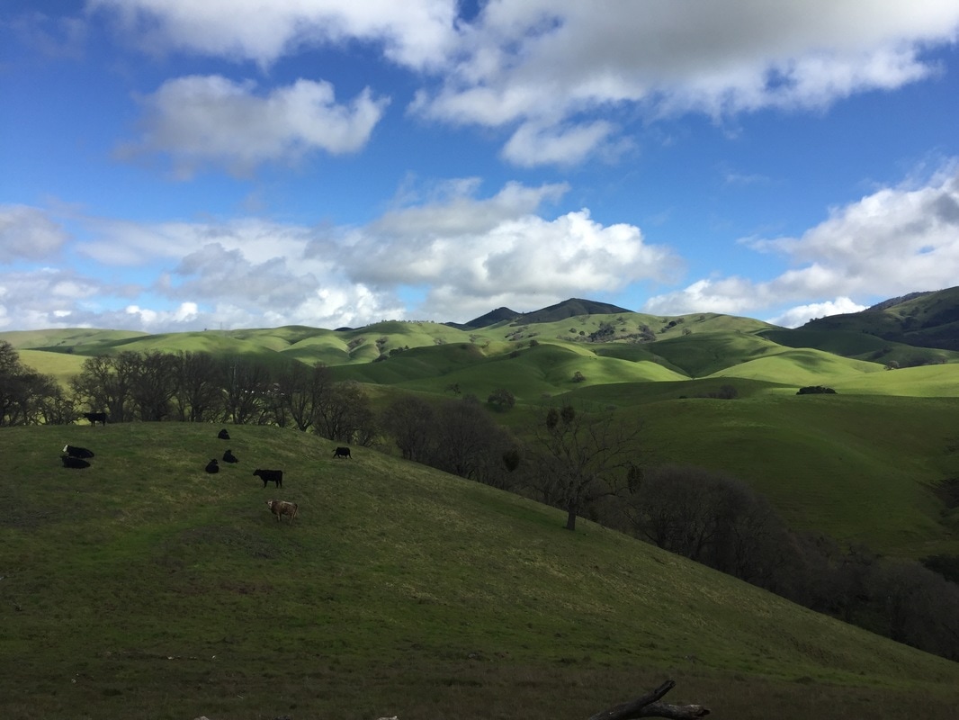
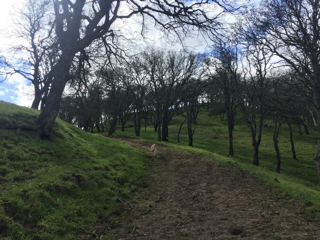
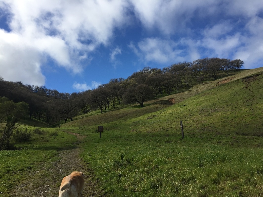
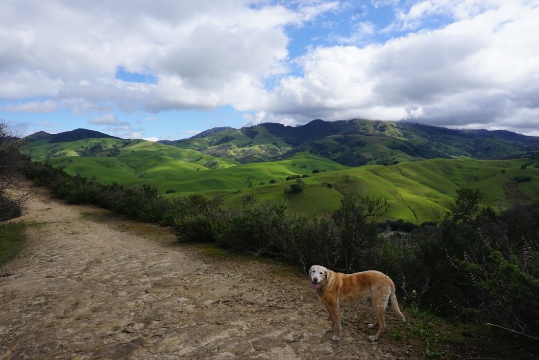
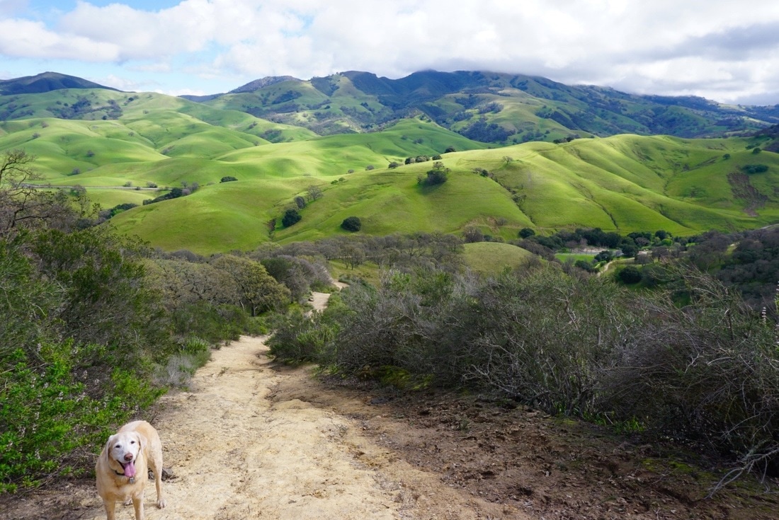
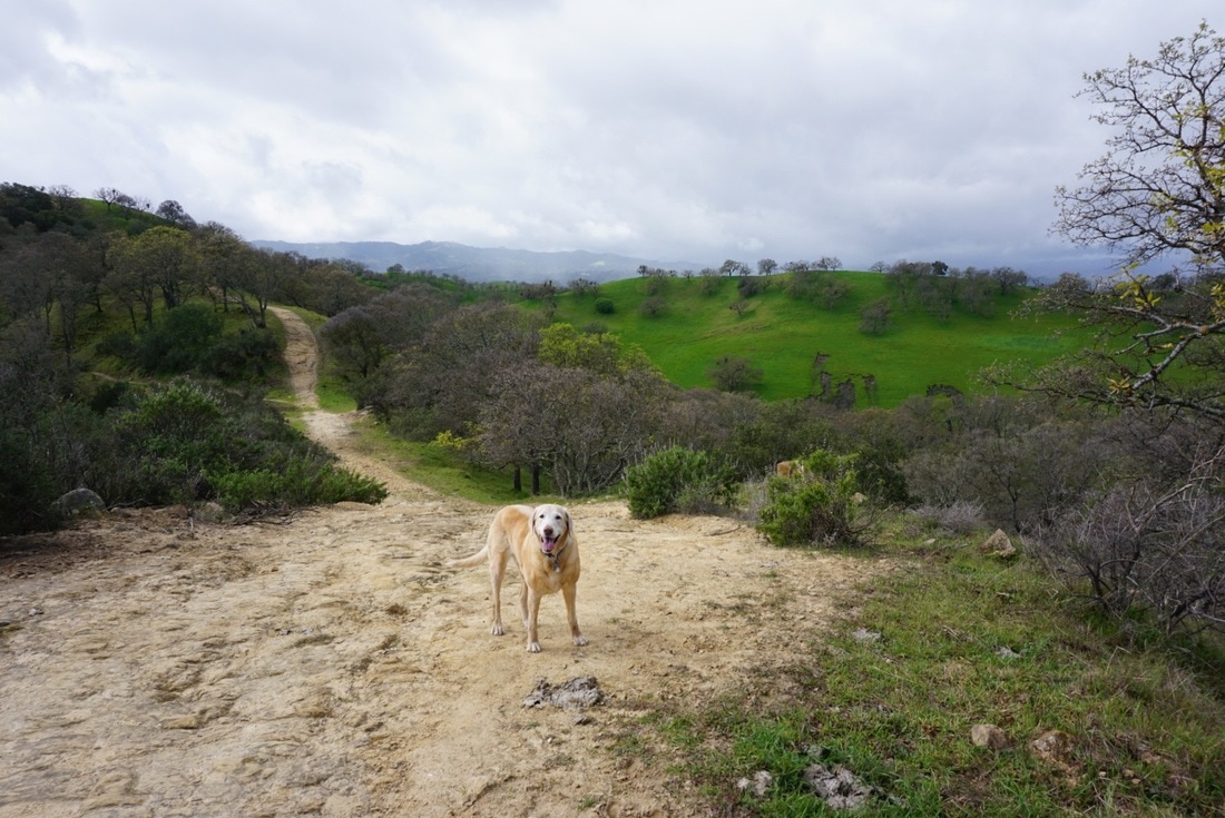
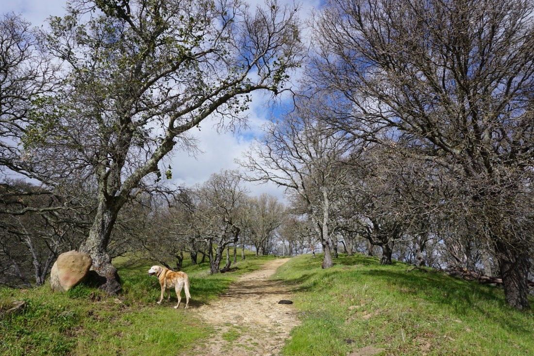
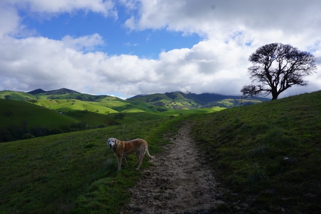
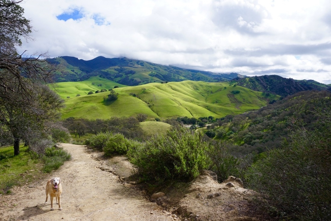
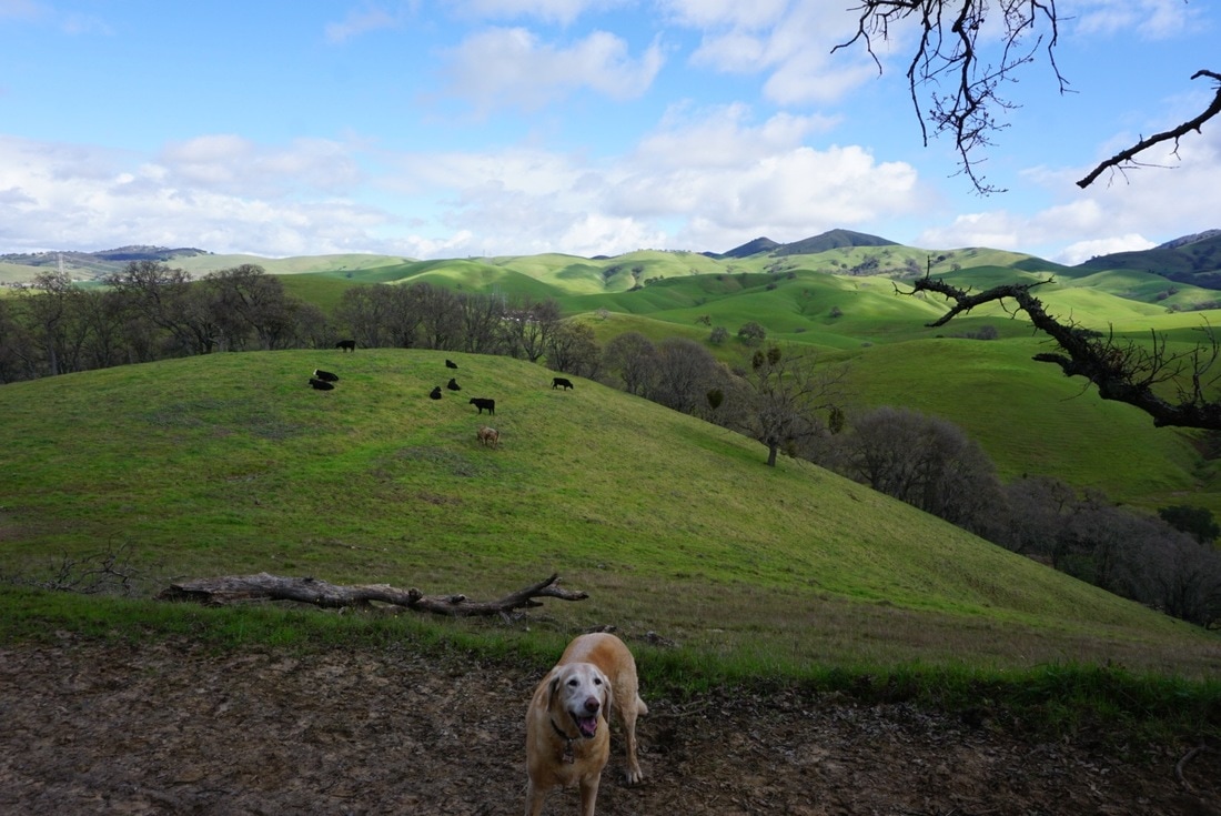
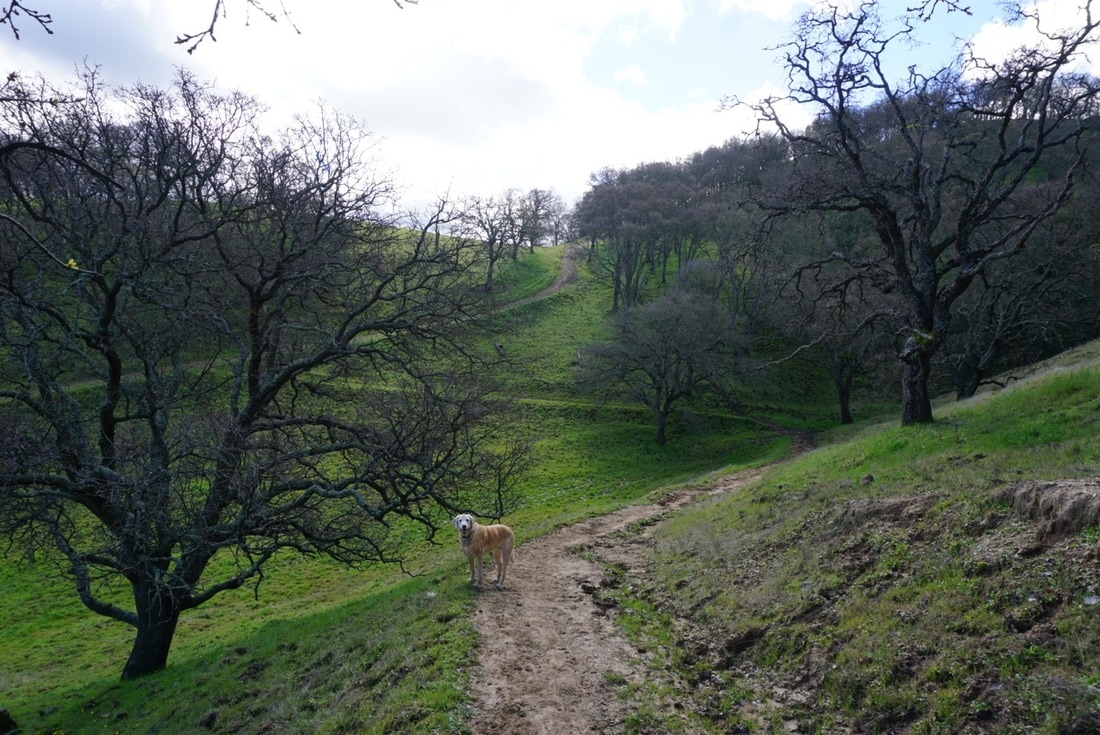
Description: Hike 1,060 acres of open space through oak woodlands, grasslands and along ridge tops with views of the surrounding cities and bay. You will even find a pond during summer but don't let your dog drink from or swim in it. During our hike we saw an abundance of birds, lizards and ground squirrels. 
​

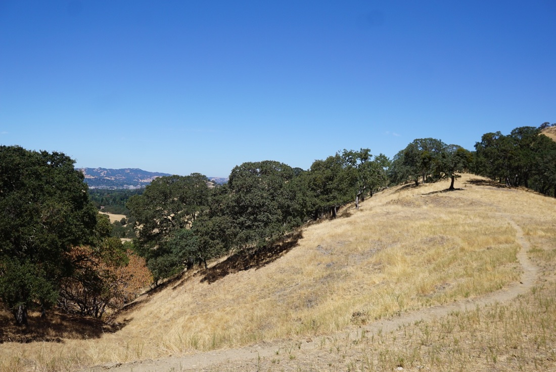
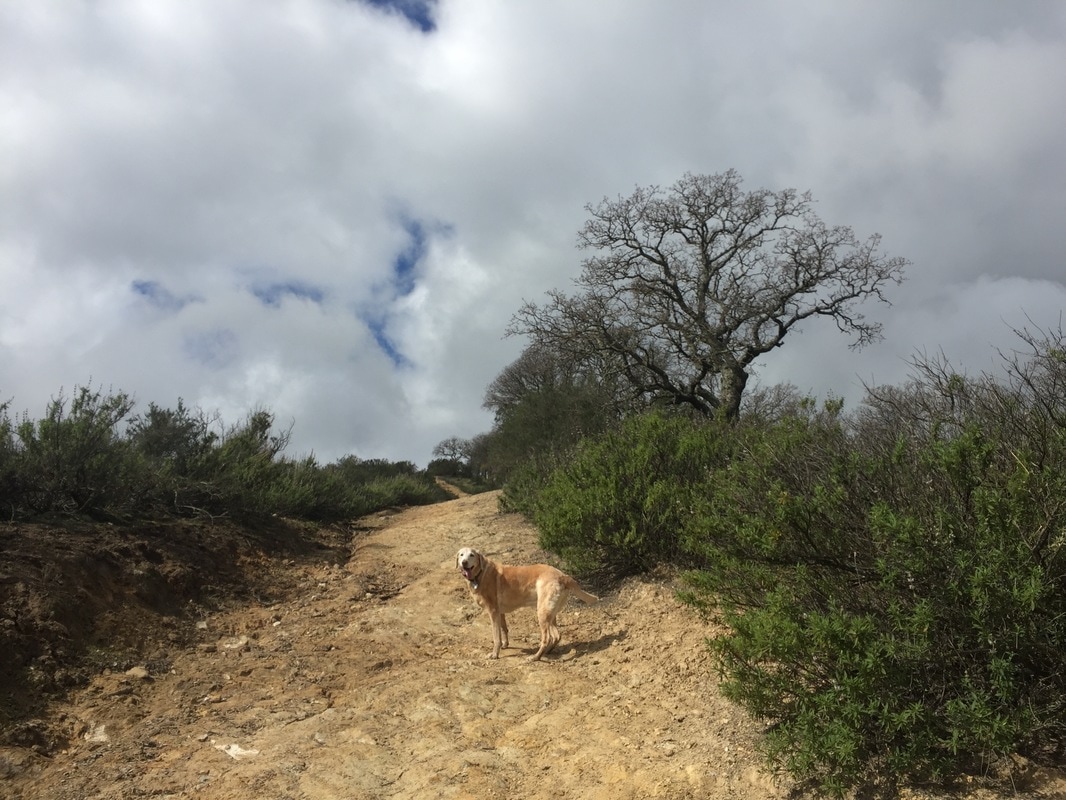
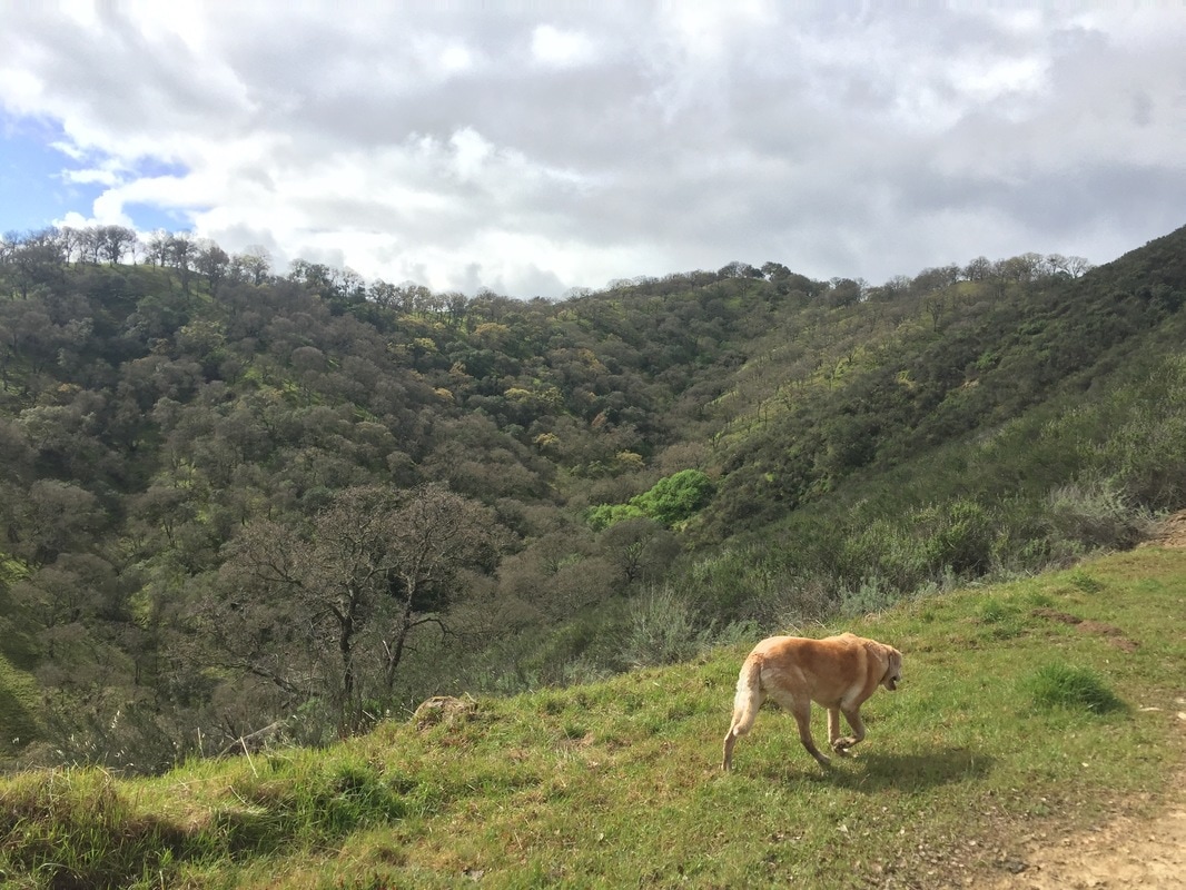
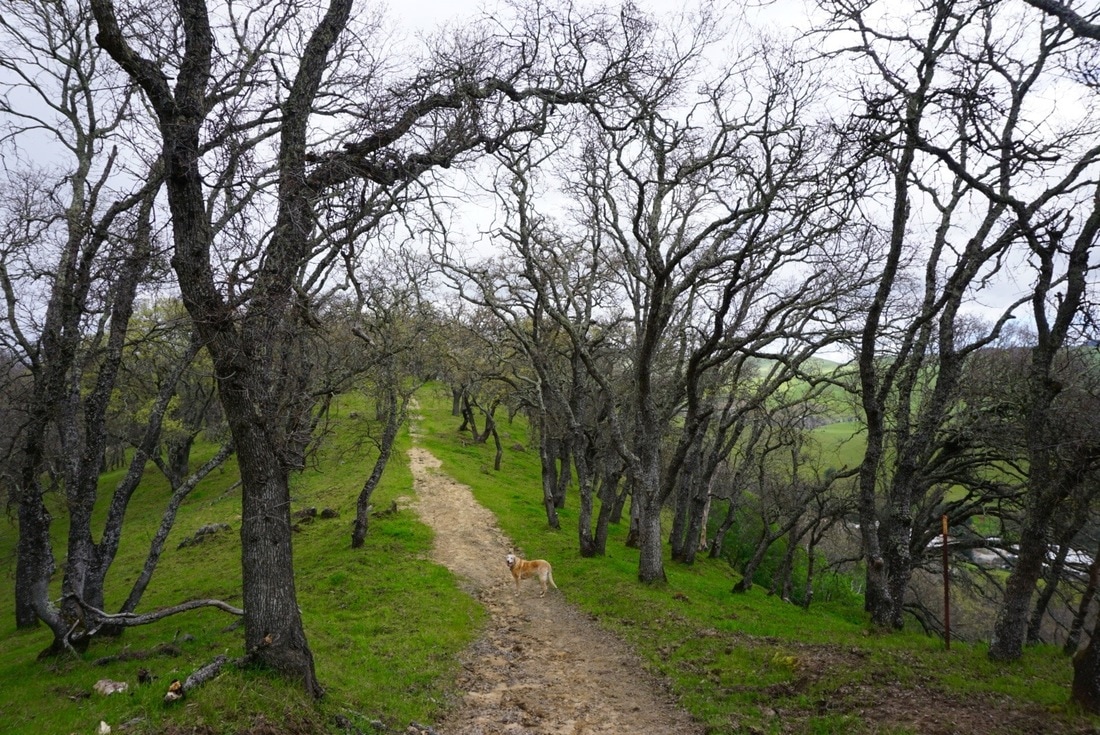
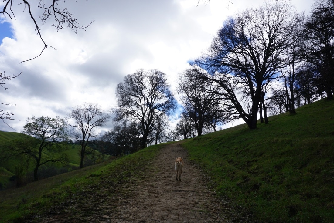
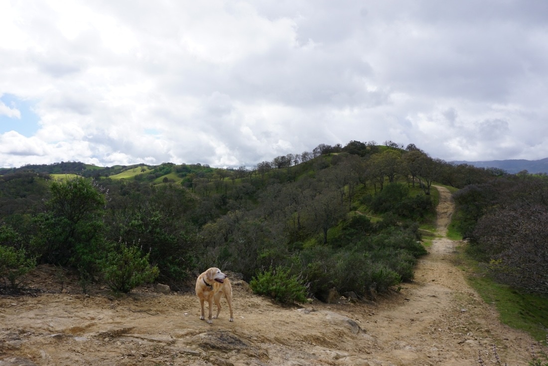
For one of our hikes, we started from the Orchard Staging Area off of Castle Rock Road. We hiked up to the Shell Ridge Trail and over to the Diablo Scenic Trail. The hike to the top was a short but very steep section, which I highly recommend for the incredible views of the rolling hills at the top. The staging area is popular among equestrians, so we saw a lot of horses on the trails. We encountered a few cattle, but they were far enough away from the trail that they didn’t seem to mind us. We intended to hike down to the Borges Ranch Trail and into Shell Ridge, but unfortunately cattle were congregating near the staging area so we didn’t chance hiking down into it. We ended up driving to Borges Ranch and hiking into Shell Ridge from there. We were able to make a loop back to where we started, although there was quite a bit of storm damage on the trail on our way back down. 

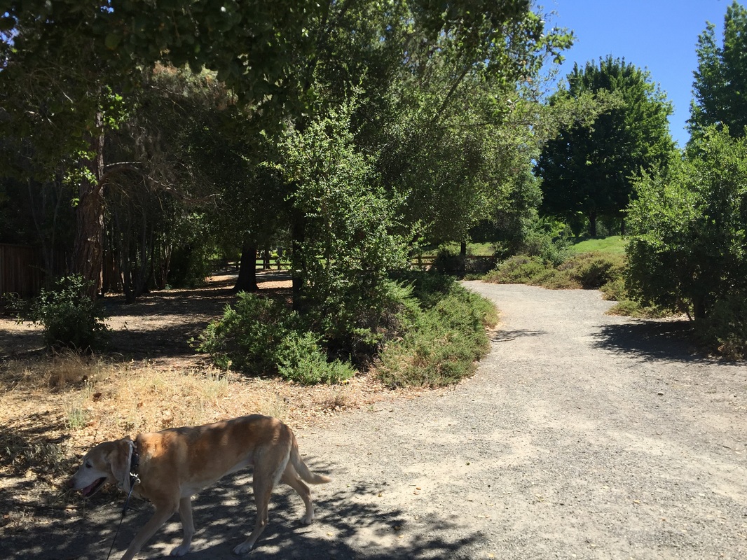
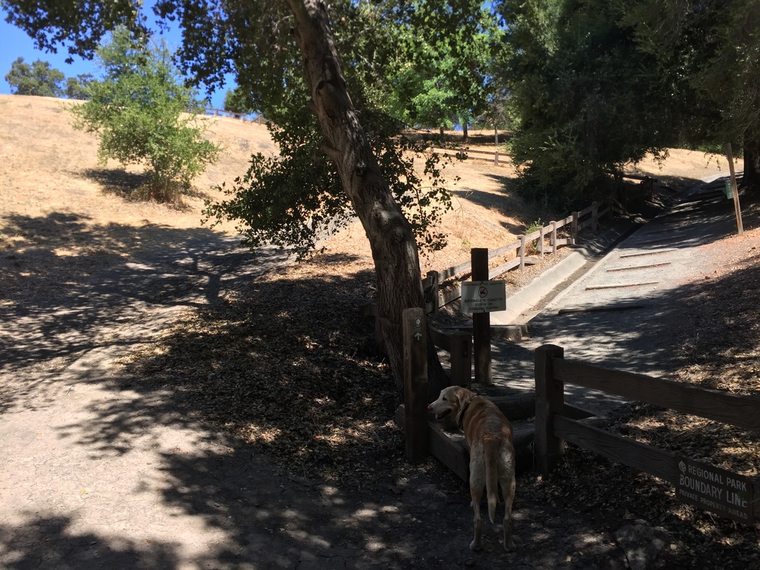
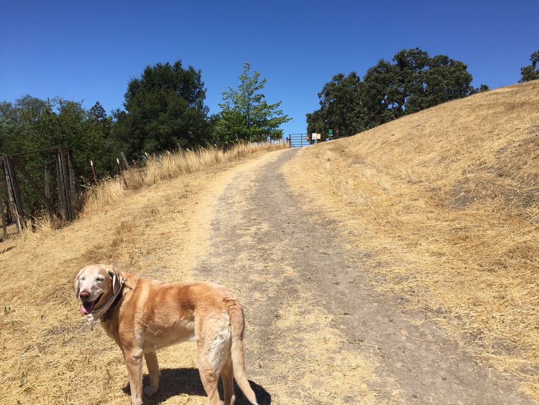
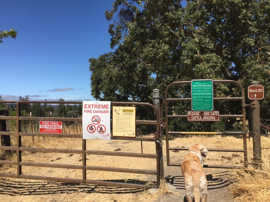
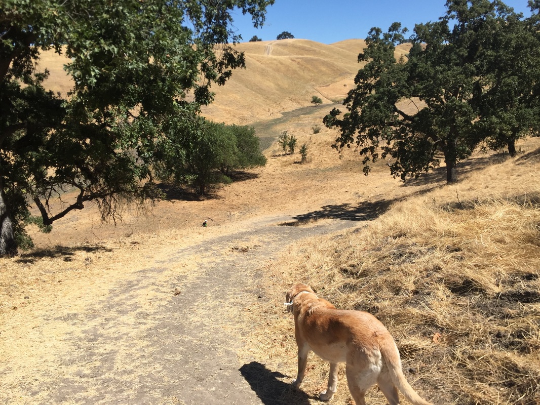
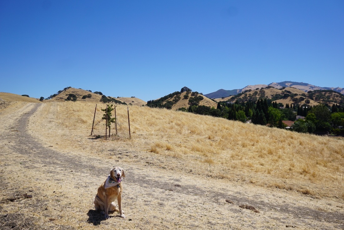
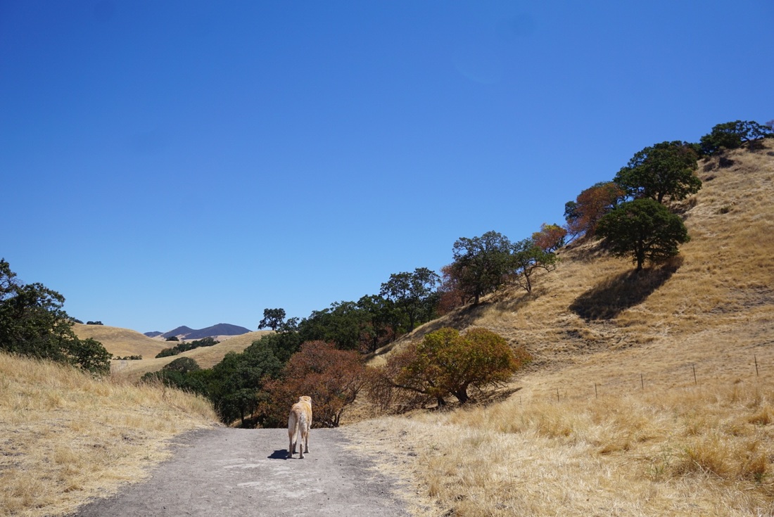
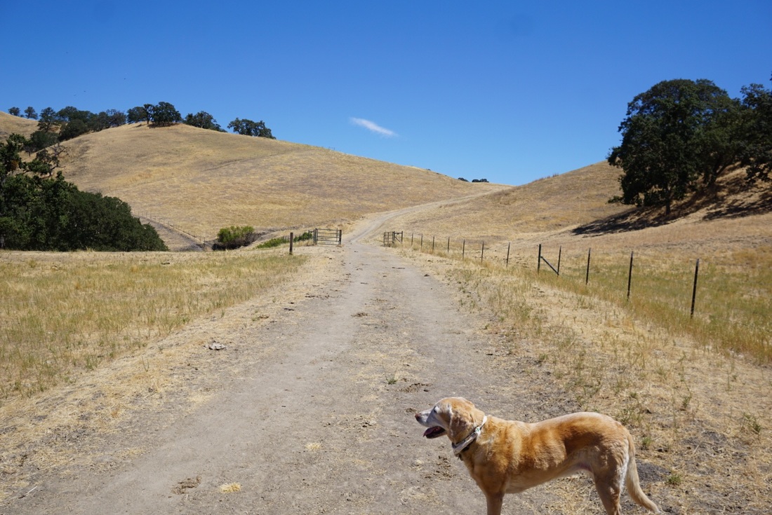
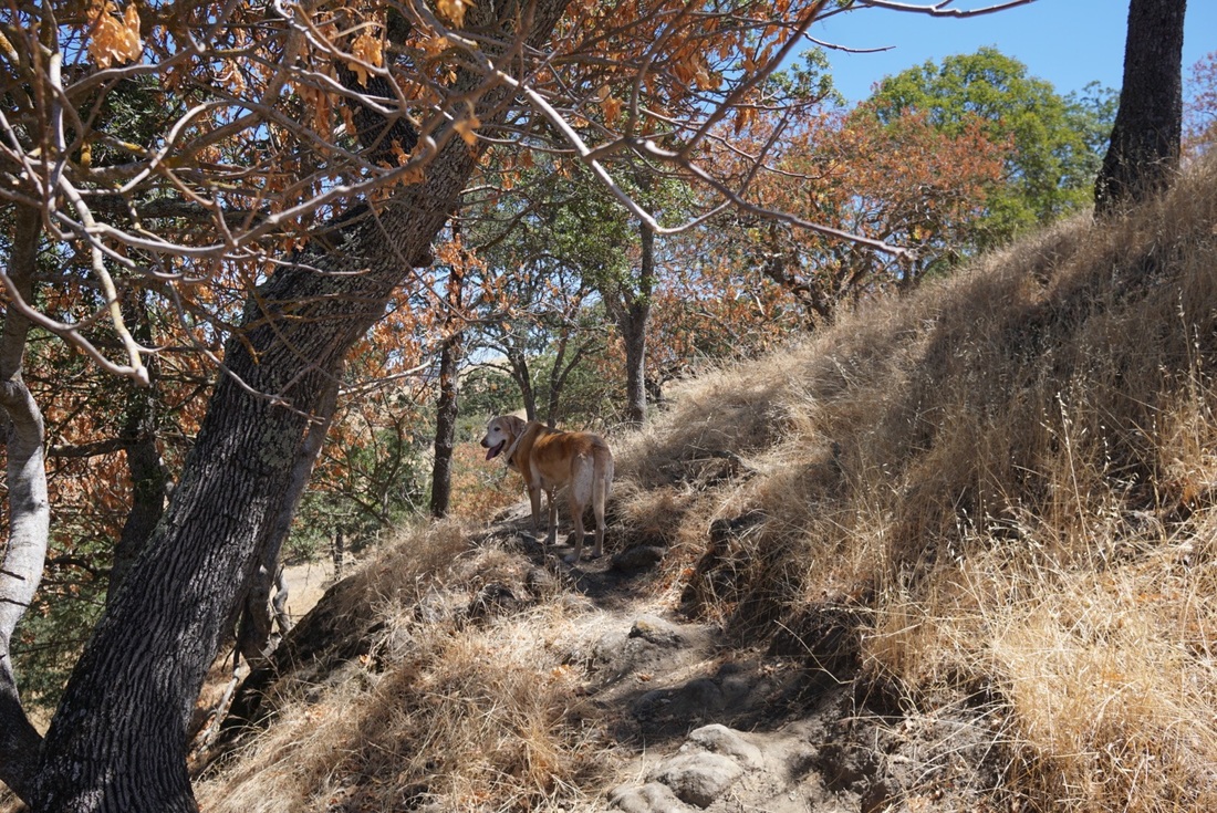
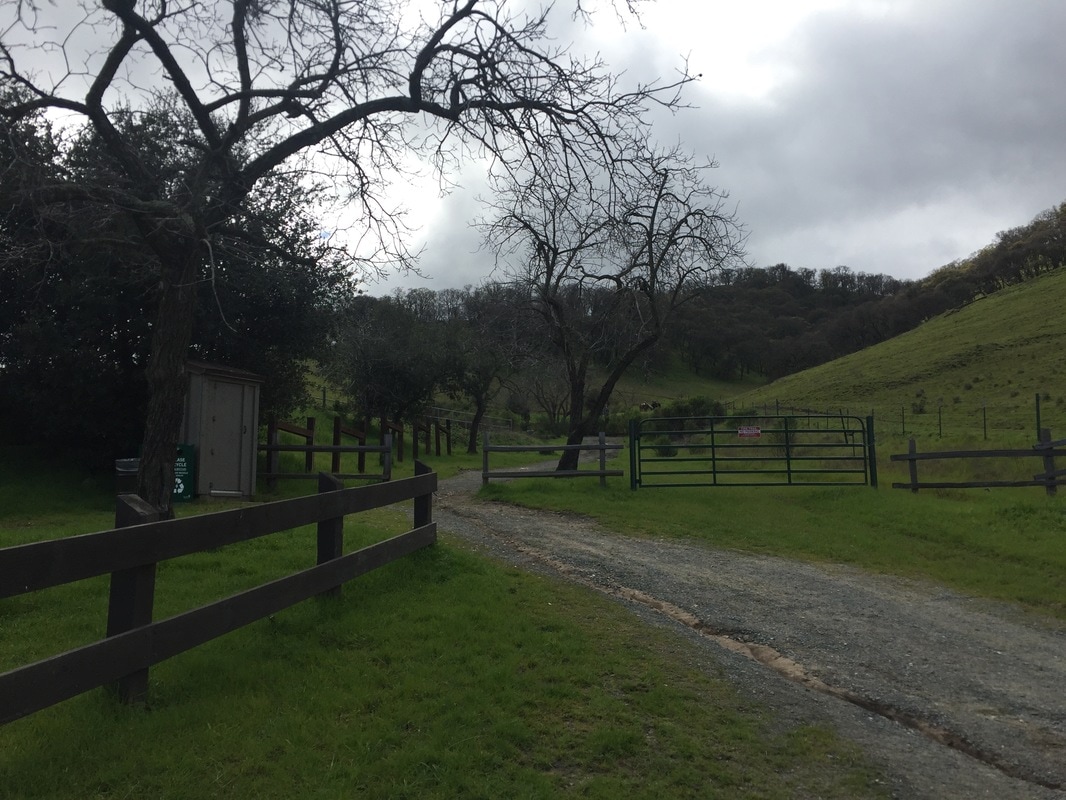
For another hike, we started from the Livorna Staging area. This took us on a short flat trail between residential areas, then climbed uphill, we went through a cattle gate, down along a pond, and then up a hill via the Foothills Trail. This trail dipped down and climbed back up several times, snaking around until reaching the EBMUD water tank. This trail yielded beautiful views of the surrounding hills and city, with several great outlook points. We also explored the Stonegate Trail, which we entered through another cattle gate. I wouldn't recommend hiking up this one with your dog, as the trail is very dry and severely cracked, which has left large craters your dog will find difficult to navigate, and may even cause a fall. However, this trail is lined with several colors of vibrant trees and will lead to the other side of the park. You can take the Foothills Trail to Twin Ponds Trail to reach the other side of the park instead. During our hike we saw cow pies that looked to be only a few days old, but we did not see any cattle during our hike. You can also hike into Shell Ridge from here. Dogs are not allowed in the nearby Castle Rock State Park or Mount Diablo State Park.

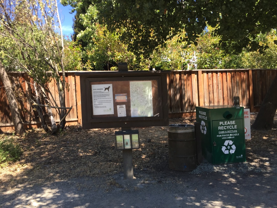
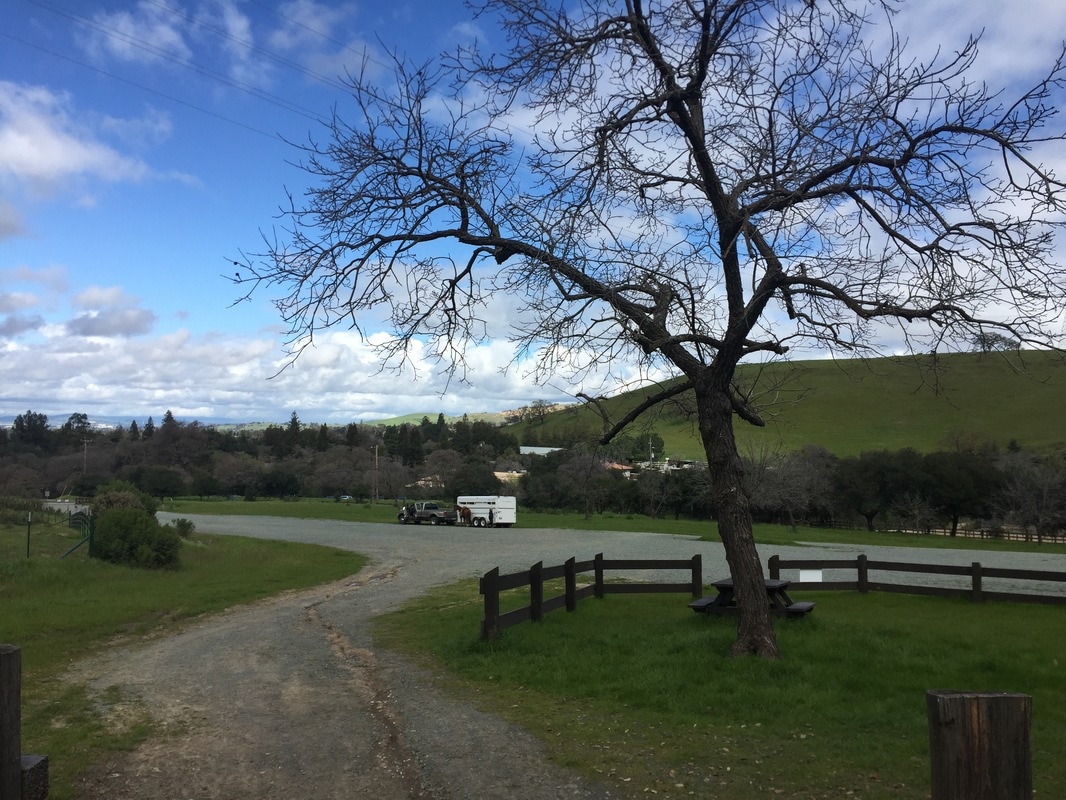
For the Livorna staging area, there is a trash can at the trailhead. No restrooms or water available nearby. Bring plenty of water. There is a pit toilet and garbage can at the Castle Rock Staging Area entrance. Flushing toilets and water are available at Borges Ranch near the interpretive center. 

​Pictures from our winter hike beginning at the Castle Rock Staging Area:

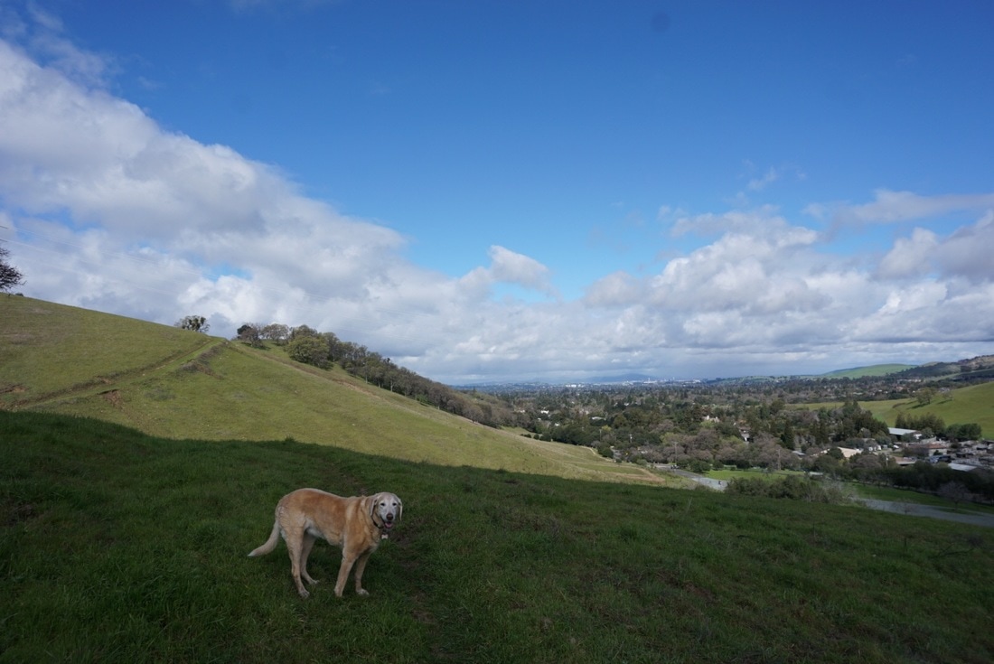
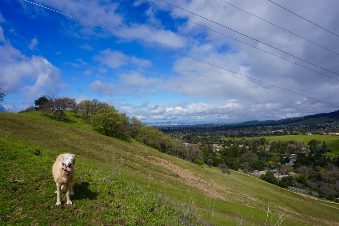
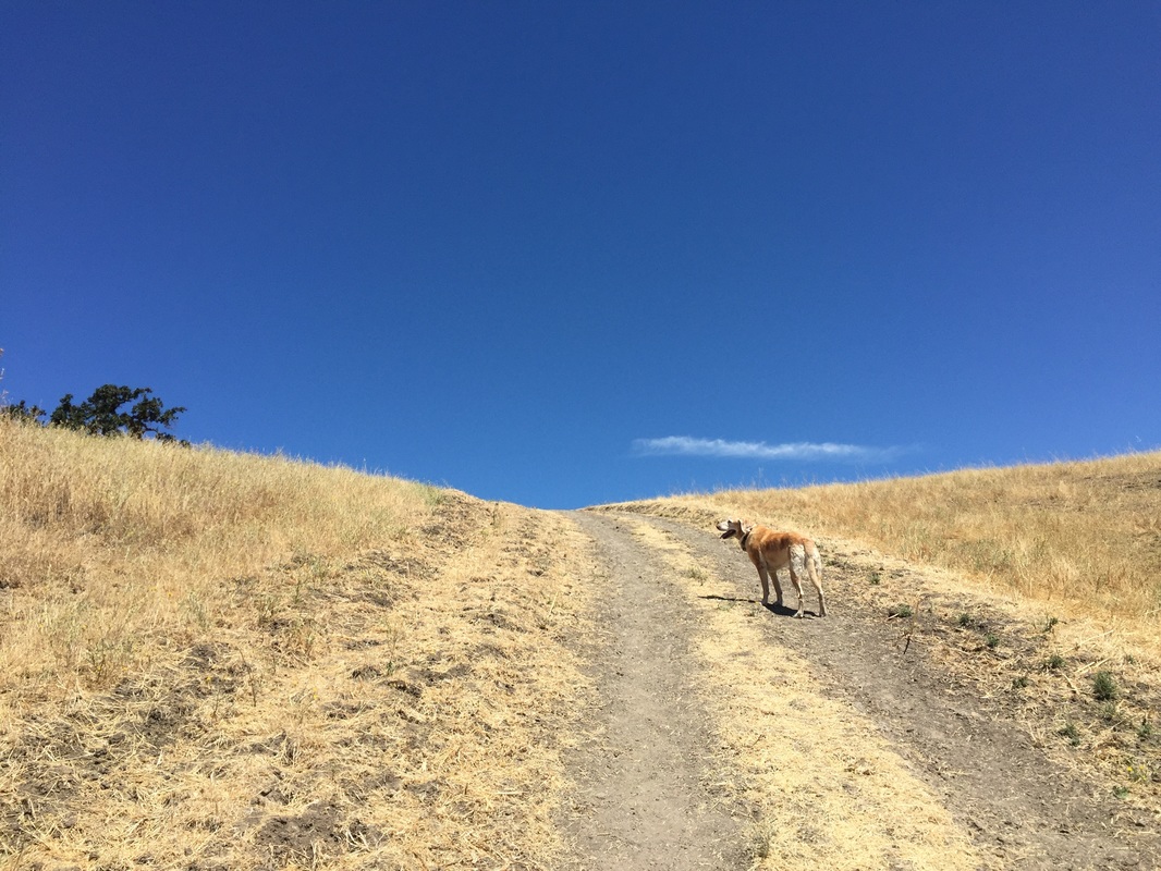
​Pictures from our summer hike beginning at the Livorna Staging Area:
Contact Us
Privacy Policy
Terms and Conditions
As an Amazon Associate I earn a commission from qualifying purchases. 
All content within this site Copyright © 2023 Hikes Dogs Love. All rights reserved. No part of this website may be reproduced without permission.
DMCA.com Protection Status
  • Home
  • Browse All
    • Alameda County >
      • Albany Bulb
      • Alameda Creek Regional Trail
      • Anthony Chabot Regional Park (Lake Chabot)
      • Aquatic Park
      • Chabot Park
      • Barlago Italian Kitchen
      • Buchanan Dog Beach
      • California Canoe & Kayak (Oakland)
      • César Chávez Park
      • Claremont Canyon
      • Coyote Hills Regional Park
      • Crab Cove
      • Cull Canyon Regional Recreation Area
      • Dimond Canyon Park
      • Don Castro Regional Recreation Area
      • Don Edwards Wildlife Refuge
      • Dublin Hills Regional Park
      • Fairmont Ridge
      • Five Canyons Open Space Preserve
      • Fremont Central Park
      • Garin/Dry Creek Pioneer Regional Park
      • Greenbelt Trails
      • Hayward Regional Shoreline
      • Heron Bay Trail
      • Holy Land Restaurant
      • Ikaros Greek Restaurant
      • Jerusalem Organic Kitchen
      • Joaquin Miller Park
      • Lake Anza
      • Lake Chabot
      • Lake Merritt
      • Leona Canyon Regional Open Space Preserve
      • Leona Heights Park
      • Marina Park
      • Martin Canyon Creek Trail
      • Martin Luther King Jr. Regional Shoreline
      • Mission Peak
      • Montclair Railroad Trail/ Torii Gate
      • Morgan Territory Regional Preserve
      • Oyster Bay Regional Shoreline
      • Park Street Classic Car Show (Annual)
      • Pleasanton Ridge Regional Preserve
      • Reinhardt Redwood Regional Park
      • Robert's Park
      • Room 389
      • Shoreline Park
      • Sibley Volcanic Regional Preserve
      • Skyline Gate Staging Area
      • Strawberry Canyon Fire Trail
      • Sunol Regional Wilderness
      • Temescal Regional Recreation Area
      • Tilden Regional Park
      • Upper Anthony Chabot Regional Park (Oakland Entrance)
      • Upper Knowland Park
      • Vargas Plateau Regional Park
    • Butte County >
      • Feather Falls
      • Motel 6 - Oroville
      • Riverbend Park
    • Contra Costa County >
      • Acalanes Ridge Open Space
      • Briones Regional Park
      • Carquinez Strait Regional Shoreline
      • Crockett Hills Regional Park
      • Diablo Foothills Regional Park
      • EBMUD Trails
      • Fernandez Ranch
      • Frowning Ridge
      • Geppetto's Caffe
      • Hacienda de las Flores Park
      • Hillside Nature Area
      • Howe Homestead Park
      • Indian Rock
      • Kennedy Grove Regional Recreation Area
      • Lafayette Community Park
      • Lafayette Reservoir
      • Las Trampas Regional Wilderness
      • Lime Ridge Open Space
      • Miller/Knox Regional Shoreline
      • Moraga Commons Park
      • Mulholland Ridge Open Space Preserve
      • Point Isabel
      • Point Molate Beach Park
      • Point Pinole Regional Shoreline
      • Point San Pablo Harbor
      • Rubio's
      • San Quentin Beach
      • Shell Ridge Open Space
      • Sobrante Ridge Regional Preserve
      • Sugarloaf Open Space
      • Sycamore Valley Open Space Preserve
      • Tender Greens
      • Tilden Regional Park
      • Wildcat Canyon Regional Park
    • El Dorado County >
      • Angora Lakes Trail
      • Bijou Community Park
      • Cascade Falls
      • Horsetail Falls
      • Inspriation Point
      • Motel 6 - South Lake Tahoe
      • Mt. Tallac
    • Marin County >
      • 101 Surf Sports
      • Baltimore Canyon Open Space Preserve
      • Blackie's Pasture
      • Camino Alto Preserve
      • Carson Falls
      • Cascade Falls
      • Cataract Falls
      • Dawn Falls
      • Ignacio Valley Preserve (Fairway Falls)
      • Indian Valley Open Space Preserve
      • King Mountain Open Space Preserve
      • Marin Headlands (Coastal Trail)
      • Old Saint Hilary's Open Space Preserve
      • Phoenix Lake
      • Ring Mountain Open Space Preserve
      • Roy's Redwoods
      • Sam's Anchor Cafe
      • Tiburon Peninsula Historical Trail
      • Tucker Trail Falls
    • Mariposa County >
      • Happy Burger Diner
      • Yosemite National Park
    • Mendocino County >
      • Catch-a-Canoe
      • MacKerricher State Park
      • Mendocino Headlands State Park
      • Navarro River Redwoods State Park
      • Princess Seafood
      • Skunk Train
      • The Stanford Inn By The Sea
      • Van Damme State Beach
    • Mono County >
      • Bodie State Historic Park
      • Jolly Kone
      • Lundy Canyon
      • Mono Lake (Tufa State National Reserve)
      • Virginia Creek Settlement
    • Monterey County >
      • 17-Mile Drive
      • Asilomar State Beach
      • Bistro Beaujolais
      • Carmel Beach
      • Fishwife
      • Fort Ord Dunes State Park
      • Garland Ranch Regional Park
      • Jack's Peak
      • Monterey Bay Coastal Trail
      • Monterey Bay Kayaks
      • Monterey Municipal Beach
      • Motel 6 - Downtown Monterey
      • Ryan Ranch Disc Golf Course
      • Ventana Wilderness
    • Nevada County >
      • Fairy Falls
    • Placer County >
      • Hidden Falls
    • San Francisco County >
      • 2.2 Mile Urban Hike
      • Bernal Heights Park
      • The Brixton
      • Billy Goat Hill Park
      • Blackwood
      • Clipper Cove Beach
      • Crissy Field
      • Dynamo Donut + Coffee
      • Fort Funston
      • Fort Mason
      • Glen Canyon Park
      • Golden Gate Park
      • Grand View Park
      • The Great Lawn/ Avenue of the Palms
      • Java Beach Cafe
      • John McLaren Park
      • Interior Greenbelt
      • Lake Merced
      • Lands End
      • Letterman Digital Arts Center
      • Marina Green
      • Mount Davidson
      • Mount Sutro Open Space Reserve
      • Ocean Beach
      • Palace of Fine Arts
      • Philz Coffee Truck
      • Stern Grove
      • Sutro Baths
      • Sutro Heights Park
      • TreasureFest
    • San Mateo County >
      • 7 Mile House Sports Bar & Grill
      • Barbara's Fishtrap
      • Bedwell Bayfront Park
      • Bob's Vegetable Stand and Pumpkin Farm
      • Cafe Pacifica
      • Devil's Slide Coastal Trail
      • Esplanade Beach
      • Flying Fish Grill
      • Half Moon Bay Kayak Co.
      • McNee Ranch State Park (Montara Mountain)
      • Montara State Beach
      • Mori Point
      • Mussel Rock Park
      • Panera Bread
      • Pedro Point Headlands
      • Poplar Beach
      • Pulgas Ridge Open Space Preserve
      • Rancho Corral de Tierra
      • Seal Point
      • Taqueria La Mexicana
      • Wavecrest Open Space
    • Santa Clara County >
      • Byxbee Park
      • Calero County Park
      • Uvas Canyon County Park
    • Santa Cruz County >
      • Byrne-Milliron Forest
      • Greyhound Rock County Park
      • Henry Cowell Redwoods State Park
      • Jaliscos Restaurant
      • Mount Madonna County Park
      • Roaring Camp Railroads
    • Solano County >
      • Lagoon Valley Park
      • Peña Adobe Regional Park
    • Sonoma County >
      • Doran Regional Park
      • Fishetarian
      • Helen Putnam Regional Park
    • Tuolumne County >
      • Donnell Vista
      • Tuttletown Recreation Area
    • Yuba County >
      • Ellis Lake
  • Map View
  • Vacation Spots
    • Vacation Hikes >
      • Arizona >
        • Papago Park
      • New Mexico >
        • Oliver Lee Memorial State Park
        • White Sands National Monument
      • Oregon >
        • Multnomah Falls
      • Washington >
        • Olympic National Park >
          • Kalaloch Beach
          • Madison Falls
          • Quinault Rainforest
        • Rattlesnake Ridge
    • Restaurants >
      • Southern California >
        • Fire Island Grill
        • Lazy Dog Restaurant & Bar
        • Perkies Coffee Haus
      • Washington >
        • Rose Pho
  • Planning Your Trip
  • About
    • Contact Us
    • Privacy Policy
    • Terms and Conditions
  • Dog Gear
  • Archived Hikes 1
    • Archived Hikes 2 >
      • Archives 2016-2018