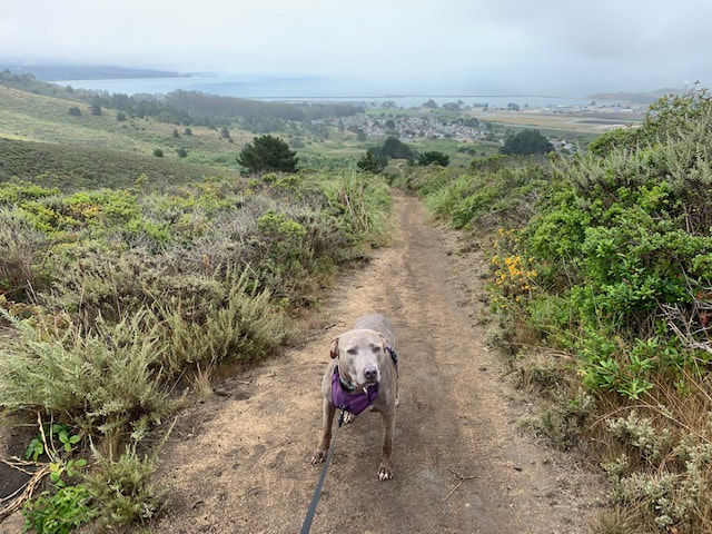
Welcome!
This is the most comprehensive, detailed guide to dog-friendly hikes in the Bay Area (and beyond).
Unlike other sites, this is not just a catalog, because:
Unlike other sites, this is not just a catalog, because:
- Each hike has been personally tested & reviewed by myself and my dogs.
- Every hike has my own photos and little-known information from first-hand experience, along with parking info, trail maps, regulations and everything you need to know about the park.
- For those days you're looking for something different, I've included some scenic walks, dog-friendly disc golf courses, train rides, campsites and restaurants.
What's new?
As you may know, my best furry friend, Bailey, who inspired this website and is pictured in nearly all of our adventures, passed away in August 2020. I've been heartbroken but received so many kind words from followers who love this website that it has given me the inspiration to keep updating. Although I don't have as much time as I used to, I'm still trying to post new hikes. I'm pleased to announce that there are over 200 dog-friendly hikes & other adventures on my website! I have nearly tripled my destinations since my launch. I hope to continue to grow at such a fast pace, but I'm only one woman with one dog! Each destination is dog-tested and approved by Bailey and/or Roxy/Keisha and I! Enjoy!
Check out our new "vacation spots" section with hikes outside of Northern California. I will continue to expand this section.
Check out our new "vacation spots" section with hikes outside of Northern California. I will continue to expand this section.
The below section will give you updates on our recent hikes. You can find more detailed information on them under their individual pages. We will continue our travels and posting cool places along the way, so don't forget to follow us!
Follow us on Instagram for new adventures!
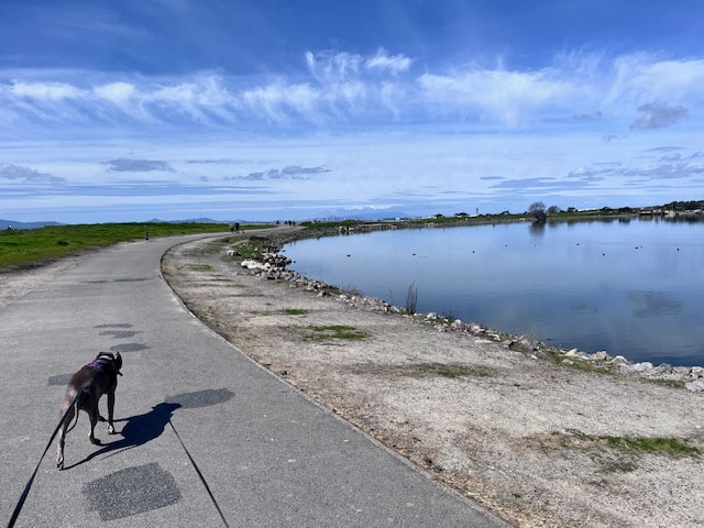
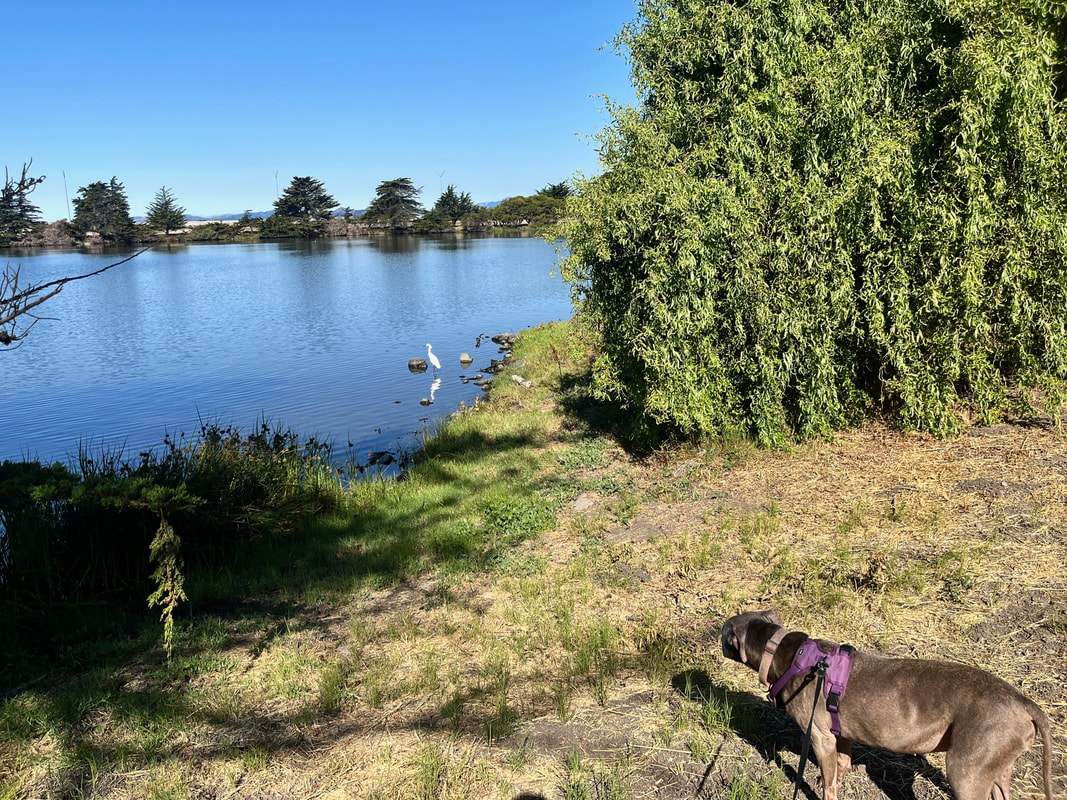
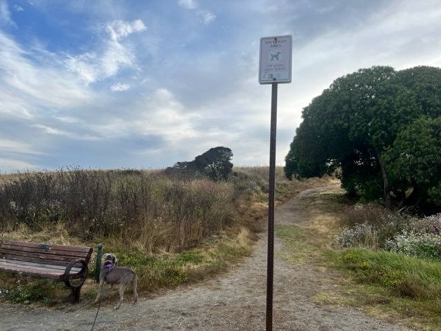
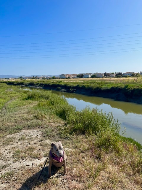
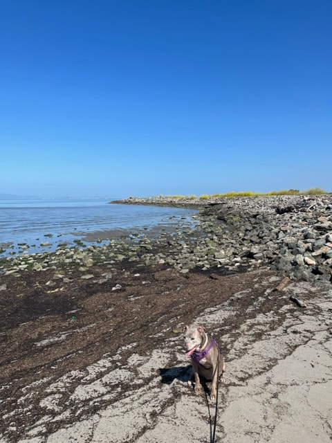
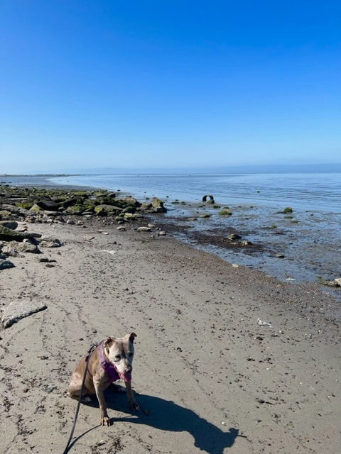
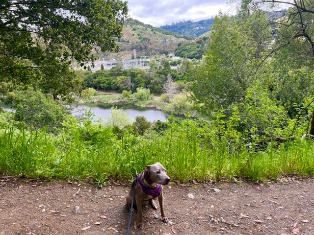
Heron Bay
July 20, 2024
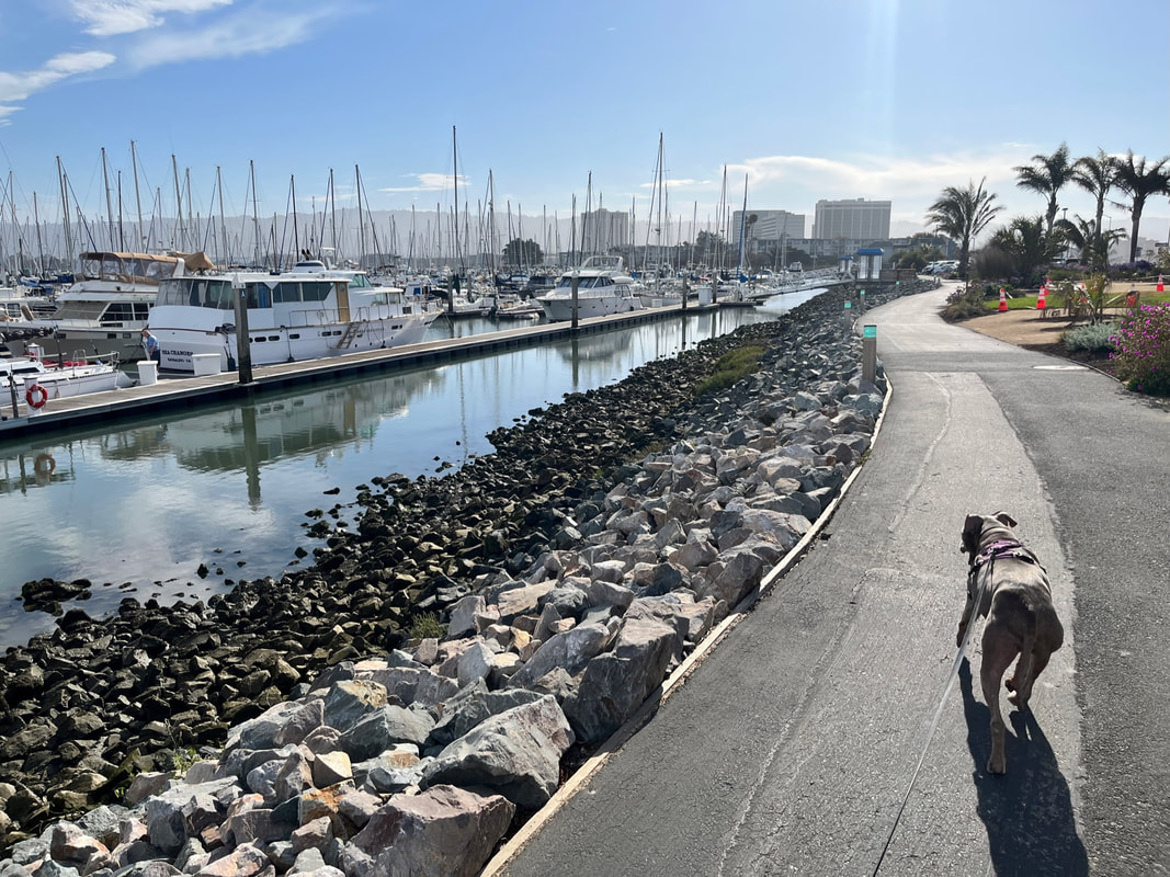
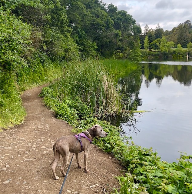
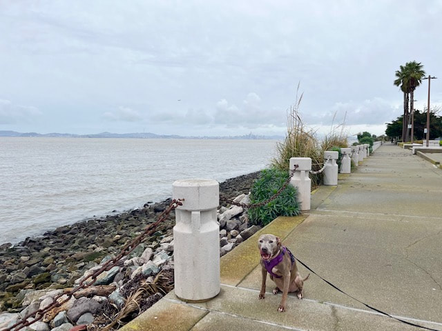
We enjoyed a beautiful evening at Heron Bay in San Leandro. It got a bit warm today, but by the time we arrived there was a gentle breeze from the water and the weather was perfect. We walked on the dirt trails around the marsh and then took the main, paved SF Bay Trail to the beach. The tide was out so it was pretty rocky, but we still found a great spot to sit and enjoy the view of the bay. This park has very limited street parking because the neighboring community has permit-only parking aside from 5 public parking spaces. We come here often and this was only the second time we didn't snag a spot, so we had to park down further, off of Wick's blvd. Overall our walk was about 2.5 miles.


Point Emery & Pizza at Gilman Brewing Co.
July 17, 2024
This weekend we went for a nice walk along the water at Point Emery in Emeryville, and then we went about 3 miles up the road to Gilman Brewing Company for pizza. The walk was very nice, with few people and only a few bikes. We liked this area because it's right along the scenic shoreline and has a dirt path with no foxtails, which is rare this time of year. I've been meaning to check out Gilman Brewing for a long time and it did not disappoint! They have lots of dog-friendly outdoor seating on either side of the entrance. The left side is covered and that's where most people sit. The right side was not covered but still shady and was completely empty. I loved the pizza because it's very unique: deep dish with a big, fluffy crust and some unique toppings. They have some standard options like cheese and supreme, but they also have some really interesting combinations as well as 15 plant-based pizzas and 9 vegan pizzas.


July 4, 2024
Martin Luther King Jr. Regional Shoreline Park
Today we got up super early to beat the heat and walked along the water at MLK Jr. Shoreline Park. It has beautiful views of the water, we saw birdwatchers, and we enjoyed a gentle early-morning breeze. We were trying to wear Roxy out before the fireworks start tonight. I know fireworks are challenging for most dogs, so I hope you can have fun but stay safe tonight!
May 24, 2024
Chabot Park - Anthony Chabot Regional Park
Today we hiked Lake Chabot from our favorite little-known entrance at Chabot Park in San Leandro. We love this trailhead because there's a huge, free parking lot and the hike from the parking lot to the lake is only about 10 minutes. The park itself is also dog-friendly with a playground, volleyball court and 18-hole disc golf course.


April 10, 2024
Wolf Creek Trail
The day after hiking Hidden Falls, we stayed at a beautiful AirBNB in Grass Valley and I woke up early and looked for an easy hike. I saw some trail on a map down the road, but I couldn't find any information online so I decided to check it out. This park has a 1.2 mile, mostly paved trail meandering above a tranquil creek and shaded by a canopy of trees, with about 180ft of altitude change. The trail begins from a parking lot next to the North Star Mining Museum where you can check out some historical mining equipment up close. About 3/4 of the way through the trail, I was happy to see a dirt trail that veered off the paved path and led down to the water. This trail runs right next to the creek and is enveloped by majestic redwoods. It was my favorite part of the park, and I highly recommend checking it out. It reminded me of hiking in Tahoe, and we only passed two people during our entire walk - a true hidden gem.
April 1, 2024
Hidden Falls
We recently went on a road trip to Grass Valley/Auburn. One of our hikes was Hidden Falls, which I hiked several years ago. It's still just as beautiful, but they now require parking reservations, so make sure you plan ahead (they do sell out!). This park has 30 miles of scenic trails and you can view two waterfalls in a little over a 3 mile hike. I'd also highly recommend checking out some of the less-traveled trails, as they are hidden gems. I'm currently working on adding new spots in this area for a full road trip agenda!
March 13, 2024
Marina Park
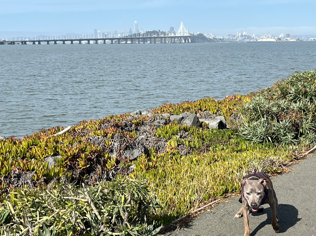
We are missing Keisha, but time doesn't stop, and I find it healing to still get outside with Roxy. It's been pretty wet and muddy lately, but the San Leandro Marina is a great place because you can walk for miles on a paved trail. We enjoyed a break in the rain with view of the the bay and SF.
March 9, 2024
Keisha has crossed the rainbow bridge
It’s with a heavy heart that I have to announce the passing of Keisha last Saturday, March 2nd. We unexpectedly found out she had cancer and she got so bad we had to put her down the next day. She showed no signs until a couple days prior, she even had a good vet check up three weeks before. It was beyond heartbreaking to find out like that, and for it to progress so fast. Although it would never be enough time, we are so thankful she made it almost 15 years and that we got those last 24 hours so spoil her.
Keisha was reactive to other dogs because she was attacked as a puppy. But she was such a sweet, affectionate, loving dog. She would light up any room with her energy and love and would smother you in kisses. We had to separate her from Bailey (and Roxy up until the end), which was often challenging. Having a reactive dog is not always easy and requires more work. But I’m thankful we always made it work. She inspired me to seek out and feature places other reactive dogs could enjoy. I wouldn’t trade those moments we got to spend with her for anything.
My heart is broken and I miss her terribly. The only thing that makes it easier is remembering how much fun she had and knowing we did everything we could to give her a good life. We just hope she enjoyed every moment as much as we did.
Please give your fur babies an extra hug tonight. Take them on adventures, spoil them, and enjoy every second


February 28, 2024
Jaguars, Wolves & Bears!
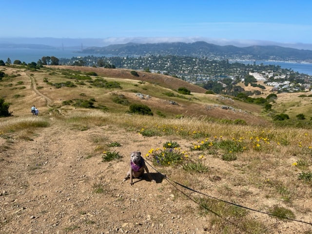
As I've mentioned before, we've seen grizzly bears and gray wolves on this hike in the past, but this time we also saw jaguars! There's probably no other hike anywhere with the same claim to fame! Every since the zoo expanded up this hillside we've been able to see animals during most of our hikes. Sometimes they're in the distance and sometimes they come up to the fence (don't worry, there are double fences, so they are not that close). Please be quiet and respectful if you come across an animal. If you don't see any animals, you can still enjoy a beautiful hike with panoramic views of the city! This hike has several different entrances and many of the trails are split by a huge valley and do not connect. If you're going to see the animals, start at one of the entrances off of Malcom Ave.
February 24, 2024
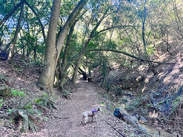
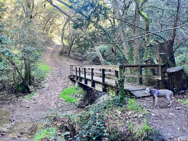
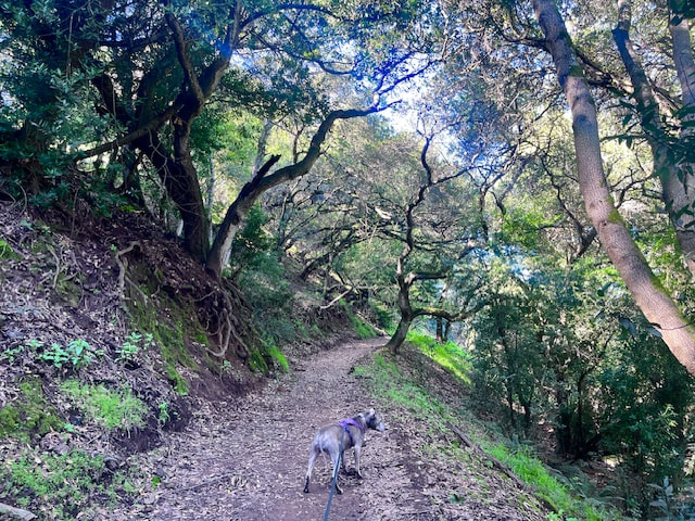
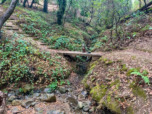
Greenbelt Trails
Lately, we've experienced a lot of rain, making today's sunny hike in the Hayward Hills all the more delightful. This particular trail, which meanders alongside a serene stream for nearly the entire hike, offers a soothing soundtrack of flowing water throughout. Shaded for the most part, the path is adorned with lush green ferns, vibrant mushrooms, moss, and multiple wooden bridges, creating a picturesque setting. At the summit, you'll enjoy a view of the Bay. Although we encountered some muddy patches on the descent, they were manageable. Despite starting later than usual, we encountered only a handful of fellow hikers along the entire route. This time we started our hike off of Campus Drive and looped bak down to Oakes Drive. Our hike was 4.2 miles with 560ft of elevation gain. You can extend your hike through various connecting trails or even crossing Campus Drive and hiking down to Memorial Park near the Hayward Plunge.
December 15, 2023
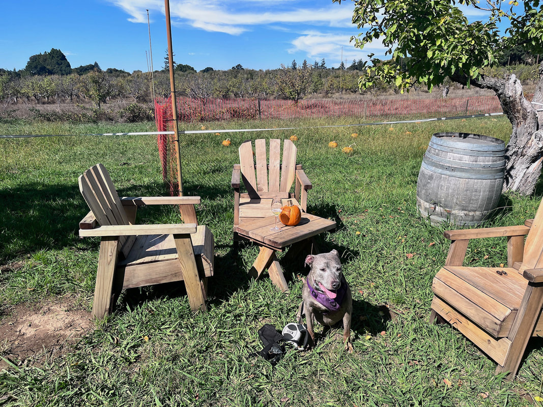
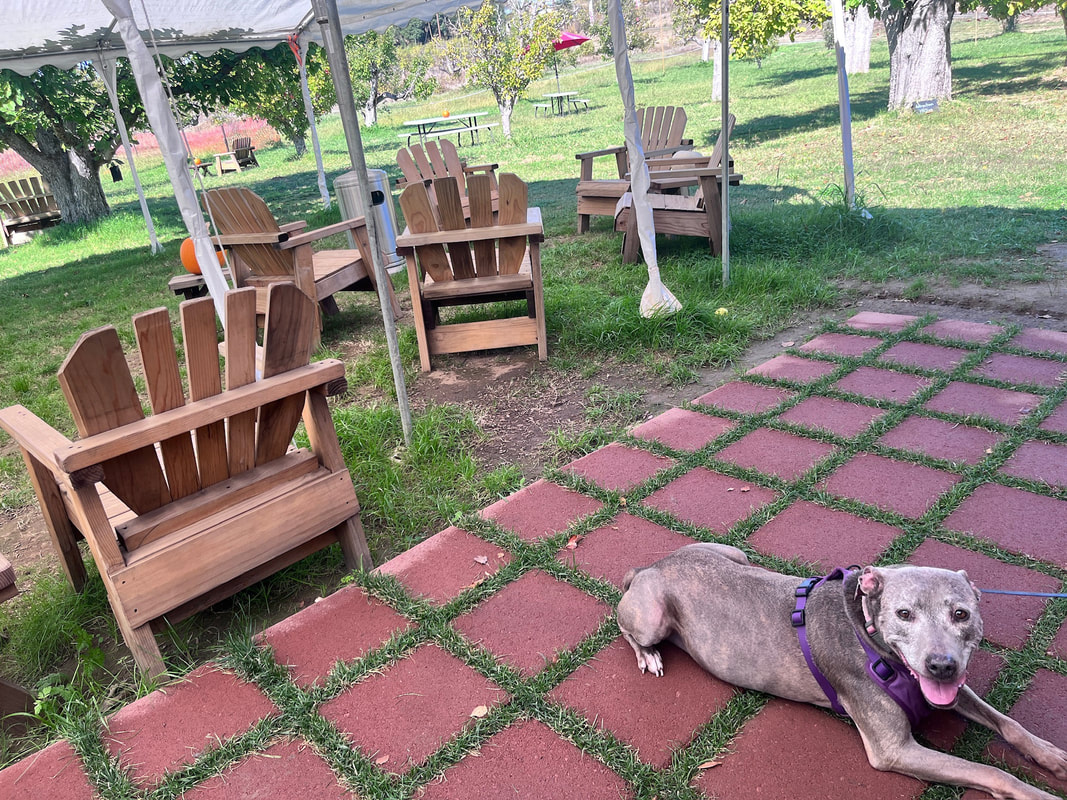
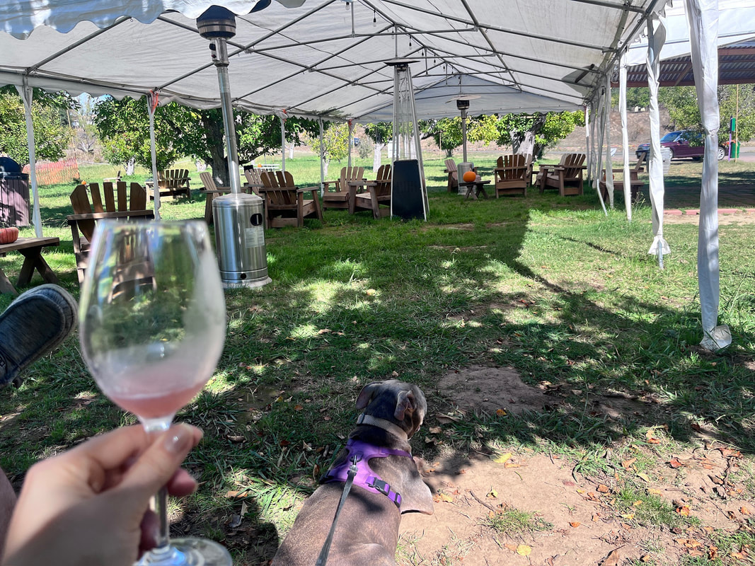
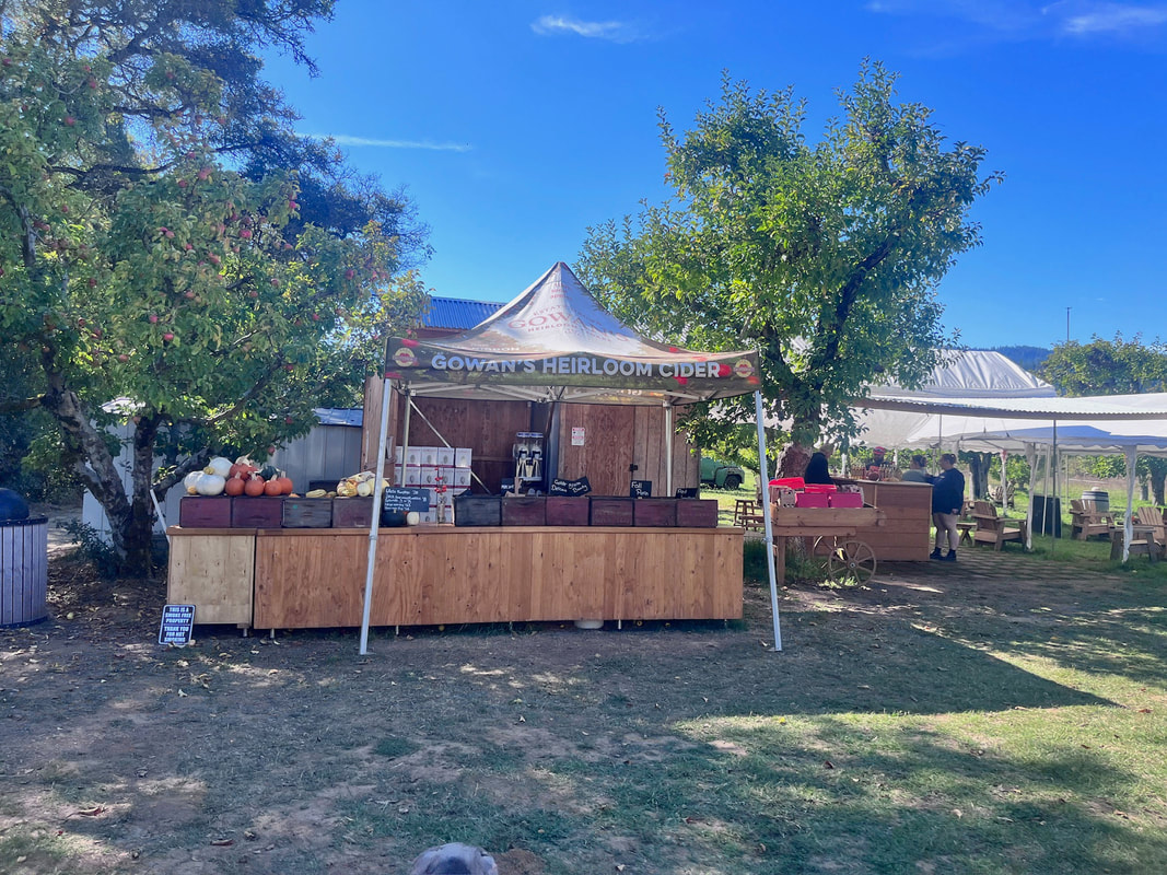
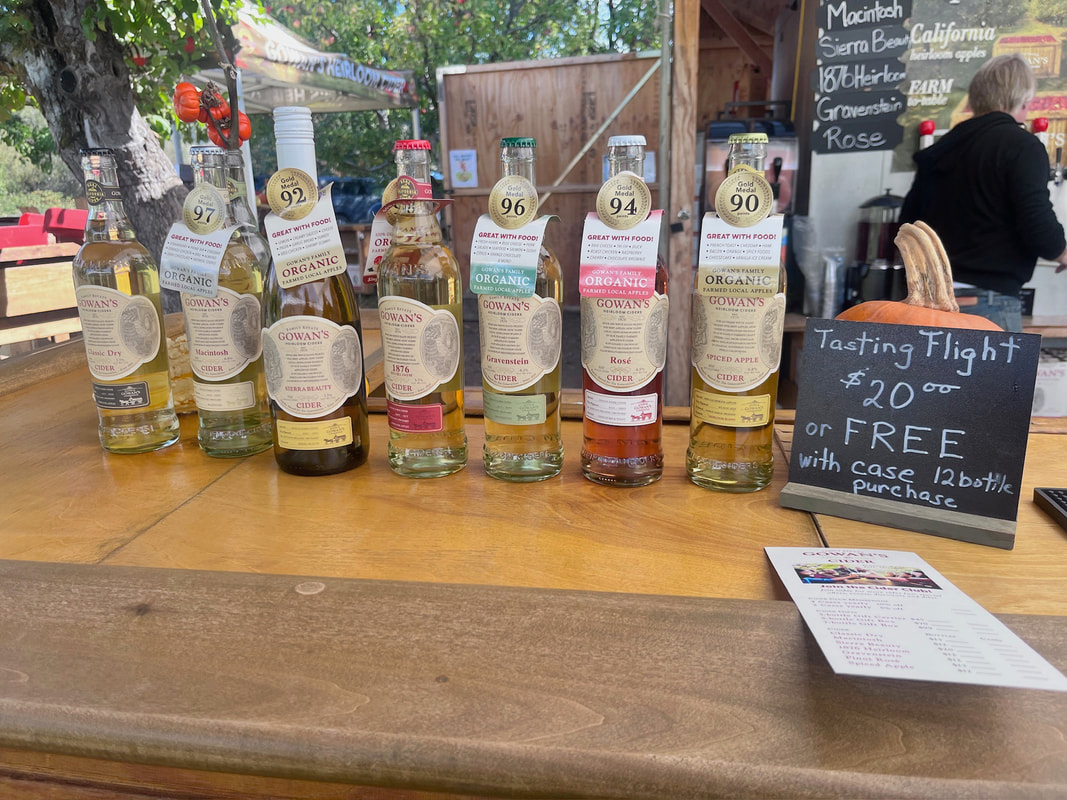
Fort Bragg & Cider Tasting
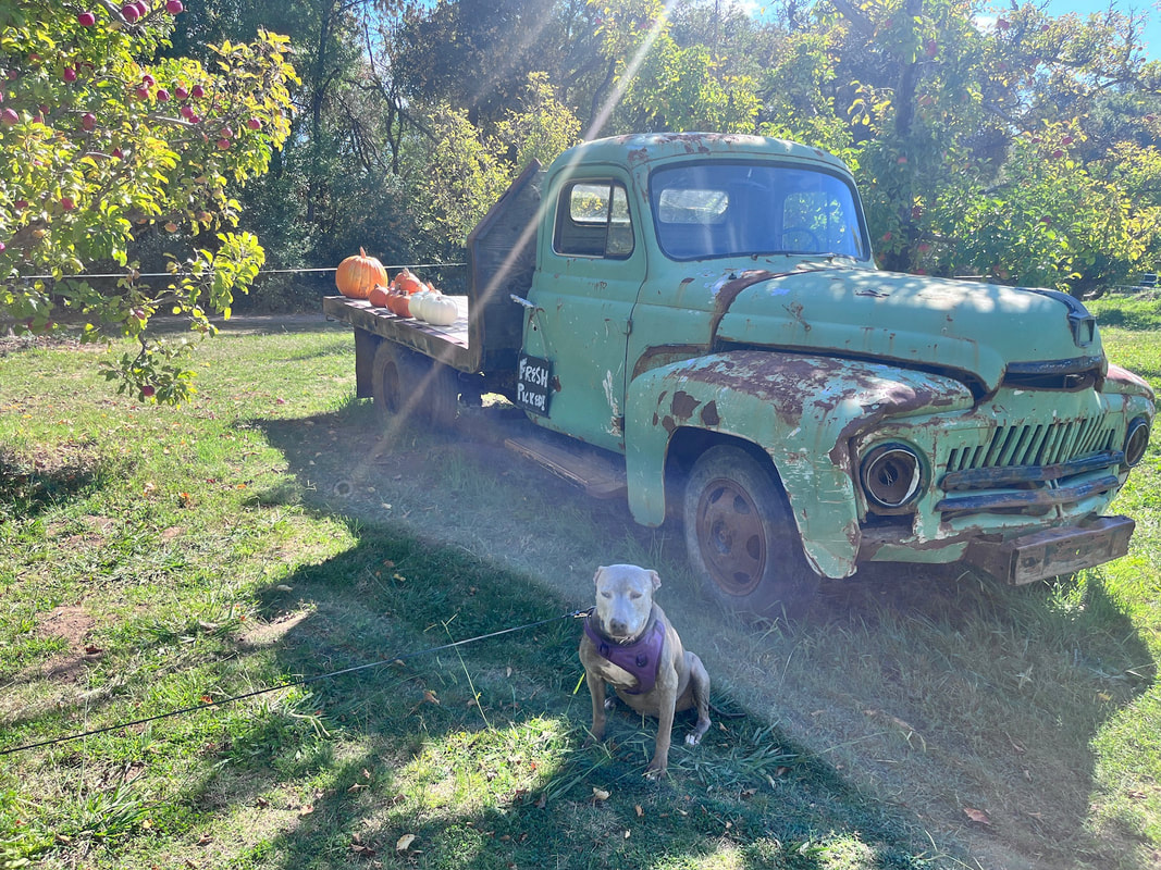
I've been super busy lately, but finally getting around to posting about our road trip. We went to Fort Bragg and explored some cool new spots in the area, and also visited some of our favorite regular spots. I'll be posting these spots as soon as I can. First stop - hard cider tasting! I'm not a fan of wine, but the allure of wine tasting always captivated me. On our way to Fort Bragg, we often spot signs for cider tasting, so this time, we couldn't resist. Our stop at Gowan's Cider Orchard off CA-128 was a delightful surprise! This nearly 150-year-old orchard boasts majestic apple trees. Some are over a century old, still bearing fruit, and you can walk right up to them. We were lucky when we arrived because we had the place practically to ourselves. We enjoyed sitting in the sun in the orchard and for $20 got to enjoy seven different hard ciders (along with a bonus slushy version and a bonus warm cider). Every flavor was delicious. Sierra Beauty, 1876 and Gravenstein were our favorites, along with spiced apple and rosé (which was an interesting rosé-wine/cider mix, but didn't have the wine aftertaste I don't like). We sat at the bar for our first couple drinks and then wandered around the beautiful grassy orchard for a while, spacing out the rest of or tasting. Staff was friendly and knowledgeable, and even brought additional tastings out to us in the orchard. We left with a case of cider and a bag of delicious fresh apples. I'm a lightweight, so this flight was a lot of alcohol for me. I'd definitely recommend splitting a flight if you're driving, and taking a few bottles home to enjoy later.
October 20, 2023
I know it's been a while since you're heard from us, but we have some exciting things coming up! We are currently on a road trip and will be updating you with some exciting new adventures, so stay tuned!
September 15, 2023
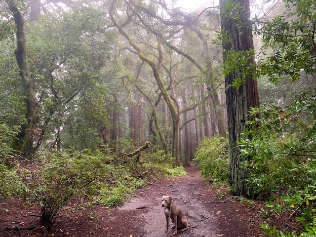
Joaquin Miller Park
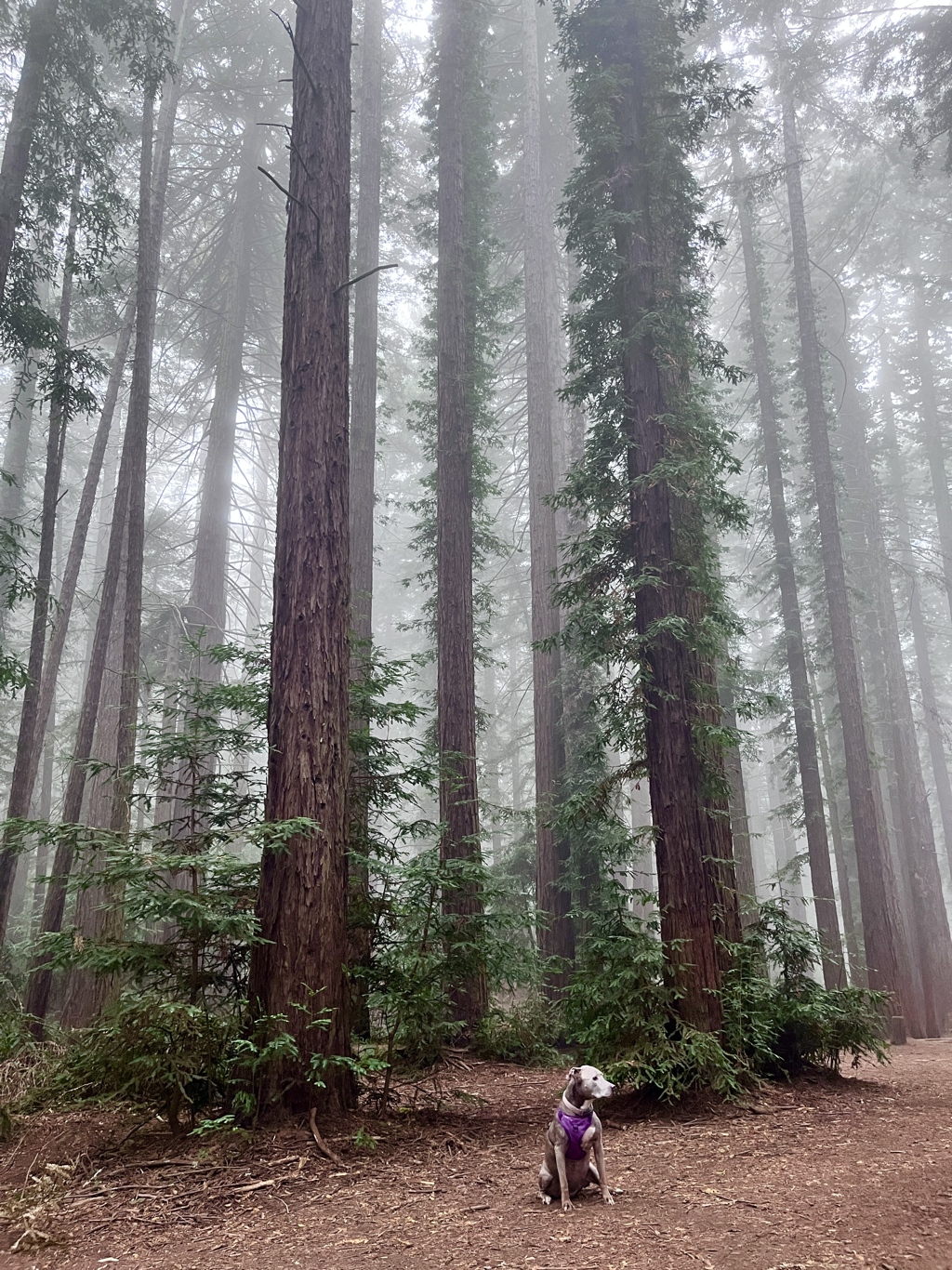
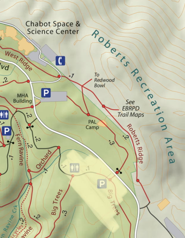
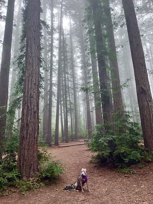
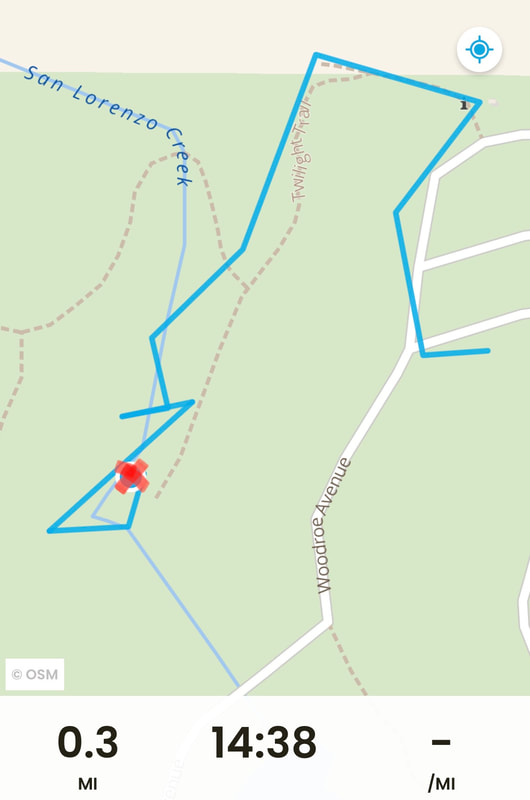
This morning we enjoyed a magical morning hike among the foggy redwoods in one of my favorite spots. If you’re lucky and you get out early, you may be able to experience this as well. Although you’ll mostly find misty, foggy mornings in winter, sometimes you’ll even get to enjoy this experience in Summer. If you wake up early, look up in the Oakland hills and you see fog, there’s a good chance you’ll get to enjoy this experience at this spot. Check out the area near Big Trees and Orchard Trails (see map below). This is a higher elevation area in the park, it’s right off the road and I think it has some of the best views of the fog with the huge redwoods in the background.
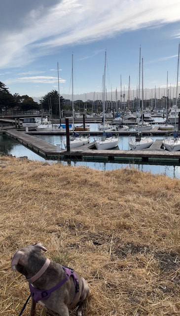
August 29, 2023
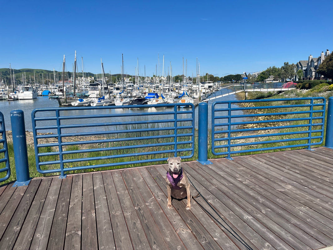
Emeryville Marina
We recently enjoyed a leisurely walk at the picturesque Emeryville Marina. It was a warm day, but we enjoyed the cool breeze here along a nice loop down Powell St. and the boat docks. There are a few trees and several benches where you can sit and enjoy the view of the SF Bay and bridges.
August 16, 2023
Aquatic Park
This is another favorite hidden gem with beautiful views and a huge disc golf course. You can loop around the entire lagoon in a little over 2 miles and the walk is mostly flat with minimal elevation change. In my experience, the majority of people who visit come to play disc golf - I've only encountered a handful of dog walkers during my visits. It's a much less crowded, quieter park to visit than surrounding parks at the marina

August 9, 2023
Brickyard Cove
Here's one you may not have heard of: Brickyard Cove in Berkeley. We checked out this park after visiting César Chávez, right down the road, and I was pleasantly surprised that it was so quiet. This is a great alternative to César Chávez, which tends to get crowded.
This 31-acre park sits at the center of McLaughlin Eastshore State Park and just opened in May 2022. It is a hidden gem. The well-maintained paths offer tranquility and breathtaking views of the San Francisco Bay. You can take the main loop trail, which approximately 1 mile long, to see views of the Bay and marsh. Connecting trails of McLaughlin Eastshore State Park extend from Richmond to the Bay Bridge, approximately 8.5 miles. Please note that most of the marshland trails in McLaughlin Eastshore State Park are preserves and therefore not dog-friendly.

August 7, 2023
César Chávez Park
We took a nice morning walk in Berkeley at a unique park that offers both on and off-leash areas. This 90-acre park features a perimeter walk ~1.5 mile loop (depending if you stick to the paved trail or explore the outer dirt trails) with breathtaking views of the SF Bay, bridges, Alcatraz, and Angel Island. If you walk slightly uphill to the center of the park, you will find a 17-acre off-leash area for dogs. There are also connecting trails you can take around the peaceful marina.
July 26, 2023
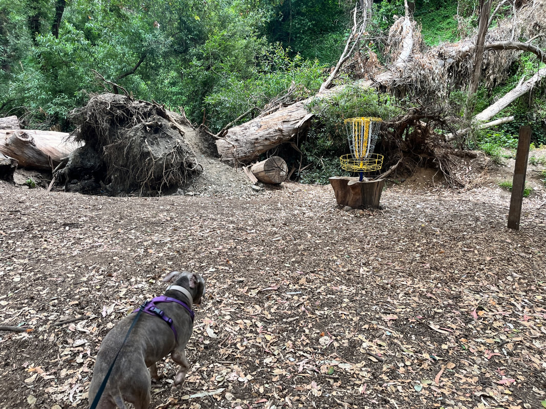
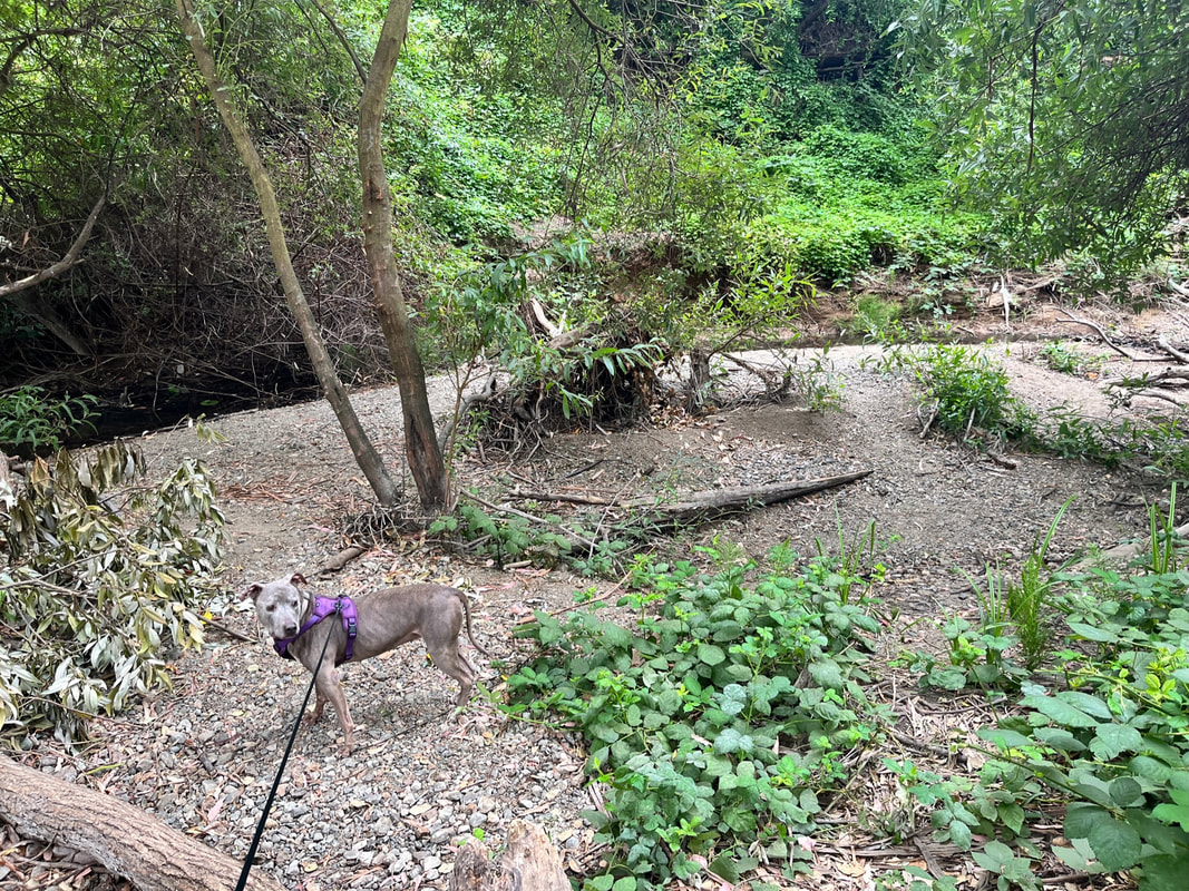
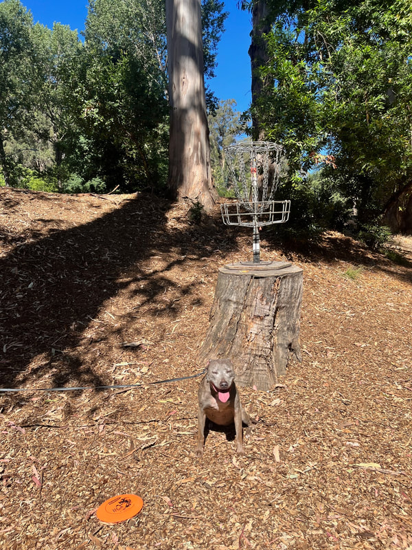
Chabot Park
We recently visited the dog-friendly hidden gem Chabot Park in San Leandro to play disc golf and go for a hike. Where else can you do both? This park has been closed for a long time, so we were excited that it reopened. The park is mostly shaded and has picnic tables, a playground and volleyball courts. The disc golf course is mostly shaded and very scenic. Several of the baskets are implanted in tree stumps, and some of the course runs along the creek. You can also access Lake Chabot from here, which is one of our favorite starting points to hike. Parking is free (unlike the main Lake Chabot entrance), and you will have views of the lake only 0.6 miles in. Currently the West Shore Trail is closed after you pass the dam, but you can still hike the other direction via Bass Cove Trail.
July 24, 2023
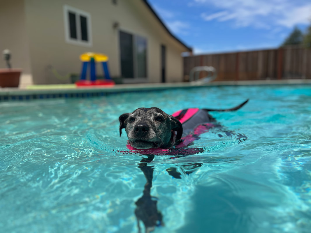
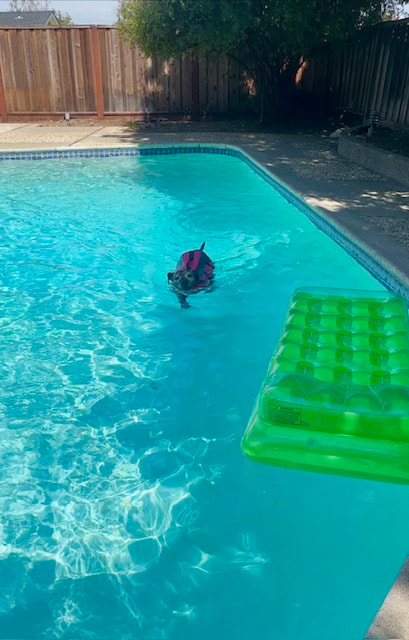
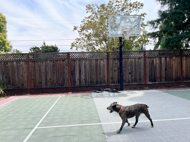
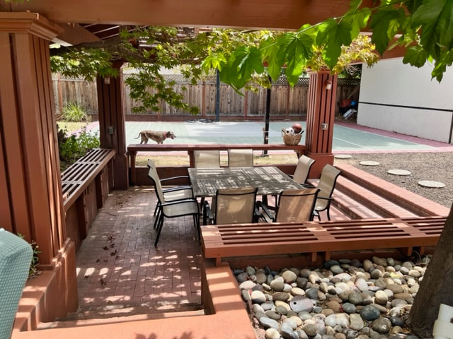
Swimply
This weekend we took Keisha for a private swim by renting out a pool on Swimply (think Airbnb but for pools). We did this last year and had to come back again because Keisha had such a blast. There are lots of listings on Swimply, but this is the only one I could find that allows dogs in the pool in the area. Keisha is reactive to other dogs (due to being attacked by another dog when she was young), so we can't take her to off-leash beaches. This is the perfect option for her, because swimming is her favorite thing in the world. This pool includes a huge, fenced in back yard with lots of shade, a basketball court, ping-pong table and plenty of comfortable places to sit. Keisha is able to run off leash without fear of other dogs. She swam for hours and we had to pull her out to take breaks because she wanted to swim non-stop. It was so much fun to see her happiness and enjoy just being a dog. We had a blast as well, and although it was 90 degrees there, it sure didn't feel like it. We stayed cool the entire time.
Please note that many Swimply listings do not allow dogs in the pool - this is the only one we could find in the area that does. Some listing allow dogs in their backyards, but not in the pools, so if you book another pool, read the fine print and check with the host. To find the listing, filter for pets in the Swimply app. It is titled "Walnut Creek Pool Basketball Court/Gazebo" located in Walnut Creek.
Swimply is offering an awesome deal right now: $100 off your first booking if you use my link below. Please note that this is not an ad and I am not affiliated with Swimply, it's just a service we really love and allows our dog to experience her favorite thing in the world without fear of other dogs.
July 19, 2023
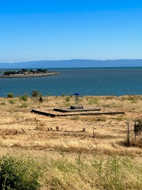
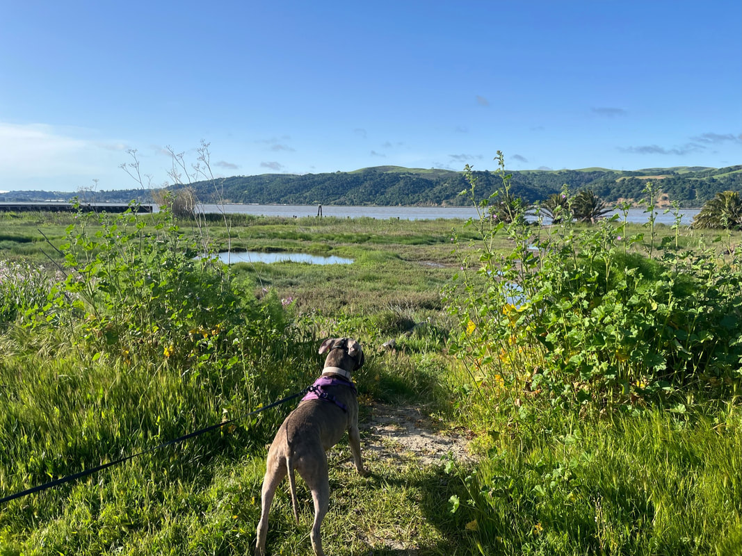
Oyster Bay
We recently took our senior dog, Keisha to Oyster Bay after her vet visit. We love this spot because it has an easy, paved trail around the perimeter (for leashed dogs) with beautiful views of the bay. It also has an off-leash, hilly area in the center with a recently renovated disc-golf course.
July 17, 2023
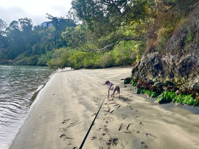
Secret Beach!
On Saturday we escaped the heat and spent a beautiful day at our favorite secret beach. It was less than a 20 minute drive from our home in Oakland, and stayed in the 70s all day (vs. nearly 90 degrees at our house). This beach has been closed for a couple years due to surrounding construction blocking access, but it recently reopened. It was never crowded before, but we were blown away by how empty it was on such a hot day. We spent about 6 hours there and only saw a handful of people come and go. Most of the day we had the beach to ourselves. We love this beach because it's only a short walk down some stairs from the parking lot to the beach, it's very clean, has soft sand and gorgeous views. It's in a cove, so it is sheltered from wind and the water is nice and calm for our dogs. There are a few bushy areas with shade, and at high tide the water comes about 1/3 of the way up the beach, making some areas further down pretty secluded from everyone else. Make sure you arrive early to snag a spot in the small parking lot, although we didn't notice it fill up until after noon during our visit.
July 14, 2023
Fairmont Ridge
This morning we had a beautiful (unexpectedly) foggy morning hike at Fairmont Ridge. I was pleasantly surprised to find no cattle here at this time- we often avoid this park because cattle graze throughout the year. We started our hike by hiking up the paved trail, then taking the split to the left and checking out the views of the bay. We headed uphill a bit and then turned right when we saw another gate to link back to the main trail. We crossed it and headed to the bench overlooking Lake Chabot. If you turn back here, it’s only about a 1 mile hike with 200ft of elevation gain. We continued on a bit. There are miles of unmarked trails to explore and even a dirt trail on the hillside that will take you back to the parking area. It was a bit overgrown so we decided to take the paved trail back. If you explore any of the hillside trails, make sure you have foxtail protection for you dog because there are a lot on the trail. Today is supposed to get hot, but we hiked it early in the morning so it was perfect. It’s not a great trail to hike on a hot day because it’s mostly exposed to sunlight.
July 10, 2023
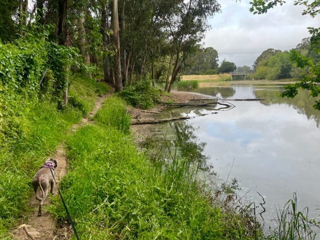
Hayward Regional Shoreline
I'm usually an early morning hiker, but yesterday we were quite busy, so I decided to find a less-crowded spot for a late afternoon hike. We chose the Hayward Regional Shoreline (starting from the San Lorenzo entrance). We practically had the place to ourselves, and it was such a peaceful walk listening to the ocean waves during most of our walk. This park has miles of connecting trails via the Bay Trail. When you start your walk and see the Bay, you can walk over the bridge to your right to Heron Bay or continue to your left (as we did) and walk for miles.
July 3, 2023
Palos Colorados Trail
We recently hiked Joaquin Miller Park from the lower entrance. We started our hike on the Palos Colorados trail off of Joaquin Miller Ct., below Sequoia Lodge. We love this spot because the trailhead is often empty; the trail begins along the creek and there's lots of shade. The trail is quite narrow, but we rarely encounter anyone on this lower part of the trail. It's a beautiful hike and there are a ton of options for connecting trails.
June 26, 2023
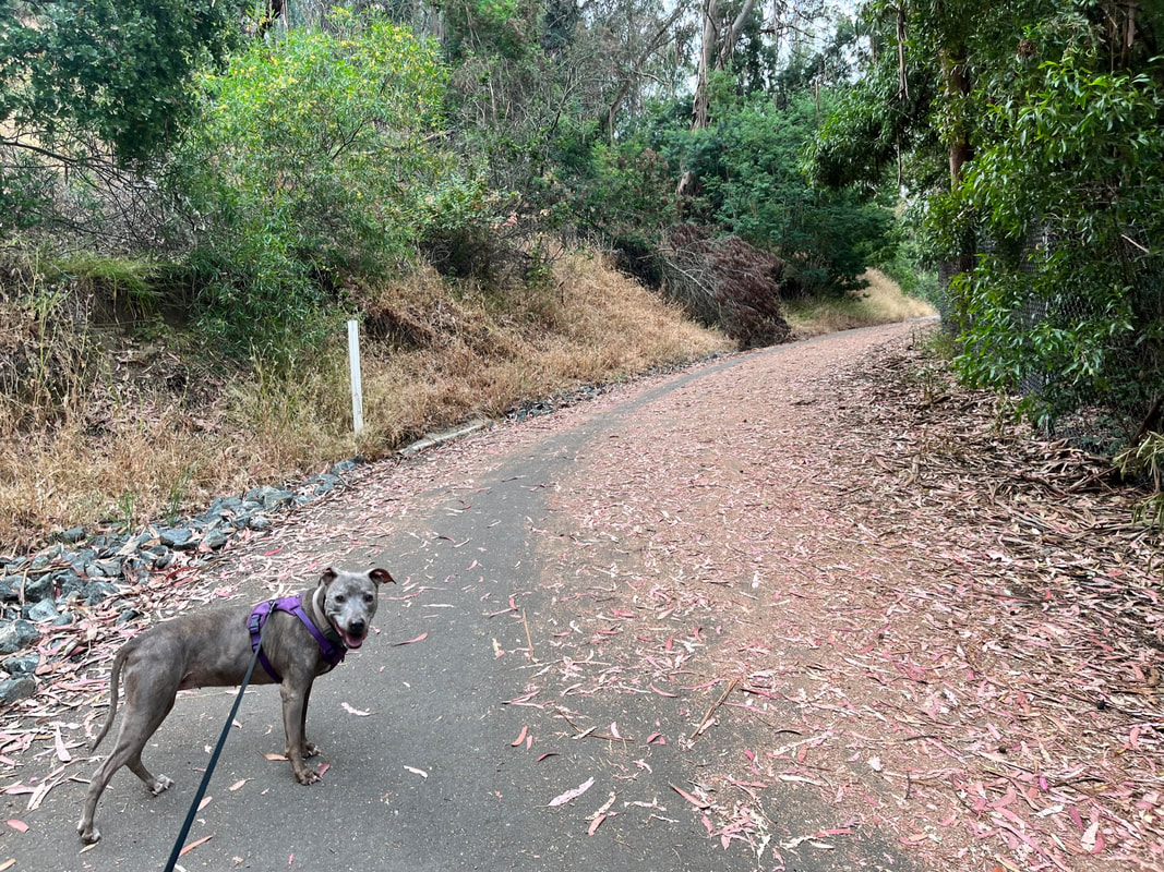
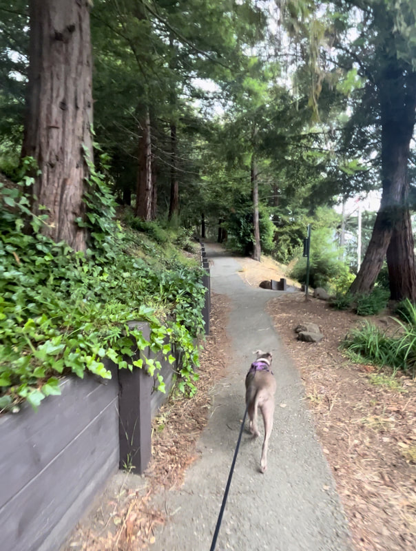
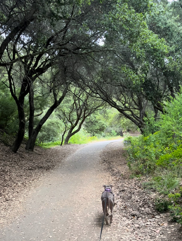
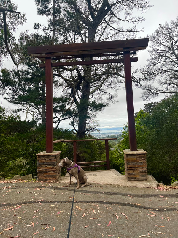
Montclair Railroad Trail
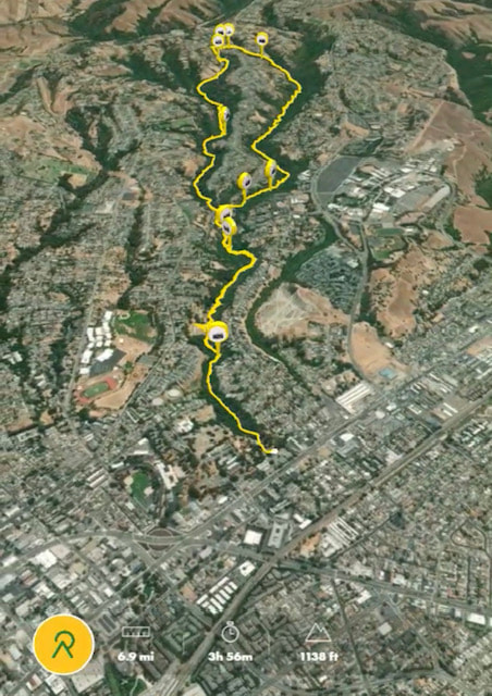
This morning we visited the Montclair Railroad Trail. This is a trail with a lot of history and used to be an old railway until 1957. It runs for a little over a mile, is flat and paved, and lined with beautiful trees. The city has made a lot of trail improvements, and there's even a BMX track up above it. We took a few side trails and visited Torii Gate. Our entire walk/hike was approximately 4 miles. If you have an elderly or reactive dog, the flat, paved trail could be a great option for you. Unlike most trails, I find that people actually follow the leash laws here. And if you go early, it's fairly empty. Click the link below for a custom map I made showing all locations mentioned above.
June 21, 2023
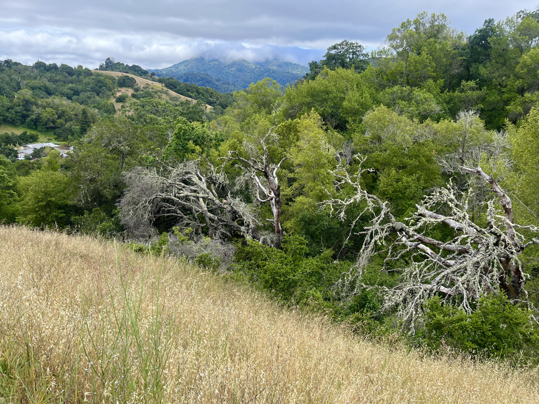
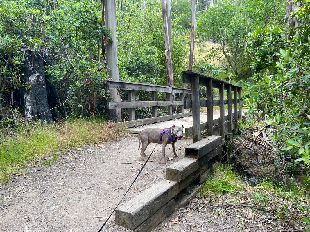
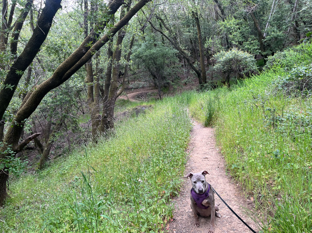
Sorich Ranch Park
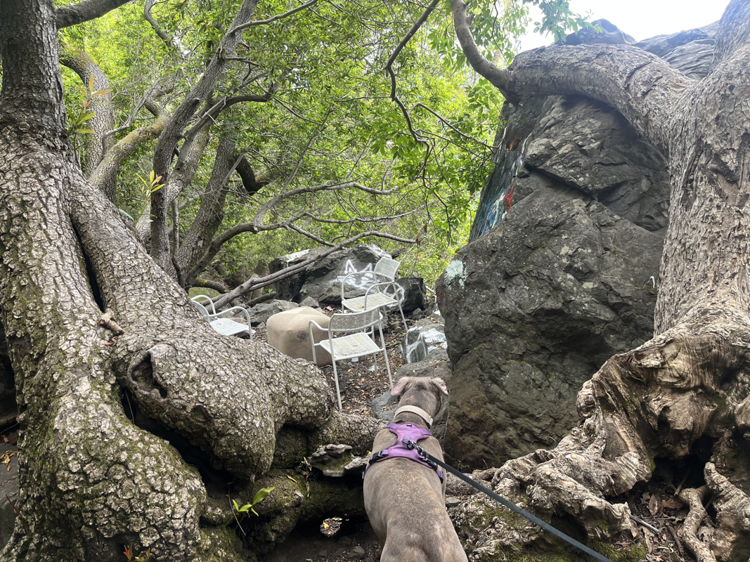
Bringing you another new hike in San Anselmo- this 60-acre scenic park offers an abundance of trails that wind through towering redwood trees, lush greenery, and tranquil (seasonal) streams. Whether you're seeking a leisurely stroll or a challenging trek, Sorich Park has something to offer for every hiker. During our hike, we explored several trails and when I saw a sign for the "Rock Fort" I had to check it out. Sometimes we find the strangest things during our hikes and this was one of those times. A large rock formation had been turned into a hang out spot. Nevertheless, this park is scenic and has a lot of different trails to choose from.
June 19, 2023
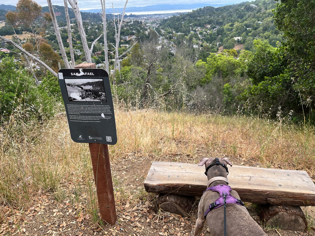
Red Hill Trail
We recently explored some new hikes in San Anselmo. This little-known hike is fairly new (completed in 2018), and it was short but sweet. This trail climbs 3/4 mile uphill 350ft with a lot of switchbacks, so the hike feels easier. As you ascend the trail, you'll be rewarded with panoramic views of lush greenery, rolling hills, and glimpses of the San Francisco Bay in the distance. Along the way, you'll encounter a diverse range of flora and fauna, adding to the enchantment of the hike. Soak in the tranquility of nature as you traverse through oak woodlands, wildflower meadows, and patches of fragrant eucalyptus trees. At the summit, be prepared to be mesmerized by a breathtaking vista and a perfectly placed bench that will make the uphill climb worth every step.

June 16, 2023
Joaquin Miller Park
We recently enjoyed an awesome morning hike at Joaquin Miller Park. I love this park for the diversity of trails and different starting points. For this hike, we got to experience some of my favorite scenery in a very short time. We started our hike off of Castle Drive in Oakland and took Sunset Trail. This trail almost immediately leads to panoramic views of the bay. Then we continued on the trail and down to the Palos Colorados Trail. The hike down had some wooden stairs, and this is a beautiful trail that runs along the creek. Down in the canyon there are towering redwoods, lush greenery like ferns and blankets of ivy and wooden bridges. And there's something so peaceful about hearing the stream as you hike along the trail. We got to experience all this in a quick morning hike: less than 1.5 miles with about 350ft of elevation gain. If you're feeling adventurous, there are plenty of other connecting trails you can take to extend your hike.
June 3, 2023
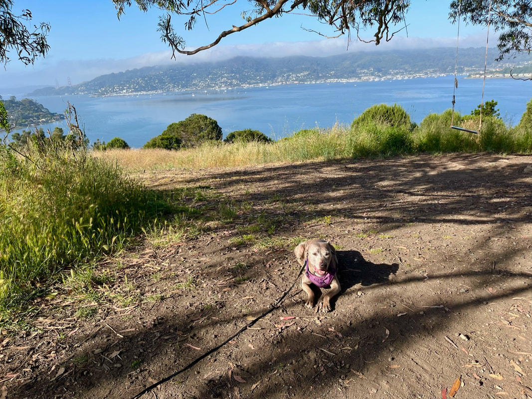
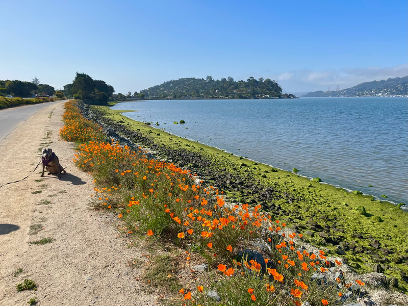
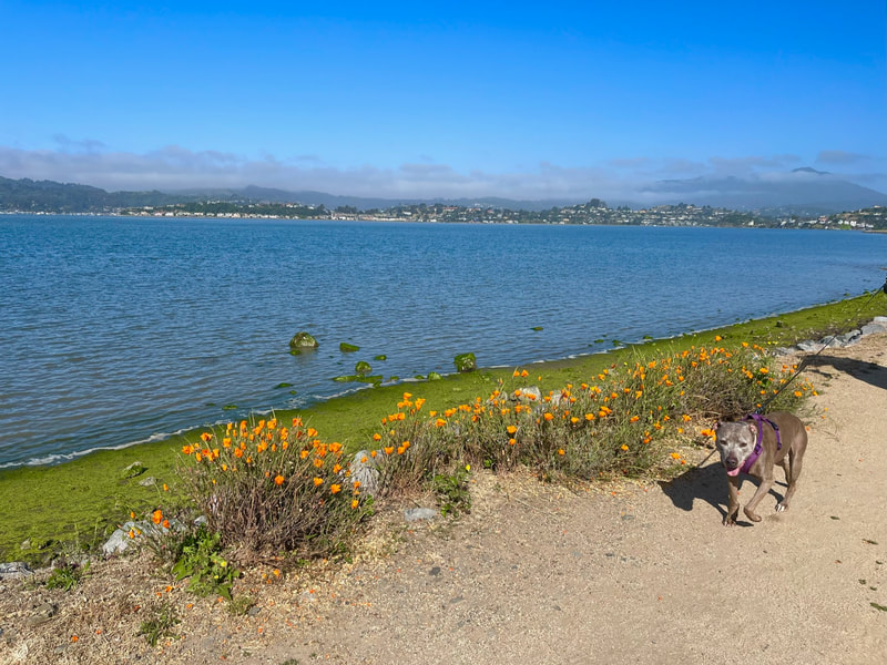
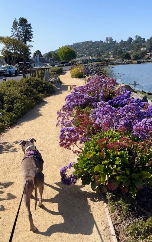
Tiburon: Hippie Tree, The Peninsula Historical Trail, Old Saint Hilary's & Tiburon Uplands
We spent the day hiking all over Tiburon, including our favorite hike with incredible views (Old Saint Hillary's), and then exploring a couple new ones. We finally made it to Hippie Tree and it is worth the hype. You can enjoy the most scenic swing you've ever seen after a quick 5-10 minute hike. You'll have two sturdy swings to choose from with incredible views of the Bay, Angel Island and the Golden Gate Bridge. There are also a bunch of connecting trails you can continue on after enjoying the swing, and not many people know about them.
We also walked along the Tiburon Peninsula Historical Trail - a waterfront trail that extends for miles in either direction. The views of the Bay are impressive, but right now a large section of it is also lined in vibrant flowers- bold orange poppies and various purple flowers. We found the section right below Gilmartin Drive to be the most vibrant. This just happens to be the street you'll come down if you visited Hippie Tree, so I definitely recommend checking out this trail as well.
Finally, we checked out the only other dog-friendly trail in Tiburon not already on my website. This area is called the Tiburon Uplands and a 0.6 mile loop will take you through shady greenery with views of the water. This hike can easily be extended to the back side of Old Saint Hilary's - although that's quite the hike up in that direction! Make sure you click the link below for all the details, because parking is very limited!

June 2, 2023
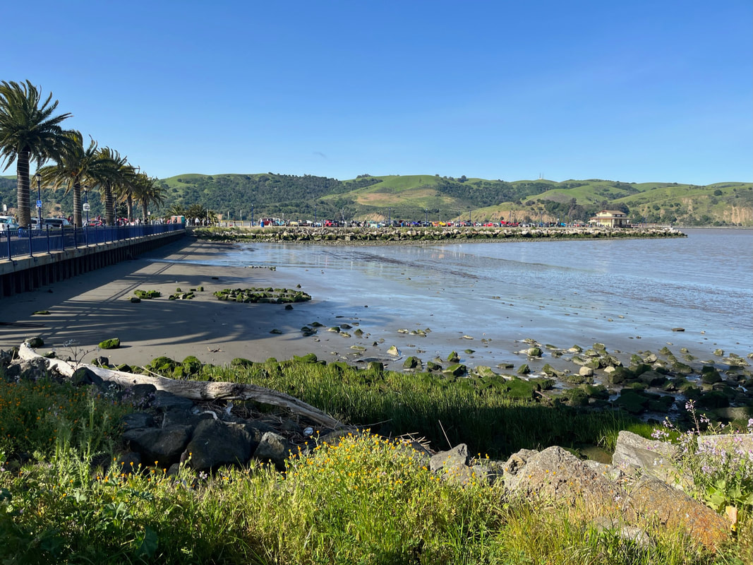
Heron Bay
This morning we enjoyed a leisurely 2+ mile walk at Heron Bay. We love this place because not too many people know about it, yet it offers incredibly scenic trails. We like to explore the lesser-traveled dirt trails along the canals, and today we also walked down to the beach and along the shoreline. This is a great spot for birdwatching and you can even see the planes come into the airport. The main trail connects to the SF Bay Trail, so you can walk for as many miles as you'd like. To the right, you will reach Marina Park and to the left you will reach the Hayward Shoreline.
May 28, 2023
Don Castro Regional Recreation Area & Cull Canyon
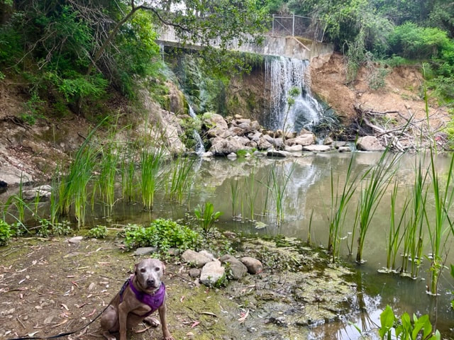
This morning we hiked Don Castro in Hayward - a 100 acre park with trails surrounding a large lake. I haven't hiked these trails in a long time, and things have changed. Because of storms, many large trees (mostly eucalyptus) have fallen. There are a couple places where large clusters have fallen, leading to trail closures. Unfortunately there is no longer a way to hike a loop around the lake, but we managed to hike a couple miles exploring the trails that were passable. Runoff from the lake has created a little-known waterfall below, which I was glad to see is still flowing freely. It's a bit difficult to find this spot, but I've provided a map below. When you drive in, head to the upper parking lot and stay to the left. You will see a trailhead marker for the Whispering Creek Trail next to some brown horizontal fencing. Head behind the fence and down to the left. The trail is a bit overgrown, but continue to follow it down and straight ahead until you hear the water. You'll see the waterfall from a distance, then head up the hill on the left and it will snake down to a clear view of the waterfall.
We also checked out Cull Canyon, and I was a bit disappointed because they have diverted water from the lake, so it's definitely not the scenic hike it used to be. Apparently the park is trying to figure out how to deal with sediment. Despite that, it's still an enjoyable, short hike.
May 13, 2023
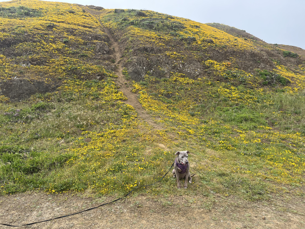
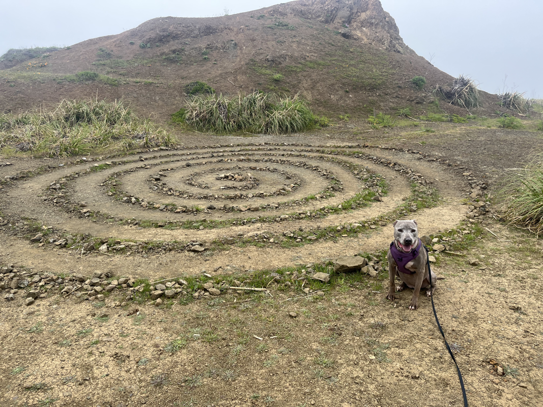
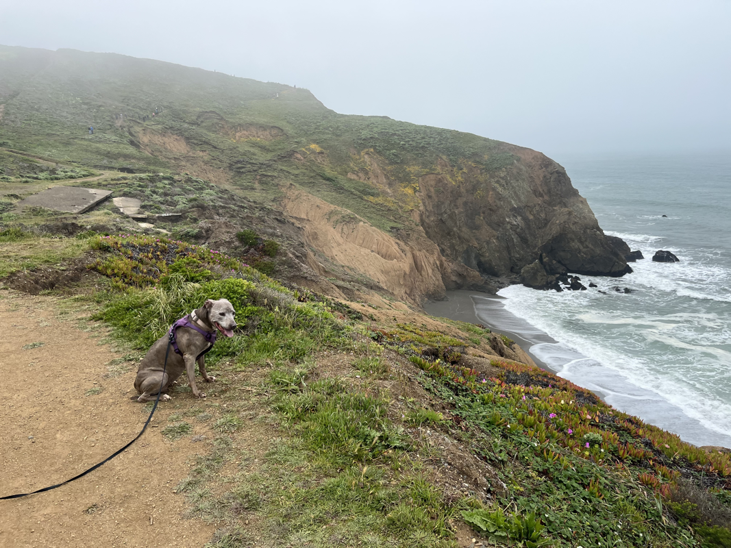
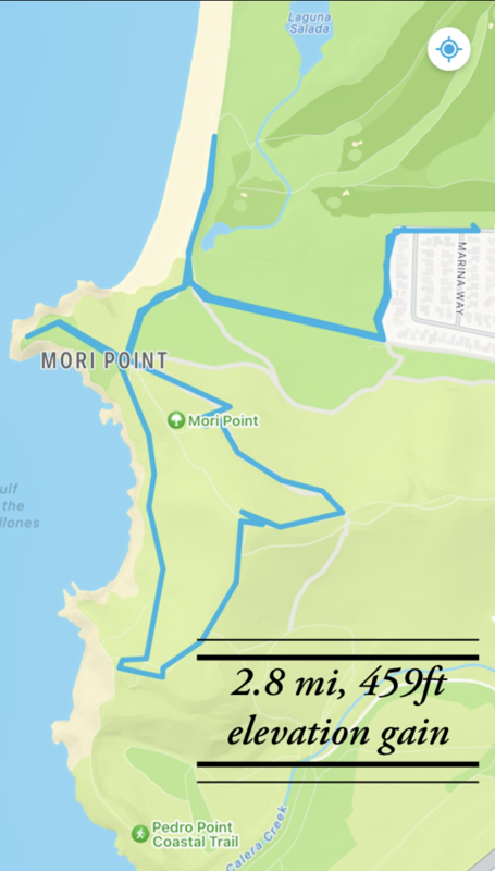
Mori Point
The wildflower blooms are incredible at Mori Point right now. You don’t need to go all the way to Southern California to see a superbloom, so this is definitely worth a visit. We hiked a roughly 2 mile loop (and added a few other random trail explorations).
Here are my tips:
*Arrive before 8am to beat the crowds and find parking. By 10am there was no parking anywhere in the surrounding neighborhood
*Go to the lookout point first (as this gets most crowded), then hike one of the loops. There are lots of wildflowers along the less crowded loops, as well as incredible ocean views, and you can choose your distance. See map below for another great (less crowded) wildflower spot about 1 mile in. You can see on the first map that there are a number of different trails you can loop back on, depending how far you want to hike.
*Bring hiking poles. If you hike one of the loops, the hike back down is slippery, rocky and difficult no matter which trail you take.
*Bring lots of water as there is none available on the trail.
*Stay on trails and keep dogs on leash- preserve the beauty!
*Check out Nick's down the road for the BEST post-hike crab sandwiches


May 11, 2023
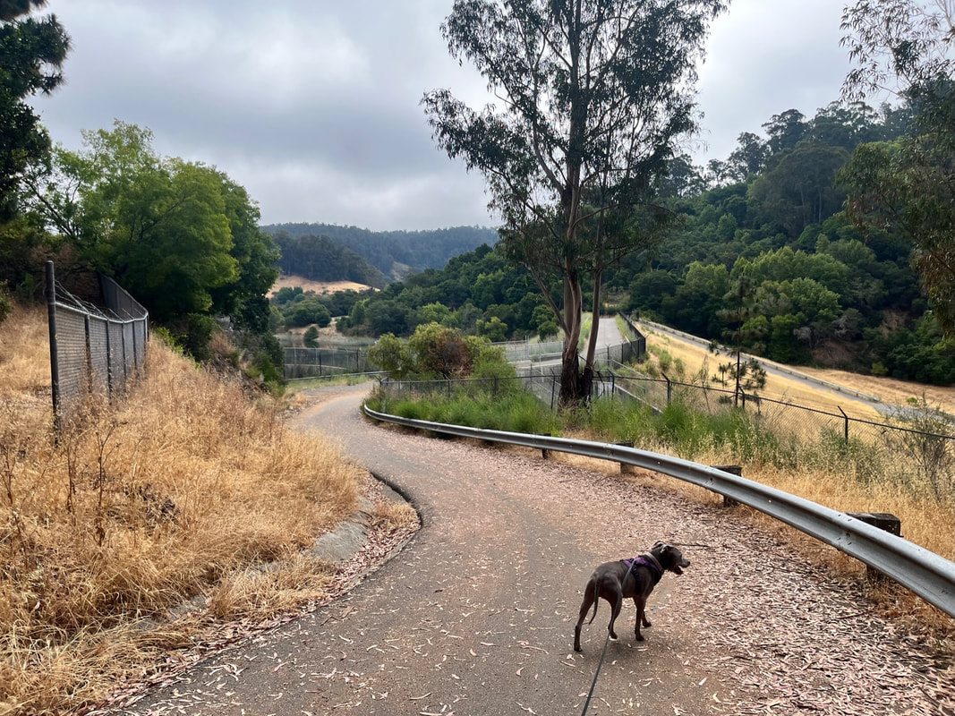
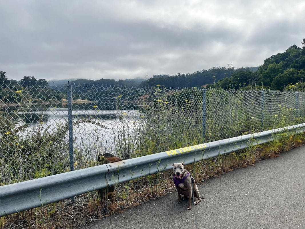
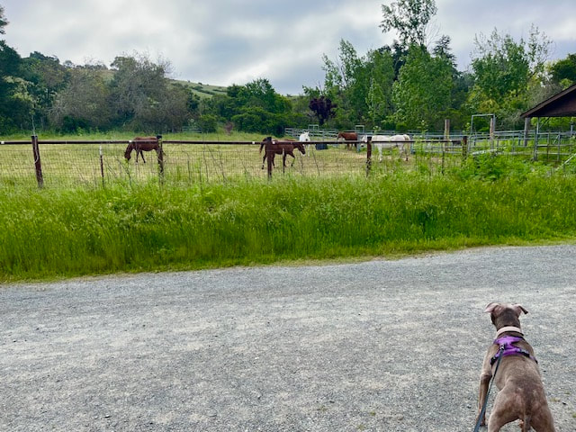
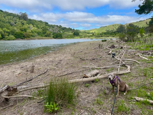
EBMUD Trails - Moraga
We went for a beautiful 7 mile hike in Moraga around the reservoir, starting at the Valle Vista Staging Area. This hike requires an inexpensive permit, which must keep people away, because it's never crowded and we practically had the trails to ourselves. We saw a lot of wildflowers and wildlife (rabbits, birds, moles, lizards) and they even have a large horse stable less than 1 mile into the hike, so it's always nice to see the horses. The beginning of the hike is mostly flat and hugs the rim of the reservoir, and then begins climbing uphill and has a nice change of scenery as the trail becomes shady, lined with colorful ferns and vibrant green moss-covered trees. There are several views of the reservoir from above as the trail peeks outward around bends in the trail. We intended to hike the entire ~7.5 mile King's Canyon Loop, but unfortunately we ran into a herd of cattle on a narrow stretch of trail about 3.5 miles in, so we turned back. I have a slight fear of cattle, as I've been chased by them while hiking before. I always make sure I give them their distance, and despite this, it was still a very beautiful hike. The section of the trail skirting the rim of the reservoir is the most scenic part of the trail anyway, so I don't feel that we missed out on much. You can make this hike as easy or challenging as you like, and I highly recommend it.

May 5, 2023
Lake Temescal
This morning we went for a quick hike at the tranquil Lake Temescal. You can find a variety of trails here, from an easy loop around the lake to a more challenging hike up the surrounding hills. I find the west side to be the most scenic because a large portion of the east trail is along the highway. So our quick hike this morning was one mile long, beginning from the Broadway Terrace parking lot. We took the shady West Shore Trail along the water, and then looped back by going uphill and taking the Oak Bay Trail back. There's a short but steep scramble up to the Oak Bay Trail, but it's worth it for a new perspective and a change in scenery. The views from above are stunning, and the upper trail is lined with flowers and towering redwoods. This hike was approximately 1 mile with 111ft of elevation gain.

April 28, 2023
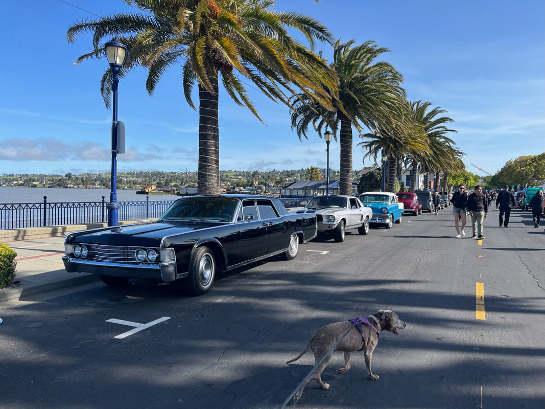
Benicia
Last weekend we decided to explore some trails in Benicia, and we found some beautiful waterfront parks, a dog-friendly beach, the marina, and we even stumbled upon a classic car show! I used to regularly attend several classic car shows in the Bay Area, but I hadn't previously heard about this one. It was huge! And it couldn't have had a more beautiful backdrop. Most of the cars had views of the water or bridge in the background, and there are plenty of connecting trails along the route to extend your visit. They even had a bunch of food trucks, so you could spend the day here. Make sure you mark your calendar for next year!
While exploring the waterfront, we found a hidden (dog-friendly) beach, and we also checked out a cool park with views of the Bay and the Carquinez Bridge.


April 8, 2023
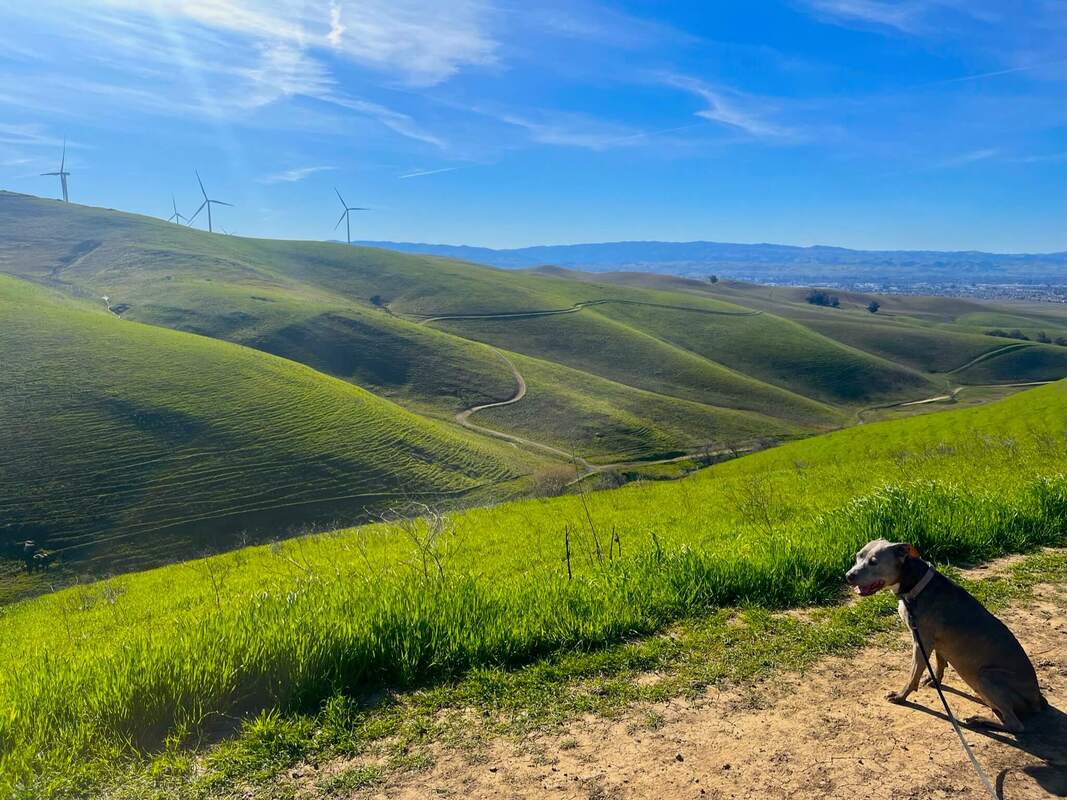
Brushy Peak Regional Preserve
It's been a while - but I'm bringing you a new hike! It's so difficult to find new hikes that aren't already on my site, but we recently found a beautiful park in Livermore. I know what you're thinking, but this park was completely different than I expected. It had lush, green hillsides, multiple huge ponds, running streams, beautiful rock formations, breathtaking views and even windmills! We went on a challenging 4.5 mile hike with 750ft of elevation gain, but it was worth it for the view from Brushy Peak!
February 24, 2023
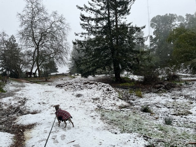
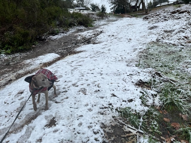
SNOW in Oakland!
Today we hiked in a winter wonderland...in Oakland! This was definitely a first for us. Not hail or frost but real, actual flakes of fluffy snow falling from the sky! On our drive up, sections of the road were covered in a thin layer of snow, and roofs and cars were blanketed in snow in some areas. I have a small car, and it was fine driving on the roads, but I just drove slow. Several of the park entrances on the way up had frost on the ground but it wasn't until we drove up higher and arrived at Sibley Volcanic Park on Skyline at about 8 AM that we found actual snow. There was snow at the entrance (6899 Skyline Blvd, Oakland), and it kept falling in larger flakes. Roxy was bundled up, but she's not used to the snow and started shivering after about a half hour, so wevgot back in the car and turned the heater on. It was a very cool experience - I haven't seen this and I've lived my entire life in Oakland.

February 20, 2023
Anthony Chabot
This short but moderate hike is great for when you're looking for a quick workout on a beautiful trail without the crowds. This hike is only half a mile, but has 200ft of elevation gain in a short but steep trek up the hill. We started our hike off of Redwood Road at the Big Bear Staging Area. There's plenty of parking, and short walk down the trail will take you to a trailhead to the right for Big Bear Loop. This trail is almost entirely covered by trees, but when you reach the top, you'll have a few chances to view the hills from the distance. Much of this trail is lined with moss and beautiful green ferns. On the way down, you'll pass a stream and might even see a small seasonal waterfall. The trail ends at Redwood Road, and a short walk down will return you to your car. You can easily extend this hike by crossing the street from where you parked into Redwood Regional or continuing down the trail to McDonald Gate.

February 17, 2023
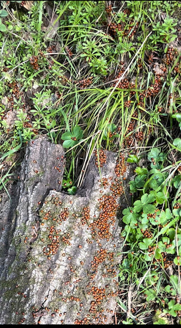
Redwood Regional - Ladybugs! (Alternate viewing area)
You still have time to see the ladybugs! Now that the lower entrance of Redwood is finally back open, we decided to hike the more popular route to see the ladybugs, from the lower entrance at Redwood Gate (off of Redwood Rd). You can definitely see why this entrance was closed for so long - there was a lot of storm damage they are still cleaning up. This is a beautiful hike along the stream, and the majority is flat with some gentle elevation gains. However, this round trip hike was much longer than the hike from the top, and there were only a small percentage of ladybugs on the trail compared to the congregations on the upper trail. We hiked along the Stream Trail and saw signs posted for the ladybugs right before Prince Trail (about 1.6 miles in). It was a bit of a letdown compared to what we saw previously when we started from the top and hiked down. You'd have to hike about a mile up to get to that spot, and the trail becomes much steeper after you pass the Prince trailhead. Overall, this hike was about 3.2 miles with 200ft of elevation gain. If you start from the upper trails (see my Jan 20th post), it's only 1.4 miles round trip, although a bit more strenuous but worth the hike! The upper trails appeared to be almost entirely covered in ladybugs on both sides in some spots, but this lower spot just had a few clusters here and there.
January 27, 2023
TRAIL ALERT (Closure) : Leona Heights Park - York Trail
This trail has always had downed trees and obstacles to transverse, so I was curious to see how it held up after our recent storms. Sadly, a large portion of the trail is washed out approximately .33 miles in (right before the 4th bridge/trail split to Merritt College). This section of the trail has always been very narrow and a bit sketchy, but now there is no way to safely cross this portion. I suspect it will be a long time before this can be repaired, since the whole hillside essentially washed away. You can still hike from the upper trails of the park, or you can hike the side trails up if you start from the yellow fire gate approx. 400 yards down from the main entrance (away from Leona Lodge). However, I would not recommend starting from the top and trying to hike all the way down. Personally, I find the trail along the creek above the closure to be very steep with loose rocks and would be extremely difficult to hike that direction. Hiking a full loop is no longer possible. The short .33 mile hike up to the washout is still a beautiful but short hike. You can extend your hike from the other entrance mentioned above, or cross the street where you'll see a sign for "overflow parking." You can walk around those trails, cross the Highway 13 overpass and follow another trail into the neighborhood. There's another park there, McCrea Memorial "the trout pond," but dogs are not allowed. We managed to hike/walk about 1.5 miles by walking to the washout and then exploring some of those side trails.

January 20, 2022
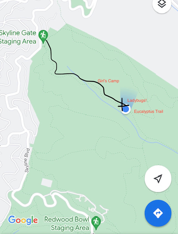
Ladybugs at Reinhardt Redwood Regional Park!
Did you know a group of ladybugs is called a loveliness? If you experience what I saw today, you'll understand why! Today we enjoyed a beautiful hike at Redwood Regional, on the search for ladybugs. They usually congregate here for a few months out of the year, but with all the rain and cold, I wasn't sure I'd find them. I was sure surprised when I found them only about a half a mile into my hike! I found them congregating on several sections of Stream Trail, on both sides, for about a quarter mile down the trail. However, the largest congregation of them appeared to be on the left side (across from the stream), a bit before the Eucalyptus Trail. I started my hike at the Skyline Gate Staging Area and hiked down Stream Trail (which you can find towards the right of the parking lot). The first approx. 0.4 miles is a steep hike down with some muddy sections, so make sure you have good hiking shoes. You'll reach a sign for the Girl's Camp, and then the trail continues to your left. After a couple bends in the trail, you should begin to spot ladybugs on both sides. This section of the trail levels out and is mostly flat. We hiked down about 0.3 miles more to the and noticed the largest concentration of ladybugs on the left side, a bit before the Eucalyptus trailhead. We hiked down a bit further, but if you're just going to see the ladybugs, your round-trip hike will be about 1.4 miles with 350ft of elevation gain. Your hike starts at about 1200 ft, dips down to about 950ft, and then climbs back up to 1200ft where you started. Be prepared for a short but steep hike back to the parking lot. We arrived on a Friday morning and the parking lot was packed, so make sure you arrive early. Right now the lower entrance to the park is closed due to storm damage, so you cannot access this trail from that entrance. Starting from the top is the quickest route anyway.
- Parking: Lot at Skyline Gate Staging Area
- Trail: Stream Trail
- Dogs on leash
- Distance: 1.4 miles (out and back)
- Elevation gain: 350ft

January 16, 2022
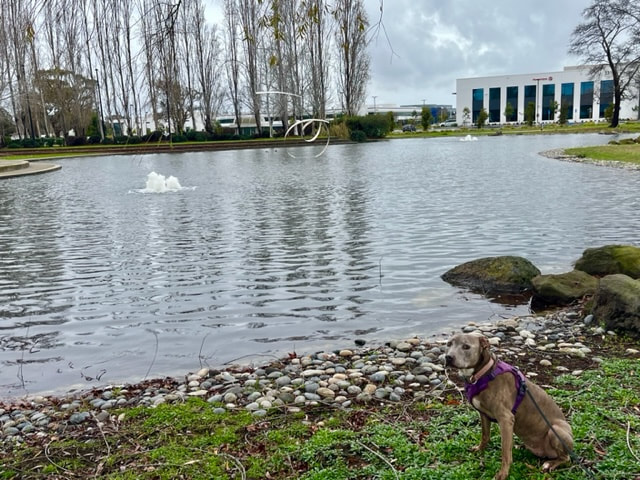
Harbor Bay Trail & Park Closures
It’s been a while since we posted, but we managed to get out to Alameda during a break in the rain this weekend. We enjoyed views of the Bay, and since the trail is almost entirely paved, we didn’t end up covered in mud. We started at the Ferry and continued our walk down to the old Raider’s training facility. There’s a nice pond there and since it’s mostly office space past the hotel at the end, we had that area all to ourselves. The walk was 1.8mi out and back. You can extend your walk even farther, past the golf course, and even loop back around if you're up for it.
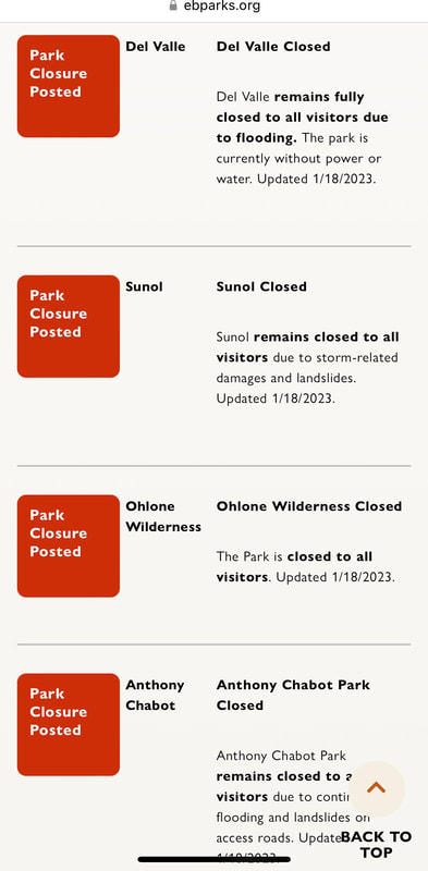
There are a lot of East Bay trail closures, and several parks are entirely closed due to storm damage. Make sure you check the park website before you head out!
November 6, 2022
Greenbelt Trails
Yesterday definitely felt like fall as we hiked 7 miles of beautiful trails in the Hayward hills. Much of the trails were lined with beautiful falling multi-colored leaves, vibrant green ferns and moss, and many streams ran along the trails. We began our hike from the parking lot next to the Hayward Plunge and hiked our way all the way up to the hills of Hayward (1,100ft of elevation gain). Most of this hike had mild hills mixed with mostly flat stretches so it didn't seem too bad until we reached the last quarter mile, which was definitely left us with sore calves today. But it was totally worth it for such an incredible hike. We spent nearly 4 hours on the trails and practically had the place to ourselves, only passing a couple people and no other dogs. This hike is perfect for a reactive dog, because all dogs are required to be on leash and not too many people know about these trails so it doesn't get crowded.
Unfortunately there's now a small homeless encampment near the trailhead, and we had to pass a couple groups of very aggressive dogs (luckily on leash). The first quarter mile of the trail had a lot of garbage surrounding it and even in the creek. I would actually recommend making this into a shorter hike, at a little less than 4 miles, by parking your car on the shoulder of Oakes Drive (off of Campus Drive) and hiking the loop East Avenue Trail and Ward Creek Rd. Trail. There's plenty of street parking and you'll still enjoy a beautiful hike without the garbage or having to worry about the aggressive dogs at the Wally Wickander Memorial trailhead.
A few favorite adventures from over the past year:
August 29, 2022
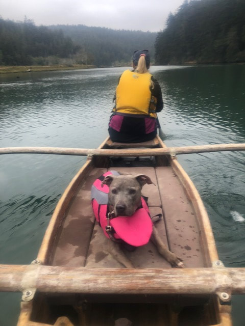
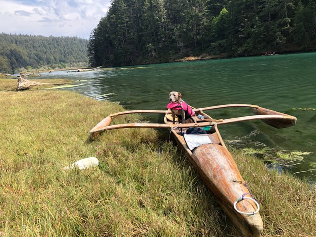
Road Trip! - To Catch a Canoe
I know we haven't posted in a while. I've been sick. But we are going on an exciting road trip! First stop, dog-friendly kayaking! I will post more when we return.
August 4, 2022
Anthony Chabot & Redwood Regional Park
We recently hiked Anthony Chabot, starting from McDonald Gate Staging Area. This is a shady entrance in the Canyon off of Redwood Road. I like this area because there are multiple trails to choose from, both in Anthony Chabot as well as Redwood Regional Park. These trails start off shady and are lined with colorful moss and ferns. From the staging area, we began on the MacDonald Trail and took the Bird Trail loop (1/3 mile shady loop with some cool bridges). You can continue on MacDonald Trail for miles up along Redwood Road. From the McDonald staging area, you can also take the short trail on the other side of the parking lot to Big Bear Staging Area. You'll find a marked trailhead (Big Bear) about half way through, which takes you up along the hillside for a little less than half a mile. If you want to extend your hike, from the Big Bear Staging Area, cross the street at the cross walk and you'll be in Redwood Regional Park. You can hike along the Golden Spike Trail or take one of the steeper trails up to West Ridge and to the main trails in the park.
July 31, 2022
Reinhardt Redwood Regional Park & Joaquin Miller Park
We had a magical early morning hike in the Oakland Hills and lucked out with stunning scenery! I was pleasantly surprised to find that it was misty and foggy when we arrived, making for a surreal hike. The towering redwoods provided a canopy from the elements, but it was still muddy and a bit wet. We started our hike from Redwood Bowl at Redwood Regional and then crossed the street and continued our hike in Joaquin Miller Park. These two parks provide countless trail options whether you're looking for an easy stroll or a steep, challenging hike.


April 2, 2022
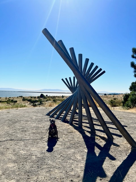
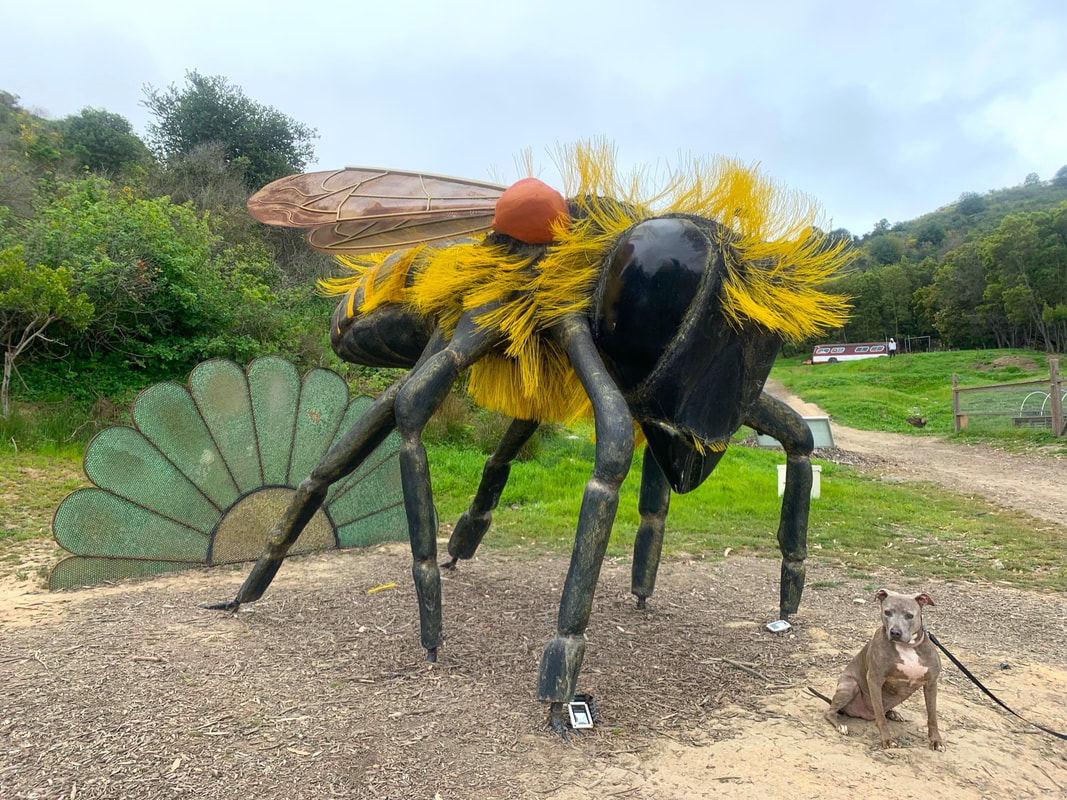
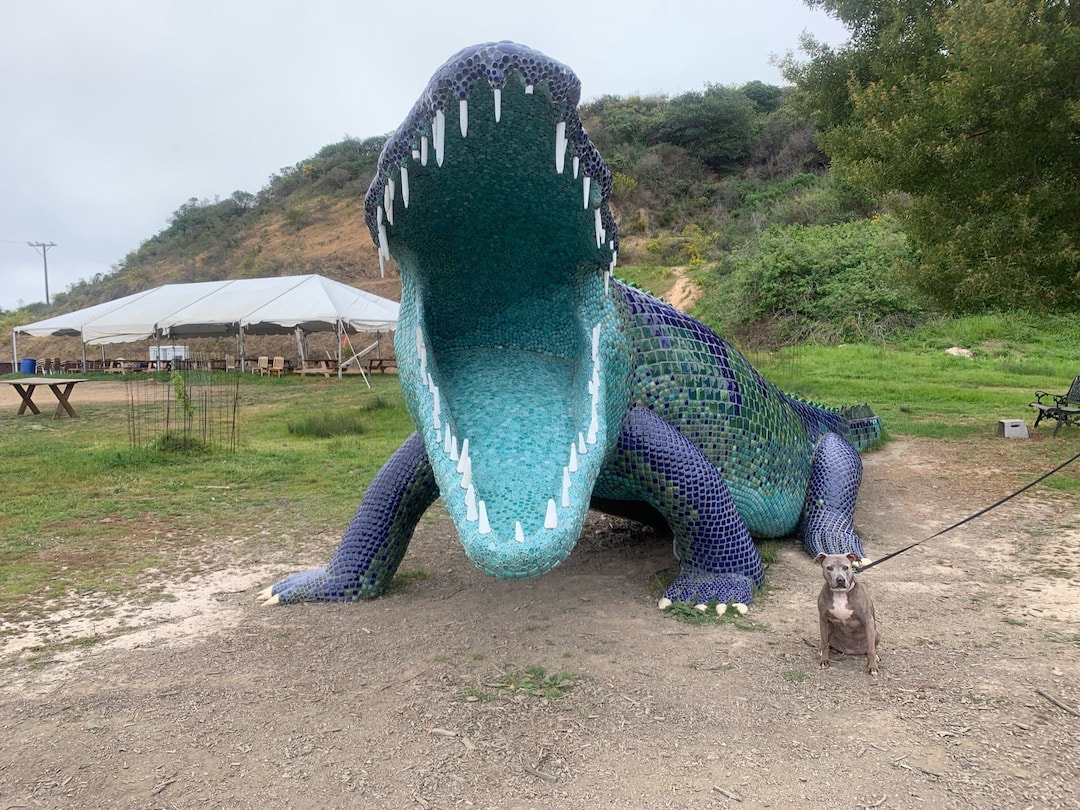
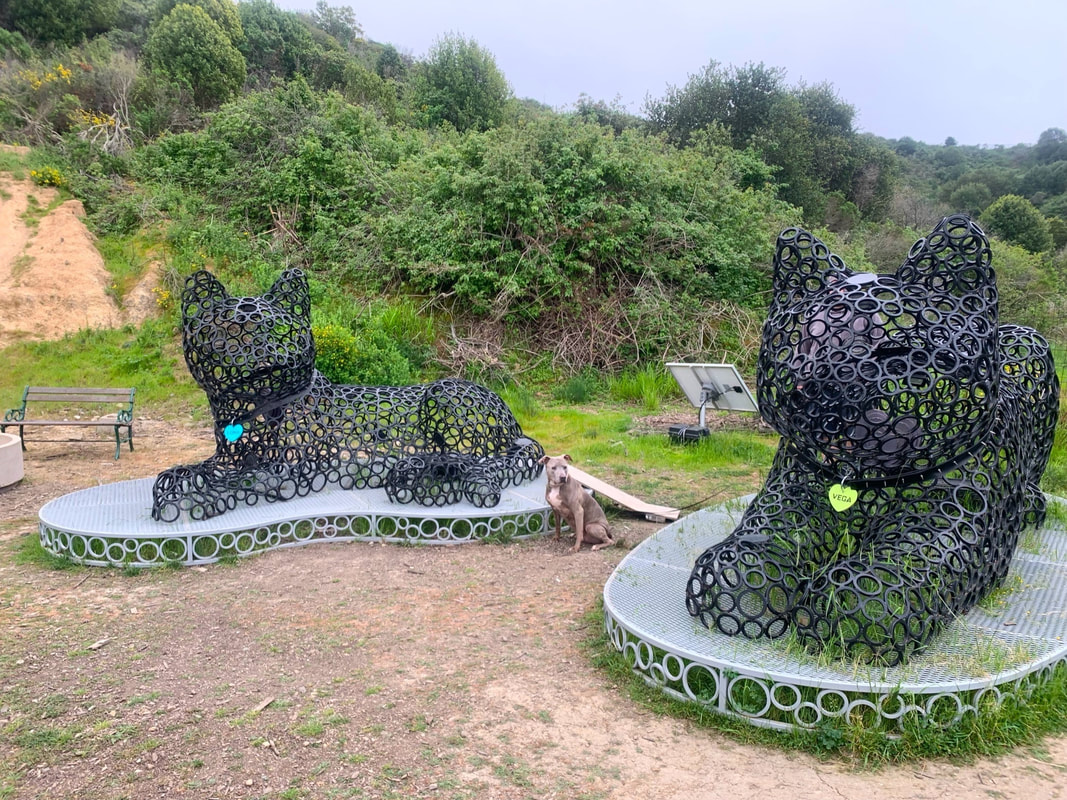
Point San Pablo Harbor
This is a fun one - most people do not know this magical place exists. Tucked away near the tip of San Pablo, after a decent drive through vacant land and abandoned Navy buildings, you'll find an incredible sculpture park. This park features five large-scale art pieces (10ft+ tall) that have been moved from the Burning Man festival. The sculptures are hand made and have intricate details, some with special features you'll have to know about to find before your visit. In addition to the small sculpture park, you can continue your walk on a trail along the water and even explore a small beach. This is a great spot to hang out in the afternoon or early evening because the restaurant, Black Star Pirate BBQ, is right next to the sculpture park. They also have live music (Fri-Sun). There is plenty of outdoor seating around the sculptures and the restaurant even has vegetarian and vegan options. There is a community of people living here, so please be respectful of residents. This park is difficult to find, so click below for all the details.
March 31, 2022
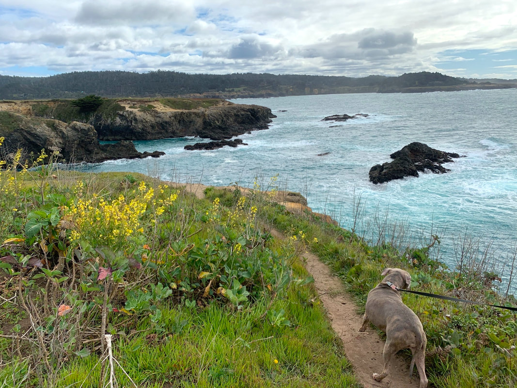
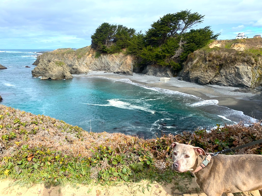
Mendocino Headlands State Park
A few steps away from the beautiful historic town of Mendocino, you'll find this breathtaking park featuring miles of coastal trails along the bluffs. The main, scenic trail is mostly flat and winds along the bluffs for a 4 mile out and back walk. This trail has elevation changes of only about 90ft. This hike surrounded me in so much beauty that I was speechless, which is a rare occurrence. The coastal trails are surrounded by vibrant green fields dotted with wildflowers and turquoise water as far as the eye can see. This place reminded me of Maui and is a wonderful stop for a picnic.
March 31, 2022
Mendocino Headlands State Park
A few steps away from the beautiful historic town of Mendocino, you'll find this breathtaking park featuring miles of coastal trails along the bluffs. The main, scenic trail is mostly flat and winds along the bluffs for a 4 mile out and back walk. This trail has elevation changes of only about 90ft. This hike surrounded me in so much beauty that I was speechless, which is a rare occurrence. The coastal trails are surrounded by vibrant green fields dotted with wildflowers and turquoise water as far as the eye can see. This place reminded me of Maui and is a wonderful stop for a picnic.

March 19, 2022
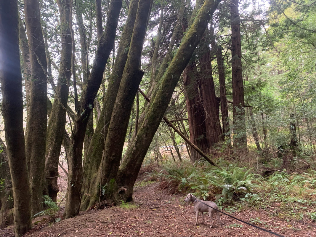
Navarro River Redwoods State Park
It's been a while since I've posted, but we went on a road trip a few weeks ago, so I'm just now getting around to the write ups and I'm bringing you some cool new adventures. Navarro River Redwoods State Park is a 660-acre park along Navarro River, which runs for 11 miles along highway 128. This is a beautiful drive through the redwoods, but it’s difficult to find trails. The first time we realized we drove through the entire park just looking for a trailhead! We found that you have to leave your vehicle to find trails, as signs are often sunken 50ft in from the road, often covered by vegetation and therefore not visible or barely visible from the highway. The difficulty of finding trails and lack of available information make this park special, because not many know about it. When we visited we only ran into one other person during our entire hike. And we also found a secluded swimming hole with turquoise water!

July 5, 2021
Rancho Corral de Tierra
We just discovered a magical hike that I highly recommend. This is the Golden Gate National Recreation Area's newest incorporated land, but few know about it. It is over 4,000 acres, but the park is split by private farmland and most trails are unmarked. I've been meaning to check out this park for a while now, but after much research, I couldn't find a lot of info on this park, and the trailheads I researched all looked sketchy. I'm so thankful I decided to drive around until I found a great trailhead and mapped out a hiking loop. I'm bringing you a magical ~3 mile hike that takes you up 900ft into the mist and fog and feels like you're entering the clouds. This hike will make you feel like you've been transported to Hawaii or a scene in Jurassic Park!