
- Home
-
Browse All
-
Alameda County
>
- Albany Bulb
- Alameda Creek Regional Trail
- Brickyard Cove
- Brushy Peak Regional Preserve
- Anthony Chabot Regional Park (Lake Chabot)
- Aquatic Park
- Barlago Italian Kitchen
- Buchanan Dog Beach
- California Canoe & Kayak (Oakland)
- Cali Kid Burgers ‘N Shakes
- César Chávez Park
- Chabot Park
- Claremont Canyon
- Coyote Hills Regional Park
- Crab Cove
- Cull Canyon Regional Recreation Area
- Dimond Canyon Park
- Don Castro Regional Recreation Area
- Don Edwards Wildlife Refuge
- Dublin Hills Regional Park
- Emeryville Marina
- Fairmont Ridge
- Five Canyons Open Space Preserve
- Fremont Central Park
- Garin/Dry Creek Pioneer Regional Park
- Gilman Brewing Company
- Greenbelt Trails
- Hayward Regional Shoreline
- Heron Bay Trail
- Ikaros Greek Restaurant
- Jerusalem Organic Kitchen
- Joaquin Miller Park
- Lake Anza
- Lake Chabot
- Lake Merritt
- Leona Canyon Regional Open Space Preserve
- Leona Heights Park
- Marina Park
- Martin Canyon Creek Trail
- Martin Luther King Jr. Regional Shoreline
- Mission Peak
- Montclair Railroad Trail/ Torii Gate
- Morgan Territory Regional Preserve
- Oyster Bay Regional Shoreline
- Park Street Classic Car Show (Annual)
- Pleasanton Ridge Regional Preserve
- Point Emery
- Reinhardt Redwood Regional Park
- Robert's Park
- Room 389
- Shoreline Park
- Sibley Volcanic Regional Preserve
- Skyline Gate Staging Area
- Strawberry Canyon Fire Trail
- Sunol Regional Wilderness
- Temescal Regional Recreation Area
- Tilden Regional Park
- Upper Anthony Chabot Regional Park (Oakland Entrance)
- Upper Knowland Park
- Vargas Plateau Regional Park
- Butte County >
-
Contra Costa County
>
- Acalanes Ridge Open Space
- Briones Regional Park
- Carquinez Strait Regional Shoreline
- Crockett Hills Regional Park
- Diablo Foothills Regional Park
- EBMUD Trails
- Fernandez Ranch
- Frowning Ridge
- Geppetto's Caffe
- Hacienda de las Flores Park
- Hillside Nature Area
- Howe Homestead Park
- Indian Rock
- Kennedy Grove Regional Recreation Area
- Lafayette Community Park
- Lafayette Reservoir
- Las Trampas Regional Wilderness
- Lime Ridge Open Space
- Miller/Knox Regional Shoreline
- Moraga Commons Park
- Mulholland Ridge Open Space Preserve
- Point Isabel
- Point Molate Beach Park
- Point Pinole Regional Shoreline
- Point San Pablo Harbor
- Rubio's
- San Quentin Beach
- Shell Ridge Open Space
- Sobrante Ridge Regional Preserve
- Sugarloaf Open Space
- Sycamore Valley Open Space Preserve
- Tender Greens
- Tilden Regional Park
- Wildcat Canyon Regional Park
- El Dorado County >
-
Marin County
>
- 101 Surf Sports
- Baltimore Canyon Open Space Preserve
- Blackie's Pasture
- Camino Alto Preserve
- Carson Falls
- Cascade Falls
- Cataract Falls
- Dawn Falls
- Hippie Tree
- Ignacio Valley Preserve (Fairway Falls)
- Indian Valley Open Space Preserve
- King Mountain Open Space Preserve
- Marin Headlands (Coastal Trail)
- Old Saint Hilary's Open Space Preserve
- Phoenix Lake
- Red Hill Dog Park
- Red Hill Trail
- Ring Mountain Open Space Preserve
- Roy's Redwoods
- Sam's Anchor Cafe
- Sorich Ranch Park
- Tiburon Peninsula Historical Trail
- Tiburon Uplands
- Tucker Trail Falls
- Mariposa County >
- Mendocino County >
- Mono County >
- Monterey County >
- Nevada County >
- Placer County >
-
San Francisco County
>
- 2.2 Mile Urban Hike
- Bernal Heights Park
- The Brixton
- Billy Goat Hill Park
- Blackwood
- Clipper Cove Beach
- Crissy Field
- Dynamo Donut + Coffee
- Fort Funston
- Fort Mason
- Glen Canyon Park
- Golden Gate Park
- Grand View Park
- The Great Lawn/ Avenue of the Palms
- Java Beach Cafe
- John McLaren Park
- Interior Greenbelt
- Lake Merced
- Lands End
- Letterman Digital Arts Center
- Marina Green
- Mount Davidson
- Mount Sutro Open Space Reserve
- Ocean Beach
- Palace of Fine Arts
- Philz Coffee Truck
- Stern Grove
- Sutro Baths
- Sutro Heights Park
- TreasureFest
-
San Mateo County
>
- 7 Mile House Sports Bar & Grill
- Barbara's Fishtrap
- Bedwell Bayfront Park
- Bob's Vegetable Stand and Pumpkin Farm
- Cafe Pacifica
- Devil's Slide Coastal Trail
- Esplanade Beach
- Flying Fish Grill
- Half Moon Bay Kayak Co.
- McNee Ranch State Park (Montara Mountain)
- Montara State Beach
- Mori Point
- Mussel Rock Park
- Nick's Seafood Restaurant
- Panera Bread
- Pedro Point Headlands
- Poplar Beach
- Pulgas Ridge Open Space Preserve
- Rancho Corral de Tierra
- Seal Point
- Taqueria La Mexicana
- Wavecrest Open Space
- Santa Clara County >
- Santa Cruz County >
- Solano County >
- Sonoma County >
- Tuolumne County >
- Yuba County >
-
Alameda County
>
- Map View
-
More
Address: Approx. 6617 Broadway Terrace, Oakland, CA
OR
Approx. 37.848224, -122.233782
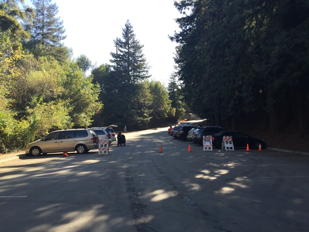
Parking: Free street parking available outside the Broadway entrance (if you arrive early), large parking lots available at both of the addresses above. $5 entrance fee and $2 dog fee April-October on weekends/holidays/ when kiosk staffed
Hours: 5 A.M. to 10 P.M. (Gates open from 8 A.M. to 10 P.M.)
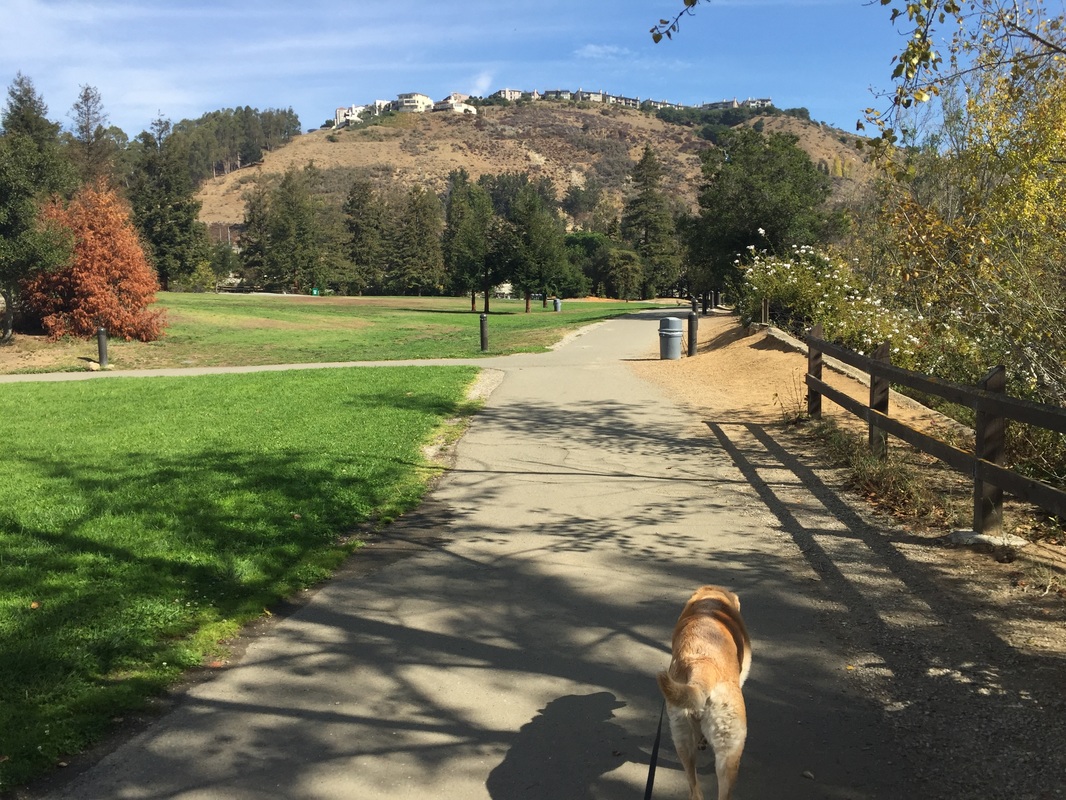
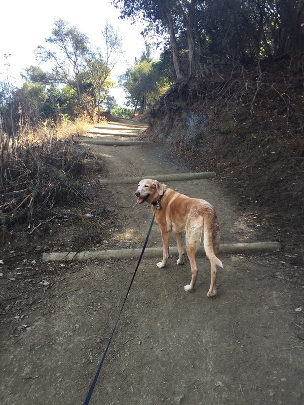
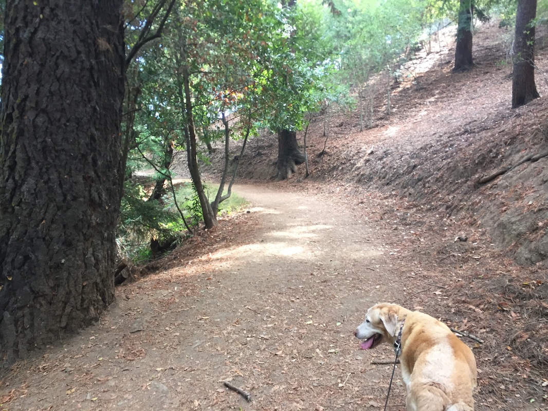
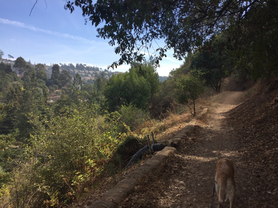
Type: Walk/hike (Easy, 1 mile)
Regulations: Dogs allowed on-leash
Best time to visit: Anytime
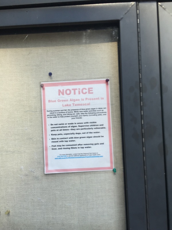
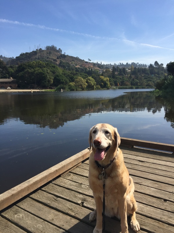
CAUTION: Do not let you dog in the lake, as it has been contaminated with deadly blue-green algae. Keep your dog close by on leash.
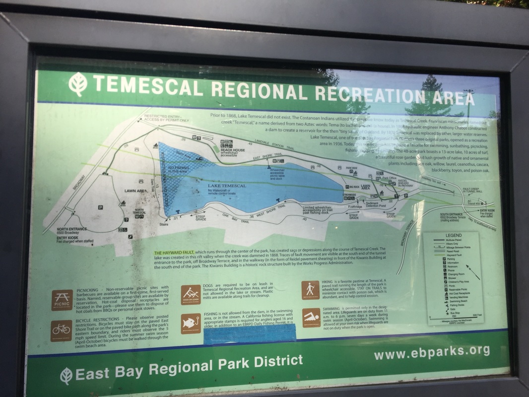
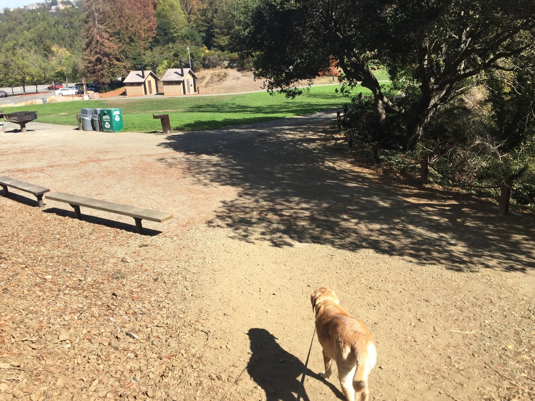
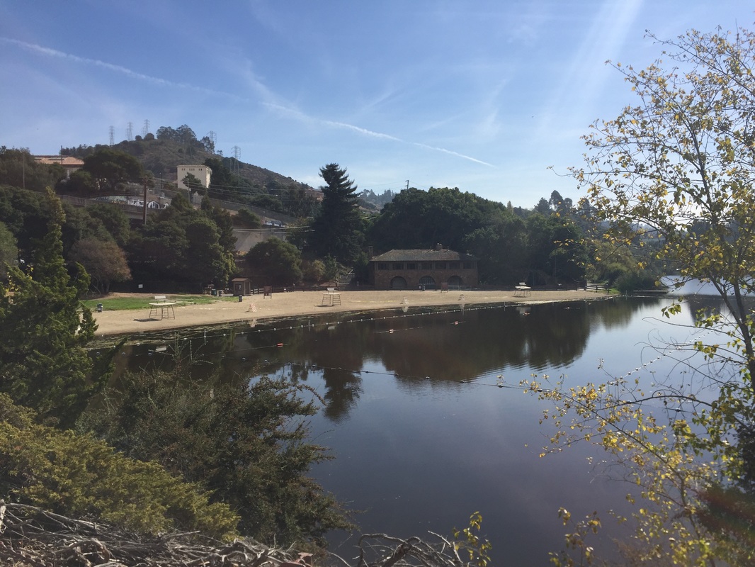
Description: This 48-acre park featuring a 13-acre lake has an easy, scenic trail looping around the base of the lake with plenty of benches to sit on and enjoy the view. It also has a steeper trail on the West shore, which has great views of the lake from above. You can start your walk at the base of the lake on the Eastshore Trail or Landvale Station Trail to the Dam Trail, and then you can hike uphill on the Oak Bay Trail and that will take you back to the parking lot. Although there’s a steep grade ascending and descending the Oak Bay Trail, it’s still an easy hike and there is significant shade along the route. It's unfortunate that this lake has also been closed for swimming due to toxic blue-green algae, but it's still a beautiful park for an easy hike.
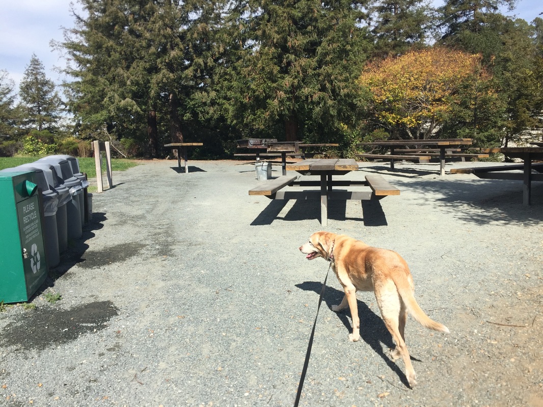
This park has restrooms, picnic tables and BBQ pits. The park also has quite a bit of history, as the Costanoan Indians utilized the creek, and in 1868 Anthony Chabot built a dam, creating Lake Temescal to be used as a reservoir for the town of Oakland.
OR
Approx. 37.848224, -122.233782
Parking: Free street parking available outside the Broadway entrance (if you arrive early), large parking lots available at both of the addresses above. $5 entrance fee and $2 dog fee April-October on weekends/holidays/ when kiosk staffed
Hours: 5 A.M. to 10 P.M. (Gates open from 8 A.M. to 10 P.M.)
Type: Walk/hike (Easy, 1 mile)
Regulations: Dogs allowed on-leash
Best time to visit: Anytime
CAUTION: Do not let you dog in the lake, as it has been contaminated with deadly blue-green algae. Keep your dog close by on leash.
Description: This 48-acre park featuring a 13-acre lake has an easy, scenic trail looping around the base of the lake with plenty of benches to sit on and enjoy the view. It also has a steeper trail on the West shore, which has great views of the lake from above. You can start your walk at the base of the lake on the Eastshore Trail or Landvale Station Trail to the Dam Trail, and then you can hike uphill on the Oak Bay Trail and that will take you back to the parking lot. Although there’s a steep grade ascending and descending the Oak Bay Trail, it’s still an easy hike and there is significant shade along the route. It's unfortunate that this lake has also been closed for swimming due to toxic blue-green algae, but it's still a beautiful park for an easy hike.
This park has restrooms, picnic tables and BBQ pits. The park also has quite a bit of history, as the Costanoan Indians utilized the creek, and in 1868 Anthony Chabot built a dam, creating Lake Temescal to be used as a reservoir for the town of Oakland.


All content within this site Copyright © 2023 Hikes Dogs Love. All rights reserved. No part of this website may be reproduced without permission.

- Home
-
Browse All
-
Alameda County
>
- Albany Bulb
- Alameda Creek Regional Trail
- Brickyard Cove
- Brushy Peak Regional Preserve
- Anthony Chabot Regional Park (Lake Chabot)
- Aquatic Park
- Barlago Italian Kitchen
- Buchanan Dog Beach
- California Canoe & Kayak (Oakland)
- Cali Kid Burgers ‘N Shakes
- César Chávez Park
- Chabot Park
- Claremont Canyon
- Coyote Hills Regional Park
- Crab Cove
- Cull Canyon Regional Recreation Area
- Dimond Canyon Park
- Don Castro Regional Recreation Area
- Don Edwards Wildlife Refuge
- Dublin Hills Regional Park
- Emeryville Marina
- Fairmont Ridge
- Five Canyons Open Space Preserve
- Fremont Central Park
- Garin/Dry Creek Pioneer Regional Park
- Gilman Brewing Company
- Greenbelt Trails
- Hayward Regional Shoreline
- Heron Bay Trail
- Ikaros Greek Restaurant
- Jerusalem Organic Kitchen
- Joaquin Miller Park
- Lake Anza
- Lake Chabot
- Lake Merritt
- Leona Canyon Regional Open Space Preserve
- Leona Heights Park
- Marina Park
- Martin Canyon Creek Trail
- Martin Luther King Jr. Regional Shoreline
- Mission Peak
- Montclair Railroad Trail/ Torii Gate
- Morgan Territory Regional Preserve
- Oyster Bay Regional Shoreline
- Park Street Classic Car Show (Annual)
- Pleasanton Ridge Regional Preserve
- Point Emery
- Reinhardt Redwood Regional Park
- Robert's Park
- Room 389
- Shoreline Park
- Sibley Volcanic Regional Preserve
- Skyline Gate Staging Area
- Strawberry Canyon Fire Trail
- Sunol Regional Wilderness
- Temescal Regional Recreation Area
- Tilden Regional Park
- Upper Anthony Chabot Regional Park (Oakland Entrance)
- Upper Knowland Park
- Vargas Plateau Regional Park
- Butte County >
-
Contra Costa County
>
- Acalanes Ridge Open Space
- Briones Regional Park
- Carquinez Strait Regional Shoreline
- Crockett Hills Regional Park
- Diablo Foothills Regional Park
- EBMUD Trails
- Fernandez Ranch
- Frowning Ridge
- Geppetto's Caffe
- Hacienda de las Flores Park
- Hillside Nature Area
- Howe Homestead Park
- Indian Rock
- Kennedy Grove Regional Recreation Area
- Lafayette Community Park
- Lafayette Reservoir
- Las Trampas Regional Wilderness
- Lime Ridge Open Space
- Miller/Knox Regional Shoreline
- Moraga Commons Park
- Mulholland Ridge Open Space Preserve
- Point Isabel
- Point Molate Beach Park
- Point Pinole Regional Shoreline
- Point San Pablo Harbor
- Rubio's
- San Quentin Beach
- Shell Ridge Open Space
- Sobrante Ridge Regional Preserve
- Sugarloaf Open Space
- Sycamore Valley Open Space Preserve
- Tender Greens
- Tilden Regional Park
- Wildcat Canyon Regional Park
- El Dorado County >
-
Marin County
>
- 101 Surf Sports
- Baltimore Canyon Open Space Preserve
- Blackie's Pasture
- Camino Alto Preserve
- Carson Falls
- Cascade Falls
- Cataract Falls
- Dawn Falls
- Hippie Tree
- Ignacio Valley Preserve (Fairway Falls)
- Indian Valley Open Space Preserve
- King Mountain Open Space Preserve
- Marin Headlands (Coastal Trail)
- Old Saint Hilary's Open Space Preserve
- Phoenix Lake
- Red Hill Dog Park
- Red Hill Trail
- Ring Mountain Open Space Preserve
- Roy's Redwoods
- Sam's Anchor Cafe
- Sorich Ranch Park
- Tiburon Peninsula Historical Trail
- Tiburon Uplands
- Tucker Trail Falls
- Mariposa County >
- Mendocino County >
- Mono County >
- Monterey County >
- Nevada County >
- Placer County >
-
San Francisco County
>
- 2.2 Mile Urban Hike
- Bernal Heights Park
- The Brixton
- Billy Goat Hill Park
- Blackwood
- Clipper Cove Beach
- Crissy Field
- Dynamo Donut + Coffee
- Fort Funston
- Fort Mason
- Glen Canyon Park
- Golden Gate Park
- Grand View Park
- The Great Lawn/ Avenue of the Palms
- Java Beach Cafe
- John McLaren Park
- Interior Greenbelt
- Lake Merced
- Lands End
- Letterman Digital Arts Center
- Marina Green
- Mount Davidson
- Mount Sutro Open Space Reserve
- Ocean Beach
- Palace of Fine Arts
- Philz Coffee Truck
- Stern Grove
- Sutro Baths
- Sutro Heights Park
- TreasureFest
-
San Mateo County
>
- 7 Mile House Sports Bar & Grill
- Barbara's Fishtrap
- Bedwell Bayfront Park
- Bob's Vegetable Stand and Pumpkin Farm
- Cafe Pacifica
- Devil's Slide Coastal Trail
- Esplanade Beach
- Flying Fish Grill
- Half Moon Bay Kayak Co.
- McNee Ranch State Park (Montara Mountain)
- Montara State Beach
- Mori Point
- Mussel Rock Park
- Nick's Seafood Restaurant
- Panera Bread
- Pedro Point Headlands
- Poplar Beach
- Pulgas Ridge Open Space Preserve
- Rancho Corral de Tierra
- Seal Point
- Taqueria La Mexicana
- Wavecrest Open Space
- Santa Clara County >
- Santa Cruz County >
- Solano County >
- Sonoma County >
- Tuolumne County >
- Yuba County >
-
Alameda County
>
- Map View
-
More