
- Home
-
Browse All
-
Alameda County
>
- Albany Bulb
- Alameda Creek Regional Trail
- Brickyard Cove
- Brushy Peak Regional Preserve
- Anthony Chabot Regional Park (Lake Chabot)
- Aquatic Park
- Barlago Italian Kitchen
- Buchanan Dog Beach
- California Canoe & Kayak (Oakland)
- Cali Kid Burgers ‘N Shakes
- César Chávez Park
- Chabot Park
- Claremont Canyon
- Coyote Hills Regional Park
- Crab Cove
- Cull Canyon Regional Recreation Area
- Dimond Canyon Park
- Don Castro Regional Recreation Area
- Don Edwards Wildlife Refuge
- Dublin Hills Regional Park
- Emeryville Marina
- Fairmont Ridge
- Five Canyons Open Space Preserve
- Fremont Central Park
- Garin/Dry Creek Pioneer Regional Park
- Gilman Brewing Company
- Greenbelt Trails
- Hayward Regional Shoreline
- Heron Bay Trail
- Ikaros Greek Restaurant
- Jerusalem Organic Kitchen
- Joaquin Miller Park
- Lake Anza
- Lake Chabot
- Lake Merritt
- Leona Canyon Regional Open Space Preserve
- Leona Heights Park
- Marina Park
- Martin Canyon Creek Trail
- Martin Luther King Jr. Regional Shoreline
- Mission Peak
- Montclair Railroad Trail/ Torii Gate
- Morgan Territory Regional Preserve
- Oyster Bay Regional Shoreline
- Park Street Classic Car Show (Annual)
- Pleasanton Ridge Regional Preserve
- Point Emery
- Reinhardt Redwood Regional Park
- Robert's Park
- Room 389
- Shoreline Park
- Sibley Volcanic Regional Preserve
- Skyline Gate Staging Area
- Strawberry Canyon Fire Trail
- Sunol Regional Wilderness
- Temescal Regional Recreation Area
- Tilden Regional Park
- Upper Anthony Chabot Regional Park (Oakland Entrance)
- Upper Knowland Park
- Vargas Plateau Regional Park
- Butte County >
-
Contra Costa County
>
- Acalanes Ridge Open Space
- Briones Regional Park
- Carquinez Strait Regional Shoreline
- Crockett Hills Regional Park
- Diablo Foothills Regional Park
- EBMUD Trails
- Fernandez Ranch
- Frowning Ridge
- Geppetto's Caffe
- Hacienda de las Flores Park
- Hillside Nature Area
- Howe Homestead Park
- Indian Rock
- Kennedy Grove Regional Recreation Area
- Lafayette Community Park
- Lafayette Reservoir
- Las Trampas Regional Wilderness
- Lime Ridge Open Space
- Miller/Knox Regional Shoreline
- Moraga Commons Park
- Mulholland Ridge Open Space Preserve
- Point Isabel
- Point Molate Beach Park
- Point Pinole Regional Shoreline
- Point San Pablo Harbor
- Rubio's
- San Quentin Beach
- Shell Ridge Open Space
- Sobrante Ridge Regional Preserve
- Sugarloaf Open Space
- Sycamore Valley Open Space Preserve
- Tender Greens
- Tilden Regional Park
- Wildcat Canyon Regional Park
- El Dorado County >
-
Marin County
>
- 101 Surf Sports
- Baltimore Canyon Open Space Preserve
- Blackie's Pasture
- Camino Alto Preserve
- Carson Falls
- Cascade Falls
- Cataract Falls
- Dawn Falls
- Hippie Tree
- Ignacio Valley Preserve (Fairway Falls)
- Indian Valley Open Space Preserve
- King Mountain Open Space Preserve
- Marin Headlands (Coastal Trail)
- Old Saint Hilary's Open Space Preserve
- Phoenix Lake
- Red Hill Dog Park
- Red Hill Trail
- Ring Mountain Open Space Preserve
- Roy's Redwoods
- Sam's Anchor Cafe
- Sorich Ranch Park
- Tiburon Peninsula Historical Trail
- Tiburon Uplands
- Tucker Trail Falls
- Mariposa County >
- Mendocino County >
- Mono County >
- Monterey County >
- Nevada County >
- Placer County >
-
San Francisco County
>
- 2.2 Mile Urban Hike
- Bernal Heights Park
- The Brixton
- Billy Goat Hill Park
- Blackwood
- Clipper Cove Beach
- Crissy Field
- Dynamo Donut + Coffee
- Fort Funston
- Fort Mason
- Glen Canyon Park
- Golden Gate Park
- Grand View Park
- The Great Lawn/ Avenue of the Palms
- Java Beach Cafe
- John McLaren Park
- Interior Greenbelt
- Lake Merced
- Lands End
- Letterman Digital Arts Center
- Marina Green
- Mount Davidson
- Mount Sutro Open Space Reserve
- Ocean Beach
- Palace of Fine Arts
- Philz Coffee Truck
- Stern Grove
- Sutro Baths
- Sutro Heights Park
- TreasureFest
-
San Mateo County
>
- 7 Mile House Sports Bar & Grill
- Barbara's Fishtrap
- Bedwell Bayfront Park
- Bob's Vegetable Stand and Pumpkin Farm
- Cafe Pacifica
- Devil's Slide Coastal Trail
- Esplanade Beach
- Flying Fish Grill
- Half Moon Bay Kayak Co.
- McNee Ranch State Park (Montara Mountain)
- Montara State Beach
- Mori Point
- Mussel Rock Park
- Nick's Seafood Restaurant
- Panera Bread
- Pedro Point Headlands
- Poplar Beach
- Pulgas Ridge Open Space Preserve
- Rancho Corral de Tierra
- Seal Point
- Taqueria La Mexicana
- Wavecrest Open Space
- Santa Clara County >
- Santa Cruz County >
- Solano County >
- Sonoma County >
- Tuolumne County >
- Yuba County >
-
Alameda County
>
- Map View
-
More
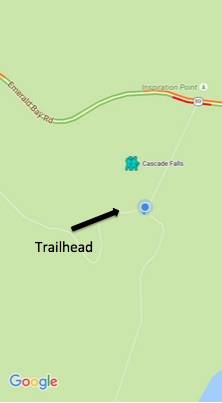
Address: 38.945840, -120.098553
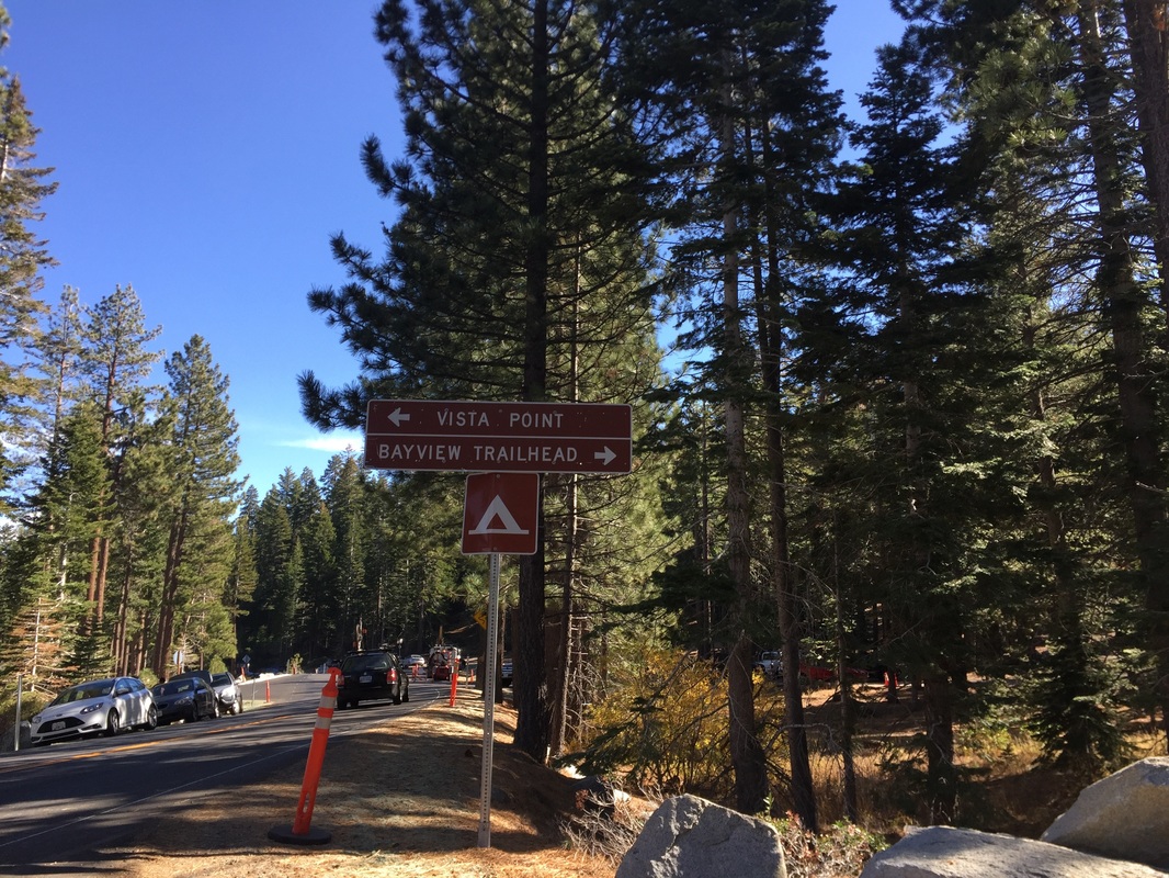
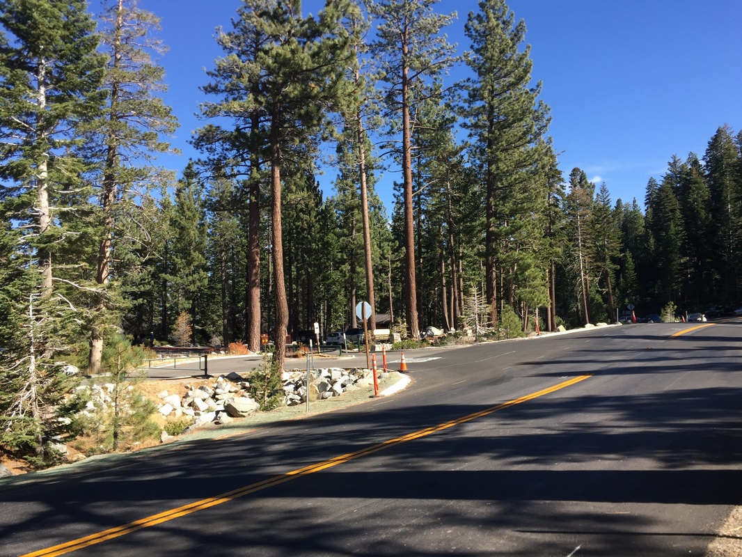
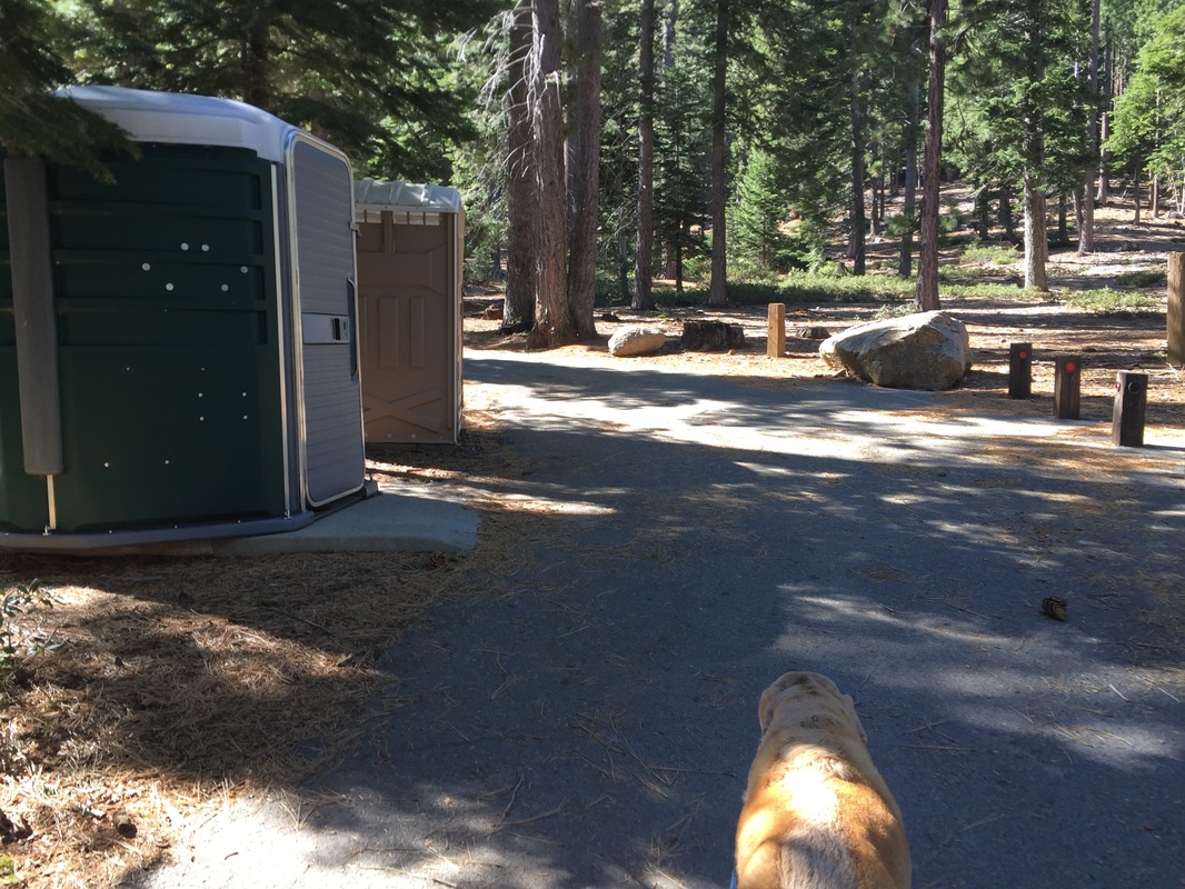
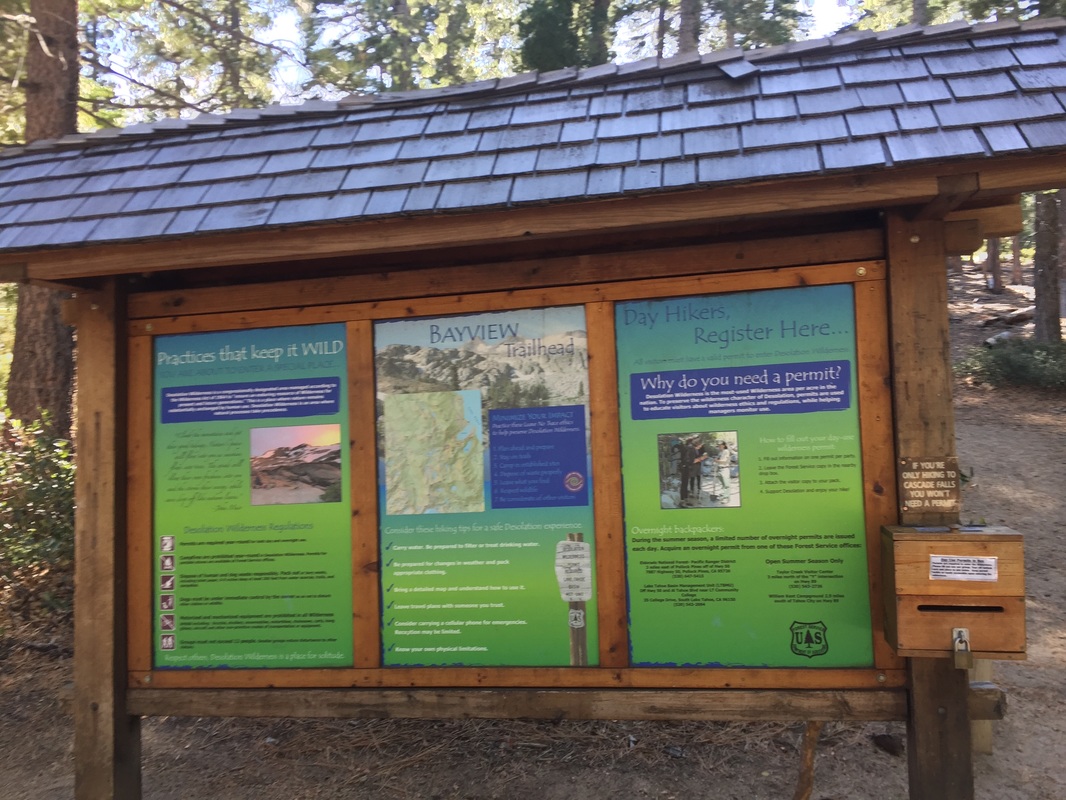
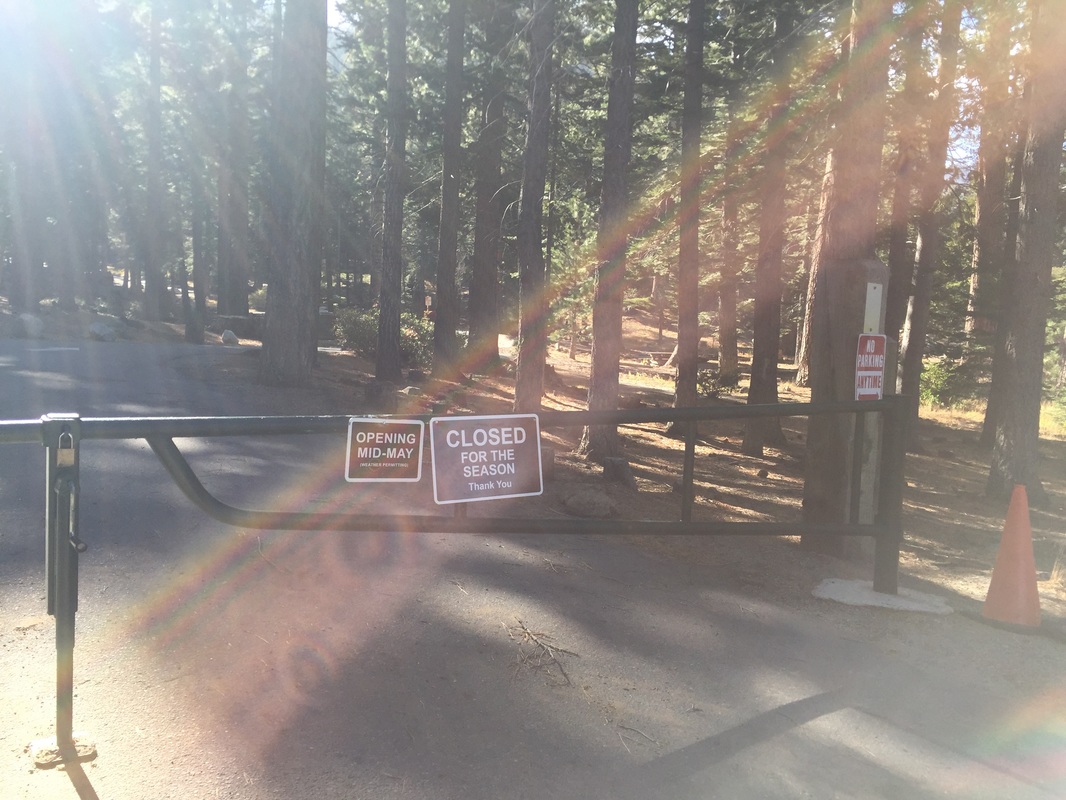
Parking: A handful of parking spots are available at the far end of the Bayview Campground (across from Inspiration Point). The campgrounds close in fall and winter and re-open mid-May (dependent on weather). If you’re hiking when it’s closed, you’ll have to park at Inspiration Point or along Highway 89. Both get very crowded so I would recommend starting early.
Hours: Not posted
Type: Hike (moderate)
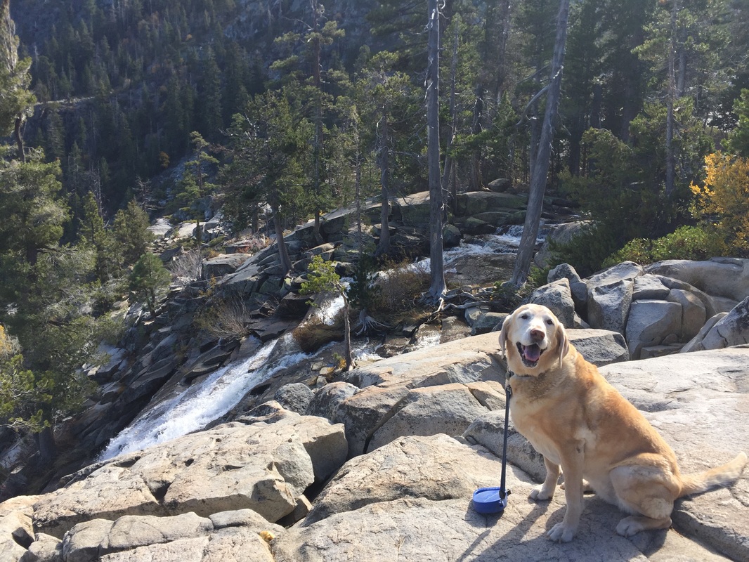
Regulations: Dogs allowed on-leash
Best time to visit: Right after a good rain but before the snow falls. Mid-October was the perfect time to visit.
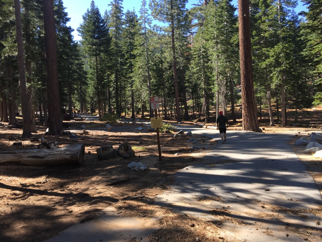
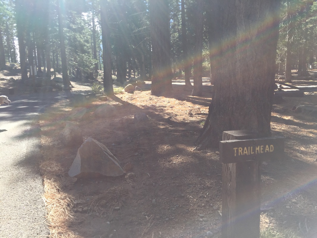
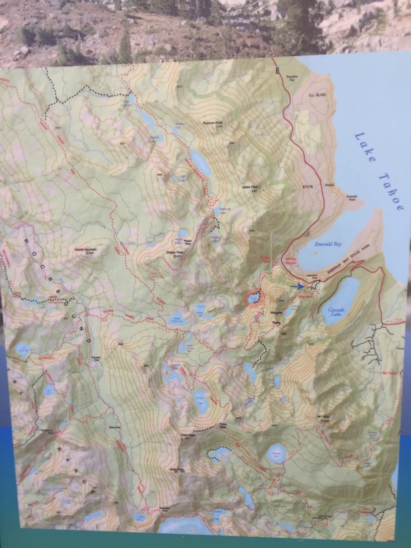
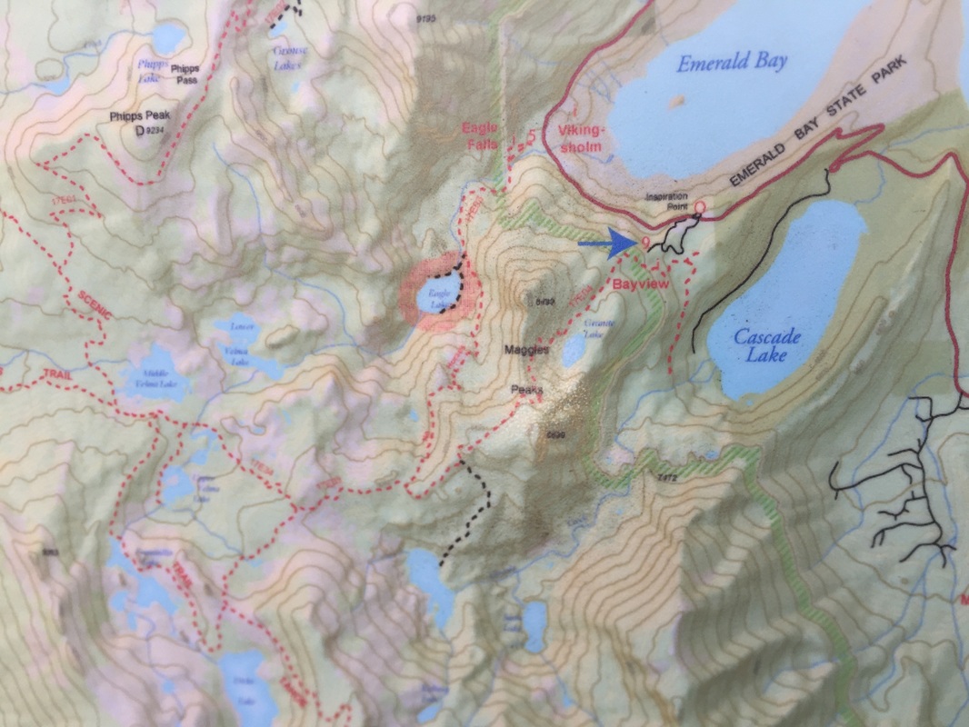
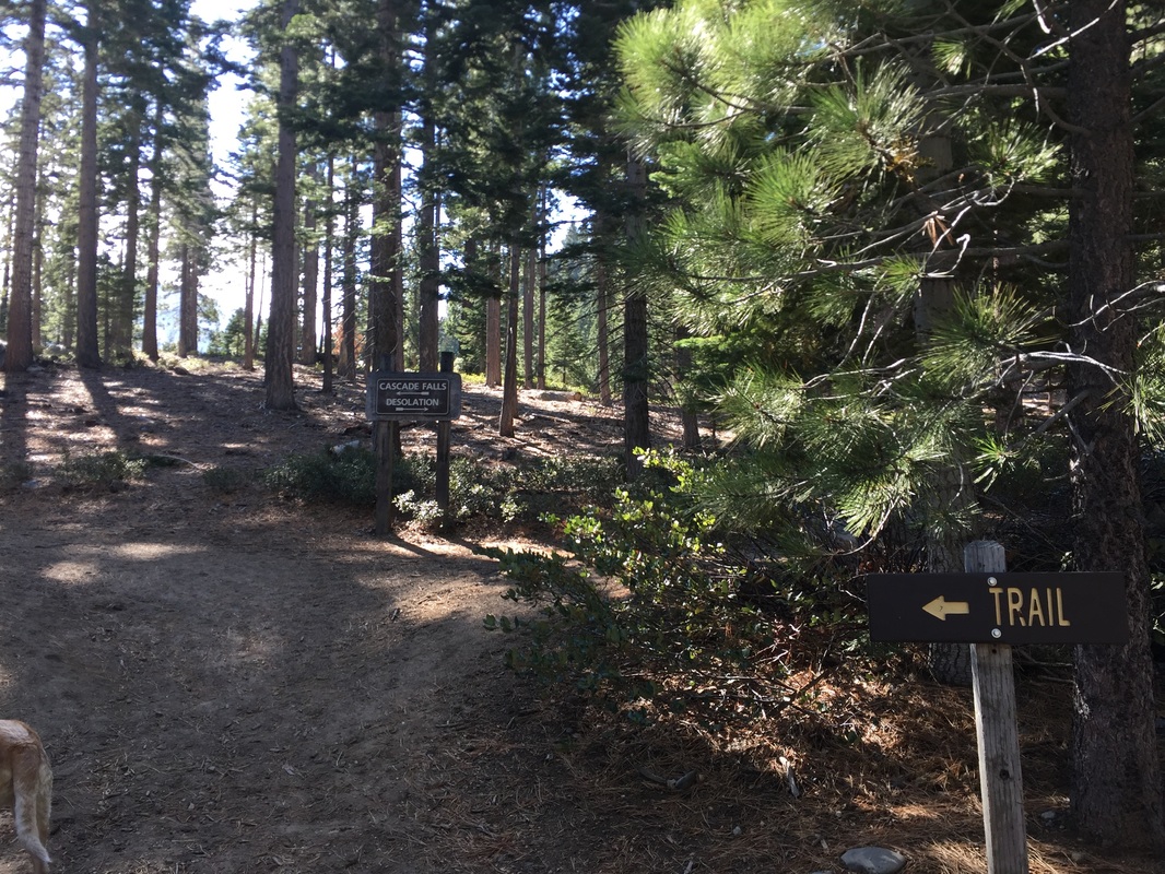
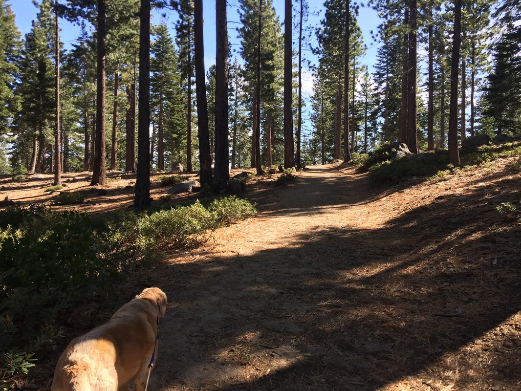
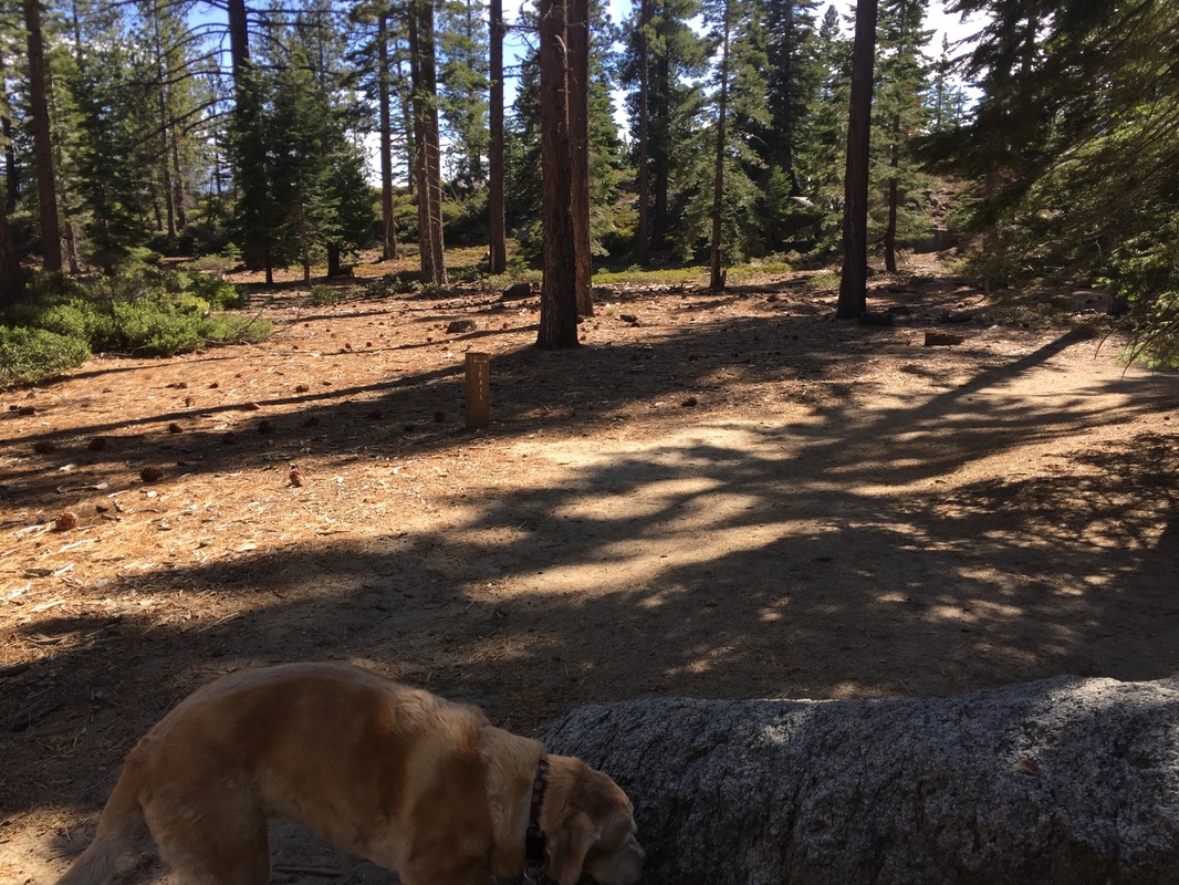
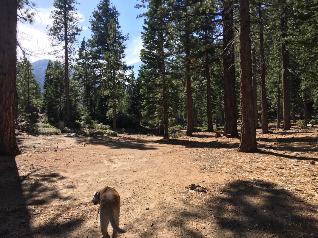
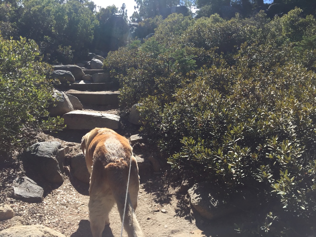
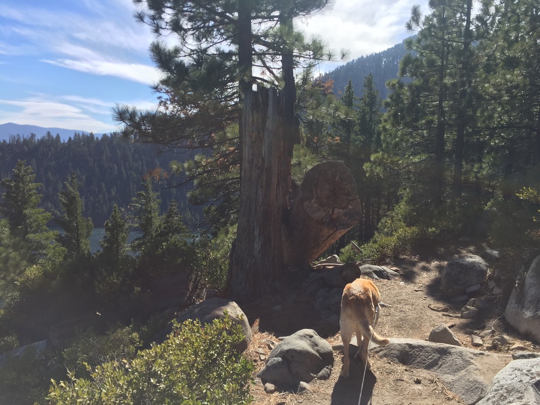
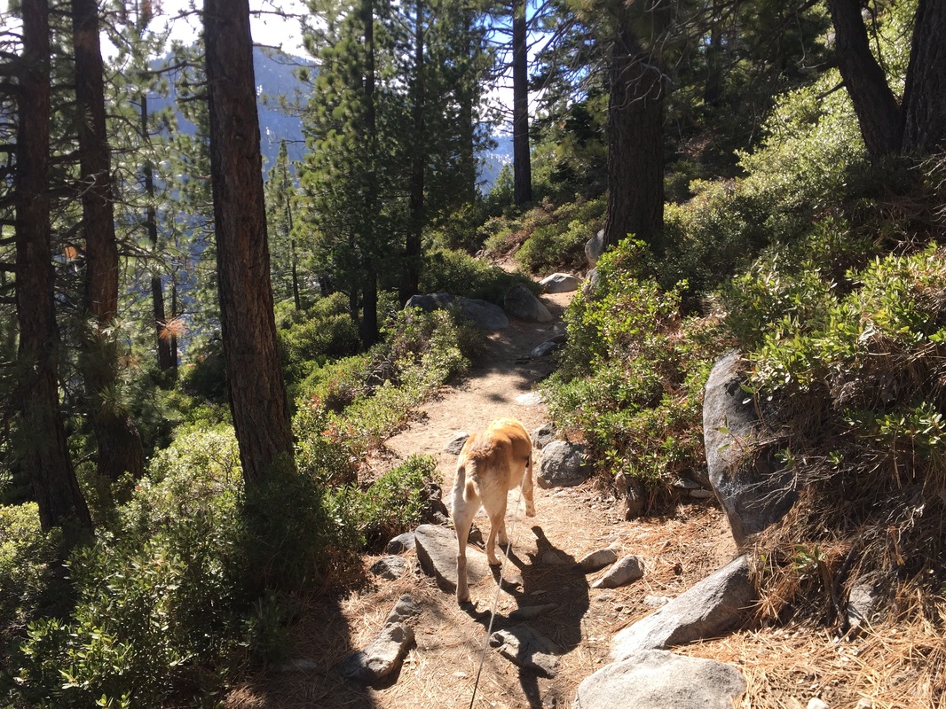
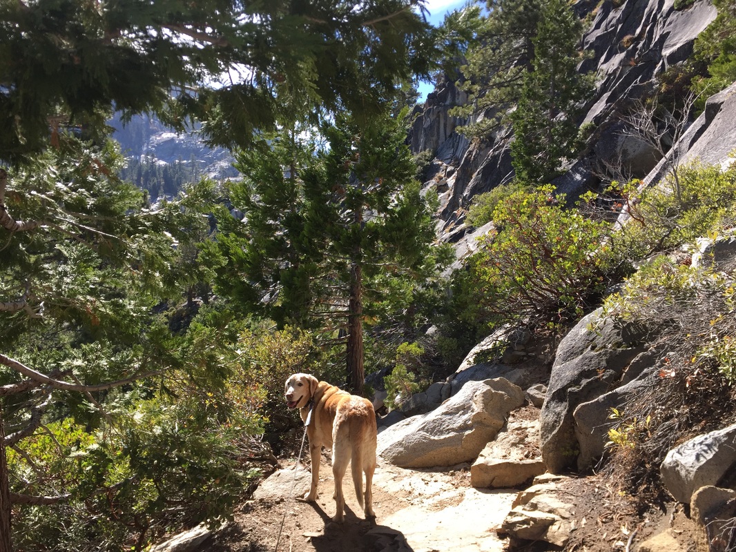
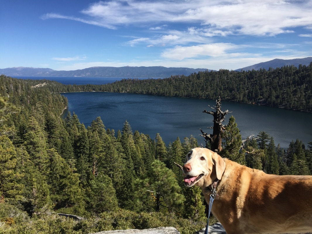
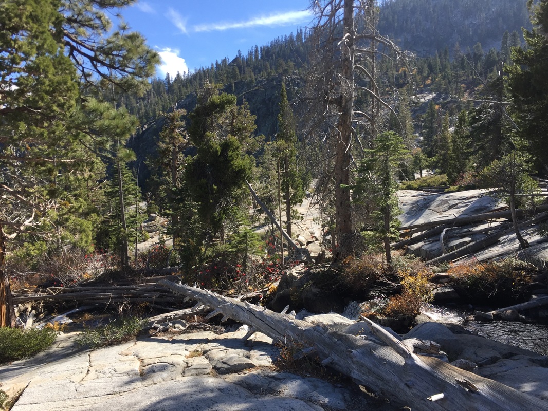
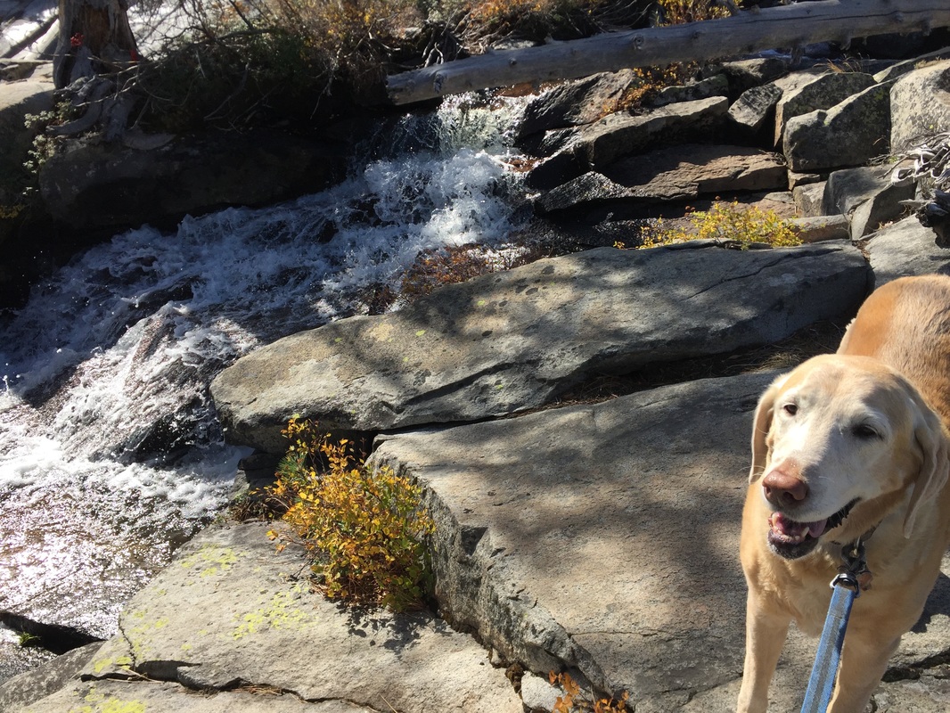
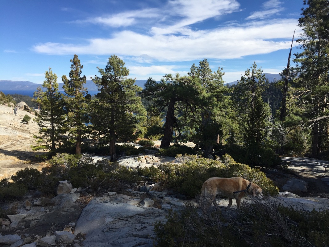
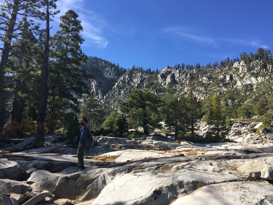
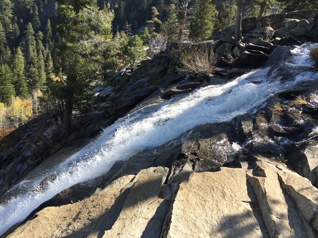
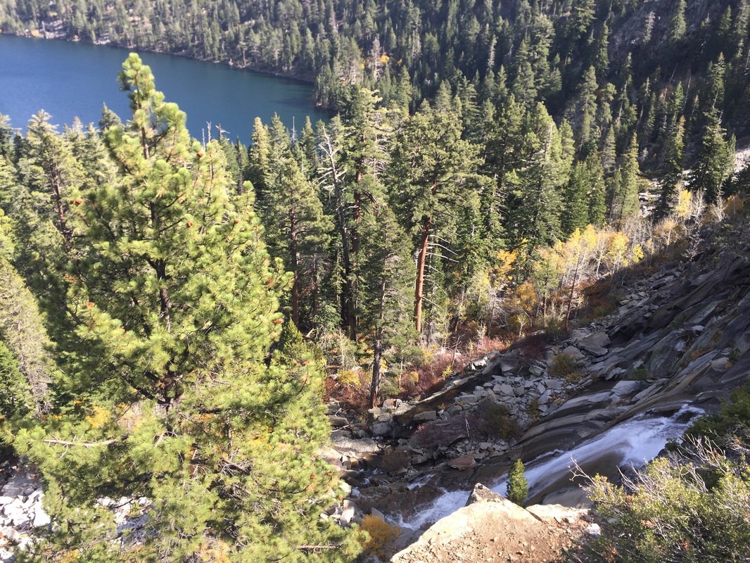
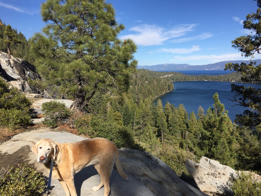
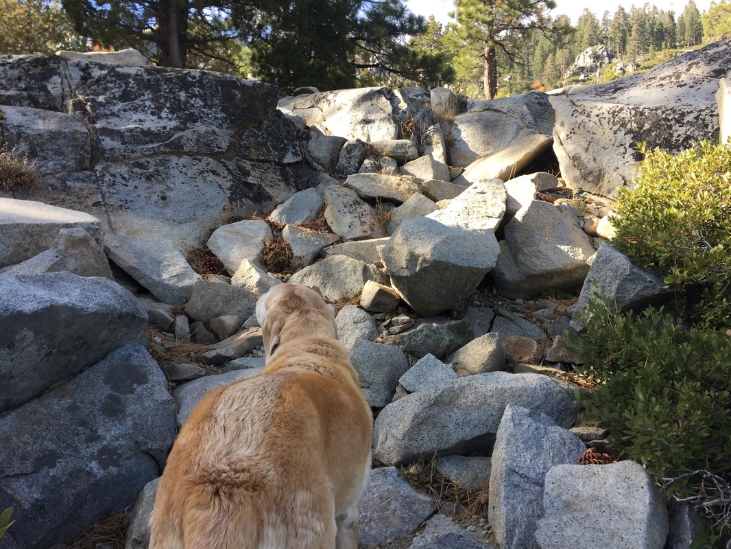
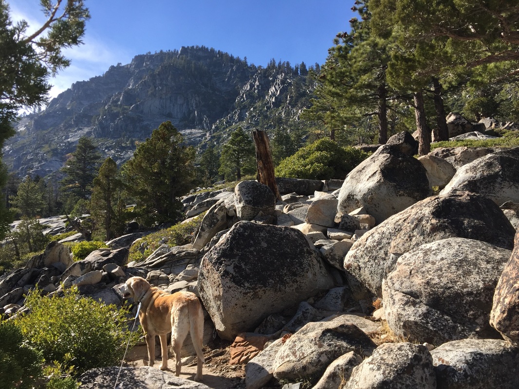
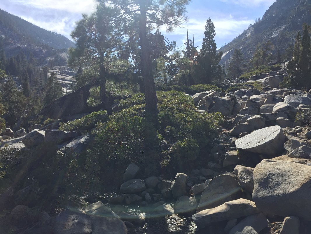
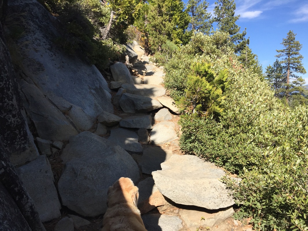
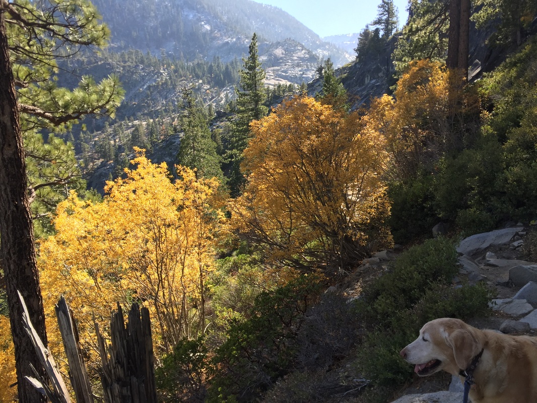
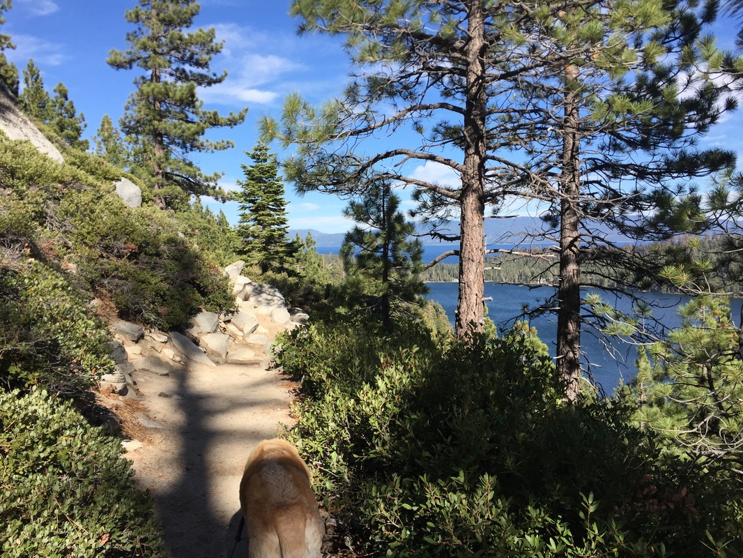
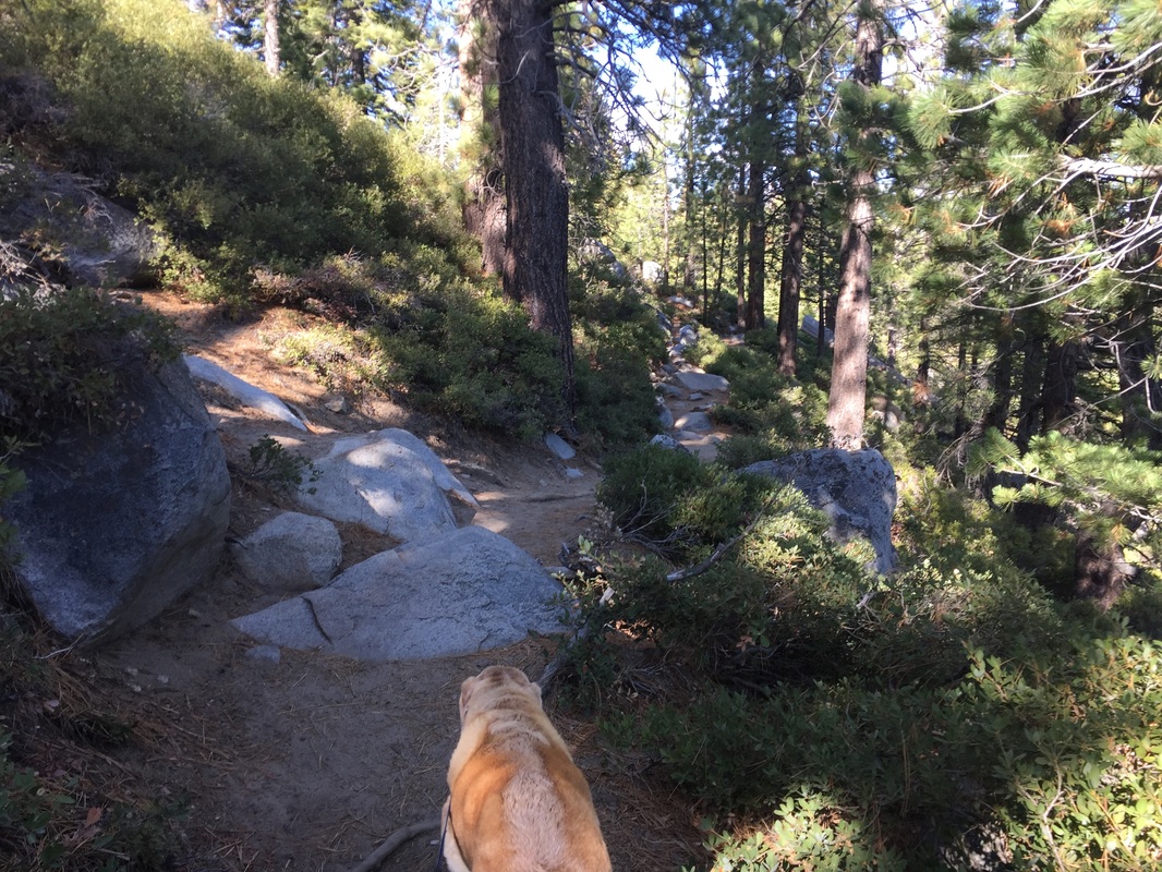
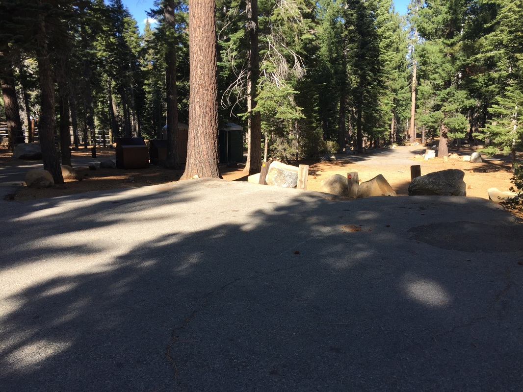
Description: 2 mile round-trip hike to the top of a 200-ft tall waterfall. The hike itself is lovely, beginning in a forest surrounded by towering trees. You will soon start climbing steps cut into the rocks, and then you’ll hike along a rocky trail cut into the side of the mountain. From this trail there are spectacular views of the lakes below. You will see the waterfall from a distance, and then it will disappear among the rocks and trees until you get close. Once you hike around the hillside, the trail will begin an easy climb as you near the waterfall. Stay to your left, and you will hike down to a wooden trail post near the waterfall. The trail is easy to lose among the rocks, but follow the sounds of the waterfall and you will find it. You’ll have to do some boulder hopping, but it’s not too difficult and you can sit right next to the top of the waterfall, watching the creek flowing into it, and dropping below you. The view of the waterfall and the lakes below is a breathtaking sight.
The Bayview Campground does not have running water during certain times of the year, and their toilets are also closed during off-season. Bring plenty of water. Trash cans are available throughout the campgrounds.
Parking: A handful of parking spots are available at the far end of the Bayview Campground (across from Inspiration Point). The campgrounds close in fall and winter and re-open mid-May (dependent on weather). If you’re hiking when it’s closed, you’ll have to park at Inspiration Point or along Highway 89. Both get very crowded so I would recommend starting early.
Hours: Not posted
Type: Hike (moderate)
Regulations: Dogs allowed on-leash
Best time to visit: Right after a good rain but before the snow falls. Mid-October was the perfect time to visit.
Description: 2 mile round-trip hike to the top of a 200-ft tall waterfall. The hike itself is lovely, beginning in a forest surrounded by towering trees. You will soon start climbing steps cut into the rocks, and then you’ll hike along a rocky trail cut into the side of the mountain. From this trail there are spectacular views of the lakes below. You will see the waterfall from a distance, and then it will disappear among the rocks and trees until you get close. Once you hike around the hillside, the trail will begin an easy climb as you near the waterfall. Stay to your left, and you will hike down to a wooden trail post near the waterfall. The trail is easy to lose among the rocks, but follow the sounds of the waterfall and you will find it. You’ll have to do some boulder hopping, but it’s not too difficult and you can sit right next to the top of the waterfall, watching the creek flowing into it, and dropping below you. The view of the waterfall and the lakes below is a breathtaking sight.
The Bayview Campground does not have running water during certain times of the year, and their toilets are also closed during off-season. Bring plenty of water. Trash cans are available throughout the campgrounds.


All content within this site Copyright © 2023 Hikes Dogs Love. All rights reserved. No part of this website may be reproduced without permission.

- Home
-
Browse All
-
Alameda County
>
- Albany Bulb
- Alameda Creek Regional Trail
- Brickyard Cove
- Brushy Peak Regional Preserve
- Anthony Chabot Regional Park (Lake Chabot)
- Aquatic Park
- Barlago Italian Kitchen
- Buchanan Dog Beach
- California Canoe & Kayak (Oakland)
- Cali Kid Burgers ‘N Shakes
- César Chávez Park
- Chabot Park
- Claremont Canyon
- Coyote Hills Regional Park
- Crab Cove
- Cull Canyon Regional Recreation Area
- Dimond Canyon Park
- Don Castro Regional Recreation Area
- Don Edwards Wildlife Refuge
- Dublin Hills Regional Park
- Emeryville Marina
- Fairmont Ridge
- Five Canyons Open Space Preserve
- Fremont Central Park
- Garin/Dry Creek Pioneer Regional Park
- Gilman Brewing Company
- Greenbelt Trails
- Hayward Regional Shoreline
- Heron Bay Trail
- Ikaros Greek Restaurant
- Jerusalem Organic Kitchen
- Joaquin Miller Park
- Lake Anza
- Lake Chabot
- Lake Merritt
- Leona Canyon Regional Open Space Preserve
- Leona Heights Park
- Marina Park
- Martin Canyon Creek Trail
- Martin Luther King Jr. Regional Shoreline
- Mission Peak
- Montclair Railroad Trail/ Torii Gate
- Morgan Territory Regional Preserve
- Oyster Bay Regional Shoreline
- Park Street Classic Car Show (Annual)
- Pleasanton Ridge Regional Preserve
- Point Emery
- Reinhardt Redwood Regional Park
- Robert's Park
- Room 389
- Shoreline Park
- Sibley Volcanic Regional Preserve
- Skyline Gate Staging Area
- Strawberry Canyon Fire Trail
- Sunol Regional Wilderness
- Temescal Regional Recreation Area
- Tilden Regional Park
- Upper Anthony Chabot Regional Park (Oakland Entrance)
- Upper Knowland Park
- Vargas Plateau Regional Park
- Butte County >
-
Contra Costa County
>
- Acalanes Ridge Open Space
- Briones Regional Park
- Carquinez Strait Regional Shoreline
- Crockett Hills Regional Park
- Diablo Foothills Regional Park
- EBMUD Trails
- Fernandez Ranch
- Frowning Ridge
- Geppetto's Caffe
- Hacienda de las Flores Park
- Hillside Nature Area
- Howe Homestead Park
- Indian Rock
- Kennedy Grove Regional Recreation Area
- Lafayette Community Park
- Lafayette Reservoir
- Las Trampas Regional Wilderness
- Lime Ridge Open Space
- Miller/Knox Regional Shoreline
- Moraga Commons Park
- Mulholland Ridge Open Space Preserve
- Point Isabel
- Point Molate Beach Park
- Point Pinole Regional Shoreline
- Point San Pablo Harbor
- Rubio's
- San Quentin Beach
- Shell Ridge Open Space
- Sobrante Ridge Regional Preserve
- Sugarloaf Open Space
- Sycamore Valley Open Space Preserve
- Tender Greens
- Tilden Regional Park
- Wildcat Canyon Regional Park
- El Dorado County >
-
Marin County
>
- 101 Surf Sports
- Baltimore Canyon Open Space Preserve
- Blackie's Pasture
- Camino Alto Preserve
- Carson Falls
- Cascade Falls
- Cataract Falls
- Dawn Falls
- Hippie Tree
- Ignacio Valley Preserve (Fairway Falls)
- Indian Valley Open Space Preserve
- King Mountain Open Space Preserve
- Marin Headlands (Coastal Trail)
- Old Saint Hilary's Open Space Preserve
- Phoenix Lake
- Red Hill Dog Park
- Red Hill Trail
- Ring Mountain Open Space Preserve
- Roy's Redwoods
- Sam's Anchor Cafe
- Sorich Ranch Park
- Tiburon Peninsula Historical Trail
- Tiburon Uplands
- Tucker Trail Falls
- Mariposa County >
- Mendocino County >
- Mono County >
- Monterey County >
- Nevada County >
- Placer County >
-
San Francisco County
>
- 2.2 Mile Urban Hike
- Bernal Heights Park
- The Brixton
- Billy Goat Hill Park
- Blackwood
- Clipper Cove Beach
- Crissy Field
- Dynamo Donut + Coffee
- Fort Funston
- Fort Mason
- Glen Canyon Park
- Golden Gate Park
- Grand View Park
- The Great Lawn/ Avenue of the Palms
- Java Beach Cafe
- John McLaren Park
- Interior Greenbelt
- Lake Merced
- Lands End
- Letterman Digital Arts Center
- Marina Green
- Mount Davidson
- Mount Sutro Open Space Reserve
- Ocean Beach
- Palace of Fine Arts
- Philz Coffee Truck
- Stern Grove
- Sutro Baths
- Sutro Heights Park
- TreasureFest
-
San Mateo County
>
- 7 Mile House Sports Bar & Grill
- Barbara's Fishtrap
- Bedwell Bayfront Park
- Bob's Vegetable Stand and Pumpkin Farm
- Cafe Pacifica
- Devil's Slide Coastal Trail
- Esplanade Beach
- Flying Fish Grill
- Half Moon Bay Kayak Co.
- McNee Ranch State Park (Montara Mountain)
- Montara State Beach
- Mori Point
- Mussel Rock Park
- Nick's Seafood Restaurant
- Panera Bread
- Pedro Point Headlands
- Poplar Beach
- Pulgas Ridge Open Space Preserve
- Rancho Corral de Tierra
- Seal Point
- Taqueria La Mexicana
- Wavecrest Open Space
- Santa Clara County >
- Santa Cruz County >
- Solano County >
- Sonoma County >
- Tuolumne County >
- Yuba County >
-
Alameda County
>
- Map View
-
More