Hikes Dogs Love
  • Home
  • Map View
    • Vacation Hikes >
      • Arizona >
        • Papago Park
      • New Mexico >
        • Oliver Lee Memorial State Park >
          • Browse All >
            • Alameda County >
              • Albany Bulb
              • Alameda Creek Regional Trail
              • Barlago Italian Kitchen
              • Brickyard Cove
              • Brushy Peak Regional Preserve
              • Anthony Chabot Regional Park (Lake Chabot)
              • Aquatic Park
              • Buchanan Dog Beach
              • California Canoe & Kayak (Oakland)
              • Cali Kid Burgers ‘N Shakes
              • César Chávez Park
              • Chabot Park
              • Claremont Canyon
              • Coyote Hills Regional Park
              • Crab Cove
              • Cull Canyon Regional Recreation Area
              • Dimond Canyon Park
              • Don Castro Regional Recreation Area
              • Don Edwards Wildlife Refuge
              • Dublin Hills Regional Park
              • Emeryville Marina
              • Fairmont Ridge
              • Five Canyons Open Space Preserve
              • Fremont Central Park
              • Garin/Dry Creek Pioneer Regional Park
              • Gilman Brewing Company
              • Greenbelt Trails
              • Hayward Regional Shoreline
              • Heron Bay Trail
              • Ikaros Greek Restaurant
              • Jerusalem Organic Kitchen
              • Joaquin Miller Park
              • Lake Anza
              • Lake Chabot
              • Lake Merritt
              • Leona Canyon Regional Open Space Preserve
              • Leona Heights Park
              • Marina Park
              • Martin Canyon Creek Trail
              • Martin Luther King Jr. Regional Shoreline
              • Mission Peak
              • Montclair Railroad Trail/ Torii Gate
              • Morgan Territory Regional Preserve
              • Oyster Bay Regional Shoreline
              • Park Street Classic Car Show (Annual)
              • Pleasanton Ridge Regional Preserve
              • Point Emery
              • Reinhardt Redwood Regional Park
              • Robert's Park
              • Room 389
              • Shoreline Park
              • Sibley Volcanic Regional Preserve
              • Skyline Gate Staging Area
              • Strawberry Canyon Fire Trail
              • Sunol Regional Wilderness
              • Temescal Regional Recreation Area
              • Tilden Regional Park
              • Upper Anthony Chabot Regional Park (Oakland Entrance)
              • Upper Knowland Park
              • Vargas Plateau Regional Park
            • Butte County >
              • Feather Falls
              • Motel 6 - Oroville
              • Riverbend Park
            • Contra Costa County >
              • Acalanes Ridge Open Space
              • Briones Regional Park
              • Carquinez Strait Regional Shoreline
              • Crockett Hills Regional Park
              • Diablo Foothills Regional Park
              • EBMUD Trails
              • Fernandez Ranch
              • Frowning Ridge
              • Geppetto's Caffe
              • Hacienda de las Flores Park
              • Hillside Nature Area
              • Howe Homestead Park
              • Indian Rock
              • Kennedy Grove Regional Recreation Area
              • Lafayette Community Park
              • Lafayette Reservoir
              • Las Trampas Regional Wilderness
              • Lime Ridge Open Space
              • Miller/Knox Regional Shoreline
              • Moraga Commons Park
              • Mulholland Ridge Open Space Preserve
              • Point Isabel
              • Point Molate Beach Park
              • Point Pinole Regional Shoreline
              • Point San Pablo Harbor
              • Rubio's
              • San Quentin Beach
              • Shell Ridge Open Space
              • Sobrante Ridge Regional Preserve
              • Sugarloaf Open Space
              • Sycamore Valley Open Space Preserve
              • Tender Greens
              • Tilden Regional Park
              • Wildcat Canyon Regional Park
            • El Dorado County >
              • Angora Lakes Trail
              • Bijou Community Park
              • Cascade Falls
              • Horsetail Falls
              • Inspriation Point
              • Motel 6 - South Lake Tahoe
              • Mt. Tallac
            • Marin County >
              • 101 Surf Sports
              • Baltimore Canyon Open Space Preserve
              • Blackie's Pasture
              • Camino Alto Preserve
              • Carson Falls
              • Cascade Falls
              • Cataract Falls
              • Dawn Falls
              • Hippie Tree
              • Ignacio Valley Preserve (Fairway Falls)
              • Indian Valley Open Space Preserve
              • King Mountain Open Space Preserve
              • Marin Headlands (Coastal Trail)
              • Old Saint Hilary's Open Space Preserve
              • Phoenix Lake
              • Red Hill Dog Park
              • Red Hill Trail
              • Ring Mountain Open Space Preserve
              • Roy's Redwoods
              • Sam's Anchor Cafe
              • Sorich Ranch Park
              • Tiburon Peninsula Historical Trail
              • Tiburon Uplands
              • Tucker Trail Falls
            • Mariposa County >
              • Happy Burger Diner
              • Yosemite National Park
            • Mendocino County >
              • Catch-a-Canoe
              • Gowan's Heirloom Ciders
              • MacKerricher State Park
              • Mendocino Headlands State Park
              • Navarro River Redwoods State Park
              • Princess Seafood
              • Skunk Train
              • The Stanford Inn By The Sea
              • Van Damme State Beach
            • Mono County >
              • Bodie State Historic Park
              • Jolly Kone
              • Lundy Canyon
              • Mono Lake (Tufa State National Reserve)
              • Virginia Creek Settlement
            • Monterey County >
              • 17-Mile Drive
              • Asilomar State Beach
              • Bistro Beaujolais
              • Carmel Beach
              • Fishwife
              • Fort Ord Dunes State Park
              • Garland Ranch Regional Park
              • Jack's Peak
              • Monterey Bay Coastal Trail
              • Monterey Bay Kayaks
              • Monterey Municipal Beach
              • Motel 6 - Downtown Monterey
              • Ryan Ranch Disc Golf Course
              • Ventana Wilderness
            • Nevada County >
              • Fairy Falls
            • Placer County >
              • Hidden Falls
              • Regional Park Auburn Disc Golf Course
              • Thirsty Barrel Taphouse & Grille
              • Wolf Creek Trail
              • The Yeti Tavern
            • San Francisco County >
              • 2.2 Mile Urban Hike
              • Bernal Heights Park
              • The Brixton
              • Billy Goat Hill Park
              • Blackwood
              • Clipper Cove Beach
              • Crissy Field
              • Dynamo Donut + Coffee
              • Fort Funston
              • Fort Mason
              • Glen Canyon Park
              • Golden Gate Park
              • Grand View Park
              • The Great Lawn/ Avenue of the Palms
              • Java Beach Cafe
              • John McLaren Park
              • Interior Greenbelt
              • Lake Merced
              • Lands End
              • Letterman Digital Arts Center
              • Marina Green
              • Mount Davidson
              • Mount Sutro Open Space Reserve
              • Ocean Beach
              • Palace of Fine Arts
              • Philz Coffee Truck
              • Stern Grove
              • Sutro Baths
              • Sutro Heights Park
              • TreasureFest
            • San Mateo County >
              • 7 Mile House Sports Bar & Grill
              • Barbara's Fishtrap
              • Bedwell Bayfront Park
              • Bob's Vegetable Stand and Pumpkin Farm
              • Cafe Pacifica
              • Devil's Slide Coastal Trail
              • Esplanade Beach
              • Flying Fish Grill
              • Half Moon Bay Kayak Co.
              • McNee Ranch State Park (Montara Mountain)
              • Montara State Beach
              • Mori Point
              • Mussel Rock Park
              • Nick's Seafood Restaurant
              • Panera Bread
              • Pedro Point Headlands
              • Poplar Beach
              • Pulgas Ridge Open Space Preserve
              • Rancho Corral de Tierra
              • Seal Point
              • Taqueria La Mexicana
              • Wavecrest Open Space
            • Santa Clara County >
              • Byxbee Park
              • Calero County Park
              • Uvas Canyon County Park
            • Santa Cruz County >
              • Byrne-Milliron Forest
              • Greyhound Rock County Park
              • Henry Cowell Redwoods State Park
              • Jaliscos Restaurant
              • Mount Madonna County Park
              • Roaring Camp Railroads
            • Solano County >
              • Alvarez 9th Street Park
              • Benicia Classic Car Show
              • Benicia Waterfront
              • Lagoon Valley Park
              • Peña Adobe Regional Park
            • Sonoma County >
              • Doran Regional Park
              • Fishetarian
              • Helen Putnam Regional Park
            • Tuolumne County >
              • Donnell Vista
              • Tuttletown Recreation Area
            • Yuba County >
              • Ellis Lake
        • White Sands National Monument
      • Oregon >
        • Multnomah Falls
      • Washington >
        • Olympic National Park >
          • Kalaloch Beach
          • Madison Falls
          • Quinault Rainforest
        • Rattlesnake Ridge
  • More
    • Vacation Spots >
      • Restaurants >
        • Southern California >
          • Fire Island Grill
          • Lazy Dog Restaurant & Bar
          • Perkies Coffee Haus
        • Washington >
          • Rose Pho
    • Archived Hikes >
      • Archived Hikes 2
      • Archives 2016-2018
    • Planning Your Trip
    • Dog Gear
    • About >
      • Contact Us
      • Privacy Policy
      • Terms and Conditions

Rancho Corral de Tierra

Approximate Address: 37°30'42.5"N 122°28'58.6"W (End of Coral Reef Ave, El Granada)
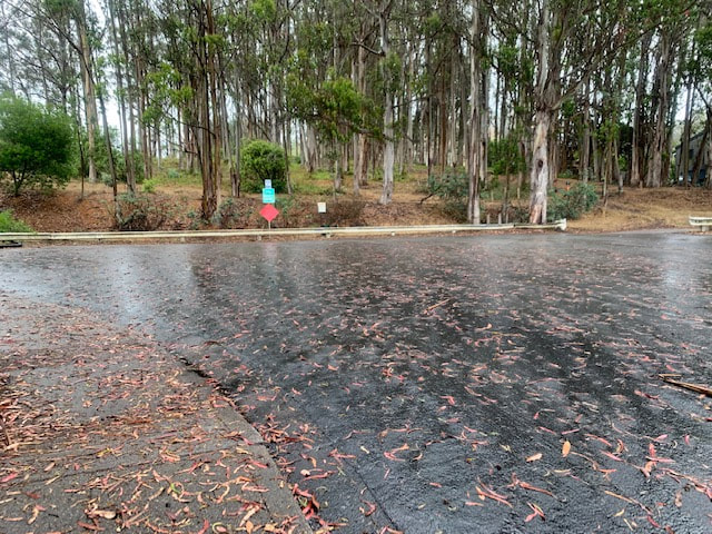
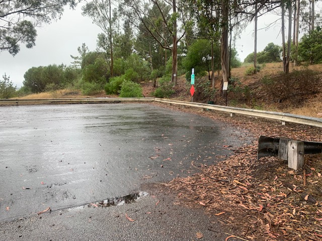
Parking: Ample parking at the end of Coral Reef Ave and in the surrounding neighborhood (please be respectful of residents)
Hours: Not posted
Type: Hike (Moderate to Strenuous)
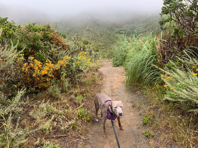
Regulations: Dogs allowed on-leash
Best time to visit: Anytime as long as it’s not a hot day. This trail normally stays cooler than the surrounding area, but it is exposed to sunlight with little shade.

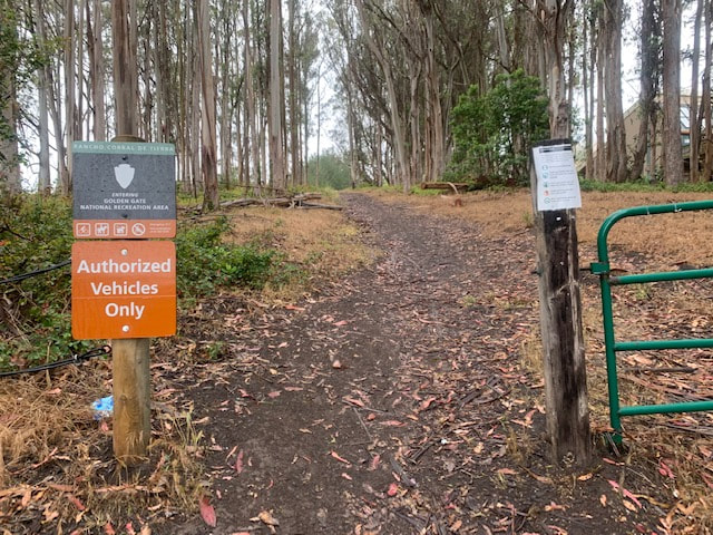
Description: This is a beautiful hike that may make you feel like you’re transported to Hawaii or a scene in Jurassic Park. This nearly 4,000 acres of land is the newest addition to the Golden Gate National Recreation Area. The park is divided by private farmland and inaccessible to hike between. There is no official public parking, but I checked out many entry points to find the best one. Parking at the end of Coral Reef Ave appears to be the safest and have the most parking of the alternatives. Alternative parking areas appeared dangerous and had longer hike-ins to reach the park. 
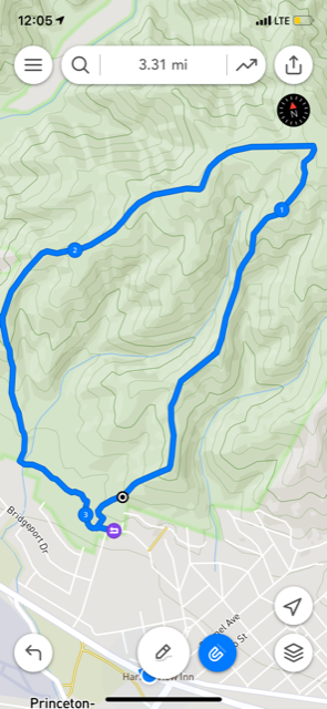
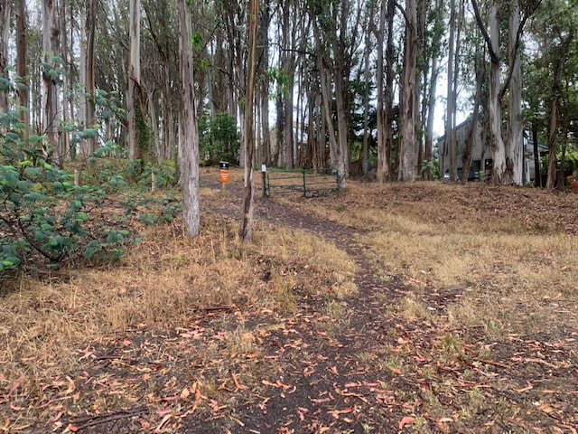
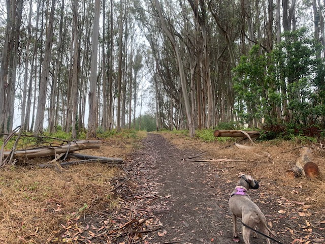
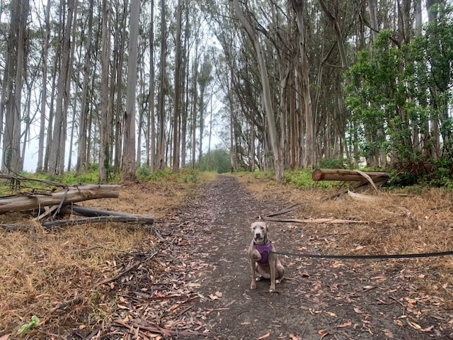
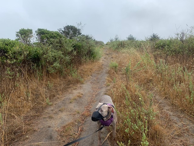
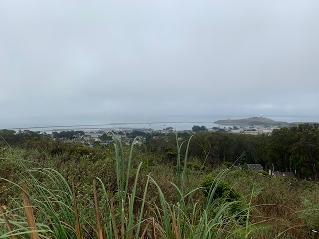
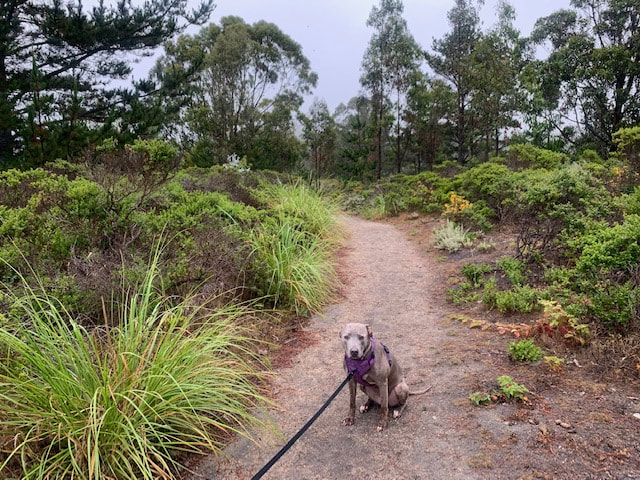
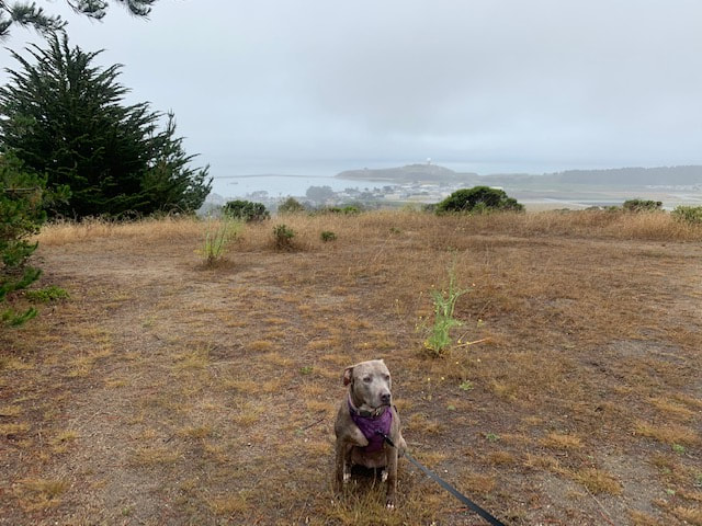
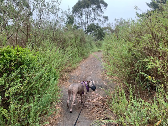
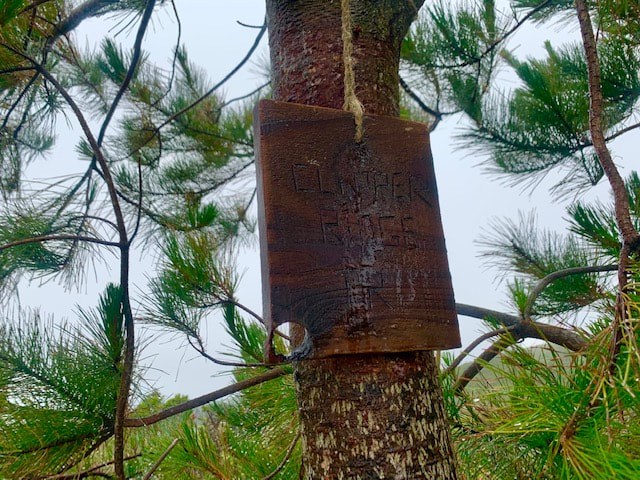
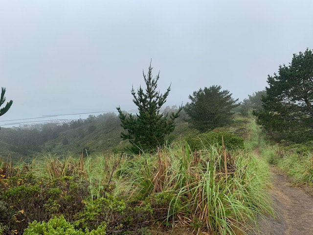
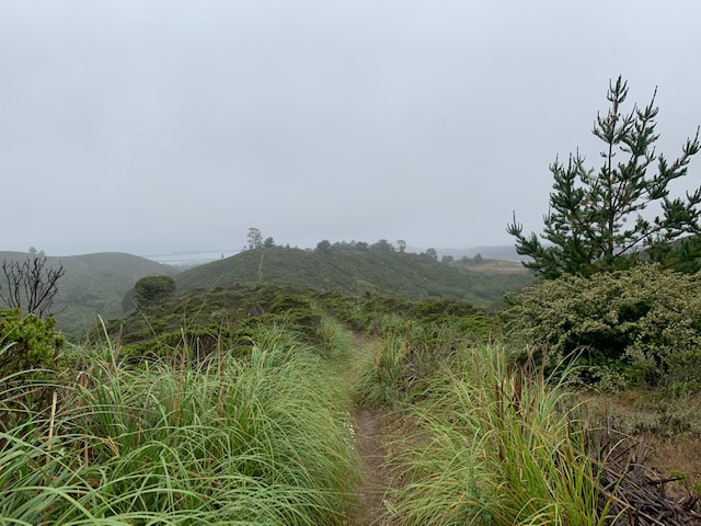
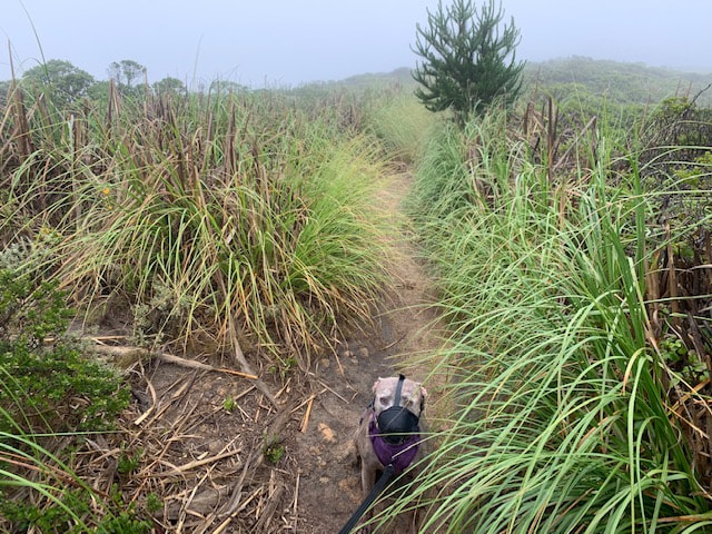
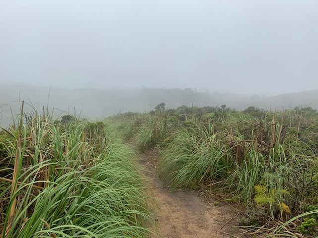
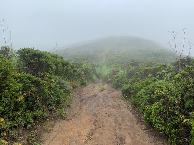
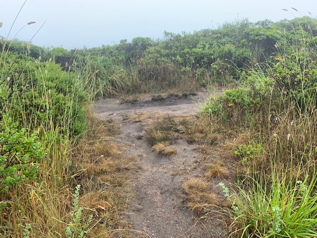
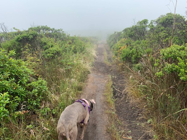
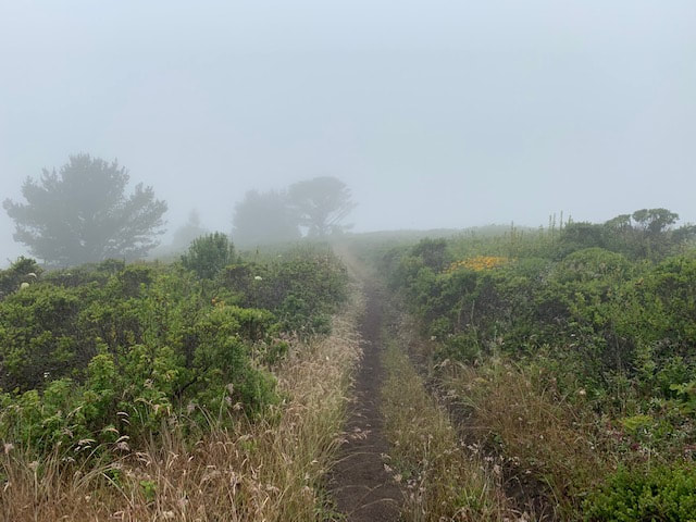
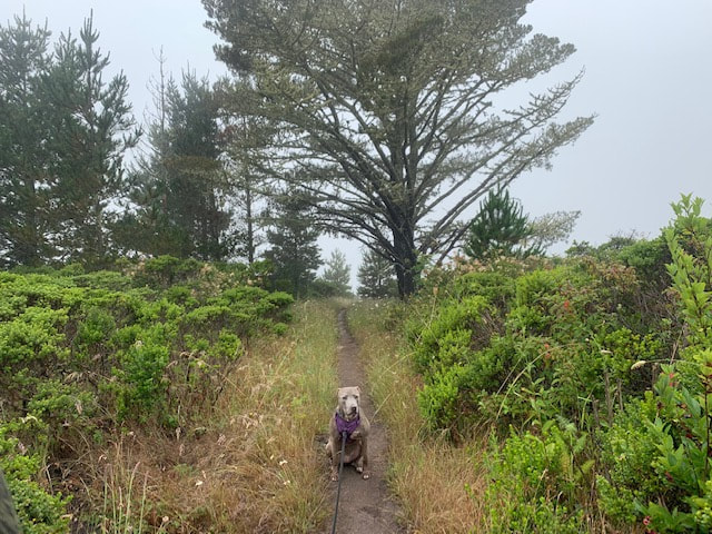
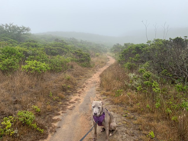
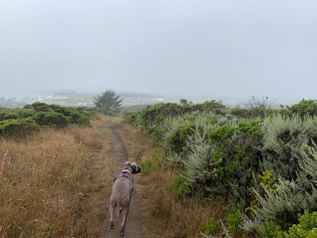
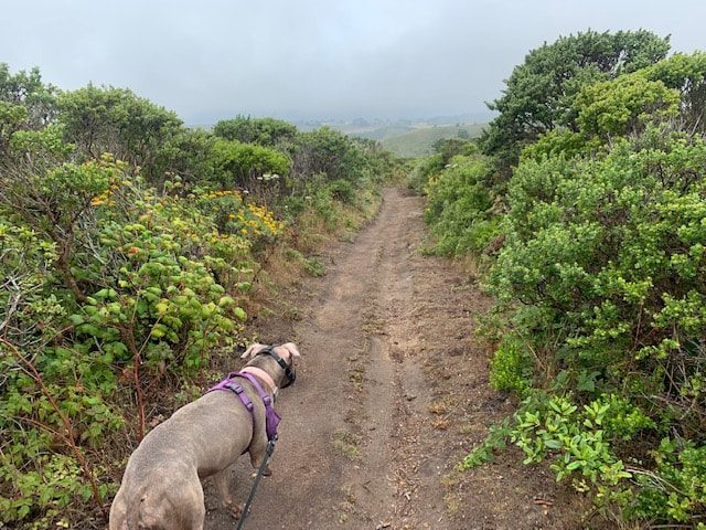
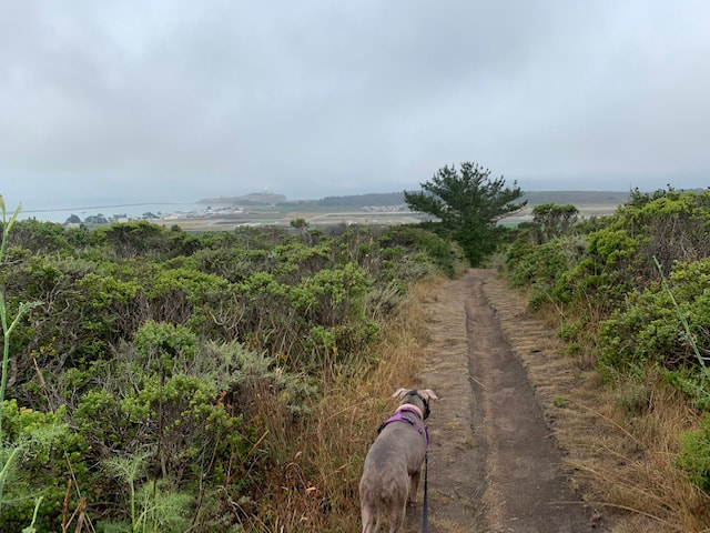
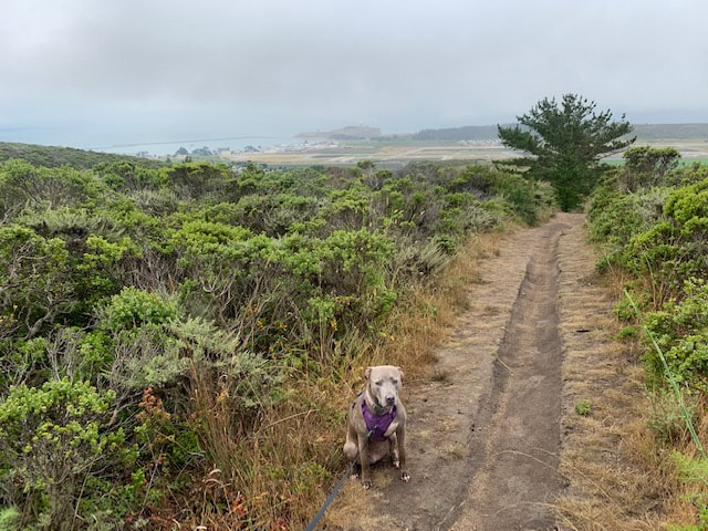
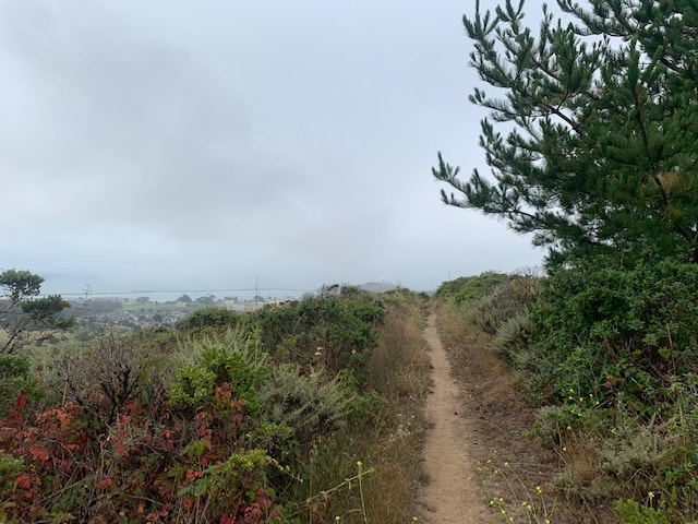
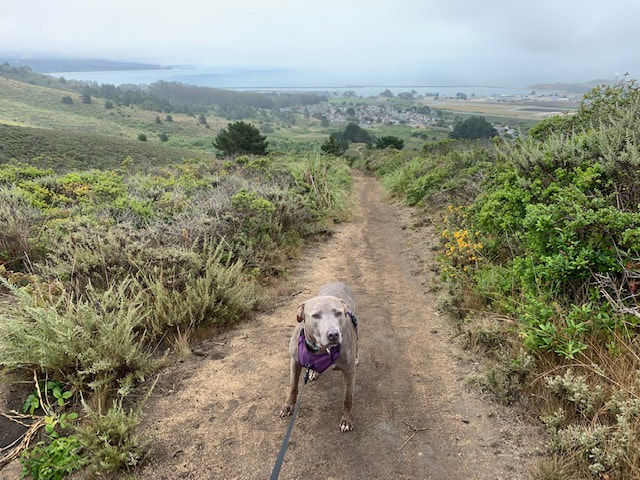
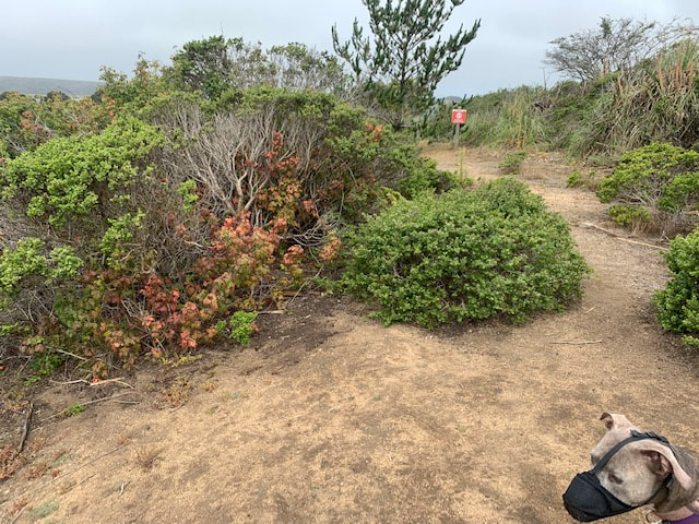
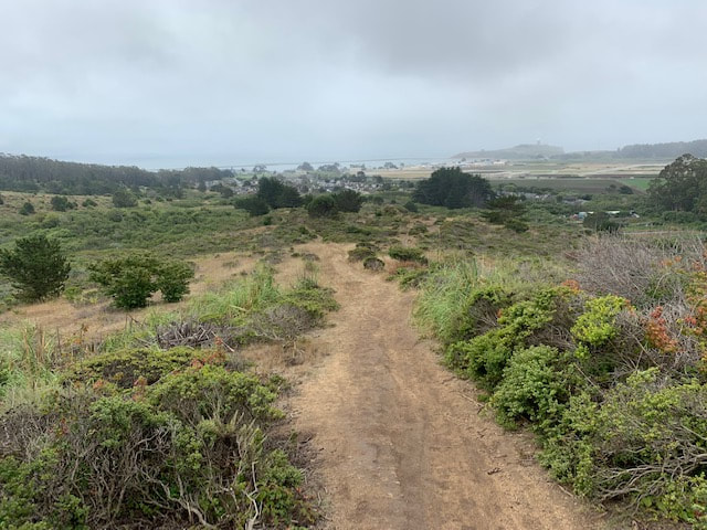
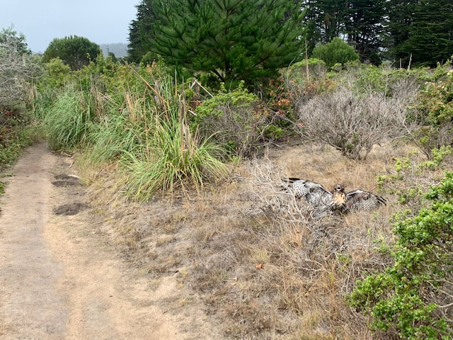
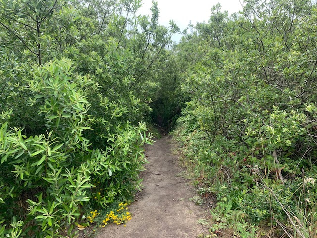
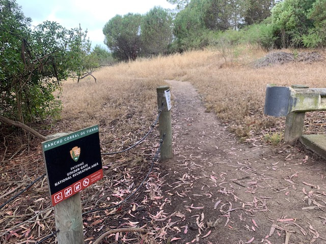
From the parking area, walk directly up the hill, behind the green gate and into the forest of eucalyptus trees. Once you emerge from the trees, the trail splits off in multiple directions. Continue uphill. Once you reach the top of this short stretch you will have beautiful ocean views behind you. Continue hiking ahead and be aware that the trail is slightly overgrown in some areas. We saw poison oak off the trail but were able to avoid it on the trail. None of the trail heads are marked, but I did notice a hand-carved piece of wood hanging from a tree to my left that read “Clipper Ridge Trail.” This trail continues climbing, dips down, and then climbs up again a couple more times. We climbed 900ft in about 1.3 miles. We were surrounded by greenery, colorful flowers, and tall grass-like bushes that overtook the trail in some areas. Bunnies constantly scampered across the trails. We started early in the morning and hiked through a constant mist and some fog as we reached higher elevations. The unique flora combined with the fog/mist and feeling of hiking above the clouds made for an incredible hike. Once we reached a split in the trail, we turned left and began hiking down French Trail; however, you could continue up Clipper Ridge for a more strenuous hike. During our hike down, the trail appeared to be wider and better maintained, although less magical than the hike up. There were a couple stretches that climbed back up slightly, but it was mostly downhill to the end, with views of the ocean and surrounding area towards the bottom. Towards the bottom of French Trail, you will pass through a gate with a sign for Rancho Corral de Tierra, and right after, the trail splits off sharply to the left. This section of the trail is narrow, a little overgrown, and it feels as if you are walking through a tunnel of trees and bushes. After a short walk, you will arrive back near where you started (on the other side of the street). If you originally parked right next to the starting trailhead, you will arrive back on the left side of that area. Since this park has no trail markers, I used a free app called “Footpath” which I referred to periodically to make sure I was on the correct trail. I highly recommend that app but it’s hard to get lost if you just keep hiking straight ahead and up and then find the split for French Trail. My app showed we hiked a total of 3.31 miles, and during our hike we only ran into two other people with a dog. 

After our hike we headed to Pacifica and got the best crab sandwich I've ever had at Nick's Seafood Restaurant. We enjoyed our takeout at Rockaway Beach next-door. 


This park does not have restrooms or running water

Click here for a trail map of Rancho Corral de Tierra
Parking area and trail photos:
Contact Us
Privacy Policy
Terms and Conditions
All content within this site Copyright © 2023 Hikes Dogs Love. All rights reserved. No part of this website may be reproduced without permission.
DMCA.com Protection Status
  • Home
  • Map View
    • Vacation Hikes >
      • Arizona >
        • Papago Park
      • New Mexico >
        • Oliver Lee Memorial State Park >
          • Browse All >
            • Alameda County >
              • Albany Bulb
              • Alameda Creek Regional Trail
              • Barlago Italian Kitchen
              • Brickyard Cove
              • Brushy Peak Regional Preserve
              • Anthony Chabot Regional Park (Lake Chabot)
              • Aquatic Park
              • Buchanan Dog Beach
              • California Canoe & Kayak (Oakland)
              • Cali Kid Burgers ‘N Shakes
              • César Chávez Park
              • Chabot Park
              • Claremont Canyon
              • Coyote Hills Regional Park
              • Crab Cove
              • Cull Canyon Regional Recreation Area
              • Dimond Canyon Park
              • Don Castro Regional Recreation Area
              • Don Edwards Wildlife Refuge
              • Dublin Hills Regional Park
              • Emeryville Marina
              • Fairmont Ridge
              • Five Canyons Open Space Preserve
              • Fremont Central Park
              • Garin/Dry Creek Pioneer Regional Park
              • Gilman Brewing Company
              • Greenbelt Trails
              • Hayward Regional Shoreline
              • Heron Bay Trail
              • Ikaros Greek Restaurant
              • Jerusalem Organic Kitchen
              • Joaquin Miller Park
              • Lake Anza
              • Lake Chabot
              • Lake Merritt
              • Leona Canyon Regional Open Space Preserve
              • Leona Heights Park
              • Marina Park
              • Martin Canyon Creek Trail
              • Martin Luther King Jr. Regional Shoreline
              • Mission Peak
              • Montclair Railroad Trail/ Torii Gate
              • Morgan Territory Regional Preserve
              • Oyster Bay Regional Shoreline
              • Park Street Classic Car Show (Annual)
              • Pleasanton Ridge Regional Preserve
              • Point Emery
              • Reinhardt Redwood Regional Park
              • Robert's Park
              • Room 389
              • Shoreline Park
              • Sibley Volcanic Regional Preserve
              • Skyline Gate Staging Area
              • Strawberry Canyon Fire Trail
              • Sunol Regional Wilderness
              • Temescal Regional Recreation Area
              • Tilden Regional Park
              • Upper Anthony Chabot Regional Park (Oakland Entrance)
              • Upper Knowland Park
              • Vargas Plateau Regional Park
            • Butte County >
              • Feather Falls
              • Motel 6 - Oroville
              • Riverbend Park
            • Contra Costa County >
              • Acalanes Ridge Open Space
              • Briones Regional Park
              • Carquinez Strait Regional Shoreline
              • Crockett Hills Regional Park
              • Diablo Foothills Regional Park
              • EBMUD Trails
              • Fernandez Ranch
              • Frowning Ridge
              • Geppetto's Caffe
              • Hacienda de las Flores Park
              • Hillside Nature Area
              • Howe Homestead Park
              • Indian Rock
              • Kennedy Grove Regional Recreation Area
              • Lafayette Community Park
              • Lafayette Reservoir
              • Las Trampas Regional Wilderness
              • Lime Ridge Open Space
              • Miller/Knox Regional Shoreline
              • Moraga Commons Park
              • Mulholland Ridge Open Space Preserve
              • Point Isabel
              • Point Molate Beach Park
              • Point Pinole Regional Shoreline
              • Point San Pablo Harbor
              • Rubio's
              • San Quentin Beach
              • Shell Ridge Open Space
              • Sobrante Ridge Regional Preserve
              • Sugarloaf Open Space
              • Sycamore Valley Open Space Preserve
              • Tender Greens
              • Tilden Regional Park
              • Wildcat Canyon Regional Park
            • El Dorado County >
              • Angora Lakes Trail
              • Bijou Community Park
              • Cascade Falls
              • Horsetail Falls
              • Inspriation Point
              • Motel 6 - South Lake Tahoe
              • Mt. Tallac
            • Marin County >
              • 101 Surf Sports
              • Baltimore Canyon Open Space Preserve
              • Blackie's Pasture
              • Camino Alto Preserve
              • Carson Falls
              • Cascade Falls
              • Cataract Falls
              • Dawn Falls
              • Hippie Tree
              • Ignacio Valley Preserve (Fairway Falls)
              • Indian Valley Open Space Preserve
              • King Mountain Open Space Preserve
              • Marin Headlands (Coastal Trail)
              • Old Saint Hilary's Open Space Preserve
              • Phoenix Lake
              • Red Hill Dog Park
              • Red Hill Trail
              • Ring Mountain Open Space Preserve
              • Roy's Redwoods
              • Sam's Anchor Cafe
              • Sorich Ranch Park
              • Tiburon Peninsula Historical Trail
              • Tiburon Uplands
              • Tucker Trail Falls
            • Mariposa County >
              • Happy Burger Diner
              • Yosemite National Park
            • Mendocino County >
              • Catch-a-Canoe
              • Gowan's Heirloom Ciders
              • MacKerricher State Park
              • Mendocino Headlands State Park
              • Navarro River Redwoods State Park
              • Princess Seafood
              • Skunk Train
              • The Stanford Inn By The Sea
              • Van Damme State Beach
            • Mono County >
              • Bodie State Historic Park
              • Jolly Kone
              • Lundy Canyon
              • Mono Lake (Tufa State National Reserve)
              • Virginia Creek Settlement
            • Monterey County >
              • 17-Mile Drive
              • Asilomar State Beach
              • Bistro Beaujolais
              • Carmel Beach
              • Fishwife
              • Fort Ord Dunes State Park
              • Garland Ranch Regional Park
              • Jack's Peak
              • Monterey Bay Coastal Trail
              • Monterey Bay Kayaks
              • Monterey Municipal Beach
              • Motel 6 - Downtown Monterey
              • Ryan Ranch Disc Golf Course
              • Ventana Wilderness
            • Nevada County >
              • Fairy Falls
            • Placer County >
              • Hidden Falls
              • Regional Park Auburn Disc Golf Course
              • Thirsty Barrel Taphouse & Grille
              • Wolf Creek Trail
              • The Yeti Tavern
            • San Francisco County >
              • 2.2 Mile Urban Hike
              • Bernal Heights Park
              • The Brixton
              • Billy Goat Hill Park
              • Blackwood
              • Clipper Cove Beach
              • Crissy Field
              • Dynamo Donut + Coffee
              • Fort Funston
              • Fort Mason
              • Glen Canyon Park
              • Golden Gate Park
              • Grand View Park
              • The Great Lawn/ Avenue of the Palms
              • Java Beach Cafe
              • John McLaren Park
              • Interior Greenbelt
              • Lake Merced
              • Lands End
              • Letterman Digital Arts Center
              • Marina Green
              • Mount Davidson
              • Mount Sutro Open Space Reserve
              • Ocean Beach
              • Palace of Fine Arts
              • Philz Coffee Truck
              • Stern Grove
              • Sutro Baths
              • Sutro Heights Park
              • TreasureFest
            • San Mateo County >
              • 7 Mile House Sports Bar & Grill
              • Barbara's Fishtrap
              • Bedwell Bayfront Park
              • Bob's Vegetable Stand and Pumpkin Farm
              • Cafe Pacifica
              • Devil's Slide Coastal Trail
              • Esplanade Beach
              • Flying Fish Grill
              • Half Moon Bay Kayak Co.
              • McNee Ranch State Park (Montara Mountain)
              • Montara State Beach
              • Mori Point
              • Mussel Rock Park
              • Nick's Seafood Restaurant
              • Panera Bread
              • Pedro Point Headlands
              • Poplar Beach
              • Pulgas Ridge Open Space Preserve
              • Rancho Corral de Tierra
              • Seal Point
              • Taqueria La Mexicana
              • Wavecrest Open Space
            • Santa Clara County >
              • Byxbee Park
              • Calero County Park
              • Uvas Canyon County Park
            • Santa Cruz County >
              • Byrne-Milliron Forest
              • Greyhound Rock County Park
              • Henry Cowell Redwoods State Park
              • Jaliscos Restaurant
              • Mount Madonna County Park
              • Roaring Camp Railroads
            • Solano County >
              • Alvarez 9th Street Park
              • Benicia Classic Car Show
              • Benicia Waterfront
              • Lagoon Valley Park
              • Peña Adobe Regional Park
            • Sonoma County >
              • Doran Regional Park
              • Fishetarian
              • Helen Putnam Regional Park
            • Tuolumne County >
              • Donnell Vista
              • Tuttletown Recreation Area
            • Yuba County >
              • Ellis Lake
        • White Sands National Monument
      • Oregon >
        • Multnomah Falls
      • Washington >
        • Olympic National Park >
          • Kalaloch Beach
          • Madison Falls
          • Quinault Rainforest
        • Rattlesnake Ridge
  • More
    • Vacation Spots >
      • Restaurants >
        • Southern California >
          • Fire Island Grill
          • Lazy Dog Restaurant & Bar
          • Perkies Coffee Haus
        • Washington >
          • Rose Pho
    • Archived Hikes >
      • Archived Hikes 2
      • Archives 2016-2018
    • Planning Your Trip
    • Dog Gear
    • About >
      • Contact Us
      • Privacy Policy
      • Terms and Conditions