Hikes Dogs Love
  • Home
  • Map View
    • Vacation Hikes >
      • Arizona >
        • Papago Park
      • New Mexico >
        • Oliver Lee Memorial State Park >
          • Browse All >
            • Alameda County >
              • Albany Bulb
              • Alameda Creek Regional Trail
              • Barlago Italian Kitchen
              • Brickyard Cove
              • Brushy Peak Regional Preserve
              • Anthony Chabot Regional Park (Lake Chabot)
              • Aquatic Park
              • Buchanan Dog Beach
              • California Canoe & Kayak (Oakland)
              • Cali Kid Burgers ‘N Shakes
              • César Chávez Park
              • Chabot Park
              • Claremont Canyon
              • Coyote Hills Regional Park
              • Crab Cove
              • Cull Canyon Regional Recreation Area
              • Dimond Canyon Park
              • Don Castro Regional Recreation Area
              • Don Edwards Wildlife Refuge
              • Dublin Hills Regional Park
              • Emeryville Marina
              • Fairmont Ridge
              • Five Canyons Open Space Preserve
              • Fremont Central Park
              • Garin/Dry Creek Pioneer Regional Park
              • Gilman Brewing Company
              • Greenbelt Trails
              • Hayward Regional Shoreline
              • Heron Bay Trail
              • Ikaros Greek Restaurant
              • Jerusalem Organic Kitchen
              • Joaquin Miller Park
              • Lake Anza
              • Lake Chabot
              • Lake Merritt
              • Leona Canyon Regional Open Space Preserve
              • Leona Heights Park
              • Marina Park
              • Martin Canyon Creek Trail
              • Martin Luther King Jr. Regional Shoreline
              • Mission Peak
              • Montclair Railroad Trail/ Torii Gate
              • Morgan Territory Regional Preserve
              • Oyster Bay Regional Shoreline
              • Park Street Classic Car Show (Annual)
              • Pleasanton Ridge Regional Preserve
              • Point Emery
              • Reinhardt Redwood Regional Park
              • Robert's Park
              • Room 389
              • Shoreline Park
              • Sibley Volcanic Regional Preserve
              • Skyline Gate Staging Area
              • Strawberry Canyon Fire Trail
              • Sunol Regional Wilderness
              • Temescal Regional Recreation Area
              • Tilden Regional Park
              • Upper Anthony Chabot Regional Park (Oakland Entrance)
              • Upper Knowland Park
              • Vargas Plateau Regional Park
            • Butte County >
              • Feather Falls
              • Motel 6 - Oroville
              • Riverbend Park
            • Contra Costa County >
              • Acalanes Ridge Open Space
              • Briones Regional Park
              • Carquinez Strait Regional Shoreline
              • Crockett Hills Regional Park
              • Diablo Foothills Regional Park
              • EBMUD Trails
              • Fernandez Ranch
              • Frowning Ridge
              • Geppetto's Caffe
              • Hacienda de las Flores Park
              • Hillside Nature Area
              • Howe Homestead Park
              • Indian Rock
              • Kennedy Grove Regional Recreation Area
              • Lafayette Community Park
              • Lafayette Reservoir
              • Las Trampas Regional Wilderness
              • Lime Ridge Open Space
              • Miller/Knox Regional Shoreline
              • Moraga Commons Park
              • Mulholland Ridge Open Space Preserve
              • Point Isabel
              • Point Molate Beach Park
              • Point Pinole Regional Shoreline
              • Point San Pablo Harbor
              • Rubio's
              • San Quentin Beach
              • Shell Ridge Open Space
              • Sobrante Ridge Regional Preserve
              • Sugarloaf Open Space
              • Sycamore Valley Open Space Preserve
              • Tender Greens
              • Tilden Regional Park
              • Wildcat Canyon Regional Park
            • El Dorado County >
              • Angora Lakes Trail
              • Bijou Community Park
              • Cascade Falls
              • Horsetail Falls
              • Inspriation Point
              • Motel 6 - South Lake Tahoe
              • Mt. Tallac
            • Marin County >
              • 101 Surf Sports
              • Baltimore Canyon Open Space Preserve
              • Blackie's Pasture
              • Camino Alto Preserve
              • Carson Falls
              • Cascade Falls
              • Cataract Falls
              • Dawn Falls
              • Hippie Tree
              • Ignacio Valley Preserve (Fairway Falls)
              • Indian Valley Open Space Preserve
              • King Mountain Open Space Preserve
              • Marin Headlands (Coastal Trail)
              • Old Saint Hilary's Open Space Preserve
              • Phoenix Lake
              • Red Hill Dog Park
              • Red Hill Trail
              • Ring Mountain Open Space Preserve
              • Roy's Redwoods
              • Sam's Anchor Cafe
              • Sorich Ranch Park
              • Tiburon Peninsula Historical Trail
              • Tiburon Uplands
              • Tucker Trail Falls
            • Mariposa County >
              • Happy Burger Diner
              • Yosemite National Park
            • Mendocino County >
              • Catch-a-Canoe
              • Gowan's Heirloom Ciders
              • MacKerricher State Park
              • Mendocino Headlands State Park
              • Navarro River Redwoods State Park
              • Princess Seafood
              • Skunk Train
              • The Stanford Inn By The Sea
              • Van Damme State Beach
            • Mono County >
              • Bodie State Historic Park
              • Jolly Kone
              • Lundy Canyon
              • Mono Lake (Tufa State National Reserve)
              • Virginia Creek Settlement
            • Monterey County >
              • 17-Mile Drive
              • Asilomar State Beach
              • Bistro Beaujolais
              • Carmel Beach
              • Fishwife
              • Fort Ord Dunes State Park
              • Garland Ranch Regional Park
              • Jack's Peak
              • Monterey Bay Coastal Trail
              • Monterey Bay Kayaks
              • Monterey Municipal Beach
              • Motel 6 - Downtown Monterey
              • Ryan Ranch Disc Golf Course
              • Ventana Wilderness
            • Nevada County >
              • Fairy Falls
            • Placer County >
              • Hidden Falls
              • Regional Park Auburn Disc Golf Course
              • Thirsty Barrel Taphouse & Grille
              • Wolf Creek Trail
              • The Yeti Tavern
            • San Francisco County >
              • 2.2 Mile Urban Hike
              • Bernal Heights Park
              • The Brixton
              • Billy Goat Hill Park
              • Blackwood
              • Clipper Cove Beach
              • Crissy Field
              • Dynamo Donut + Coffee
              • Fort Funston
              • Fort Mason
              • Glen Canyon Park
              • Golden Gate Park
              • Grand View Park
              • The Great Lawn/ Avenue of the Palms
              • Java Beach Cafe
              • John McLaren Park
              • Interior Greenbelt
              • Lake Merced
              • Lands End
              • Letterman Digital Arts Center
              • Marina Green
              • Mount Davidson
              • Mount Sutro Open Space Reserve
              • Ocean Beach
              • Palace of Fine Arts
              • Philz Coffee Truck
              • Stern Grove
              • Sutro Baths
              • Sutro Heights Park
              • TreasureFest
            • San Mateo County >
              • 7 Mile House Sports Bar & Grill
              • Barbara's Fishtrap
              • Bedwell Bayfront Park
              • Bob's Vegetable Stand and Pumpkin Farm
              • Cafe Pacifica
              • Devil's Slide Coastal Trail
              • Esplanade Beach
              • Flying Fish Grill
              • Half Moon Bay Kayak Co.
              • McNee Ranch State Park (Montara Mountain)
              • Montara State Beach
              • Mori Point
              • Mussel Rock Park
              • Nick's Seafood Restaurant
              • Panera Bread
              • Pedro Point Headlands
              • Poplar Beach
              • Pulgas Ridge Open Space Preserve
              • Rancho Corral de Tierra
              • Seal Point
              • Taqueria La Mexicana
              • Wavecrest Open Space
            • Santa Clara County >
              • Byxbee Park
              • Calero County Park
              • Uvas Canyon County Park
            • Santa Cruz County >
              • Byrne-Milliron Forest
              • Greyhound Rock County Park
              • Henry Cowell Redwoods State Park
              • Jaliscos Restaurant
              • Mount Madonna County Park
              • Roaring Camp Railroads
            • Solano County >
              • Alvarez 9th Street Park
              • Benicia Classic Car Show
              • Benicia Waterfront
              • Lagoon Valley Park
              • Peña Adobe Regional Park
            • Sonoma County >
              • Doran Regional Park
              • Fishetarian
              • Helen Putnam Regional Park
            • Tuolumne County >
              • Donnell Vista
              • Tuttletown Recreation Area
            • Yuba County >
              • Ellis Lake
        • White Sands National Monument
      • Oregon >
        • Multnomah Falls
      • Washington >
        • Olympic National Park >
          • Kalaloch Beach
          • Madison Falls
          • Quinault Rainforest
        • Rattlesnake Ridge
  • More
    • Vacation Spots >
      • Restaurants >
        • Southern California >
          • Fire Island Grill
          • Lazy Dog Restaurant & Bar
          • Perkies Coffee Haus
        • Washington >
          • Rose Pho
    • Archived Hikes >
      • Archived Hikes 2
      • Archives 2016-2018
    • Planning Your Trip
    • Dog Gear
    • About >
      • Contact Us
      • Privacy Policy
      • Terms and Conditions

Claremont Canyon

Address: 99 Stonewall rd, Berkeley, CA (See #1)
                                     OR
                37.871675, -122.224236 (approx) to pullout parking area at top - (easiest access to the Labyrinth) (See #2)
                                     OR
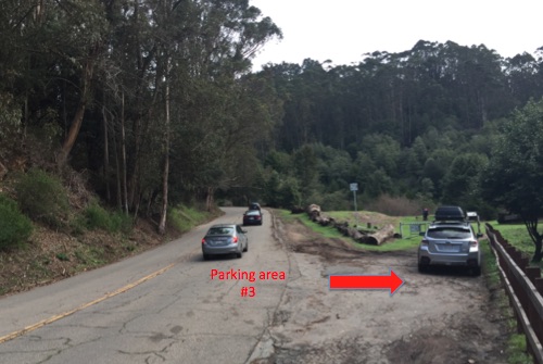
                37.870004, -122.225632 (opposite side of Claremont Ave) (See #3)
Parking: Free 2-hour parking available in the neighborhood near parking area #1. Please be respectful of residents. Pullouts with no     
               time limits at parking areas #2 and #3.

Hours: 5 A.M. to 10 P.M.
Type: Hike (moderate/3 miles)
Regulations: Dogs allowed off-leash if under voice control
Best time to visit: Anytime on a cool day
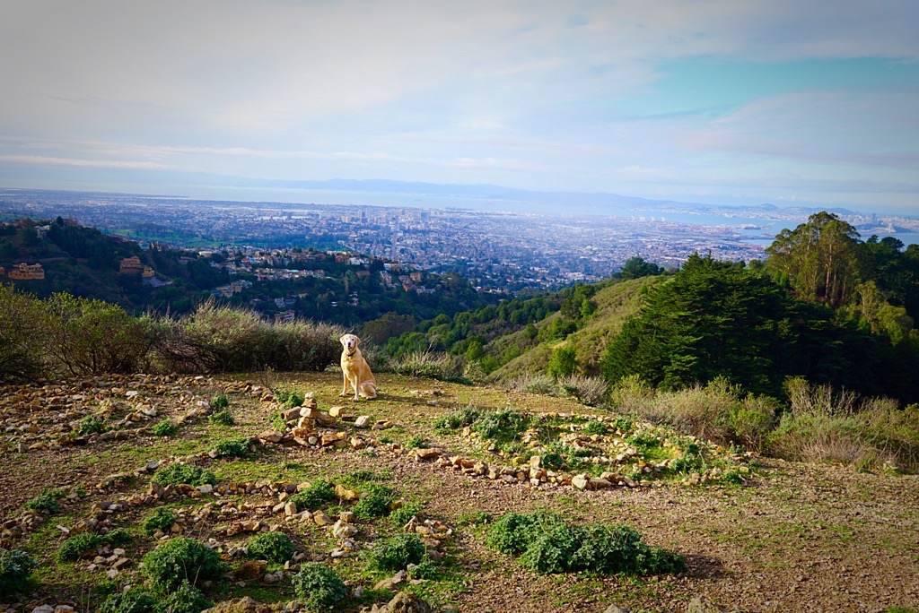
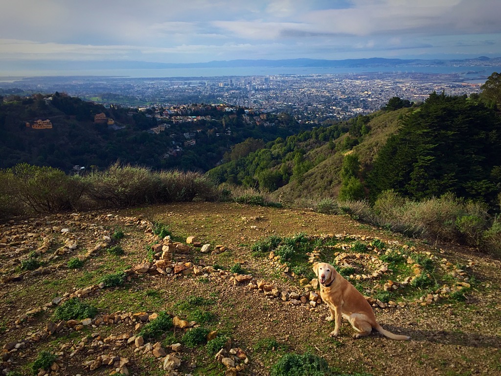
Don't miss: The labyrinth! (see bottom of page for hiking/parking directions)


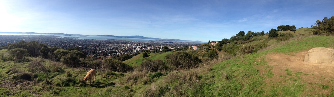
Description: This 500-acre preserve is a popular park with some of the best views in the bay area. This park has trails on both sides of Claremont Ave, and you can even connect to trails into Strawberry Canyon, up to the Frowning Ridge firetrails, or even into Tilden. Below I have listed 3 different hikes from different starting points.

Panoramic Trail
Parking area #1 is the one most people are familiar with, and this gets crowded. There have also been car break-ins here, so be careful. From this parking area, there is only one trail from the trailhead, the Panoramic Trail, which begins with a steep hill. It levels off for a bit, and then there's a gradual uphill section of the trail with a bench overlooking the bay. After this, there's one more very steep section to tackle, and another bench to take a break. It's a short hike, but a tough couple of hills. When you reach the top you'll know it was definitely worth it because you'll be rewarded with breathtaking  panoramic views of the bay. You can continue your workout past the .05 mile paved section of Bancroft Place (where you see a house, but there are no cars on the road), and the Stonewall-Panoramic trail continues. You can keep hiking up to the East-West Trail all the way up to Grizzly Peak, or go down onto the Upper Jordan Trail which will take you into Strawberry Canyon. See below for hikes starting from parking areas #2 and #3.

Don't attempt this hike on a hot day, as it's in full sun exposure and the trails get hot.
Click here for a trail map courtesy of Claremont Canyon Conservancy

Directions to the labyrinth:

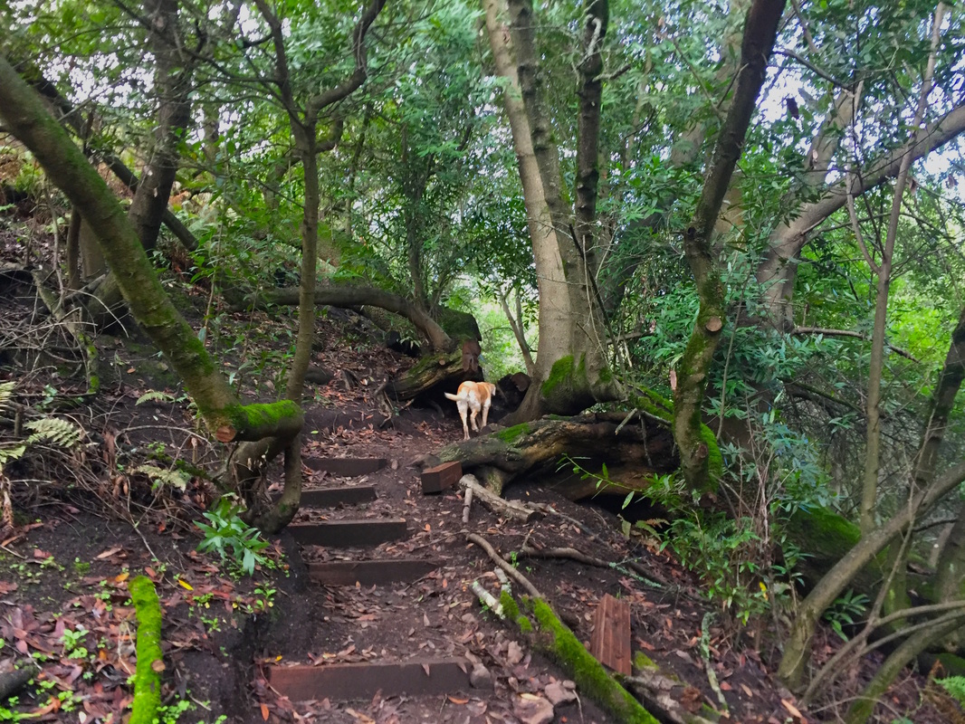
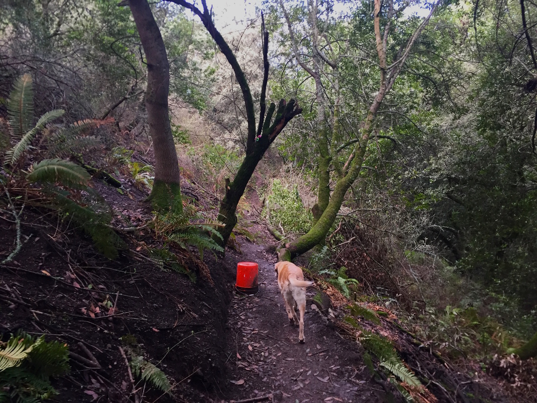
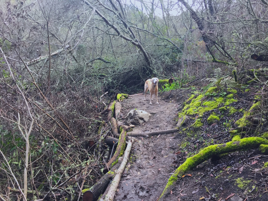
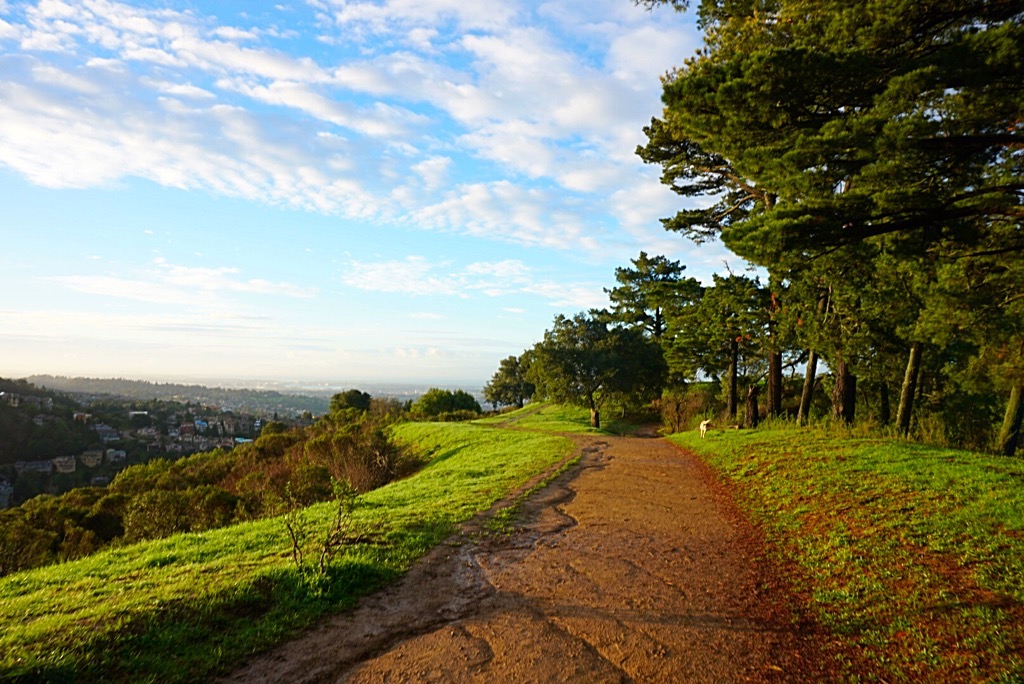
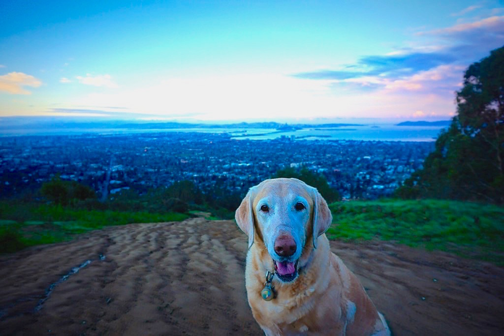
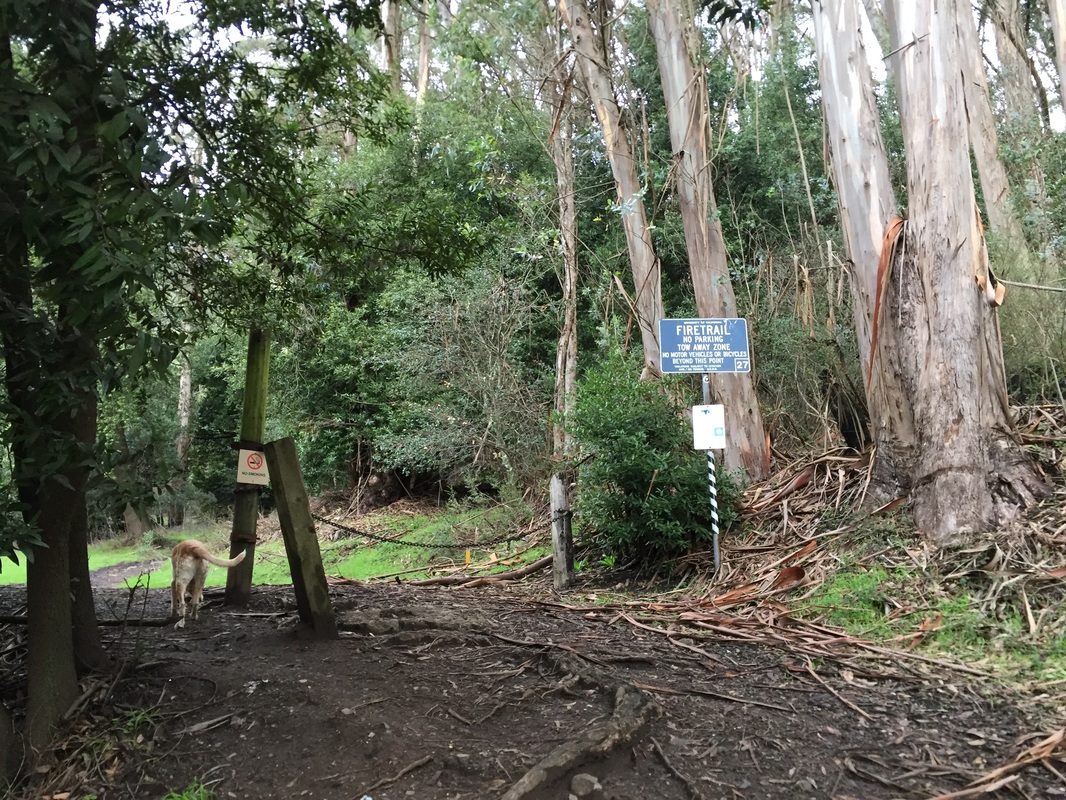
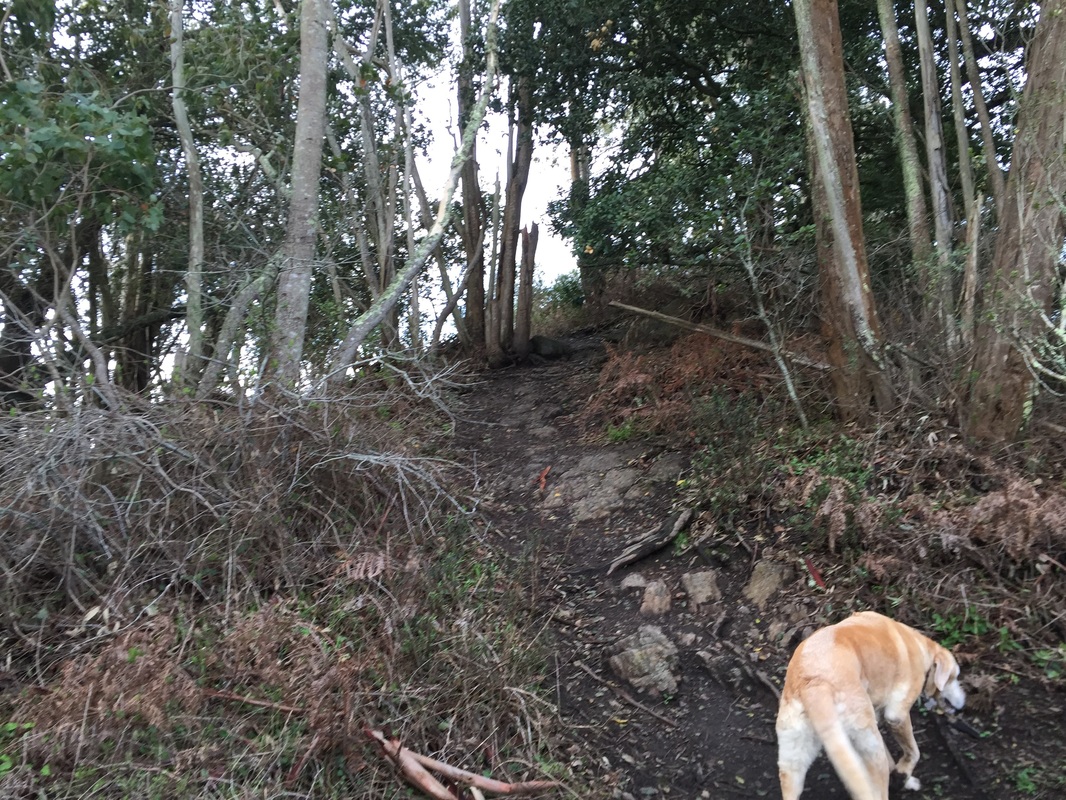
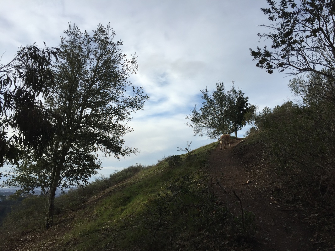
From parking area #2, it's easiest to reach the labyrinth. Heading up Claremont Ave, pass the back side of the Claremont hotel, continue past Stonewall Rd (the main entrance), and after about 1.3 miles you will see a pullout on the left side of Claremont. Park here. There's a new trail map here. Take the steep fire trail up 0.35 miles and you will come to a flat intersection at the top with 3 options for continuing the trail to your left, right, or straight ahead. Take the trail to your left. You'll hike up two small hills, and right before the trail starts leading steeply downhill (which takes you to Stonewall Dr), take the unmarked trail to your right. It's a little overgrown but you can spot the trail pretty easily. Walk up, over some boulders, and in about 200 ft you'll see the labyrinth overlooking the bay. From here, you can retrace your steps back, head down to Stonewall Dr, or even into Strawberry Canyon. You can also reach this spot from the Stonewall Drive trail head, by just continuing up the Panoramic trail, but it's a longer and more strenuous route.
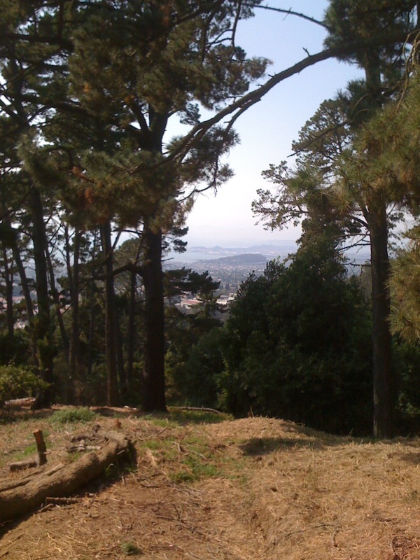
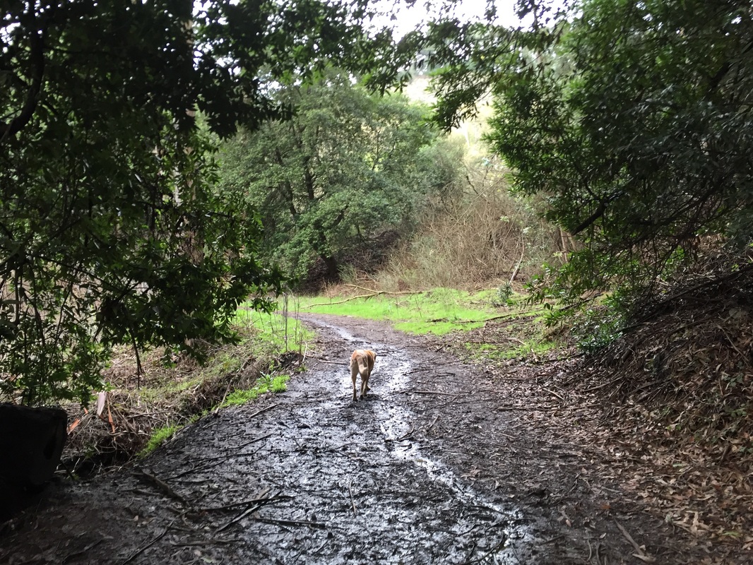
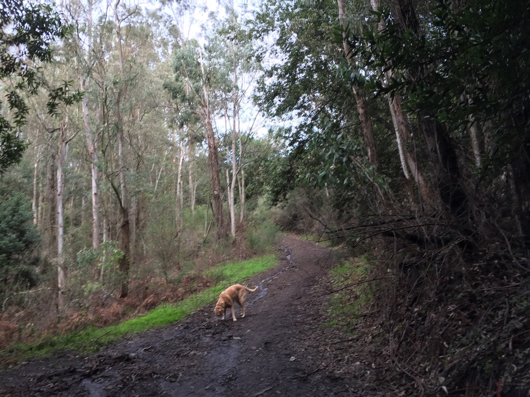
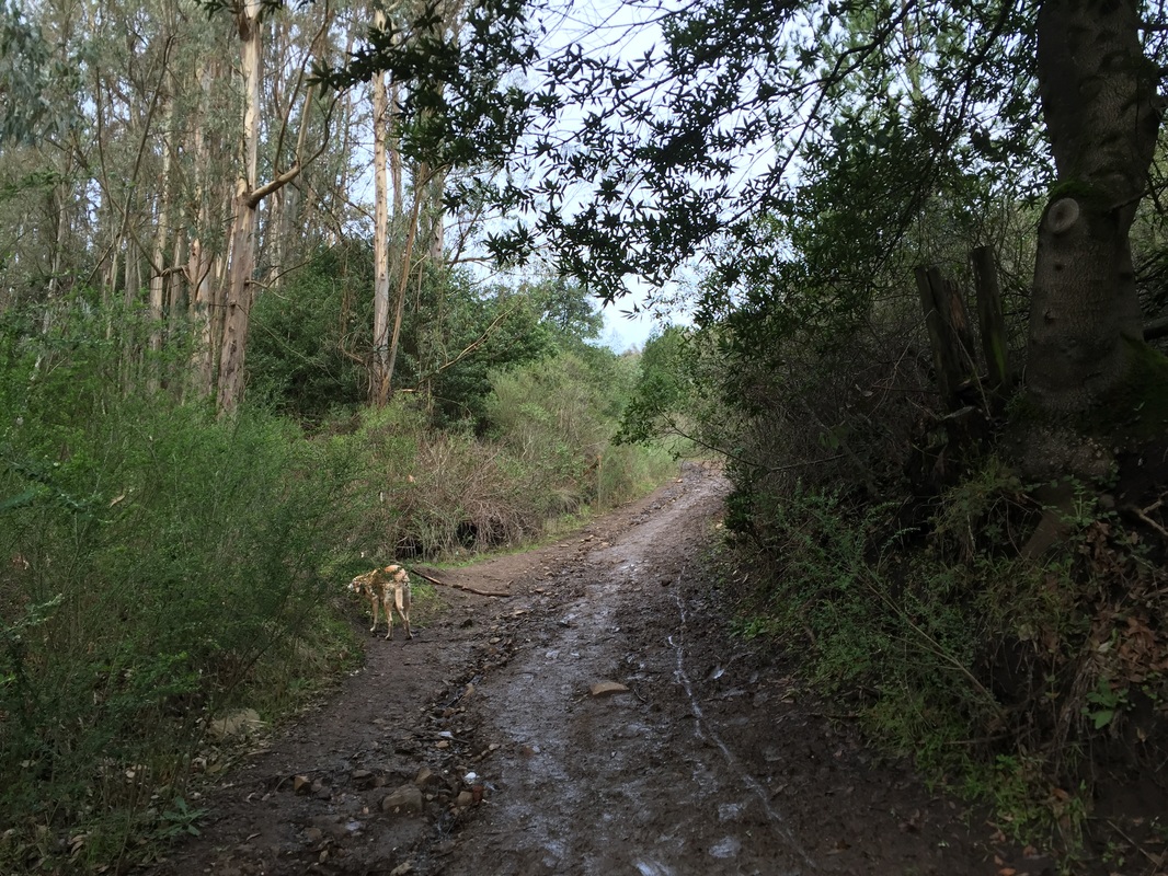
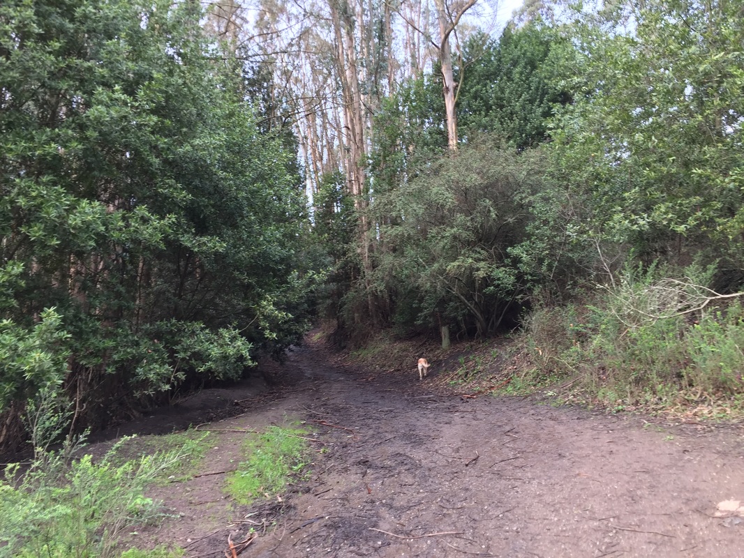
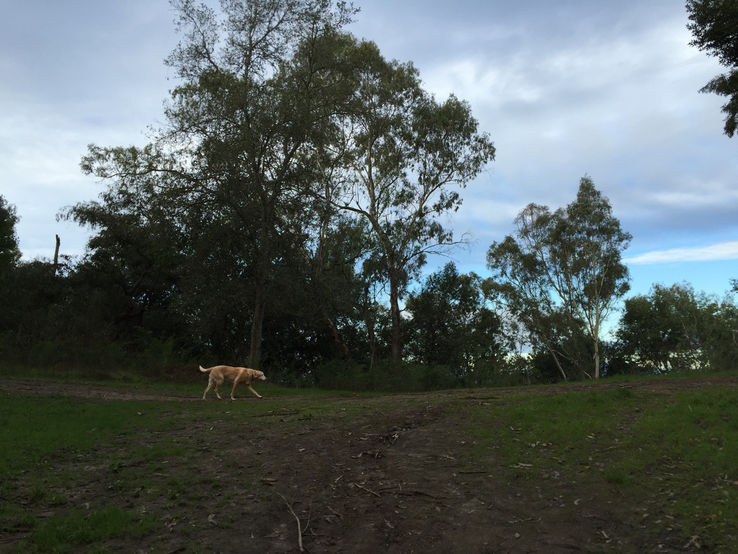
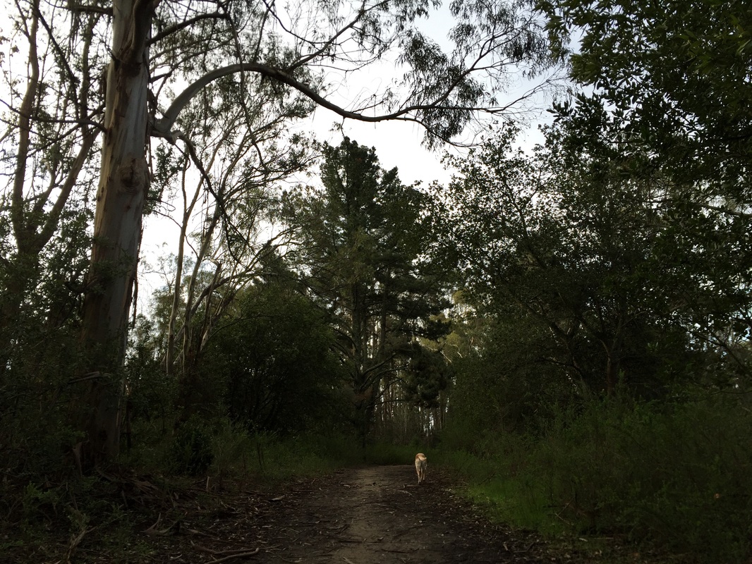
Photos of the trail mentioned above, with pictures heading up to the labyrinth:

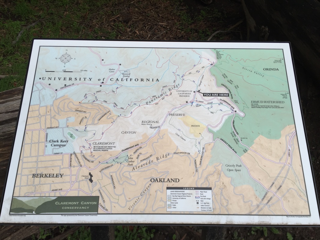
Summit House & Willow Trails

From parking area #3, at signpost 29, you can hike the little-known trails on the right side of Claremont Ave. The hikes described above have both been on the left side of Claremont Ave. Heading up Claremont Ave, pass the back side of the Claremont hotel, continue past Stonewall Rd (the main entrance), and after about 1.1 miles you will see a pullout on the right side of Claremont with a fire gate. Park here, but don't block the gate. Walk past the gate and you will see a trail post for two trails: Summit House Trail and Willow Trail. This is a beautiful loop with some shade, and after a rain you can hear the creek running nearby. If you take Willow Trail down to your right and then loop over to Summit House on your left, you'll have a short, approximately 1 mile loop hike with a few hills. You can also continue down Willow Trail to your right, which will take you along the creek for over a mile down into Gwin Canyon. This trail ends a little past the trailhead in the neighborhood on Norfolk Rd. You can hike back from here and even add the loop to make a 3 mile hike. Currently there are some trail improvements taking place on the bridge and stairs on Willow Trail (as of February 26, 2016).
Click here for a trail map courtesy of Claremont Canyon Conservancy
Contact Us
Privacy Policy
Terms and Conditions
All content within this site Copyright © 2023 Hikes Dogs Love. All rights reserved. No part of this website may be reproduced without permission.
DMCA.com Protection Status
  • Home
  • Map View
    • Vacation Hikes >
      • Arizona >
        • Papago Park
      • New Mexico >
        • Oliver Lee Memorial State Park >
          • Browse All >
            • Alameda County >
              • Albany Bulb
              • Alameda Creek Regional Trail
              • Barlago Italian Kitchen
              • Brickyard Cove
              • Brushy Peak Regional Preserve
              • Anthony Chabot Regional Park (Lake Chabot)
              • Aquatic Park
              • Buchanan Dog Beach
              • California Canoe & Kayak (Oakland)
              • Cali Kid Burgers ‘N Shakes
              • César Chávez Park
              • Chabot Park
              • Claremont Canyon
              • Coyote Hills Regional Park
              • Crab Cove
              • Cull Canyon Regional Recreation Area
              • Dimond Canyon Park
              • Don Castro Regional Recreation Area
              • Don Edwards Wildlife Refuge
              • Dublin Hills Regional Park
              • Emeryville Marina
              • Fairmont Ridge
              • Five Canyons Open Space Preserve
              • Fremont Central Park
              • Garin/Dry Creek Pioneer Regional Park
              • Gilman Brewing Company
              • Greenbelt Trails
              • Hayward Regional Shoreline
              • Heron Bay Trail
              • Ikaros Greek Restaurant
              • Jerusalem Organic Kitchen
              • Joaquin Miller Park
              • Lake Anza
              • Lake Chabot
              • Lake Merritt
              • Leona Canyon Regional Open Space Preserve
              • Leona Heights Park
              • Marina Park
              • Martin Canyon Creek Trail
              • Martin Luther King Jr. Regional Shoreline
              • Mission Peak
              • Montclair Railroad Trail/ Torii Gate
              • Morgan Territory Regional Preserve
              • Oyster Bay Regional Shoreline
              • Park Street Classic Car Show (Annual)
              • Pleasanton Ridge Regional Preserve
              • Point Emery
              • Reinhardt Redwood Regional Park
              • Robert's Park
              • Room 389
              • Shoreline Park
              • Sibley Volcanic Regional Preserve
              • Skyline Gate Staging Area
              • Strawberry Canyon Fire Trail
              • Sunol Regional Wilderness
              • Temescal Regional Recreation Area
              • Tilden Regional Park
              • Upper Anthony Chabot Regional Park (Oakland Entrance)
              • Upper Knowland Park
              • Vargas Plateau Regional Park
            • Butte County >
              • Feather Falls
              • Motel 6 - Oroville
              • Riverbend Park
            • Contra Costa County >
              • Acalanes Ridge Open Space
              • Briones Regional Park
              • Carquinez Strait Regional Shoreline
              • Crockett Hills Regional Park
              • Diablo Foothills Regional Park
              • EBMUD Trails
              • Fernandez Ranch
              • Frowning Ridge
              • Geppetto's Caffe
              • Hacienda de las Flores Park
              • Hillside Nature Area
              • Howe Homestead Park
              • Indian Rock
              • Kennedy Grove Regional Recreation Area
              • Lafayette Community Park
              • Lafayette Reservoir
              • Las Trampas Regional Wilderness
              • Lime Ridge Open Space
              • Miller/Knox Regional Shoreline
              • Moraga Commons Park
              • Mulholland Ridge Open Space Preserve
              • Point Isabel
              • Point Molate Beach Park
              • Point Pinole Regional Shoreline
              • Point San Pablo Harbor
              • Rubio's
              • San Quentin Beach
              • Shell Ridge Open Space
              • Sobrante Ridge Regional Preserve
              • Sugarloaf Open Space
              • Sycamore Valley Open Space Preserve
              • Tender Greens
              • Tilden Regional Park
              • Wildcat Canyon Regional Park
            • El Dorado County >
              • Angora Lakes Trail
              • Bijou Community Park
              • Cascade Falls
              • Horsetail Falls
              • Inspriation Point
              • Motel 6 - South Lake Tahoe
              • Mt. Tallac
            • Marin County >
              • 101 Surf Sports
              • Baltimore Canyon Open Space Preserve
              • Blackie's Pasture
              • Camino Alto Preserve
              • Carson Falls
              • Cascade Falls
              • Cataract Falls
              • Dawn Falls
              • Hippie Tree
              • Ignacio Valley Preserve (Fairway Falls)
              • Indian Valley Open Space Preserve
              • King Mountain Open Space Preserve
              • Marin Headlands (Coastal Trail)
              • Old Saint Hilary's Open Space Preserve
              • Phoenix Lake
              • Red Hill Dog Park
              • Red Hill Trail
              • Ring Mountain Open Space Preserve
              • Roy's Redwoods
              • Sam's Anchor Cafe
              • Sorich Ranch Park
              • Tiburon Peninsula Historical Trail
              • Tiburon Uplands
              • Tucker Trail Falls
            • Mariposa County >
              • Happy Burger Diner
              • Yosemite National Park
            • Mendocino County >
              • Catch-a-Canoe
              • Gowan's Heirloom Ciders
              • MacKerricher State Park
              • Mendocino Headlands State Park
              • Navarro River Redwoods State Park
              • Princess Seafood
              • Skunk Train
              • The Stanford Inn By The Sea
              • Van Damme State Beach
            • Mono County >
              • Bodie State Historic Park
              • Jolly Kone
              • Lundy Canyon
              • Mono Lake (Tufa State National Reserve)
              • Virginia Creek Settlement
            • Monterey County >
              • 17-Mile Drive
              • Asilomar State Beach
              • Bistro Beaujolais
              • Carmel Beach
              • Fishwife
              • Fort Ord Dunes State Park
              • Garland Ranch Regional Park
              • Jack's Peak
              • Monterey Bay Coastal Trail
              • Monterey Bay Kayaks
              • Monterey Municipal Beach
              • Motel 6 - Downtown Monterey
              • Ryan Ranch Disc Golf Course
              • Ventana Wilderness
            • Nevada County >
              • Fairy Falls
            • Placer County >
              • Hidden Falls
              • Regional Park Auburn Disc Golf Course
              • Thirsty Barrel Taphouse & Grille
              • Wolf Creek Trail
              • The Yeti Tavern
            • San Francisco County >
              • 2.2 Mile Urban Hike
              • Bernal Heights Park
              • The Brixton
              • Billy Goat Hill Park
              • Blackwood
              • Clipper Cove Beach
              • Crissy Field
              • Dynamo Donut + Coffee
              • Fort Funston
              • Fort Mason
              • Glen Canyon Park
              • Golden Gate Park
              • Grand View Park
              • The Great Lawn/ Avenue of the Palms
              • Java Beach Cafe
              • John McLaren Park
              • Interior Greenbelt
              • Lake Merced
              • Lands End
              • Letterman Digital Arts Center
              • Marina Green
              • Mount Davidson
              • Mount Sutro Open Space Reserve
              • Ocean Beach
              • Palace of Fine Arts
              • Philz Coffee Truck
              • Stern Grove
              • Sutro Baths
              • Sutro Heights Park
              • TreasureFest
            • San Mateo County >
              • 7 Mile House Sports Bar & Grill
              • Barbara's Fishtrap
              • Bedwell Bayfront Park
              • Bob's Vegetable Stand and Pumpkin Farm
              • Cafe Pacifica
              • Devil's Slide Coastal Trail
              • Esplanade Beach
              • Flying Fish Grill
              • Half Moon Bay Kayak Co.
              • McNee Ranch State Park (Montara Mountain)
              • Montara State Beach
              • Mori Point
              • Mussel Rock Park
              • Nick's Seafood Restaurant
              • Panera Bread
              • Pedro Point Headlands
              • Poplar Beach
              • Pulgas Ridge Open Space Preserve
              • Rancho Corral de Tierra
              • Seal Point
              • Taqueria La Mexicana
              • Wavecrest Open Space
            • Santa Clara County >
              • Byxbee Park
              • Calero County Park
              • Uvas Canyon County Park
            • Santa Cruz County >
              • Byrne-Milliron Forest
              • Greyhound Rock County Park
              • Henry Cowell Redwoods State Park
              • Jaliscos Restaurant
              • Mount Madonna County Park
              • Roaring Camp Railroads
            • Solano County >
              • Alvarez 9th Street Park
              • Benicia Classic Car Show
              • Benicia Waterfront
              • Lagoon Valley Park
              • Peña Adobe Regional Park
            • Sonoma County >
              • Doran Regional Park
              • Fishetarian
              • Helen Putnam Regional Park
            • Tuolumne County >
              • Donnell Vista
              • Tuttletown Recreation Area
            • Yuba County >
              • Ellis Lake
        • White Sands National Monument
      • Oregon >
        • Multnomah Falls
      • Washington >
        • Olympic National Park >
          • Kalaloch Beach
          • Madison Falls
          • Quinault Rainforest
        • Rattlesnake Ridge
  • More
    • Vacation Spots >
      • Restaurants >
        • Southern California >
          • Fire Island Grill
          • Lazy Dog Restaurant & Bar
          • Perkies Coffee Haus
        • Washington >
          • Rose Pho
    • Archived Hikes >
      • Archived Hikes 2
      • Archives 2016-2018
    • Planning Your Trip
    • Dog Gear
    • About >
      • Contact Us
      • Privacy Policy
      • Terms and Conditions