Hikes Dogs Love
  • Home
  • Browse All
    • Alameda County >
      • Albany Bulb
      • Alameda Creek Regional Trail
      • Anthony Chabot Regional Park (Lake Chabot)
      • Aquatic Park
      • Chabot Park
      • Barlago Italian Kitchen
      • Buchanan Dog Beach
      • California Canoe & Kayak (Oakland)
      • César Chávez Park
      • Claremont Canyon
      • Coyote Hills Regional Park
      • Crab Cove
      • Cull Canyon Regional Recreation Area
      • Dimond Canyon Park
      • Don Castro Regional Recreation Area
      • Don Edwards Wildlife Refuge
      • Dublin Hills Regional Park
      • Fairmont Ridge
      • Five Canyons Open Space Preserve
      • Fremont Central Park
      • Garin/Dry Creek Pioneer Regional Park
      • Greenbelt Trails
      • Hayward Regional Shoreline
      • Heron Bay Trail
      • Holy Land Restaurant
      • Ikaros Greek Restaurant
      • Jerusalem Organic Kitchen
      • Joaquin Miller Park
      • Lake Anza
      • Lake Chabot
      • Lake Merritt
      • Leona Canyon Regional Open Space Preserve
      • Leona Heights Park
      • Marina Park
      • Martin Canyon Creek Trail
      • Martin Luther King Jr. Regional Shoreline
      • Mission Peak
      • Montclair Railroad Trail/ Torii Gate
      • Morgan Territory Regional Preserve
      • Oyster Bay Regional Shoreline
      • Park Street Classic Car Show (Annual)
      • Pleasanton Ridge Regional Preserve
      • Reinhardt Redwood Regional Park
      • Robert's Park
      • Room 389
      • Shoreline Park
      • Sibley Volcanic Regional Preserve
      • Skyline Gate Staging Area
      • Strawberry Canyon Fire Trail
      • Sunol Regional Wilderness
      • Temescal Regional Recreation Area
      • Tilden Regional Park
      • Upper Anthony Chabot Regional Park (Oakland Entrance)
      • Upper Knowland Park
      • Vargas Plateau Regional Park
    • Butte County >
      • Feather Falls
      • Motel 6 - Oroville
      • Riverbend Park
    • Contra Costa County >
      • Acalanes Ridge Open Space
      • Briones Regional Park
      • Carquinez Strait Regional Shoreline
      • Crockett Hills Regional Park
      • Diablo Foothills Regional Park
      • EBMUD Trails
      • Fernandez Ranch
      • Frowning Ridge
      • Geppetto's Caffe
      • Hacienda de las Flores Park
      • Hillside Nature Area
      • Howe Homestead Park
      • Indian Rock
      • Kennedy Grove Regional Recreation Area
      • Lafayette Community Park
      • Lafayette Reservoir
      • Las Trampas Regional Wilderness
      • Lime Ridge Open Space
      • Miller/Knox Regional Shoreline
      • Moraga Commons Park
      • Mulholland Ridge Open Space Preserve
      • Point Isabel
      • Point Molate Beach Park
      • Point Pinole Regional Shoreline
      • Point San Pablo Harbor
      • Rubio's
      • San Quentin Beach
      • Shell Ridge Open Space
      • Sobrante Ridge Regional Preserve
      • Sugarloaf Open Space
      • Sycamore Valley Open Space Preserve
      • Tender Greens
      • Tilden Regional Park
      • Wildcat Canyon Regional Park
    • El Dorado County >
      • Angora Lakes Trail
      • Bijou Community Park
      • Cascade Falls
      • Horsetail Falls
      • Inspriation Point
      • Motel 6 - South Lake Tahoe
      • Mt. Tallac
    • Marin County >
      • 101 Surf Sports
      • Baltimore Canyon Open Space Preserve
      • Blackie's Pasture
      • Camino Alto Preserve
      • Carson Falls
      • Cascade Falls
      • Cataract Falls
      • Dawn Falls
      • Ignacio Valley Preserve (Fairway Falls)
      • Indian Valley Open Space Preserve
      • King Mountain Open Space Preserve
      • Marin Headlands (Coastal Trail)
      • Old Saint Hilary's Open Space Preserve
      • Phoenix Lake
      • Ring Mountain Open Space Preserve
      • Roy's Redwoods
      • Sam's Anchor Cafe
      • Tiburon Peninsula Historical Trail
      • Tucker Trail Falls
    • Mariposa County >
      • Happy Burger Diner
      • Yosemite National Park
    • Mendocino County >
      • Catch-a-Canoe
      • MacKerricher State Park
      • Mendocino Headlands State Park
      • Navarro River Redwoods State Park
      • Princess Seafood
      • Skunk Train
      • The Stanford Inn By The Sea
      • Van Damme State Beach
    • Mono County >
      • Bodie State Historic Park
      • Jolly Kone
      • Lundy Canyon
      • Mono Lake (Tufa State National Reserve)
      • Virginia Creek Settlement
    • Monterey County >
      • 17-Mile Drive
      • Asilomar State Beach
      • Bistro Beaujolais
      • Carmel Beach
      • Fishwife
      • Fort Ord Dunes State Park
      • Garland Ranch Regional Park
      • Jack's Peak
      • Monterey Bay Coastal Trail
      • Monterey Bay Kayaks
      • Monterey Municipal Beach
      • Motel 6 - Downtown Monterey
      • Ryan Ranch Disc Golf Course
      • Ventana Wilderness
    • Nevada County >
      • Fairy Falls
    • Placer County >
      • Hidden Falls
    • San Francisco County >
      • 2.2 Mile Urban Hike
      • Bernal Heights Park
      • The Brixton
      • Billy Goat Hill Park
      • Blackwood
      • Clipper Cove Beach
      • Crissy Field
      • Dynamo Donut + Coffee
      • Fort Funston
      • Fort Mason
      • Glen Canyon Park
      • Golden Gate Park
      • Grand View Park
      • The Great Lawn/ Avenue of the Palms
      • Java Beach Cafe
      • John McLaren Park
      • Interior Greenbelt
      • Lake Merced
      • Lands End
      • Letterman Digital Arts Center
      • Marina Green
      • Mount Davidson
      • Mount Sutro Open Space Reserve
      • Ocean Beach
      • Palace of Fine Arts
      • Philz Coffee Truck
      • Stern Grove
      • Sutro Baths
      • Sutro Heights Park
      • TreasureFest
    • San Mateo County >
      • 7 Mile House Sports Bar & Grill
      • Barbara's Fishtrap
      • Bedwell Bayfront Park
      • Bob's Vegetable Stand and Pumpkin Farm
      • Cafe Pacifica
      • Devil's Slide Coastal Trail
      • Esplanade Beach
      • Flying Fish Grill
      • Half Moon Bay Kayak Co.
      • McNee Ranch State Park (Montara Mountain)
      • Montara State Beach
      • Mori Point
      • Mussel Rock Park
      • Panera Bread
      • Pedro Point Headlands
      • Poplar Beach
      • Pulgas Ridge Open Space Preserve
      • Rancho Corral de Tierra
      • Seal Point
      • Taqueria La Mexicana
      • Wavecrest Open Space
    • Santa Clara County >
      • Byxbee Park
      • Calero County Park
      • Uvas Canyon County Park
    • Santa Cruz County >
      • Byrne-Milliron Forest
      • Greyhound Rock County Park
      • Henry Cowell Redwoods State Park
      • Jaliscos Restaurant
      • Mount Madonna County Park
      • Roaring Camp Railroads
    • Solano County >
      • Lagoon Valley Park
      • Peña Adobe Regional Park
    • Sonoma County >
      • Doran Regional Park
      • Fishetarian
      • Helen Putnam Regional Park
    • Tuolumne County >
      • Donnell Vista
      • Tuttletown Recreation Area
    • Yuba County >
      • Ellis Lake
  • Map View
  • Vacation Spots
    • Vacation Hikes >
      • Arizona >
        • Papago Park
      • New Mexico >
        • Oliver Lee Memorial State Park
        • White Sands National Monument
      • Oregon >
        • Multnomah Falls
      • Washington >
        • Olympic National Park >
          • Kalaloch Beach
          • Madison Falls
          • Quinault Rainforest
        • Rattlesnake Ridge
    • Restaurants >
      • Southern California >
        • Fire Island Grill
        • Lazy Dog Restaurant & Bar
        • Perkies Coffee Haus
      • Washington >
        • Rose Pho
  • Planning Your Trip
  • About
    • Contact Us
    • Privacy Policy
    • Terms and Conditions
  • Dog Gear
  • Archived Hikes 1
    • Archived Hikes 2 >
      • Archives 2016-2018

Morgan Territory Regional Preserve

Address: 9401 Morgan Territory Rd, Livermore, CA 94551
Parking: Free parking lot at the address above
Hours: April 18-Sept 5: 8AM-8PM, Sept 6- Nov 5: 8AM-7PM, Nov 6- Dec 31: 8AM-5PM, Jan 1-31: 8AM-5PM, Feb 1- Mar 12: 8AM-6PM, Mar 13-Apr 17: 8AM-7PM
Type: Hike (moderate)
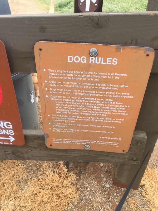
Dog Rules: Dogs allowed off-leash if under voice control in undeveloped areas. Bring a leash in case you encounter grazing cattle.
Best time to visit: Anytime except a very hot day. If it’s a hot day, stick to the shaded Coyote Trail.
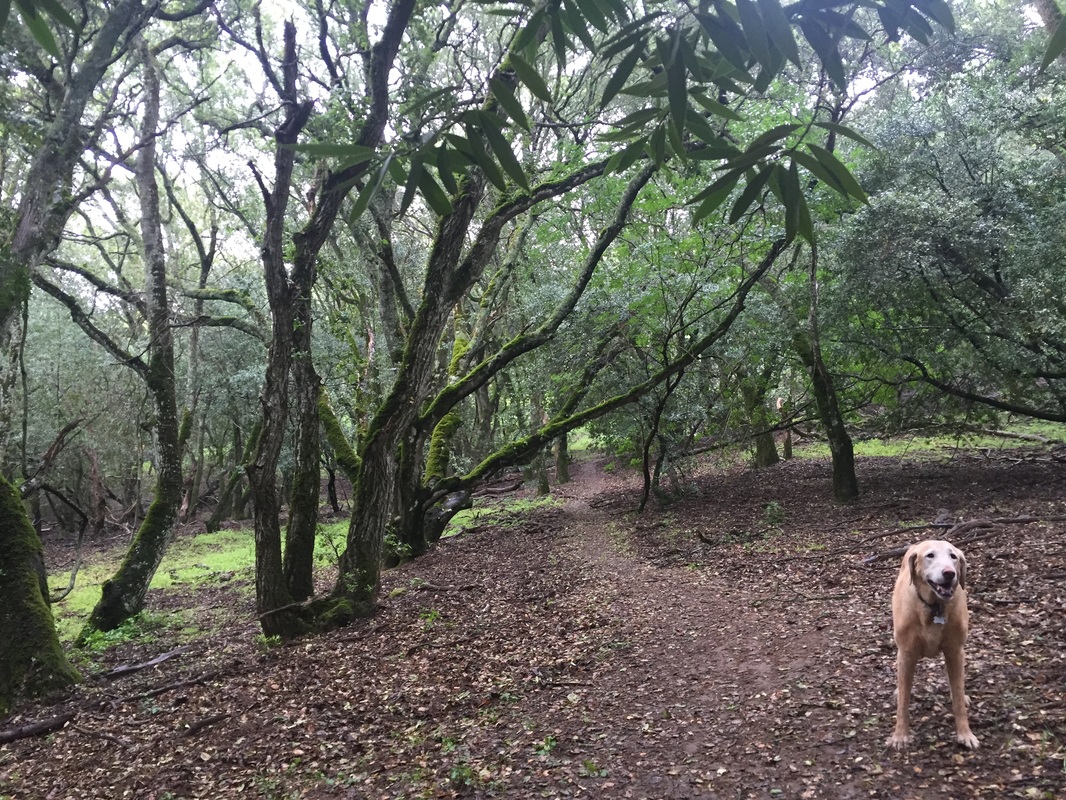
Don’t Miss: The Coyote Trail – it’s magical
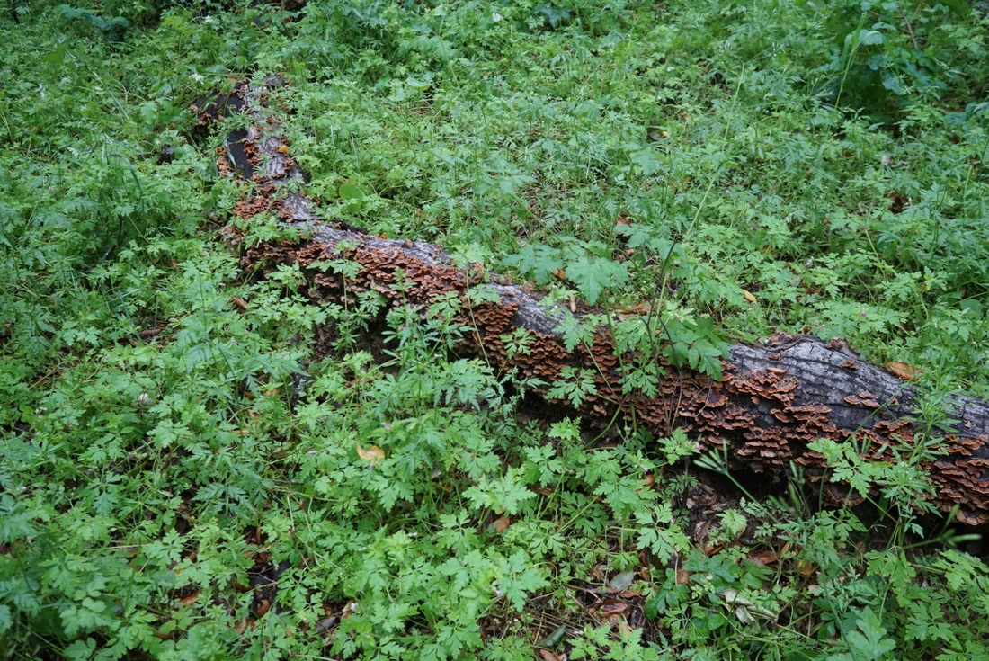
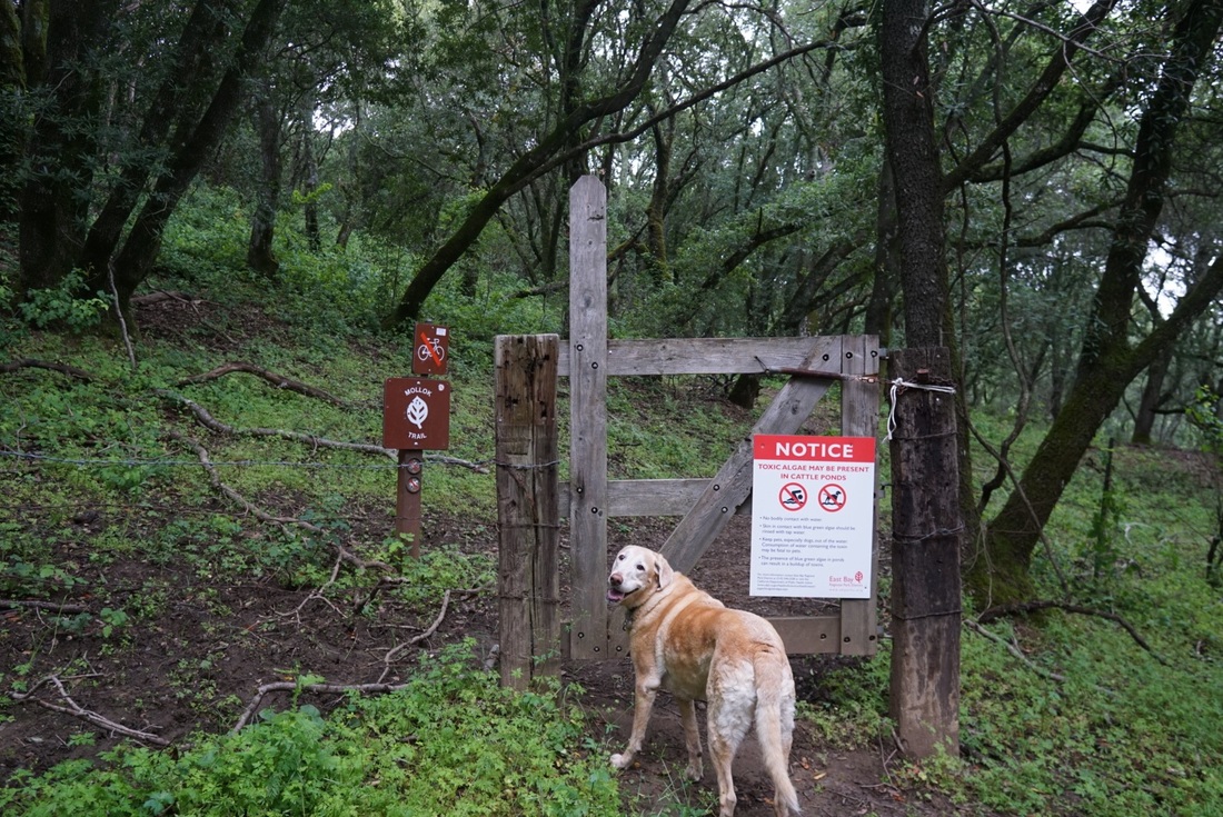
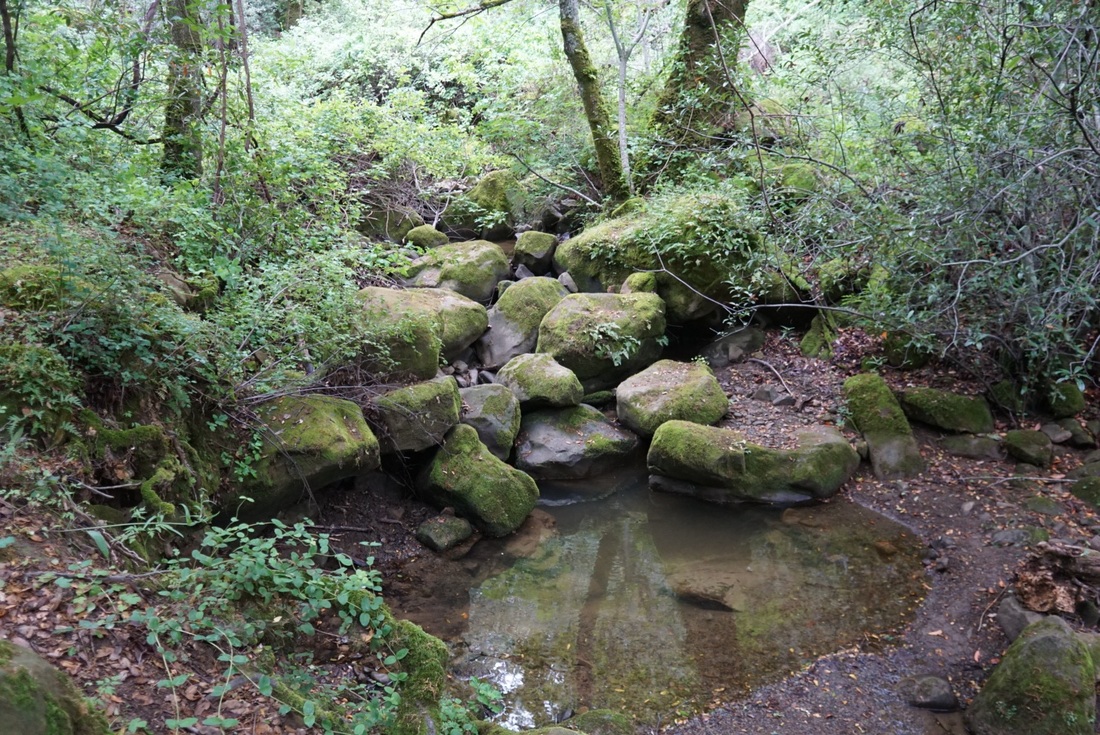
CAUTION: Do not let your dog drink from the streams or ponds, as there are warning signs that toxic blue-green algae are present in the water. As of September 2016, poison oak has become overgrown on some trails. This happens every year, and the EBRPD has plans to perform trail maintenance. If you're concerned about it, I recommend keeping your dog on-leash on narrow, single-track trails.
 
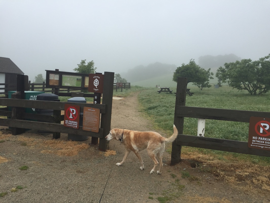
To reach the park: You will drive down a one-lane road for about 4.5 miles, but there's plenty of room for cars to pass on most of it. We went early and the last 2 miles were foggy with low visibility, so drive slowly and be cautious. Watch for deer and cyclists coming around the bend.
 
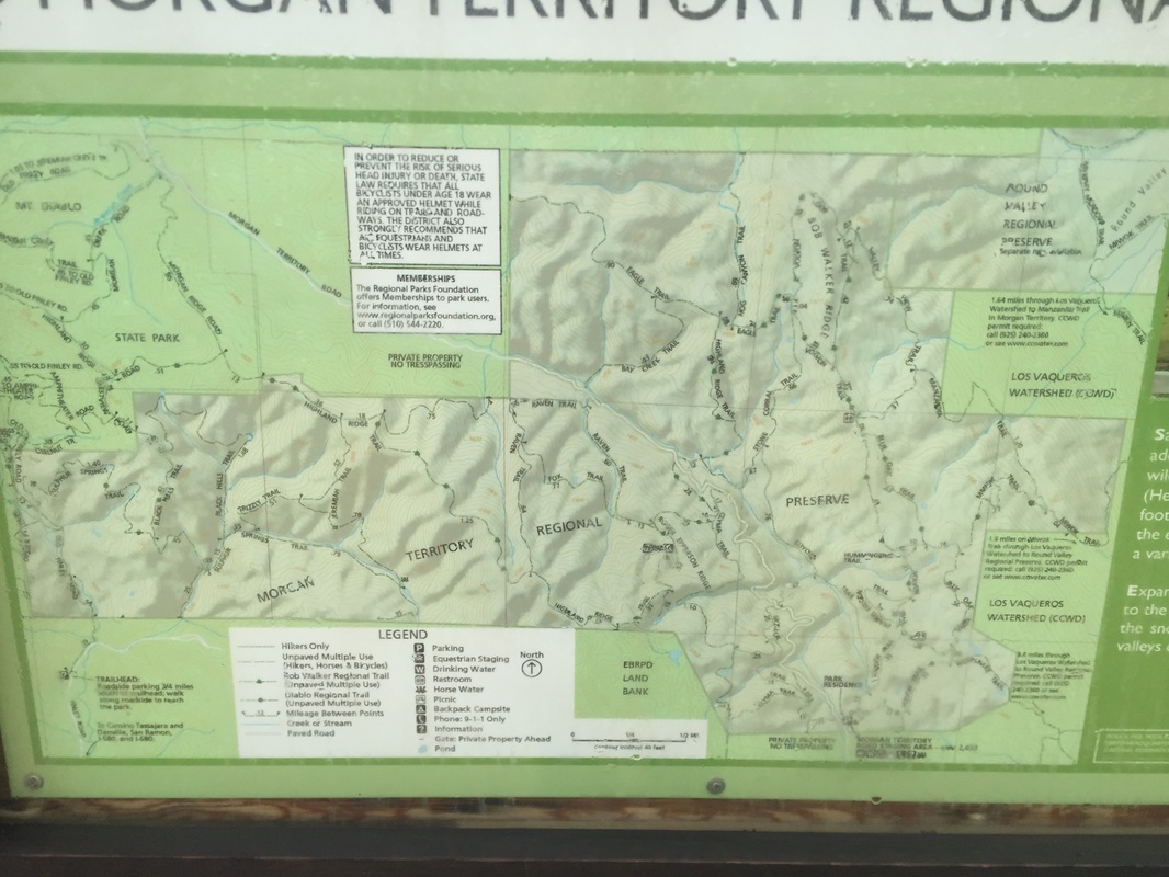
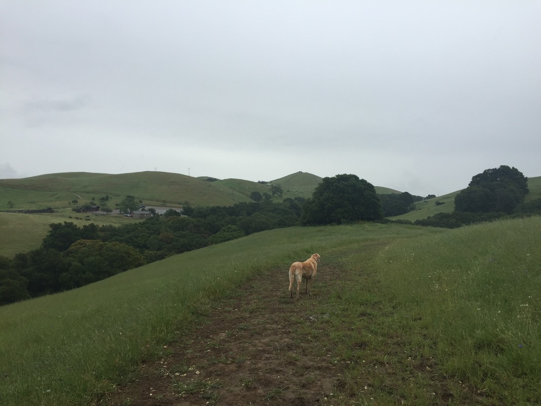
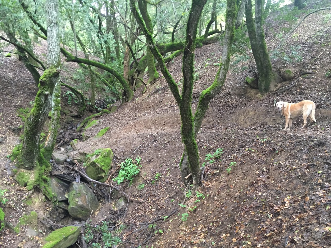
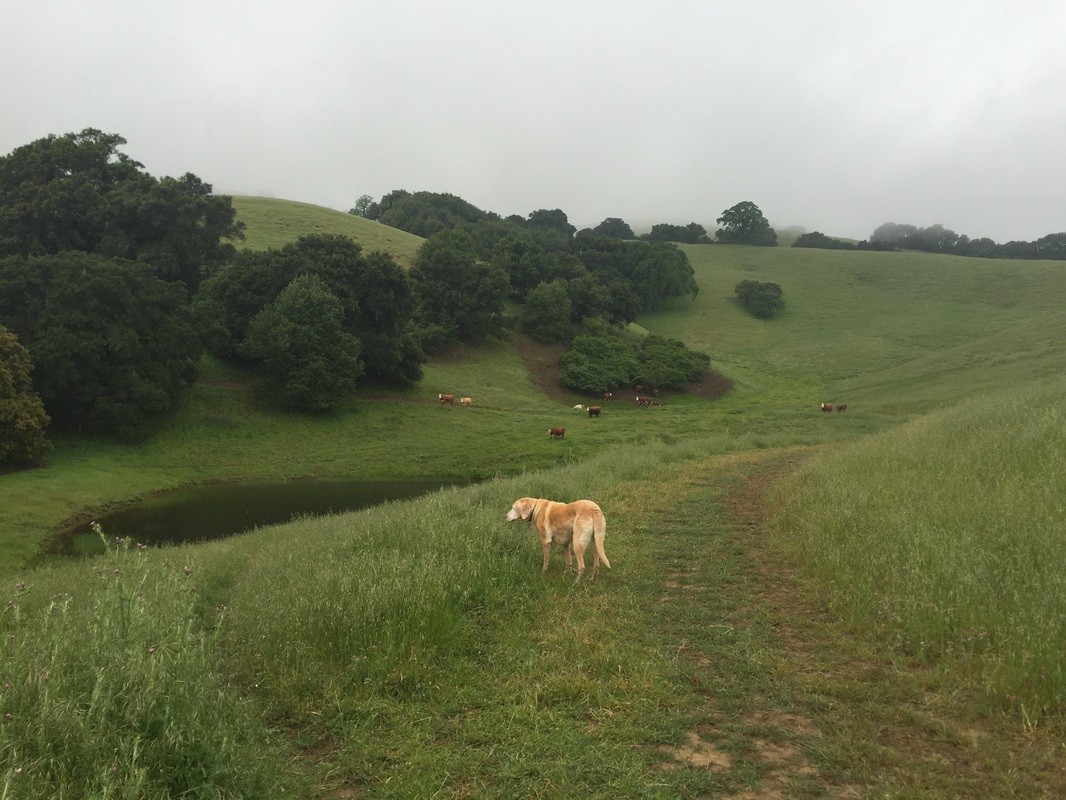
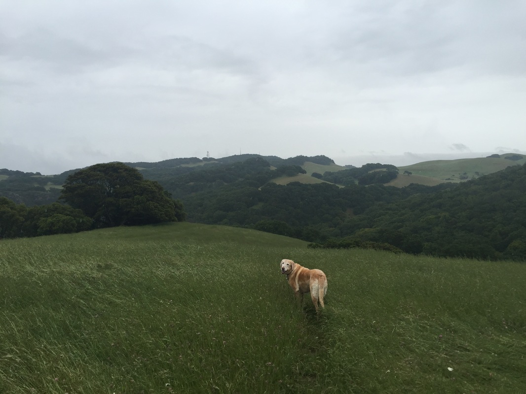
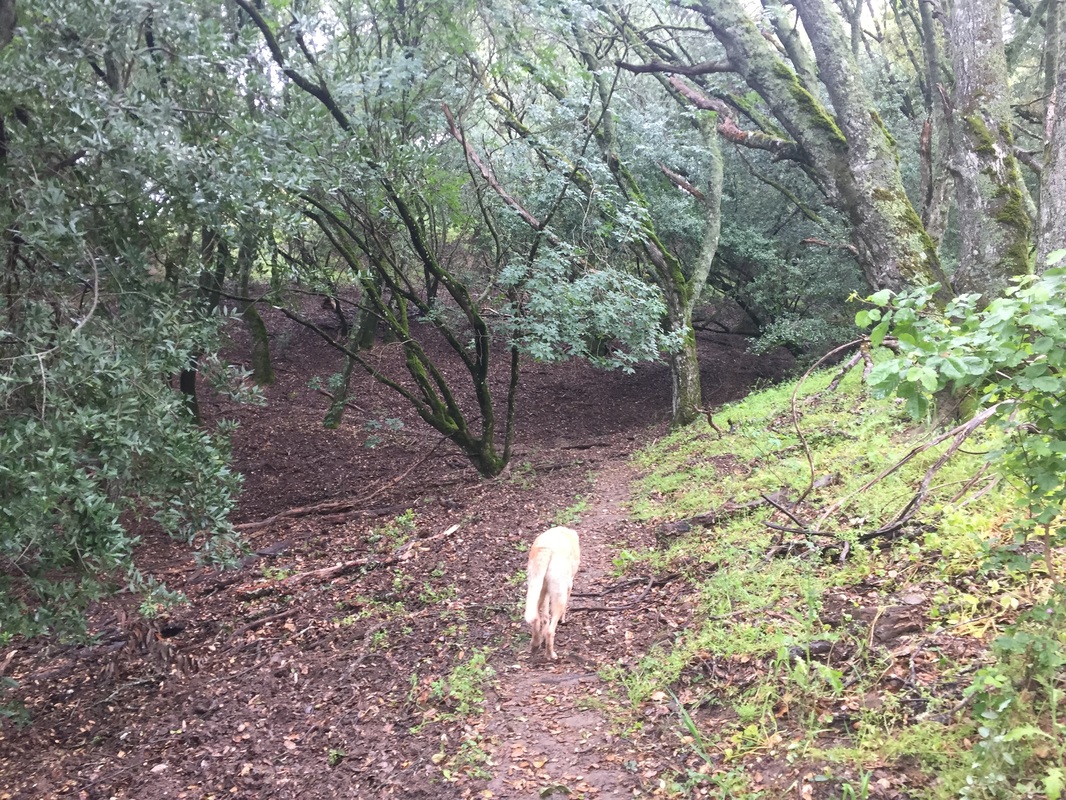
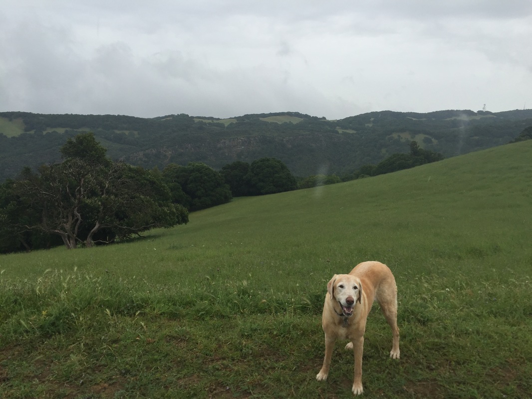
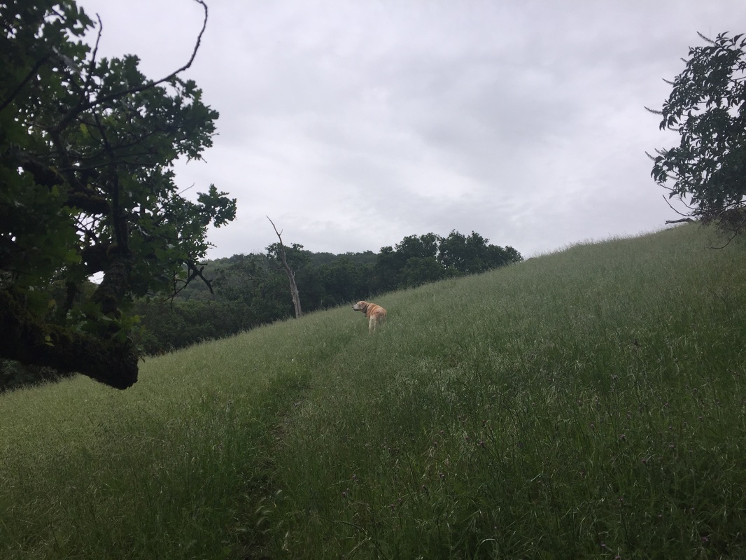
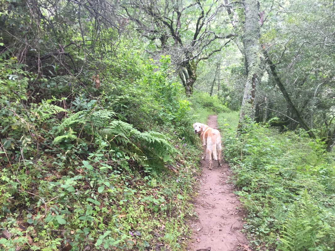
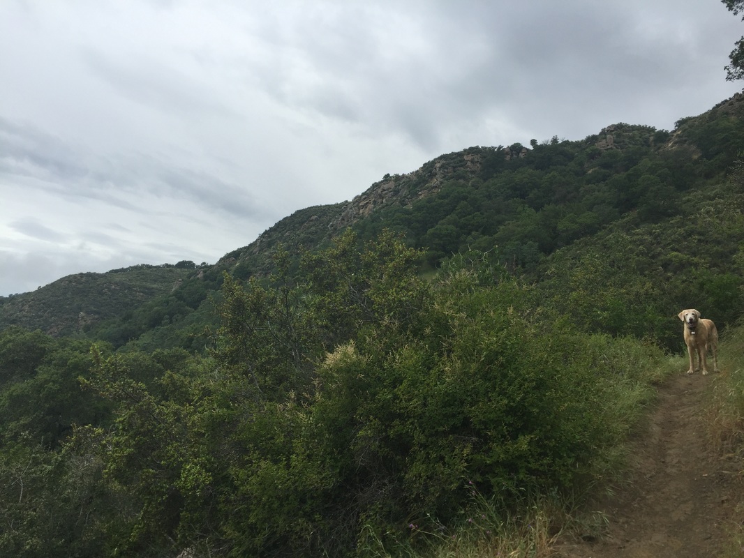
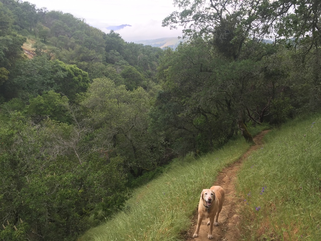
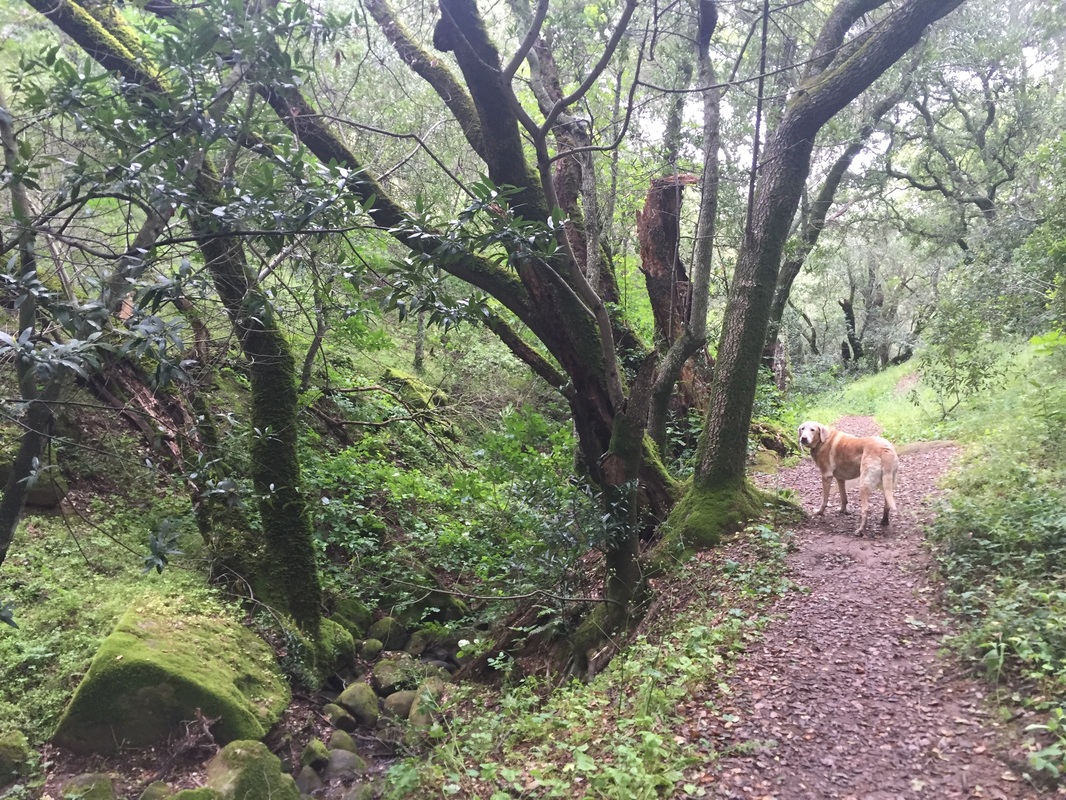
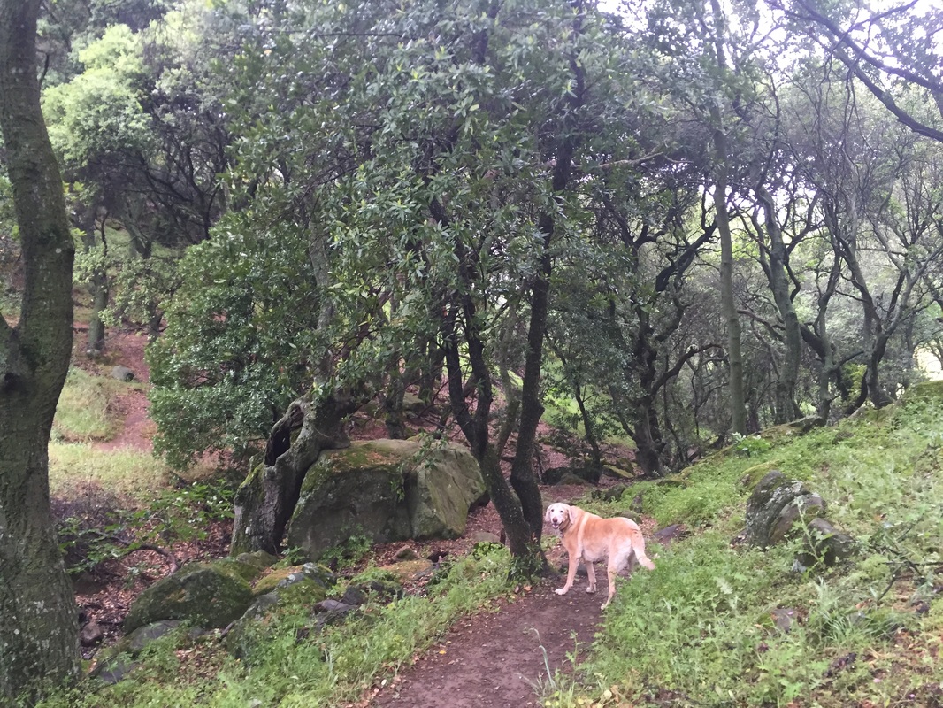
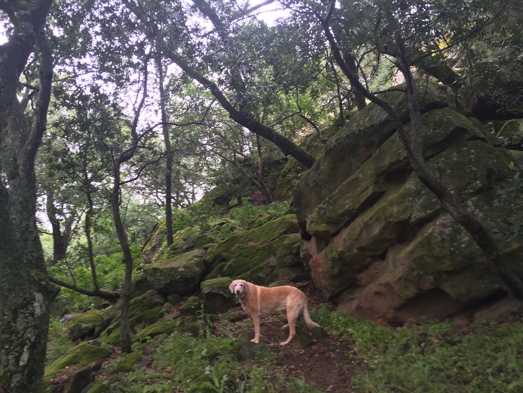
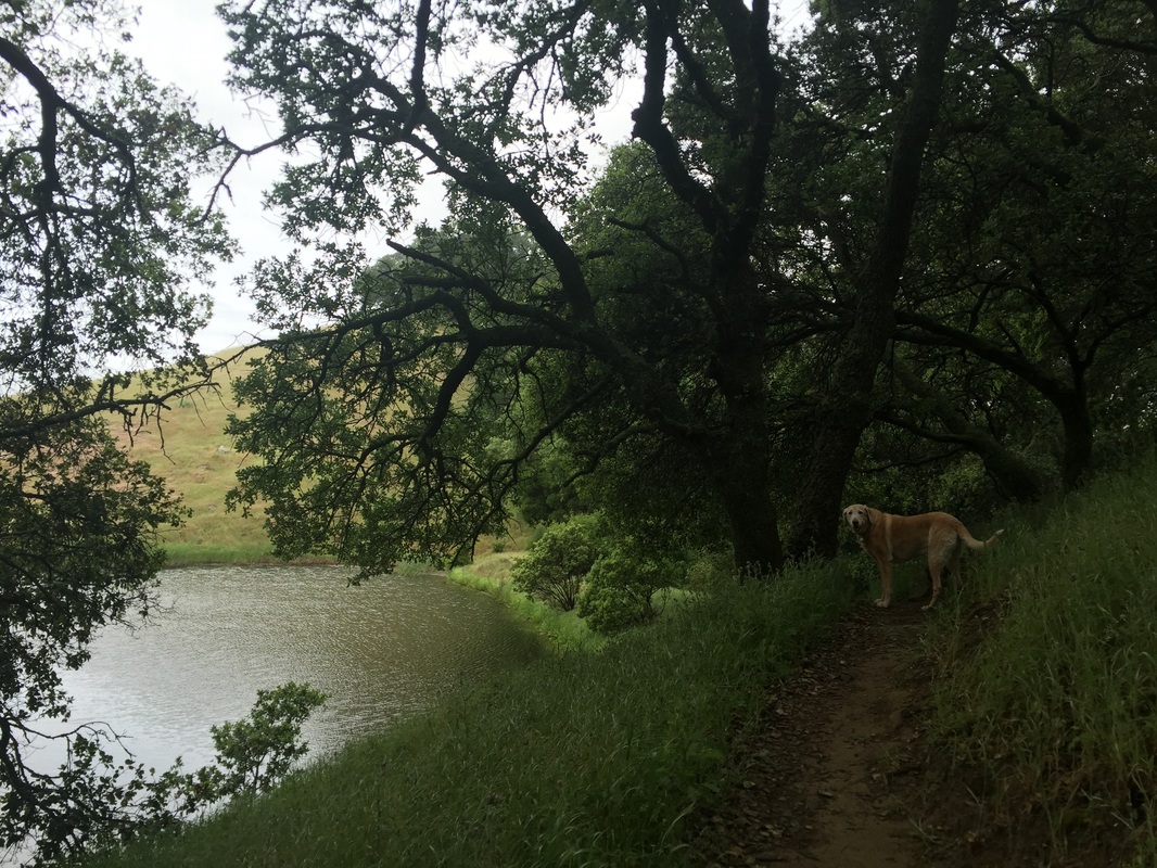
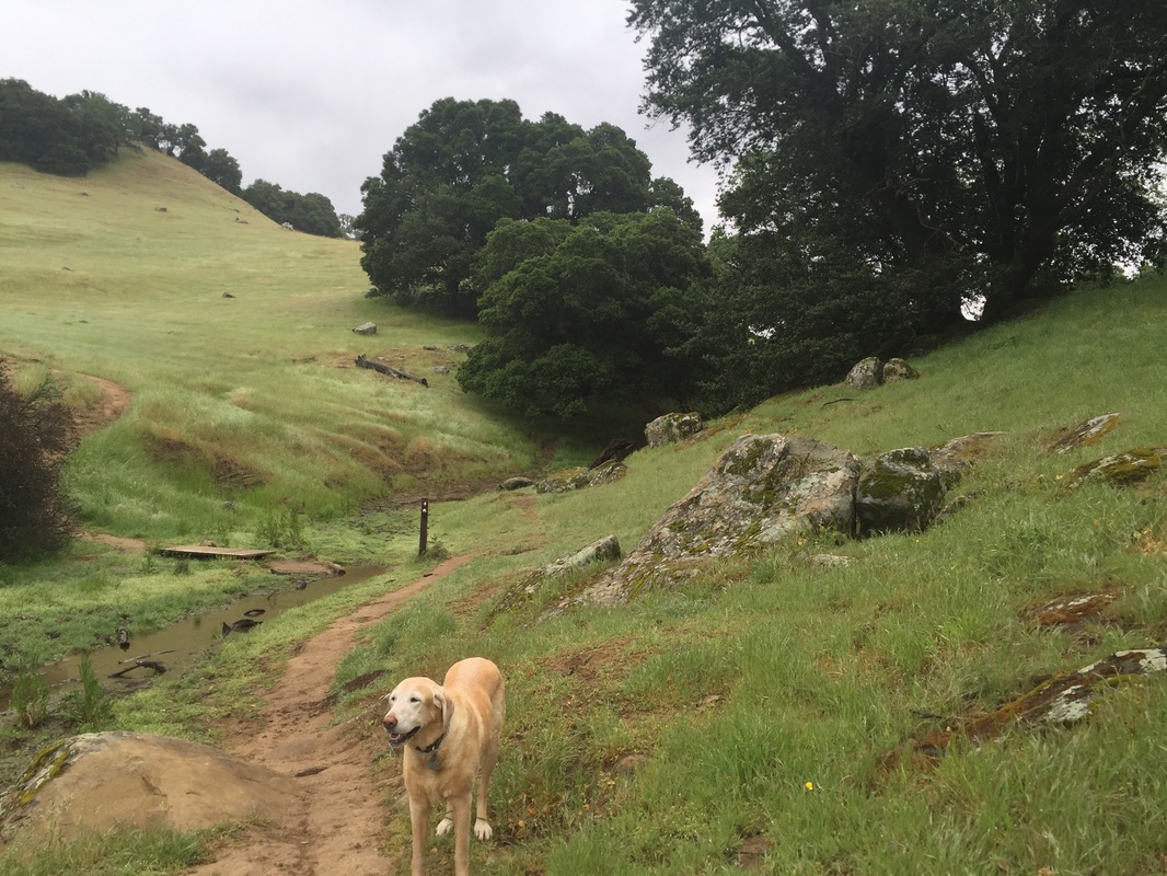
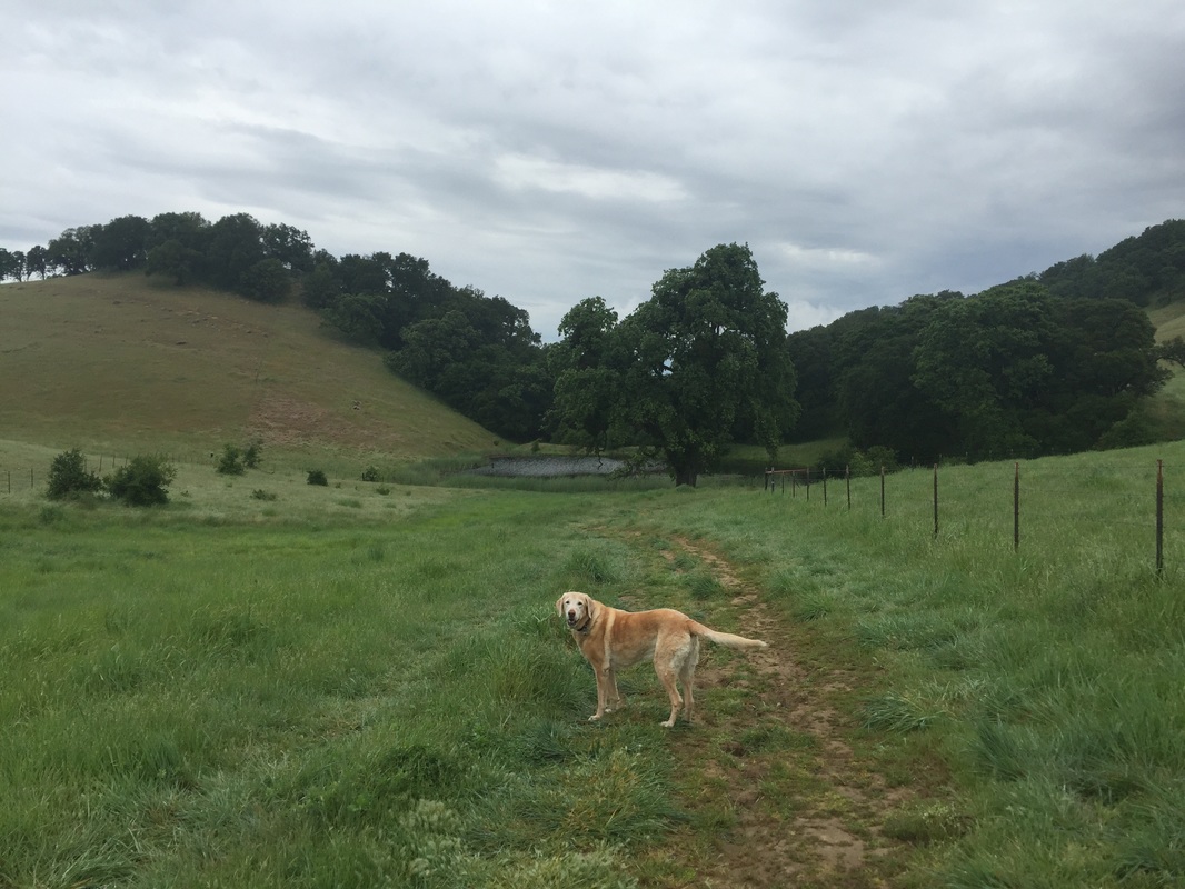
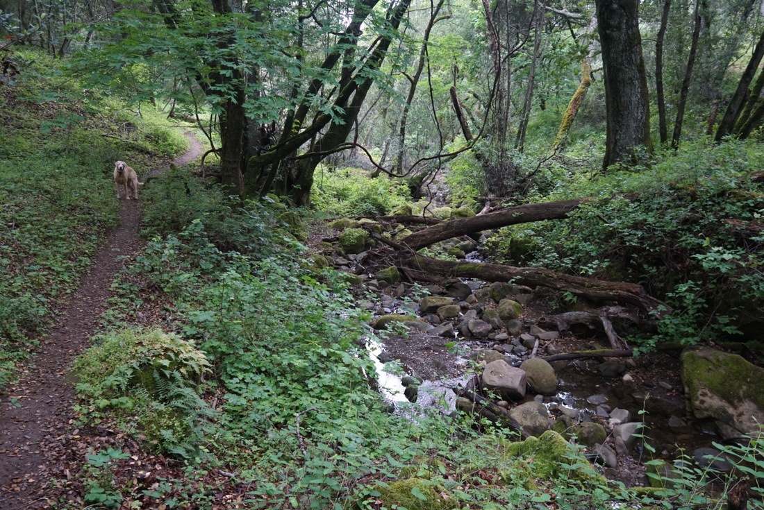
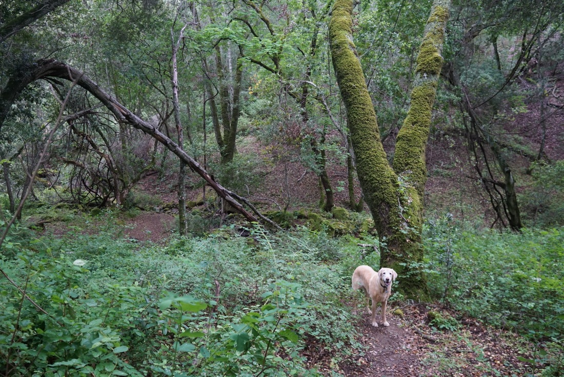
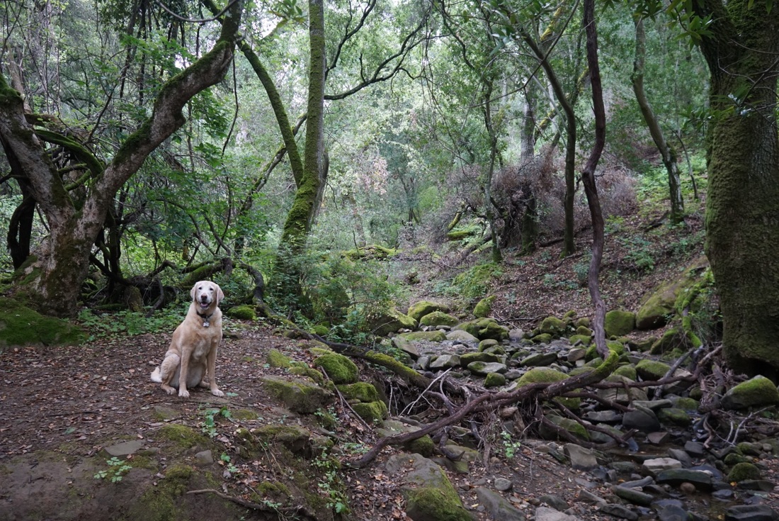
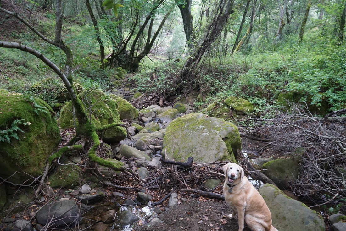
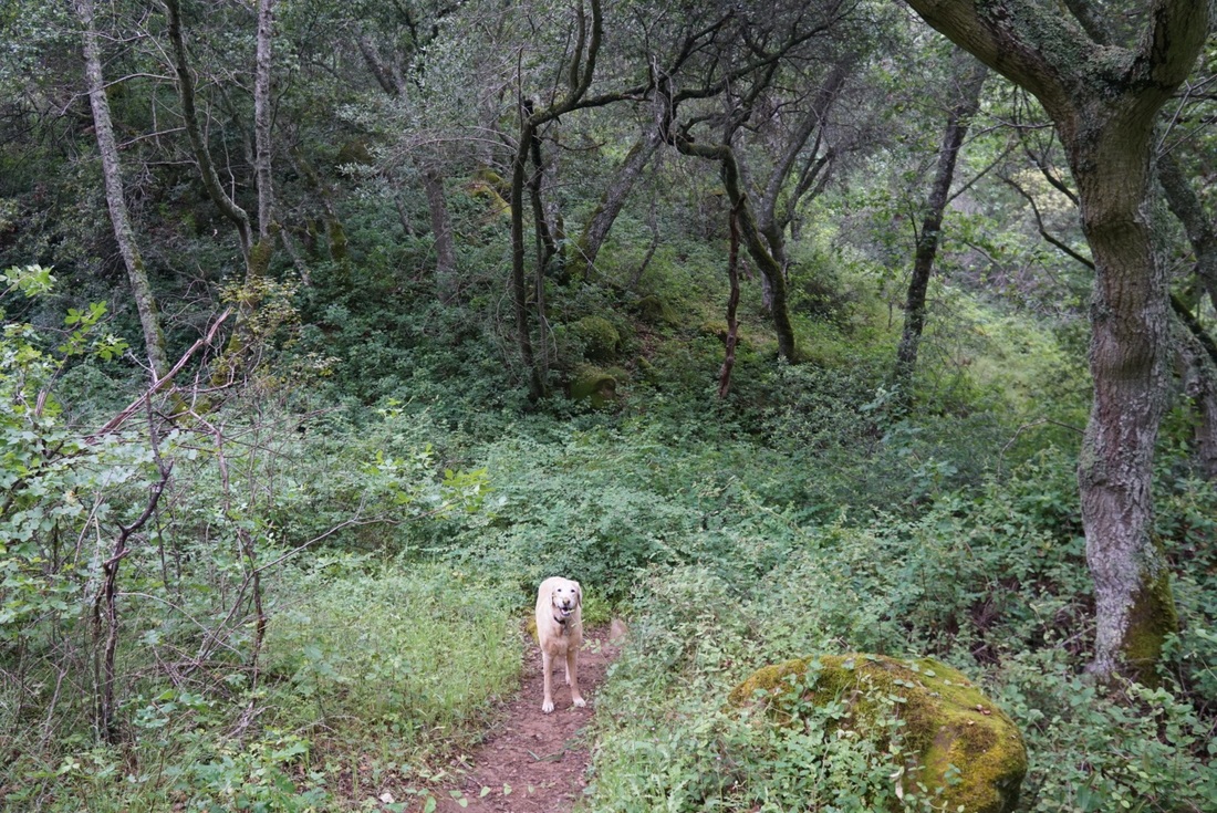
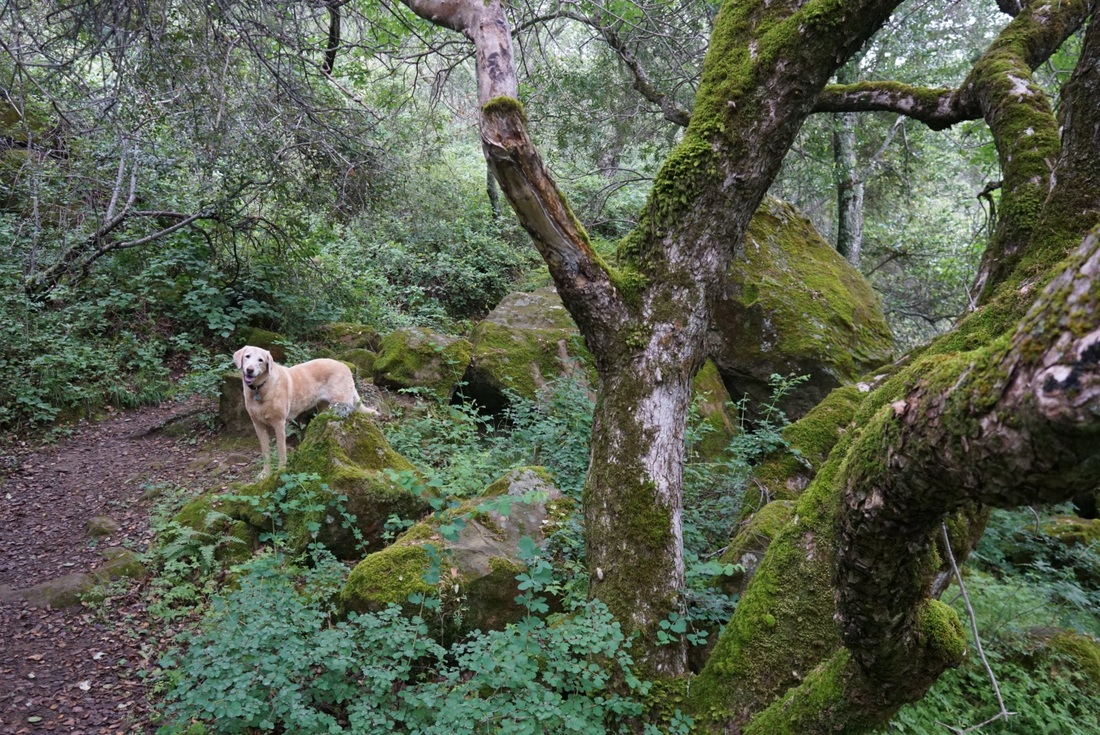
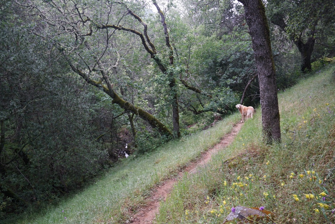
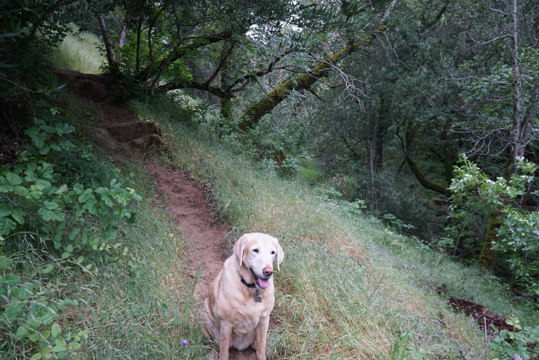
Description: This 4,708-acre park is a hidden gem with a lot to offer. There are shady, moss-covered trails running along the creek, open meadows filled with wildflowers, and ridgetop views of Mount Diablo, St. Helena and the Sierras.

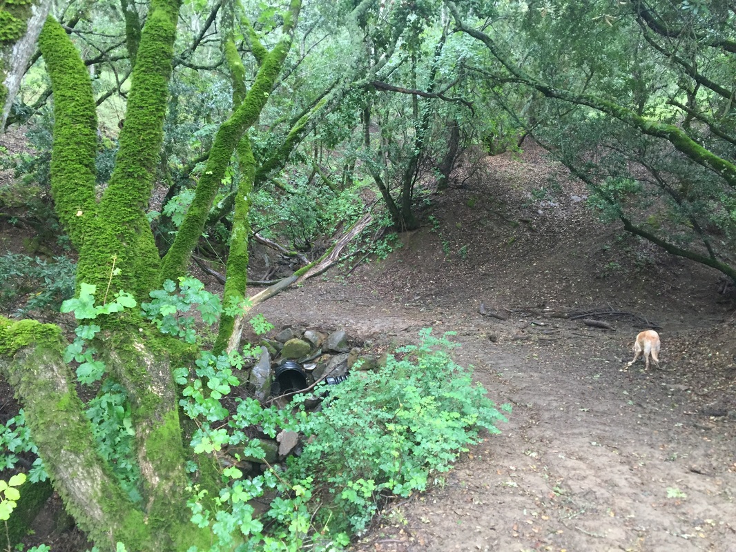
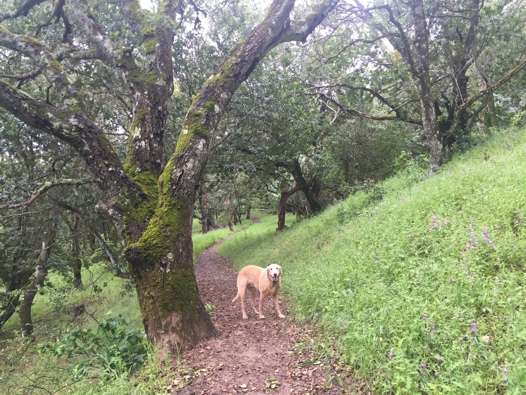
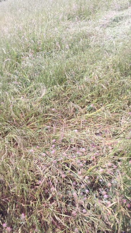
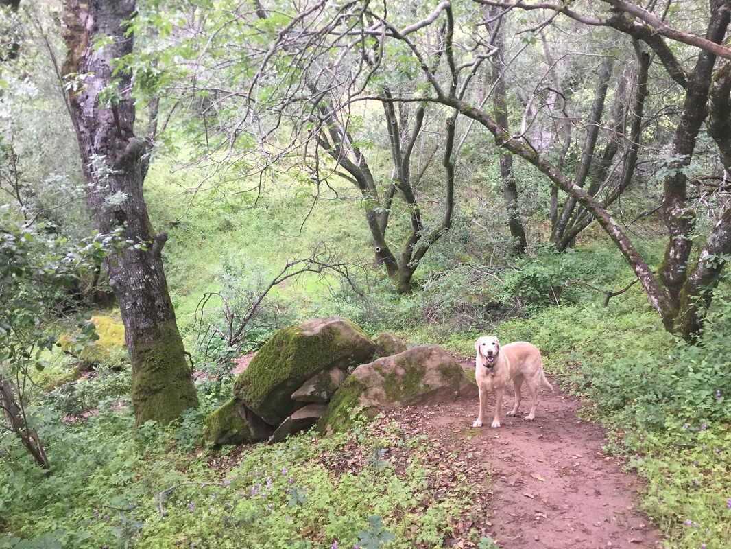
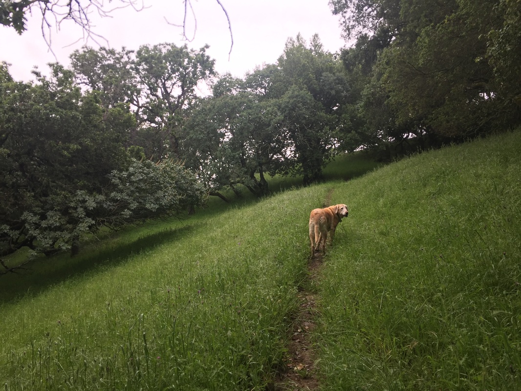
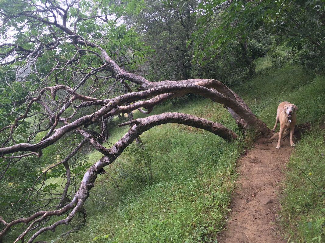
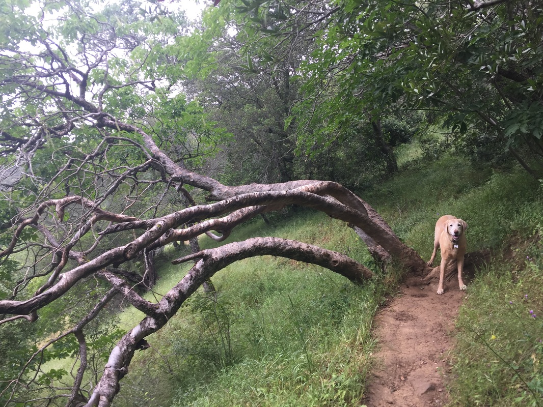
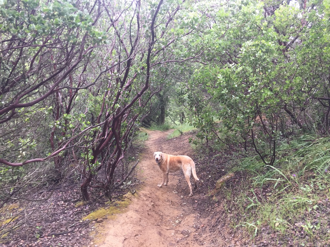
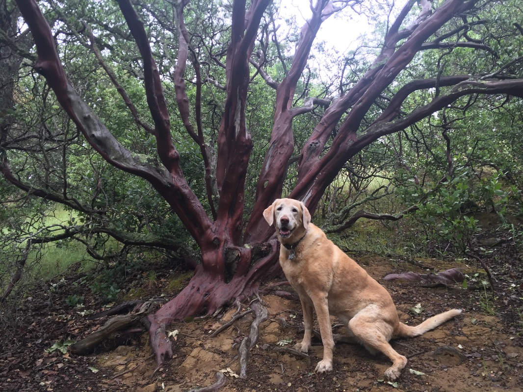
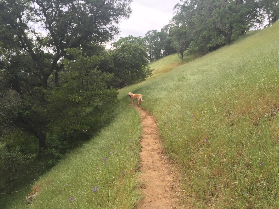
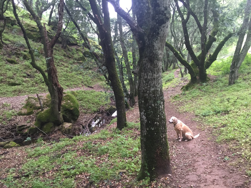
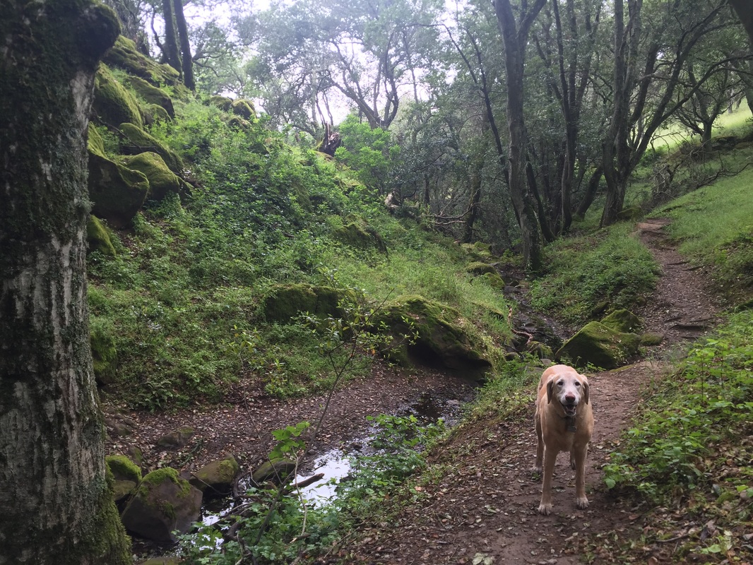
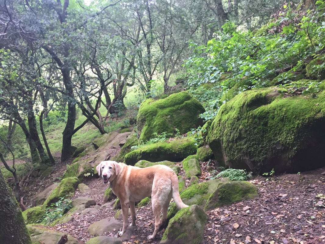
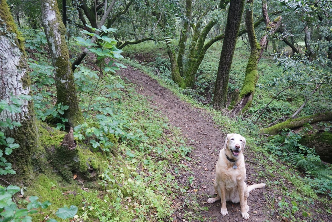
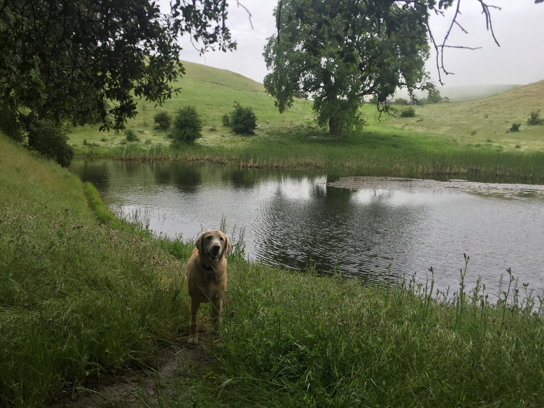
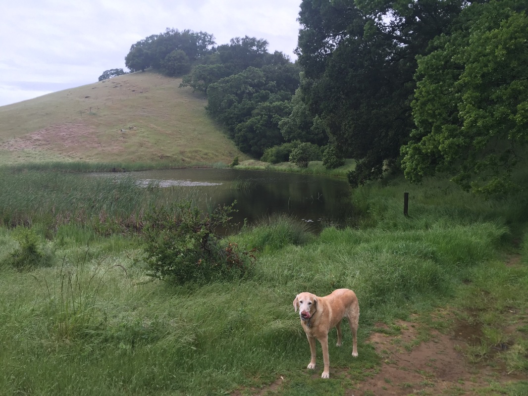
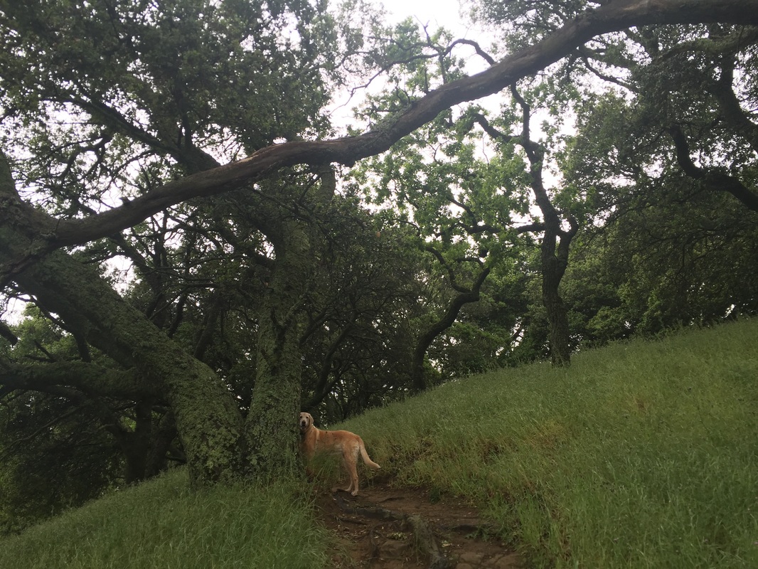
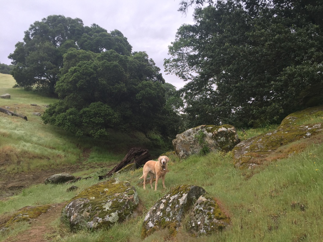
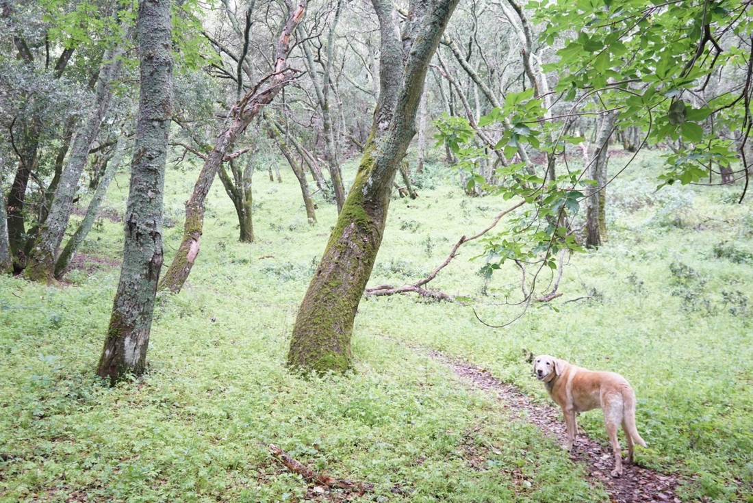
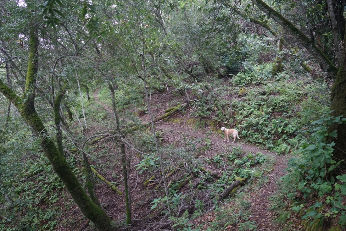
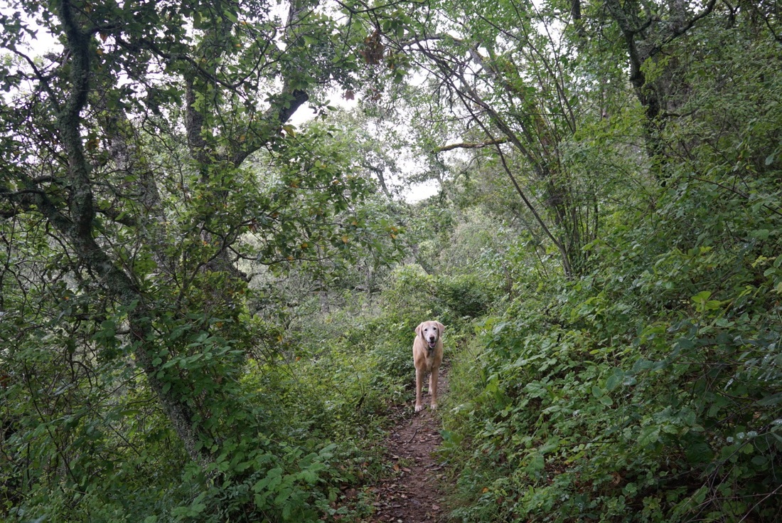
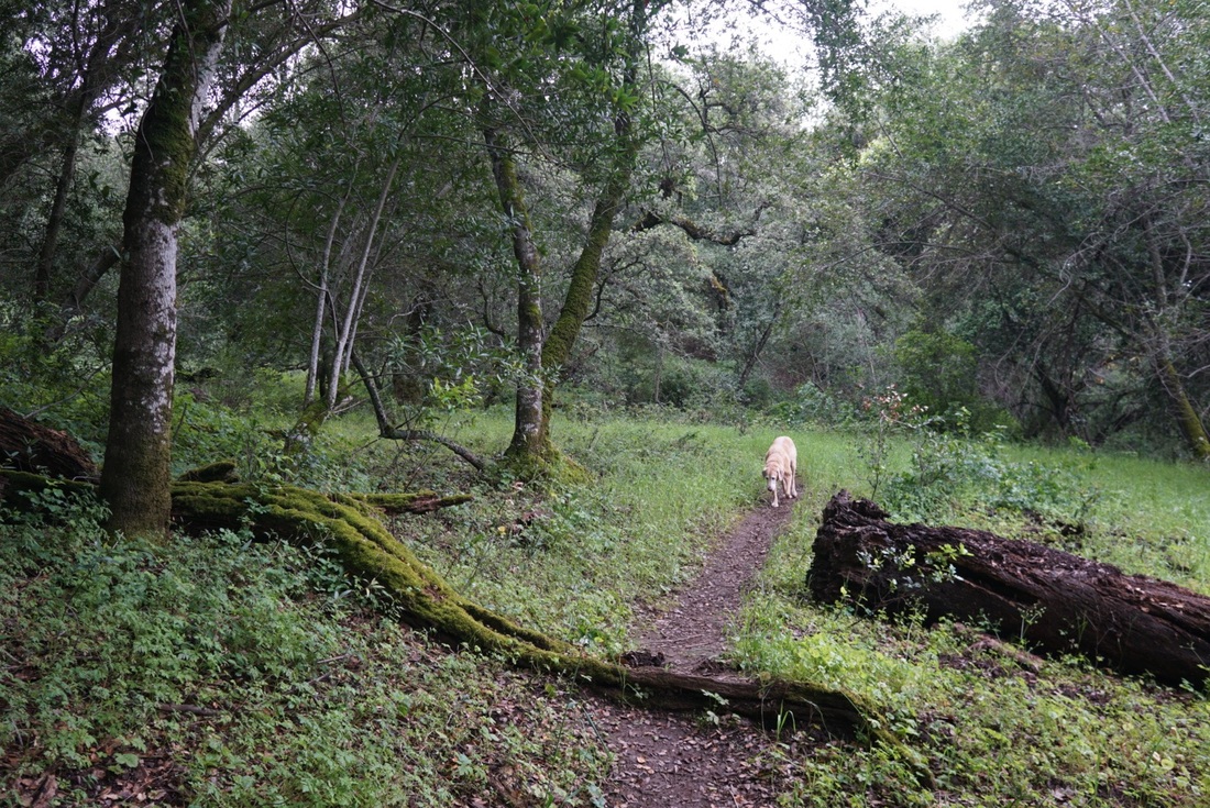
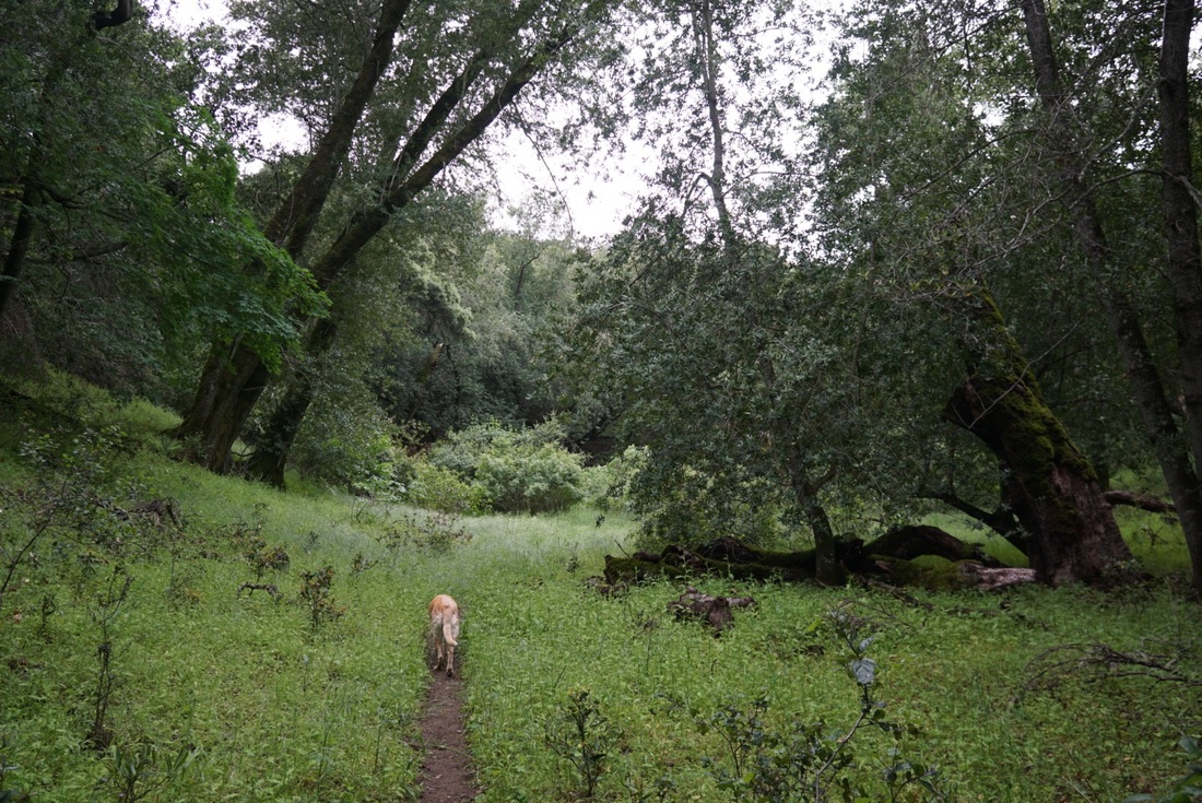
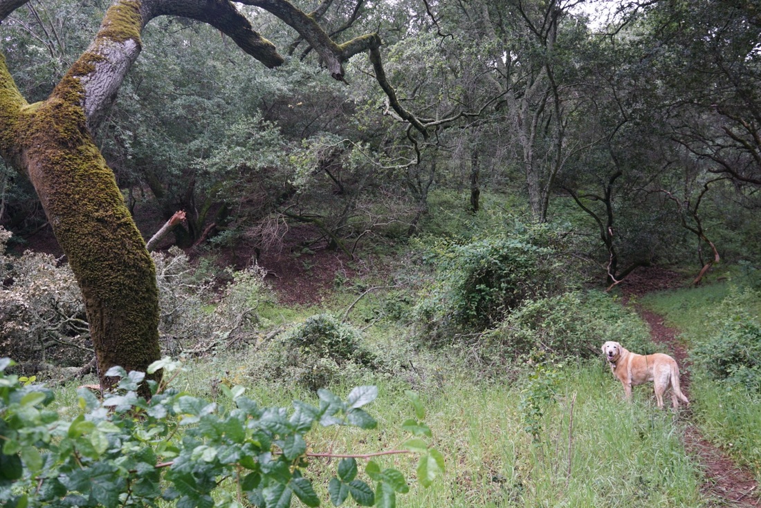
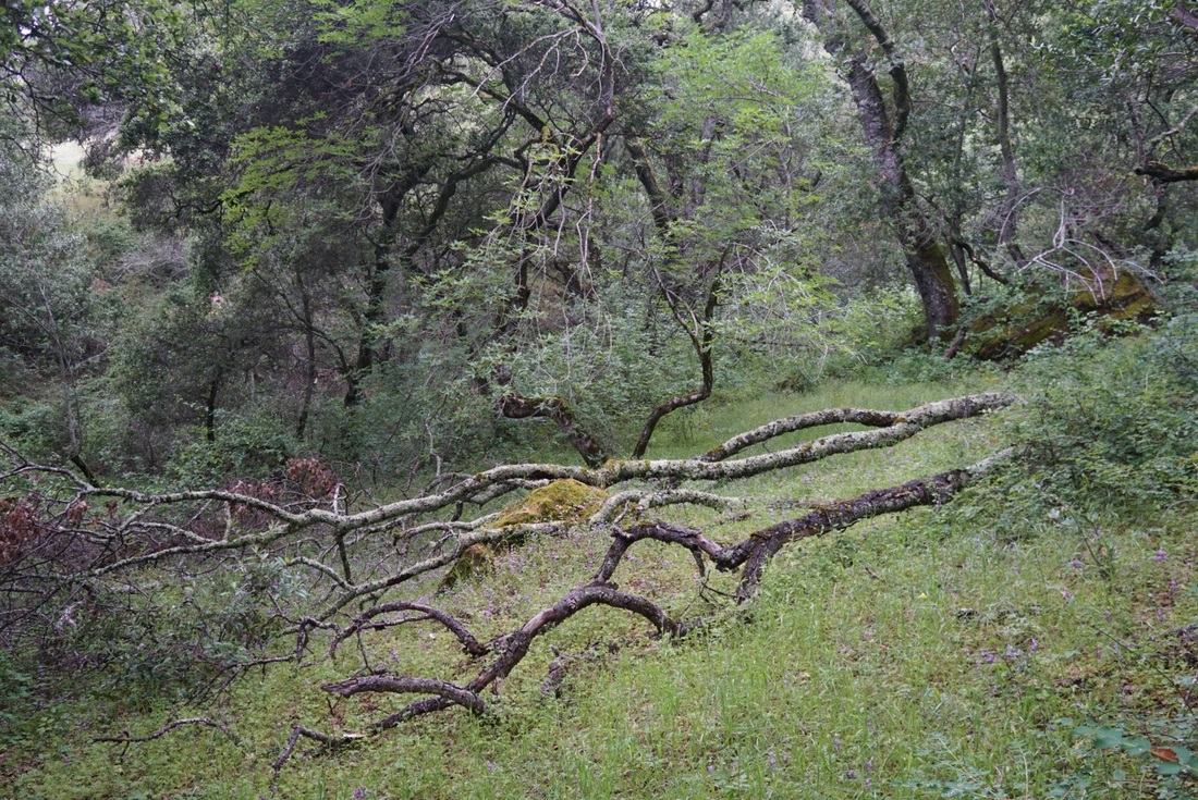
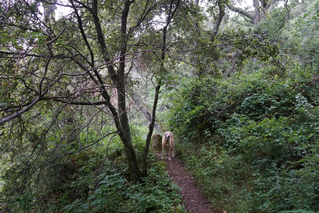
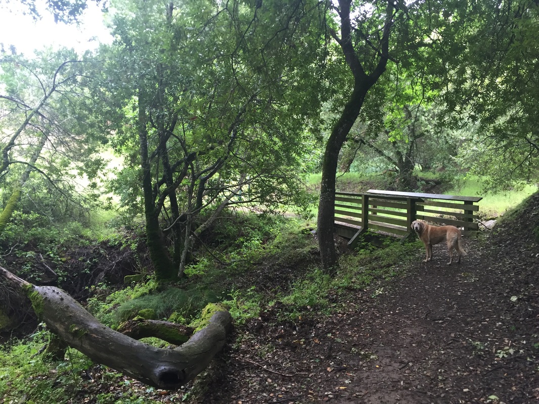
We started our hike on the Coyote Trail. It snaked along a large pond and then through a forest running along the creek. The forest was lined with moss-covered boulders and gave it a magical feel. We then passed through a Manzanita forest and the trail began a slow descent. For a moment we got a glimpse through the trees of the hills and Mt. Diablo as the trail peeked out on the ridge. The trail continued its descent, began to follow more closely along the stream and we could hear the water gushing as we hiked. Soon we came to a trailhead at (0.68 miles). Go left at Mollok Trail. This will take you through a stretch of moss-covered trees with vines hanging above the creek. Cross the creek and continue on the trail. The trail begins climbing and a few hundred feet of the trail are overgrown with tall grass. Keep straight and you will see the trail begin again soon. At 0.42 miles you will come to a cattle gate. Cross the road and continue on Mollok Trail. This trail climbs again, taking you through a dense forest. We saw deer feeding not too far from the trail. The trail will appear to split to the right via an unmarked trail, but disregard this and keep straight on the trail. At 0.26 miles the trail splits again. We took a right here and hiked up to the ridge on Clyma Trail. This trail was badly overgrown with high grass and we couldn’t see much of the trail. I wouldn’t recommend hiking this trail in summer because I can see the dry foxtail being a huge problem. We came to another trailhead and the watershed boundary. We hiked left to the large pond on Clyma trail, but there was a large herd of cattle here blocking the trail, so we retraced our steps back down to the Mollok Trail. From here we hiked to the right on a trail that took us through the forest and across the stream, snaking up the hillside above the road. We came to a trailhead after 0.74 miles and continued straight on the trail. The trail below leads you to the street. After a few hundred feet we came out on the hillside and could see the parking lot in the distance, but it is still 0.40 miles away. The trail snaked around a few bends, over the creek, and over a bridge. We came to a cattle gate, crossed the road and we were back at the parking lot. Overall the trail descended about 400ft and then climbed back up 600ft to reach a peak at 2,200ft. Our hike was just a little over 4 miles long. On your drive out look for the fresh strawberries being sold at the stand on Livermore Ave, before you reach the highway.

A note on poison oak: Poison oak is part of the natural habitat and is a native plant, so it is commonly found on trails. Throughout the year it can become overgrown in certain areas. Luckily Bailey and I have not had any issues with poison oak, but some people are more allergic than others. To help avoid exposure to poison oak I recommend keeping dogs on leash on narrow single track trails with dense vegetation (like the Clyma trail). If you are concerned about poison oak, it might be wise to call the park a day or two ahead and get an update on the poison oak situation. Always keep your dog visible, train your dog to stay on the designated trail and under voice control. Be alert, look ahead on the trail for anything unsafe, and use common sense.
 
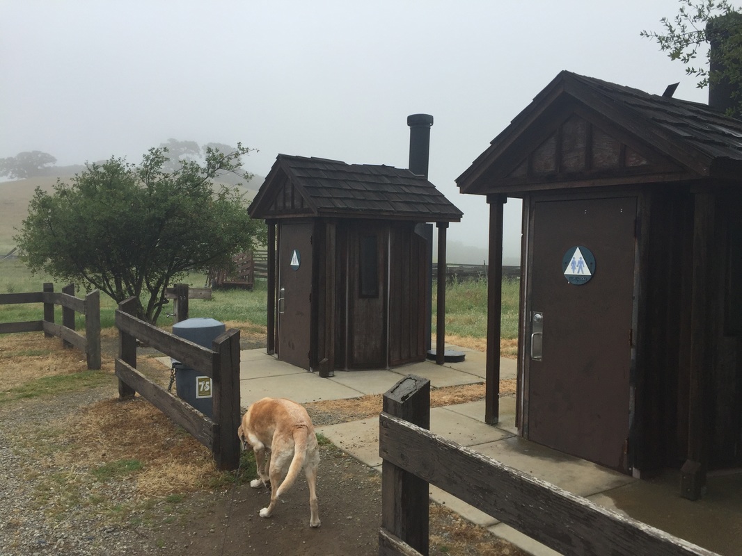
This park has 2 pit toilets, garbage cans and 2 water faucets near the parking lot.
Click here for a trail map courtesy of the EBRPD
Contact Us
Privacy Policy
Terms and Conditions
As an Amazon Associate I earn a commission from qualifying purchases. 
All content within this site Copyright © 2023 Hikes Dogs Love. All rights reserved. No part of this website may be reproduced without permission.
DMCA.com Protection Status
  • Home
  • Browse All
    • Alameda County >
      • Albany Bulb
      • Alameda Creek Regional Trail
      • Anthony Chabot Regional Park (Lake Chabot)
      • Aquatic Park
      • Chabot Park
      • Barlago Italian Kitchen
      • Buchanan Dog Beach
      • California Canoe & Kayak (Oakland)
      • César Chávez Park
      • Claremont Canyon
      • Coyote Hills Regional Park
      • Crab Cove
      • Cull Canyon Regional Recreation Area
      • Dimond Canyon Park
      • Don Castro Regional Recreation Area
      • Don Edwards Wildlife Refuge
      • Dublin Hills Regional Park
      • Fairmont Ridge
      • Five Canyons Open Space Preserve
      • Fremont Central Park
      • Garin/Dry Creek Pioneer Regional Park
      • Greenbelt Trails
      • Hayward Regional Shoreline
      • Heron Bay Trail
      • Holy Land Restaurant
      • Ikaros Greek Restaurant
      • Jerusalem Organic Kitchen
      • Joaquin Miller Park
      • Lake Anza
      • Lake Chabot
      • Lake Merritt
      • Leona Canyon Regional Open Space Preserve
      • Leona Heights Park
      • Marina Park
      • Martin Canyon Creek Trail
      • Martin Luther King Jr. Regional Shoreline
      • Mission Peak
      • Montclair Railroad Trail/ Torii Gate
      • Morgan Territory Regional Preserve
      • Oyster Bay Regional Shoreline
      • Park Street Classic Car Show (Annual)
      • Pleasanton Ridge Regional Preserve
      • Reinhardt Redwood Regional Park
      • Robert's Park
      • Room 389
      • Shoreline Park
      • Sibley Volcanic Regional Preserve
      • Skyline Gate Staging Area
      • Strawberry Canyon Fire Trail
      • Sunol Regional Wilderness
      • Temescal Regional Recreation Area
      • Tilden Regional Park
      • Upper Anthony Chabot Regional Park (Oakland Entrance)
      • Upper Knowland Park
      • Vargas Plateau Regional Park
    • Butte County >
      • Feather Falls
      • Motel 6 - Oroville
      • Riverbend Park
    • Contra Costa County >
      • Acalanes Ridge Open Space
      • Briones Regional Park
      • Carquinez Strait Regional Shoreline
      • Crockett Hills Regional Park
      • Diablo Foothills Regional Park
      • EBMUD Trails
      • Fernandez Ranch
      • Frowning Ridge
      • Geppetto's Caffe
      • Hacienda de las Flores Park
      • Hillside Nature Area
      • Howe Homestead Park
      • Indian Rock
      • Kennedy Grove Regional Recreation Area
      • Lafayette Community Park
      • Lafayette Reservoir
      • Las Trampas Regional Wilderness
      • Lime Ridge Open Space
      • Miller/Knox Regional Shoreline
      • Moraga Commons Park
      • Mulholland Ridge Open Space Preserve
      • Point Isabel
      • Point Molate Beach Park
      • Point Pinole Regional Shoreline
      • Point San Pablo Harbor
      • Rubio's
      • San Quentin Beach
      • Shell Ridge Open Space
      • Sobrante Ridge Regional Preserve
      • Sugarloaf Open Space
      • Sycamore Valley Open Space Preserve
      • Tender Greens
      • Tilden Regional Park
      • Wildcat Canyon Regional Park
    • El Dorado County >
      • Angora Lakes Trail
      • Bijou Community Park
      • Cascade Falls
      • Horsetail Falls
      • Inspriation Point
      • Motel 6 - South Lake Tahoe
      • Mt. Tallac
    • Marin County >
      • 101 Surf Sports
      • Baltimore Canyon Open Space Preserve
      • Blackie's Pasture
      • Camino Alto Preserve
      • Carson Falls
      • Cascade Falls
      • Cataract Falls
      • Dawn Falls
      • Ignacio Valley Preserve (Fairway Falls)
      • Indian Valley Open Space Preserve
      • King Mountain Open Space Preserve
      • Marin Headlands (Coastal Trail)
      • Old Saint Hilary's Open Space Preserve
      • Phoenix Lake
      • Ring Mountain Open Space Preserve
      • Roy's Redwoods
      • Sam's Anchor Cafe
      • Tiburon Peninsula Historical Trail
      • Tucker Trail Falls
    • Mariposa County >
      • Happy Burger Diner
      • Yosemite National Park
    • Mendocino County >
      • Catch-a-Canoe
      • MacKerricher State Park
      • Mendocino Headlands State Park
      • Navarro River Redwoods State Park
      • Princess Seafood
      • Skunk Train
      • The Stanford Inn By The Sea
      • Van Damme State Beach
    • Mono County >
      • Bodie State Historic Park
      • Jolly Kone
      • Lundy Canyon
      • Mono Lake (Tufa State National Reserve)
      • Virginia Creek Settlement
    • Monterey County >
      • 17-Mile Drive
      • Asilomar State Beach
      • Bistro Beaujolais
      • Carmel Beach
      • Fishwife
      • Fort Ord Dunes State Park
      • Garland Ranch Regional Park
      • Jack's Peak
      • Monterey Bay Coastal Trail
      • Monterey Bay Kayaks
      • Monterey Municipal Beach
      • Motel 6 - Downtown Monterey
      • Ryan Ranch Disc Golf Course
      • Ventana Wilderness
    • Nevada County >
      • Fairy Falls
    • Placer County >
      • Hidden Falls
    • San Francisco County >
      • 2.2 Mile Urban Hike
      • Bernal Heights Park
      • The Brixton
      • Billy Goat Hill Park
      • Blackwood
      • Clipper Cove Beach
      • Crissy Field
      • Dynamo Donut + Coffee
      • Fort Funston
      • Fort Mason
      • Glen Canyon Park
      • Golden Gate Park
      • Grand View Park
      • The Great Lawn/ Avenue of the Palms
      • Java Beach Cafe
      • John McLaren Park
      • Interior Greenbelt
      • Lake Merced
      • Lands End
      • Letterman Digital Arts Center
      • Marina Green
      • Mount Davidson
      • Mount Sutro Open Space Reserve
      • Ocean Beach
      • Palace of Fine Arts
      • Philz Coffee Truck
      • Stern Grove
      • Sutro Baths
      • Sutro Heights Park
      • TreasureFest
    • San Mateo County >
      • 7 Mile House Sports Bar & Grill
      • Barbara's Fishtrap
      • Bedwell Bayfront Park
      • Bob's Vegetable Stand and Pumpkin Farm
      • Cafe Pacifica
      • Devil's Slide Coastal Trail
      • Esplanade Beach
      • Flying Fish Grill
      • Half Moon Bay Kayak Co.
      • McNee Ranch State Park (Montara Mountain)
      • Montara State Beach
      • Mori Point
      • Mussel Rock Park
      • Panera Bread
      • Pedro Point Headlands
      • Poplar Beach
      • Pulgas Ridge Open Space Preserve
      • Rancho Corral de Tierra
      • Seal Point
      • Taqueria La Mexicana
      • Wavecrest Open Space
    • Santa Clara County >
      • Byxbee Park
      • Calero County Park
      • Uvas Canyon County Park
    • Santa Cruz County >
      • Byrne-Milliron Forest
      • Greyhound Rock County Park
      • Henry Cowell Redwoods State Park
      • Jaliscos Restaurant
      • Mount Madonna County Park
      • Roaring Camp Railroads
    • Solano County >
      • Lagoon Valley Park
      • Peña Adobe Regional Park
    • Sonoma County >
      • Doran Regional Park
      • Fishetarian
      • Helen Putnam Regional Park
    • Tuolumne County >
      • Donnell Vista
      • Tuttletown Recreation Area
    • Yuba County >
      • Ellis Lake
  • Map View
  • Vacation Spots
    • Vacation Hikes >
      • Arizona >
        • Papago Park
      • New Mexico >
        • Oliver Lee Memorial State Park
        • White Sands National Monument
      • Oregon >
        • Multnomah Falls
      • Washington >
        • Olympic National Park >
          • Kalaloch Beach
          • Madison Falls
          • Quinault Rainforest
        • Rattlesnake Ridge
    • Restaurants >
      • Southern California >
        • Fire Island Grill
        • Lazy Dog Restaurant & Bar
        • Perkies Coffee Haus
      • Washington >
        • Rose Pho
  • Planning Your Trip
  • About
    • Contact Us
    • Privacy Policy
    • Terms and Conditions
  • Dog Gear
  • Archived Hikes 1
    • Archived Hikes 2 >
      • Archives 2016-2018