
- Home
-
Browse All
-
Alameda County
>
- Albany Bulb
- Alameda Creek Regional Trail
- Brickyard Cove
- Brushy Peak Regional Preserve
- Anthony Chabot Regional Park (Lake Chabot)
- Aquatic Park
- Barlago Italian Kitchen
- Buchanan Dog Beach
- California Canoe & Kayak (Oakland)
- Cali Kid Burgers ‘N Shakes
- César Chávez Park
- Chabot Park
- Claremont Canyon
- Coyote Hills Regional Park
- Crab Cove
- Cull Canyon Regional Recreation Area
- Dimond Canyon Park
- Don Castro Regional Recreation Area
- Don Edwards Wildlife Refuge
- Dublin Hills Regional Park
- Emeryville Marina
- Fairmont Ridge
- Five Canyons Open Space Preserve
- Fremont Central Park
- Garin/Dry Creek Pioneer Regional Park
- Gilman Brewing Company
- Greenbelt Trails
- Hayward Regional Shoreline
- Heron Bay Trail
- Ikaros Greek Restaurant
- Jerusalem Organic Kitchen
- Joaquin Miller Park
- Lake Anza
- Lake Chabot
- Lake Merritt
- Leona Canyon Regional Open Space Preserve
- Leona Heights Park
- Marina Park
- Martin Canyon Creek Trail
- Martin Luther King Jr. Regional Shoreline
- Mission Peak
- Montclair Railroad Trail/ Torii Gate
- Morgan Territory Regional Preserve
- Oyster Bay Regional Shoreline
- Park Street Classic Car Show (Annual)
- Pleasanton Ridge Regional Preserve
- Point Emery
- Reinhardt Redwood Regional Park
- Robert's Park
- Room 389
- Shoreline Park
- Sibley Volcanic Regional Preserve
- Skyline Gate Staging Area
- Strawberry Canyon Fire Trail
- Sunol Regional Wilderness
- Temescal Regional Recreation Area
- Tilden Regional Park
- Upper Anthony Chabot Regional Park (Oakland Entrance)
- Upper Knowland Park
- Vargas Plateau Regional Park
- Butte County >
-
Contra Costa County
>
- Acalanes Ridge Open Space
- Briones Regional Park
- Carquinez Strait Regional Shoreline
- Crockett Hills Regional Park
- Diablo Foothills Regional Park
- EBMUD Trails
- Fernandez Ranch
- Frowning Ridge
- Geppetto's Caffe
- Hacienda de las Flores Park
- Hillside Nature Area
- Howe Homestead Park
- Indian Rock
- Kennedy Grove Regional Recreation Area
- Lafayette Community Park
- Lafayette Reservoir
- Las Trampas Regional Wilderness
- Lime Ridge Open Space
- Miller/Knox Regional Shoreline
- Moraga Commons Park
- Mulholland Ridge Open Space Preserve
- Point Isabel
- Point Molate Beach Park
- Point Pinole Regional Shoreline
- Point San Pablo Harbor
- Rubio's
- San Quentin Beach
- Shell Ridge Open Space
- Sobrante Ridge Regional Preserve
- Sugarloaf Open Space
- Sycamore Valley Open Space Preserve
- Tender Greens
- Tilden Regional Park
- Wildcat Canyon Regional Park
- El Dorado County >
-
Marin County
>
- 101 Surf Sports
- Baltimore Canyon Open Space Preserve
- Blackie's Pasture
- Camino Alto Preserve
- Carson Falls
- Cascade Falls
- Cataract Falls
- Dawn Falls
- Hippie Tree
- Ignacio Valley Preserve (Fairway Falls)
- Indian Valley Open Space Preserve
- King Mountain Open Space Preserve
- Marin Headlands (Coastal Trail)
- Old Saint Hilary's Open Space Preserve
- Phoenix Lake
- Red Hill Dog Park
- Red Hill Trail
- Ring Mountain Open Space Preserve
- Roy's Redwoods
- Sam's Anchor Cafe
- Sorich Ranch Park
- Tiburon Peninsula Historical Trail
- Tiburon Uplands
- Tucker Trail Falls
- Mariposa County >
- Mendocino County >
- Mono County >
- Monterey County >
- Nevada County >
- Placer County >
-
San Francisco County
>
- 2.2 Mile Urban Hike
- Bernal Heights Park
- The Brixton
- Billy Goat Hill Park
- Blackwood
- Clipper Cove Beach
- Crissy Field
- Dynamo Donut + Coffee
- Fort Funston
- Fort Mason
- Glen Canyon Park
- Golden Gate Park
- Grand View Park
- The Great Lawn/ Avenue of the Palms
- Java Beach Cafe
- John McLaren Park
- Interior Greenbelt
- Lake Merced
- Lands End
- Letterman Digital Arts Center
- Marina Green
- Mount Davidson
- Mount Sutro Open Space Reserve
- Ocean Beach
- Palace of Fine Arts
- Philz Coffee Truck
- Stern Grove
- Sutro Baths
- Sutro Heights Park
- TreasureFest
-
San Mateo County
>
- 7 Mile House Sports Bar & Grill
- Barbara's Fishtrap
- Bedwell Bayfront Park
- Bob's Vegetable Stand and Pumpkin Farm
- Cafe Pacifica
- Devil's Slide Coastal Trail
- Esplanade Beach
- Flying Fish Grill
- Half Moon Bay Kayak Co.
- McNee Ranch State Park (Montara Mountain)
- Montara State Beach
- Mori Point
- Mussel Rock Park
- Nick's Seafood Restaurant
- Panera Bread
- Pedro Point Headlands
- Poplar Beach
- Pulgas Ridge Open Space Preserve
- Rancho Corral de Tierra
- Seal Point
- Taqueria La Mexicana
- Wavecrest Open Space
- Santa Clara County >
- Santa Cruz County >
- Solano County >
- Sonoma County >
- Tuolumne County >
- Yuba County >
-
Alameda County
>
- Map View
-
More
Address: The dead-end of Fairway Drive, off of Bradford Way, Pacifica, CA
GPS Coordinates: 37°37'18.1"N, 122°29'29.8"W (approx.) This is a residential area. Please be respectful of residents.
OR
The dead-end of Mori Point Road (off of Bradford Way), Pacifica, CA. This is the official parking area, but as mentioned below, I find it easier to park at the end of Fairway Drive.
Parking: Free parking in the areas above. Please be respectful of residents.
Hours: Sunrise to Sunset
Type: Hike (easy to moderate depending on trail)
Regulations: Dogs allowed on-leash (Please keep dogs on leash at all times to protect sensitive habitat and wildflowers)
Best time to visit: Anytime on a clear day, but these trails can get windy.
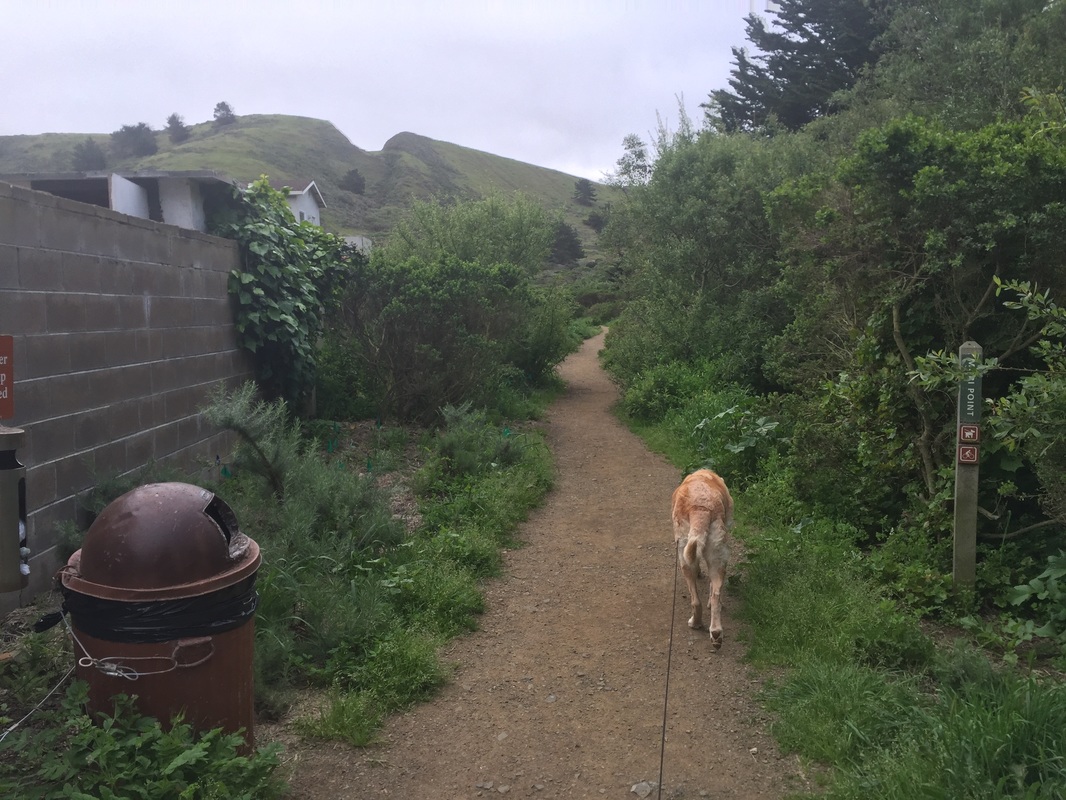
There is one restroom at the Mori Point trailhead down Old Mori Trail near the parking lot. I don't recommend parking in that lot because it fills so fast and can be a zoo to exit/enter. It's about 0.3 miles down from the marsh area close to the highway. There are trash cans near the trailhead as well.
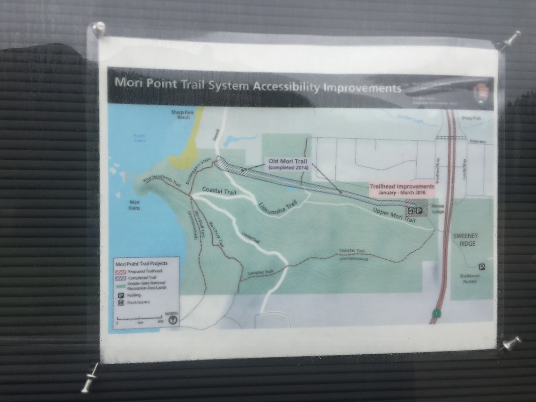
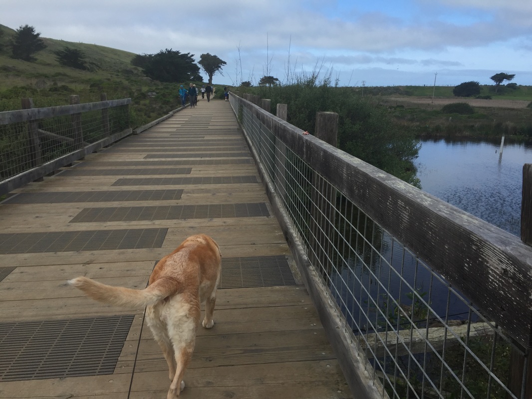
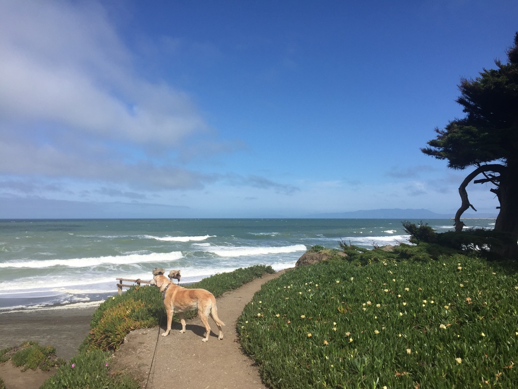
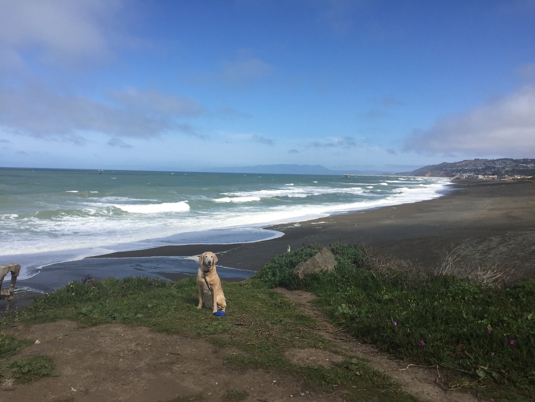
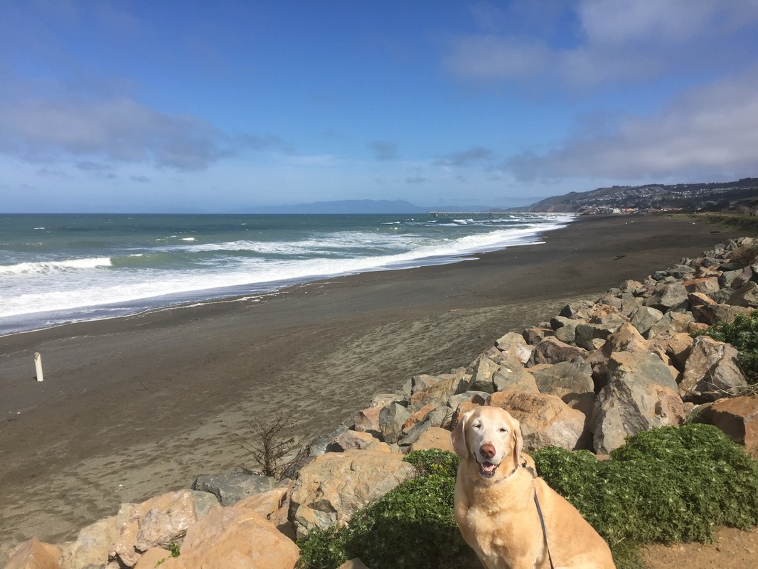
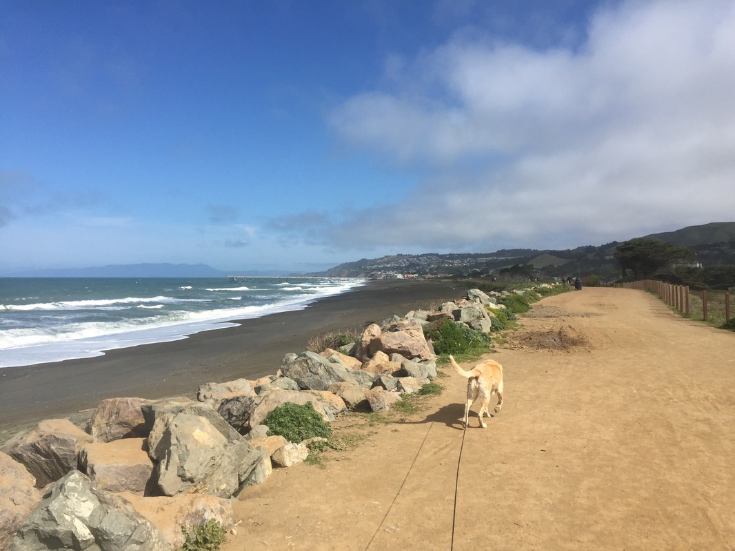
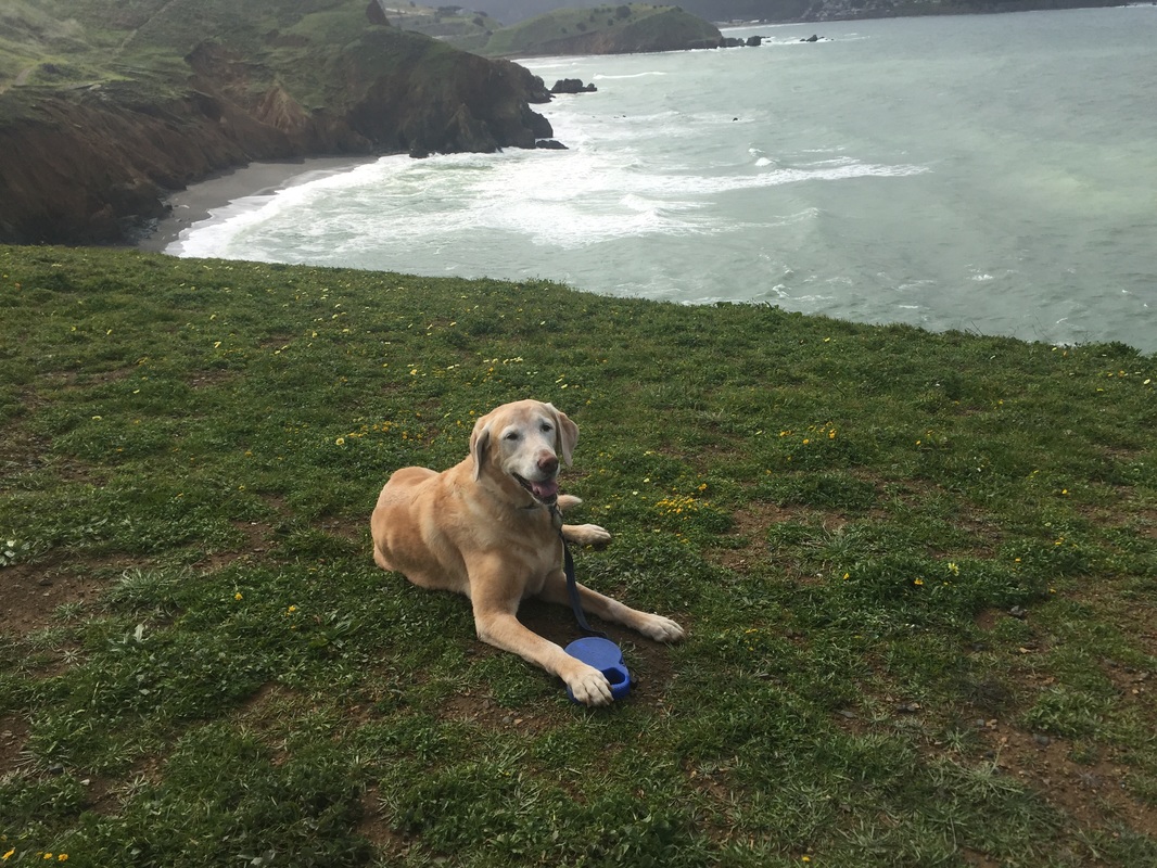
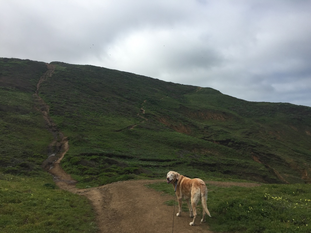
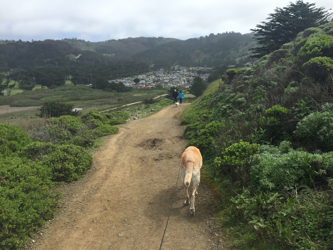
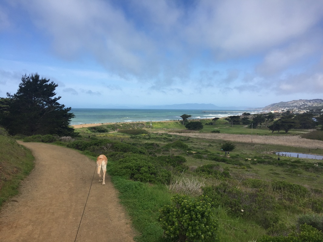
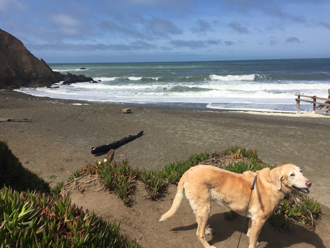
Description: This 32-acre park offers gorgeous coastal hikes with options for a leisurely stroll along the coast or a more challenging hike up the cliff side. Your hike starts at the end of Fairway Drive, over a wooden bridge in back of some houses. It soon opens up to a wetland, with red-legged frog ponds along a boardwalk. If you continue straight ahead, you’ll reach Sharp Park Beach, where dogs are allowed if on-leash. The city has proposed to make this beach off-leash, but it’s not official yet.
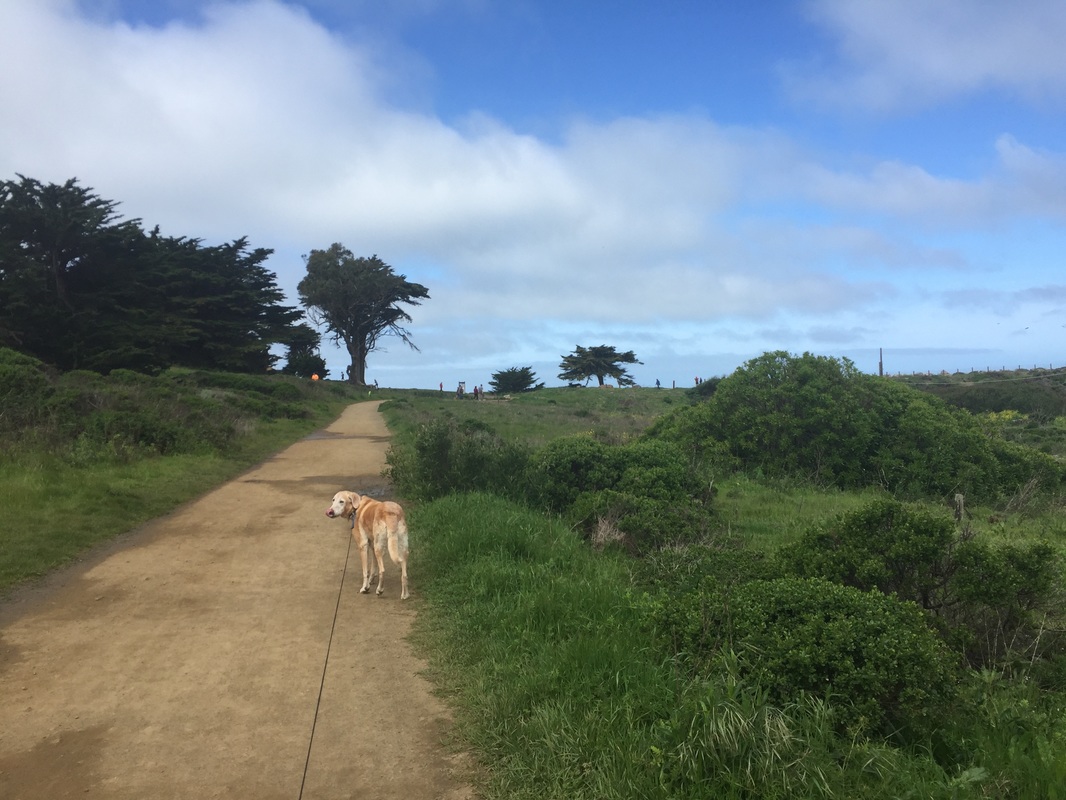
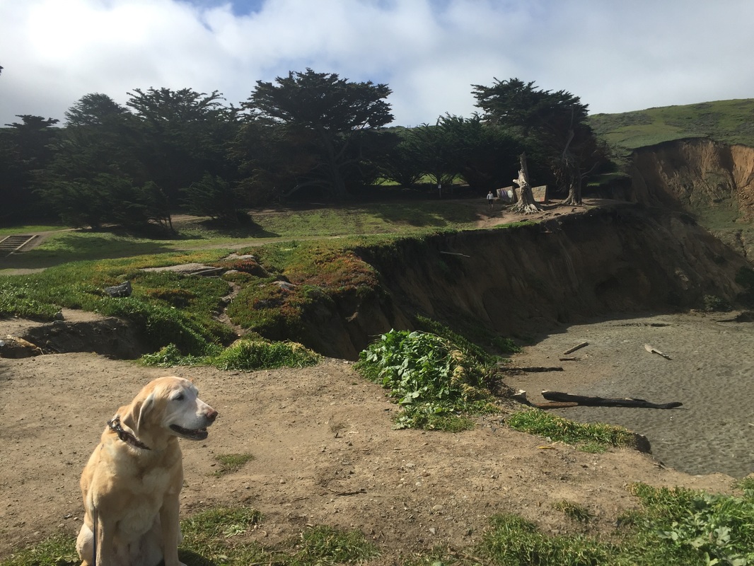
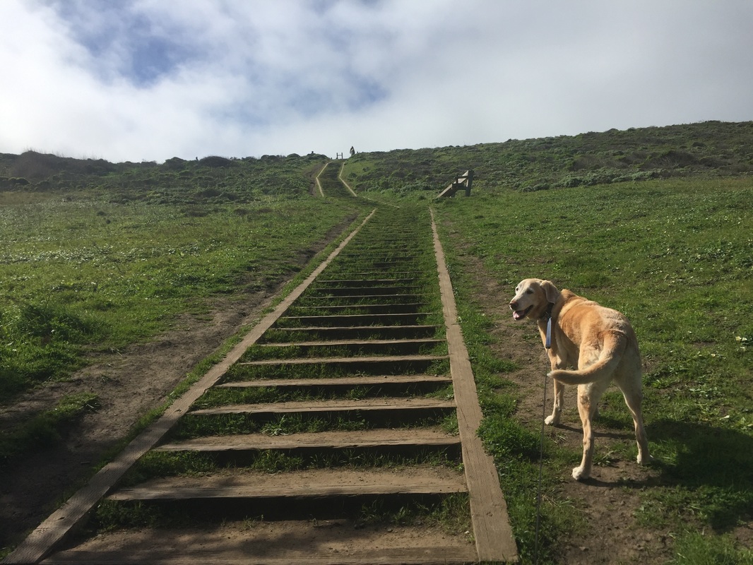
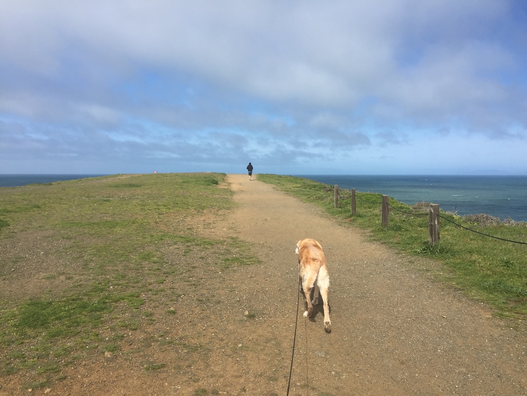
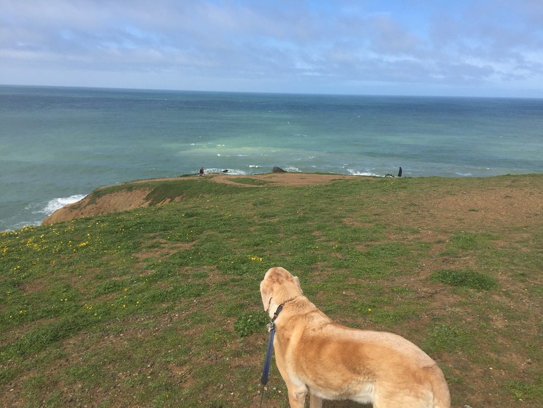
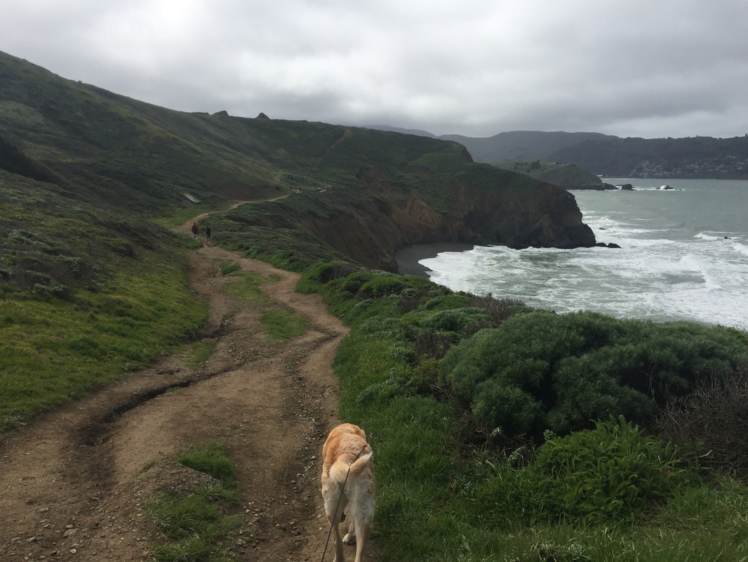
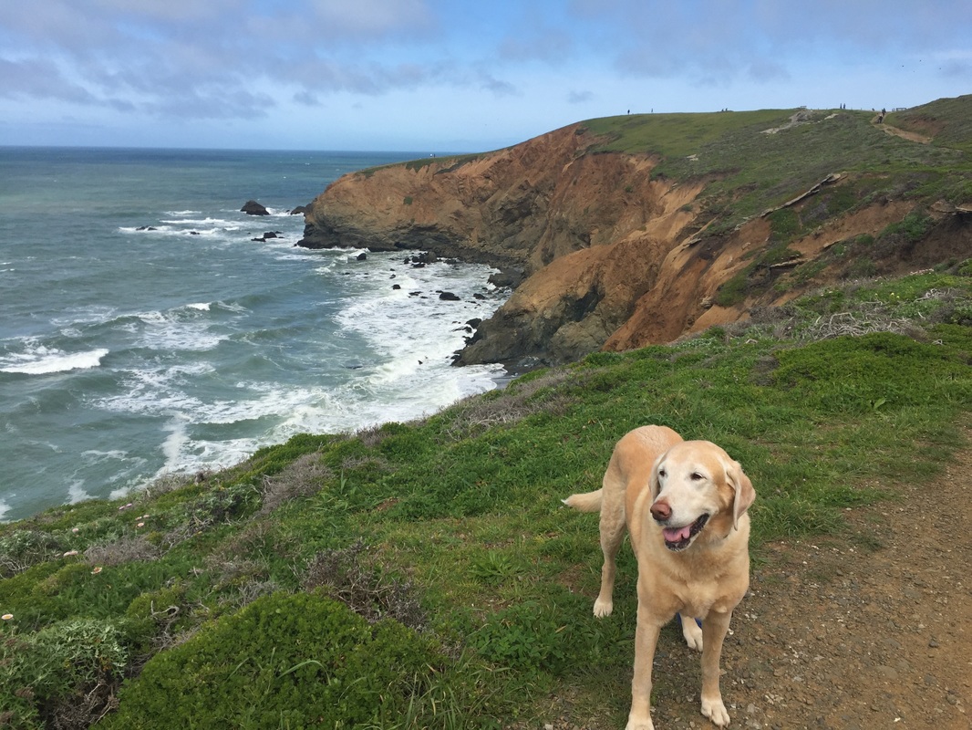
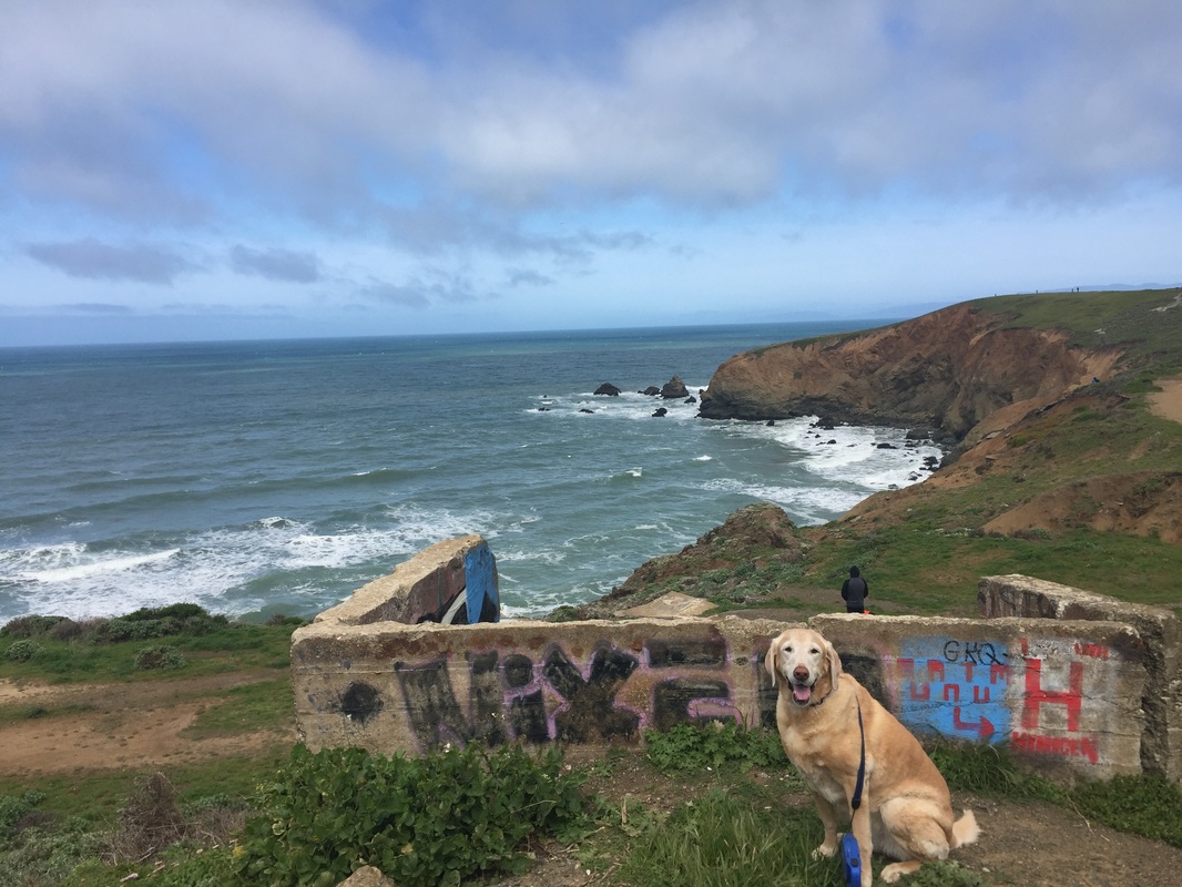
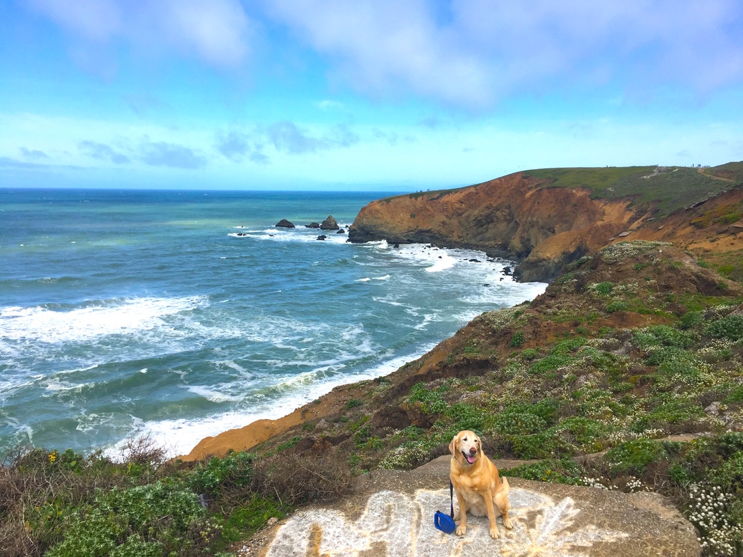
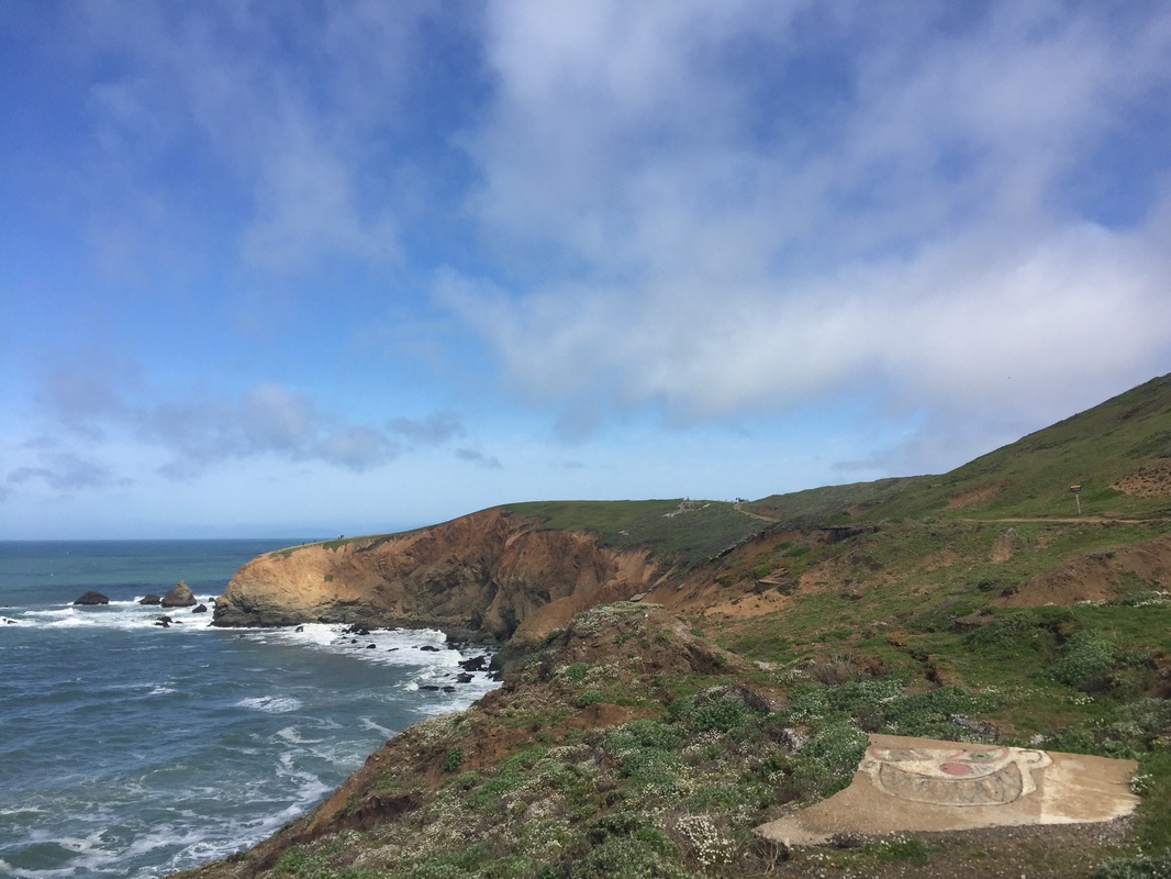
If you head to your right, you can walk along the coast via a flat 0.5 mile trail. If instead you go left, you will climb some stairs and reach a gorgeous cliff overlooking the ocean. This is called "The Point" and blooms with beautiful wildflowers during certain times of the year. You can continue ahead along a rocky trail hugging the coast, which soon snakes steeply up the hill. There are a variety of other unnamed trails you can take from there to loop back, with the shortest loop about a 1.75 mile hike. During your hike you’ll pass through green bluffs dotted with wildflowers and you will have stunning views of the ocean and cliff side. On your hike back, you will have to navigate one of the steep, slippery trails back down, so I recommend good shoes and hiking poles. When you reach the flat area near "The Point," you can retrace your steps down the stairs, or instead take the trail to your right, which has a switchback and leads you back near the bottom of the stairs.
This place has a lot of history, and was once farmland and home to the Mori Point Inn, a speakeasy during prohibition. On the cliff side, there are still remnants of structures used to pull buckets of sand ashore during WWII.
GPS Coordinates: 37°37'18.1"N, 122°29'29.8"W (approx.) This is a residential area. Please be respectful of residents.
OR
The dead-end of Mori Point Road (off of Bradford Way), Pacifica, CA. This is the official parking area, but as mentioned below, I find it easier to park at the end of Fairway Drive.
Parking: Free parking in the areas above. Please be respectful of residents.
Hours: Sunrise to Sunset
Type: Hike (easy to moderate depending on trail)
Regulations: Dogs allowed on-leash (Please keep dogs on leash at all times to protect sensitive habitat and wildflowers)
Best time to visit: Anytime on a clear day, but these trails can get windy.
There is one restroom at the Mori Point trailhead down Old Mori Trail near the parking lot. I don't recommend parking in that lot because it fills so fast and can be a zoo to exit/enter. It's about 0.3 miles down from the marsh area close to the highway. There are trash cans near the trailhead as well.
Description: This 32-acre park offers gorgeous coastal hikes with options for a leisurely stroll along the coast or a more challenging hike up the cliff side. Your hike starts at the end of Fairway Drive, over a wooden bridge in back of some houses. It soon opens up to a wetland, with red-legged frog ponds along a boardwalk. If you continue straight ahead, you’ll reach Sharp Park Beach, where dogs are allowed if on-leash. The city has proposed to make this beach off-leash, but it’s not official yet.
If you head to your right, you can walk along the coast via a flat 0.5 mile trail. If instead you go left, you will climb some stairs and reach a gorgeous cliff overlooking the ocean. This is called "The Point" and blooms with beautiful wildflowers during certain times of the year. You can continue ahead along a rocky trail hugging the coast, which soon snakes steeply up the hill. There are a variety of other unnamed trails you can take from there to loop back, with the shortest loop about a 1.75 mile hike. During your hike you’ll pass through green bluffs dotted with wildflowers and you will have stunning views of the ocean and cliff side. On your hike back, you will have to navigate one of the steep, slippery trails back down, so I recommend good shoes and hiking poles. When you reach the flat area near "The Point," you can retrace your steps down the stairs, or instead take the trail to your right, which has a switchback and leads you back near the bottom of the stairs.
This place has a lot of history, and was once farmland and home to the Mori Point Inn, a speakeasy during prohibition. On the cliff side, there are still remnants of structures used to pull buckets of sand ashore during WWII.


Wildflower Superbloom Hike (May 13, 2023):


All content within this site Copyright © 2023 Hikes Dogs Love. All rights reserved. No part of this website may be reproduced without permission.

- Home
-
Browse All
-
Alameda County
>
- Albany Bulb
- Alameda Creek Regional Trail
- Brickyard Cove
- Brushy Peak Regional Preserve
- Anthony Chabot Regional Park (Lake Chabot)
- Aquatic Park
- Barlago Italian Kitchen
- Buchanan Dog Beach
- California Canoe & Kayak (Oakland)
- Cali Kid Burgers ‘N Shakes
- César Chávez Park
- Chabot Park
- Claremont Canyon
- Coyote Hills Regional Park
- Crab Cove
- Cull Canyon Regional Recreation Area
- Dimond Canyon Park
- Don Castro Regional Recreation Area
- Don Edwards Wildlife Refuge
- Dublin Hills Regional Park
- Emeryville Marina
- Fairmont Ridge
- Five Canyons Open Space Preserve
- Fremont Central Park
- Garin/Dry Creek Pioneer Regional Park
- Gilman Brewing Company
- Greenbelt Trails
- Hayward Regional Shoreline
- Heron Bay Trail
- Ikaros Greek Restaurant
- Jerusalem Organic Kitchen
- Joaquin Miller Park
- Lake Anza
- Lake Chabot
- Lake Merritt
- Leona Canyon Regional Open Space Preserve
- Leona Heights Park
- Marina Park
- Martin Canyon Creek Trail
- Martin Luther King Jr. Regional Shoreline
- Mission Peak
- Montclair Railroad Trail/ Torii Gate
- Morgan Territory Regional Preserve
- Oyster Bay Regional Shoreline
- Park Street Classic Car Show (Annual)
- Pleasanton Ridge Regional Preserve
- Point Emery
- Reinhardt Redwood Regional Park
- Robert's Park
- Room 389
- Shoreline Park
- Sibley Volcanic Regional Preserve
- Skyline Gate Staging Area
- Strawberry Canyon Fire Trail
- Sunol Regional Wilderness
- Temescal Regional Recreation Area
- Tilden Regional Park
- Upper Anthony Chabot Regional Park (Oakland Entrance)
- Upper Knowland Park
- Vargas Plateau Regional Park
- Butte County >
-
Contra Costa County
>
- Acalanes Ridge Open Space
- Briones Regional Park
- Carquinez Strait Regional Shoreline
- Crockett Hills Regional Park
- Diablo Foothills Regional Park
- EBMUD Trails
- Fernandez Ranch
- Frowning Ridge
- Geppetto's Caffe
- Hacienda de las Flores Park
- Hillside Nature Area
- Howe Homestead Park
- Indian Rock
- Kennedy Grove Regional Recreation Area
- Lafayette Community Park
- Lafayette Reservoir
- Las Trampas Regional Wilderness
- Lime Ridge Open Space
- Miller/Knox Regional Shoreline
- Moraga Commons Park
- Mulholland Ridge Open Space Preserve
- Point Isabel
- Point Molate Beach Park
- Point Pinole Regional Shoreline
- Point San Pablo Harbor
- Rubio's
- San Quentin Beach
- Shell Ridge Open Space
- Sobrante Ridge Regional Preserve
- Sugarloaf Open Space
- Sycamore Valley Open Space Preserve
- Tender Greens
- Tilden Regional Park
- Wildcat Canyon Regional Park
- El Dorado County >
-
Marin County
>
- 101 Surf Sports
- Baltimore Canyon Open Space Preserve
- Blackie's Pasture
- Camino Alto Preserve
- Carson Falls
- Cascade Falls
- Cataract Falls
- Dawn Falls
- Hippie Tree
- Ignacio Valley Preserve (Fairway Falls)
- Indian Valley Open Space Preserve
- King Mountain Open Space Preserve
- Marin Headlands (Coastal Trail)
- Old Saint Hilary's Open Space Preserve
- Phoenix Lake
- Red Hill Dog Park
- Red Hill Trail
- Ring Mountain Open Space Preserve
- Roy's Redwoods
- Sam's Anchor Cafe
- Sorich Ranch Park
- Tiburon Peninsula Historical Trail
- Tiburon Uplands
- Tucker Trail Falls
- Mariposa County >
- Mendocino County >
- Mono County >
- Monterey County >
- Nevada County >
- Placer County >
-
San Francisco County
>
- 2.2 Mile Urban Hike
- Bernal Heights Park
- The Brixton
- Billy Goat Hill Park
- Blackwood
- Clipper Cove Beach
- Crissy Field
- Dynamo Donut + Coffee
- Fort Funston
- Fort Mason
- Glen Canyon Park
- Golden Gate Park
- Grand View Park
- The Great Lawn/ Avenue of the Palms
- Java Beach Cafe
- John McLaren Park
- Interior Greenbelt
- Lake Merced
- Lands End
- Letterman Digital Arts Center
- Marina Green
- Mount Davidson
- Mount Sutro Open Space Reserve
- Ocean Beach
- Palace of Fine Arts
- Philz Coffee Truck
- Stern Grove
- Sutro Baths
- Sutro Heights Park
- TreasureFest
-
San Mateo County
>
- 7 Mile House Sports Bar & Grill
- Barbara's Fishtrap
- Bedwell Bayfront Park
- Bob's Vegetable Stand and Pumpkin Farm
- Cafe Pacifica
- Devil's Slide Coastal Trail
- Esplanade Beach
- Flying Fish Grill
- Half Moon Bay Kayak Co.
- McNee Ranch State Park (Montara Mountain)
- Montara State Beach
- Mori Point
- Mussel Rock Park
- Nick's Seafood Restaurant
- Panera Bread
- Pedro Point Headlands
- Poplar Beach
- Pulgas Ridge Open Space Preserve
- Rancho Corral de Tierra
- Seal Point
- Taqueria La Mexicana
- Wavecrest Open Space
- Santa Clara County >
- Santa Cruz County >
- Solano County >
- Sonoma County >
- Tuolumne County >
- Yuba County >
-
Alameda County
>
- Map View
-
More