Hikes Dogs Love
  • Home
  • Map View
    • Vacation Hikes >
      • Arizona >
        • Papago Park
      • New Mexico >
        • Oliver Lee Memorial State Park >
          • Browse All >
            • Alameda County >
              • Albany Bulb
              • Alameda Creek Regional Trail
              • Barlago Italian Kitchen
              • Brickyard Cove
              • Brushy Peak Regional Preserve
              • Anthony Chabot Regional Park (Lake Chabot)
              • Aquatic Park
              • Buchanan Dog Beach
              • California Canoe & Kayak (Oakland)
              • Cali Kid Burgers ‘N Shakes
              • César Chávez Park
              • Chabot Park
              • Claremont Canyon
              • Coyote Hills Regional Park
              • Crab Cove
              • Cull Canyon Regional Recreation Area
              • Dimond Canyon Park
              • Don Castro Regional Recreation Area
              • Don Edwards Wildlife Refuge
              • Dublin Hills Regional Park
              • Emeryville Marina
              • Fairmont Ridge
              • Five Canyons Open Space Preserve
              • Fremont Central Park
              • Garin/Dry Creek Pioneer Regional Park
              • Gilman Brewing Company
              • Greenbelt Trails
              • Hayward Regional Shoreline
              • Heron Bay Trail
              • Ikaros Greek Restaurant
              • Jerusalem Organic Kitchen
              • Joaquin Miller Park
              • Lake Anza
              • Lake Chabot
              • Lake Merritt
              • Leona Canyon Regional Open Space Preserve
              • Leona Heights Park
              • Marina Park
              • Martin Canyon Creek Trail
              • Martin Luther King Jr. Regional Shoreline
              • Mission Peak
              • Montclair Railroad Trail/ Torii Gate
              • Morgan Territory Regional Preserve
              • Oyster Bay Regional Shoreline
              • Park Street Classic Car Show (Annual)
              • Pleasanton Ridge Regional Preserve
              • Point Emery
              • Reinhardt Redwood Regional Park
              • Robert's Park
              • Room 389
              • Shoreline Park
              • Sibley Volcanic Regional Preserve
              • Skyline Gate Staging Area
              • Strawberry Canyon Fire Trail
              • Sunol Regional Wilderness
              • Temescal Regional Recreation Area
              • Tilden Regional Park
              • Upper Anthony Chabot Regional Park (Oakland Entrance)
              • Upper Knowland Park
              • Vargas Plateau Regional Park
            • Butte County >
              • Feather Falls
              • Motel 6 - Oroville
              • Riverbend Park
            • Contra Costa County >
              • Acalanes Ridge Open Space
              • Briones Regional Park
              • Carquinez Strait Regional Shoreline
              • Crockett Hills Regional Park
              • Diablo Foothills Regional Park
              • EBMUD Trails
              • Fernandez Ranch
              • Frowning Ridge
              • Geppetto's Caffe
              • Hacienda de las Flores Park
              • Hillside Nature Area
              • Howe Homestead Park
              • Indian Rock
              • Kennedy Grove Regional Recreation Area
              • Lafayette Community Park
              • Lafayette Reservoir
              • Las Trampas Regional Wilderness
              • Lime Ridge Open Space
              • Miller/Knox Regional Shoreline
              • Moraga Commons Park
              • Mulholland Ridge Open Space Preserve
              • Point Isabel
              • Point Molate Beach Park
              • Point Pinole Regional Shoreline
              • Point San Pablo Harbor
              • Rubio's
              • San Quentin Beach
              • Shell Ridge Open Space
              • Sobrante Ridge Regional Preserve
              • Sugarloaf Open Space
              • Sycamore Valley Open Space Preserve
              • Tender Greens
              • Tilden Regional Park
              • Wildcat Canyon Regional Park
            • El Dorado County >
              • Angora Lakes Trail
              • Bijou Community Park
              • Cascade Falls
              • Horsetail Falls
              • Inspriation Point
              • Motel 6 - South Lake Tahoe
              • Mt. Tallac
            • Marin County >
              • 101 Surf Sports
              • Baltimore Canyon Open Space Preserve
              • Blackie's Pasture
              • Camino Alto Preserve
              • Carson Falls
              • Cascade Falls
              • Cataract Falls
              • Dawn Falls
              • Hippie Tree
              • Ignacio Valley Preserve (Fairway Falls)
              • Indian Valley Open Space Preserve
              • King Mountain Open Space Preserve
              • Marin Headlands (Coastal Trail)
              • Old Saint Hilary's Open Space Preserve
              • Phoenix Lake
              • Red Hill Dog Park
              • Red Hill Trail
              • Ring Mountain Open Space Preserve
              • Roy's Redwoods
              • Sam's Anchor Cafe
              • Sorich Ranch Park
              • Tiburon Peninsula Historical Trail
              • Tiburon Uplands
              • Tucker Trail Falls
            • Mariposa County >
              • Happy Burger Diner
              • Yosemite National Park
            • Mendocino County >
              • Catch-a-Canoe
              • Gowan's Heirloom Ciders
              • MacKerricher State Park
              • Mendocino Headlands State Park
              • Navarro River Redwoods State Park
              • Princess Seafood
              • Skunk Train
              • The Stanford Inn By The Sea
              • Van Damme State Beach
            • Mono County >
              • Bodie State Historic Park
              • Jolly Kone
              • Lundy Canyon
              • Mono Lake (Tufa State National Reserve)
              • Virginia Creek Settlement
            • Monterey County >
              • 17-Mile Drive
              • Asilomar State Beach
              • Bistro Beaujolais
              • Carmel Beach
              • Fishwife
              • Fort Ord Dunes State Park
              • Garland Ranch Regional Park
              • Jack's Peak
              • Monterey Bay Coastal Trail
              • Monterey Bay Kayaks
              • Monterey Municipal Beach
              • Motel 6 - Downtown Monterey
              • Ryan Ranch Disc Golf Course
              • Ventana Wilderness
            • Nevada County >
              • Fairy Falls
            • Placer County >
              • Hidden Falls
              • Regional Park Auburn Disc Golf Course
              • Thirsty Barrel Taphouse & Grille
              • Wolf Creek Trail
              • The Yeti Tavern
            • San Francisco County >
              • 2.2 Mile Urban Hike
              • Bernal Heights Park
              • The Brixton
              • Billy Goat Hill Park
              • Blackwood
              • Clipper Cove Beach
              • Crissy Field
              • Dynamo Donut + Coffee
              • Fort Funston
              • Fort Mason
              • Glen Canyon Park
              • Golden Gate Park
              • Grand View Park
              • The Great Lawn/ Avenue of the Palms
              • Java Beach Cafe
              • John McLaren Park
              • Interior Greenbelt
              • Lake Merced
              • Lands End
              • Letterman Digital Arts Center
              • Marina Green
              • Mount Davidson
              • Mount Sutro Open Space Reserve
              • Ocean Beach
              • Palace of Fine Arts
              • Philz Coffee Truck
              • Stern Grove
              • Sutro Baths
              • Sutro Heights Park
              • TreasureFest
            • San Mateo County >
              • 7 Mile House Sports Bar & Grill
              • Barbara's Fishtrap
              • Bedwell Bayfront Park
              • Bob's Vegetable Stand and Pumpkin Farm
              • Cafe Pacifica
              • Devil's Slide Coastal Trail
              • Esplanade Beach
              • Flying Fish Grill
              • Half Moon Bay Kayak Co.
              • McNee Ranch State Park (Montara Mountain)
              • Montara State Beach
              • Mori Point
              • Mussel Rock Park
              • Nick's Seafood Restaurant
              • Panera Bread
              • Pedro Point Headlands
              • Poplar Beach
              • Pulgas Ridge Open Space Preserve
              • Rancho Corral de Tierra
              • Seal Point
              • Taqueria La Mexicana
              • Wavecrest Open Space
            • Santa Clara County >
              • Byxbee Park
              • Calero County Park
              • Uvas Canyon County Park
            • Santa Cruz County >
              • Byrne-Milliron Forest
              • Greyhound Rock County Park
              • Henry Cowell Redwoods State Park
              • Jaliscos Restaurant
              • Mount Madonna County Park
              • Roaring Camp Railroads
            • Solano County >
              • Alvarez 9th Street Park
              • Benicia Classic Car Show
              • Benicia Waterfront
              • Lagoon Valley Park
              • Peña Adobe Regional Park
            • Sonoma County >
              • Doran Regional Park
              • Fishetarian
              • Helen Putnam Regional Park
            • Tuolumne County >
              • Donnell Vista
              • Tuttletown Recreation Area
            • Yuba County >
              • Ellis Lake
        • White Sands National Monument
      • Oregon >
        • Multnomah Falls
      • Washington >
        • Olympic National Park >
          • Kalaloch Beach
          • Madison Falls
          • Quinault Rainforest
        • Rattlesnake Ridge
  • More
    • Vacation Spots >
      • Restaurants >
        • Southern California >
          • Fire Island Grill
          • Lazy Dog Restaurant & Bar
          • Perkies Coffee Haus
        • Washington >
          • Rose Pho
    • Archived Hikes >
      • Archived Hikes 2
      • Archives 2016-2018
    • Planning Your Trip
    • Dog Gear
    • About >
      • Contact Us
      • Privacy Policy
      • Terms and Conditions

Hidden Falls

Address: 7587 Mears Pl, Auburn, CA 95603 (I encourage you to save your map offline as you may lose reception)
Parking: Parking reservations are now required on ALL weekends, some holidays and high usage dates. See link below for reservation details. Partial day ($4)/ Full day ($8)
Hours: Sunrise to Sunset
Type: Hike (moderate)
Regulations: Dogs allowed on-leash
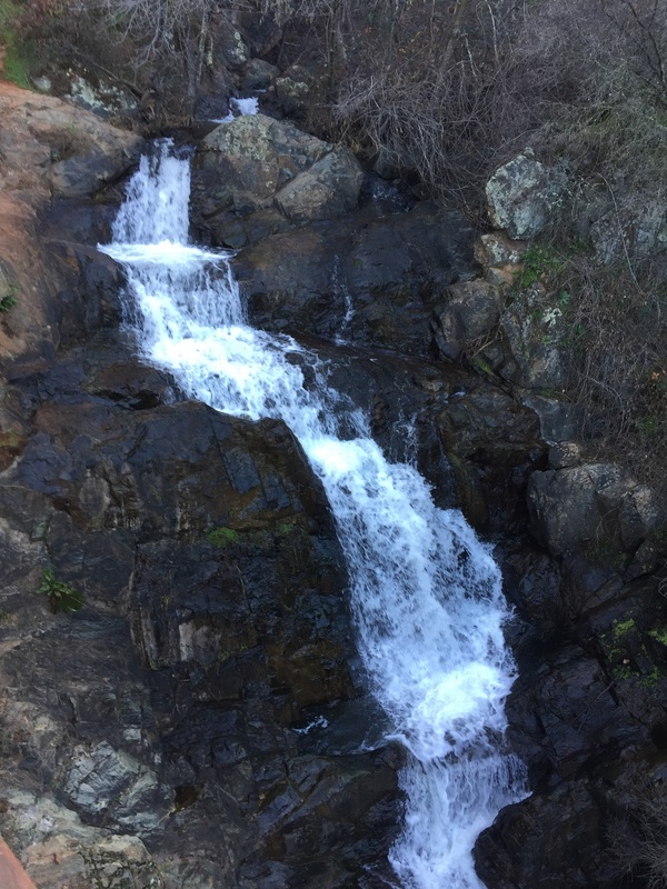
Best time to visit: After a good rain storm, when the falls are in full force

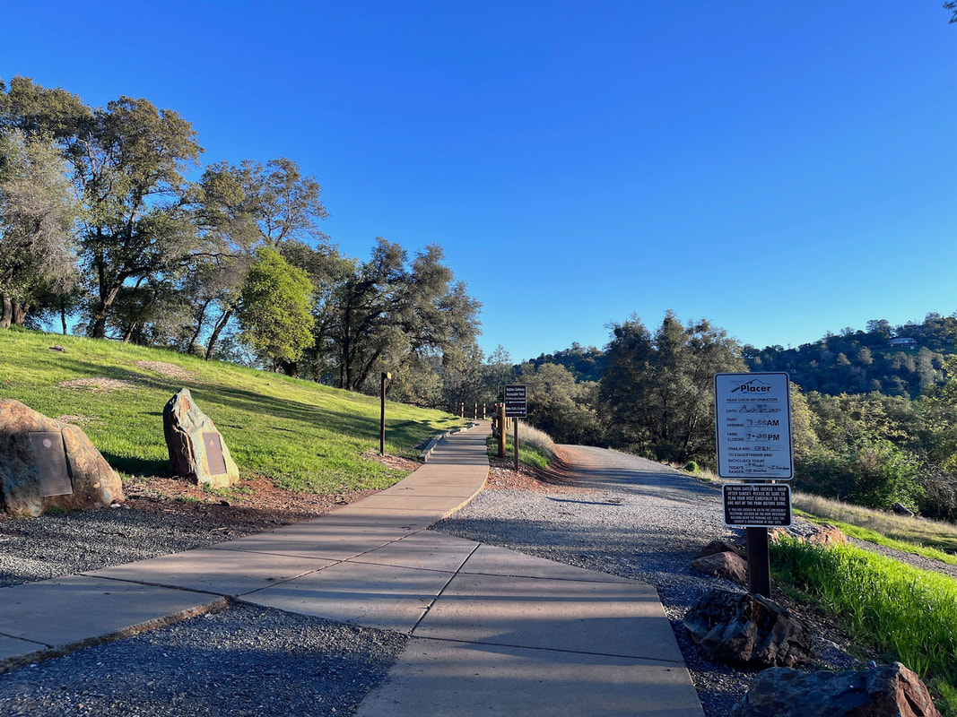
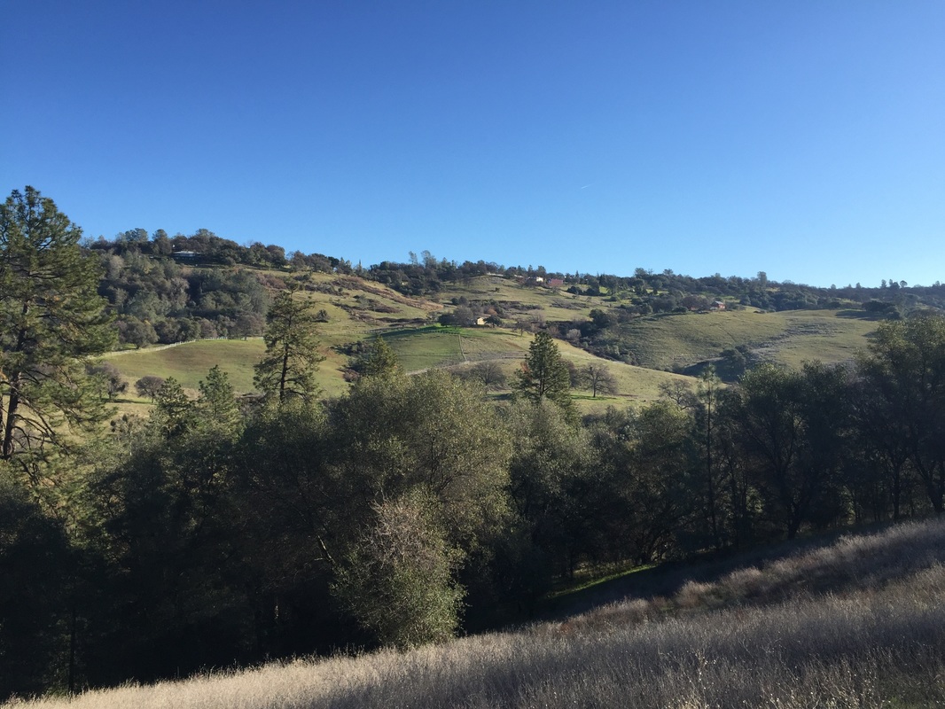
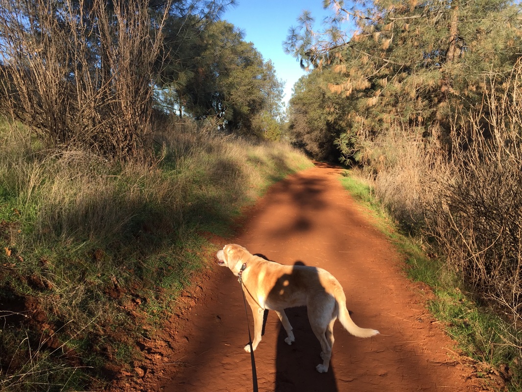
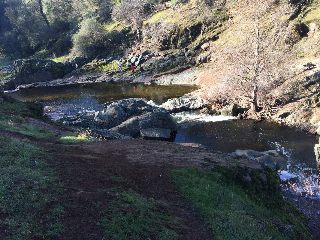
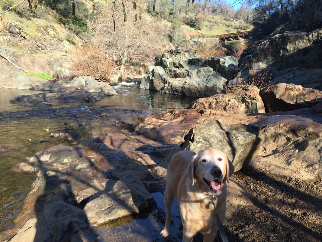
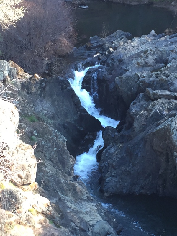
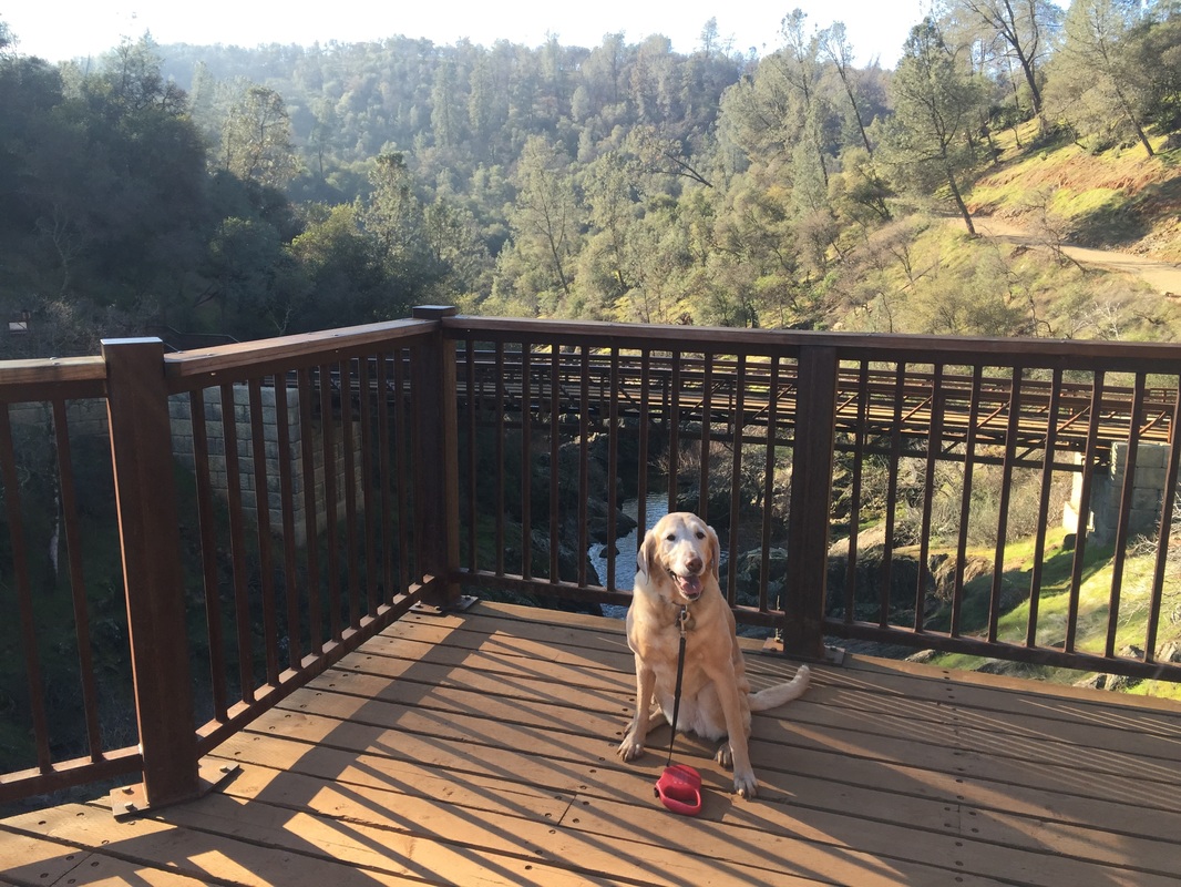
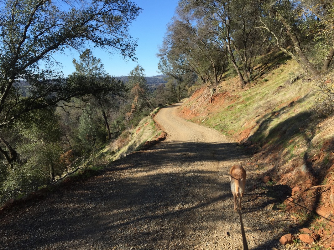
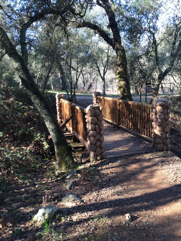
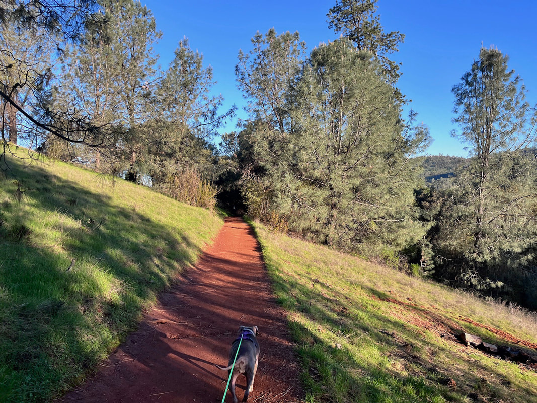
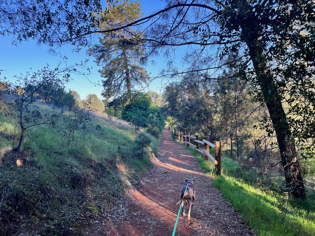
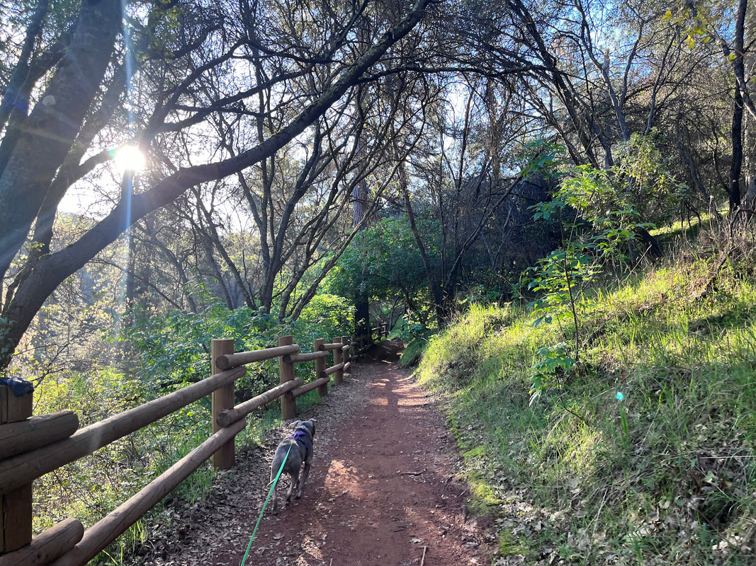
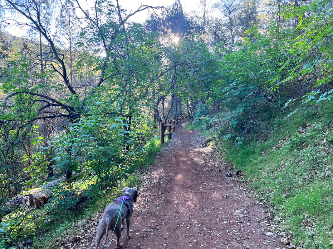
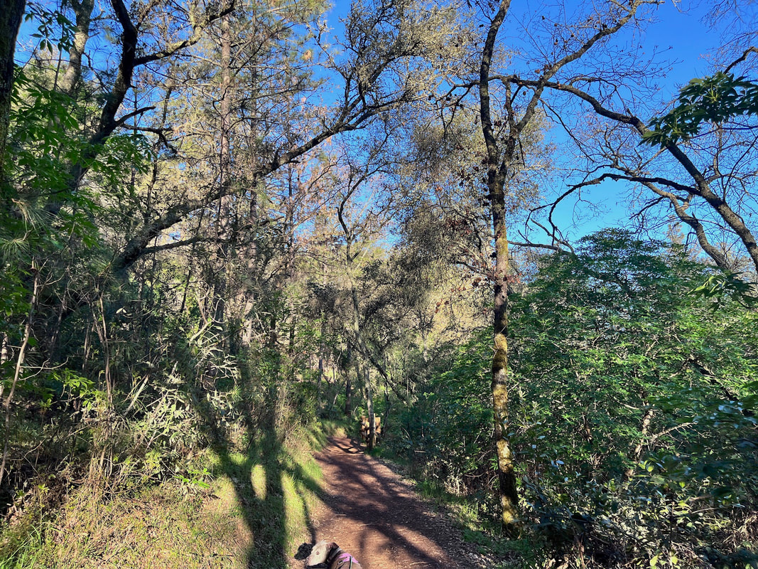
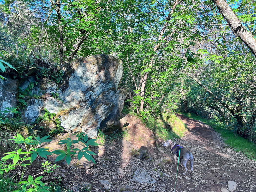
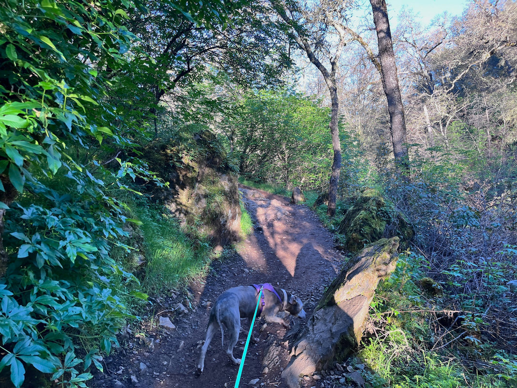
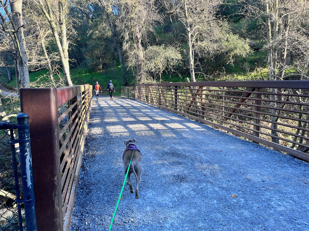
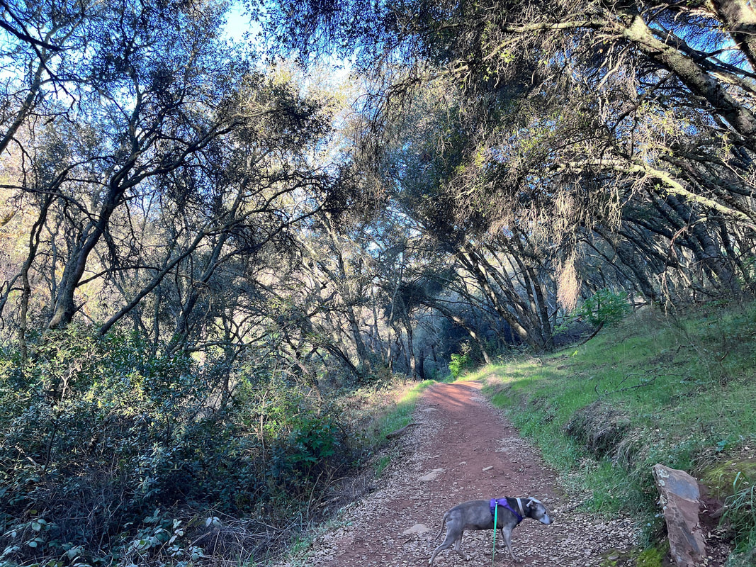
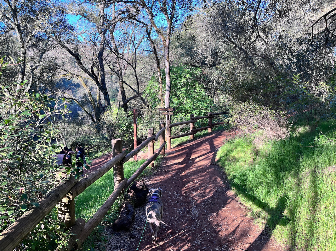
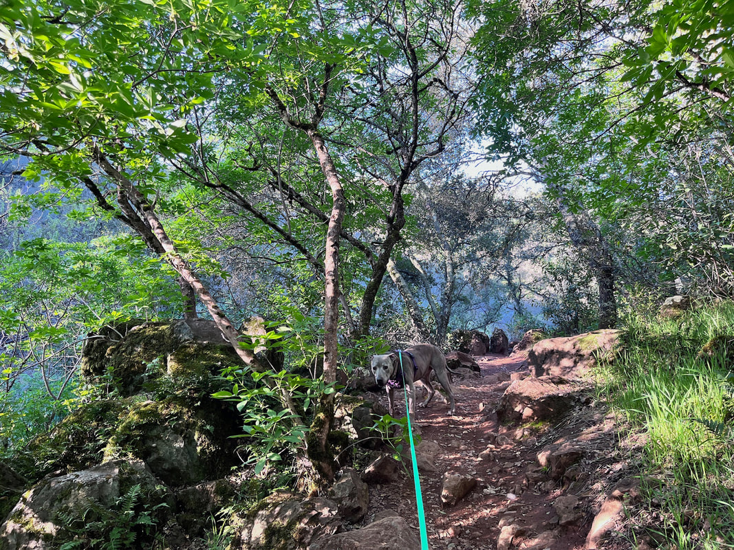
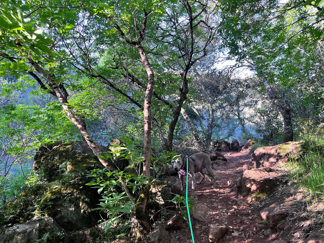
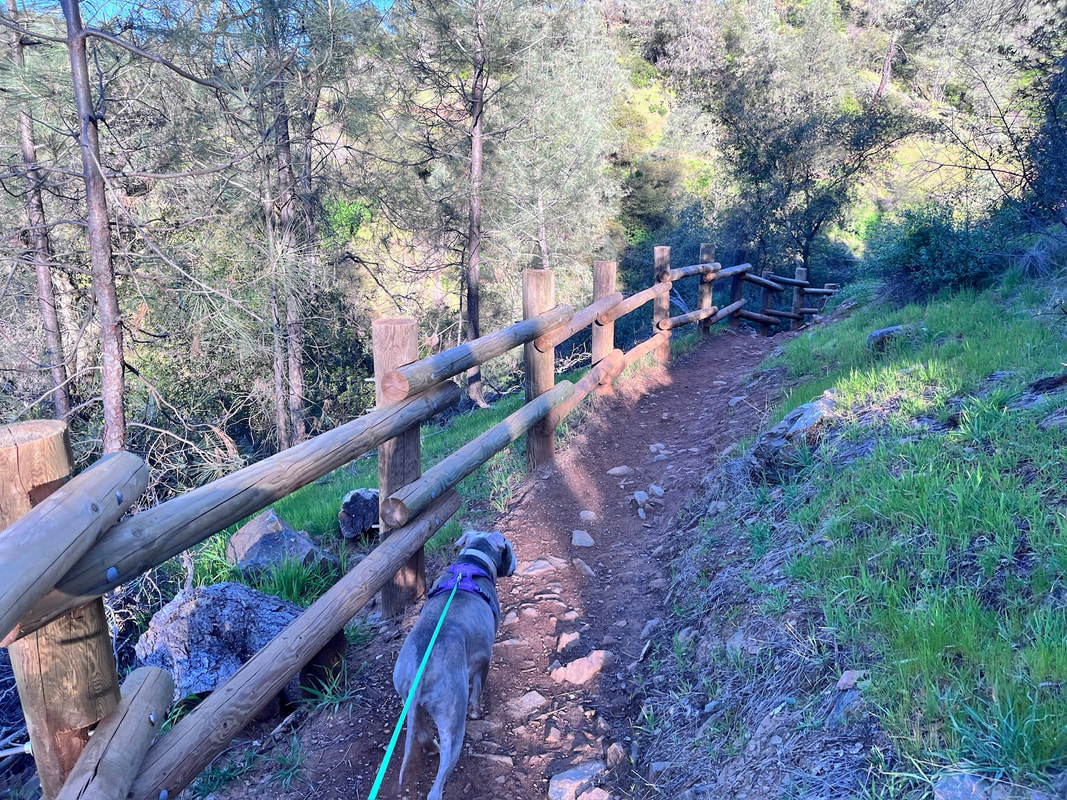
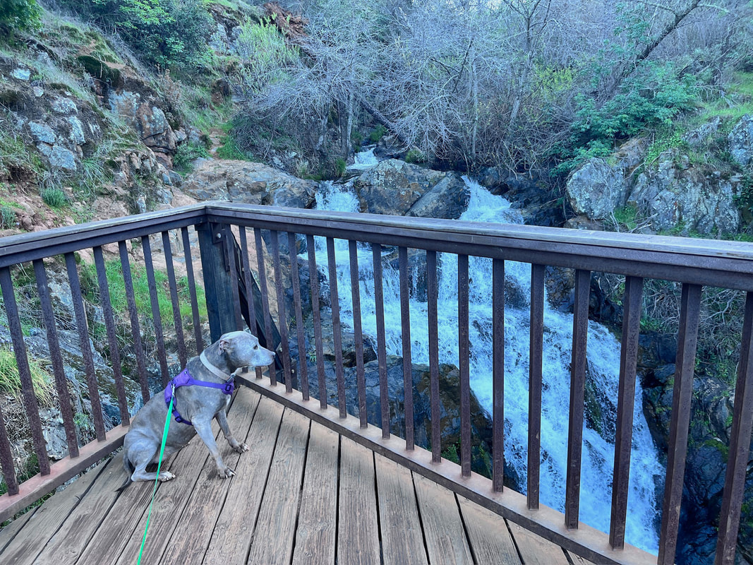
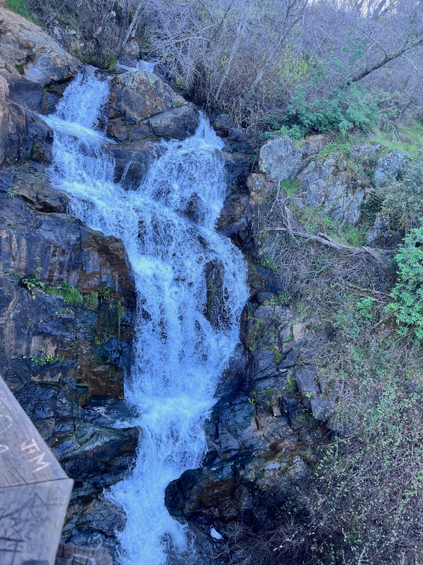
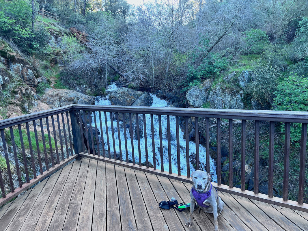
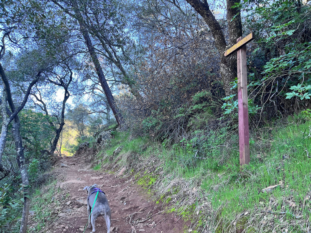
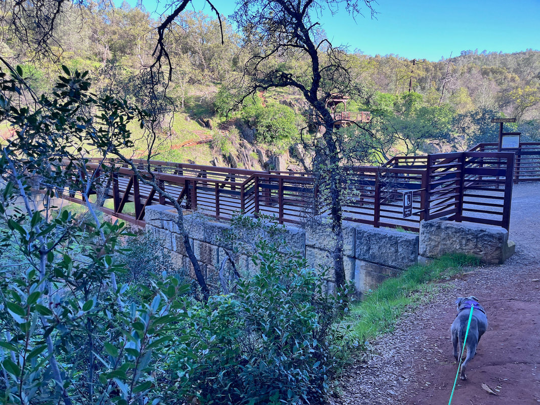
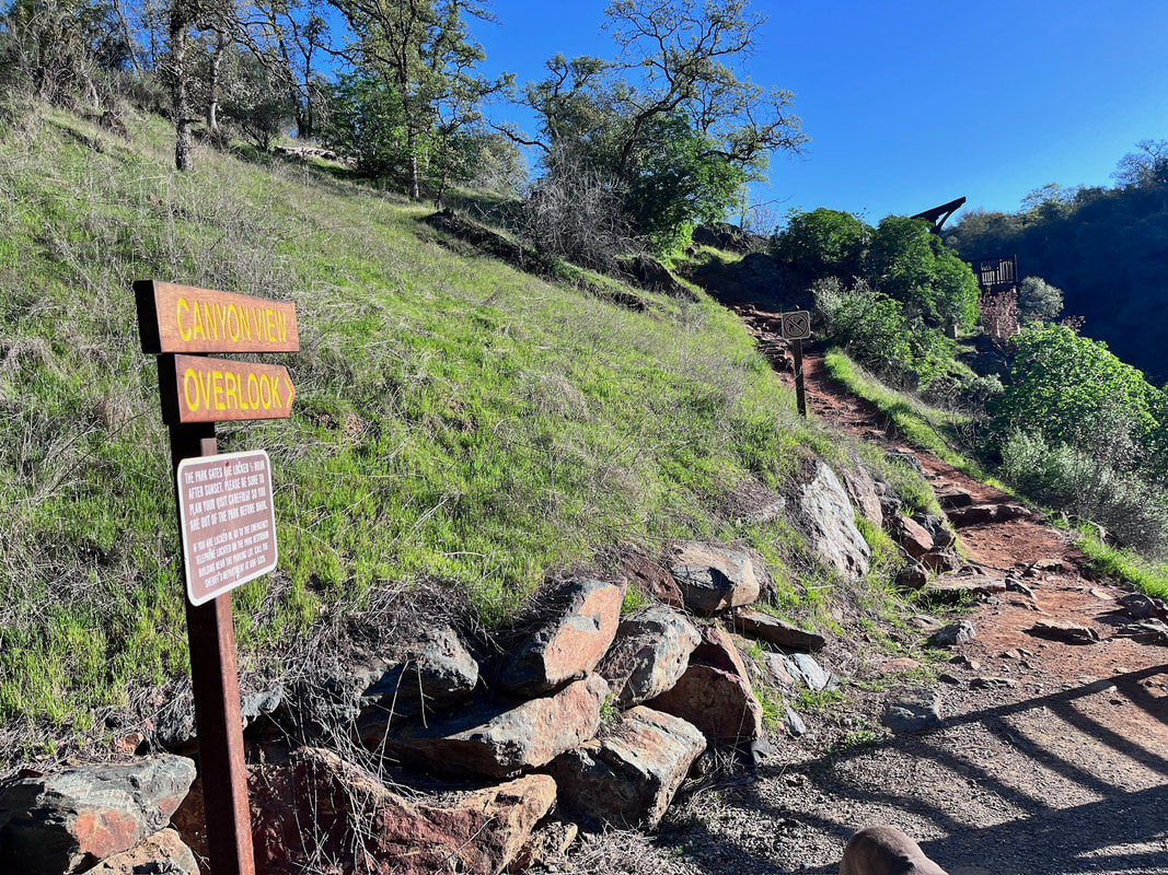
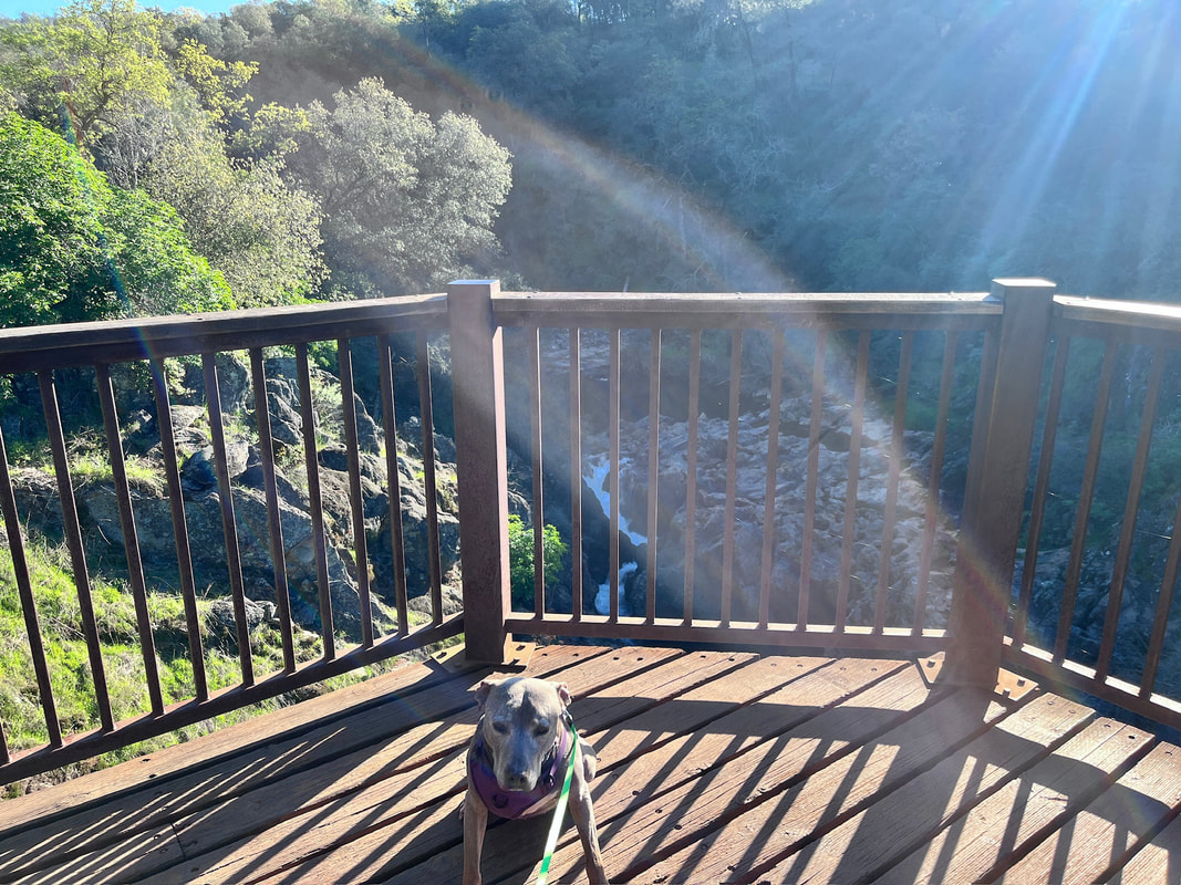
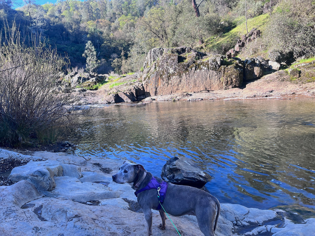
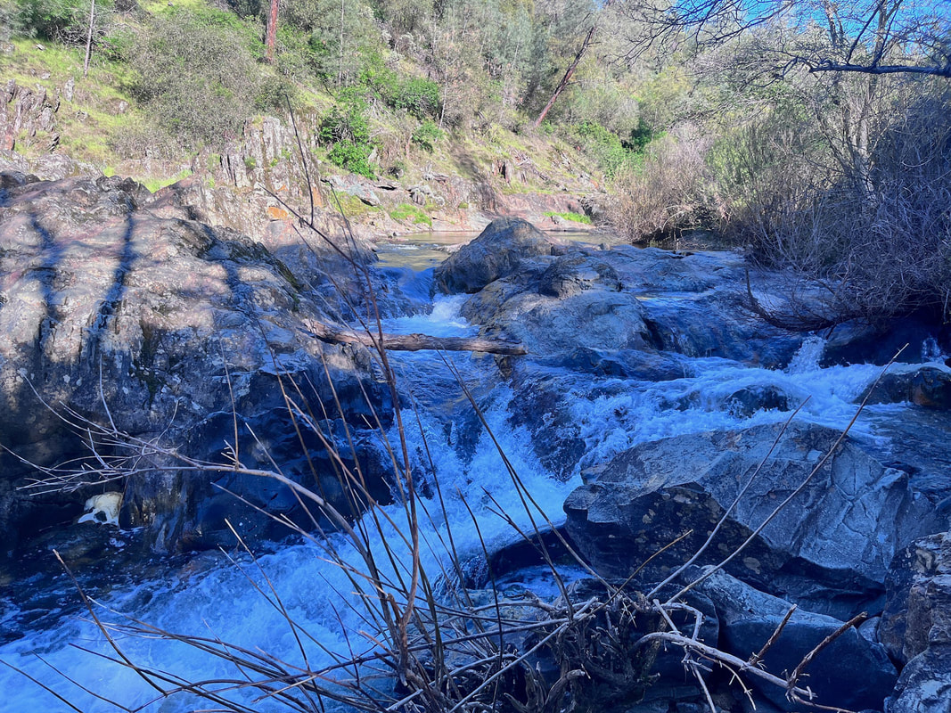
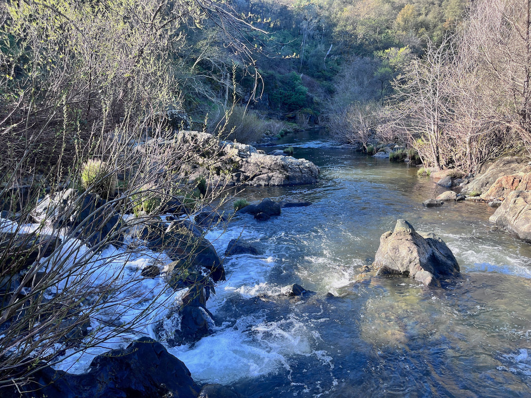
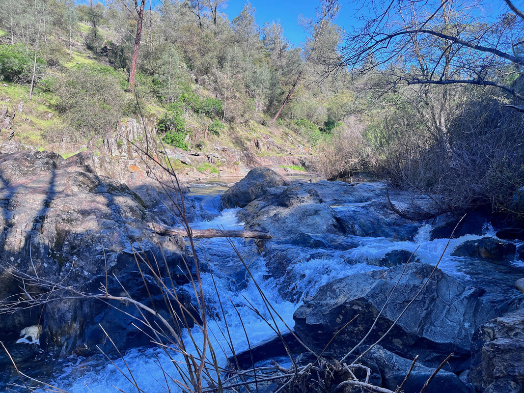
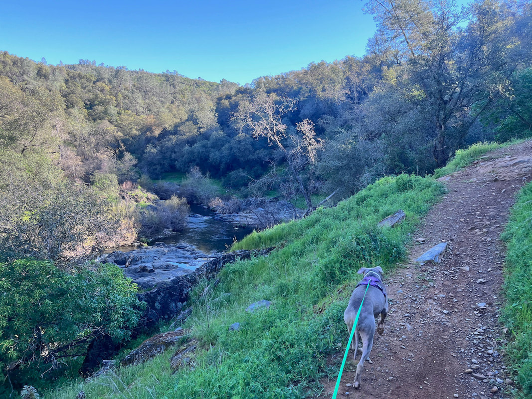
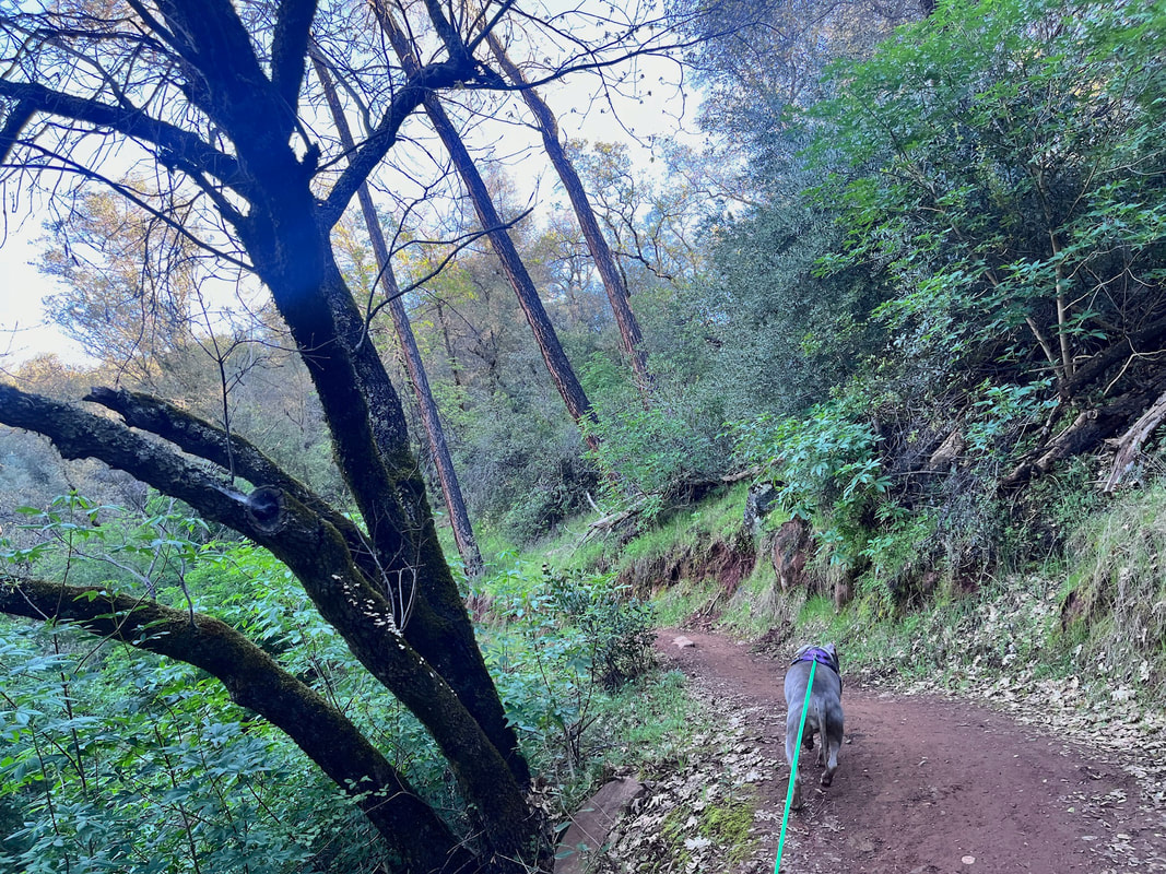
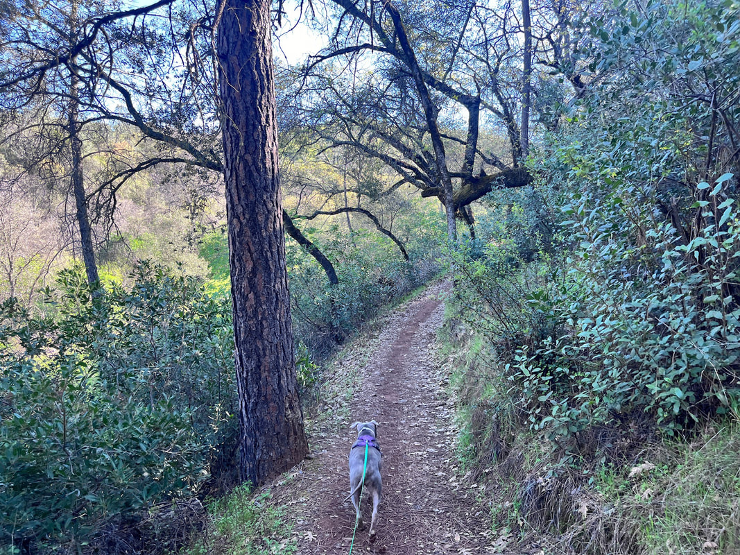
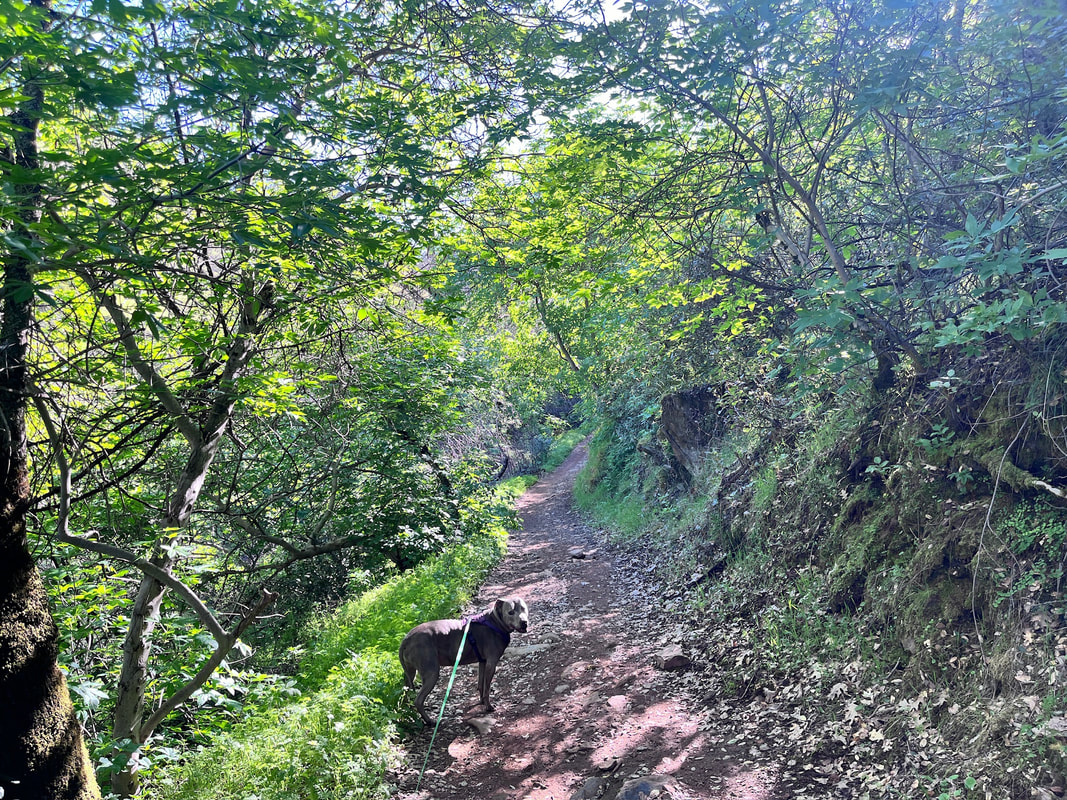
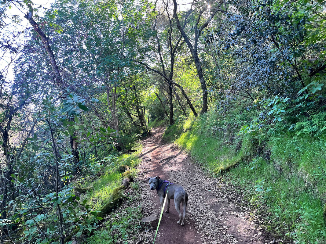
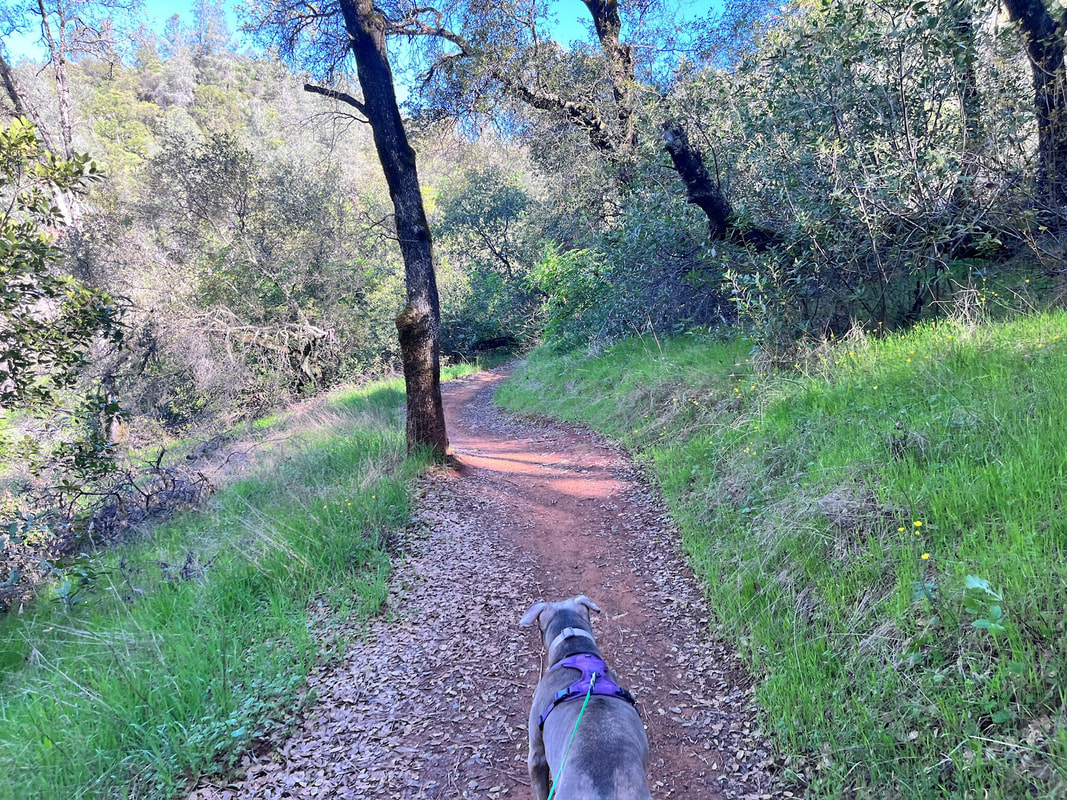
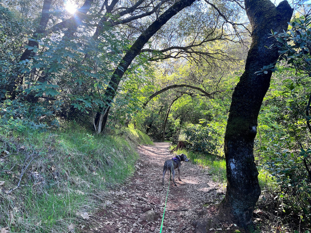
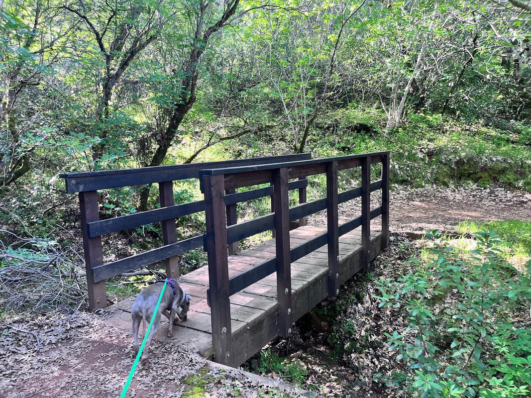
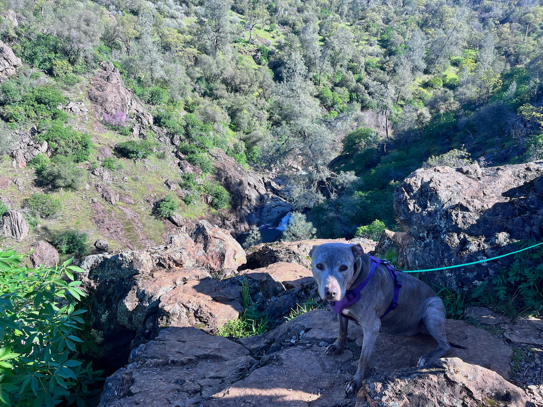
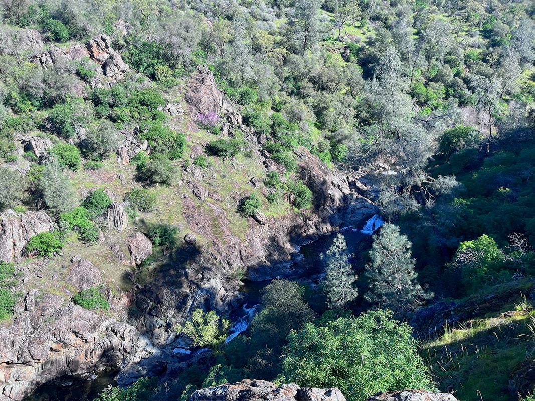
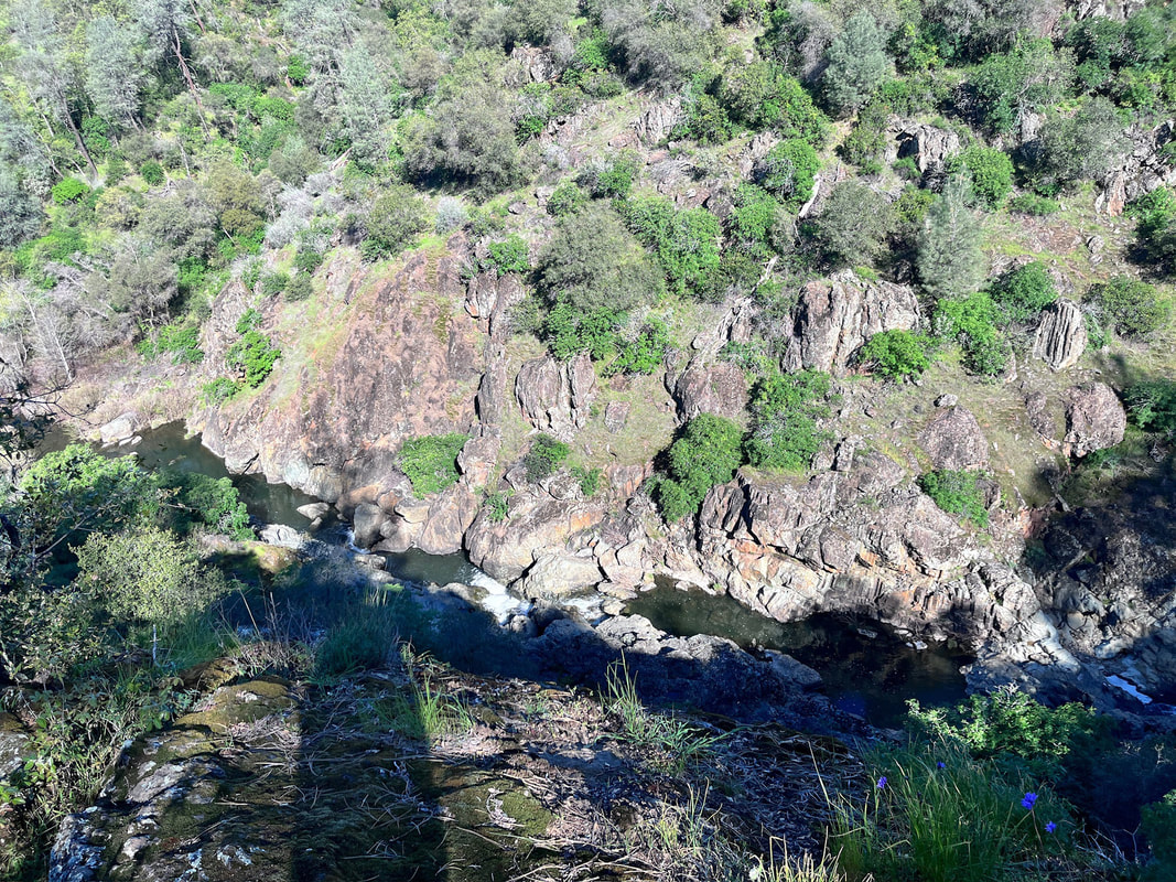
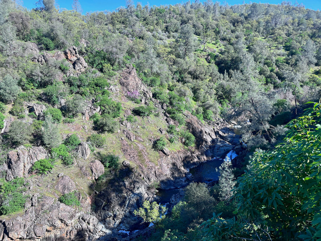
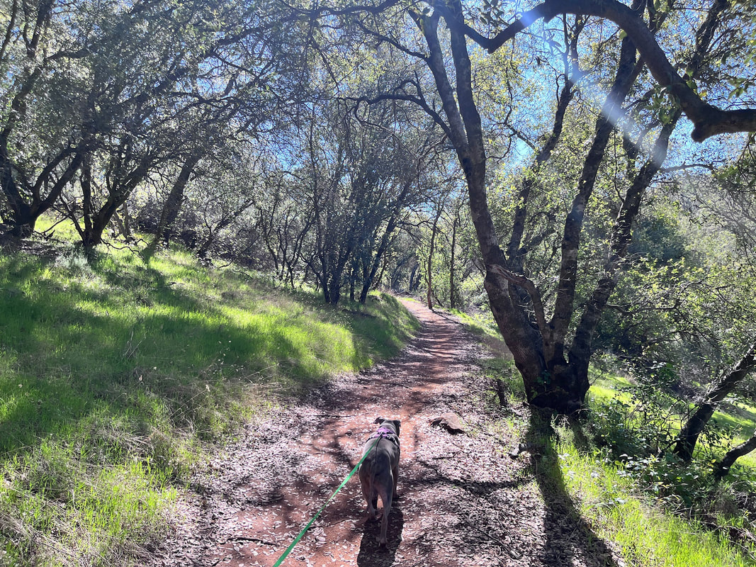
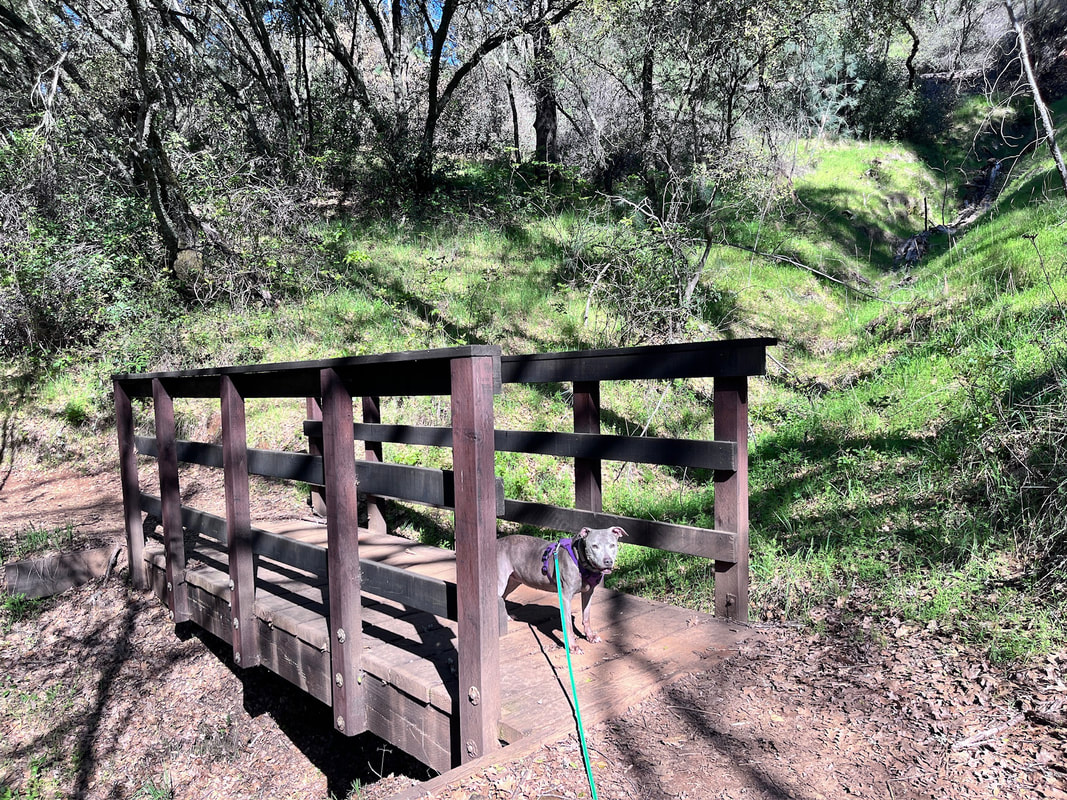
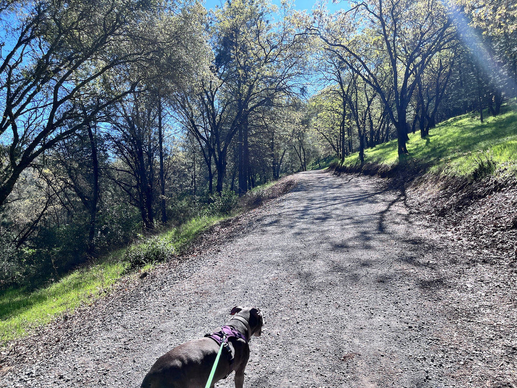
Description: This is a very scenic park with 30 miles of trails, multiple waterfalls, well maintained trails, beautifully constructed bridges, decks and a lookout tower. The first time we visited (years ago), reservations weren't required and it was pretty packed by mid-day. This time we visited early on a weekend, but hiked until noon, and we did not encounter crowds at all. I'd recommend you start by hiking down to Hidden Falls first, as this is the spot that gets crowded. A short walk from there will take you to the lookout of Canyon View Falls. If you head back from here, it's only about a 3.5 mile round trip hike, but I'd encourage you to check out some other trails. Most people stick to the waterfall area, so once you head out from there, you probably won't encounter many people. I found the hike to Seven Pools Vista just as scenic and enjoyable as the beginning of the hike, and it made me wonder why no one else was hiking it. We encountered a few people on horses when we were headed back, but the remainder of the hike we had to ourselves. Please see below for more info on this recommended route. 

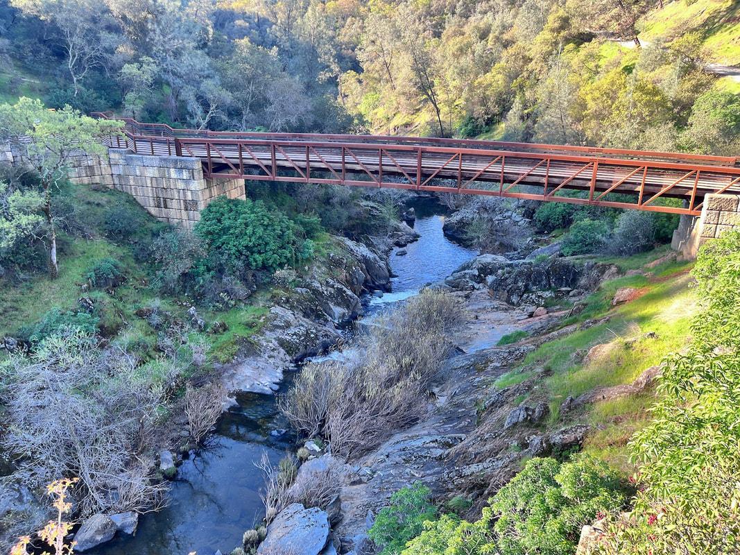
On a different visit, I hiked the other side of the park, past the Canyon View Lookout, but I much preferred the Seven Pools Vista side. During that visit, I wanted to loop back via Ringtail Trail, but this was a one-way only trail, which it did not note on the map. We ended up on the ridge, where there was not much to see and we didn't pass anyone for miles. There were a lot of Mountain Lion warning signs, and we passed some deer bones, which made me uneasy. We hiked all the way to Gold Finch and South Legacy Way. Salmon Run Bridge was a welcome scene after not seeing much for several miles. Overall, this route was about a 10 mile hike. It was a great workout, but not very scenic. As mentioned previously, I'd definitely recommend sticking to the Seven Pools Vista side of the park. 

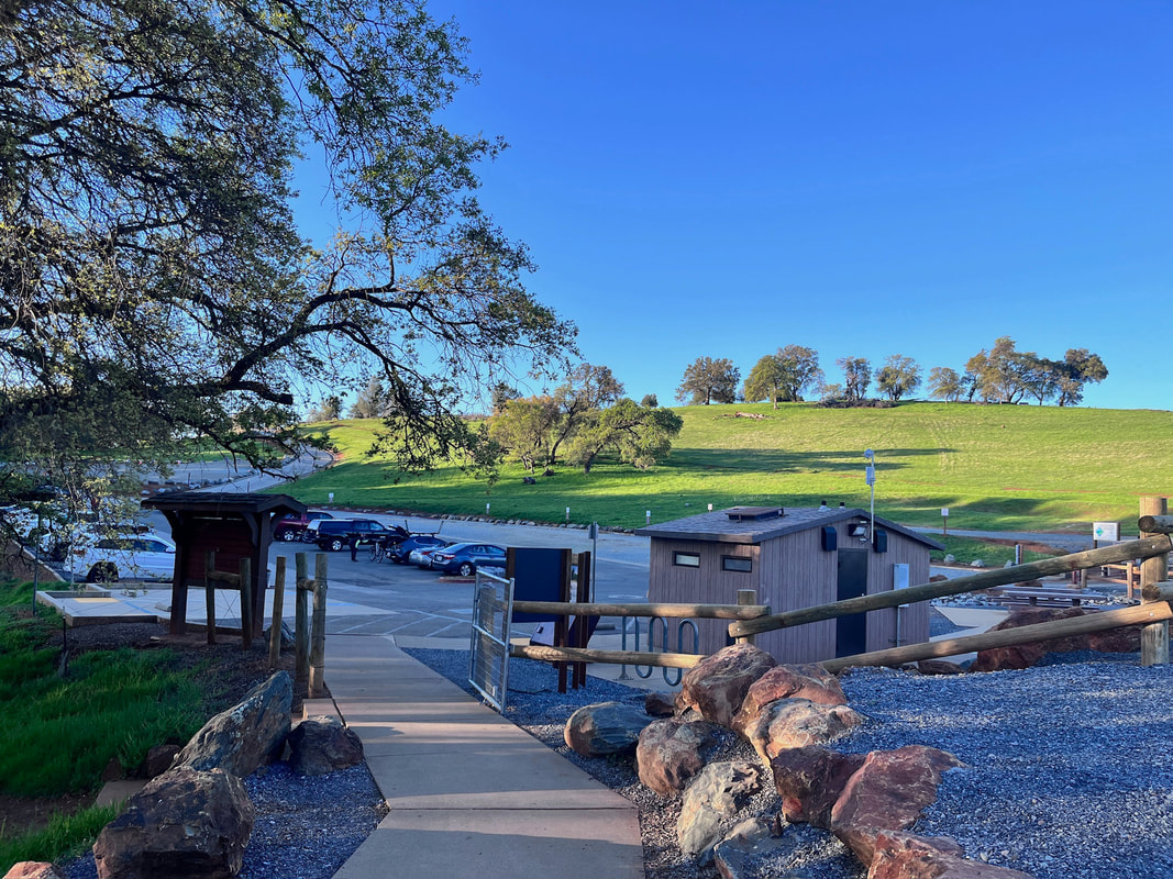
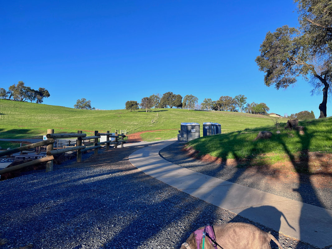
There are toilets, water and trash cans at the trailhead.
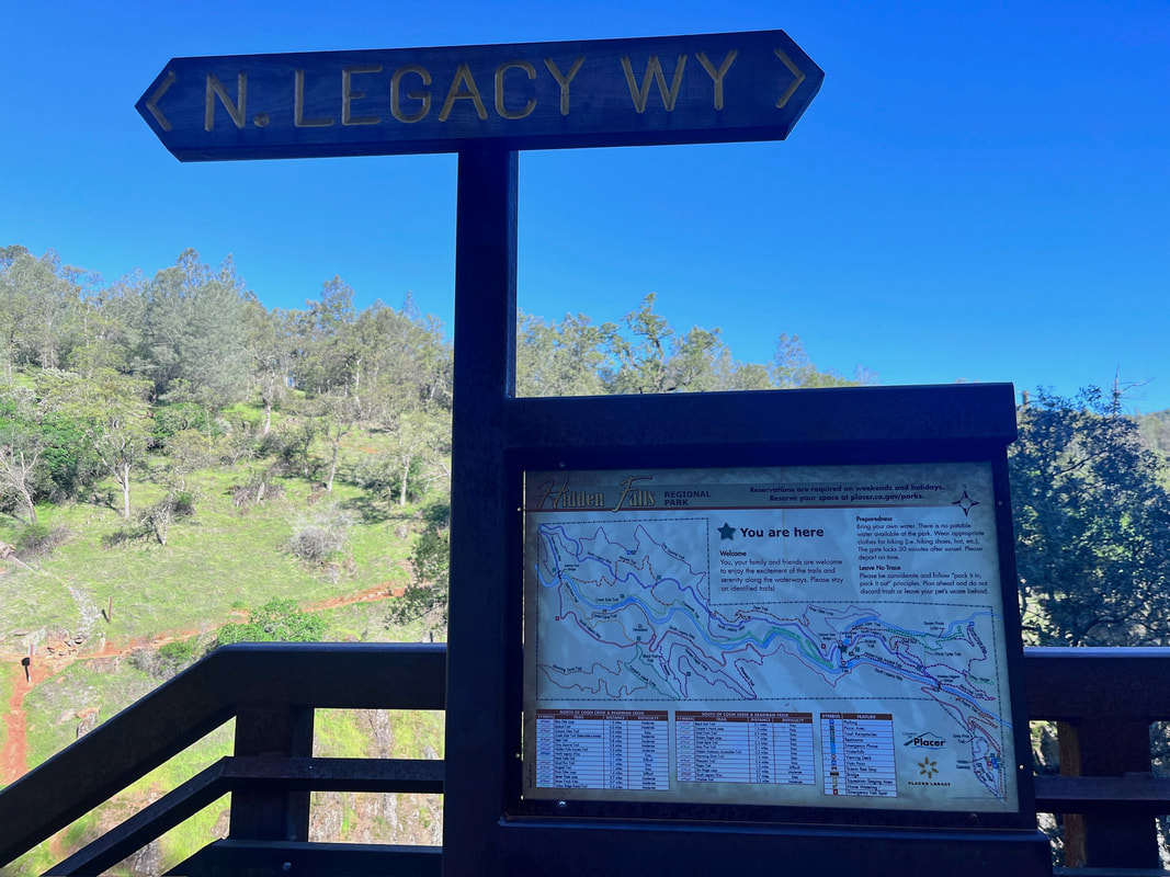
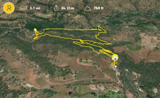
Click here for more information on reservations, and to reserve parking
Click here for a trail map courtesy of the County of Placer Parks and Open Space
Recommended Loop 
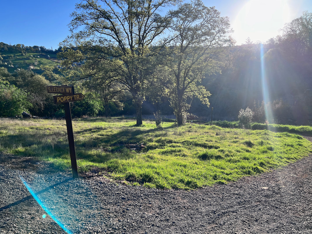
Poppy Trail>Hidden Falls Access Trail>Canyon View Bridge>Canyon View Trail>Seen Pools Loop>Seven Pools Vista>Blue Oak>South Legacy Way
Trail stats: 5.1 miles, 767ft elevation gain
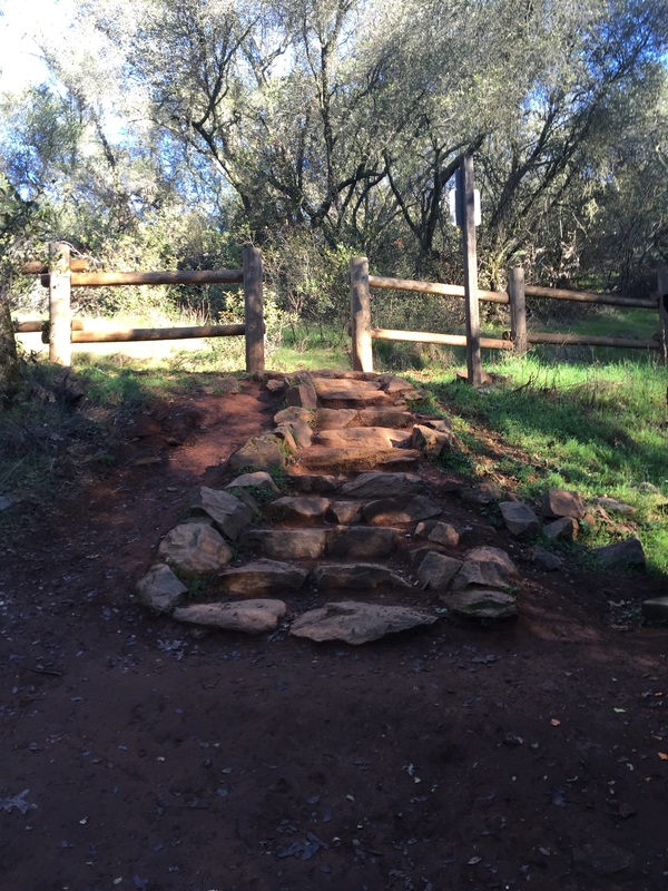
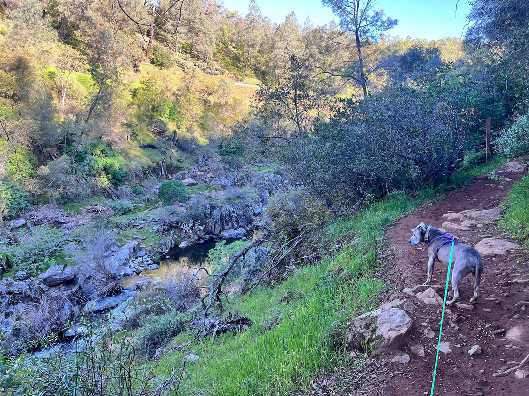
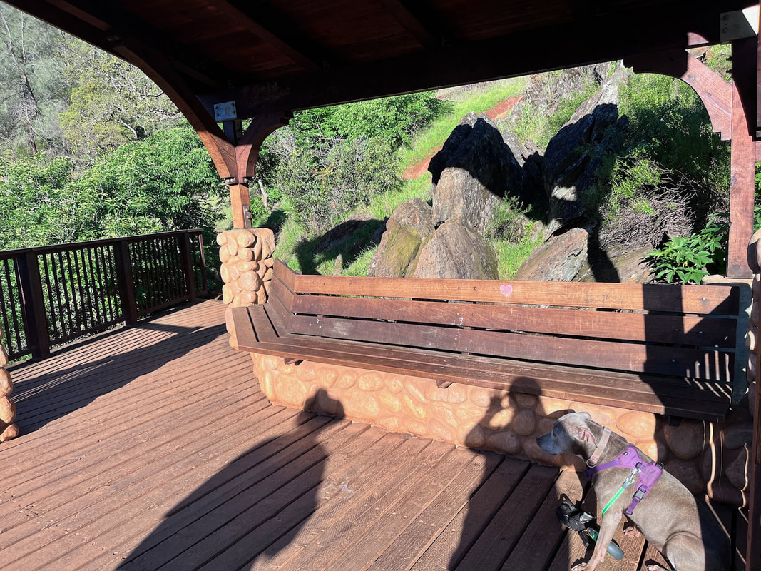
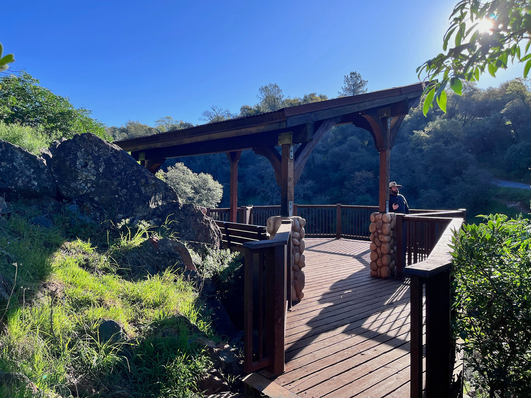
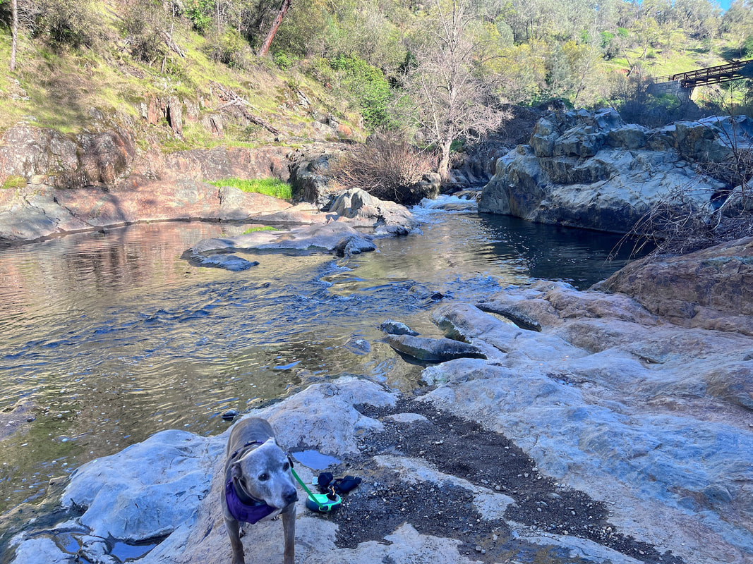
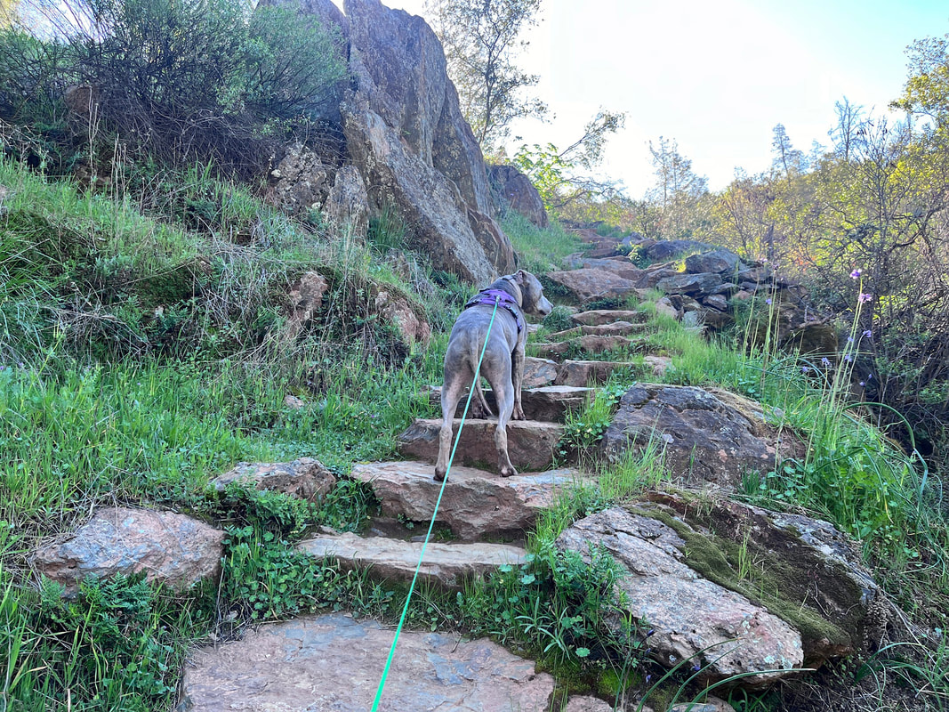
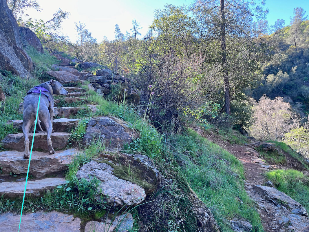
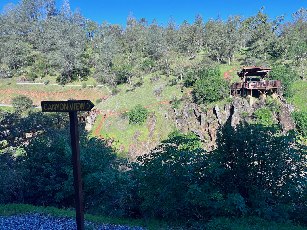
We took Poppy Trail down to Hidden Falls Access Trail, which is the most scenic. You can also take South Legacy Way, which is slightly shorter but not as scenic. After viewing the waterfall from the deck lookout, we headed down to the water (there are rock stairs a bit before the lookout). There's one large boulder near the bottom that will be difficult for dogs, but if you have two people, you should easily be able to help your down down. It's a beautiful spot to sit by the running creek and take a break. From there, we crossed Canyon View Bridge and went to the Canyon View lookout, where you can see Canyon Falls in the distance. We took Canyon View trail to Seven Pools Loop to Seven Pools Vista. There's a beautiful lookout spot there overlooking the canyon and several pools down below. This was a great spot to stop for lunch. From there we headed back by taking Blue Oak to North Legacy to South Legacy Way. ​
Picture
Contact Us
Privacy Policy
Terms and Conditions
All content within this site Copyright © 2023 Hikes Dogs Love. All rights reserved. No part of this website may be reproduced without permission.
DMCA.com Protection Status
  • Home
  • Map View
    • Vacation Hikes >
      • Arizona >
        • Papago Park
      • New Mexico >
        • Oliver Lee Memorial State Park >
          • Browse All >
            • Alameda County >
              • Albany Bulb
              • Alameda Creek Regional Trail
              • Barlago Italian Kitchen
              • Brickyard Cove
              • Brushy Peak Regional Preserve
              • Anthony Chabot Regional Park (Lake Chabot)
              • Aquatic Park
              • Buchanan Dog Beach
              • California Canoe & Kayak (Oakland)
              • Cali Kid Burgers ‘N Shakes
              • César Chávez Park
              • Chabot Park
              • Claremont Canyon
              • Coyote Hills Regional Park
              • Crab Cove
              • Cull Canyon Regional Recreation Area
              • Dimond Canyon Park
              • Don Castro Regional Recreation Area
              • Don Edwards Wildlife Refuge
              • Dublin Hills Regional Park
              • Emeryville Marina
              • Fairmont Ridge
              • Five Canyons Open Space Preserve
              • Fremont Central Park
              • Garin/Dry Creek Pioneer Regional Park
              • Gilman Brewing Company
              • Greenbelt Trails
              • Hayward Regional Shoreline
              • Heron Bay Trail
              • Ikaros Greek Restaurant
              • Jerusalem Organic Kitchen
              • Joaquin Miller Park
              • Lake Anza
              • Lake Chabot
              • Lake Merritt
              • Leona Canyon Regional Open Space Preserve
              • Leona Heights Park
              • Marina Park
              • Martin Canyon Creek Trail
              • Martin Luther King Jr. Regional Shoreline
              • Mission Peak
              • Montclair Railroad Trail/ Torii Gate
              • Morgan Territory Regional Preserve
              • Oyster Bay Regional Shoreline
              • Park Street Classic Car Show (Annual)
              • Pleasanton Ridge Regional Preserve
              • Point Emery
              • Reinhardt Redwood Regional Park
              • Robert's Park
              • Room 389
              • Shoreline Park
              • Sibley Volcanic Regional Preserve
              • Skyline Gate Staging Area
              • Strawberry Canyon Fire Trail
              • Sunol Regional Wilderness
              • Temescal Regional Recreation Area
              • Tilden Regional Park
              • Upper Anthony Chabot Regional Park (Oakland Entrance)
              • Upper Knowland Park
              • Vargas Plateau Regional Park
            • Butte County >
              • Feather Falls
              • Motel 6 - Oroville
              • Riverbend Park
            • Contra Costa County >
              • Acalanes Ridge Open Space
              • Briones Regional Park
              • Carquinez Strait Regional Shoreline
              • Crockett Hills Regional Park
              • Diablo Foothills Regional Park
              • EBMUD Trails
              • Fernandez Ranch
              • Frowning Ridge
              • Geppetto's Caffe
              • Hacienda de las Flores Park
              • Hillside Nature Area
              • Howe Homestead Park
              • Indian Rock
              • Kennedy Grove Regional Recreation Area
              • Lafayette Community Park
              • Lafayette Reservoir
              • Las Trampas Regional Wilderness
              • Lime Ridge Open Space
              • Miller/Knox Regional Shoreline
              • Moraga Commons Park
              • Mulholland Ridge Open Space Preserve
              • Point Isabel
              • Point Molate Beach Park
              • Point Pinole Regional Shoreline
              • Point San Pablo Harbor
              • Rubio's
              • San Quentin Beach
              • Shell Ridge Open Space
              • Sobrante Ridge Regional Preserve
              • Sugarloaf Open Space
              • Sycamore Valley Open Space Preserve
              • Tender Greens
              • Tilden Regional Park
              • Wildcat Canyon Regional Park
            • El Dorado County >
              • Angora Lakes Trail
              • Bijou Community Park
              • Cascade Falls
              • Horsetail Falls
              • Inspriation Point
              • Motel 6 - South Lake Tahoe
              • Mt. Tallac
            • Marin County >
              • 101 Surf Sports
              • Baltimore Canyon Open Space Preserve
              • Blackie's Pasture
              • Camino Alto Preserve
              • Carson Falls
              • Cascade Falls
              • Cataract Falls
              • Dawn Falls
              • Hippie Tree
              • Ignacio Valley Preserve (Fairway Falls)
              • Indian Valley Open Space Preserve
              • King Mountain Open Space Preserve
              • Marin Headlands (Coastal Trail)
              • Old Saint Hilary's Open Space Preserve
              • Phoenix Lake
              • Red Hill Dog Park
              • Red Hill Trail
              • Ring Mountain Open Space Preserve
              • Roy's Redwoods
              • Sam's Anchor Cafe
              • Sorich Ranch Park
              • Tiburon Peninsula Historical Trail
              • Tiburon Uplands
              • Tucker Trail Falls
            • Mariposa County >
              • Happy Burger Diner
              • Yosemite National Park
            • Mendocino County >
              • Catch-a-Canoe
              • Gowan's Heirloom Ciders
              • MacKerricher State Park
              • Mendocino Headlands State Park
              • Navarro River Redwoods State Park
              • Princess Seafood
              • Skunk Train
              • The Stanford Inn By The Sea
              • Van Damme State Beach
            • Mono County >
              • Bodie State Historic Park
              • Jolly Kone
              • Lundy Canyon
              • Mono Lake (Tufa State National Reserve)
              • Virginia Creek Settlement
            • Monterey County >
              • 17-Mile Drive
              • Asilomar State Beach
              • Bistro Beaujolais
              • Carmel Beach
              • Fishwife
              • Fort Ord Dunes State Park
              • Garland Ranch Regional Park
              • Jack's Peak
              • Monterey Bay Coastal Trail
              • Monterey Bay Kayaks
              • Monterey Municipal Beach
              • Motel 6 - Downtown Monterey
              • Ryan Ranch Disc Golf Course
              • Ventana Wilderness
            • Nevada County >
              • Fairy Falls
            • Placer County >
              • Hidden Falls
              • Regional Park Auburn Disc Golf Course
              • Thirsty Barrel Taphouse & Grille
              • Wolf Creek Trail
              • The Yeti Tavern
            • San Francisco County >
              • 2.2 Mile Urban Hike
              • Bernal Heights Park
              • The Brixton
              • Billy Goat Hill Park
              • Blackwood
              • Clipper Cove Beach
              • Crissy Field
              • Dynamo Donut + Coffee
              • Fort Funston
              • Fort Mason
              • Glen Canyon Park
              • Golden Gate Park
              • Grand View Park
              • The Great Lawn/ Avenue of the Palms
              • Java Beach Cafe
              • John McLaren Park
              • Interior Greenbelt
              • Lake Merced
              • Lands End
              • Letterman Digital Arts Center
              • Marina Green
              • Mount Davidson
              • Mount Sutro Open Space Reserve
              • Ocean Beach
              • Palace of Fine Arts
              • Philz Coffee Truck
              • Stern Grove
              • Sutro Baths
              • Sutro Heights Park
              • TreasureFest
            • San Mateo County >
              • 7 Mile House Sports Bar & Grill
              • Barbara's Fishtrap
              • Bedwell Bayfront Park
              • Bob's Vegetable Stand and Pumpkin Farm
              • Cafe Pacifica
              • Devil's Slide Coastal Trail
              • Esplanade Beach
              • Flying Fish Grill
              • Half Moon Bay Kayak Co.
              • McNee Ranch State Park (Montara Mountain)
              • Montara State Beach
              • Mori Point
              • Mussel Rock Park
              • Nick's Seafood Restaurant
              • Panera Bread
              • Pedro Point Headlands
              • Poplar Beach
              • Pulgas Ridge Open Space Preserve
              • Rancho Corral de Tierra
              • Seal Point
              • Taqueria La Mexicana
              • Wavecrest Open Space
            • Santa Clara County >
              • Byxbee Park
              • Calero County Park
              • Uvas Canyon County Park
            • Santa Cruz County >
              • Byrne-Milliron Forest
              • Greyhound Rock County Park
              • Henry Cowell Redwoods State Park
              • Jaliscos Restaurant
              • Mount Madonna County Park
              • Roaring Camp Railroads
            • Solano County >
              • Alvarez 9th Street Park
              • Benicia Classic Car Show
              • Benicia Waterfront
              • Lagoon Valley Park
              • Peña Adobe Regional Park
            • Sonoma County >
              • Doran Regional Park
              • Fishetarian
              • Helen Putnam Regional Park
            • Tuolumne County >
              • Donnell Vista
              • Tuttletown Recreation Area
            • Yuba County >
              • Ellis Lake
        • White Sands National Monument
      • Oregon >
        • Multnomah Falls
      • Washington >
        • Olympic National Park >
          • Kalaloch Beach
          • Madison Falls
          • Quinault Rainforest
        • Rattlesnake Ridge
  • More
    • Vacation Spots >
      • Restaurants >
        • Southern California >
          • Fire Island Grill
          • Lazy Dog Restaurant & Bar
          • Perkies Coffee Haus
        • Washington >
          • Rose Pho
    • Archived Hikes >
      • Archived Hikes 2
      • Archives 2016-2018
    • Planning Your Trip
    • Dog Gear
    • About >
      • Contact Us
      • Privacy Policy
      • Terms and Conditions