Hikes Dogs Love
  • Home
  • Browse All
    • Alameda County >
      • Albany Bulb
      • Alameda Creek Regional Trail
      • Anthony Chabot Regional Park (Lake Chabot)
      • Aquatic Park
      • Chabot Park
      • Barlago Italian Kitchen
      • Buchanan Dog Beach
      • California Canoe & Kayak (Oakland)
      • César Chávez Park
      • Claremont Canyon
      • Coyote Hills Regional Park
      • Crab Cove
      • Cull Canyon Regional Recreation Area
      • Dimond Canyon Park
      • Don Castro Regional Recreation Area
      • Don Edwards Wildlife Refuge
      • Dublin Hills Regional Park
      • Fairmont Ridge
      • Five Canyons Open Space Preserve
      • Fremont Central Park
      • Garin/Dry Creek Pioneer Regional Park
      • Greenbelt Trails
      • Hayward Regional Shoreline
      • Heron Bay Trail
      • Holy Land Restaurant
      • Ikaros Greek Restaurant
      • Jerusalem Organic Kitchen
      • Joaquin Miller Park
      • Lake Anza
      • Lake Chabot
      • Lake Merritt
      • Leona Canyon Regional Open Space Preserve
      • Leona Heights Park
      • Marina Park
      • Martin Canyon Creek Trail
      • Martin Luther King Jr. Regional Shoreline
      • Mission Peak
      • Montclair Railroad Trail/ Torii Gate
      • Morgan Territory Regional Preserve
      • Oyster Bay Regional Shoreline
      • Park Street Classic Car Show (Annual)
      • Pleasanton Ridge Regional Preserve
      • Reinhardt Redwood Regional Park
      • Robert's Park
      • Room 389
      • Shoreline Park
      • Sibley Volcanic Regional Preserve
      • Skyline Gate Staging Area
      • Strawberry Canyon Fire Trail
      • Sunol Regional Wilderness
      • Temescal Regional Recreation Area
      • Tilden Regional Park
      • Upper Anthony Chabot Regional Park (Oakland Entrance)
      • Upper Knowland Park
      • Vargas Plateau Regional Park
    • Butte County >
      • Feather Falls
      • Motel 6 - Oroville
      • Riverbend Park
    • Contra Costa County >
      • Acalanes Ridge Open Space
      • Briones Regional Park
      • Carquinez Strait Regional Shoreline
      • Crockett Hills Regional Park
      • Diablo Foothills Regional Park
      • EBMUD Trails
      • Fernandez Ranch
      • Frowning Ridge
      • Geppetto's Caffe
      • Hacienda de las Flores Park
      • Hillside Nature Area
      • Howe Homestead Park
      • Indian Rock
      • Kennedy Grove Regional Recreation Area
      • Lafayette Community Park
      • Lafayette Reservoir
      • Las Trampas Regional Wilderness
      • Lime Ridge Open Space
      • Miller/Knox Regional Shoreline
      • Moraga Commons Park
      • Mulholland Ridge Open Space Preserve
      • Point Isabel
      • Point Molate Beach Park
      • Point Pinole Regional Shoreline
      • Point San Pablo Harbor
      • Rubio's
      • San Quentin Beach
      • Shell Ridge Open Space
      • Sobrante Ridge Regional Preserve
      • Sugarloaf Open Space
      • Sycamore Valley Open Space Preserve
      • Tender Greens
      • Tilden Regional Park
      • Wildcat Canyon Regional Park
    • El Dorado County >
      • Angora Lakes Trail
      • Bijou Community Park
      • Cascade Falls
      • Horsetail Falls
      • Inspriation Point
      • Motel 6 - South Lake Tahoe
      • Mt. Tallac
    • Marin County >
      • 101 Surf Sports
      • Baltimore Canyon Open Space Preserve
      • Blackie's Pasture
      • Camino Alto Preserve
      • Carson Falls
      • Cascade Falls
      • Cataract Falls
      • Dawn Falls
      • Ignacio Valley Preserve (Fairway Falls)
      • Indian Valley Open Space Preserve
      • King Mountain Open Space Preserve
      • Marin Headlands (Coastal Trail)
      • Old Saint Hilary's Open Space Preserve
      • Phoenix Lake
      • Ring Mountain Open Space Preserve
      • Roy's Redwoods
      • Sam's Anchor Cafe
      • Tiburon Peninsula Historical Trail
      • Tucker Trail Falls
    • Mariposa County >
      • Happy Burger Diner
      • Yosemite National Park
    • Mendocino County >
      • Catch-a-Canoe
      • MacKerricher State Park
      • Mendocino Headlands State Park
      • Navarro River Redwoods State Park
      • Princess Seafood
      • Skunk Train
      • The Stanford Inn By The Sea
      • Van Damme State Beach
    • Mono County >
      • Bodie State Historic Park
      • Jolly Kone
      • Lundy Canyon
      • Mono Lake (Tufa State National Reserve)
      • Virginia Creek Settlement
    • Monterey County >
      • 17-Mile Drive
      • Asilomar State Beach
      • Bistro Beaujolais
      • Carmel Beach
      • Fishwife
      • Fort Ord Dunes State Park
      • Garland Ranch Regional Park
      • Jack's Peak
      • Monterey Bay Coastal Trail
      • Monterey Bay Kayaks
      • Monterey Municipal Beach
      • Motel 6 - Downtown Monterey
      • Ryan Ranch Disc Golf Course
      • Ventana Wilderness
    • Nevada County >
      • Fairy Falls
    • Placer County >
      • Hidden Falls
    • San Francisco County >
      • 2.2 Mile Urban Hike
      • Bernal Heights Park
      • The Brixton
      • Billy Goat Hill Park
      • Blackwood
      • Clipper Cove Beach
      • Crissy Field
      • Dynamo Donut + Coffee
      • Fort Funston
      • Fort Mason
      • Glen Canyon Park
      • Golden Gate Park
      • Grand View Park
      • The Great Lawn/ Avenue of the Palms
      • Java Beach Cafe
      • John McLaren Park
      • Interior Greenbelt
      • Lake Merced
      • Lands End
      • Letterman Digital Arts Center
      • Marina Green
      • Mount Davidson
      • Mount Sutro Open Space Reserve
      • Ocean Beach
      • Palace of Fine Arts
      • Philz Coffee Truck
      • Stern Grove
      • Sutro Baths
      • Sutro Heights Park
      • TreasureFest
    • San Mateo County >
      • 7 Mile House Sports Bar & Grill
      • Barbara's Fishtrap
      • Bedwell Bayfront Park
      • Bob's Vegetable Stand and Pumpkin Farm
      • Cafe Pacifica
      • Devil's Slide Coastal Trail
      • Esplanade Beach
      • Flying Fish Grill
      • Half Moon Bay Kayak Co.
      • McNee Ranch State Park (Montara Mountain)
      • Montara State Beach
      • Mori Point
      • Mussel Rock Park
      • Panera Bread
      • Pedro Point Headlands
      • Poplar Beach
      • Pulgas Ridge Open Space Preserve
      • Rancho Corral de Tierra
      • Seal Point
      • Taqueria La Mexicana
      • Wavecrest Open Space
    • Santa Clara County >
      • Byxbee Park
      • Calero County Park
      • Uvas Canyon County Park
    • Santa Cruz County >
      • Byrne-Milliron Forest
      • Greyhound Rock County Park
      • Henry Cowell Redwoods State Park
      • Jaliscos Restaurant
      • Mount Madonna County Park
      • Roaring Camp Railroads
    • Solano County >
      • Lagoon Valley Park
      • Peña Adobe Regional Park
    • Sonoma County >
      • Doran Regional Park
      • Fishetarian
      • Helen Putnam Regional Park
    • Tuolumne County >
      • Donnell Vista
      • Tuttletown Recreation Area
    • Yuba County >
      • Ellis Lake
  • Map View
  • Vacation Spots
    • Vacation Hikes >
      • Arizona >
        • Papago Park
      • New Mexico >
        • Oliver Lee Memorial State Park
        • White Sands National Monument
      • Oregon >
        • Multnomah Falls
      • Washington >
        • Olympic National Park >
          • Kalaloch Beach
          • Madison Falls
          • Quinault Rainforest
        • Rattlesnake Ridge
    • Restaurants >
      • Southern California >
        • Fire Island Grill
        • Lazy Dog Restaurant & Bar
        • Perkies Coffee Haus
      • Washington >
        • Rose Pho
  • Planning Your Trip
  • About
    • Contact Us
    • Privacy Policy
    • Terms and Conditions
  • Dog Gear
  • Archived Hikes 1
    • Archived Hikes 2 >
      • Archives 2016-2018

Montclair Railroad Trail/ Torii Gate

Address: 37.827988, -122.208690
Parking: Free parking in the neighborhood at address above (end of Cortereal Ave; please be respectful of residents).
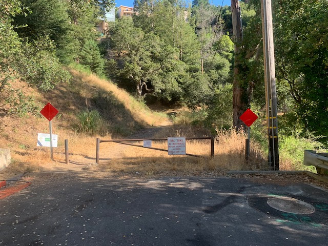
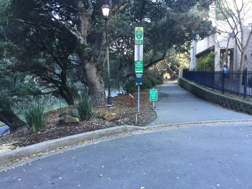
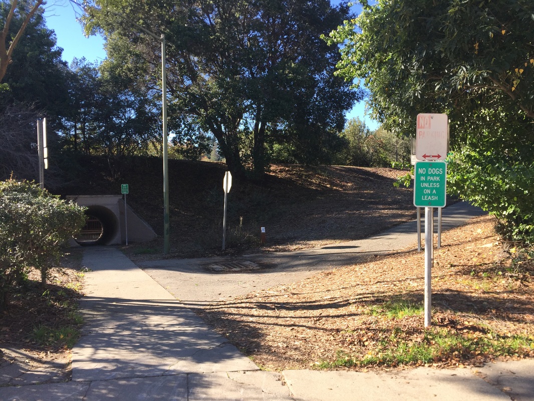
You can also park in the Shepherd Canyon Park parking lot, cross the street at the fire station and take the trail with the yellow barrier up behind the Corporation Yard. There is also trail access via the stairs to Pacific Union Realtors off of Mountain Blvd, and trail access behind the Montclair Parking Garage. This garage is $2/hr, free parking Sundays. There are a few other access points, but they have difficult/slippery hikes down.
(Note: Bishops Ct. specifically states no trailhead parking in the neighborhood)
Hours: Dawn to Dusk
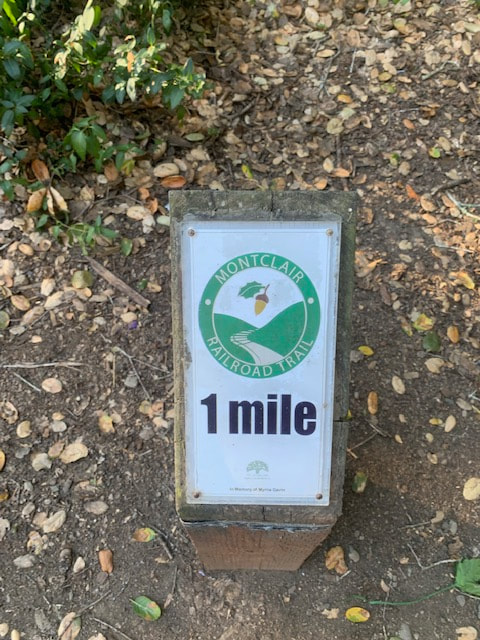
Type: Easy hike (1.5 mile paved Railroad Trail), can easily be extended to longer hike
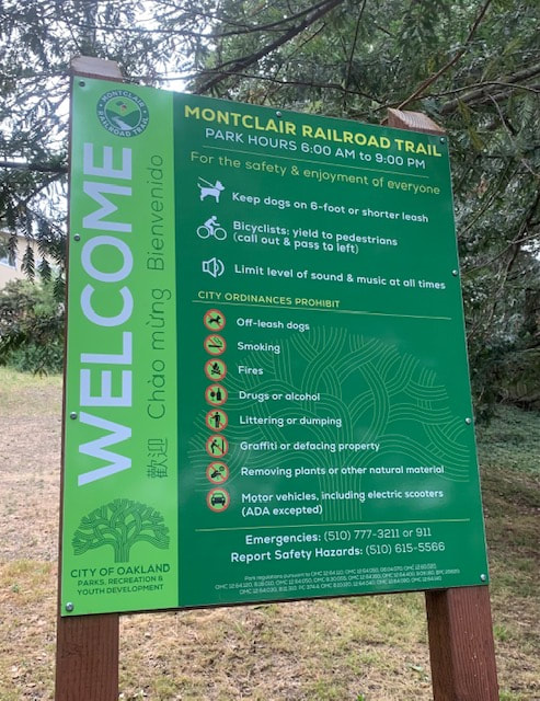
Regulations: Dogs allowed on-leash
Best time to visit: Anytime, as the trails are mostly shady.
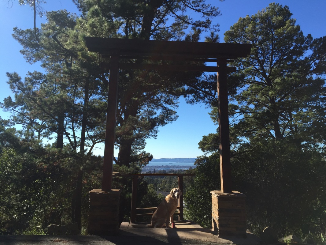
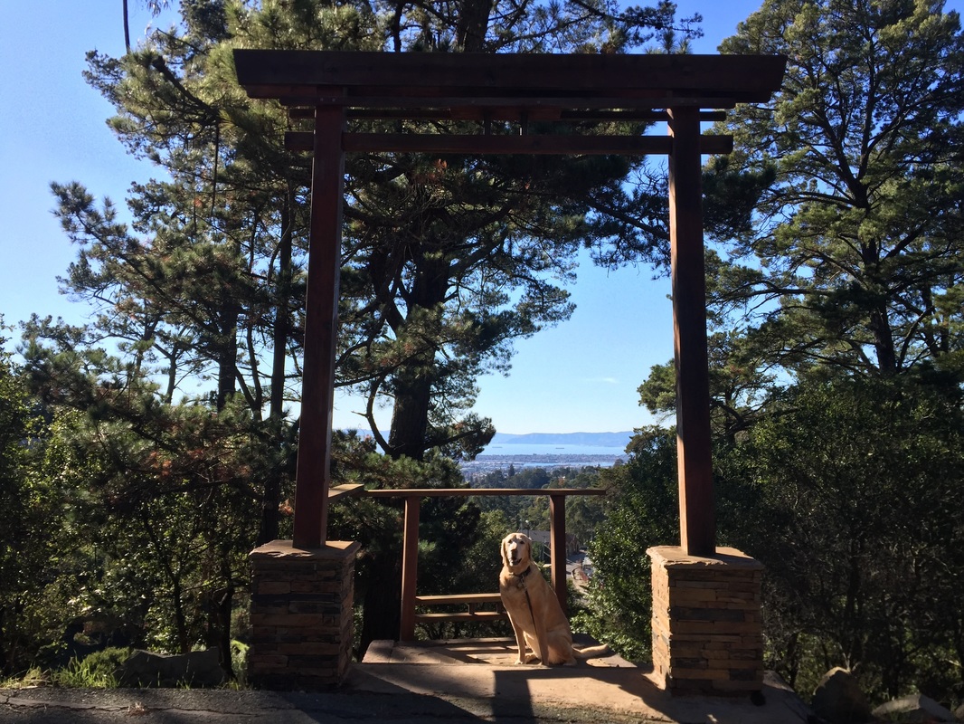
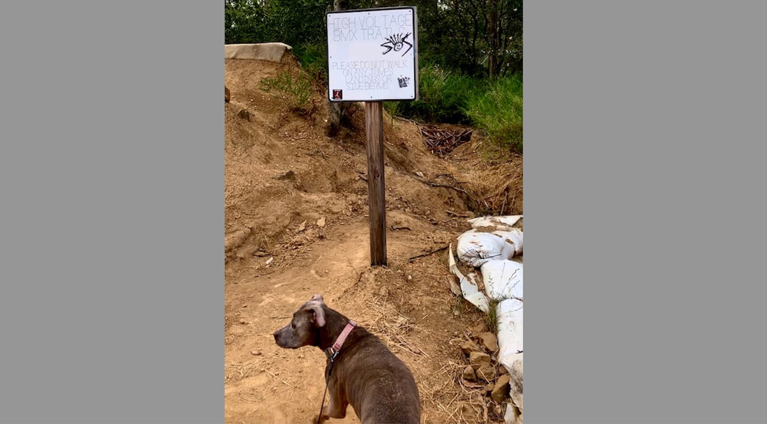
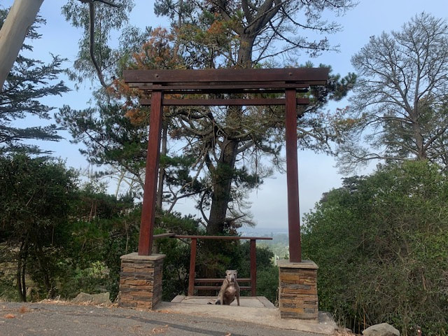
Don't miss: Torii Gate and the BMX trail (if you're visiting in the early morning)
 
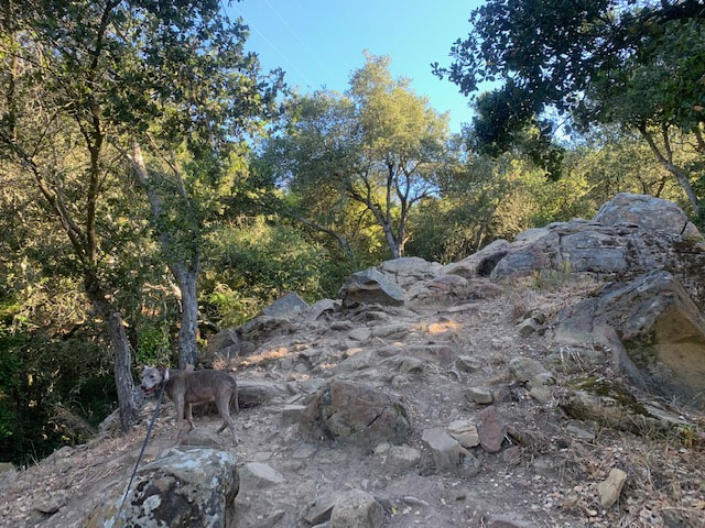
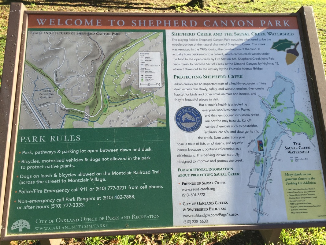
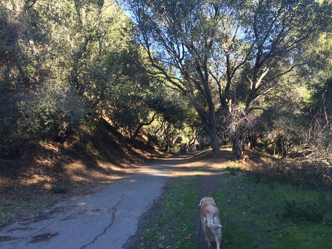
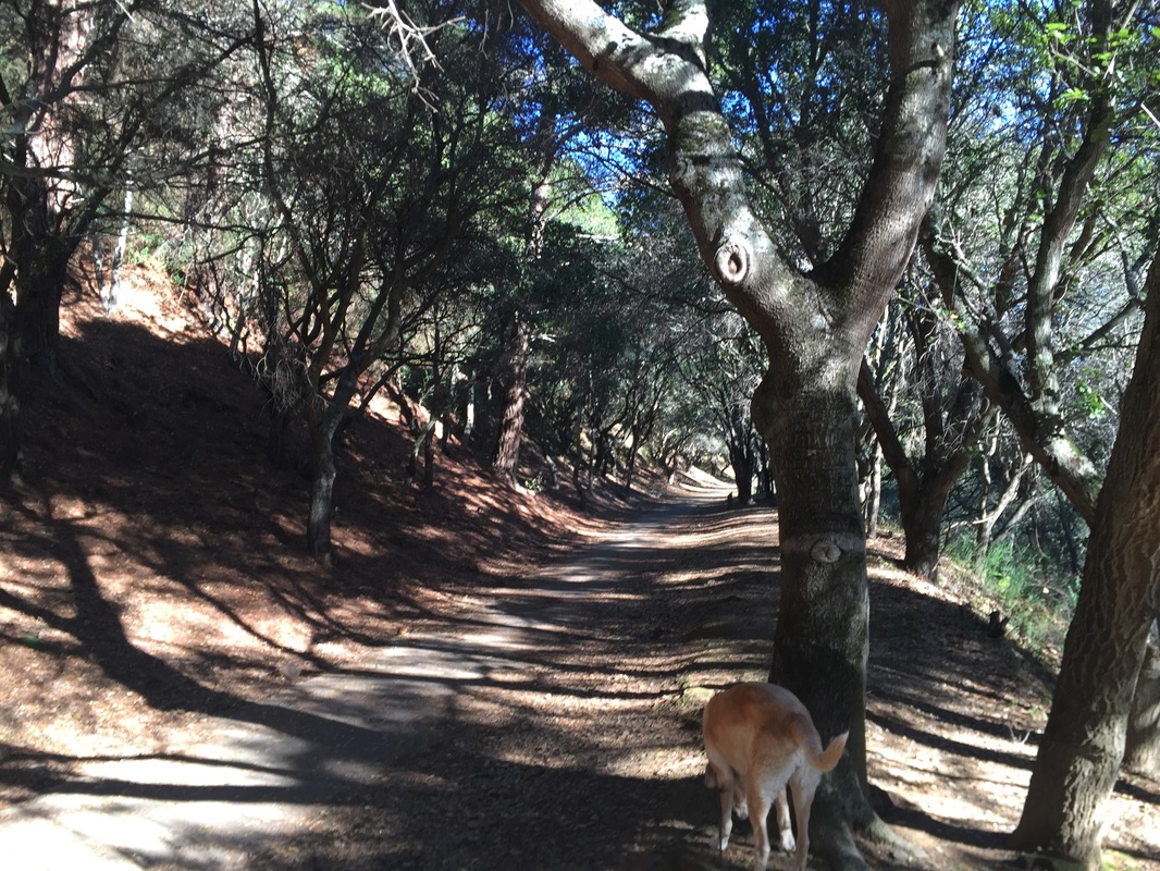
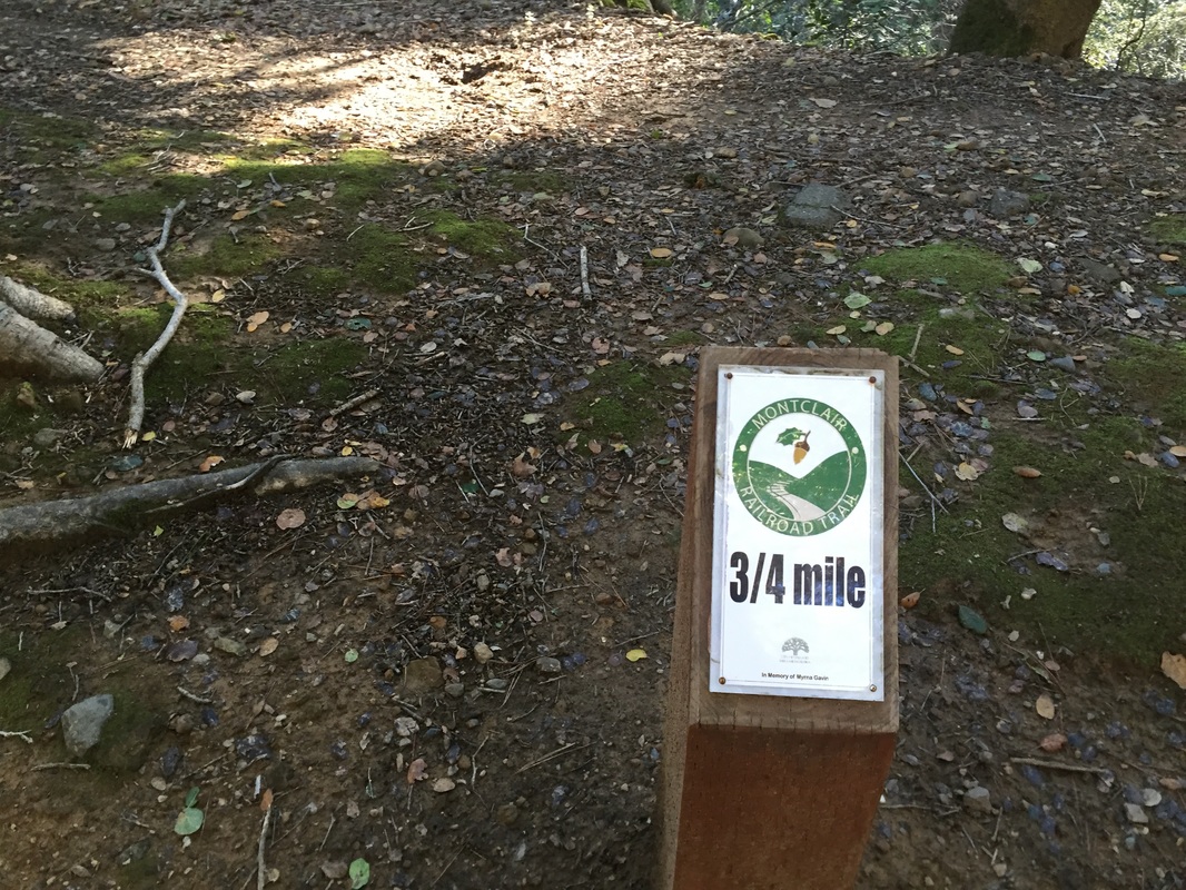
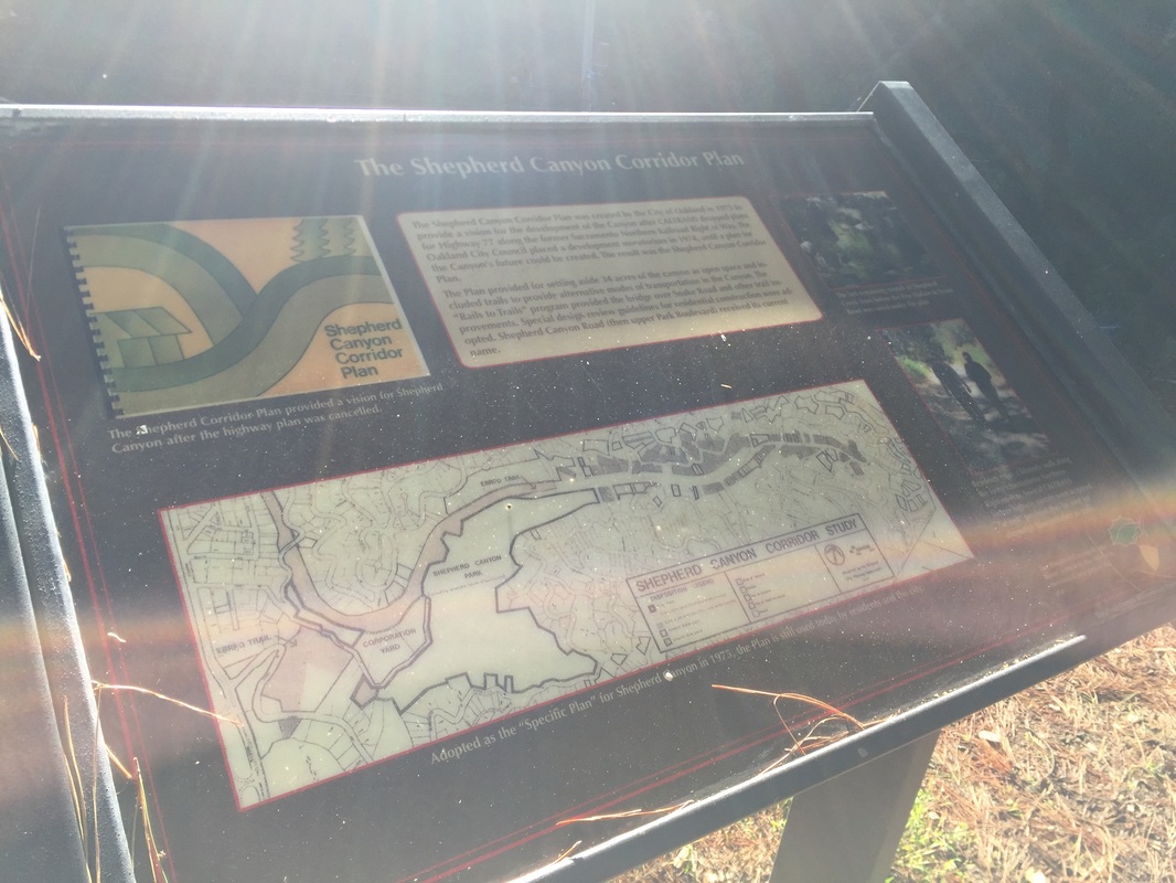
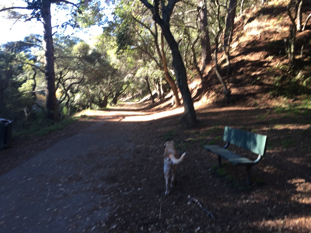
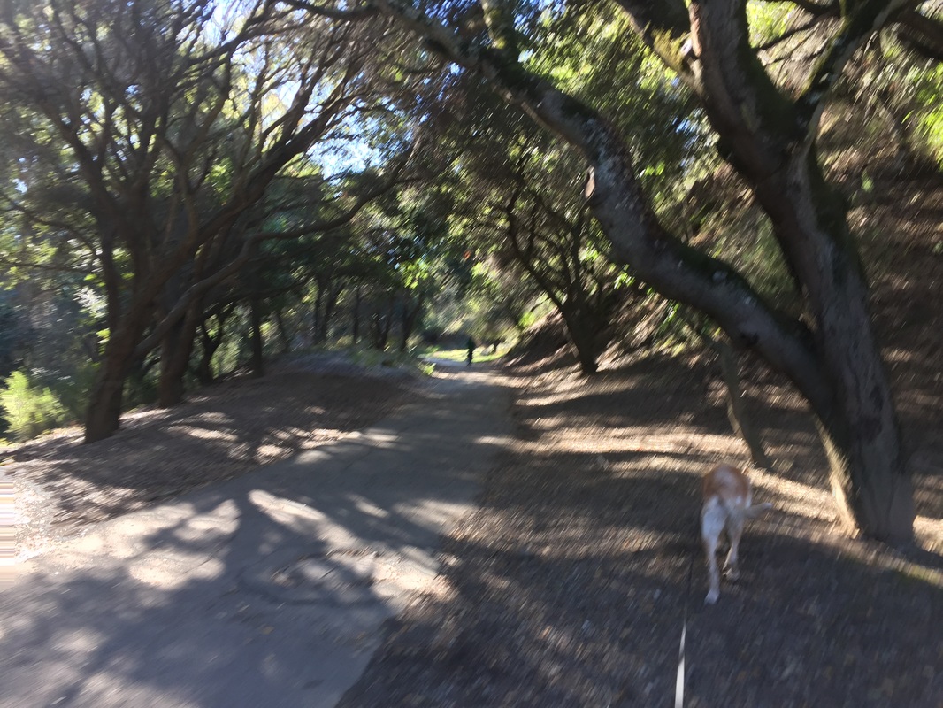
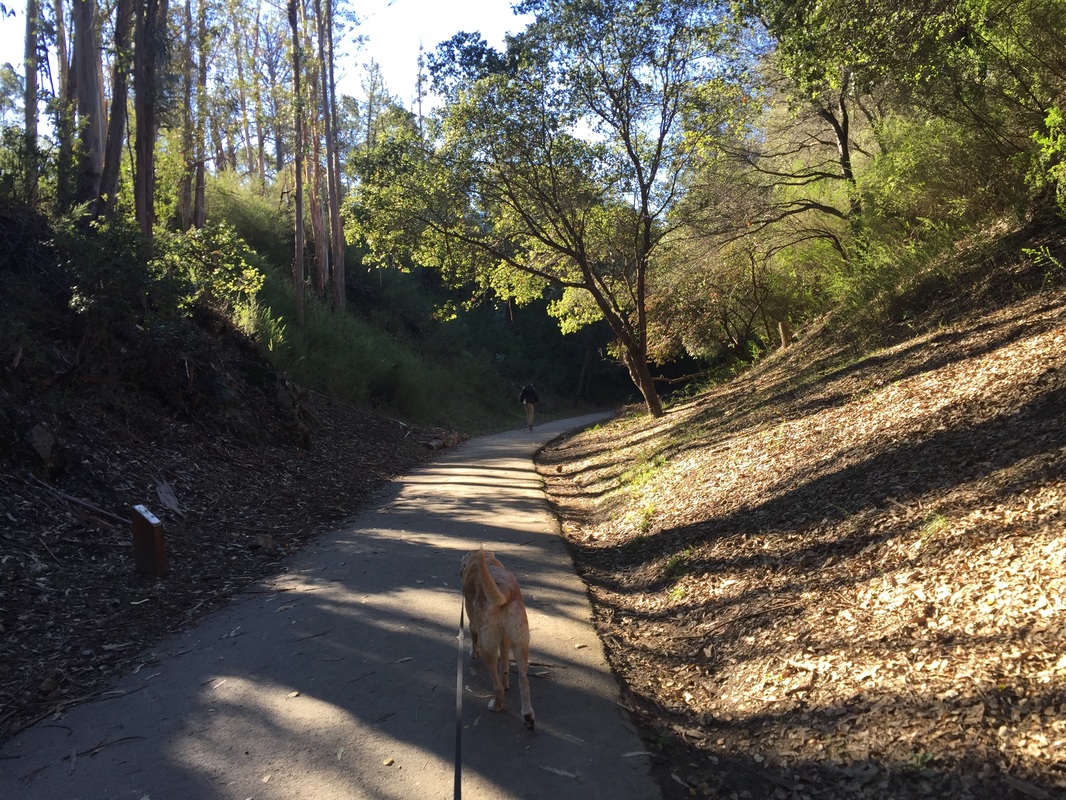
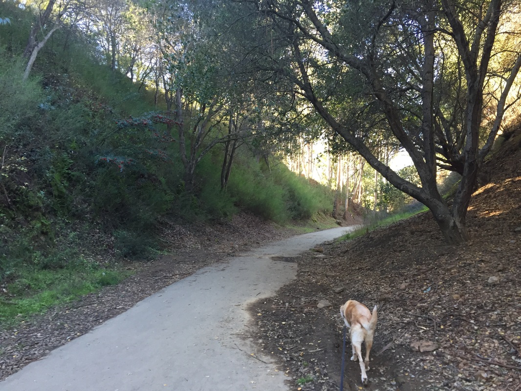
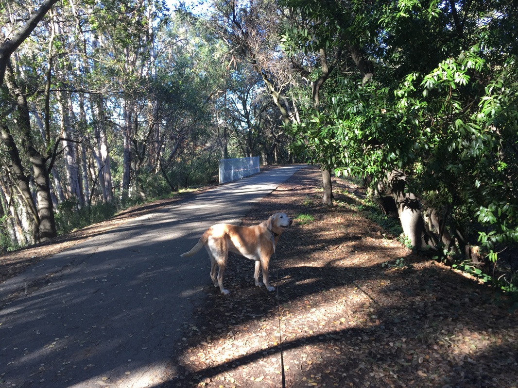
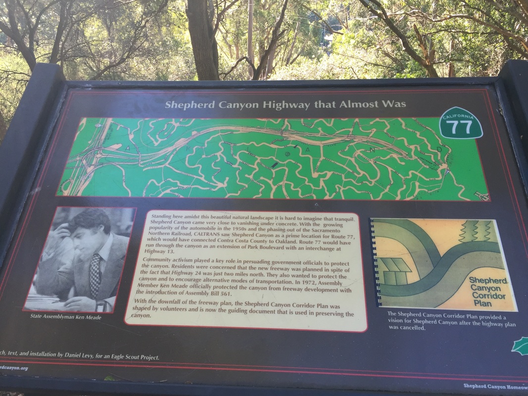
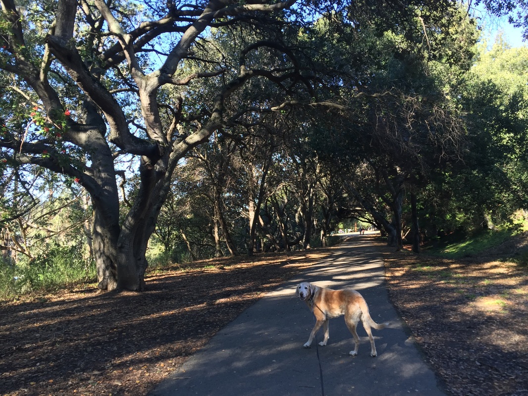
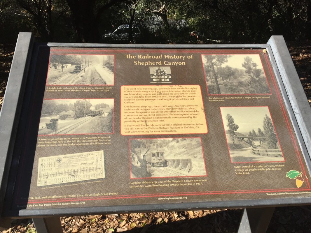
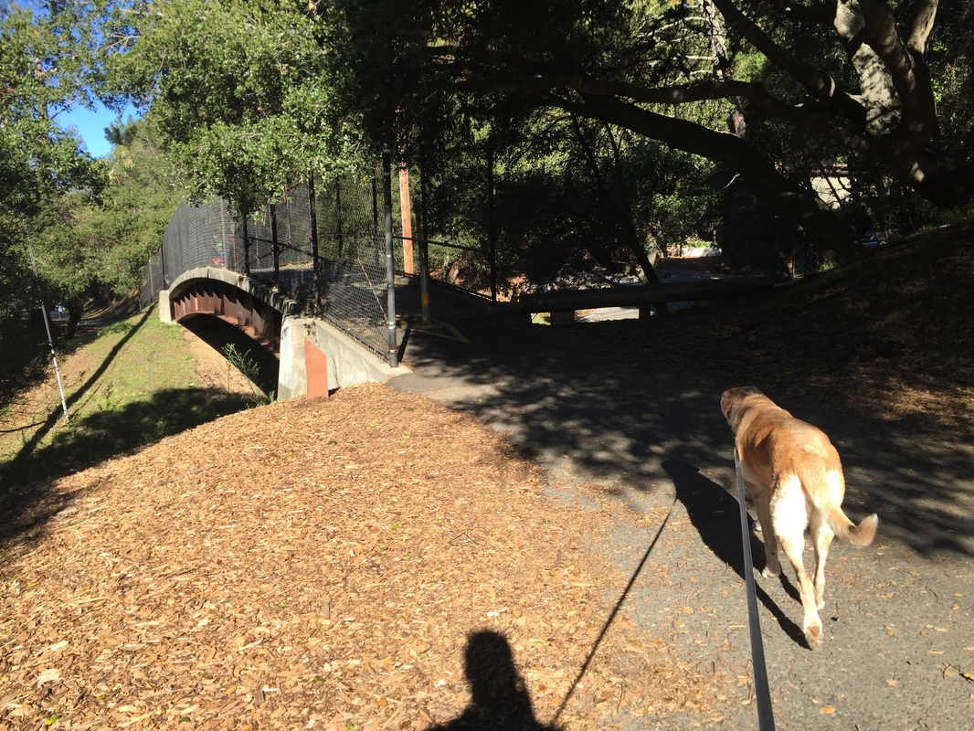
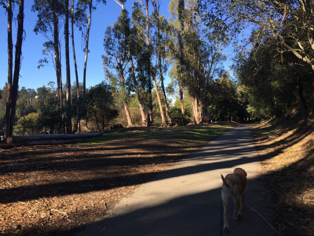
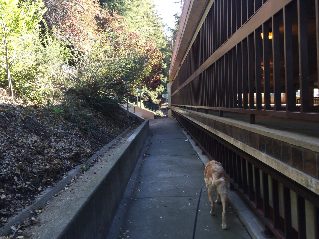
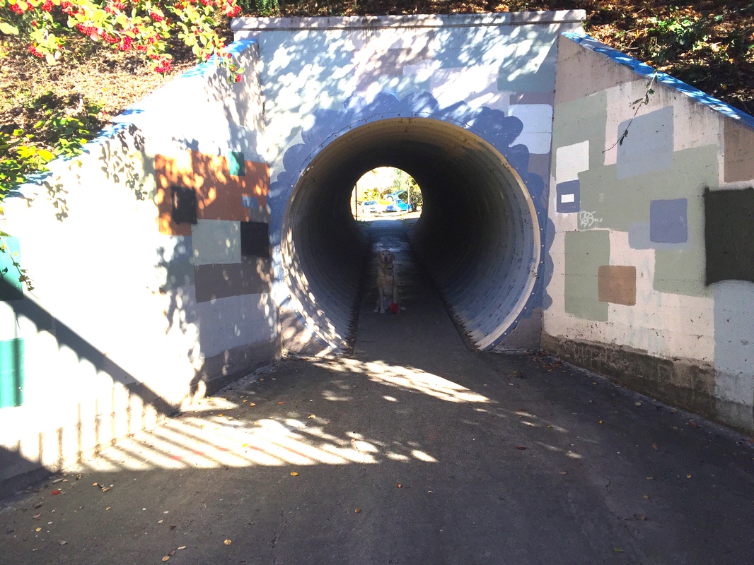
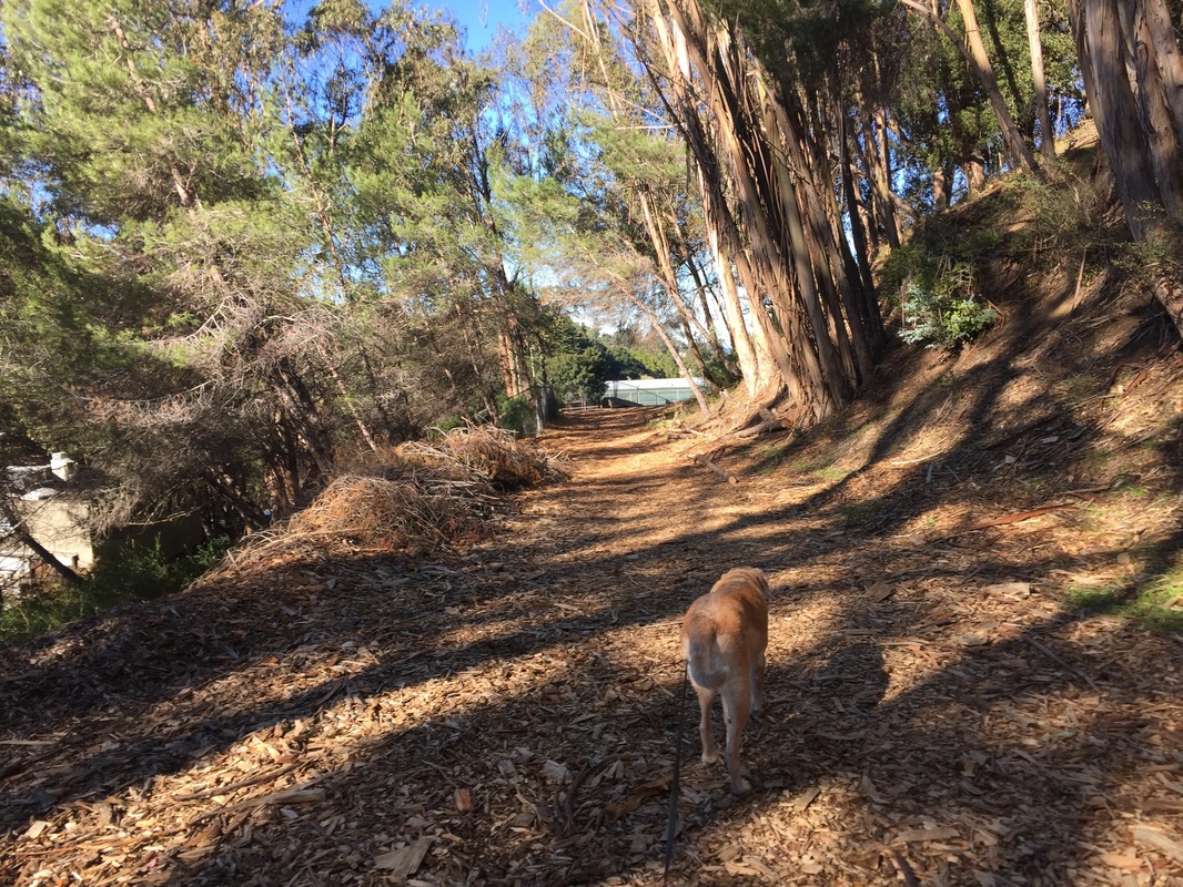
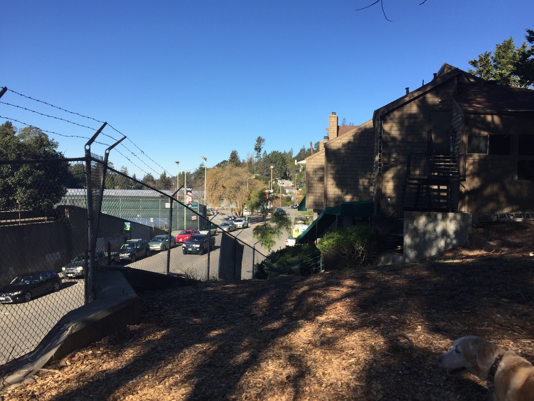
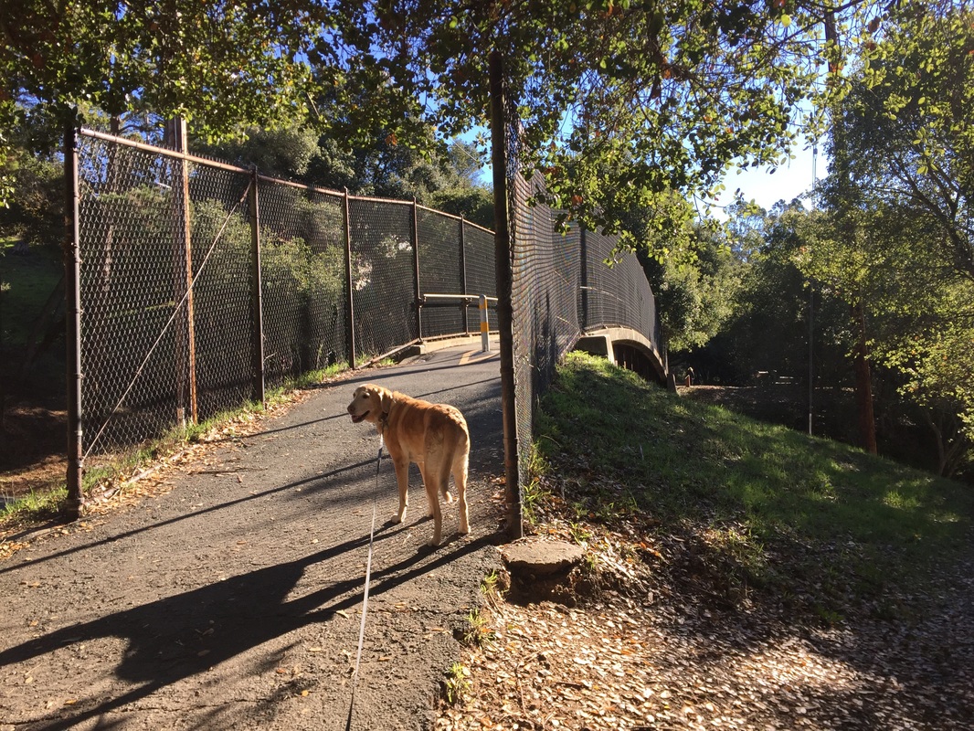
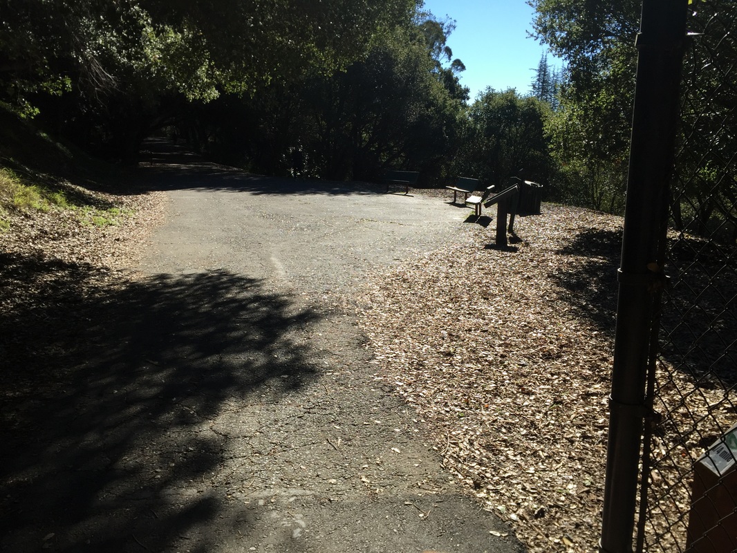
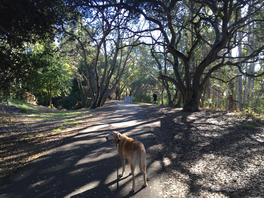
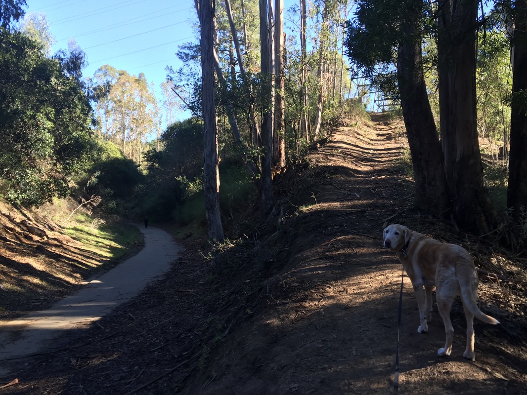
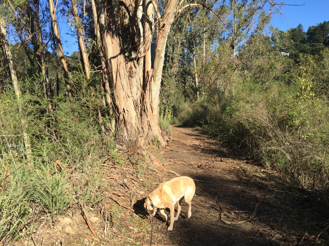
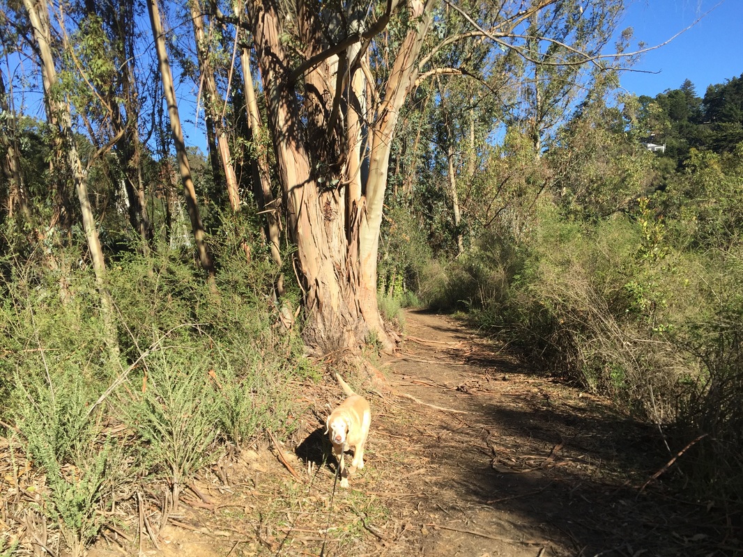
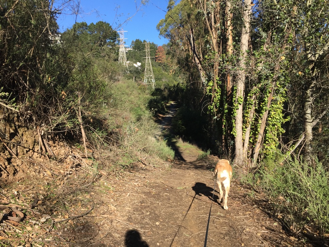
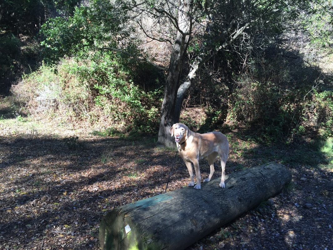
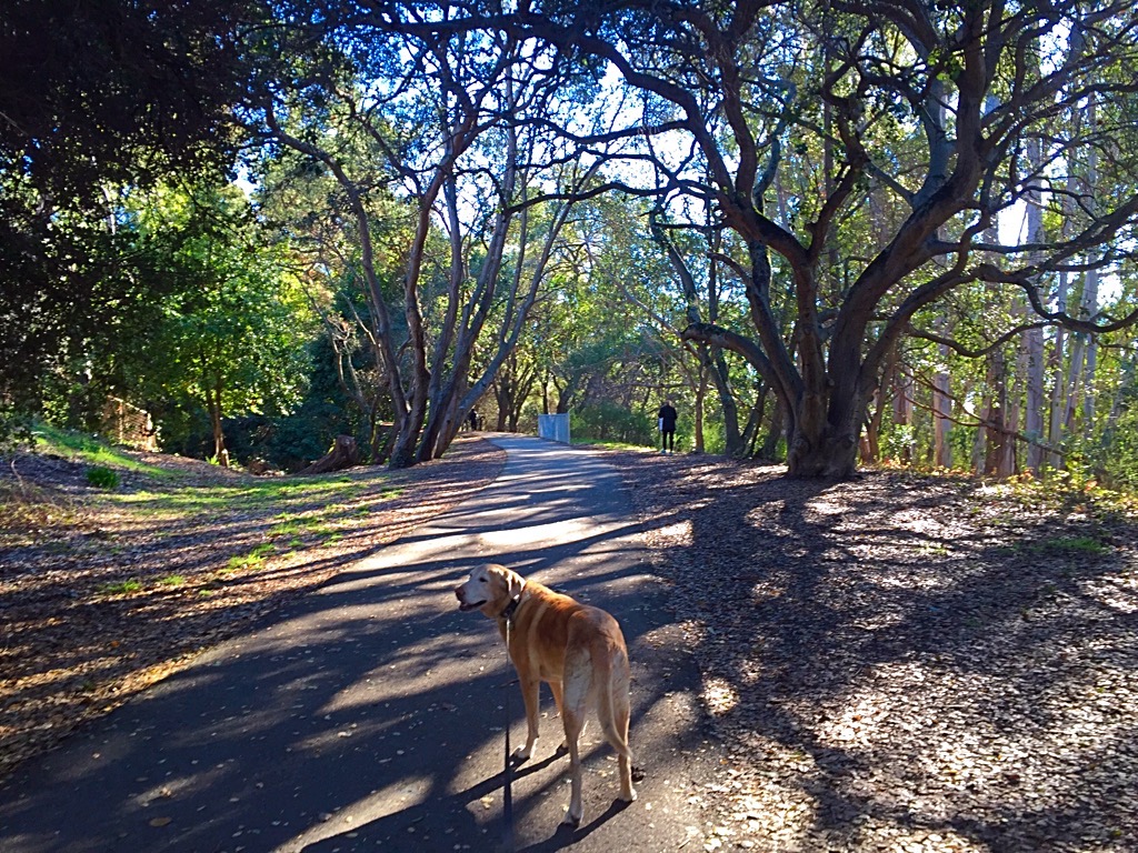
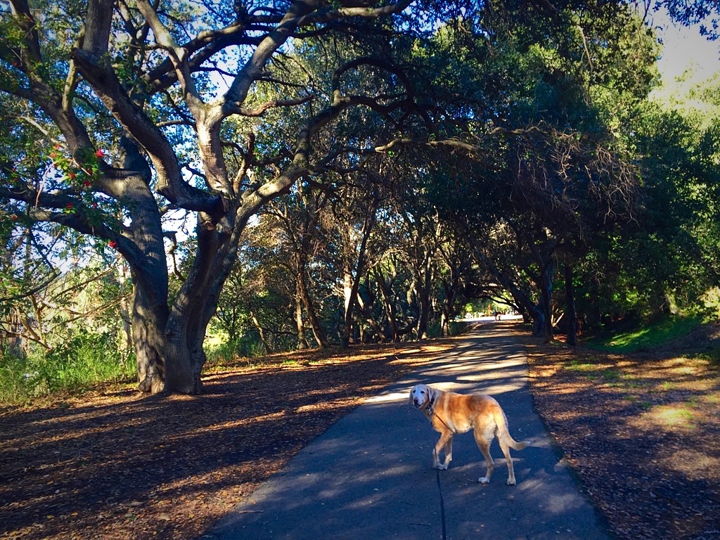
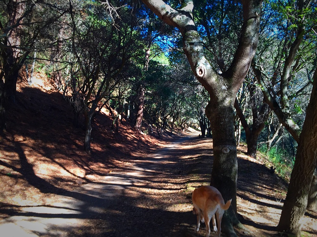
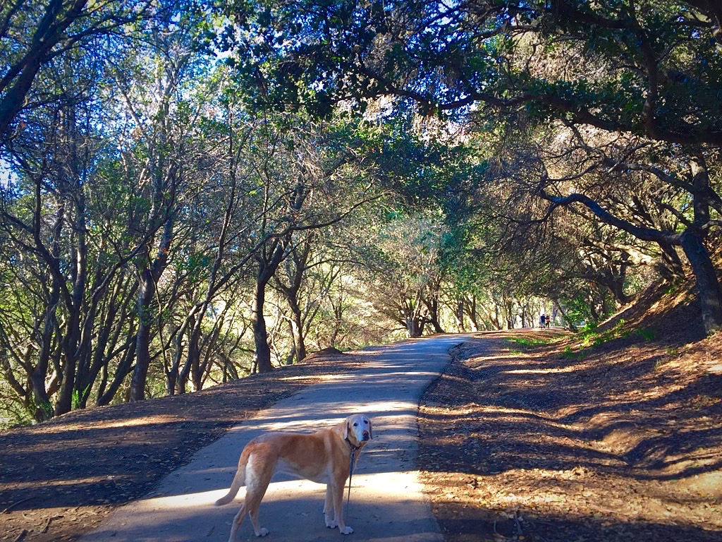
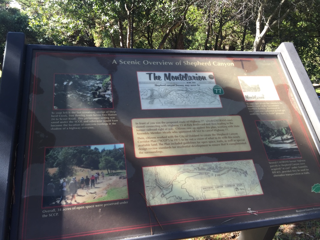
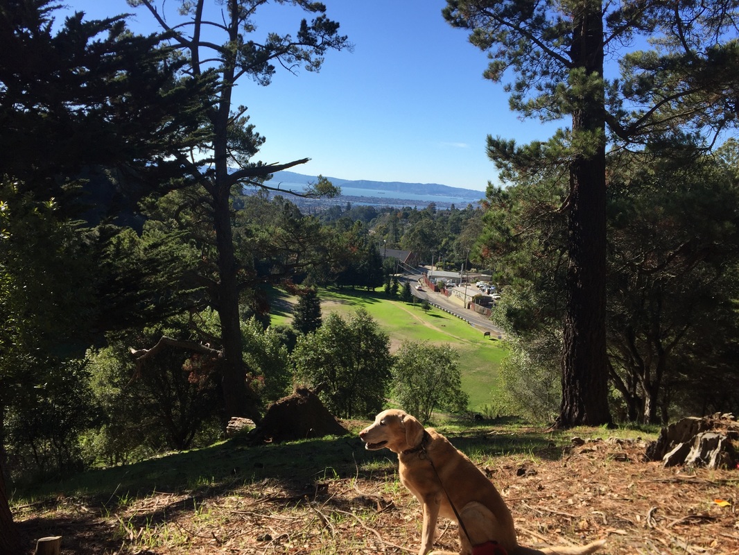
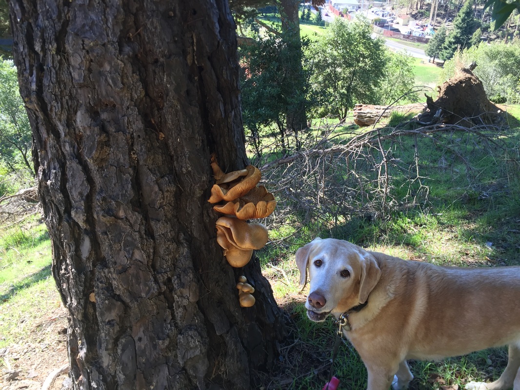
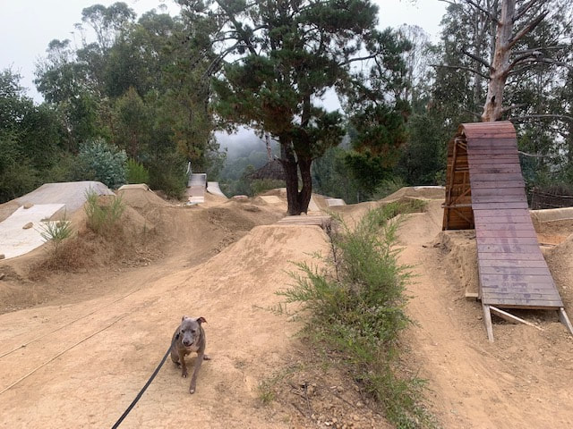
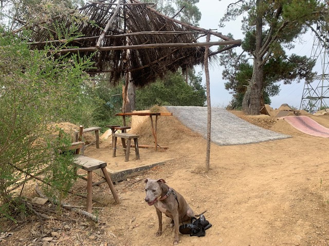
Description: This is a beautiful hike in the Oakland hills, above Montclair Village. The 1.5 mile paved Montclair Railroad Trail was once part of the route of the Sacramento Northern Railway, which took passenger between Oakland and Chico from 1912 to 1957. In the 1970’s, a freeway was proposed to take its place, but luckily never came to fruition. This trail snakes through groves of trees, and even includes an overpass crossing Snake Rd (which, if you’re like me, you’ve probably driven under numerous times but never realized was part of a trail). There's a cool tunnel you can walk through from the Cortereal Ave or Montclair Parking Garage entrances. There is a steep, dirt stretch of trail behind the Corporation Yard (across from the fire station) which will take you up to a transmission tower. Behind that is a small BMX course built from dirt mounds with a couple wood ramps. From here you can catch a glimpse of the bay, and head down the other side to join back on the paved trail. If you do visit the BMX course, I'd recommend only going during the early morning. Once riders come, it will be difficult/dangerous to hike up here. Please be respectful of the course and do not walk on it. 
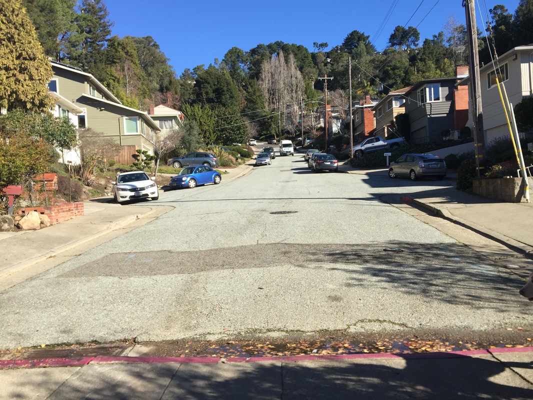
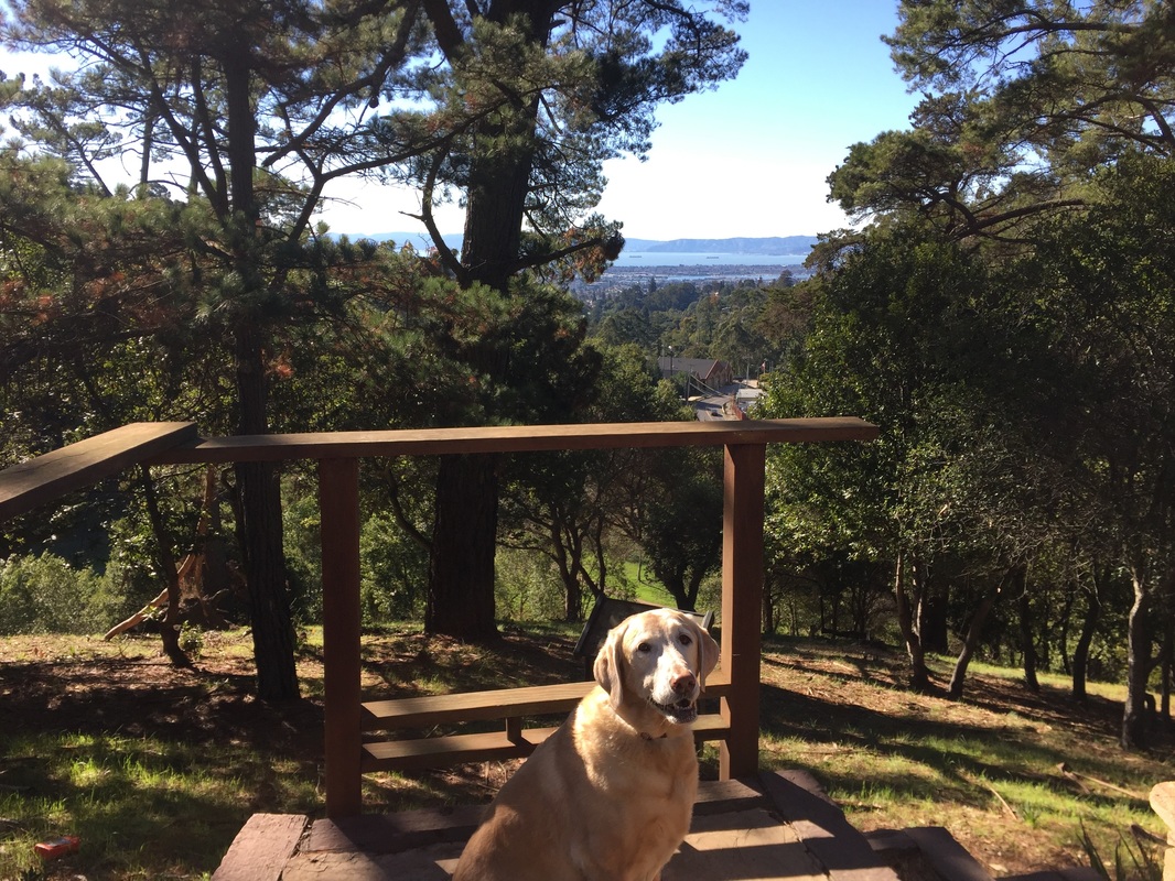
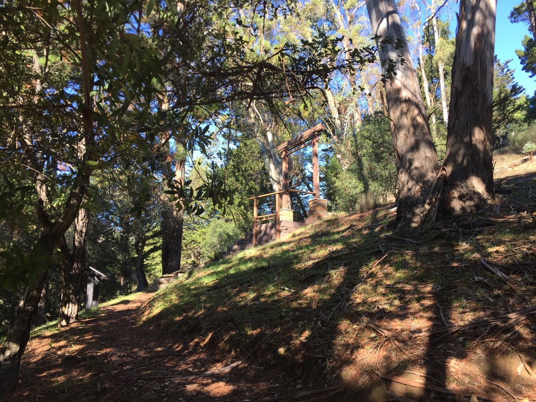
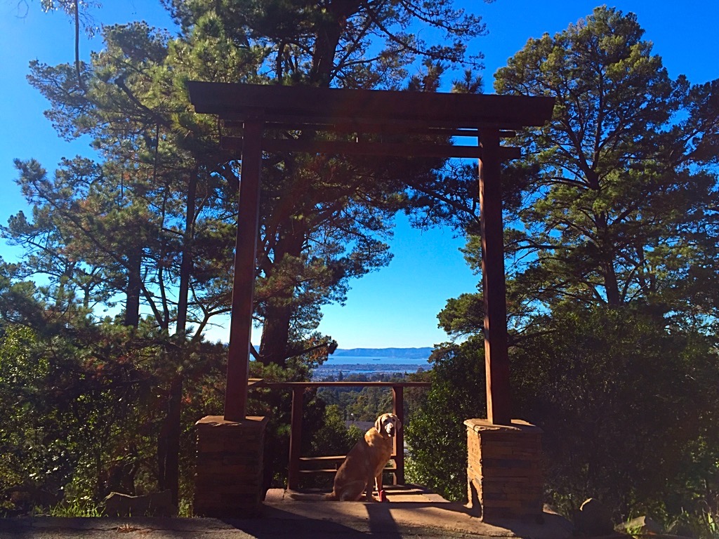
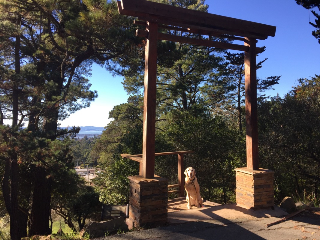
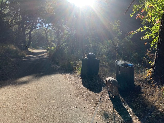
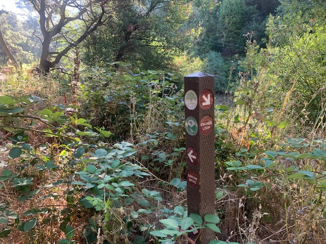
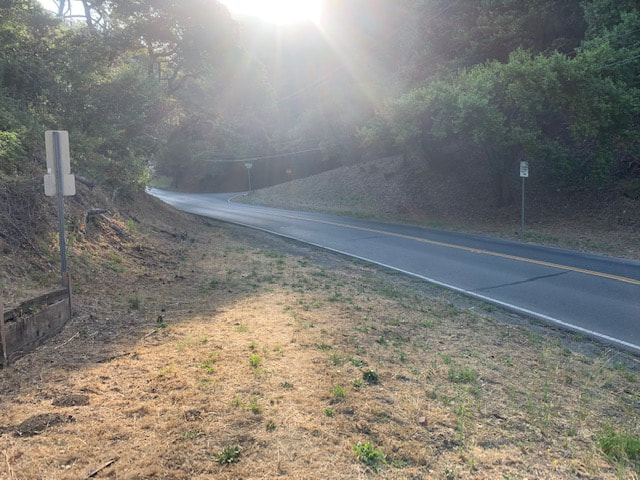
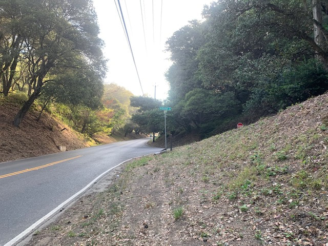
Continuing along the main trail in the direction of Bishop’s Court, you will have the option to take an approximately 1 mile (1/2 mile out and back) detour to visit Torii gate. This is a traditional Japanese gate above Shepard Canyon Park, which perfectly frames a beautiful view of the bay. To access it, after you pass some trash cans, you will see a trailhead pointing to the right for "Escher Loop." Head down this short, slightly overgrown trail to Snake Road. Carefully cross the road and head up and to the right to Escher Drive. You will see another trailhead sign there. It's about .40 miles to Torii gate and about 200ft of elevation gain. Below Torii Gate is trail snaking down to the soccer field and parking lot at Shepherd Canyon Park, but unfortunately dogs are not allowed in this park. From here, retrace your steps back to the main Montclair Railroad Trail. 
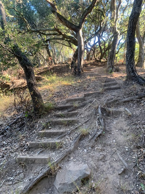
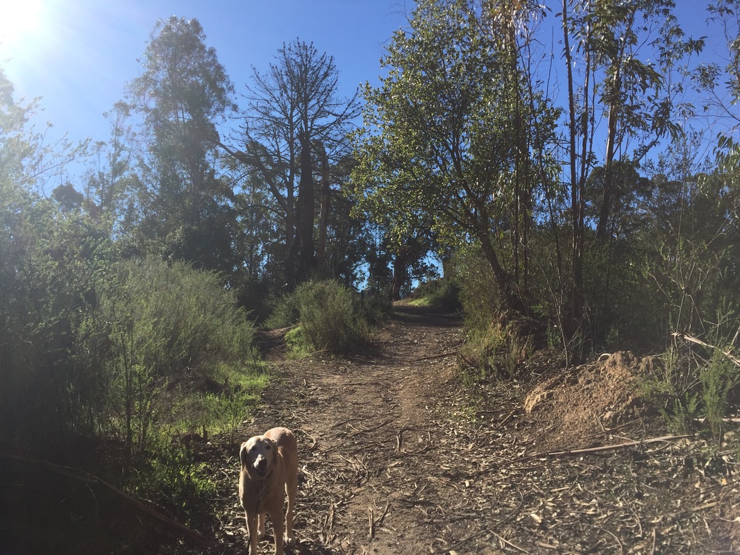
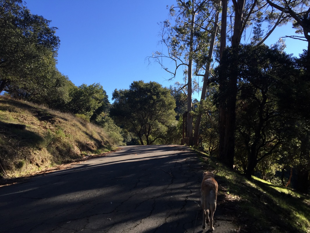
The trail ends in a short distance further at Bishops Ct. To extend your hike, walk back along the Railroad Trail. After you pass the trailhead for Escher Loop, look for a large hill on your right. You'll find a steep dirt/wood stairway. This is a bit of a scramble, and I wouldn't recommend it during/after a rain because it gets slippery, but if you have good shoes it's worth the hike. There are some cool rock formations up there, but don't hike to the top. Once you see a transmission tower up in the distance, look for a dirt trail to your left. This will take you to another shady trail that links the ends of Zinn Drive. From here, we took neighborhood roads back to where we parked instead of scrambling back down the steep stairs to the Railroad Trail. 


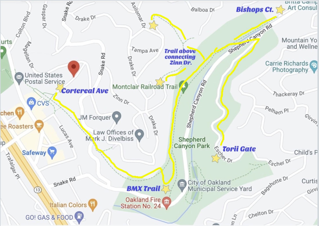
If you start your hike from the parking garage, explore the side trail to the BMX course, visit Torii Gate and returned to the parking garage, it will be a roughly 4 mile hike. You can extend your hike via the trail between the ends of Zinn Drive, or you can take residential streets to join Sibley or Redwood Regional Park.
 
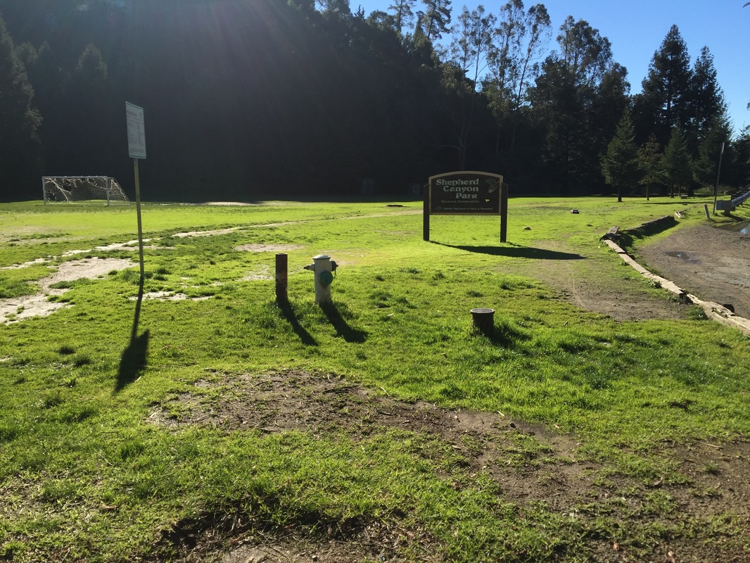
Several trash cans along the Railroad Trail. Restrooms and running water are available at the parking lot in Shepherd Canyon Park but dogs are not allowed in the park.

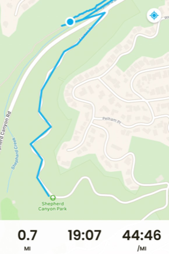
​My trail map (Stars are points of interest referenced above; yellow line maps out different routes): 
Picture

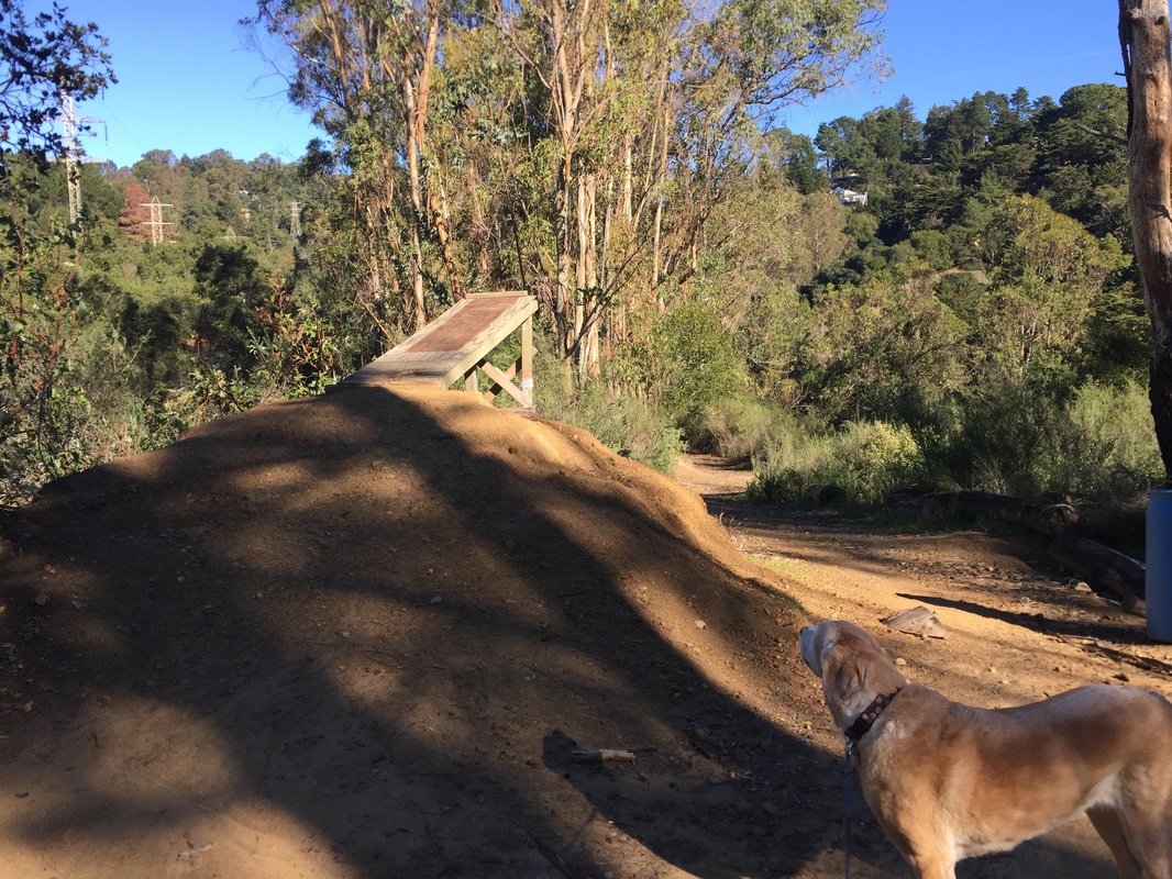
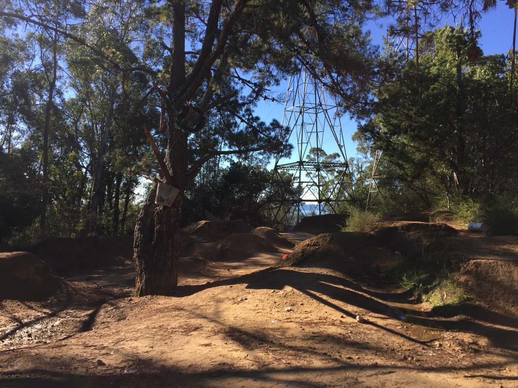
​BMX Trails (July 2022):

Trail leading to ​Torii Gate:

Trail leading up to ends of Zinn Drive:
Contact Us
Privacy Policy
Terms and Conditions
As an Amazon Associate I earn a commission from qualifying purchases. 
All content within this site Copyright © 2023 Hikes Dogs Love. All rights reserved. No part of this website may be reproduced without permission.
DMCA.com Protection Status
  • Home
  • Browse All
    • Alameda County >
      • Albany Bulb
      • Alameda Creek Regional Trail
      • Anthony Chabot Regional Park (Lake Chabot)
      • Aquatic Park
      • Chabot Park
      • Barlago Italian Kitchen
      • Buchanan Dog Beach
      • California Canoe & Kayak (Oakland)
      • César Chávez Park
      • Claremont Canyon
      • Coyote Hills Regional Park
      • Crab Cove
      • Cull Canyon Regional Recreation Area
      • Dimond Canyon Park
      • Don Castro Regional Recreation Area
      • Don Edwards Wildlife Refuge
      • Dublin Hills Regional Park
      • Fairmont Ridge
      • Five Canyons Open Space Preserve
      • Fremont Central Park
      • Garin/Dry Creek Pioneer Regional Park
      • Greenbelt Trails
      • Hayward Regional Shoreline
      • Heron Bay Trail
      • Holy Land Restaurant
      • Ikaros Greek Restaurant
      • Jerusalem Organic Kitchen
      • Joaquin Miller Park
      • Lake Anza
      • Lake Chabot
      • Lake Merritt
      • Leona Canyon Regional Open Space Preserve
      • Leona Heights Park
      • Marina Park
      • Martin Canyon Creek Trail
      • Martin Luther King Jr. Regional Shoreline
      • Mission Peak
      • Montclair Railroad Trail/ Torii Gate
      • Morgan Territory Regional Preserve
      • Oyster Bay Regional Shoreline
      • Park Street Classic Car Show (Annual)
      • Pleasanton Ridge Regional Preserve
      • Reinhardt Redwood Regional Park
      • Robert's Park
      • Room 389
      • Shoreline Park
      • Sibley Volcanic Regional Preserve
      • Skyline Gate Staging Area
      • Strawberry Canyon Fire Trail
      • Sunol Regional Wilderness
      • Temescal Regional Recreation Area
      • Tilden Regional Park
      • Upper Anthony Chabot Regional Park (Oakland Entrance)
      • Upper Knowland Park
      • Vargas Plateau Regional Park
    • Butte County >
      • Feather Falls
      • Motel 6 - Oroville
      • Riverbend Park
    • Contra Costa County >
      • Acalanes Ridge Open Space
      • Briones Regional Park
      • Carquinez Strait Regional Shoreline
      • Crockett Hills Regional Park
      • Diablo Foothills Regional Park
      • EBMUD Trails
      • Fernandez Ranch
      • Frowning Ridge
      • Geppetto's Caffe
      • Hacienda de las Flores Park
      • Hillside Nature Area
      • Howe Homestead Park
      • Indian Rock
      • Kennedy Grove Regional Recreation Area
      • Lafayette Community Park
      • Lafayette Reservoir
      • Las Trampas Regional Wilderness
      • Lime Ridge Open Space
      • Miller/Knox Regional Shoreline
      • Moraga Commons Park
      • Mulholland Ridge Open Space Preserve
      • Point Isabel
      • Point Molate Beach Park
      • Point Pinole Regional Shoreline
      • Point San Pablo Harbor
      • Rubio's
      • San Quentin Beach
      • Shell Ridge Open Space
      • Sobrante Ridge Regional Preserve
      • Sugarloaf Open Space
      • Sycamore Valley Open Space Preserve
      • Tender Greens
      • Tilden Regional Park
      • Wildcat Canyon Regional Park
    • El Dorado County >
      • Angora Lakes Trail
      • Bijou Community Park
      • Cascade Falls
      • Horsetail Falls
      • Inspriation Point
      • Motel 6 - South Lake Tahoe
      • Mt. Tallac
    • Marin County >
      • 101 Surf Sports
      • Baltimore Canyon Open Space Preserve
      • Blackie's Pasture
      • Camino Alto Preserve
      • Carson Falls
      • Cascade Falls
      • Cataract Falls
      • Dawn Falls
      • Ignacio Valley Preserve (Fairway Falls)
      • Indian Valley Open Space Preserve
      • King Mountain Open Space Preserve
      • Marin Headlands (Coastal Trail)
      • Old Saint Hilary's Open Space Preserve
      • Phoenix Lake
      • Ring Mountain Open Space Preserve
      • Roy's Redwoods
      • Sam's Anchor Cafe
      • Tiburon Peninsula Historical Trail
      • Tucker Trail Falls
    • Mariposa County >
      • Happy Burger Diner
      • Yosemite National Park
    • Mendocino County >
      • Catch-a-Canoe
      • MacKerricher State Park
      • Mendocino Headlands State Park
      • Navarro River Redwoods State Park
      • Princess Seafood
      • Skunk Train
      • The Stanford Inn By The Sea
      • Van Damme State Beach
    • Mono County >
      • Bodie State Historic Park
      • Jolly Kone
      • Lundy Canyon
      • Mono Lake (Tufa State National Reserve)
      • Virginia Creek Settlement
    • Monterey County >
      • 17-Mile Drive
      • Asilomar State Beach
      • Bistro Beaujolais
      • Carmel Beach
      • Fishwife
      • Fort Ord Dunes State Park
      • Garland Ranch Regional Park
      • Jack's Peak
      • Monterey Bay Coastal Trail
      • Monterey Bay Kayaks
      • Monterey Municipal Beach
      • Motel 6 - Downtown Monterey
      • Ryan Ranch Disc Golf Course
      • Ventana Wilderness
    • Nevada County >
      • Fairy Falls
    • Placer County >
      • Hidden Falls
    • San Francisco County >
      • 2.2 Mile Urban Hike
      • Bernal Heights Park
      • The Brixton
      • Billy Goat Hill Park
      • Blackwood
      • Clipper Cove Beach
      • Crissy Field
      • Dynamo Donut + Coffee
      • Fort Funston
      • Fort Mason
      • Glen Canyon Park
      • Golden Gate Park
      • Grand View Park
      • The Great Lawn/ Avenue of the Palms
      • Java Beach Cafe
      • John McLaren Park
      • Interior Greenbelt
      • Lake Merced
      • Lands End
      • Letterman Digital Arts Center
      • Marina Green
      • Mount Davidson
      • Mount Sutro Open Space Reserve
      • Ocean Beach
      • Palace of Fine Arts
      • Philz Coffee Truck
      • Stern Grove
      • Sutro Baths
      • Sutro Heights Park
      • TreasureFest
    • San Mateo County >
      • 7 Mile House Sports Bar & Grill
      • Barbara's Fishtrap
      • Bedwell Bayfront Park
      • Bob's Vegetable Stand and Pumpkin Farm
      • Cafe Pacifica
      • Devil's Slide Coastal Trail
      • Esplanade Beach
      • Flying Fish Grill
      • Half Moon Bay Kayak Co.
      • McNee Ranch State Park (Montara Mountain)
      • Montara State Beach
      • Mori Point
      • Mussel Rock Park
      • Panera Bread
      • Pedro Point Headlands
      • Poplar Beach
      • Pulgas Ridge Open Space Preserve
      • Rancho Corral de Tierra
      • Seal Point
      • Taqueria La Mexicana
      • Wavecrest Open Space
    • Santa Clara County >
      • Byxbee Park
      • Calero County Park
      • Uvas Canyon County Park
    • Santa Cruz County >
      • Byrne-Milliron Forest
      • Greyhound Rock County Park
      • Henry Cowell Redwoods State Park
      • Jaliscos Restaurant
      • Mount Madonna County Park
      • Roaring Camp Railroads
    • Solano County >
      • Lagoon Valley Park
      • Peña Adobe Regional Park
    • Sonoma County >
      • Doran Regional Park
      • Fishetarian
      • Helen Putnam Regional Park
    • Tuolumne County >
      • Donnell Vista
      • Tuttletown Recreation Area
    • Yuba County >
      • Ellis Lake
  • Map View
  • Vacation Spots
    • Vacation Hikes >
      • Arizona >
        • Papago Park
      • New Mexico >
        • Oliver Lee Memorial State Park
        • White Sands National Monument
      • Oregon >
        • Multnomah Falls
      • Washington >
        • Olympic National Park >
          • Kalaloch Beach
          • Madison Falls
          • Quinault Rainforest
        • Rattlesnake Ridge
    • Restaurants >
      • Southern California >
        • Fire Island Grill
        • Lazy Dog Restaurant & Bar
        • Perkies Coffee Haus
      • Washington >
        • Rose Pho
  • Planning Your Trip
  • About
    • Contact Us
    • Privacy Policy
    • Terms and Conditions
  • Dog Gear
  • Archived Hikes 1
    • Archived Hikes 2 >
      • Archives 2016-2018