Hikes Dogs Love
  • Home
  • Browse All
    • Alameda County >
      • Albany Bulb
      • Alameda Creek Regional Trail
      • Anthony Chabot Regional Park (Lake Chabot)
      • Aquatic Park
      • Chabot Park
      • Barlago Italian Kitchen
      • Buchanan Dog Beach
      • California Canoe & Kayak (Oakland)
      • César Chávez Park
      • Claremont Canyon
      • Coyote Hills Regional Park
      • Crab Cove
      • Cull Canyon Regional Recreation Area
      • Dimond Canyon Park
      • Don Castro Regional Recreation Area
      • Don Edwards Wildlife Refuge
      • Dublin Hills Regional Park
      • Fairmont Ridge
      • Five Canyons Open Space Preserve
      • Fremont Central Park
      • Garin/Dry Creek Pioneer Regional Park
      • Greenbelt Trails
      • Hayward Regional Shoreline
      • Heron Bay Trail
      • Holy Land Restaurant
      • Ikaros Greek Restaurant
      • Jerusalem Organic Kitchen
      • Joaquin Miller Park
      • Lake Anza
      • Lake Chabot
      • Lake Merritt
      • Leona Canyon Regional Open Space Preserve
      • Leona Heights Park
      • Marina Park
      • Martin Canyon Creek Trail
      • Martin Luther King Jr. Regional Shoreline
      • Mission Peak
      • Montclair Railroad Trail/ Torii Gate
      • Morgan Territory Regional Preserve
      • Oyster Bay Regional Shoreline
      • Park Street Classic Car Show (Annual)
      • Pleasanton Ridge Regional Preserve
      • Reinhardt Redwood Regional Park
      • Robert's Park
      • Room 389
      • Shoreline Park
      • Sibley Volcanic Regional Preserve
      • Skyline Gate Staging Area
      • Strawberry Canyon Fire Trail
      • Sunol Regional Wilderness
      • Temescal Regional Recreation Area
      • Tilden Regional Park
      • Upper Anthony Chabot Regional Park (Oakland Entrance)
      • Upper Knowland Park
      • Vargas Plateau Regional Park
    • Butte County >
      • Feather Falls
      • Motel 6 - Oroville
      • Riverbend Park
    • Contra Costa County >
      • Acalanes Ridge Open Space
      • Briones Regional Park
      • Carquinez Strait Regional Shoreline
      • Crockett Hills Regional Park
      • Diablo Foothills Regional Park
      • EBMUD Trails
      • Fernandez Ranch
      • Frowning Ridge
      • Geppetto's Caffe
      • Hacienda de las Flores Park
      • Hillside Nature Area
      • Howe Homestead Park
      • Indian Rock
      • Kennedy Grove Regional Recreation Area
      • Lafayette Community Park
      • Lafayette Reservoir
      • Las Trampas Regional Wilderness
      • Lime Ridge Open Space
      • Miller/Knox Regional Shoreline
      • Moraga Commons Park
      • Mulholland Ridge Open Space Preserve
      • Point Isabel
      • Point Molate Beach Park
      • Point Pinole Regional Shoreline
      • Point San Pablo Harbor
      • Rubio's
      • San Quentin Beach
      • Shell Ridge Open Space
      • Sobrante Ridge Regional Preserve
      • Sugarloaf Open Space
      • Sycamore Valley Open Space Preserve
      • Tender Greens
      • Tilden Regional Park
      • Wildcat Canyon Regional Park
    • El Dorado County >
      • Angora Lakes Trail
      • Bijou Community Park
      • Cascade Falls
      • Horsetail Falls
      • Inspriation Point
      • Motel 6 - South Lake Tahoe
      • Mt. Tallac
    • Marin County >
      • 101 Surf Sports
      • Baltimore Canyon Open Space Preserve
      • Blackie's Pasture
      • Camino Alto Preserve
      • Carson Falls
      • Cascade Falls
      • Cataract Falls
      • Dawn Falls
      • Ignacio Valley Preserve (Fairway Falls)
      • Indian Valley Open Space Preserve
      • King Mountain Open Space Preserve
      • Marin Headlands (Coastal Trail)
      • Old Saint Hilary's Open Space Preserve
      • Phoenix Lake
      • Ring Mountain Open Space Preserve
      • Roy's Redwoods
      • Sam's Anchor Cafe
      • Tiburon Peninsula Historical Trail
      • Tucker Trail Falls
    • Mariposa County >
      • Happy Burger Diner
      • Yosemite National Park
    • Mendocino County >
      • Catch-a-Canoe
      • MacKerricher State Park
      • Mendocino Headlands State Park
      • Navarro River Redwoods State Park
      • Princess Seafood
      • Skunk Train
      • The Stanford Inn By The Sea
      • Van Damme State Beach
    • Mono County >
      • Bodie State Historic Park
      • Jolly Kone
      • Lundy Canyon
      • Mono Lake (Tufa State National Reserve)
      • Virginia Creek Settlement
    • Monterey County >
      • 17-Mile Drive
      • Asilomar State Beach
      • Bistro Beaujolais
      • Carmel Beach
      • Fishwife
      • Fort Ord Dunes State Park
      • Garland Ranch Regional Park
      • Jack's Peak
      • Monterey Bay Coastal Trail
      • Monterey Bay Kayaks
      • Monterey Municipal Beach
      • Motel 6 - Downtown Monterey
      • Ryan Ranch Disc Golf Course
      • Ventana Wilderness
    • Nevada County >
      • Fairy Falls
    • Placer County >
      • Hidden Falls
    • San Francisco County >
      • 2.2 Mile Urban Hike
      • Bernal Heights Park
      • The Brixton
      • Billy Goat Hill Park
      • Blackwood
      • Clipper Cove Beach
      • Crissy Field
      • Dynamo Donut + Coffee
      • Fort Funston
      • Fort Mason
      • Glen Canyon Park
      • Golden Gate Park
      • Grand View Park
      • The Great Lawn/ Avenue of the Palms
      • Java Beach Cafe
      • John McLaren Park
      • Interior Greenbelt
      • Lake Merced
      • Lands End
      • Letterman Digital Arts Center
      • Marina Green
      • Mount Davidson
      • Mount Sutro Open Space Reserve
      • Ocean Beach
      • Palace of Fine Arts
      • Philz Coffee Truck
      • Stern Grove
      • Sutro Baths
      • Sutro Heights Park
      • TreasureFest
    • San Mateo County >
      • 7 Mile House Sports Bar & Grill
      • Barbara's Fishtrap
      • Bedwell Bayfront Park
      • Bob's Vegetable Stand and Pumpkin Farm
      • Cafe Pacifica
      • Devil's Slide Coastal Trail
      • Esplanade Beach
      • Flying Fish Grill
      • Half Moon Bay Kayak Co.
      • McNee Ranch State Park (Montara Mountain)
      • Montara State Beach
      • Mori Point
      • Mussel Rock Park
      • Panera Bread
      • Pedro Point Headlands
      • Poplar Beach
      • Pulgas Ridge Open Space Preserve
      • Rancho Corral de Tierra
      • Seal Point
      • Taqueria La Mexicana
      • Wavecrest Open Space
    • Santa Clara County >
      • Byxbee Park
      • Calero County Park
      • Uvas Canyon County Park
    • Santa Cruz County >
      • Byrne-Milliron Forest
      • Greyhound Rock County Park
      • Henry Cowell Redwoods State Park
      • Jaliscos Restaurant
      • Mount Madonna County Park
      • Roaring Camp Railroads
    • Solano County >
      • Lagoon Valley Park
      • Peña Adobe Regional Park
    • Sonoma County >
      • Doran Regional Park
      • Fishetarian
      • Helen Putnam Regional Park
    • Tuolumne County >
      • Donnell Vista
      • Tuttletown Recreation Area
    • Yuba County >
      • Ellis Lake
  • Map View
  • Vacation Spots
    • Vacation Hikes >
      • Arizona >
        • Papago Park
      • New Mexico >
        • Oliver Lee Memorial State Park
        • White Sands National Monument
      • Oregon >
        • Multnomah Falls
      • Washington >
        • Olympic National Park >
          • Kalaloch Beach
          • Madison Falls
          • Quinault Rainforest
        • Rattlesnake Ridge
    • Restaurants >
      • Southern California >
        • Fire Island Grill
        • Lazy Dog Restaurant & Bar
        • Perkies Coffee Haus
      • Washington >
        • Rose Pho
  • Planning Your Trip
  • About
    • Contact Us
    • Privacy Policy
    • Terms and Conditions
  • Dog Gear
  • Archived Hikes 1
    • Archived Hikes 2 >
      • Archives 2016-2018

Dimond Canyon Park

Address: 4499 Bridgeview Dr, Oakland, CA (Approx)
                                             OR
                 37.809008, -122.216051 (end of Benevides Ave)
                                             OR
                 37.817823, -122.204617 (Monterey Blvd)
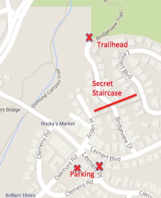
Parking: Free street parking available at the addresses above. I usually prefer to start at the Bridgeview Drive trail head. This is a narrow street and the trailhead is at a dead-end. Please be respectful of residents. I recommend parking on or near Leimert Place and walking up one of Oakland's hidden staircases (on Arden Place) to Bridgeview Drive. Parking down below is easier and I prefer it if I'm doing the Bridgeview Trail/Old Cañon Trail (Sausal Creek) loop.
Hours: 6 A.M. to 9 P.M.
Type: Hike (easy to moderate)
Regulations: Dogs allowed on-leash

Best time to visit: Anytime, as the trails are mostly shaded
Don't miss: The Old Cañon Trail
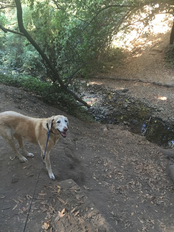
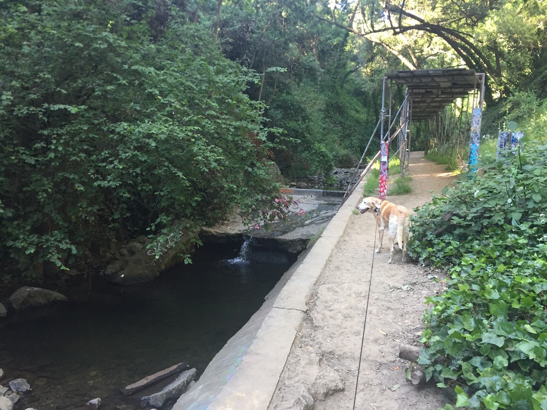
WARNING: Keep your dog out of the water. Water may contain raw sewage. 

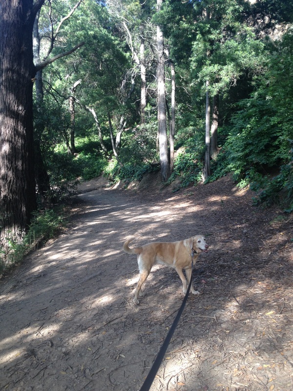
Description: This is a great hidden gem, with options for an easy, mostly flat hike (Bridgeview trail), or a moderate, longer hike (Old Cañon Trail-Google Maps calls it Sausal Creek Trail). It's difficult to get lost, but if you do, Google Maps will show you the trails and there is reception in the park. Please keep your dog on leash and out of the water. As of May 2017, we noticed a sign warning that water may contain raw sewage. 


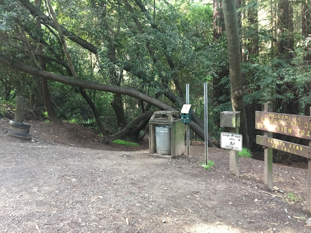
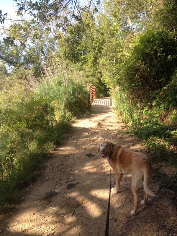
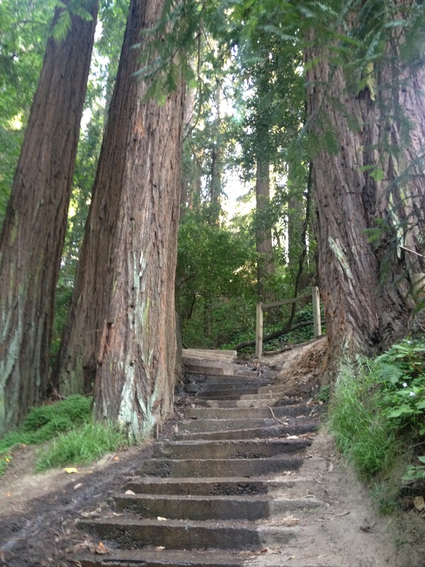
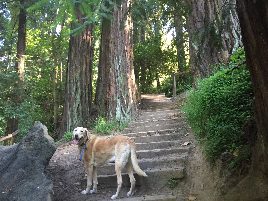
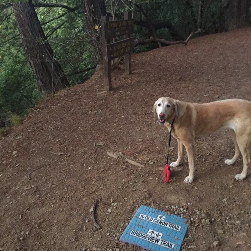
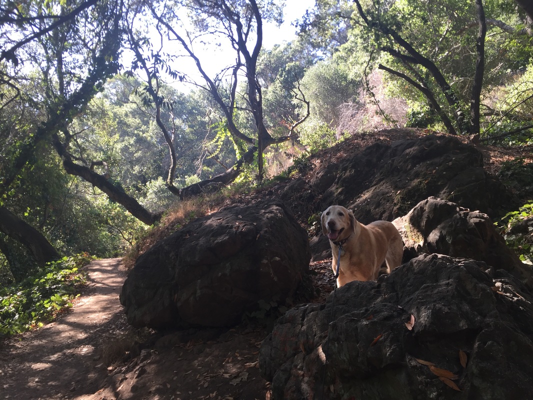
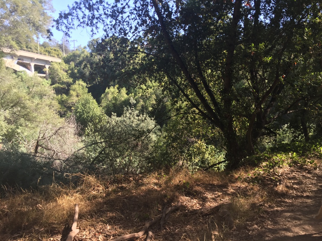
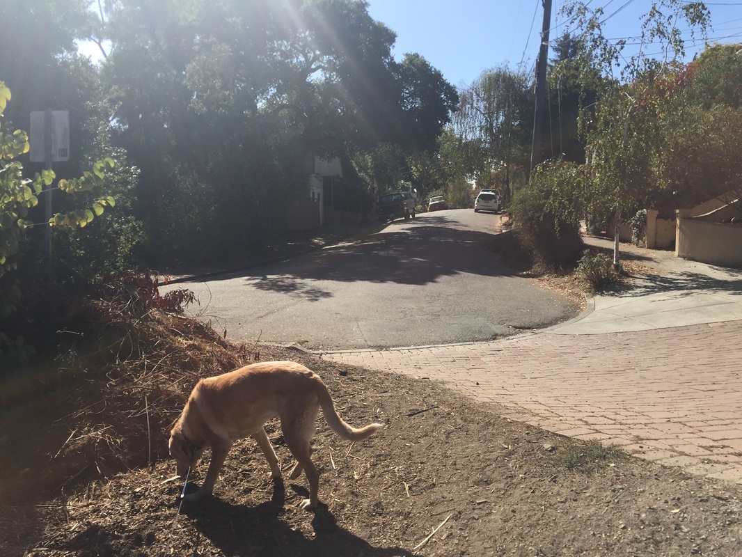
For the Dimond Canyon Trail hike: from the trailhead, where Bridgeview Drive dead-ends, you will follow the main trail past the golf course to Monterey Blvd. There's a nice bridge, great views of people at the driving range, huge redwoods, and a beautiful creek. It's a pretty quiet trail and is a fairly flat trail to run on. There's a great stair running spot at the end where the canyon connects to Monterey Blvd. There are even some rope swings for the kids above the trail. For a longer hike, you can walk back to the "Bridgeview Trail" sign and hike down into lower Dimond canyon (see Old Canon/ Sausal Creek Trail description below). Another option is to cross Monterey Blvd under the freeway to Joaquin Miller Ct, which will take you to trails in Joaquin Miller Park, and then you can follow the same trails back at anytime. I've also hiked a loop through the neighborhoods after reaching the end at Monterey Blvd, by walking up Montery Blvd to Leimert and back to where I parked. Some parts of the road do not have a shoulder, but it's a nice walk with views of the bay.

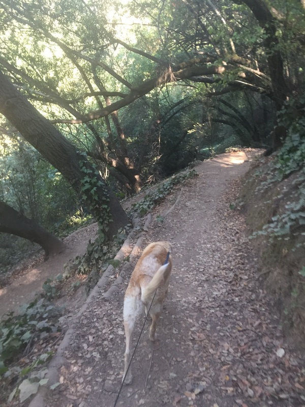
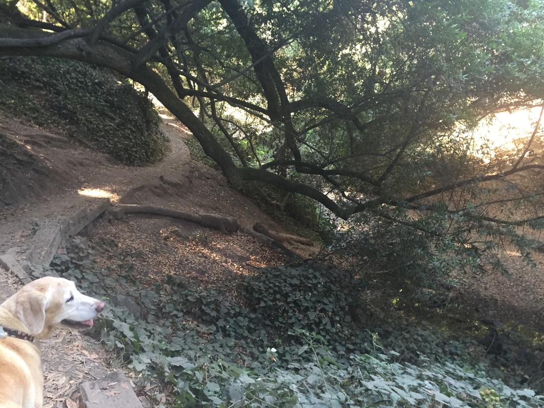
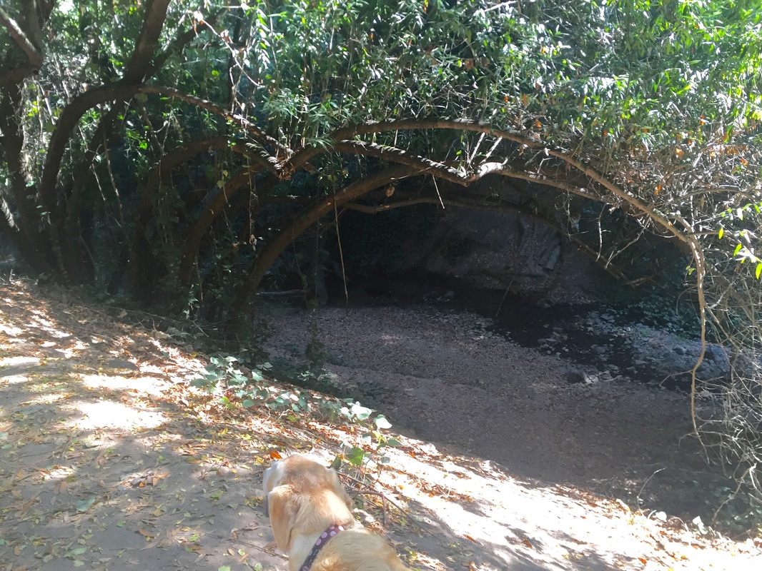
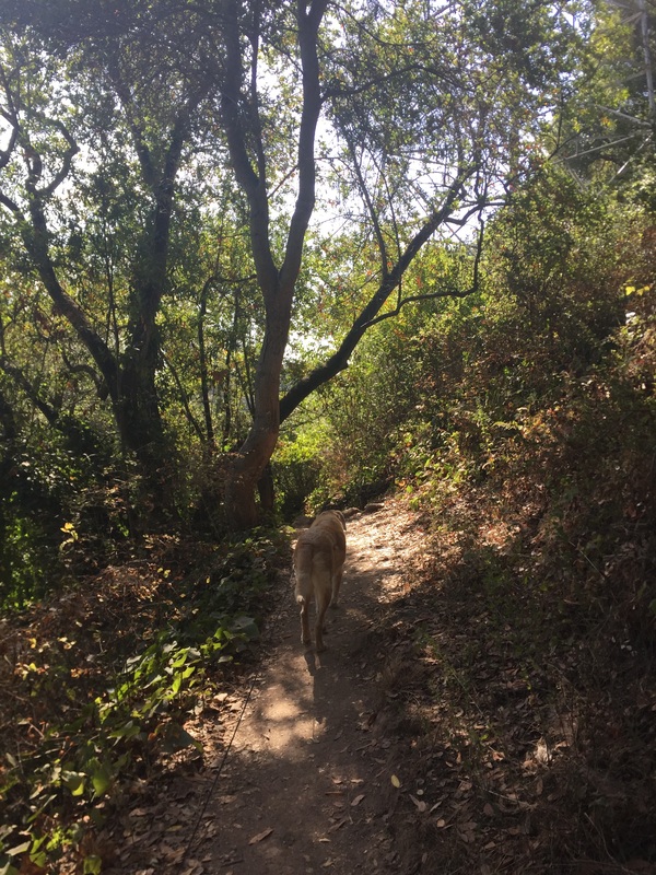
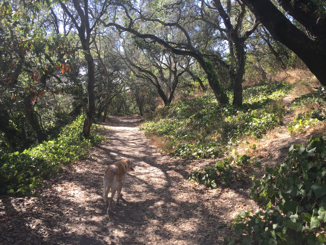
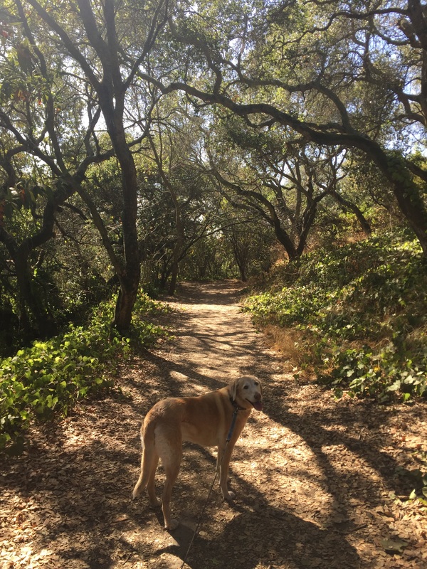
For the Old Cañon Trail (Sausal Creek) hike: From the trailhead, where Bridgeview Drive dead-ends, you will follow the main trail until you reach the "Bridgeview Trail" sign, and hike down to your left via the Old Cañon Trail. There are several switchbacks, and the trail slopes down into the canyon and follows along the creek. I often see dogs running down and playing in the creek, but I noticed a lot of algae in there so I wouldn't chance it. The trail will continue up and under the bridge on Leimert, with several switchbacks. If you keep heading straight, the trail changes to Dimond Canyon Trail, which eventually ends on Benevides Ave. If you continue on Old Cañon Trail, which splits to the left, it will take you down into the canyon again and along the creek. This eventually leads to another park entrance at El Centro Ave, the "El Centro Trailhead." From here you can either:
  • Retrace your steps back to the trailhead, or
  • Cross El Centro Ave into the park on the other side of the street. Stay to the left and walk up the Dimond Recreation Center driveway (since the road does not have a shoulder). Your first left will lead you to Oakmore Road. You can follow sidewalks back through nice neighborhoods and you will be at your car in only a few blocks. Overall, this is approximately a 2 mile hike.
You could also choose to begin your hike at either the El Centro Trailhead or dead-end of Benevides Ave and loop back. From the El Centro Trailhead, you can cross the street and keep hiking to Lyman Rd or Dimond Ave. The trail map in the park is not very detailed, but if you Google the area you can also see the main trail on Google Maps, which runs from El Centro Ave to Monterey Blvd. The section from El Centro Ave down to Fruitvale (Lyman) Ave is the actual children's park, not hiking trails, but you can cut through it.
Here's a trail map courtesy of Friends of Sausual Creek.
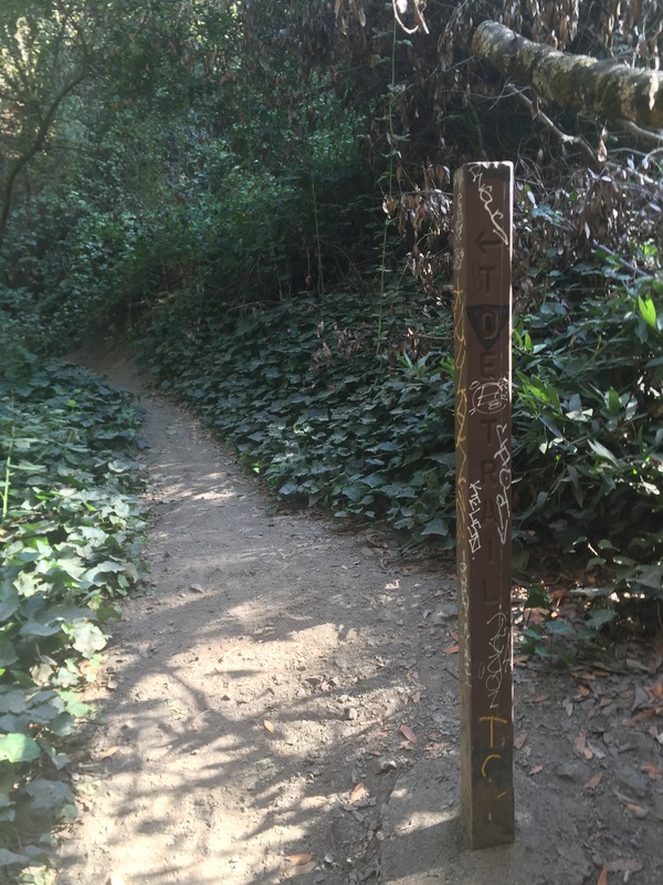
Please note that trail names have been changed from the link above. Sam's and Toe Trails have new signage noting that it's "Old Cañon Trail." The Bridgeview Trail loop is pretty much impassible due to the creek and trail overgrowth. Follow my hiking directions above.
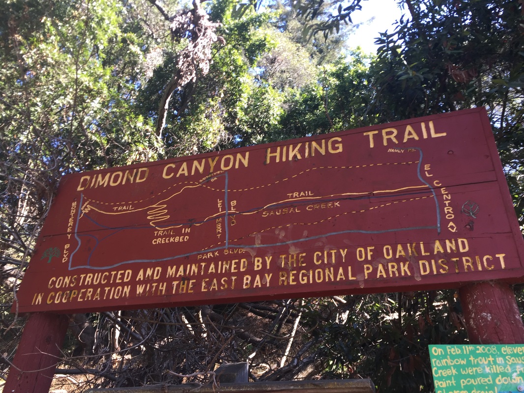
Trail Map:
Picture

​WARNING SIGN: 

Bridgeview Trail Hike Pictures:

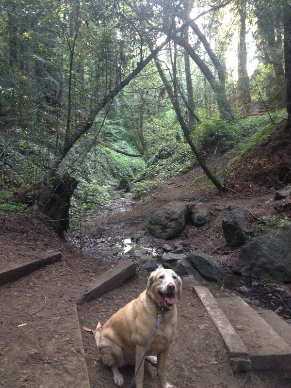
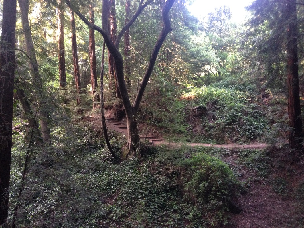
Old Cañon Trail (Sausal Creek Trail) Hike Pictures:
Benevides Ave & El Centro Trailheads:
Monterey Blvd Trailhead: 
Contact Us
Privacy Policy
Terms and Conditions
As an Amazon Associate I earn a commission from qualifying purchases. 
All content within this site Copyright © 2023 Hikes Dogs Love. All rights reserved. No part of this website may be reproduced without permission.
DMCA.com Protection Status
  • Home
  • Browse All
    • Alameda County >
      • Albany Bulb
      • Alameda Creek Regional Trail
      • Anthony Chabot Regional Park (Lake Chabot)
      • Aquatic Park
      • Chabot Park
      • Barlago Italian Kitchen
      • Buchanan Dog Beach
      • California Canoe & Kayak (Oakland)
      • César Chávez Park
      • Claremont Canyon
      • Coyote Hills Regional Park
      • Crab Cove
      • Cull Canyon Regional Recreation Area
      • Dimond Canyon Park
      • Don Castro Regional Recreation Area
      • Don Edwards Wildlife Refuge
      • Dublin Hills Regional Park
      • Fairmont Ridge
      • Five Canyons Open Space Preserve
      • Fremont Central Park
      • Garin/Dry Creek Pioneer Regional Park
      • Greenbelt Trails
      • Hayward Regional Shoreline
      • Heron Bay Trail
      • Holy Land Restaurant
      • Ikaros Greek Restaurant
      • Jerusalem Organic Kitchen
      • Joaquin Miller Park
      • Lake Anza
      • Lake Chabot
      • Lake Merritt
      • Leona Canyon Regional Open Space Preserve
      • Leona Heights Park
      • Marina Park
      • Martin Canyon Creek Trail
      • Martin Luther King Jr. Regional Shoreline
      • Mission Peak
      • Montclair Railroad Trail/ Torii Gate
      • Morgan Territory Regional Preserve
      • Oyster Bay Regional Shoreline
      • Park Street Classic Car Show (Annual)
      • Pleasanton Ridge Regional Preserve
      • Reinhardt Redwood Regional Park
      • Robert's Park
      • Room 389
      • Shoreline Park
      • Sibley Volcanic Regional Preserve
      • Skyline Gate Staging Area
      • Strawberry Canyon Fire Trail
      • Sunol Regional Wilderness
      • Temescal Regional Recreation Area
      • Tilden Regional Park
      • Upper Anthony Chabot Regional Park (Oakland Entrance)
      • Upper Knowland Park
      • Vargas Plateau Regional Park
    • Butte County >
      • Feather Falls
      • Motel 6 - Oroville
      • Riverbend Park
    • Contra Costa County >
      • Acalanes Ridge Open Space
      • Briones Regional Park
      • Carquinez Strait Regional Shoreline
      • Crockett Hills Regional Park
      • Diablo Foothills Regional Park
      • EBMUD Trails
      • Fernandez Ranch
      • Frowning Ridge
      • Geppetto's Caffe
      • Hacienda de las Flores Park
      • Hillside Nature Area
      • Howe Homestead Park
      • Indian Rock
      • Kennedy Grove Regional Recreation Area
      • Lafayette Community Park
      • Lafayette Reservoir
      • Las Trampas Regional Wilderness
      • Lime Ridge Open Space
      • Miller/Knox Regional Shoreline
      • Moraga Commons Park
      • Mulholland Ridge Open Space Preserve
      • Point Isabel
      • Point Molate Beach Park
      • Point Pinole Regional Shoreline
      • Point San Pablo Harbor
      • Rubio's
      • San Quentin Beach
      • Shell Ridge Open Space
      • Sobrante Ridge Regional Preserve
      • Sugarloaf Open Space
      • Sycamore Valley Open Space Preserve
      • Tender Greens
      • Tilden Regional Park
      • Wildcat Canyon Regional Park
    • El Dorado County >
      • Angora Lakes Trail
      • Bijou Community Park
      • Cascade Falls
      • Horsetail Falls
      • Inspriation Point
      • Motel 6 - South Lake Tahoe
      • Mt. Tallac
    • Marin County >
      • 101 Surf Sports
      • Baltimore Canyon Open Space Preserve
      • Blackie's Pasture
      • Camino Alto Preserve
      • Carson Falls
      • Cascade Falls
      • Cataract Falls
      • Dawn Falls
      • Ignacio Valley Preserve (Fairway Falls)
      • Indian Valley Open Space Preserve
      • King Mountain Open Space Preserve
      • Marin Headlands (Coastal Trail)
      • Old Saint Hilary's Open Space Preserve
      • Phoenix Lake
      • Ring Mountain Open Space Preserve
      • Roy's Redwoods
      • Sam's Anchor Cafe
      • Tiburon Peninsula Historical Trail
      • Tucker Trail Falls
    • Mariposa County >
      • Happy Burger Diner
      • Yosemite National Park
    • Mendocino County >
      • Catch-a-Canoe
      • MacKerricher State Park
      • Mendocino Headlands State Park
      • Navarro River Redwoods State Park
      • Princess Seafood
      • Skunk Train
      • The Stanford Inn By The Sea
      • Van Damme State Beach
    • Mono County >
      • Bodie State Historic Park
      • Jolly Kone
      • Lundy Canyon
      • Mono Lake (Tufa State National Reserve)
      • Virginia Creek Settlement
    • Monterey County >
      • 17-Mile Drive
      • Asilomar State Beach
      • Bistro Beaujolais
      • Carmel Beach
      • Fishwife
      • Fort Ord Dunes State Park
      • Garland Ranch Regional Park
      • Jack's Peak
      • Monterey Bay Coastal Trail
      • Monterey Bay Kayaks
      • Monterey Municipal Beach
      • Motel 6 - Downtown Monterey
      • Ryan Ranch Disc Golf Course
      • Ventana Wilderness
    • Nevada County >
      • Fairy Falls
    • Placer County >
      • Hidden Falls
    • San Francisco County >
      • 2.2 Mile Urban Hike
      • Bernal Heights Park
      • The Brixton
      • Billy Goat Hill Park
      • Blackwood
      • Clipper Cove Beach
      • Crissy Field
      • Dynamo Donut + Coffee
      • Fort Funston
      • Fort Mason
      • Glen Canyon Park
      • Golden Gate Park
      • Grand View Park
      • The Great Lawn/ Avenue of the Palms
      • Java Beach Cafe
      • John McLaren Park
      • Interior Greenbelt
      • Lake Merced
      • Lands End
      • Letterman Digital Arts Center
      • Marina Green
      • Mount Davidson
      • Mount Sutro Open Space Reserve
      • Ocean Beach
      • Palace of Fine Arts
      • Philz Coffee Truck
      • Stern Grove
      • Sutro Baths
      • Sutro Heights Park
      • TreasureFest
    • San Mateo County >
      • 7 Mile House Sports Bar & Grill
      • Barbara's Fishtrap
      • Bedwell Bayfront Park
      • Bob's Vegetable Stand and Pumpkin Farm
      • Cafe Pacifica
      • Devil's Slide Coastal Trail
      • Esplanade Beach
      • Flying Fish Grill
      • Half Moon Bay Kayak Co.
      • McNee Ranch State Park (Montara Mountain)
      • Montara State Beach
      • Mori Point
      • Mussel Rock Park
      • Panera Bread
      • Pedro Point Headlands
      • Poplar Beach
      • Pulgas Ridge Open Space Preserve
      • Rancho Corral de Tierra
      • Seal Point
      • Taqueria La Mexicana
      • Wavecrest Open Space
    • Santa Clara County >
      • Byxbee Park
      • Calero County Park
      • Uvas Canyon County Park
    • Santa Cruz County >
      • Byrne-Milliron Forest
      • Greyhound Rock County Park
      • Henry Cowell Redwoods State Park
      • Jaliscos Restaurant
      • Mount Madonna County Park
      • Roaring Camp Railroads
    • Solano County >
      • Lagoon Valley Park
      • Peña Adobe Regional Park
    • Sonoma County >
      • Doran Regional Park
      • Fishetarian
      • Helen Putnam Regional Park
    • Tuolumne County >
      • Donnell Vista
      • Tuttletown Recreation Area
    • Yuba County >
      • Ellis Lake
  • Map View
  • Vacation Spots
    • Vacation Hikes >
      • Arizona >
        • Papago Park
      • New Mexico >
        • Oliver Lee Memorial State Park
        • White Sands National Monument
      • Oregon >
        • Multnomah Falls
      • Washington >
        • Olympic National Park >
          • Kalaloch Beach
          • Madison Falls
          • Quinault Rainforest
        • Rattlesnake Ridge
    • Restaurants >
      • Southern California >
        • Fire Island Grill
        • Lazy Dog Restaurant & Bar
        • Perkies Coffee Haus
      • Washington >
        • Rose Pho
  • Planning Your Trip
  • About
    • Contact Us
    • Privacy Policy
    • Terms and Conditions
  • Dog Gear
  • Archived Hikes 1
    • Archived Hikes 2 >
      • Archives 2016-2018