
- Home
-
Browse All
-
Alameda County
>
- Albany Bulb
- Alameda Creek Regional Trail
- Brickyard Cove
- Brushy Peak Regional Preserve
- Anthony Chabot Regional Park (Lake Chabot)
- Aquatic Park
- Barlago Italian Kitchen
- Buchanan Dog Beach
- California Canoe & Kayak (Oakland)
- Cali Kid Burgers ‘N Shakes
- César Chávez Park
- Chabot Park
- Claremont Canyon
- Coyote Hills Regional Park
- Crab Cove
- Cull Canyon Regional Recreation Area
- Dimond Canyon Park
- Don Castro Regional Recreation Area
- Don Edwards Wildlife Refuge
- Dublin Hills Regional Park
- Emeryville Marina
- Fairmont Ridge
- Five Canyons Open Space Preserve
- Fremont Central Park
- Garin/Dry Creek Pioneer Regional Park
- Gilman Brewing Company
- Greenbelt Trails
- Hayward Regional Shoreline
- Heron Bay Trail
- Ikaros Greek Restaurant
- Jerusalem Organic Kitchen
- Joaquin Miller Park
- Lake Anza
- Lake Chabot
- Lake Merritt
- Leona Canyon Regional Open Space Preserve
- Leona Heights Park
- Marina Park
- Martin Canyon Creek Trail
- Martin Luther King Jr. Regional Shoreline
- Mission Peak
- Montclair Railroad Trail/ Torii Gate
- Morgan Territory Regional Preserve
- Oyster Bay Regional Shoreline
- Park Street Classic Car Show (Annual)
- Pleasanton Ridge Regional Preserve
- Point Emery
- Reinhardt Redwood Regional Park
- Robert's Park
- Room 389
- Shoreline Park
- Sibley Volcanic Regional Preserve
- Skyline Gate Staging Area
- Strawberry Canyon Fire Trail
- Sunol Regional Wilderness
- Temescal Regional Recreation Area
- Tilden Regional Park
- Upper Anthony Chabot Regional Park (Oakland Entrance)
- Upper Knowland Park
- Vargas Plateau Regional Park
- Butte County >
-
Contra Costa County
>
- Acalanes Ridge Open Space
- Briones Regional Park
- Carquinez Strait Regional Shoreline
- Crockett Hills Regional Park
- Diablo Foothills Regional Park
- EBMUD Trails
- Fernandez Ranch
- Frowning Ridge
- Geppetto's Caffe
- Hacienda de las Flores Park
- Hillside Nature Area
- Howe Homestead Park
- Indian Rock
- Kennedy Grove Regional Recreation Area
- Lafayette Community Park
- Lafayette Reservoir
- Las Trampas Regional Wilderness
- Lime Ridge Open Space
- Miller/Knox Regional Shoreline
- Moraga Commons Park
- Mulholland Ridge Open Space Preserve
- Point Isabel
- Point Molate Beach Park
- Point Pinole Regional Shoreline
- Point San Pablo Harbor
- Rubio's
- San Quentin Beach
- Shell Ridge Open Space
- Sobrante Ridge Regional Preserve
- Sugarloaf Open Space
- Sycamore Valley Open Space Preserve
- Tender Greens
- Tilden Regional Park
- Wildcat Canyon Regional Park
- El Dorado County >
-
Marin County
>
- 101 Surf Sports
- Baltimore Canyon Open Space Preserve
- Blackie's Pasture
- Camino Alto Preserve
- Carson Falls
- Cascade Falls
- Cataract Falls
- Dawn Falls
- Hippie Tree
- Ignacio Valley Preserve (Fairway Falls)
- Indian Valley Open Space Preserve
- King Mountain Open Space Preserve
- Marin Headlands (Coastal Trail)
- Old Saint Hilary's Open Space Preserve
- Phoenix Lake
- Red Hill Dog Park
- Red Hill Trail
- Ring Mountain Open Space Preserve
- Roy's Redwoods
- Sam's Anchor Cafe
- Sorich Ranch Park
- Tiburon Peninsula Historical Trail
- Tiburon Uplands
- Tucker Trail Falls
- Mariposa County >
- Mendocino County >
- Mono County >
- Monterey County >
- Nevada County >
- Placer County >
-
San Francisco County
>
- 2.2 Mile Urban Hike
- Bernal Heights Park
- The Brixton
- Billy Goat Hill Park
- Blackwood
- Clipper Cove Beach
- Crissy Field
- Dynamo Donut + Coffee
- Fort Funston
- Fort Mason
- Glen Canyon Park
- Golden Gate Park
- Grand View Park
- The Great Lawn/ Avenue of the Palms
- Java Beach Cafe
- John McLaren Park
- Interior Greenbelt
- Lake Merced
- Lands End
- Letterman Digital Arts Center
- Marina Green
- Mount Davidson
- Mount Sutro Open Space Reserve
- Ocean Beach
- Palace of Fine Arts
- Philz Coffee Truck
- Stern Grove
- Sutro Baths
- Sutro Heights Park
- TreasureFest
-
San Mateo County
>
- 7 Mile House Sports Bar & Grill
- Barbara's Fishtrap
- Bedwell Bayfront Park
- Bob's Vegetable Stand and Pumpkin Farm
- Cafe Pacifica
- Devil's Slide Coastal Trail
- Esplanade Beach
- Flying Fish Grill
- Half Moon Bay Kayak Co.
- McNee Ranch State Park (Montara Mountain)
- Montara State Beach
- Mori Point
- Mussel Rock Park
- Nick's Seafood Restaurant
- Panera Bread
- Pedro Point Headlands
- Poplar Beach
- Pulgas Ridge Open Space Preserve
- Rancho Corral de Tierra
- Seal Point
- Taqueria La Mexicana
- Wavecrest Open Space
- Santa Clara County >
- Santa Cruz County >
- Solano County >
- Sonoma County >
- Tuolumne County >
- Yuba County >
-
Alameda County
>
- Map View
-
More
Address: 6899 Skyline Blvd, Oakland, CA
OR
37°51'22.8"N 122°12'24.8"W (of of Fish Ranch Road in Orinda)
Parking: Free parking available at the address above
Hours: Nov-Feb: 7 A.M. to 6 P.M., March-Oct: 7 A.M. to 10 P.M.
Type: Hike (moderate)
Regulations: Dogs allowed off-leash if under voice control
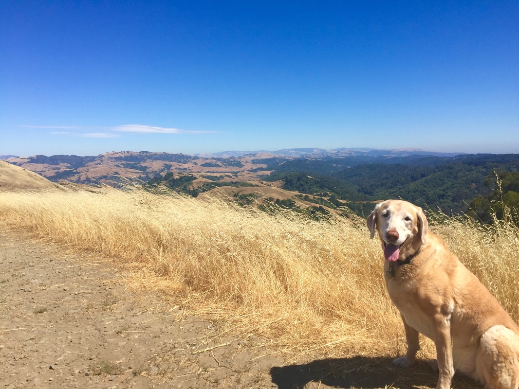
Best time to visit: Cool days, as trails can get hot in summer and there is little shade. Trails are lush and beautiful in winter.
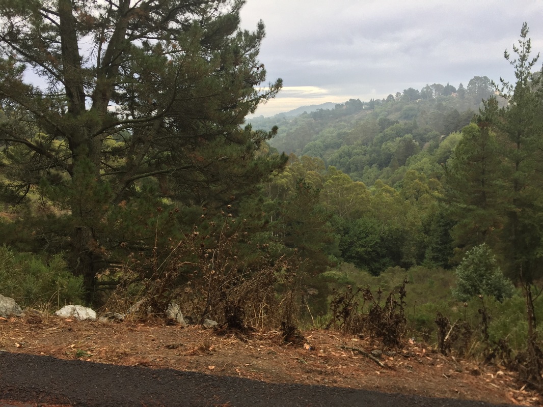
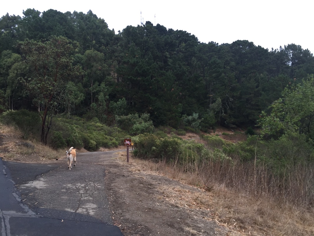
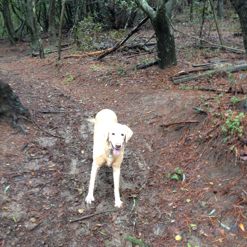
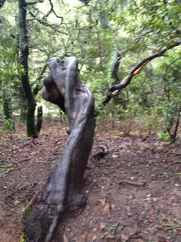
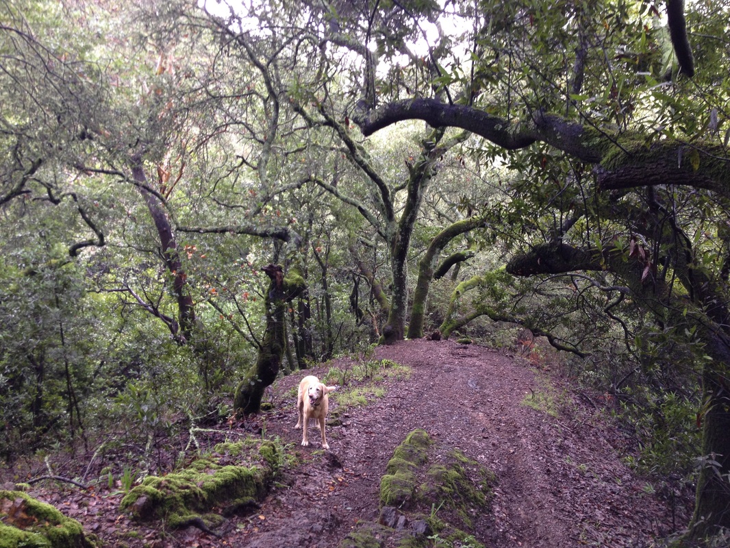
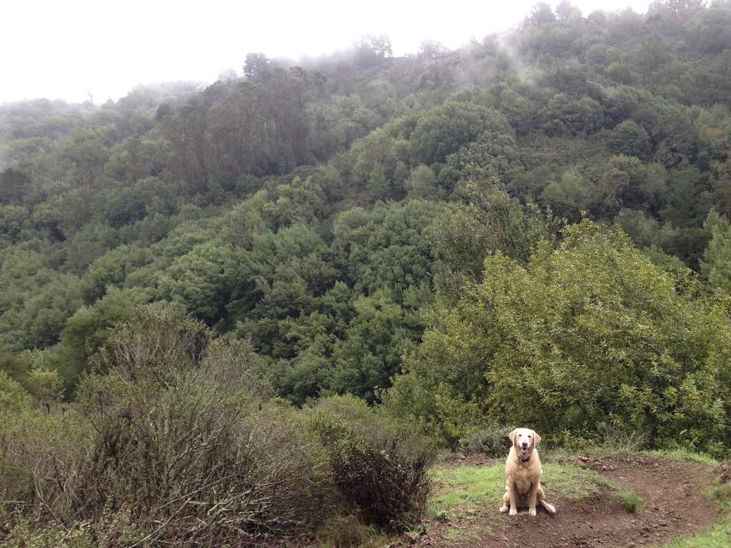
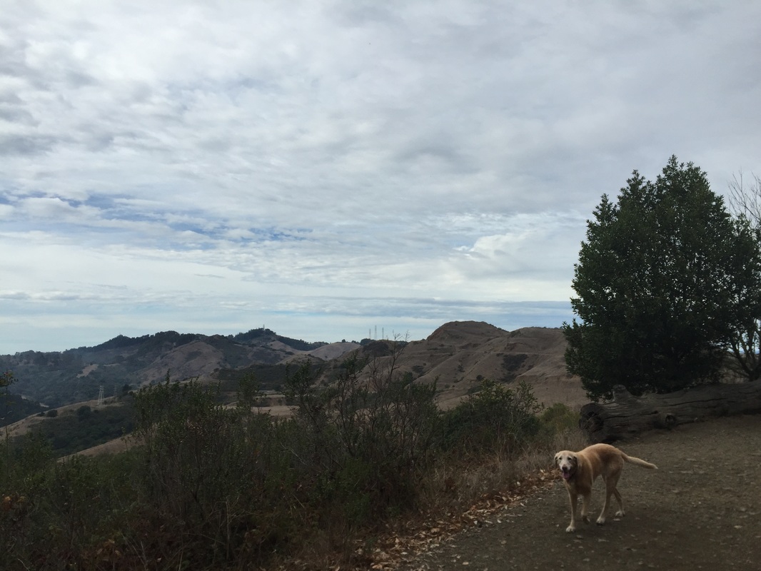
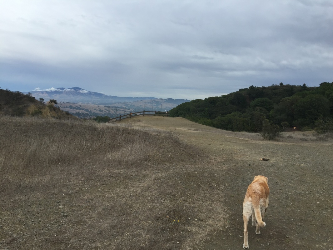
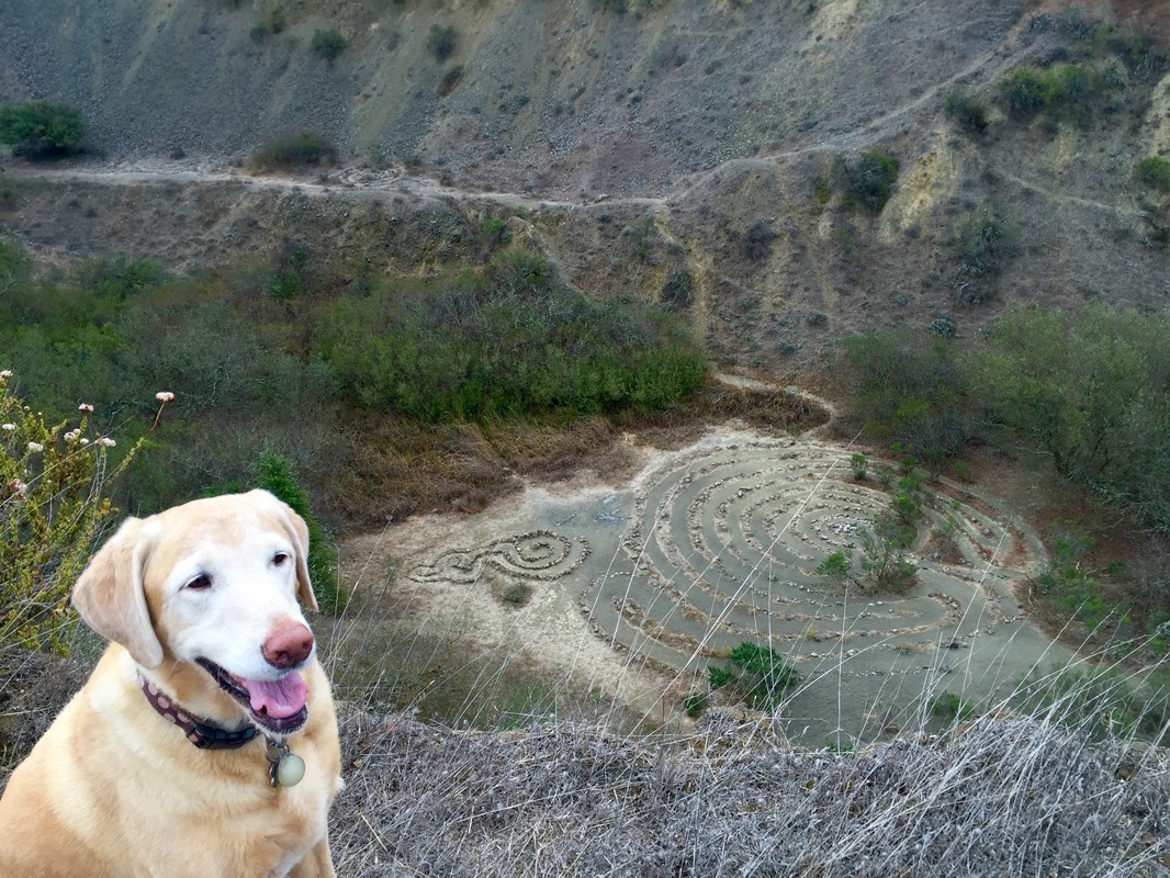
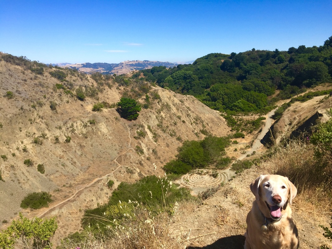
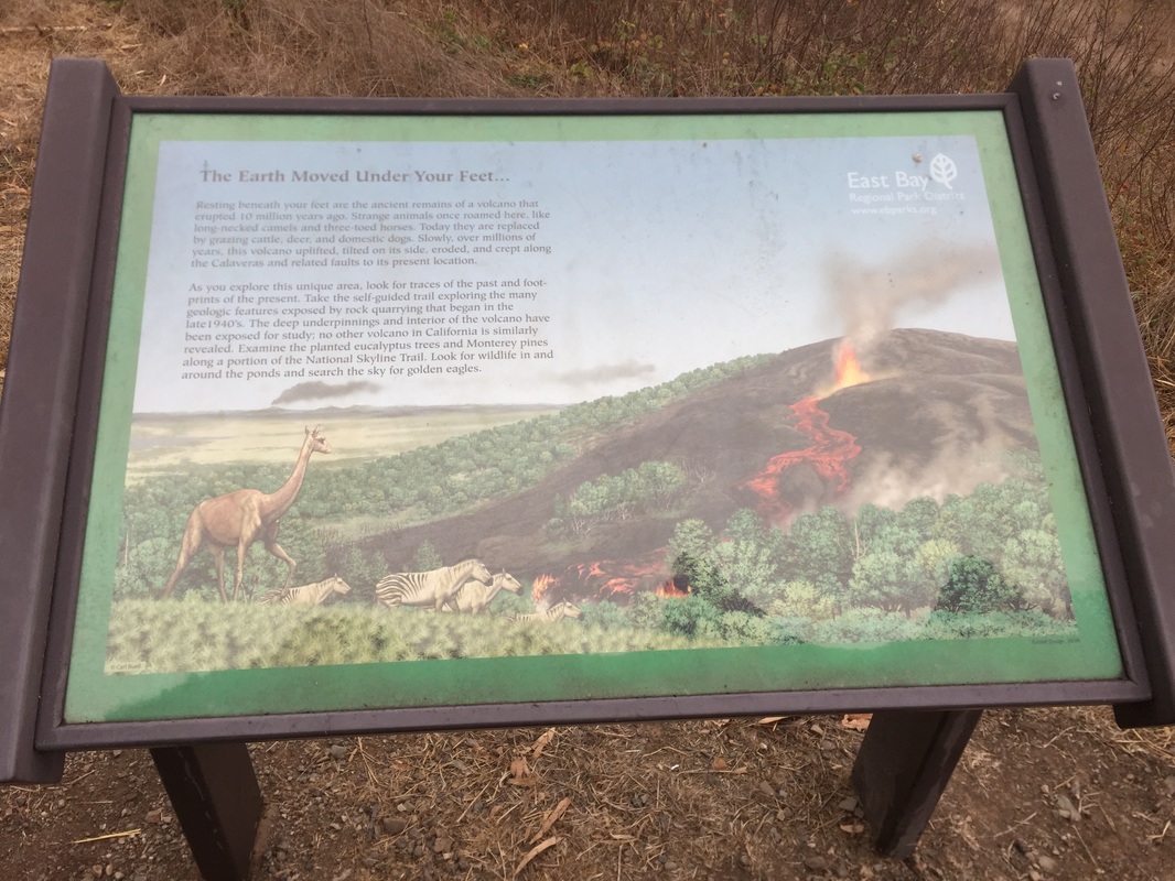
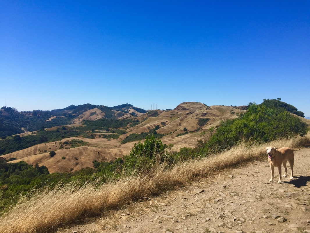
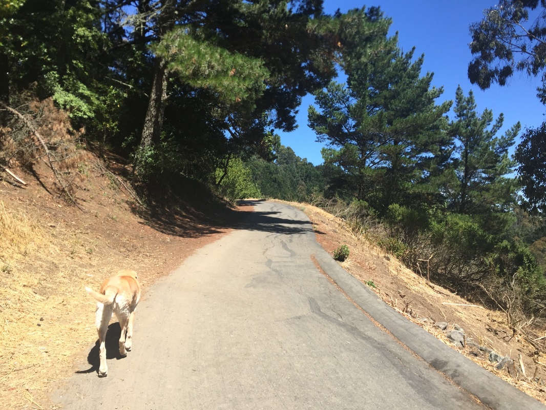
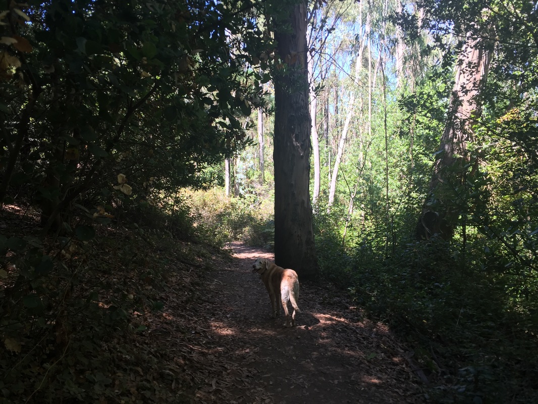
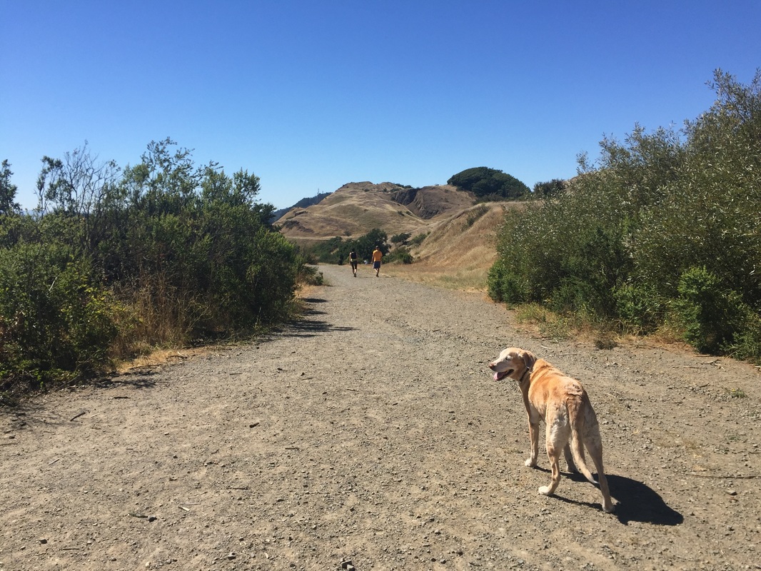
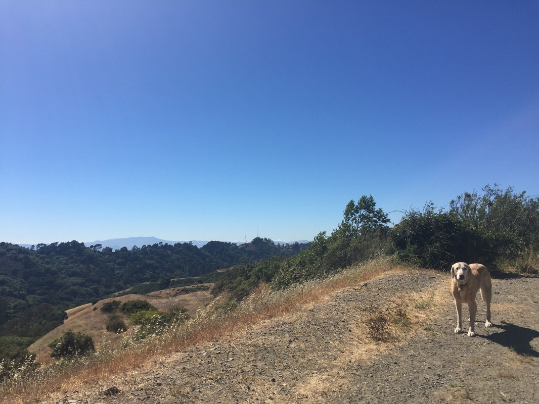
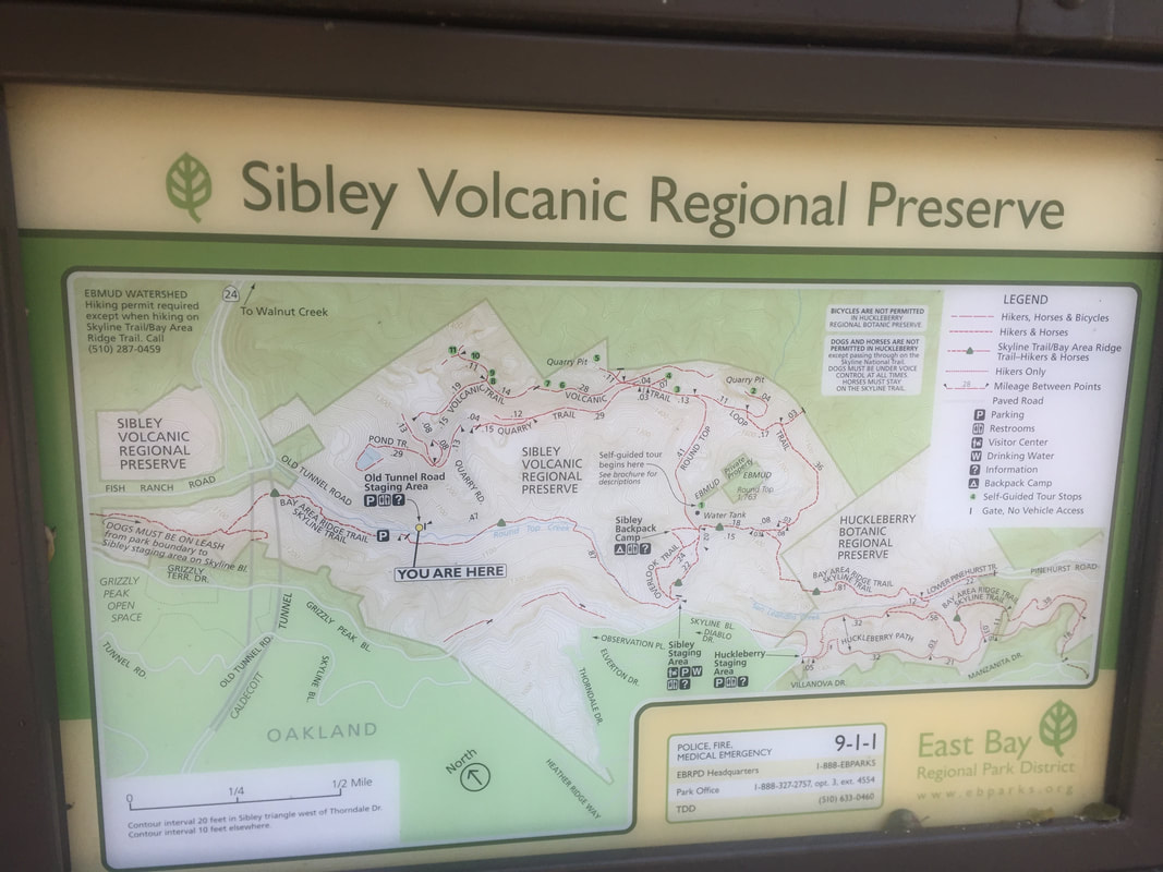
Description: One of the best features of this park is that you can hike around a volcano! Although it's inactive, it's still a fun hike to tell your friends about. The main trail from the parking lot begins on a paved trail, and splits off to the left through a cattle gate into the hillside. It has beautiful views of the canyon and eroded rock walls lining some of the trails. There are also multiple rock labyrinths you can walk down into and explore. One was created by a local artist in 1989, but no one knows how the others appeared. You may miss one in winter, as it turns into a pond. You can also hike down to another large pond, or all the way to Wildcat Canyon or Anthony Chabot Regional Park. The loop around the volcano is the Round Top Loop Trail.
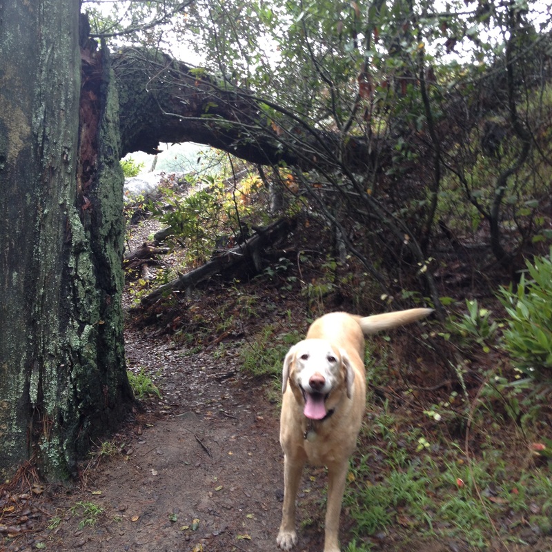
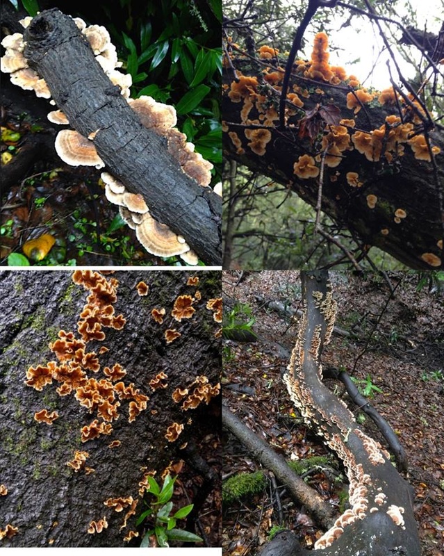
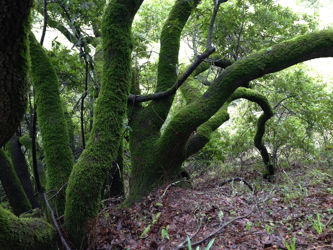
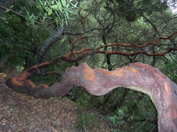
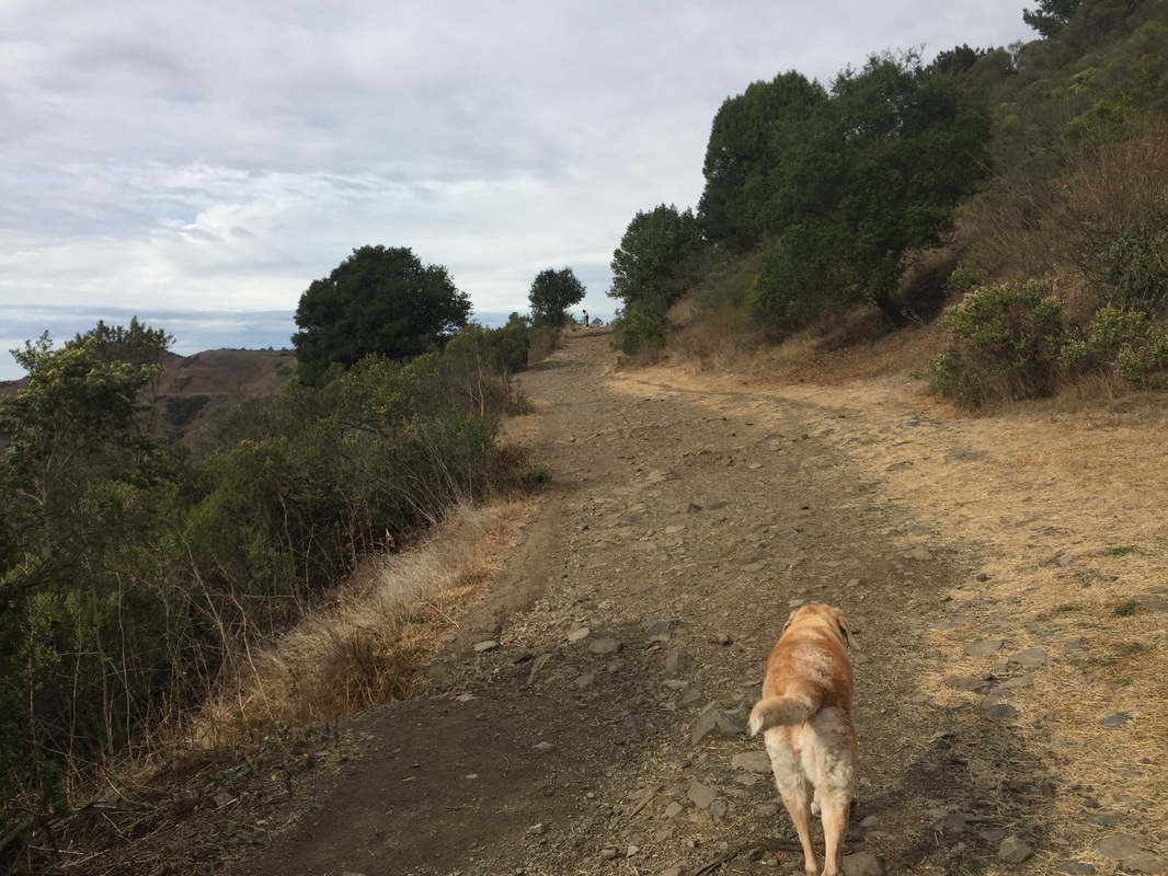
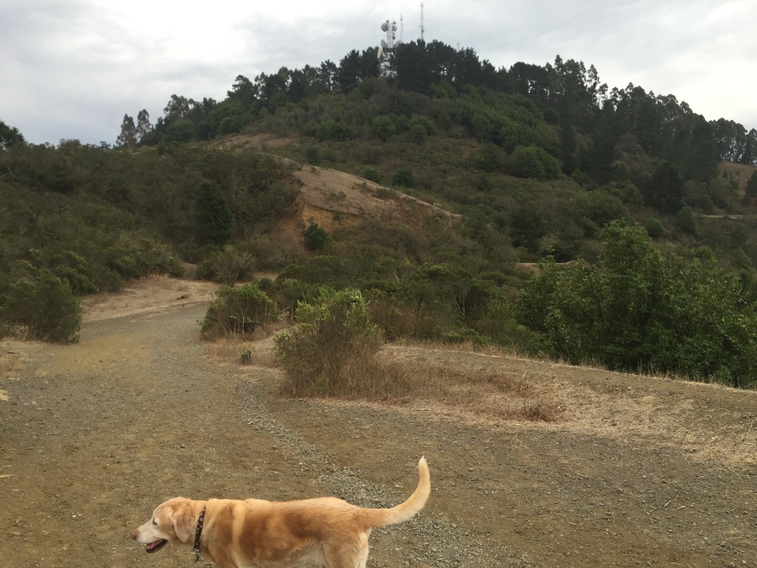
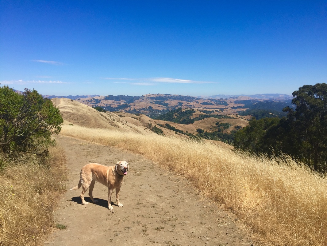
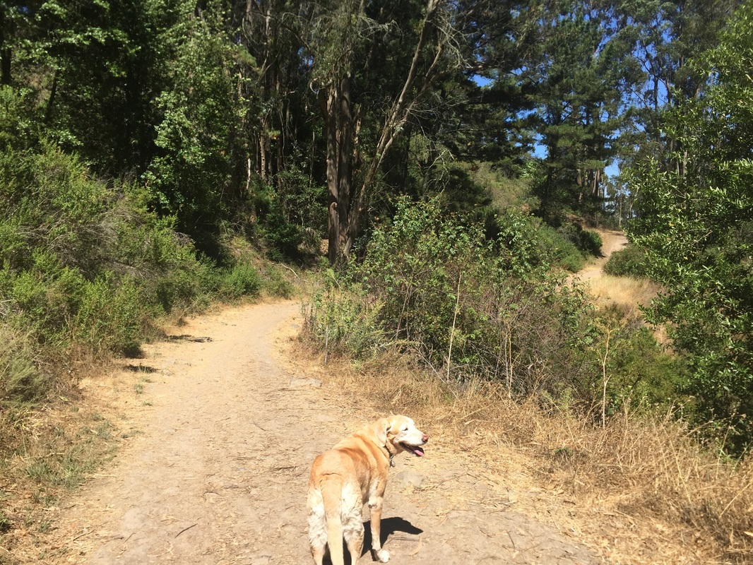
From the parking lot, if you take the main paved trail and then the split off on the dirt trail to the right, you can hike up to the volcano via the Round Top Loop trail. This circles the volcano, which is 1,763 ft above sea level. There is another split on this dirt trail, and if you take the trail to the right down into the valley, it leads to a beautiful shaded hike. This is my favorite trail, and it's the Bay Area Ridge Trail, but is labeled the "East Bay Skyline Trail." This trail leads down into Huckleberry Botanic Regional Preserve (which is not dog friendly), but you and your dog are allowed to take this trail down into Huckleberry to just pass through. The trail leading down is a must-see. It is lush and green in winter, and often lined with colorful fungi.
Most of the trails in the park are moderate, but you can make the hike as challenging as you wish by hiking into Wildcat Canyon or Chabot and back.
This park has clean restrooms, picnic tables, running water and faucets to fill your dog's bowl.
OR
37°51'22.8"N 122°12'24.8"W (of of Fish Ranch Road in Orinda)
Parking: Free parking available at the address above
Hours: Nov-Feb: 7 A.M. to 6 P.M., March-Oct: 7 A.M. to 10 P.M.
Type: Hike (moderate)
Regulations: Dogs allowed off-leash if under voice control
Best time to visit: Cool days, as trails can get hot in summer and there is little shade. Trails are lush and beautiful in winter.
Description: One of the best features of this park is that you can hike around a volcano! Although it's inactive, it's still a fun hike to tell your friends about. The main trail from the parking lot begins on a paved trail, and splits off to the left through a cattle gate into the hillside. It has beautiful views of the canyon and eroded rock walls lining some of the trails. There are also multiple rock labyrinths you can walk down into and explore. One was created by a local artist in 1989, but no one knows how the others appeared. You may miss one in winter, as it turns into a pond. You can also hike down to another large pond, or all the way to Wildcat Canyon or Anthony Chabot Regional Park. The loop around the volcano is the Round Top Loop Trail.
From the parking lot, if you take the main paved trail and then the split off on the dirt trail to the right, you can hike up to the volcano via the Round Top Loop trail. This circles the volcano, which is 1,763 ft above sea level. There is another split on this dirt trail, and if you take the trail to the right down into the valley, it leads to a beautiful shaded hike. This is my favorite trail, and it's the Bay Area Ridge Trail, but is labeled the "East Bay Skyline Trail." This trail leads down into Huckleberry Botanic Regional Preserve (which is not dog friendly), but you and your dog are allowed to take this trail down into Huckleberry to just pass through. The trail leading down is a must-see. It is lush and green in winter, and often lined with colorful fungi.
Most of the trails in the park are moderate, but you can make the hike as challenging as you wish by hiking into Wildcat Canyon or Chabot and back.
This park has clean restrooms, picnic tables, running water and faucets to fill your dog's bowl.
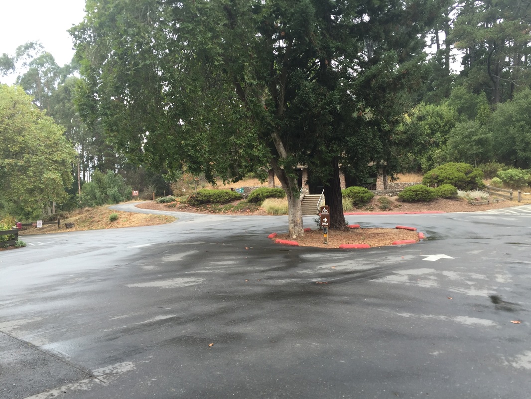

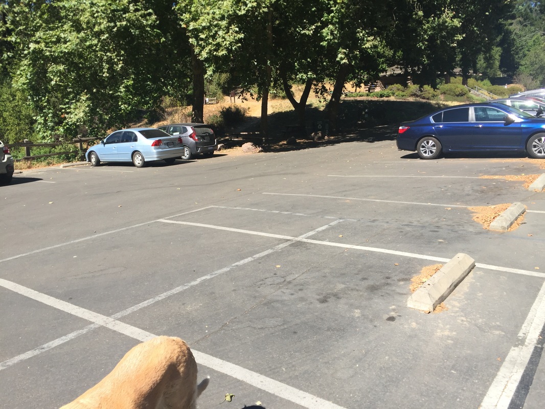


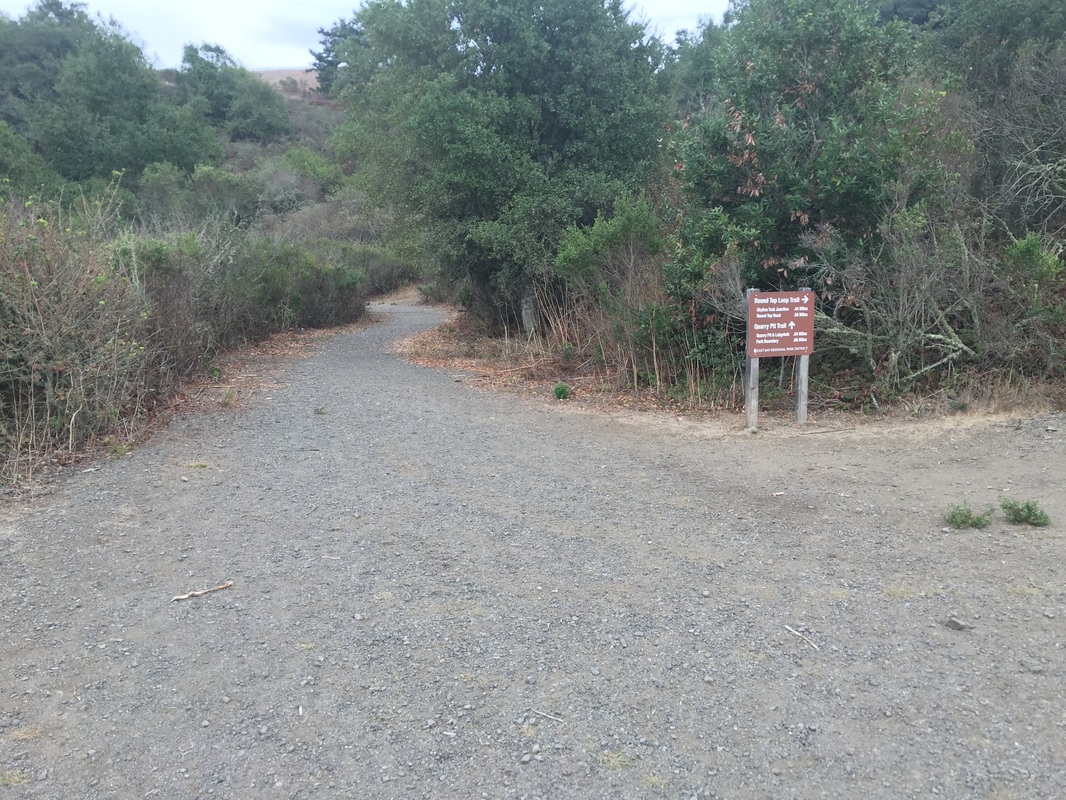


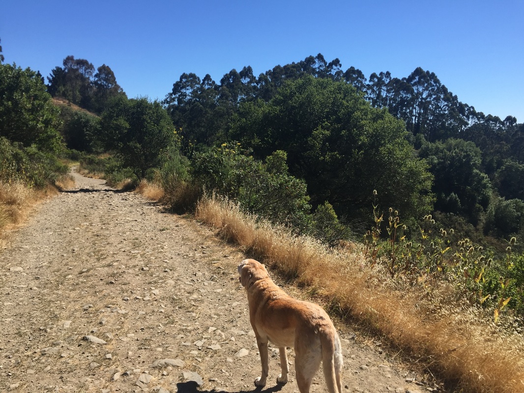
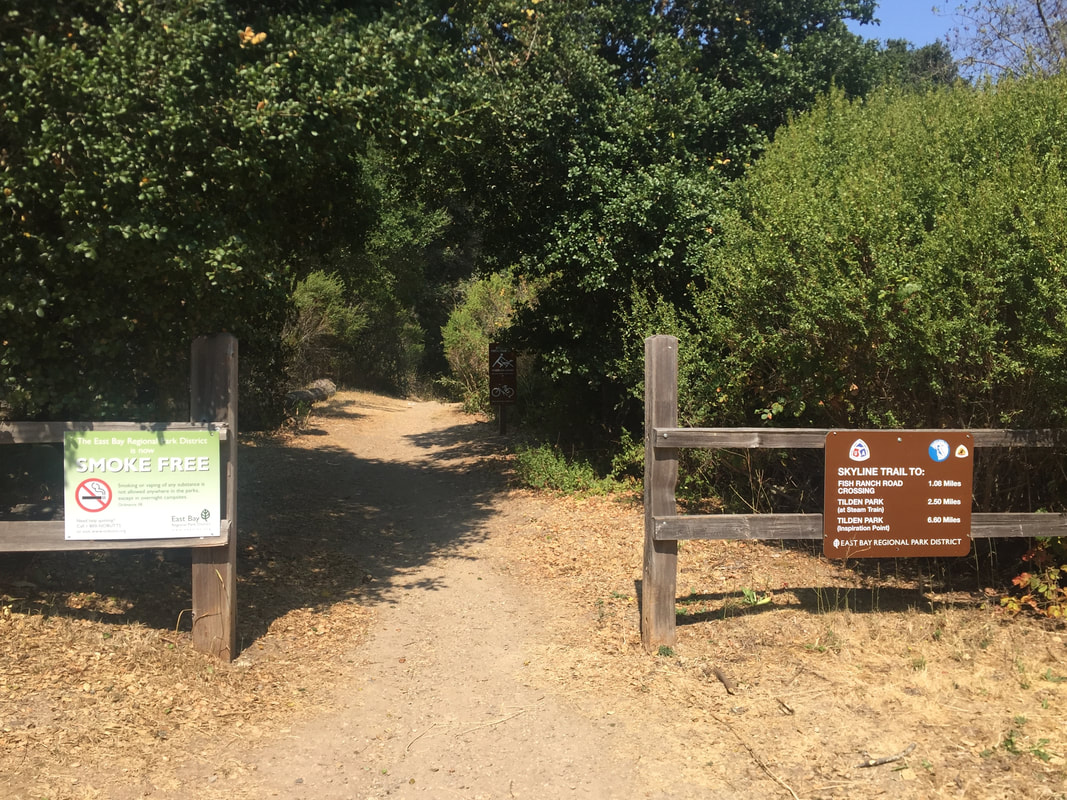
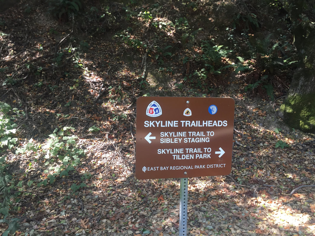
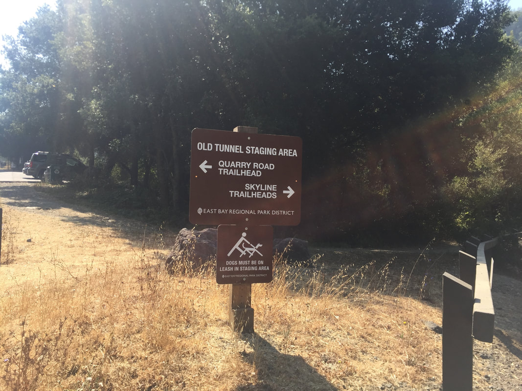
Photos from the Orinda entrance. There are approximately 10 parking spaces at two separate trail heads:


All content within this site Copyright © 2023 Hikes Dogs Love. All rights reserved. No part of this website may be reproduced without permission.

- Home
-
Browse All
-
Alameda County
>
- Albany Bulb
- Alameda Creek Regional Trail
- Brickyard Cove
- Brushy Peak Regional Preserve
- Anthony Chabot Regional Park (Lake Chabot)
- Aquatic Park
- Barlago Italian Kitchen
- Buchanan Dog Beach
- California Canoe & Kayak (Oakland)
- Cali Kid Burgers ‘N Shakes
- César Chávez Park
- Chabot Park
- Claremont Canyon
- Coyote Hills Regional Park
- Crab Cove
- Cull Canyon Regional Recreation Area
- Dimond Canyon Park
- Don Castro Regional Recreation Area
- Don Edwards Wildlife Refuge
- Dublin Hills Regional Park
- Emeryville Marina
- Fairmont Ridge
- Five Canyons Open Space Preserve
- Fremont Central Park
- Garin/Dry Creek Pioneer Regional Park
- Gilman Brewing Company
- Greenbelt Trails
- Hayward Regional Shoreline
- Heron Bay Trail
- Ikaros Greek Restaurant
- Jerusalem Organic Kitchen
- Joaquin Miller Park
- Lake Anza
- Lake Chabot
- Lake Merritt
- Leona Canyon Regional Open Space Preserve
- Leona Heights Park
- Marina Park
- Martin Canyon Creek Trail
- Martin Luther King Jr. Regional Shoreline
- Mission Peak
- Montclair Railroad Trail/ Torii Gate
- Morgan Territory Regional Preserve
- Oyster Bay Regional Shoreline
- Park Street Classic Car Show (Annual)
- Pleasanton Ridge Regional Preserve
- Point Emery
- Reinhardt Redwood Regional Park
- Robert's Park
- Room 389
- Shoreline Park
- Sibley Volcanic Regional Preserve
- Skyline Gate Staging Area
- Strawberry Canyon Fire Trail
- Sunol Regional Wilderness
- Temescal Regional Recreation Area
- Tilden Regional Park
- Upper Anthony Chabot Regional Park (Oakland Entrance)
- Upper Knowland Park
- Vargas Plateau Regional Park
- Butte County >
-
Contra Costa County
>
- Acalanes Ridge Open Space
- Briones Regional Park
- Carquinez Strait Regional Shoreline
- Crockett Hills Regional Park
- Diablo Foothills Regional Park
- EBMUD Trails
- Fernandez Ranch
- Frowning Ridge
- Geppetto's Caffe
- Hacienda de las Flores Park
- Hillside Nature Area
- Howe Homestead Park
- Indian Rock
- Kennedy Grove Regional Recreation Area
- Lafayette Community Park
- Lafayette Reservoir
- Las Trampas Regional Wilderness
- Lime Ridge Open Space
- Miller/Knox Regional Shoreline
- Moraga Commons Park
- Mulholland Ridge Open Space Preserve
- Point Isabel
- Point Molate Beach Park
- Point Pinole Regional Shoreline
- Point San Pablo Harbor
- Rubio's
- San Quentin Beach
- Shell Ridge Open Space
- Sobrante Ridge Regional Preserve
- Sugarloaf Open Space
- Sycamore Valley Open Space Preserve
- Tender Greens
- Tilden Regional Park
- Wildcat Canyon Regional Park
- El Dorado County >
-
Marin County
>
- 101 Surf Sports
- Baltimore Canyon Open Space Preserve
- Blackie's Pasture
- Camino Alto Preserve
- Carson Falls
- Cascade Falls
- Cataract Falls
- Dawn Falls
- Hippie Tree
- Ignacio Valley Preserve (Fairway Falls)
- Indian Valley Open Space Preserve
- King Mountain Open Space Preserve
- Marin Headlands (Coastal Trail)
- Old Saint Hilary's Open Space Preserve
- Phoenix Lake
- Red Hill Dog Park
- Red Hill Trail
- Ring Mountain Open Space Preserve
- Roy's Redwoods
- Sam's Anchor Cafe
- Sorich Ranch Park
- Tiburon Peninsula Historical Trail
- Tiburon Uplands
- Tucker Trail Falls
- Mariposa County >
- Mendocino County >
- Mono County >
- Monterey County >
- Nevada County >
- Placer County >
-
San Francisco County
>
- 2.2 Mile Urban Hike
- Bernal Heights Park
- The Brixton
- Billy Goat Hill Park
- Blackwood
- Clipper Cove Beach
- Crissy Field
- Dynamo Donut + Coffee
- Fort Funston
- Fort Mason
- Glen Canyon Park
- Golden Gate Park
- Grand View Park
- The Great Lawn/ Avenue of the Palms
- Java Beach Cafe
- John McLaren Park
- Interior Greenbelt
- Lake Merced
- Lands End
- Letterman Digital Arts Center
- Marina Green
- Mount Davidson
- Mount Sutro Open Space Reserve
- Ocean Beach
- Palace of Fine Arts
- Philz Coffee Truck
- Stern Grove
- Sutro Baths
- Sutro Heights Park
- TreasureFest
-
San Mateo County
>
- 7 Mile House Sports Bar & Grill
- Barbara's Fishtrap
- Bedwell Bayfront Park
- Bob's Vegetable Stand and Pumpkin Farm
- Cafe Pacifica
- Devil's Slide Coastal Trail
- Esplanade Beach
- Flying Fish Grill
- Half Moon Bay Kayak Co.
- McNee Ranch State Park (Montara Mountain)
- Montara State Beach
- Mori Point
- Mussel Rock Park
- Nick's Seafood Restaurant
- Panera Bread
- Pedro Point Headlands
- Poplar Beach
- Pulgas Ridge Open Space Preserve
- Rancho Corral de Tierra
- Seal Point
- Taqueria La Mexicana
- Wavecrest Open Space
- Santa Clara County >
- Santa Cruz County >
- Solano County >
- Sonoma County >
- Tuolumne County >
- Yuba County >
-
Alameda County
>
- Map View
-
More