Hikes Dogs Love
  • Home
  • Browse All
    • Alameda County >
      • Albany Bulb
      • Alameda Creek Regional Trail
      • Anthony Chabot Regional Park (Lake Chabot)
      • Aquatic Park
      • Chabot Park
      • Barlago Italian Kitchen
      • Buchanan Dog Beach
      • California Canoe & Kayak (Oakland)
      • César Chávez Park
      • Claremont Canyon
      • Coyote Hills Regional Park
      • Crab Cove
      • Cull Canyon Regional Recreation Area
      • Dimond Canyon Park
      • Don Castro Regional Recreation Area
      • Don Edwards Wildlife Refuge
      • Dublin Hills Regional Park
      • Fairmont Ridge
      • Five Canyons Open Space Preserve
      • Fremont Central Park
      • Garin/Dry Creek Pioneer Regional Park
      • Greenbelt Trails
      • Hayward Regional Shoreline
      • Heron Bay Trail
      • Holy Land Restaurant
      • Ikaros Greek Restaurant
      • Jerusalem Organic Kitchen
      • Joaquin Miller Park
      • Lake Anza
      • Lake Chabot
      • Lake Merritt
      • Leona Canyon Regional Open Space Preserve
      • Leona Heights Park
      • Marina Park
      • Martin Canyon Creek Trail
      • Martin Luther King Jr. Regional Shoreline
      • Mission Peak
      • Montclair Railroad Trail/ Torii Gate
      • Morgan Territory Regional Preserve
      • Oyster Bay Regional Shoreline
      • Park Street Classic Car Show (Annual)
      • Pleasanton Ridge Regional Preserve
      • Reinhardt Redwood Regional Park
      • Robert's Park
      • Room 389
      • Shoreline Park
      • Sibley Volcanic Regional Preserve
      • Skyline Gate Staging Area
      • Strawberry Canyon Fire Trail
      • Sunol Regional Wilderness
      • Temescal Regional Recreation Area
      • Tilden Regional Park
      • Upper Anthony Chabot Regional Park (Oakland Entrance)
      • Upper Knowland Park
      • Vargas Plateau Regional Park
    • Butte County >
      • Feather Falls
      • Motel 6 - Oroville
      • Riverbend Park
    • Contra Costa County >
      • Acalanes Ridge Open Space
      • Briones Regional Park
      • Carquinez Strait Regional Shoreline
      • Crockett Hills Regional Park
      • Diablo Foothills Regional Park
      • EBMUD Trails
      • Fernandez Ranch
      • Frowning Ridge
      • Geppetto's Caffe
      • Hacienda de las Flores Park
      • Hillside Nature Area
      • Howe Homestead Park
      • Indian Rock
      • Kennedy Grove Regional Recreation Area
      • Lafayette Community Park
      • Lafayette Reservoir
      • Las Trampas Regional Wilderness
      • Lime Ridge Open Space
      • Miller/Knox Regional Shoreline
      • Moraga Commons Park
      • Mulholland Ridge Open Space Preserve
      • Point Isabel
      • Point Molate Beach Park
      • Point Pinole Regional Shoreline
      • Point San Pablo Harbor
      • Rubio's
      • San Quentin Beach
      • Shell Ridge Open Space
      • Sobrante Ridge Regional Preserve
      • Sugarloaf Open Space
      • Sycamore Valley Open Space Preserve
      • Tender Greens
      • Tilden Regional Park
      • Wildcat Canyon Regional Park
    • El Dorado County >
      • Angora Lakes Trail
      • Bijou Community Park
      • Cascade Falls
      • Horsetail Falls
      • Inspriation Point
      • Motel 6 - South Lake Tahoe
      • Mt. Tallac
    • Marin County >
      • 101 Surf Sports
      • Baltimore Canyon Open Space Preserve
      • Blackie's Pasture
      • Camino Alto Preserve
      • Carson Falls
      • Cascade Falls
      • Cataract Falls
      • Dawn Falls
      • Ignacio Valley Preserve (Fairway Falls)
      • Indian Valley Open Space Preserve
      • King Mountain Open Space Preserve
      • Marin Headlands (Coastal Trail)
      • Old Saint Hilary's Open Space Preserve
      • Phoenix Lake
      • Ring Mountain Open Space Preserve
      • Roy's Redwoods
      • Sam's Anchor Cafe
      • Tiburon Peninsula Historical Trail
      • Tucker Trail Falls
    • Mariposa County >
      • Happy Burger Diner
      • Yosemite National Park
    • Mendocino County >
      • Catch-a-Canoe
      • MacKerricher State Park
      • Mendocino Headlands State Park
      • Navarro River Redwoods State Park
      • Princess Seafood
      • Skunk Train
      • The Stanford Inn By The Sea
      • Van Damme State Beach
    • Mono County >
      • Bodie State Historic Park
      • Jolly Kone
      • Lundy Canyon
      • Mono Lake (Tufa State National Reserve)
      • Virginia Creek Settlement
    • Monterey County >
      • 17-Mile Drive
      • Asilomar State Beach
      • Bistro Beaujolais
      • Carmel Beach
      • Fishwife
      • Fort Ord Dunes State Park
      • Garland Ranch Regional Park
      • Jack's Peak
      • Monterey Bay Coastal Trail
      • Monterey Bay Kayaks
      • Monterey Municipal Beach
      • Motel 6 - Downtown Monterey
      • Ryan Ranch Disc Golf Course
      • Ventana Wilderness
    • Nevada County >
      • Fairy Falls
    • Placer County >
      • Hidden Falls
    • San Francisco County >
      • 2.2 Mile Urban Hike
      • Bernal Heights Park
      • The Brixton
      • Billy Goat Hill Park
      • Blackwood
      • Clipper Cove Beach
      • Crissy Field
      • Dynamo Donut + Coffee
      • Fort Funston
      • Fort Mason
      • Glen Canyon Park
      • Golden Gate Park
      • Grand View Park
      • The Great Lawn/ Avenue of the Palms
      • Java Beach Cafe
      • John McLaren Park
      • Interior Greenbelt
      • Lake Merced
      • Lands End
      • Letterman Digital Arts Center
      • Marina Green
      • Mount Davidson
      • Mount Sutro Open Space Reserve
      • Ocean Beach
      • Palace of Fine Arts
      • Philz Coffee Truck
      • Stern Grove
      • Sutro Baths
      • Sutro Heights Park
      • TreasureFest
    • San Mateo County >
      • 7 Mile House Sports Bar & Grill
      • Barbara's Fishtrap
      • Bedwell Bayfront Park
      • Bob's Vegetable Stand and Pumpkin Farm
      • Cafe Pacifica
      • Devil's Slide Coastal Trail
      • Esplanade Beach
      • Flying Fish Grill
      • Half Moon Bay Kayak Co.
      • McNee Ranch State Park (Montara Mountain)
      • Montara State Beach
      • Mori Point
      • Mussel Rock Park
      • Panera Bread
      • Pedro Point Headlands
      • Poplar Beach
      • Pulgas Ridge Open Space Preserve
      • Rancho Corral de Tierra
      • Seal Point
      • Taqueria La Mexicana
      • Wavecrest Open Space
    • Santa Clara County >
      • Byxbee Park
      • Calero County Park
      • Uvas Canyon County Park
    • Santa Cruz County >
      • Byrne-Milliron Forest
      • Greyhound Rock County Park
      • Henry Cowell Redwoods State Park
      • Jaliscos Restaurant
      • Mount Madonna County Park
      • Roaring Camp Railroads
    • Solano County >
      • Lagoon Valley Park
      • Peña Adobe Regional Park
    • Sonoma County >
      • Doran Regional Park
      • Fishetarian
      • Helen Putnam Regional Park
    • Tuolumne County >
      • Donnell Vista
      • Tuttletown Recreation Area
    • Yuba County >
      • Ellis Lake
  • Map View
  • Vacation Spots
    • Vacation Hikes >
      • Arizona >
        • Papago Park
      • New Mexico >
        • Oliver Lee Memorial State Park
        • White Sands National Monument
      • Oregon >
        • Multnomah Falls
      • Washington >
        • Olympic National Park >
          • Kalaloch Beach
          • Madison Falls
          • Quinault Rainforest
        • Rattlesnake Ridge
    • Restaurants >
      • Southern California >
        • Fire Island Grill
        • Lazy Dog Restaurant & Bar
        • Perkies Coffee Haus
      • Washington >
        • Rose Pho
  • Planning Your Trip
  • About
  • Dog Gear
  • Archived Hikes 1
    • Archived Hikes 2 >
      • Archives 2016-2018

Pedro Point Headlands

Address: 37.584999, -122.508034
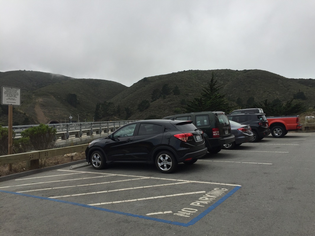
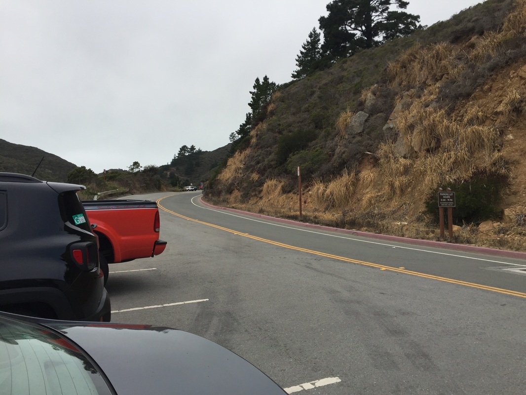
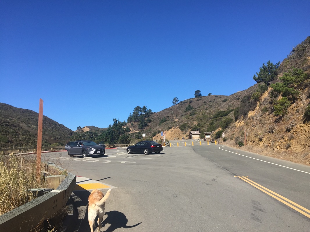
Parking: Free (limited) parking near the address above. There are 5 spots closest to the trailhead and a 7 more viewable down the road, at the end of the Devil's Slide Trail. Trailhead is up a ramp off of Hwy 1.
Hours: 8 A.M. to 5 P.M.
Type: Hike (moderate)
Regulations: Dogs allowed on-leash
Best time to visit: Anytime, but the best views are on a clear day
 
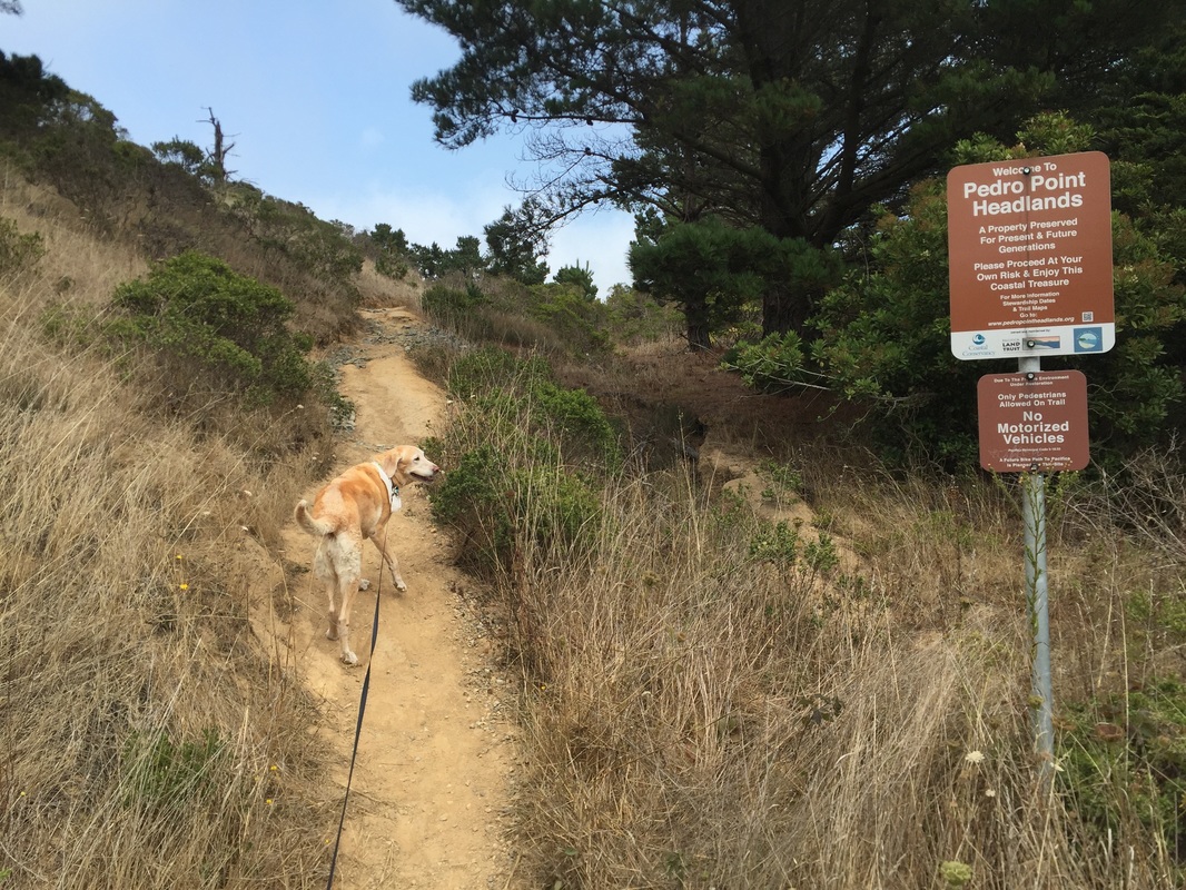
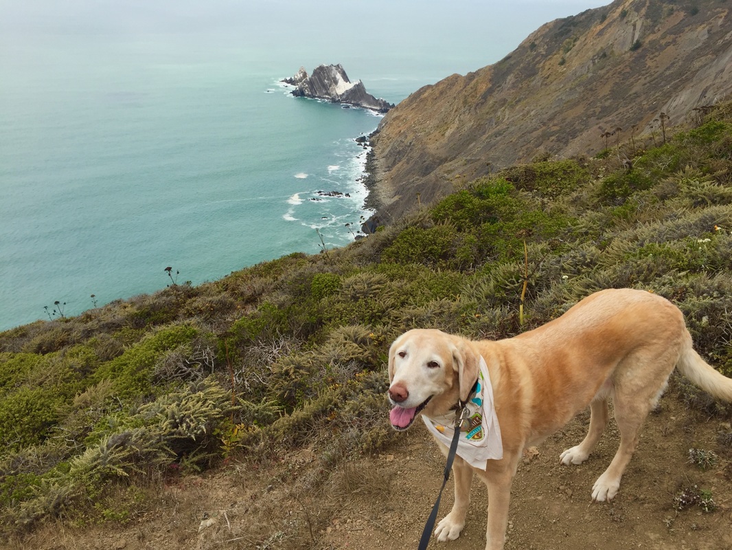
Description: This is a hard to find hidden gem, and has become one of my favorite hikes in the bay area. Even on a weekend, you may have the place all to yourself. This park has beautiful trails hugging the bluffs with panoramic views of the ocean. It also offers great lookout points to whale watch.
 
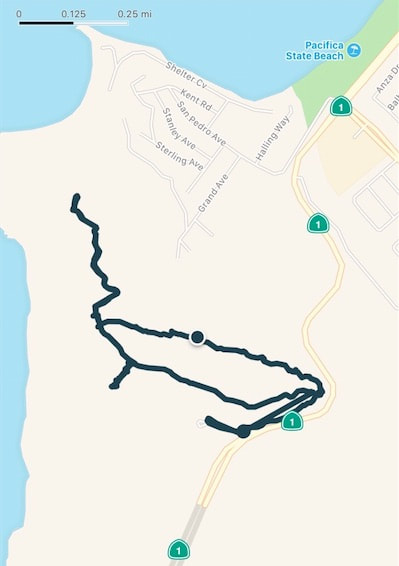
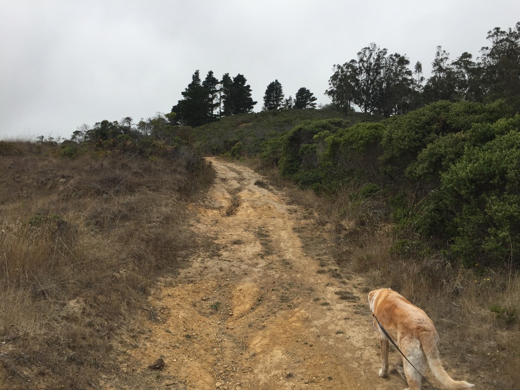
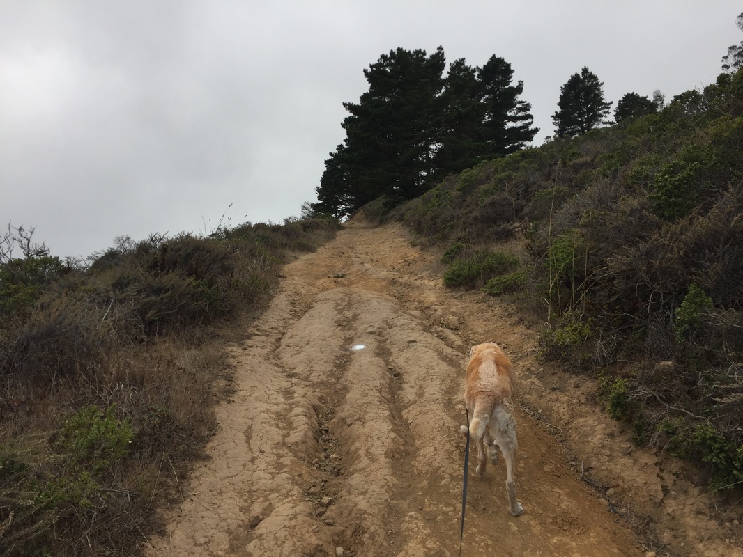
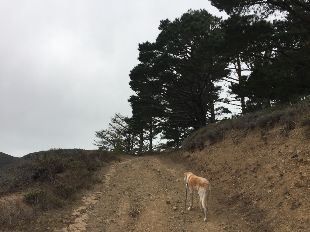
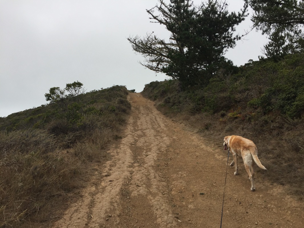
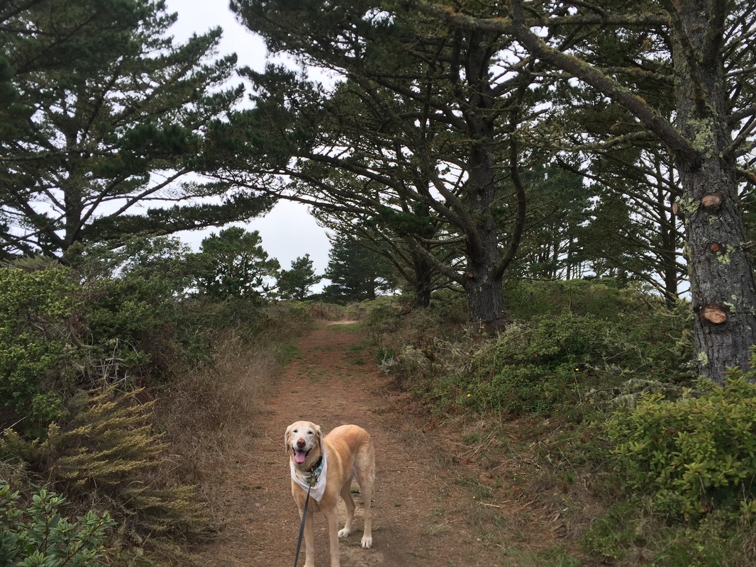
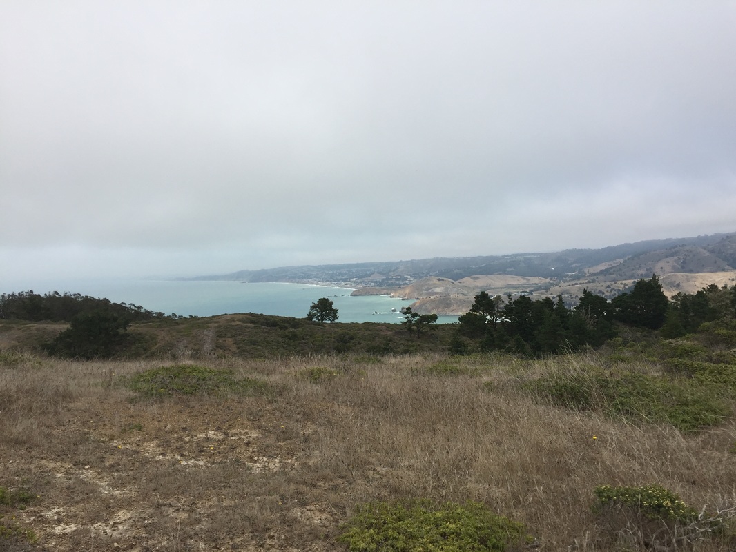
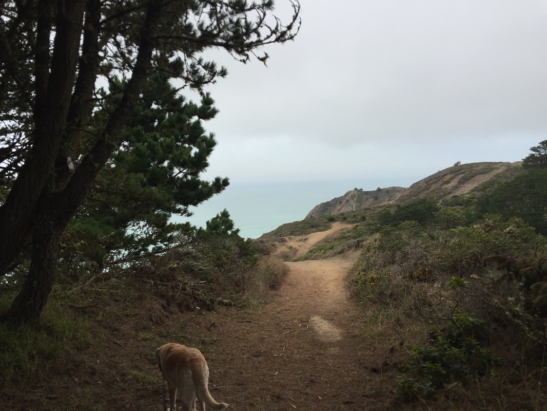
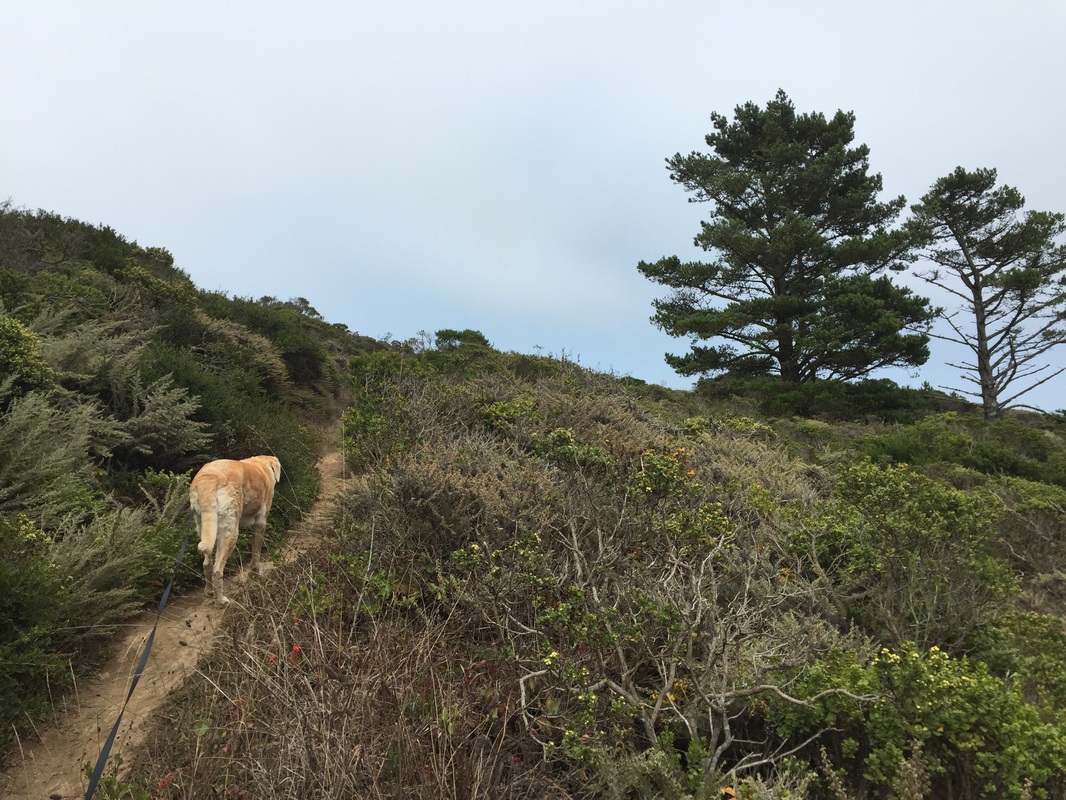
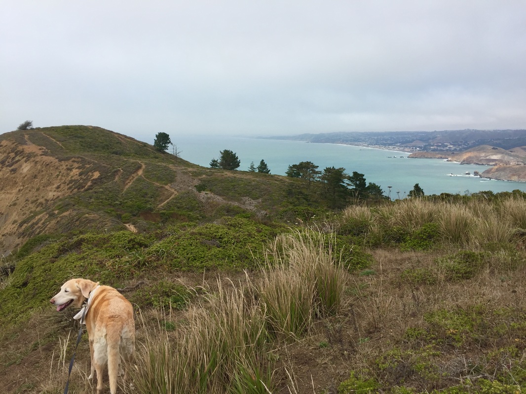
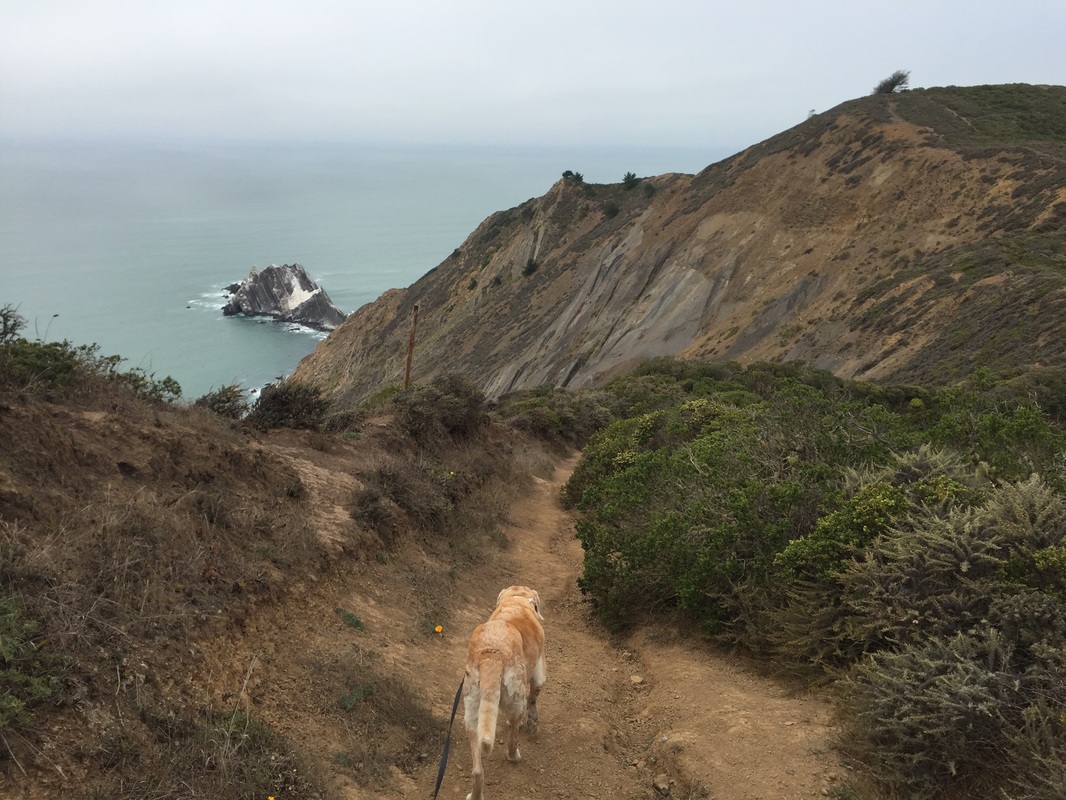
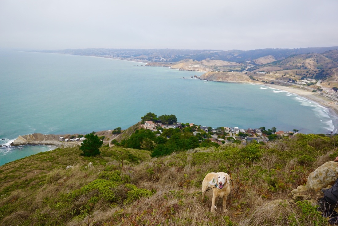
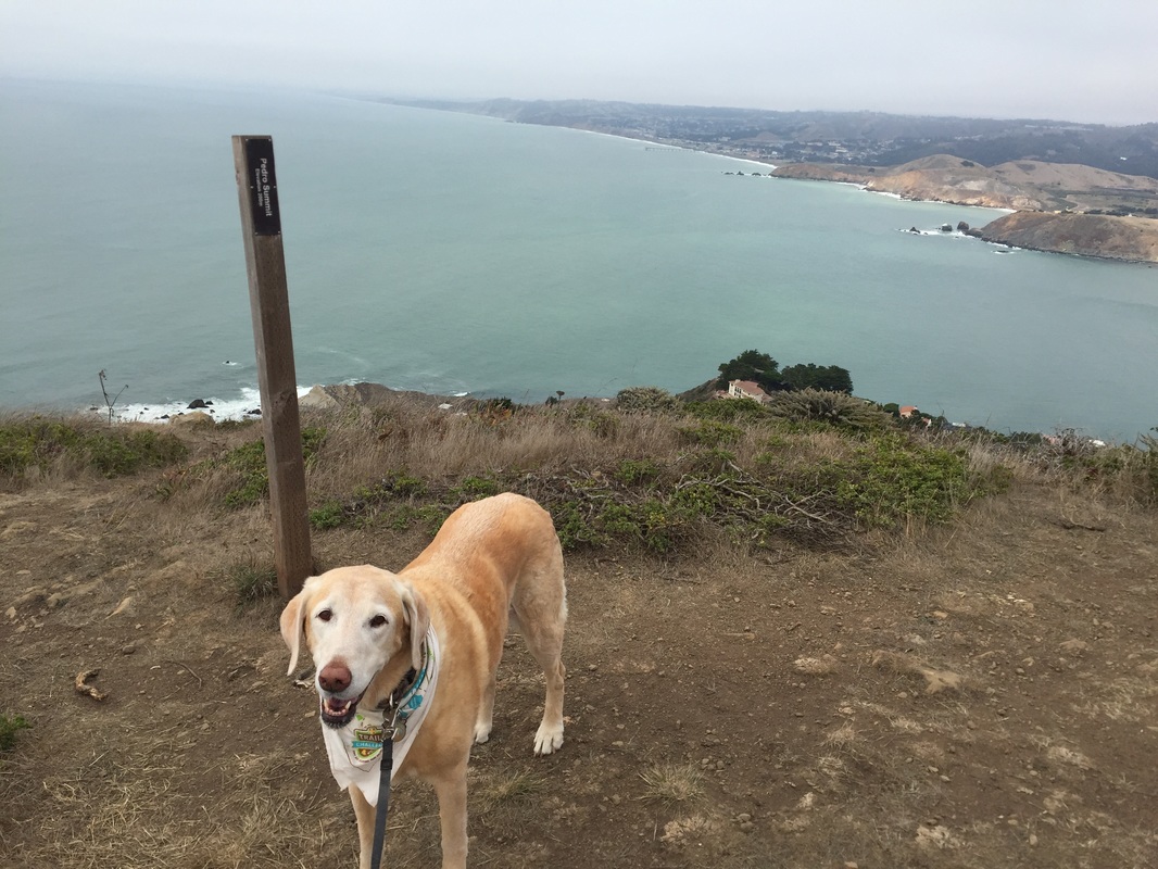
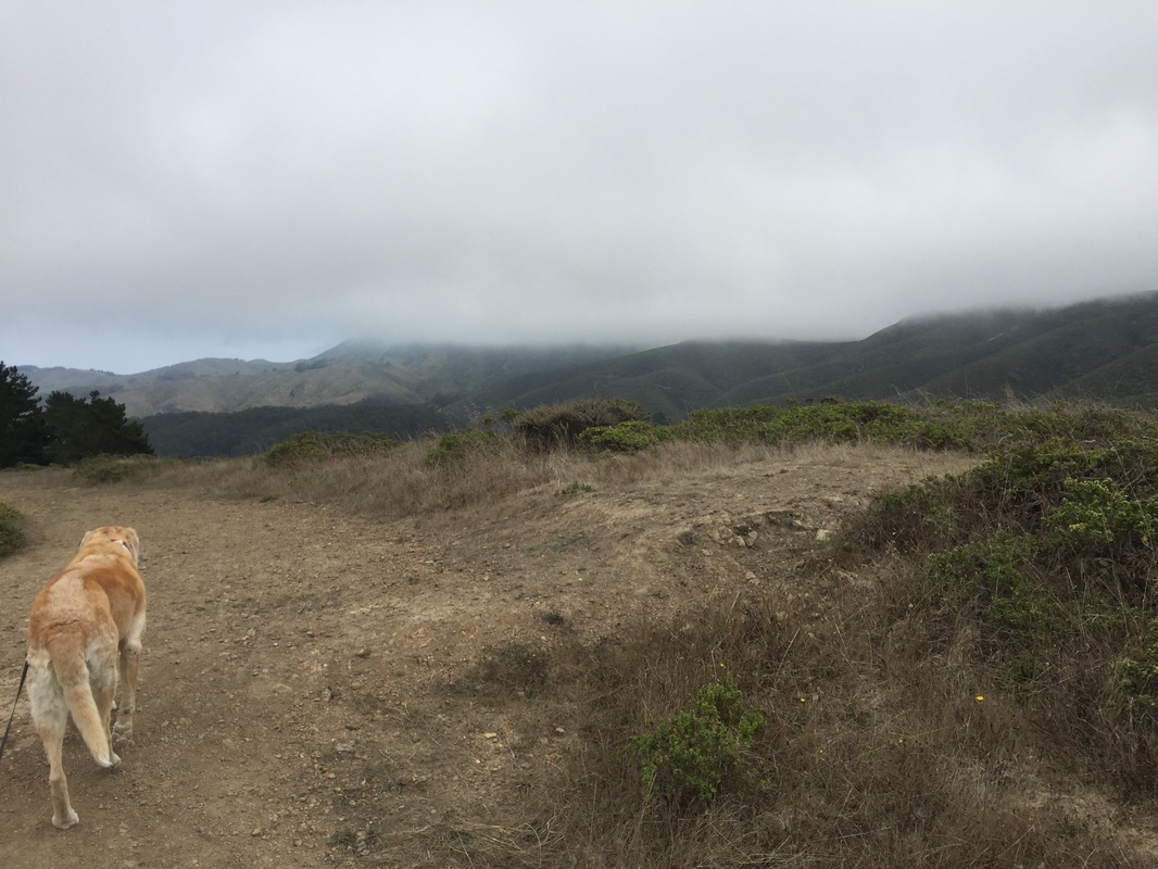
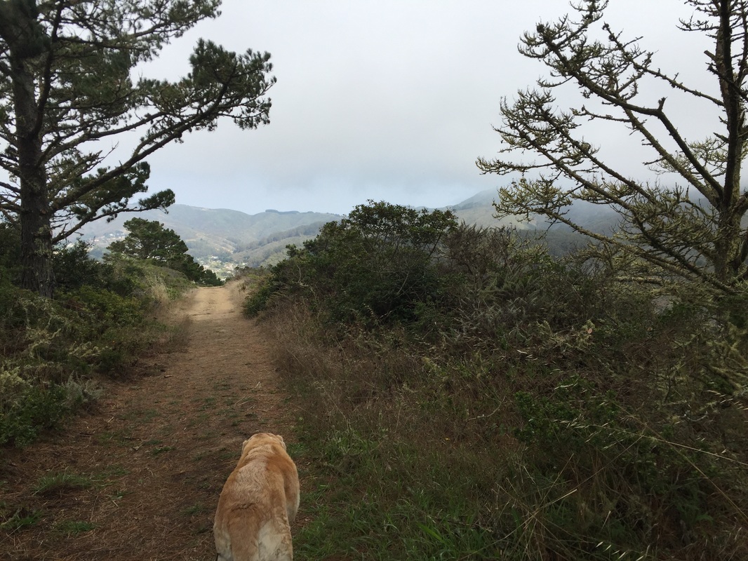
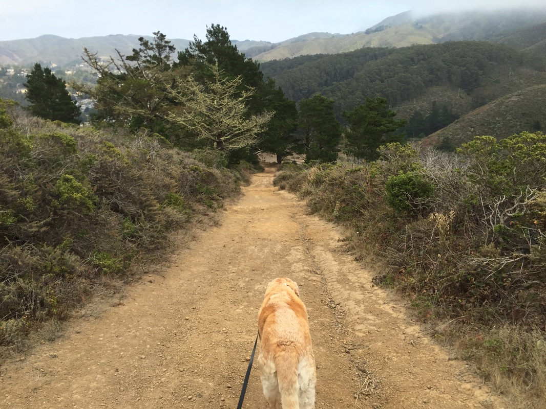
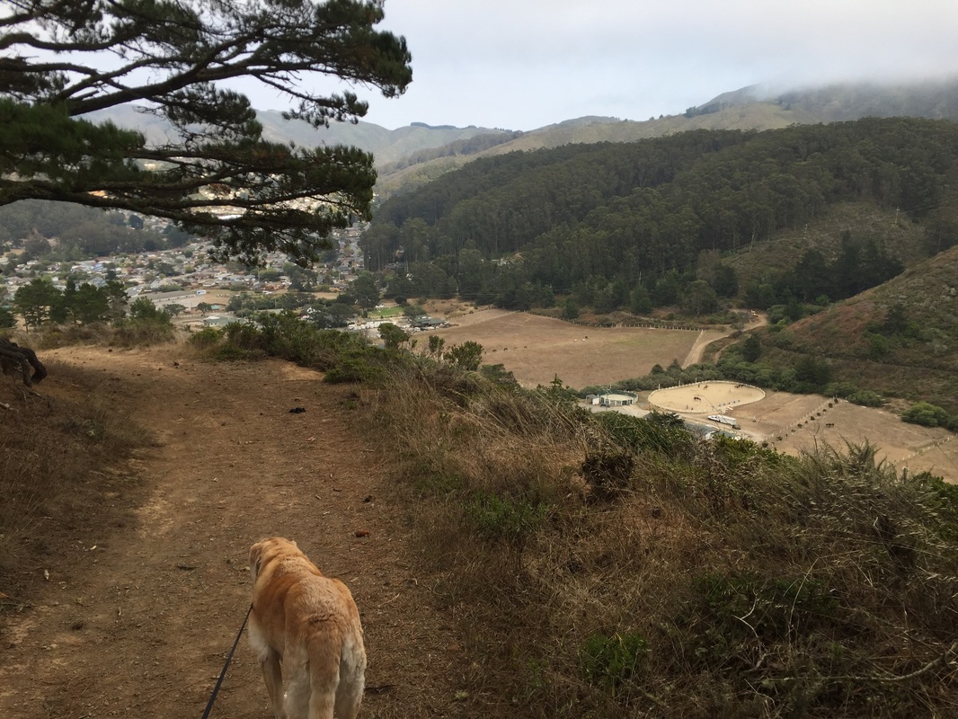
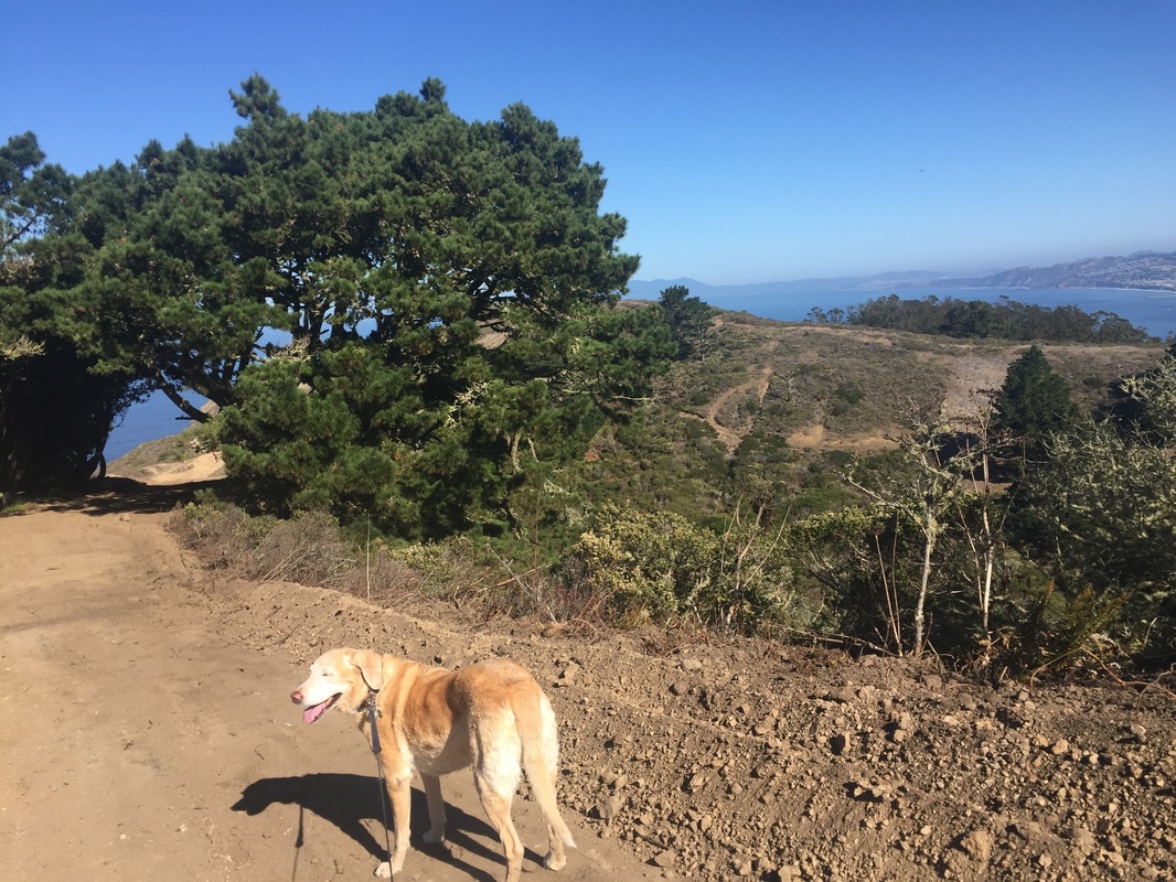
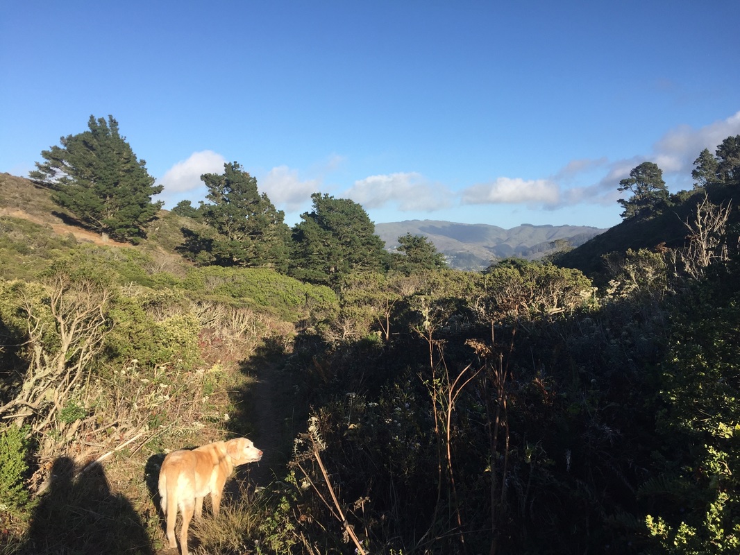
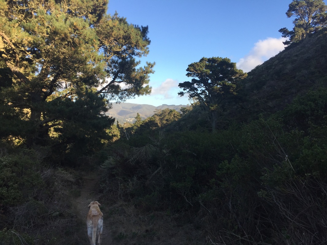
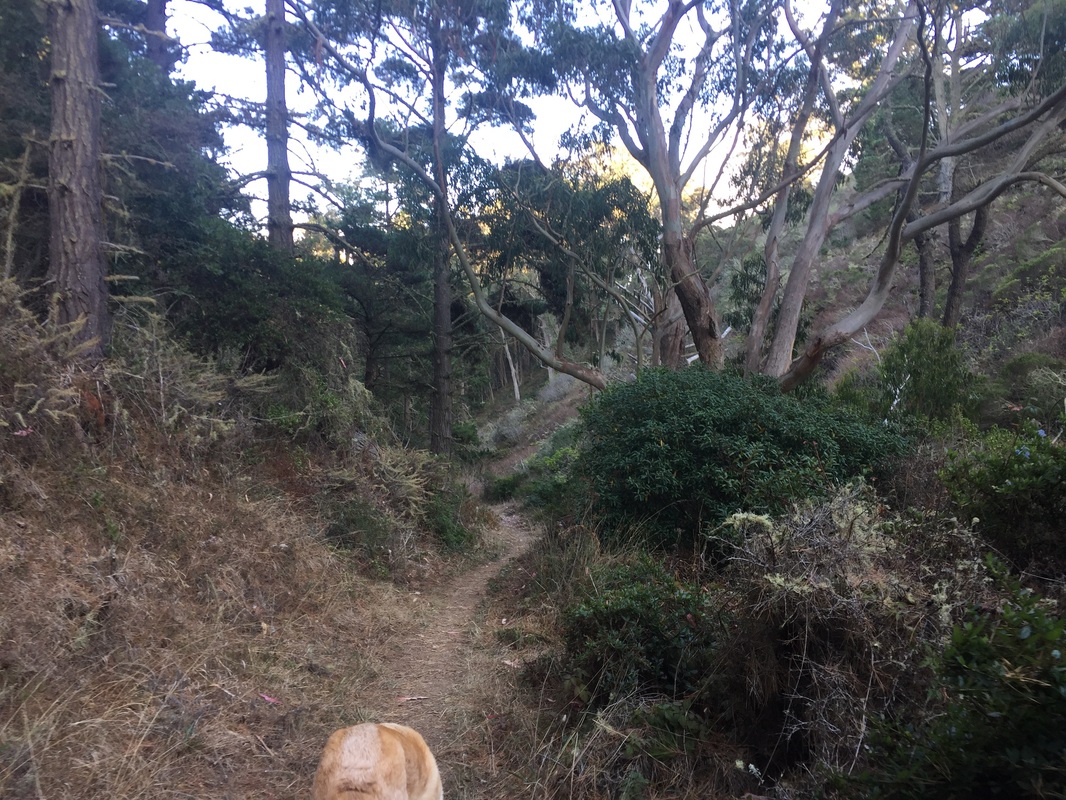
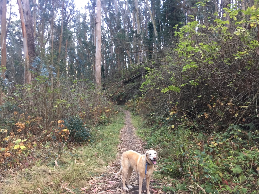
From the parking across from Devil’s Slide, look down Highway 1 (away from Devil’s Slide) and you will see a ramp gently sloping uphill. Take this ramp and you will soon see a brown welcome sign. Head uphill via the narrow trail and you will come to a large bulletin board with information. Head past it and you will see a trailhead sign for the South Ridge Trail. This trail climbs uphill at a moderately steep pace. It used to be rocky but has just been graded, so it's easier on your feet. You’ll pass moss-covered trees and coastal shrubs. Continue your hike up to the top and the trail will open up to views of the ocean. You will be able to see San Pedro Point, a triangular shaped rock on one side, and Egg Rock, near Devil’s Slide on the other side of the coast. The trail will begin to descend and you’ll have views of the ocean on either side. Take the Bluff Trail to Pedro Summit for breathtaking views of the ocean towards Mori Point. This is also a great place to whale watch! You can return the way you came or head back via the Middle Ridge Trail and Arroyo Trails for a slightly longer hike. If you return via the Arroyo Trail, you will avoid the last stretch of uphill on the Bluff Trail. The Arroyo Trail will also give you a change of scenery. Although it doesn't have any ocean views, you'll pass vibrant green trees towering above you and some ferns lining the trail as you hike down into the canyon. The trail ends right below where you started on a gravel trail. I would recommend walking up where the trail splits to return to where you started (you'll spot the construction vehicles and fence above you that you noticed when you began your hike). However, if you continue down you'll see a long gate at the other exit. This is for construction vehicles and there's room to walk around the gate. You will have to walk a few feet up the highway to return to your car. There's a large shoulder, but I would recommend avoiding this altogether and just exiting where you began your hike. When you return to your car and exit onto Highway 1, be careful and patient if you’re heading back to Pacifica, because traffic does not stop on either direction on the highway and you will have to wait for an opening. 

There are no restrooms, garbage cans or running water on this trail. When you park, if you walk away from the trailhead towards Devil's Slide, you'll soon notice a building with pit toilets around the bend. There is also a water fountain at the trailhead to Devil's Slide. 
Click here for a trail map courtesy of the Pacifica Land Trust
Picture

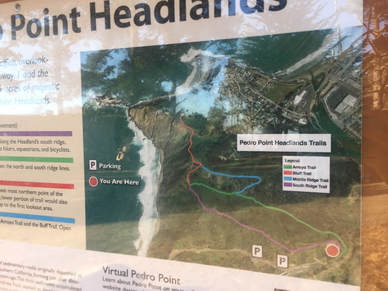
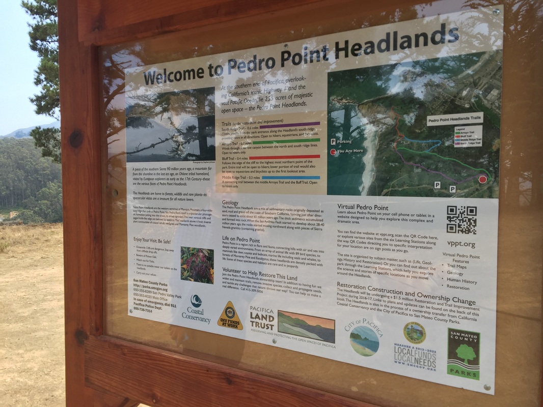
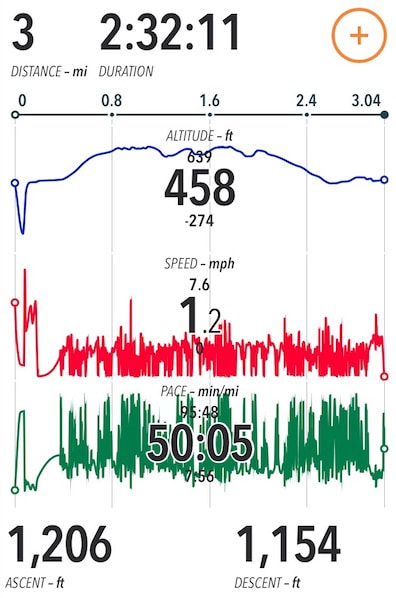
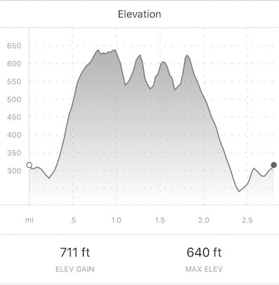
Recommended Loop (with trail stats):
​
South Ridge Trail>Bluff Trail>Arroyo Trail
Length: Approx. 3 miles
Elevation Gain: Approx. 700 ft

The South Ridge Trail begins as a steep, mostly exposed climb up, and once you reach the top you'll have panoramic ocean views. The Bluff Trail continues along the bluffs, dips down a couple times and then climbs to the summit overlooking the popular surfing beach below. You will have to retrace your steps a bit, up the steep hill you came down to reach the Arroyo Trail. This narrow trail snakes through a pine forest and then continues into a eucalyptus forest lined with vibrant green ferns. It climbs back up gently, and as soon as you see a trail split to your right, take it and you'll soon see the construction equipment near the trailhead. We stopped to take many photos, and we also took a short, unmarked side trail, so the data below may be slightly off and should not take you nearly as long to hike. 
As an Amazon Associate I earn a commission from qualifying purchases. 
All content within this site Copyright © 2022 Hikes Dogs Love. All rights reserved. No part of this website may be reproduced without permission.
DMCA.com Protection Status
  • Home
  • Browse All
    • Alameda County >
      • Albany Bulb
      • Alameda Creek Regional Trail
      • Anthony Chabot Regional Park (Lake Chabot)
      • Aquatic Park
      • Chabot Park
      • Barlago Italian Kitchen
      • Buchanan Dog Beach
      • California Canoe & Kayak (Oakland)
      • César Chávez Park
      • Claremont Canyon
      • Coyote Hills Regional Park
      • Crab Cove
      • Cull Canyon Regional Recreation Area
      • Dimond Canyon Park
      • Don Castro Regional Recreation Area
      • Don Edwards Wildlife Refuge
      • Dublin Hills Regional Park
      • Fairmont Ridge
      • Five Canyons Open Space Preserve
      • Fremont Central Park
      • Garin/Dry Creek Pioneer Regional Park
      • Greenbelt Trails
      • Hayward Regional Shoreline
      • Heron Bay Trail
      • Holy Land Restaurant
      • Ikaros Greek Restaurant
      • Jerusalem Organic Kitchen
      • Joaquin Miller Park
      • Lake Anza
      • Lake Chabot
      • Lake Merritt
      • Leona Canyon Regional Open Space Preserve
      • Leona Heights Park
      • Marina Park
      • Martin Canyon Creek Trail
      • Martin Luther King Jr. Regional Shoreline
      • Mission Peak
      • Montclair Railroad Trail/ Torii Gate
      • Morgan Territory Regional Preserve
      • Oyster Bay Regional Shoreline
      • Park Street Classic Car Show (Annual)
      • Pleasanton Ridge Regional Preserve
      • Reinhardt Redwood Regional Park
      • Robert's Park
      • Room 389
      • Shoreline Park
      • Sibley Volcanic Regional Preserve
      • Skyline Gate Staging Area
      • Strawberry Canyon Fire Trail
      • Sunol Regional Wilderness
      • Temescal Regional Recreation Area
      • Tilden Regional Park
      • Upper Anthony Chabot Regional Park (Oakland Entrance)
      • Upper Knowland Park
      • Vargas Plateau Regional Park
    • Butte County >
      • Feather Falls
      • Motel 6 - Oroville
      • Riverbend Park
    • Contra Costa County >
      • Acalanes Ridge Open Space
      • Briones Regional Park
      • Carquinez Strait Regional Shoreline
      • Crockett Hills Regional Park
      • Diablo Foothills Regional Park
      • EBMUD Trails
      • Fernandez Ranch
      • Frowning Ridge
      • Geppetto's Caffe
      • Hacienda de las Flores Park
      • Hillside Nature Area
      • Howe Homestead Park
      • Indian Rock
      • Kennedy Grove Regional Recreation Area
      • Lafayette Community Park
      • Lafayette Reservoir
      • Las Trampas Regional Wilderness
      • Lime Ridge Open Space
      • Miller/Knox Regional Shoreline
      • Moraga Commons Park
      • Mulholland Ridge Open Space Preserve
      • Point Isabel
      • Point Molate Beach Park
      • Point Pinole Regional Shoreline
      • Point San Pablo Harbor
      • Rubio's
      • San Quentin Beach
      • Shell Ridge Open Space
      • Sobrante Ridge Regional Preserve
      • Sugarloaf Open Space
      • Sycamore Valley Open Space Preserve
      • Tender Greens
      • Tilden Regional Park
      • Wildcat Canyon Regional Park
    • El Dorado County >
      • Angora Lakes Trail
      • Bijou Community Park
      • Cascade Falls
      • Horsetail Falls
      • Inspriation Point
      • Motel 6 - South Lake Tahoe
      • Mt. Tallac
    • Marin County >
      • 101 Surf Sports
      • Baltimore Canyon Open Space Preserve
      • Blackie's Pasture
      • Camino Alto Preserve
      • Carson Falls
      • Cascade Falls
      • Cataract Falls
      • Dawn Falls
      • Ignacio Valley Preserve (Fairway Falls)
      • Indian Valley Open Space Preserve
      • King Mountain Open Space Preserve
      • Marin Headlands (Coastal Trail)
      • Old Saint Hilary's Open Space Preserve
      • Phoenix Lake
      • Ring Mountain Open Space Preserve
      • Roy's Redwoods
      • Sam's Anchor Cafe
      • Tiburon Peninsula Historical Trail
      • Tucker Trail Falls
    • Mariposa County >
      • Happy Burger Diner
      • Yosemite National Park
    • Mendocino County >
      • Catch-a-Canoe
      • MacKerricher State Park
      • Mendocino Headlands State Park
      • Navarro River Redwoods State Park
      • Princess Seafood
      • Skunk Train
      • The Stanford Inn By The Sea
      • Van Damme State Beach
    • Mono County >
      • Bodie State Historic Park
      • Jolly Kone
      • Lundy Canyon
      • Mono Lake (Tufa State National Reserve)
      • Virginia Creek Settlement
    • Monterey County >
      • 17-Mile Drive
      • Asilomar State Beach
      • Bistro Beaujolais
      • Carmel Beach
      • Fishwife
      • Fort Ord Dunes State Park
      • Garland Ranch Regional Park
      • Jack's Peak
      • Monterey Bay Coastal Trail
      • Monterey Bay Kayaks
      • Monterey Municipal Beach
      • Motel 6 - Downtown Monterey
      • Ryan Ranch Disc Golf Course
      • Ventana Wilderness
    • Nevada County >
      • Fairy Falls
    • Placer County >
      • Hidden Falls
    • San Francisco County >
      • 2.2 Mile Urban Hike
      • Bernal Heights Park
      • The Brixton
      • Billy Goat Hill Park
      • Blackwood
      • Clipper Cove Beach
      • Crissy Field
      • Dynamo Donut + Coffee
      • Fort Funston
      • Fort Mason
      • Glen Canyon Park
      • Golden Gate Park
      • Grand View Park
      • The Great Lawn/ Avenue of the Palms
      • Java Beach Cafe
      • John McLaren Park
      • Interior Greenbelt
      • Lake Merced
      • Lands End
      • Letterman Digital Arts Center
      • Marina Green
      • Mount Davidson
      • Mount Sutro Open Space Reserve
      • Ocean Beach
      • Palace of Fine Arts
      • Philz Coffee Truck
      • Stern Grove
      • Sutro Baths
      • Sutro Heights Park
      • TreasureFest
    • San Mateo County >
      • 7 Mile House Sports Bar & Grill
      • Barbara's Fishtrap
      • Bedwell Bayfront Park
      • Bob's Vegetable Stand and Pumpkin Farm
      • Cafe Pacifica
      • Devil's Slide Coastal Trail
      • Esplanade Beach
      • Flying Fish Grill
      • Half Moon Bay Kayak Co.
      • McNee Ranch State Park (Montara Mountain)
      • Montara State Beach
      • Mori Point
      • Mussel Rock Park
      • Panera Bread
      • Pedro Point Headlands
      • Poplar Beach
      • Pulgas Ridge Open Space Preserve
      • Rancho Corral de Tierra
      • Seal Point
      • Taqueria La Mexicana
      • Wavecrest Open Space
    • Santa Clara County >
      • Byxbee Park
      • Calero County Park
      • Uvas Canyon County Park
    • Santa Cruz County >
      • Byrne-Milliron Forest
      • Greyhound Rock County Park
      • Henry Cowell Redwoods State Park
      • Jaliscos Restaurant
      • Mount Madonna County Park
      • Roaring Camp Railroads
    • Solano County >
      • Lagoon Valley Park
      • Peña Adobe Regional Park
    • Sonoma County >
      • Doran Regional Park
      • Fishetarian
      • Helen Putnam Regional Park
    • Tuolumne County >
      • Donnell Vista
      • Tuttletown Recreation Area
    • Yuba County >
      • Ellis Lake
  • Map View
  • Vacation Spots
    • Vacation Hikes >
      • Arizona >
        • Papago Park
      • New Mexico >
        • Oliver Lee Memorial State Park
        • White Sands National Monument
      • Oregon >
        • Multnomah Falls
      • Washington >
        • Olympic National Park >
          • Kalaloch Beach
          • Madison Falls
          • Quinault Rainforest
        • Rattlesnake Ridge
    • Restaurants >
      • Southern California >
        • Fire Island Grill
        • Lazy Dog Restaurant & Bar
        • Perkies Coffee Haus
      • Washington >
        • Rose Pho
  • Planning Your Trip
  • About
  • Dog Gear
  • Archived Hikes 1
    • Archived Hikes 2 >
      • Archives 2016-2018