
- Home
-
Browse All
-
Alameda County
>
- Albany Bulb
- Alameda Creek Regional Trail
- Brickyard Cove
- Brushy Peak Regional Preserve
- Anthony Chabot Regional Park (Lake Chabot)
- Aquatic Park
- Barlago Italian Kitchen
- Buchanan Dog Beach
- California Canoe & Kayak (Oakland)
- Cali Kid Burgers ‘N Shakes
- César Chávez Park
- Chabot Park
- Claremont Canyon
- Coyote Hills Regional Park
- Crab Cove
- Cull Canyon Regional Recreation Area
- Dimond Canyon Park
- Don Castro Regional Recreation Area
- Don Edwards Wildlife Refuge
- Dublin Hills Regional Park
- Emeryville Marina
- Fairmont Ridge
- Five Canyons Open Space Preserve
- Fremont Central Park
- Garin/Dry Creek Pioneer Regional Park
- Gilman Brewing Company
- Greenbelt Trails
- Hayward Regional Shoreline
- Heron Bay Trail
- Ikaros Greek Restaurant
- Jerusalem Organic Kitchen
- Joaquin Miller Park
- Lake Anza
- Lake Chabot
- Lake Merritt
- Leona Canyon Regional Open Space Preserve
- Leona Heights Park
- Marina Park
- Martin Canyon Creek Trail
- Martin Luther King Jr. Regional Shoreline
- Mission Peak
- Montclair Railroad Trail/ Torii Gate
- Morgan Territory Regional Preserve
- Oyster Bay Regional Shoreline
- Park Street Classic Car Show (Annual)
- Pleasanton Ridge Regional Preserve
- Point Emery
- Reinhardt Redwood Regional Park
- Robert's Park
- Room 389
- Shoreline Park
- Sibley Volcanic Regional Preserve
- Skyline Gate Staging Area
- Strawberry Canyon Fire Trail
- Sunol Regional Wilderness
- Temescal Regional Recreation Area
- Tilden Regional Park
- Upper Anthony Chabot Regional Park (Oakland Entrance)
- Upper Knowland Park
- Vargas Plateau Regional Park
- Butte County >
-
Contra Costa County
>
- Acalanes Ridge Open Space
- Briones Regional Park
- Carquinez Strait Regional Shoreline
- Crockett Hills Regional Park
- Diablo Foothills Regional Park
- EBMUD Trails
- Fernandez Ranch
- Frowning Ridge
- Geppetto's Caffe
- Hacienda de las Flores Park
- Hillside Nature Area
- Howe Homestead Park
- Indian Rock
- Kennedy Grove Regional Recreation Area
- Lafayette Community Park
- Lafayette Reservoir
- Las Trampas Regional Wilderness
- Lime Ridge Open Space
- Miller/Knox Regional Shoreline
- Moraga Commons Park
- Mulholland Ridge Open Space Preserve
- Point Isabel
- Point Molate Beach Park
- Point Pinole Regional Shoreline
- Point San Pablo Harbor
- Rubio's
- San Quentin Beach
- Shell Ridge Open Space
- Sobrante Ridge Regional Preserve
- Sugarloaf Open Space
- Sycamore Valley Open Space Preserve
- Tender Greens
- Tilden Regional Park
- Wildcat Canyon Regional Park
- El Dorado County >
-
Marin County
>
- 101 Surf Sports
- Baltimore Canyon Open Space Preserve
- Blackie's Pasture
- Camino Alto Preserve
- Carson Falls
- Cascade Falls
- Cataract Falls
- Dawn Falls
- Hippie Tree
- Ignacio Valley Preserve (Fairway Falls)
- Indian Valley Open Space Preserve
- King Mountain Open Space Preserve
- Marin Headlands (Coastal Trail)
- Old Saint Hilary's Open Space Preserve
- Phoenix Lake
- Red Hill Dog Park
- Red Hill Trail
- Ring Mountain Open Space Preserve
- Roy's Redwoods
- Sam's Anchor Cafe
- Sorich Ranch Park
- Tiburon Peninsula Historical Trail
- Tiburon Uplands
- Tucker Trail Falls
- Mariposa County >
- Mendocino County >
- Mono County >
- Monterey County >
- Nevada County >
- Placer County >
-
San Francisco County
>
- 2.2 Mile Urban Hike
- Bernal Heights Park
- The Brixton
- Billy Goat Hill Park
- Blackwood
- Clipper Cove Beach
- Crissy Field
- Dynamo Donut + Coffee
- Fort Funston
- Fort Mason
- Glen Canyon Park
- Golden Gate Park
- Grand View Park
- The Great Lawn/ Avenue of the Palms
- Java Beach Cafe
- John McLaren Park
- Interior Greenbelt
- Lake Merced
- Lands End
- Letterman Digital Arts Center
- Marina Green
- Mount Davidson
- Mount Sutro Open Space Reserve
- Ocean Beach
- Palace of Fine Arts
- Philz Coffee Truck
- Stern Grove
- Sutro Baths
- Sutro Heights Park
- TreasureFest
-
San Mateo County
>
- 7 Mile House Sports Bar & Grill
- Barbara's Fishtrap
- Bedwell Bayfront Park
- Bob's Vegetable Stand and Pumpkin Farm
- Cafe Pacifica
- Devil's Slide Coastal Trail
- Esplanade Beach
- Flying Fish Grill
- Half Moon Bay Kayak Co.
- McNee Ranch State Park (Montara Mountain)
- Montara State Beach
- Mori Point
- Mussel Rock Park
- Nick's Seafood Restaurant
- Panera Bread
- Pedro Point Headlands
- Poplar Beach
- Pulgas Ridge Open Space Preserve
- Rancho Corral de Tierra
- Seal Point
- Taqueria La Mexicana
- Wavecrest Open Space
- Santa Clara County >
- Santa Cruz County >
- Solano County >
- Sonoma County >
- Tuolumne County >
- Yuba County >
-
Alameda County
>
- Map View
-
More
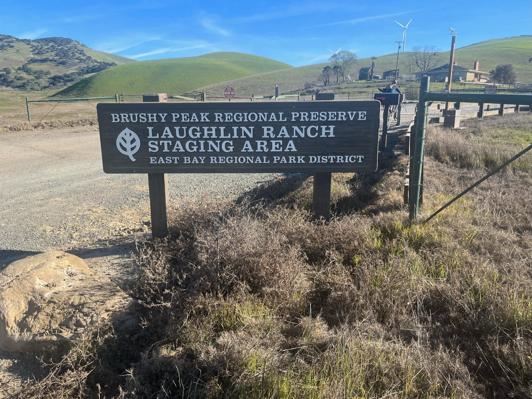
Address: 3899 Laughlin Rd, Livermore, CA 94551
Parking: Free parking lot available at the address above
Hours: Jan. 1-31: 8am-5pm, Feb. 1-Mar. 12: 8am-6pm, Mar. 13-April 17: 8am-7pm, Apr. 18, Sep. 5: 8am-8pm, Sep. 6-Nov. 5: 8am-7pm, Nov. 6-Dec. 31: 8am-5pm
Type: Hike (moderate)
Regulations: Dogs allowed on-leash
Best time to visit: Cool days, but I recommend waiting a few days after a rainstorm. In the winter, trails can get extremely muddy and large sections are difficult to hike. In the summer, trails can get very hot and there is little shade. Trails are lush and beautiful in winter. Come early, because the parking lot fills up fast. You can park along the shoulder of the street if no spaces are available in the lot.
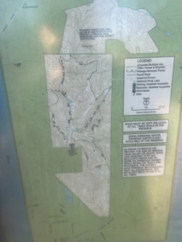
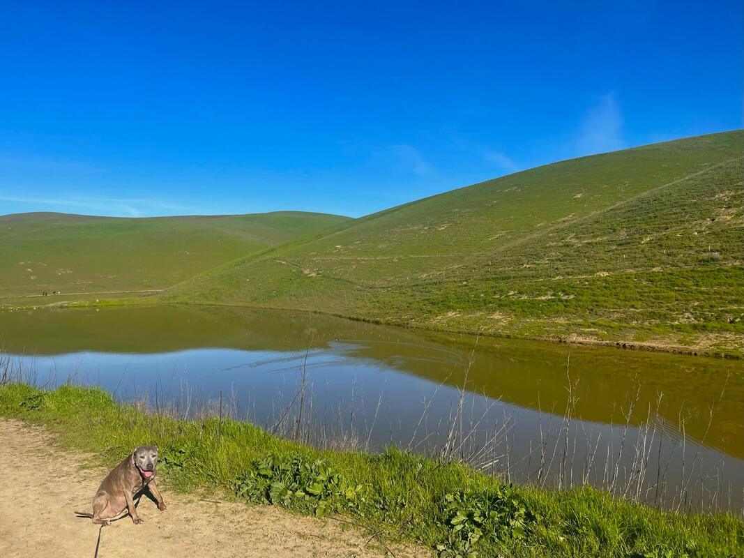
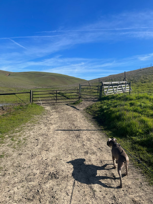
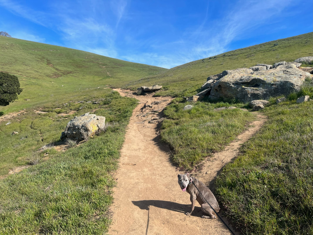
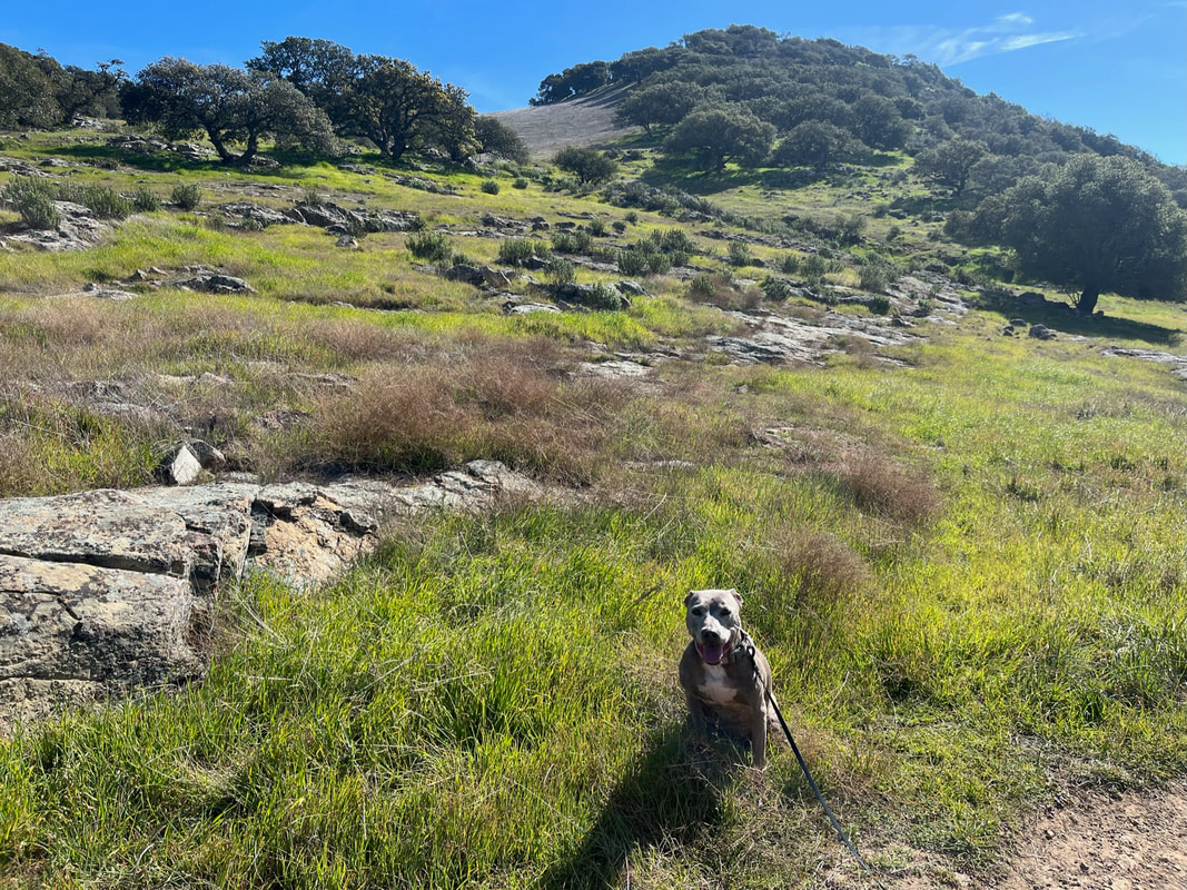
Description: Brushy Peak Regional Preserve is 1,979 acres, offers hiking loops in three directions and a 1,702 foot tall landmark named Brushy Peak. Part of this park is a resource protection area, and it has a variety of wildlife, plants, wildflowers and even seasonal wetlands. Native Californians recognize the peak as a sacred area, and the park is at the center of ancient trade routes once used by the Ohlones and Miwoks.This is a relatively new park, with EBRPD acquiring about ¼ of the land in the 1990s.
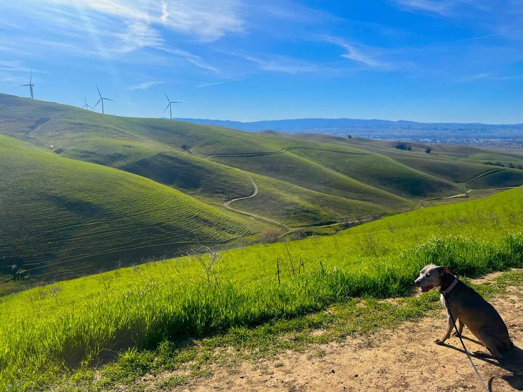
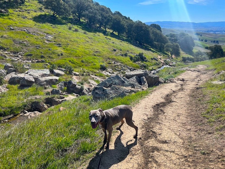
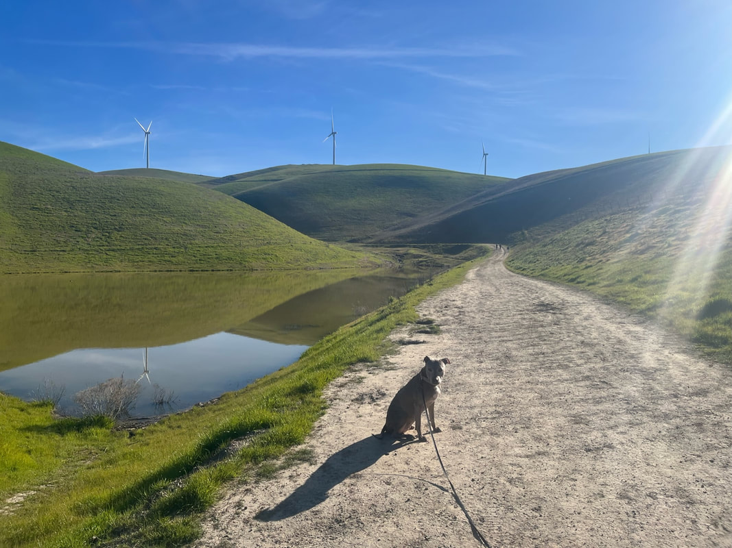
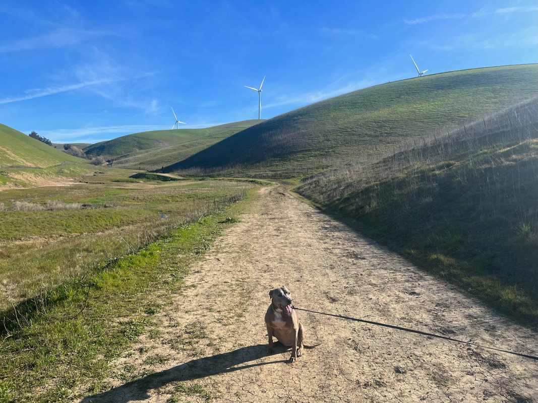
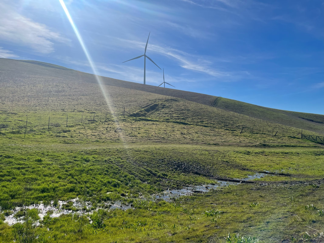
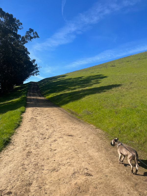
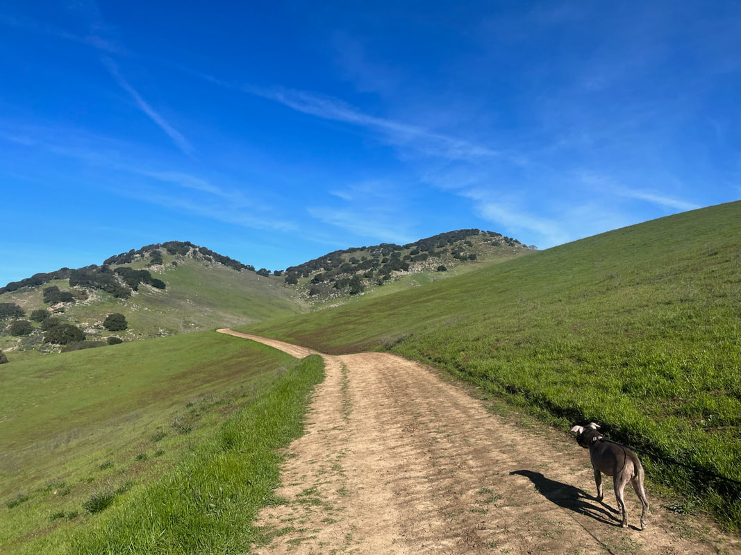
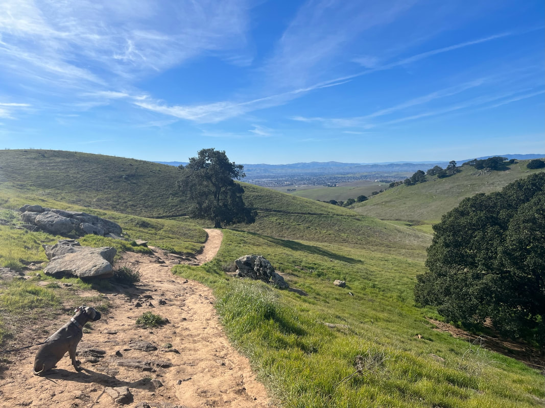
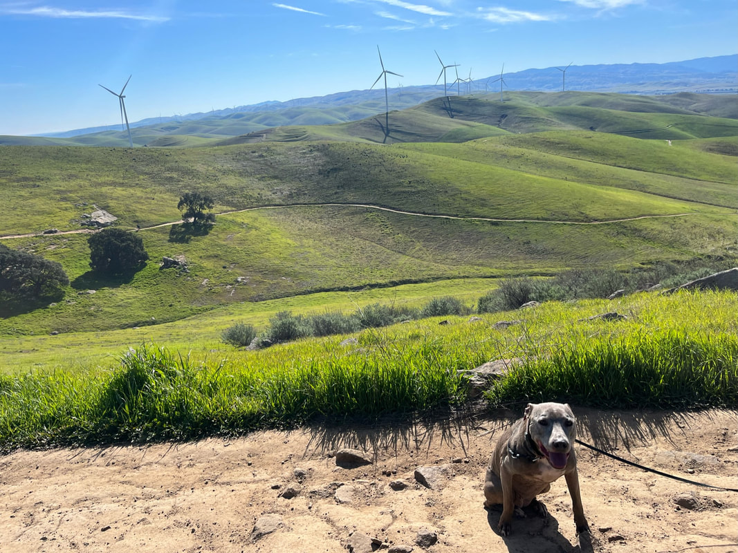
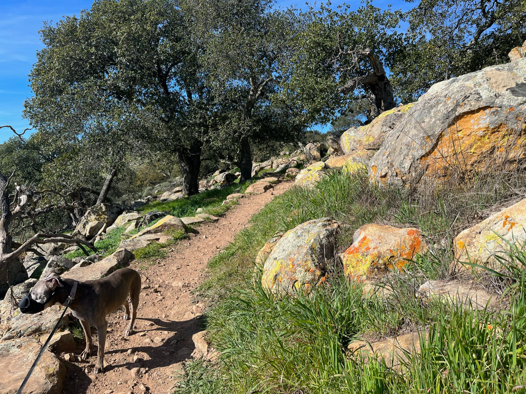
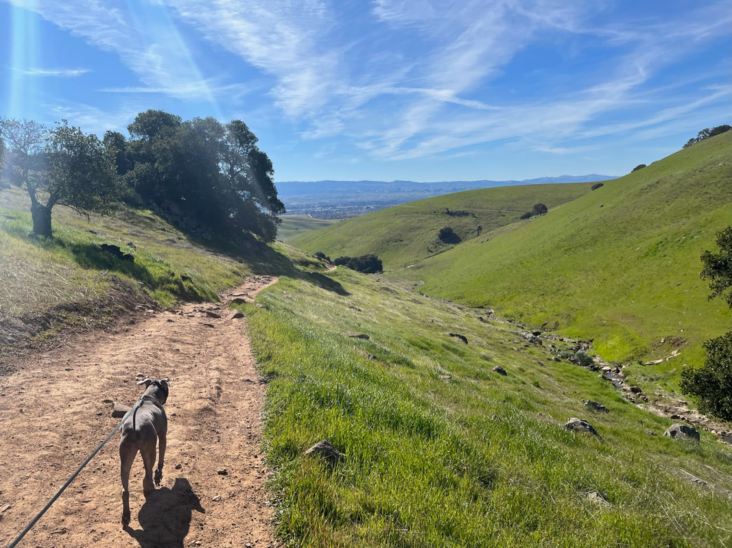
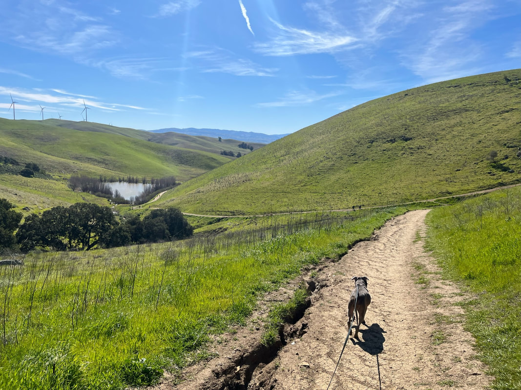
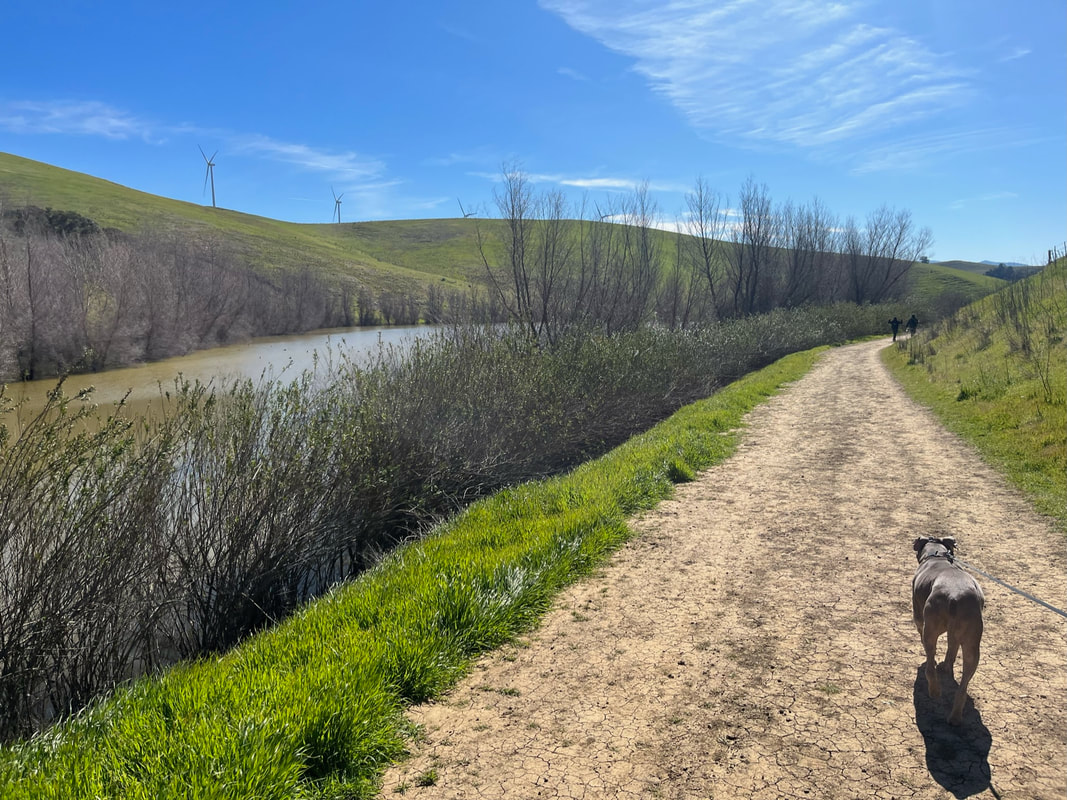
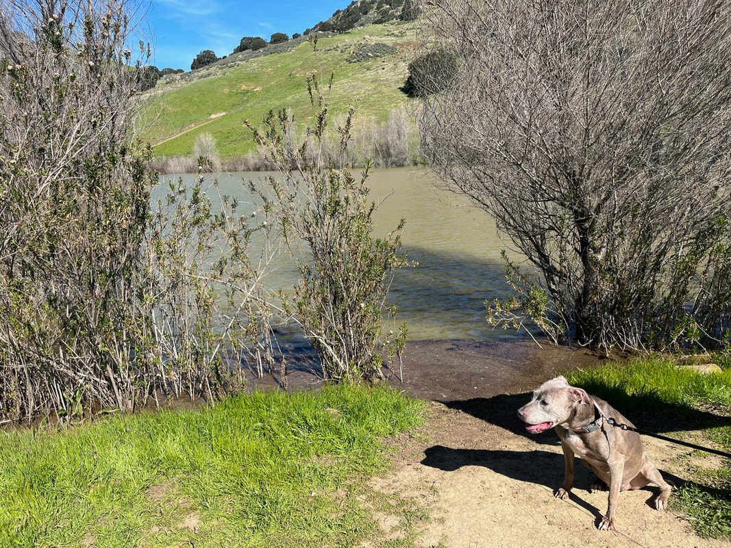
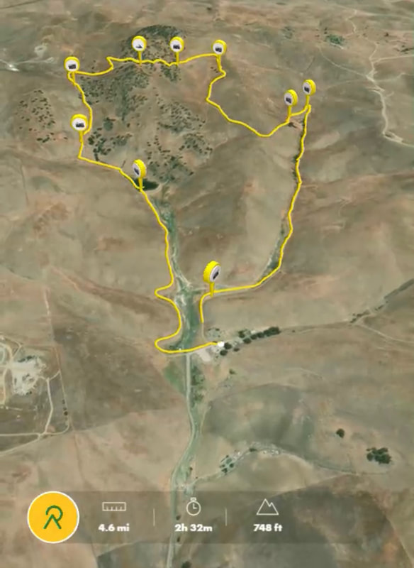
We hiked the Brushy Peak Loop Trail to West Side Loop, which was about 4.5 miles with 750 ft of elevation gain. This hike takes hikers through picturesque hillsides, open grasslands and scenic vistas. Although the trail just skirts along the peak at about 1,400 ft, there’s still an incredible view from the trail. The beginning of this trail passes a large pond and then weaves around below the windmills, which you’ve probably seen from I-580. It was incredible to see these towering windmills in person. A steep hike up takes you up along a seasonal creek, and this area can become extremely muddy and difficult to hike. Eventually you will have to cross the stream to reach the other side of the trail, and this can be difficult if the surrounding area is muddy. After skirting around a smaller hill with some beautiful views, the trail has a couple switchbacks before beginning a steep ascent to Brushy Peak. There are some brightly colored rock formations here, possibly due to a type of moss. These rocks make for a perfect spot to stop and enjoy the panoramic view of the Bay Area. The remainder of the hike is mostly downhill and skirts along a seasonal stream with mini waterfalls, eventually leading into a large pond.
I was pleasantly surprised by the beauty of this park, as I associate Livermore with dry and desolate hills, but this park offers lush green hills, towering trees, seasonal streams and large ponds. It is definitely worth a visit.
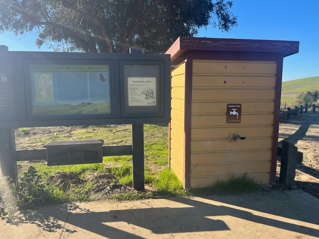
There is a pit toilet and trash cans available next to the parking lot, but no drinking water is available. Pack plenty of water with you.
After our hike, we headed to the Livermore Outlets and had a wonderful lunch at Cali Kid Burgers ‘N Shakes. They have plenty of parking, outdoor seating next to the restaurant, and plenty of benches further down if you want some privacy. They offer burgers, salads, and several vegetarian options.
Parking: Free parking lot available at the address above
Hours: Jan. 1-31: 8am-5pm, Feb. 1-Mar. 12: 8am-6pm, Mar. 13-April 17: 8am-7pm, Apr. 18, Sep. 5: 8am-8pm, Sep. 6-Nov. 5: 8am-7pm, Nov. 6-Dec. 31: 8am-5pm
Type: Hike (moderate)
Regulations: Dogs allowed on-leash
Best time to visit: Cool days, but I recommend waiting a few days after a rainstorm. In the winter, trails can get extremely muddy and large sections are difficult to hike. In the summer, trails can get very hot and there is little shade. Trails are lush and beautiful in winter. Come early, because the parking lot fills up fast. You can park along the shoulder of the street if no spaces are available in the lot.
Description: Brushy Peak Regional Preserve is 1,979 acres, offers hiking loops in three directions and a 1,702 foot tall landmark named Brushy Peak. Part of this park is a resource protection area, and it has a variety of wildlife, plants, wildflowers and even seasonal wetlands. Native Californians recognize the peak as a sacred area, and the park is at the center of ancient trade routes once used by the Ohlones and Miwoks.This is a relatively new park, with EBRPD acquiring about ¼ of the land in the 1990s.
We hiked the Brushy Peak Loop Trail to West Side Loop, which was about 4.5 miles with 750 ft of elevation gain. This hike takes hikers through picturesque hillsides, open grasslands and scenic vistas. Although the trail just skirts along the peak at about 1,400 ft, there’s still an incredible view from the trail. The beginning of this trail passes a large pond and then weaves around below the windmills, which you’ve probably seen from I-580. It was incredible to see these towering windmills in person. A steep hike up takes you up along a seasonal creek, and this area can become extremely muddy and difficult to hike. Eventually you will have to cross the stream to reach the other side of the trail, and this can be difficult if the surrounding area is muddy. After skirting around a smaller hill with some beautiful views, the trail has a couple switchbacks before beginning a steep ascent to Brushy Peak. There are some brightly colored rock formations here, possibly due to a type of moss. These rocks make for a perfect spot to stop and enjoy the panoramic view of the Bay Area. The remainder of the hike is mostly downhill and skirts along a seasonal stream with mini waterfalls, eventually leading into a large pond.
I was pleasantly surprised by the beauty of this park, as I associate Livermore with dry and desolate hills, but this park offers lush green hills, towering trees, seasonal streams and large ponds. It is definitely worth a visit.
There is a pit toilet and trash cans available next to the parking lot, but no drinking water is available. Pack plenty of water with you.
After our hike, we headed to the Livermore Outlets and had a wonderful lunch at Cali Kid Burgers ‘N Shakes. They have plenty of parking, outdoor seating next to the restaurant, and plenty of benches further down if you want some privacy. They offer burgers, salads, and several vegetarian options.


All content within this site Copyright © 2023 Hikes Dogs Love. All rights reserved. No part of this website may be reproduced without permission.

- Home
-
Browse All
-
Alameda County
>
- Albany Bulb
- Alameda Creek Regional Trail
- Brickyard Cove
- Brushy Peak Regional Preserve
- Anthony Chabot Regional Park (Lake Chabot)
- Aquatic Park
- Barlago Italian Kitchen
- Buchanan Dog Beach
- California Canoe & Kayak (Oakland)
- Cali Kid Burgers ‘N Shakes
- César Chávez Park
- Chabot Park
- Claremont Canyon
- Coyote Hills Regional Park
- Crab Cove
- Cull Canyon Regional Recreation Area
- Dimond Canyon Park
- Don Castro Regional Recreation Area
- Don Edwards Wildlife Refuge
- Dublin Hills Regional Park
- Emeryville Marina
- Fairmont Ridge
- Five Canyons Open Space Preserve
- Fremont Central Park
- Garin/Dry Creek Pioneer Regional Park
- Gilman Brewing Company
- Greenbelt Trails
- Hayward Regional Shoreline
- Heron Bay Trail
- Ikaros Greek Restaurant
- Jerusalem Organic Kitchen
- Joaquin Miller Park
- Lake Anza
- Lake Chabot
- Lake Merritt
- Leona Canyon Regional Open Space Preserve
- Leona Heights Park
- Marina Park
- Martin Canyon Creek Trail
- Martin Luther King Jr. Regional Shoreline
- Mission Peak
- Montclair Railroad Trail/ Torii Gate
- Morgan Territory Regional Preserve
- Oyster Bay Regional Shoreline
- Park Street Classic Car Show (Annual)
- Pleasanton Ridge Regional Preserve
- Point Emery
- Reinhardt Redwood Regional Park
- Robert's Park
- Room 389
- Shoreline Park
- Sibley Volcanic Regional Preserve
- Skyline Gate Staging Area
- Strawberry Canyon Fire Trail
- Sunol Regional Wilderness
- Temescal Regional Recreation Area
- Tilden Regional Park
- Upper Anthony Chabot Regional Park (Oakland Entrance)
- Upper Knowland Park
- Vargas Plateau Regional Park
- Butte County >
-
Contra Costa County
>
- Acalanes Ridge Open Space
- Briones Regional Park
- Carquinez Strait Regional Shoreline
- Crockett Hills Regional Park
- Diablo Foothills Regional Park
- EBMUD Trails
- Fernandez Ranch
- Frowning Ridge
- Geppetto's Caffe
- Hacienda de las Flores Park
- Hillside Nature Area
- Howe Homestead Park
- Indian Rock
- Kennedy Grove Regional Recreation Area
- Lafayette Community Park
- Lafayette Reservoir
- Las Trampas Regional Wilderness
- Lime Ridge Open Space
- Miller/Knox Regional Shoreline
- Moraga Commons Park
- Mulholland Ridge Open Space Preserve
- Point Isabel
- Point Molate Beach Park
- Point Pinole Regional Shoreline
- Point San Pablo Harbor
- Rubio's
- San Quentin Beach
- Shell Ridge Open Space
- Sobrante Ridge Regional Preserve
- Sugarloaf Open Space
- Sycamore Valley Open Space Preserve
- Tender Greens
- Tilden Regional Park
- Wildcat Canyon Regional Park
- El Dorado County >
-
Marin County
>
- 101 Surf Sports
- Baltimore Canyon Open Space Preserve
- Blackie's Pasture
- Camino Alto Preserve
- Carson Falls
- Cascade Falls
- Cataract Falls
- Dawn Falls
- Hippie Tree
- Ignacio Valley Preserve (Fairway Falls)
- Indian Valley Open Space Preserve
- King Mountain Open Space Preserve
- Marin Headlands (Coastal Trail)
- Old Saint Hilary's Open Space Preserve
- Phoenix Lake
- Red Hill Dog Park
- Red Hill Trail
- Ring Mountain Open Space Preserve
- Roy's Redwoods
- Sam's Anchor Cafe
- Sorich Ranch Park
- Tiburon Peninsula Historical Trail
- Tiburon Uplands
- Tucker Trail Falls
- Mariposa County >
- Mendocino County >
- Mono County >
- Monterey County >
- Nevada County >
- Placer County >
-
San Francisco County
>
- 2.2 Mile Urban Hike
- Bernal Heights Park
- The Brixton
- Billy Goat Hill Park
- Blackwood
- Clipper Cove Beach
- Crissy Field
- Dynamo Donut + Coffee
- Fort Funston
- Fort Mason
- Glen Canyon Park
- Golden Gate Park
- Grand View Park
- The Great Lawn/ Avenue of the Palms
- Java Beach Cafe
- John McLaren Park
- Interior Greenbelt
- Lake Merced
- Lands End
- Letterman Digital Arts Center
- Marina Green
- Mount Davidson
- Mount Sutro Open Space Reserve
- Ocean Beach
- Palace of Fine Arts
- Philz Coffee Truck
- Stern Grove
- Sutro Baths
- Sutro Heights Park
- TreasureFest
-
San Mateo County
>
- 7 Mile House Sports Bar & Grill
- Barbara's Fishtrap
- Bedwell Bayfront Park
- Bob's Vegetable Stand and Pumpkin Farm
- Cafe Pacifica
- Devil's Slide Coastal Trail
- Esplanade Beach
- Flying Fish Grill
- Half Moon Bay Kayak Co.
- McNee Ranch State Park (Montara Mountain)
- Montara State Beach
- Mori Point
- Mussel Rock Park
- Nick's Seafood Restaurant
- Panera Bread
- Pedro Point Headlands
- Poplar Beach
- Pulgas Ridge Open Space Preserve
- Rancho Corral de Tierra
- Seal Point
- Taqueria La Mexicana
- Wavecrest Open Space
- Santa Clara County >
- Santa Cruz County >
- Solano County >
- Sonoma County >
- Tuolumne County >
- Yuba County >
-
Alameda County
>
- Map View
-
More